July 21st to July 24th, 2026 . Nakabusa Onsen 中房温泉 to Kamikochi 上高地 This is a long and demanding multi-day hike suitable for experienced hikers. Do not attempt this hike unless you have experience in route-finding. Carry the relevant topographic...
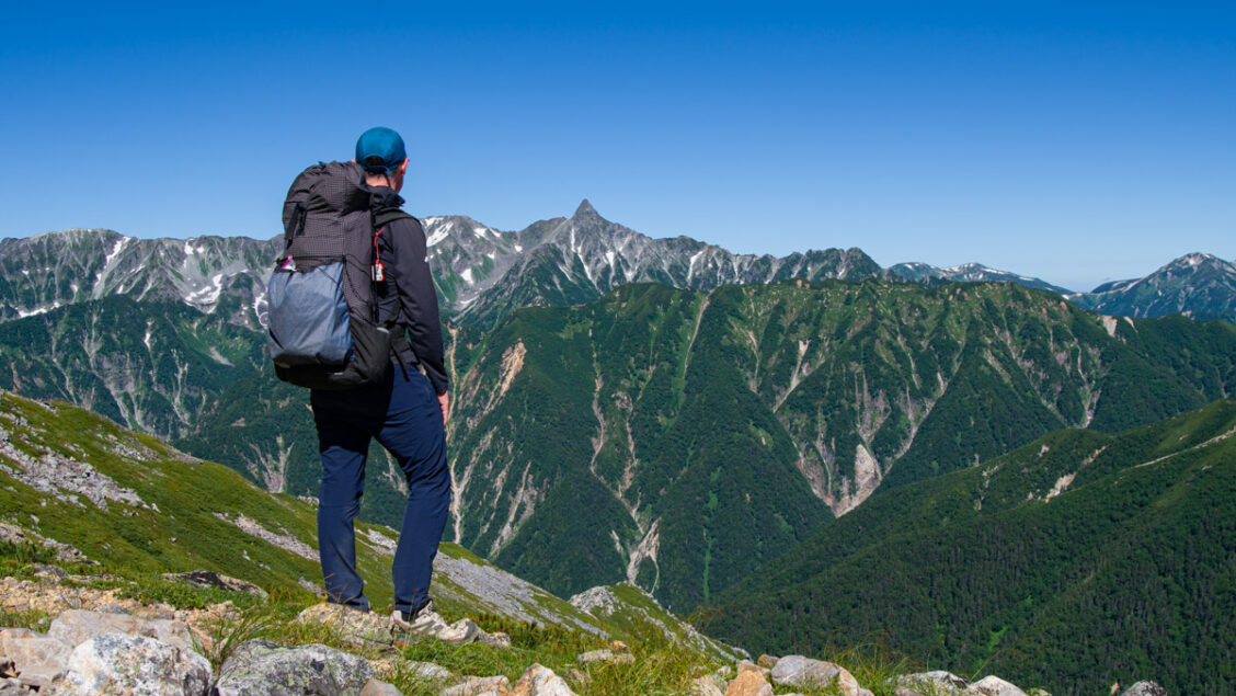
July 21st to July 24th, 2026 . Nakabusa Onsen 中房温泉 to Kamikochi 上高地 This is a long and demanding multi-day hike suitable for experienced hikers. Do not attempt this hike unless you have experience in route-finding. Carry the relevant topographic...
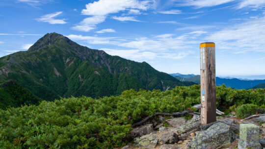
Hiked on Jul 13, 2026 . Hirogawara 広河原 – Shiraneoike 白根御池 – Mt. Mae-Kotaroyama 前小太郎山 Duration: 2 days Distance: 13.3 km Elevation change: 1340 metres Highest point: 2860 metres Start: Hirogawara Bus Stop Finish: Hirogawara Bus Stop ...
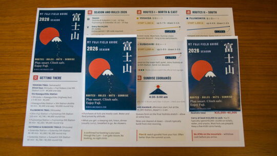
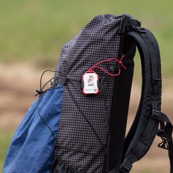
A Pocket Guide for Climbing Mt Fuji in 2026 Hot on the heels of the Japan Hiking Field Guide comes its first companion: a pocket reference built for one mountain and one mountain only. If you’re climbing Mt Fuji this season, this pocket guide is...
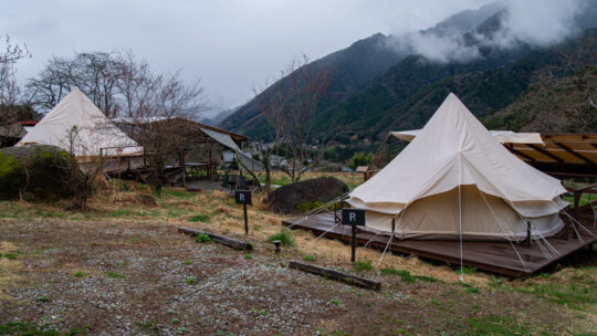
Where to Pitch a Tent in the Kiso Valley Most people walking the Nakasendo Kiso Valley stay in ryokan and minshuku, and for good reason: it’s both the traditional and enjoyable way to do this route, and the welcome at places like Minshuku Matsuo or...
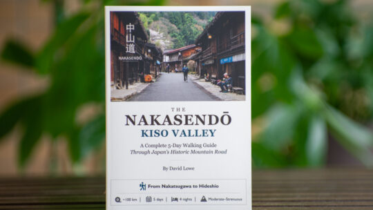
Book Launch I’m pleased to announce that The Nakasendo Kiso Valley: A Complete 5-Day Walking Guide is now available as a paperback on Amazon, with availability across several international Amazon stores, alongside the existing PDF edition on Ko-fi...
Hiked on June 12, 2026 . Asama-sanso 浅間山荘 – Asama-kazankan 火山館 – Mt. Maekake 前掛山 Duration: 2 days Distance: 22.3 km Elevation change: 1320 metres Highest point: 2524 metres Start: Asamayama tozan-guchi bus stop Finish: Asamayama tozan...
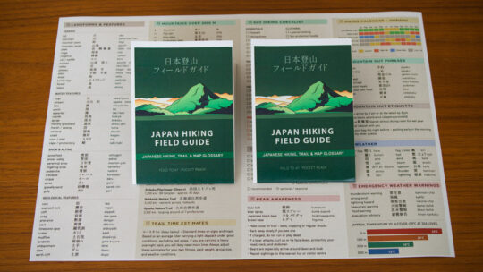
A New Pocket Reference for the Trail I’ll preface this by saying this is one of the projects on the blog I’m happiest with. Pulling all of this information together into one place has been a labour of love – something I’ve spent a good chunk of time...
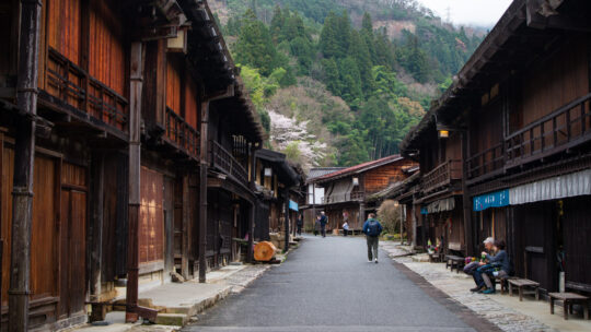
Route Notes, Accommodation & Logistics As someone who naturally gravitates towards longer, multi-day walks, the Nakasendō had long been on my radar – not as a quick day trip between Magome and Tsumago, but as a continuous walk through the Kiso...
Hiked on Apr 28, 2026 . Mt. Obinayama 帯那山 – Tara-toge 太良峠 – Mt. Tanayama 棚山 Duration: 2 days Distance: 18.5 km Elevation change: 1091 metres Highest point: 1422 metres Start: Toichi bus stop (taxi) Finish: Yamanashi-shi Station (JR Chuo...

Hiked on Apr 25, 2026 . Mt. Odake 王岳 – Mt. Kagikake 鍵掛 – Mt. Settogatake 雪頭ヶ岳 Duration: 6 hours Distance: 10.4 km Elevation change: 828 metres Highest point: 1738 metres Start: Saiko Iyashi-no-Sato Nenba bus stop Finish: Saiko Iyashi-no...

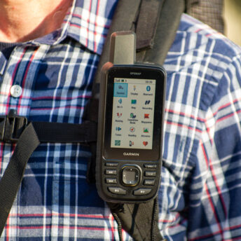
The Best Headlamp for Most Hikers Of all the items in your pack, few carry higher stakes than a headlamp. A sleeping pad that fails means sleeping on the ground; a headlamp that fails at the wrong moment can be genuinely dangerous. On a dark...

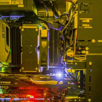
The Actual Costs, and What a Blog Like This Earns Around 450 posts, roughly 19,000 page views a month, and a question I get surprisingly often: “What does it cost to run the blog and does it make any money?” This post attempts to answer that...

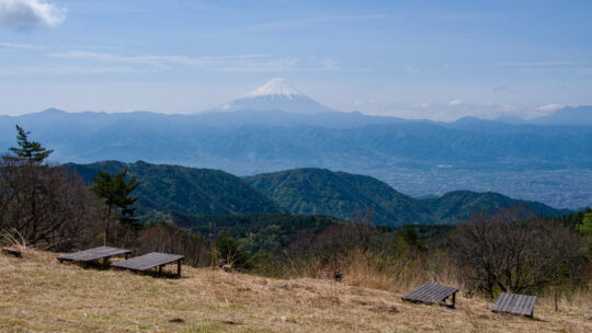
My Personal Top Fuji-View Hikes in Japan After 13 years of hiking and writing about the trails of Kanto and beyond, I’ve put together this guide to the best hikes in Japan for Mt. Fuji views – twenty-one personal favourites spanning prefectures from...
Hiked on Mar 14, 2026 . Onnazaka-toge 女坂峠 – Shoji-toge 精進峠 – Panorami-dai パノラマ台 Duration: 5 hours Distance: 8.5 km Elevation change: 512 metres Highest point: 1422 metres Start: Shoji bus stop Finish: Panorama-dai-shita bus stop ...
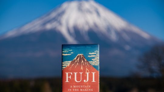
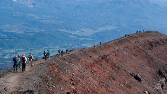
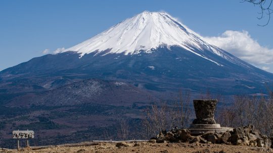
History, Belief, and the Making of Japan’s Most Enduring Symbol Living in Tokyo gives me the somewhat rare privilege of seeing Mount Fuji from my balcony on clear days – a view that renders the peak as a serene, distant icon. Yet, having climbed the...
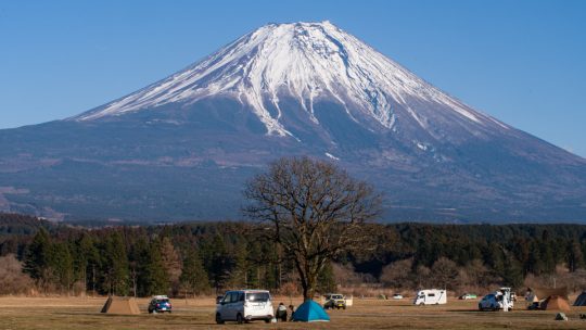
Camping at the Foot of a Giant When it comes to “galactic scale” campgrounds in Japan, Fumotoppara ふもとっぱら in the Asagiri Kogen highlands of Shizuoka Prefecture reigns supreme. Spreading out at the foot of majestic Mount Fuji, the site is a behemoth;...