Mountains You Can Climb in a Day from Tokyo
For residents and tourists alike spending too much time in Tokyo can well make you go bonkers after a while. Thus, to keep your Zen, frequent getaways to the surrounding mountains are well-advised. The following rundown of hikes complements The Best Day Hikes Around Tokyo a smaller selection I put together a few years ago. All are doable as day outings and cater to a range of hiking abilities, from casual day hikers to more experienced adventure-seekers, spanning seven prefectures across the Kanto region. One-way travel times are within 3 hours of downtown Tokyo.
Contents
1. Mt. Takao – Tokyo
2. Mt. Odake – Tokyo
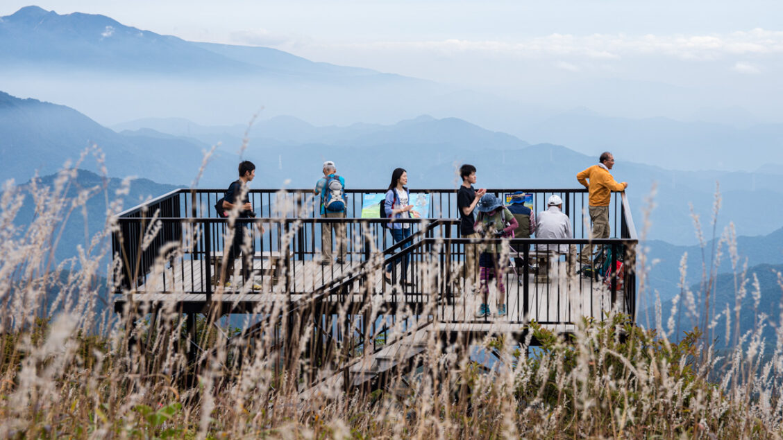
3. Mt. Jinba – Kanagawa Prefecture/Tokyo
4. Mt. Bukka (Bukkasan)- Kanagawa Prefecture
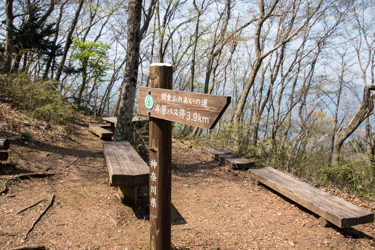
5. Mt. Koubou – Kanagawa Prefecture
6. Mt. Kintoki (Mt. Ashigara) – Kanagawa Prefecture
7. Mt. Mitsutoge – Yamanashi Prefecture
8. Mt. Takagawa – Yamanashi Prefecture
9. Mt. Kentoku – Yamanashi Prefecture
10. Mt. Nokogiri – Chiba Prefecture
11. Mt. Hodosan – Saitama Prefecture
12. Mt. Hiwada – Saitama Prefecture
13. Mt. Bonomine (Mt. Bonoore) – Saitama Prefecture/Tokyo
14. Mt. Akagi – Gunma Prefecture
15. Mt. Tsukuba – Ibaraki Prefecture
.
1. Mount Takao – Tokyo
Difficulty: Duration: 4 hours Distance: 11.4 km
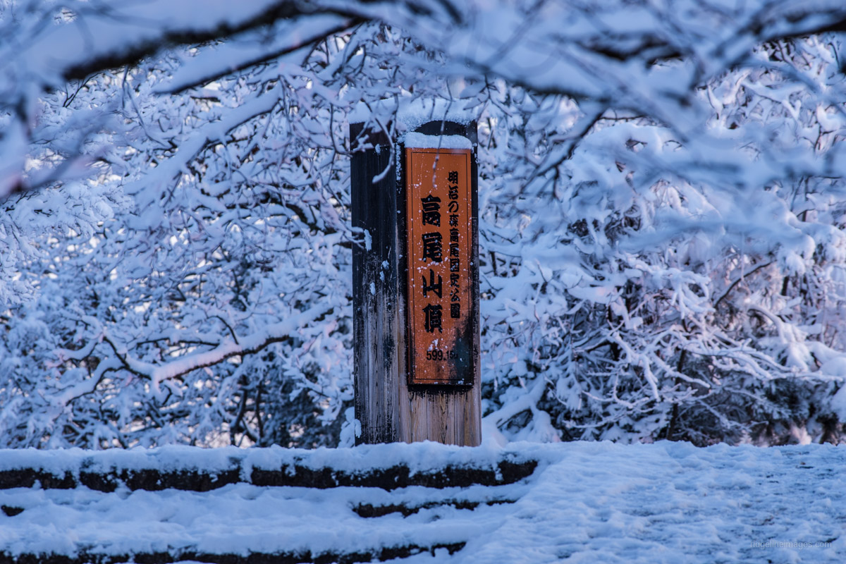 Mt. Takao needs little in the way of introduction. It attracts more climbers than any other mountain in the world (around 3 million annually), and even Michelin has awarded it a three-star tourist destination. Like many Tokyoites, I climb Takaosan regularly to maintain fitness in the off-season, and no matter how many times you hike it, you’ll always encounter something new. There are no less than seven hiking trails to the summit, and for families with little ones in tow, the cable car and chair lift transport you to 472 metres in about 6 minutes. For those looking to lengthen the hike, options include following the Takao-Jinba Trail across to Mt. Kobotoke-Shiroyama and down to Sagamiko Station or even across to Mt. Jinba is a good 4-hour hike away.
2. Mt. Odake – Tokyo
Difficulty: Duration: 5.5 hours Distance: 14.5 km
 Mt. Odake is both a 200 Famous Japanese Mountain and one of the three famous peaks of Okutama. It is easily accessible by public transportation and has some of the best hiking in Tokyo, with several hiking approaches to the summit. A cable car runs from the foot of neighbouring Mt. Mitake a short detour after passing through the throng of Showa-era shops and restaurants and the Musashi Mitake Shrine on the summit. If the weather cooperates, the summit of Odakesan offers a splendid view of Mt. Fuji. Options from here include returning to the upper cable car station or battling on to Mt. Nokogiri, finishing at the Atago Shrine near Okutama Station.
3. Mt. Jinba – Kanagawa Prefecture/Tokyo
Difficulty: Duration: 4 hours Distance: 9.4 km
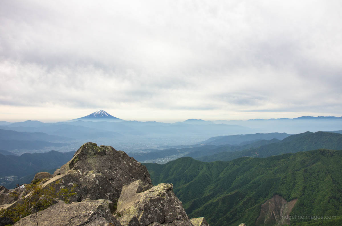
 Located on the Tokyo and Kanagawa border Mt. Jinba embodies much of what is great about hiking in Tokyo – quiet enough to feel you’ve escaped the rat race but still accessible enough from downtown Tokyo. The broad sunbathed summit provides a 360-degree view of Mt. Fuji, Tanzawa Mountains, Okuchichibu, and if you’re lucky even Mt. Tsukuba. Like nearby Mt. Takao it’s a crowd-puller with those who enjoy hiking and mountain climbing. There are a couple of teahouses on the mountaintop, so you can eat udon and soba while watching the spectacular view. The easiest route is a 30-minute climb from Wada-toge carpark. The hike in the link description commences at the Jinba Kogen Shita bus stop finishing like the Takaosan hike at Sagamiko Station.
4. Mt. Bukka (Bukkasan) – Kanagawa Prefecture
Difficulty: Duration: 4.5 hours Distance: 9.3 km
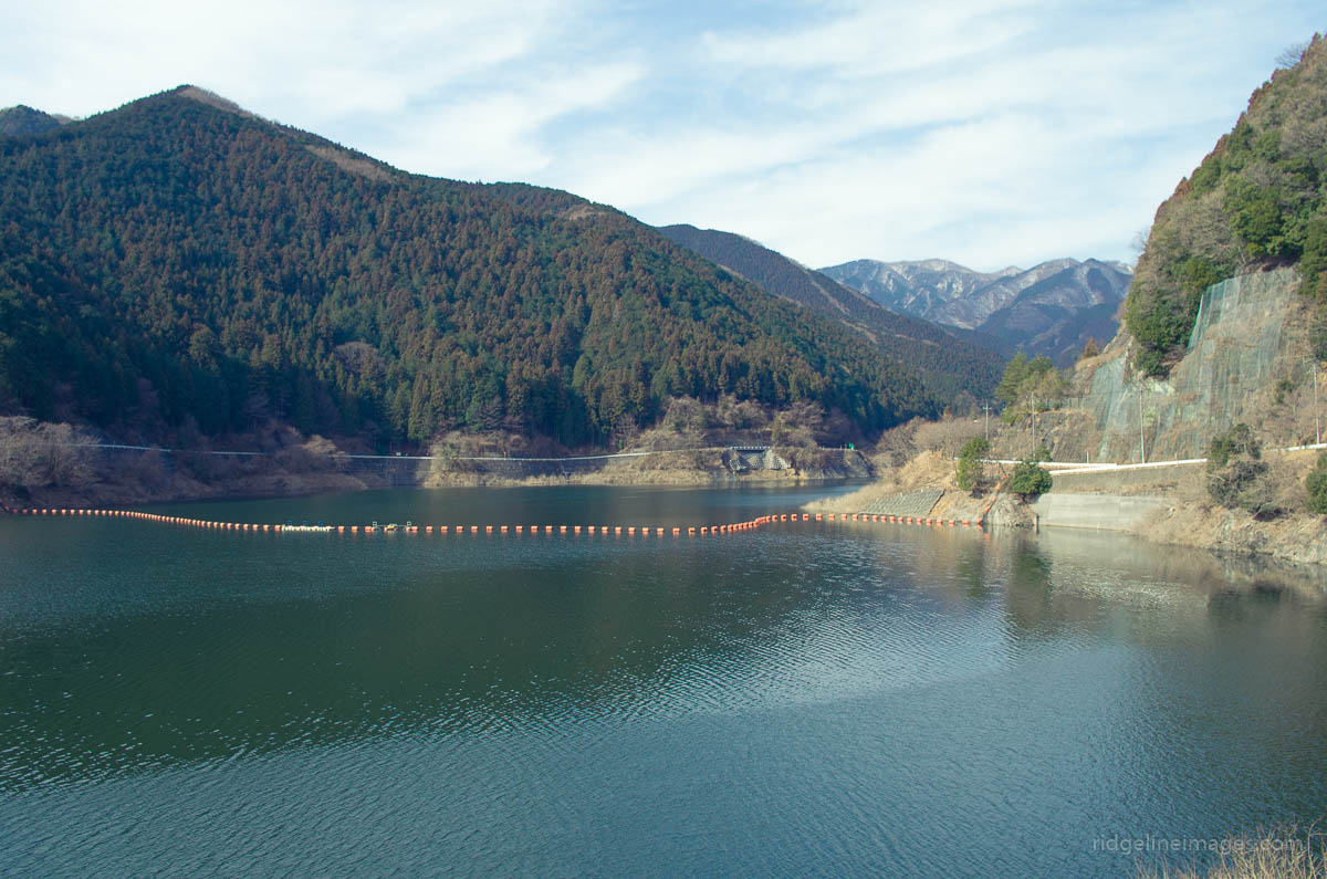
 Compared to the nearby Tanzawa Mountains, Mt. Bukka is relatively low at 700 metres, making it suited to a range of hiking abilities. The shortest route to the summit is an out-and-back hike or piston from the Bukkasan Tozanguchi, but if you’re looking to make a day of it, start at Tsuchiyama-toge and finish at the northern end of the Miyagase Dam. Both summits of Mt. Bukka and Mt. Takatori have 13 metre steel-framed lookout towers that loom above the canopy, providing a terrific 360-degree view.
5. Mt. Koubou – Kanagawa Prefecture
Difficulty: Duration: 2.5 hours Distance: 8.2 km
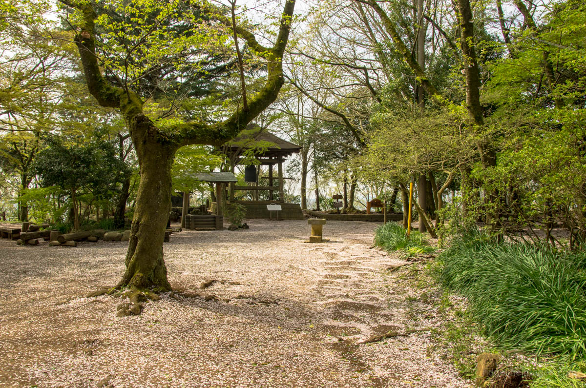 Mt. Koubou rests inside Koboyama Park and is a favourite with families with leisurely hiking trails in Hadano City, Kanagawa. Thanks to its 2,000 Yoshino cherry blossoms the park attracts large numbers of sightseers in early spring. The observation rotunda which sits atop of Mt. Koubou has an impressive outlook of Fujisan as well as night views of the surrounding city. A longitudinal hiking trail runs from Hadano Station to Tsurumaki-Onsen Station suitable for people of all ages and abilities. To top it off are hot springs within walking distance from both stations to relax afterwards.
6. Mt. Kintoki (Mt. Ashigara) – Kanagawa Prefecture
Difficulty: Duration: 3.5 hours Distance: 6.3 km
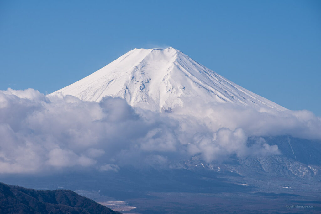
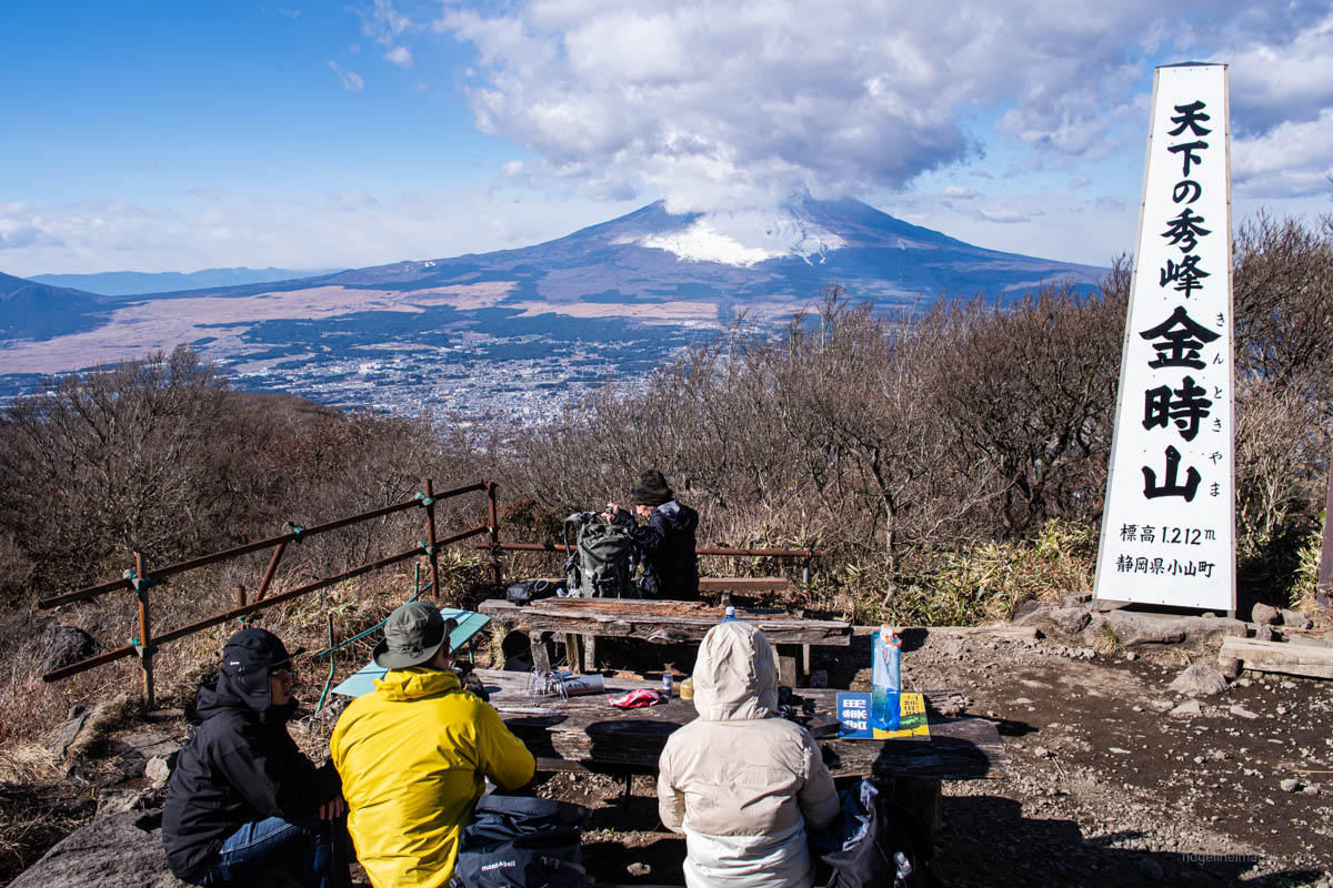 Mt. Kintoki (also called Mt. Ashigara) is a 300 Famous Mountain loved by beginners and famed for Japanese folklore warrior Sakata Kintoki (Kintaro). It also happens to be one of the best spots to get up close and personal with Mt. Fuji. There is a teahouse on the summit, so you can enjoy lunch while taking in one of the best views in the Kanto region. The mountain has several trailheads, three of which are dotted along the historic National Route 138, the most popular being an out-and-back piston commencing at Kintoki Tozanguchi. The hike here describes a circular course beginning and ending one stop further along at Kintoki Jinja Iriguchi Bus Stop.
7. Mt. Mitsutoge – Yamanashi Prefecture
Difficulty: Duration: 6.5 hours Distance: 17 km
 While Mt. Mitsutoge deservedly gets a bad rap for its unsightly radio antennas, but what isn’t in dispute is its dazzling view of Fujisan. Mitsutogeyama is a general term for a trio of summits comprising Mt. Kaiun, Mt. Osutaka, and Mt. Kenashi. The mountain is rich in alpine plants and wildflowers and has been selected as one of the 100 Flower Mountains of Japan. The standard hiking route from Mitsutoge Station is tough going and requires an early start, but it is one where you can fully enjoy the mountain’s charms. The closest climbing approach is from Mitsutoge Tozanguchi, a 25-minute bus ride from Kawaguchiko Station.
8. Mt. Takagawa – Yamanashi Prefecture
Difficulty: Duration: 4.5 hours Distance: 8.8 km
 Mt. Takagawa in Otsuki City, Yamanashi is a crowd-puller owing to its beginner-friendly trails and unobstructed view of Mt. Fuji. There are several climbing courses, with the most popular being a traverse between Hatsukari and Otsuki stations on the JR Chuo Main Line. It is also possible to shorten the hike by taking alternative trails down to Kasei and Tanokura stations on the Fujikyuko Line. From Hatsukari Station, it’s a 30-minute walk to the trailhead, and a further hour after this to reach the summit. The mountain can be climbed year-round, though four-point crampons or microspikes are advisable to carry during the winter.
9. Mt. Kentoku – Yamanashi Prefecture
Difficulty: Duration: 7 hours Distance: 11.1 km
 If you’re looking to push the envelope and wish to experience the thrill of scaling a 20-metre rock face, then think about pencilling in a trip out to Yamanashi to climb Mt. Kentoku. The hike begins its ascent through lowland forest, passing through a grassland plateau home to a herd of friendly deer before hitting its craggy peak. Closer to the summit, there are fixed chains to navigate a couple of gnarly parts a little before reaching the enormous rock slab. After soaking up the fine panorama consisting of Mt. Fuji, Minami Alps, and the Okuchichibu Mountains return to the plateau, where you can descend via the alternate but steeper Douman Ridge.
10. Mt. Nokogiri – Chiba Prefecture
Difficulty: Duration: 3.5 hours Distance: 6.9 km
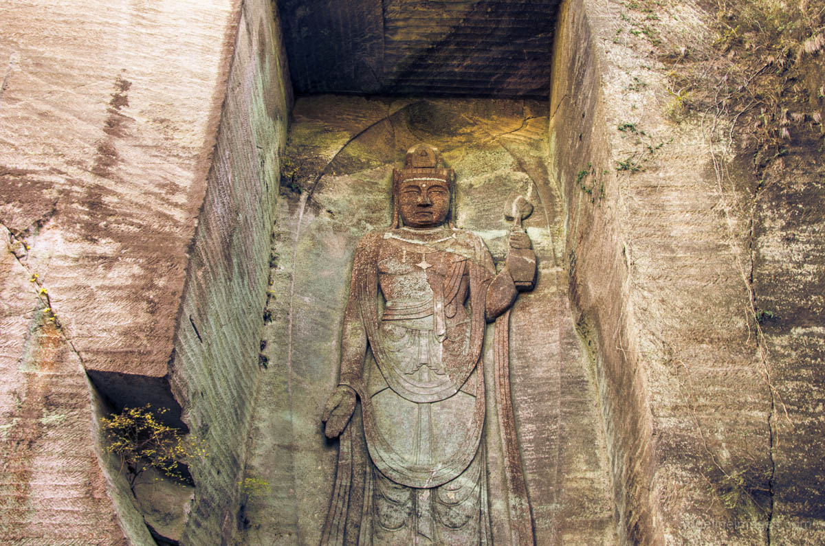 For top-notch views across Tokyo Bay as well as a look back on history, Mt. Nokogiri or “saw mountain” on the Boso Peninsula is a worthwhile day trip. A popular approach to the summit is via the Kanto Fureai No Michi and return by the Nokogiriyama Ropeway. The hiking course draws attention to the mountain’s history as a stone quarry during the Edo period. The best bit of the mountain of course is the Jigoku Nozoki or “View of Hell” a jutted rock precipice that seems to defy gravity. From here a path heads down to the mountain’s other pièce de résistance the 31-metre high Nihonji Daibutsu – the largest pre-modern stone carved Buddha in Japan.
11. Mt. Hodosan – Saitama Prefecture
Difficulty: Duration: 3 hours Distance: 6.2 km
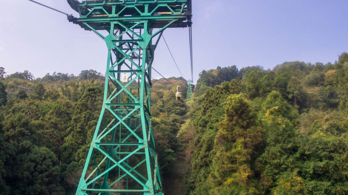 Chichibu’s Mt. Hodosan is another great option for families and beginners. Hodosan is probably best known for its flowers, including the sweet-smelling wintersweet, which blooms at the end of January followed by plum blossoms, cherry blossoms, and azaleas in late April. A free shuttle bus runs from Nagatoro Station to the lower cable car station during operating hours, which whisks you to within a stone’s throw of the summit in about 5 minutes. Alternatively, there is a trail which winds its way up the mountain, where if you’re lucky, you can pay witness to a “sea of clouds” which spread through the Chichibu basin in the spring and autumn.
12. Mt. Hiwada – Saitama Prefecture
Difficulty: Duration: 3.5 hours Distance: 9.2 km
 Overlooking Kinchakuda “Red Spider Lily Park” Mt. Hiwada is popular amongst beginners and families due to its convenient access and easy hiking. Even though the mountain is a lowly 305 metres it boasts good views – you can see Mt. Tsukuba on clear days and is climbable year-round. The trailhead is a 20-minute walk from Koma Station or if you’re coming by car there is plenty of parking available. The round-trip course to Mt. Hiwada is only 4.5 km, but if you’re looking for something longer you can start the hike at Musashi-Yokote Station and pass by Mt. Monomi and Mt. Takazasu. Hidaka City where Mt. Hiwada is located is notable for its early Korean heritage adding some historical interest to the hike.
13. Mt. Bonomine (Mt. Bonoore) – Saitama Prefecture/Tokyo
Difficulty: Duration: 6 hours Distance: 11.2 km
 Straddling the Saitama and Tokyo borders, Mt. Bonomine a popular mountain with numerous approaches to the summit. The hike described in the link follows a lesser-used and rather demanding loop trail starting at the far end of Naguri Lake. The route used by most hikers, however, is an out-and-back piston commencing near the Arima Dam and following the clear waters of the Shirayazawa Creek. There are several waterfalls to enjoy as you make your way along the rocky valley towards the broad summit. In fine weather, there are views across the Okuchichibu Mountains is a perfect place to spread the picnic blanket and take lunch. Don’t attempt this hike after heavy rain or in winter due to a number of stream crossings and lingering ice.
14. Mt. Akagi – Gunma Prefecture
Difficulty: Duration: 5 hours Distance: 12.3 km
 Mt. Akagi is another of the 100 famous mountains and a mecca for nature lovers with activities including camping, mountain climbing, boating, and smelt fishing in winter. A walking path meanders around Oonuma Lake, which sits below the central caldera. For more experienced adventure-seekers, abundant mountain climbing routes centre on the highest peak, Mt. Kurobi. The hiking course described in the notes is a steady climb starting from the Mt. Kurobi trailhead. The summit offers views of Nikko Oku-Shirane and Mt. Tanigawa. From here, traverse across to nearby Mt. Komagatake and back down to the lake, where you can extend the hike or head back, calling by the Fujimi-onsen for a well-earned soak on the way back to Maebashi Station.
15. Mt. Tsukuba – Ibaraki Prefecture
Difficulty: Duration: 3.5 hours Distance: 5.9 km
 With a cable car and ropeway straddling its slopes means Mt. Tsukuba is no stranger to crowds. Adding to its notoriety is its inclusion as one of the 100 famous mountains in Japan. Luckily for those looking to give the masses a wide birth, there are a variety of climbing courses. The hike in the link description starts at the lower cable car station taking a bit over an hour to reach the cavalcade of late Showa era omiyage shops and restaurants next to the Koma Observatory. After making a short detour to Mt. Nantai the lesser of Tsukubasan’s twin peaks continue across to Mt. Nyotai the highest point. The hike finishes at the bottom of the Tsutsujigaoka ropeway where you can pick up a return bus to Tsukuba Station. Like Mt. Takao plan for an early start.


David
Thank you for helping get my Japan mountains fix when Covid prevents me from getting back there.
Thanks for reading Stewart, I think every time I say hopefully won’t be too much longer it inevitably is, so I won’t say that, but glad to hear my hike reports go somewhere near to providing that fix.
An excellent list! Might I add Oyama reached also from Odakyu’s Hadano station and a short bus ride. It’s an excellent hike, but bring some poles for the stairs down though! But the view of the Shonan coast and Enoshima are worth it.
We actually managed Goshikinuma Ponds and Bandai san as an autumn day trip, starting in the dark and getting back to Tokyo Station just before midnight. My little party came down the mountain’s ski slopes once we’d lost the light.
Cheers Patrick. Thanks for highlighting the Oyama hike which is well recommended. I didn’t mention it as it was included in my previous best Tokyo hikes list.
My top 3 day hikes for views, in no order:
Mt. Ono (Access Yamakita Station)
Mt. Mura (Ashigakubo Station)
Mt. Tonodake (ShibusawaStation)