.
Asama-sanso 浅間山荘 – Asama-kazankan 火山館 – Mt. Maekake 前掛山
Distance: 22.3 km
Elevation change: 1320 metres
Highest point: 2524 metres
Start: Asamayama tozan-guchi bus stop
Finish: Asamayama tozan-guchi bus stop
Difficulty: ▅▅▅▅▅▅▅▅▅▅ ❹
Map: Yama to Kogen Chizu 山と高原地図[No.19 浅間山 ASAMA-YAMA]
GPX TrackKML TrackGSI MAPPDF Topo Map
Hiking Honshu’s Most Active Volcano
Mount Asama, one of the Hyakumeizan and straddling the Gunma–Nagano border, is the most active volcano on Honshu and among the most active stratovolcanoes in the country. Over tens of thousands of years, repeated eruptions and collapses have shaped its distinctive landscape of overlapping calderas and rugged volcanic terrain, with the most recent eruption occurring in 2019. Last month (May 23), for the first time in more than three years, access to Mt. Maekake (2,524 m) was reopened following a reduction in the volcanic alert level from Level 2 to Level 1. Located on the volcano’s second outer rim, Mt. Maekake offers hikers a rare opportunity to approach the active crater area, with panoramic views stretching as far as Mt. Fuji and across to Mt. Asama itself, while remaining outside the permanently restricted zone that extends within a 500-metre radius of the summit.
Day 1: Setting Up Camp at Asama Sanso (4.2 km)
To reach the trailhead, board the Hokuriku Shinkansen from Tokyo Station and head to Sakudaira Station 佐久平駅. After exiting the ticket gates, turn right towards the Tateshina Exit 蓼科口. The bus departs from bus stop No. 3. Note that there are only two daily JR-run bus services (IC accepted), departing at 8:40 am and 2:00 pm, bound for Takamine Kogen Hotel-mae 高峰高原ホテル前 (located near the visitor centre), an alternative starting point for the hike. For this route, alight at Asamayama Tozan-guchi 浅間山登山口 (35 minutes, 920 yen). From the bus stop, follow the forest road for 4 km, which takes around an hour to reach Asama Sanso. The walk is quite pleasant, although unfortunately there are no shortcuts to avoid the road’s switchbacks.
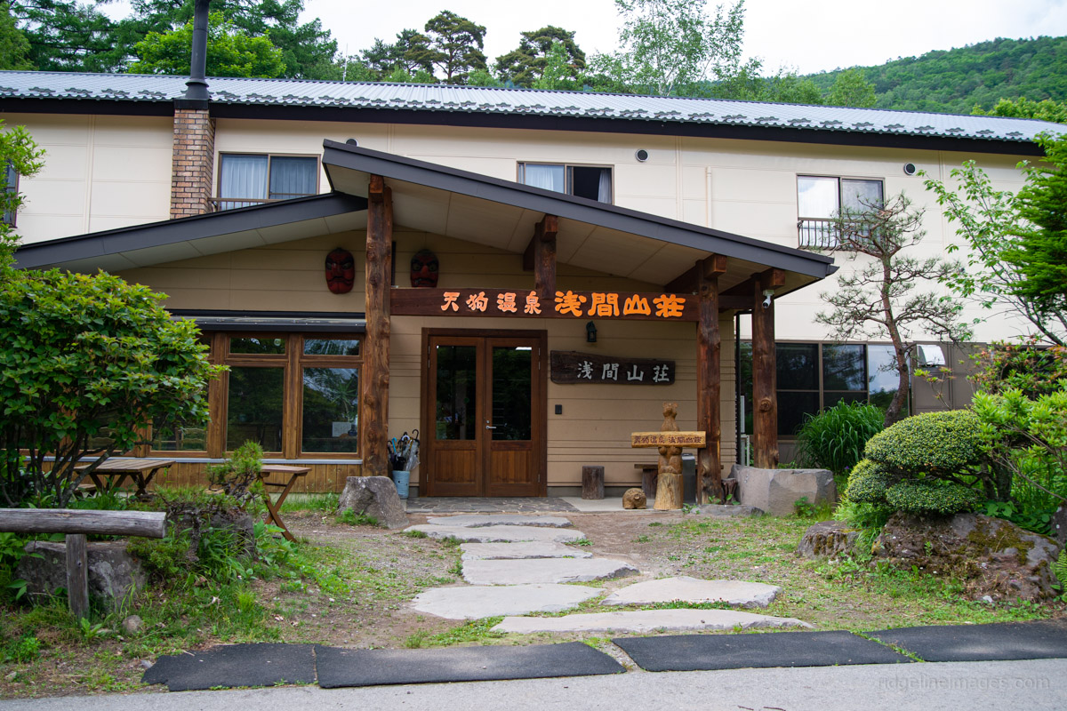
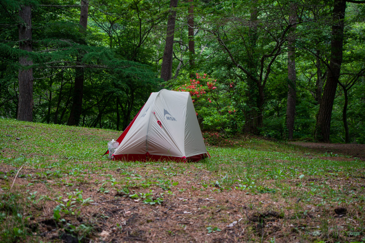
Climbing Mt. Maekake as a day hike via public transport from Tokyo, either from Takamine Kogen Hotel-mae or Asamayama Tozan-guchi, is possible, but the schedule is very tight and requires hiking faster than the standard map times in order to make the return bus. Another option worth considering is getting off at Karuizawa and transferring to a local train for Komoro Station 小諸駅. From there, take a taxi directly to Tengu Onsen/Asama Sanso 天狗温泉浅間山荘 (approximately 4,500 yen). This cuts out the additional walk along the forest road and allows you to begin the hike at around 8:30 am.
The approach I took was to head up the day before, catch the 2:00 pm bus, and spend the night at the lovely Asama Sanso Auto Campsite. I had expected it to be quite busy, but thankfully there were only a handful of other hikers staying there. It also worked out to be reasonably affordable at 2,420 yen per person per night (without a car), with an additional 800 yen for access to the onsen inside the lodge. It also meant I could get a good night’s sleep and make an early start on the trail the following morning. Another plus was that even though the official check-out time was 11:00 am, they said I could return later in the afternoon to pack up the tent and leave the campsite.
Day 2: To the Crater Rim of Mt. Maekake (18.1 km)
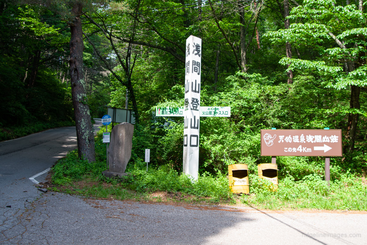
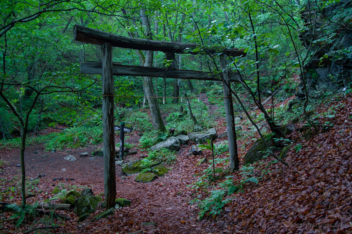
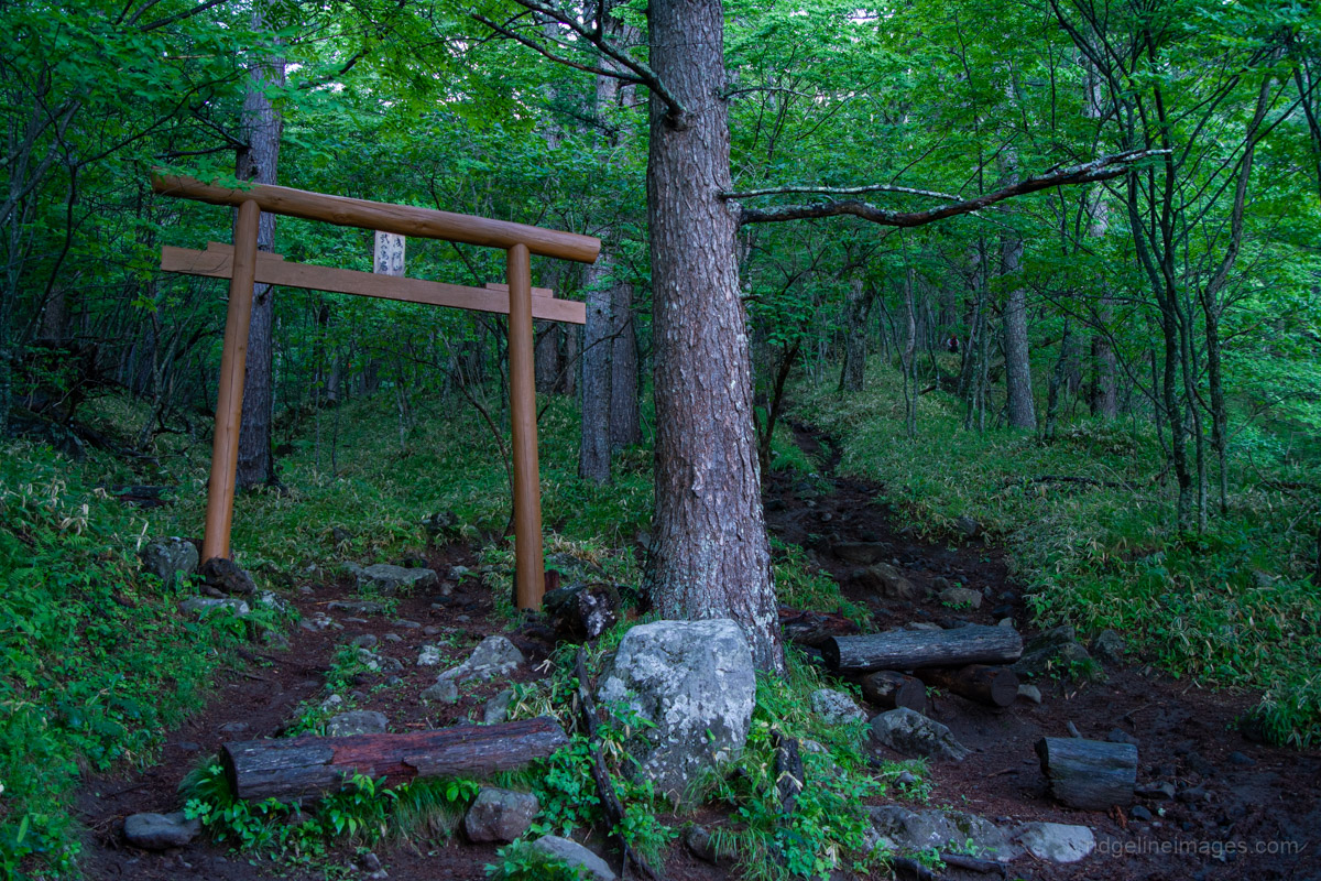
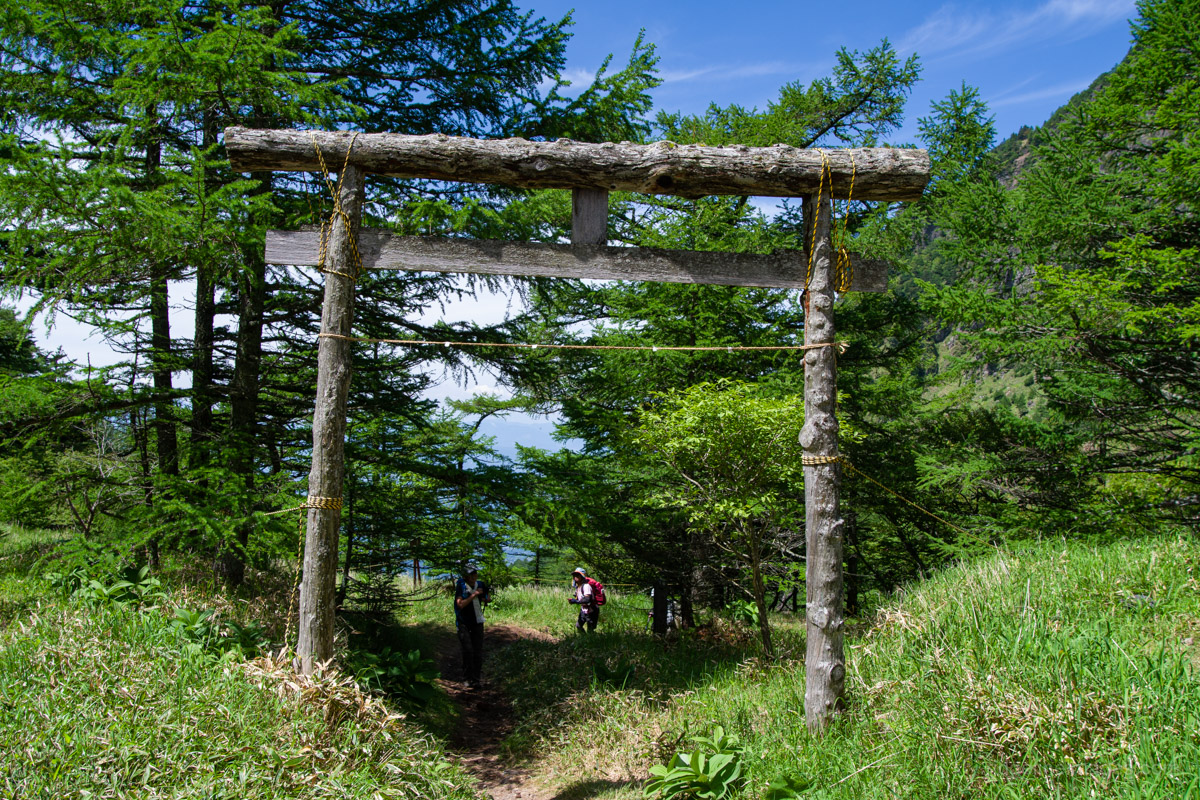
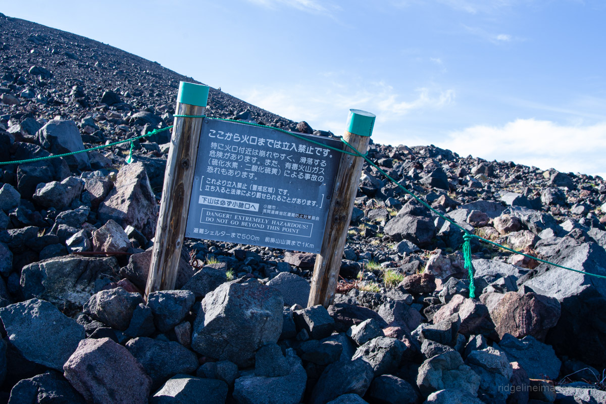
The previous evening a storm had passed through, though its wake brought clear skies in the morning. Leaving the campsite at 4:20 am, a good number of cars had already arrived. This was to be expected on a Saturday with rare clear weather in the middle of the rainy season, along with the downgrading of the volcanic alert level – a bit of a perfect storm, so to speak. The Mt. Asama trailhead, marked by a torii gate, is located next to the lodge, with a sign indicating the eruption alert level, which read Level 1. There is also a post box to submit your hiking plans before setting off. While Nagano Prefecture strongly recommends climbing helmets, and a small number of hikers on the day were wearing them, they are generally not necessary for this route.
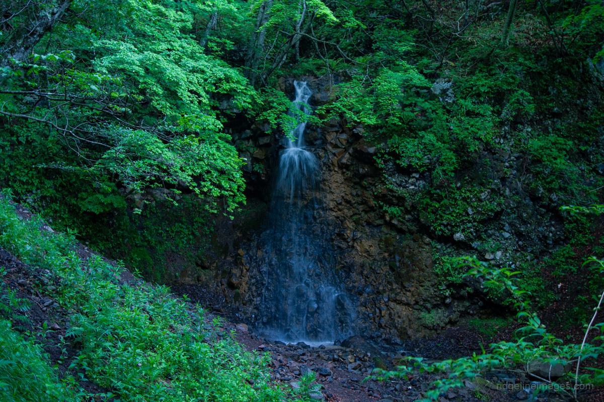
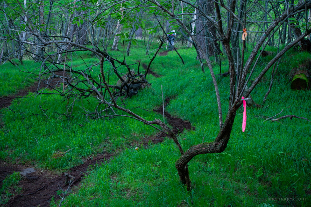
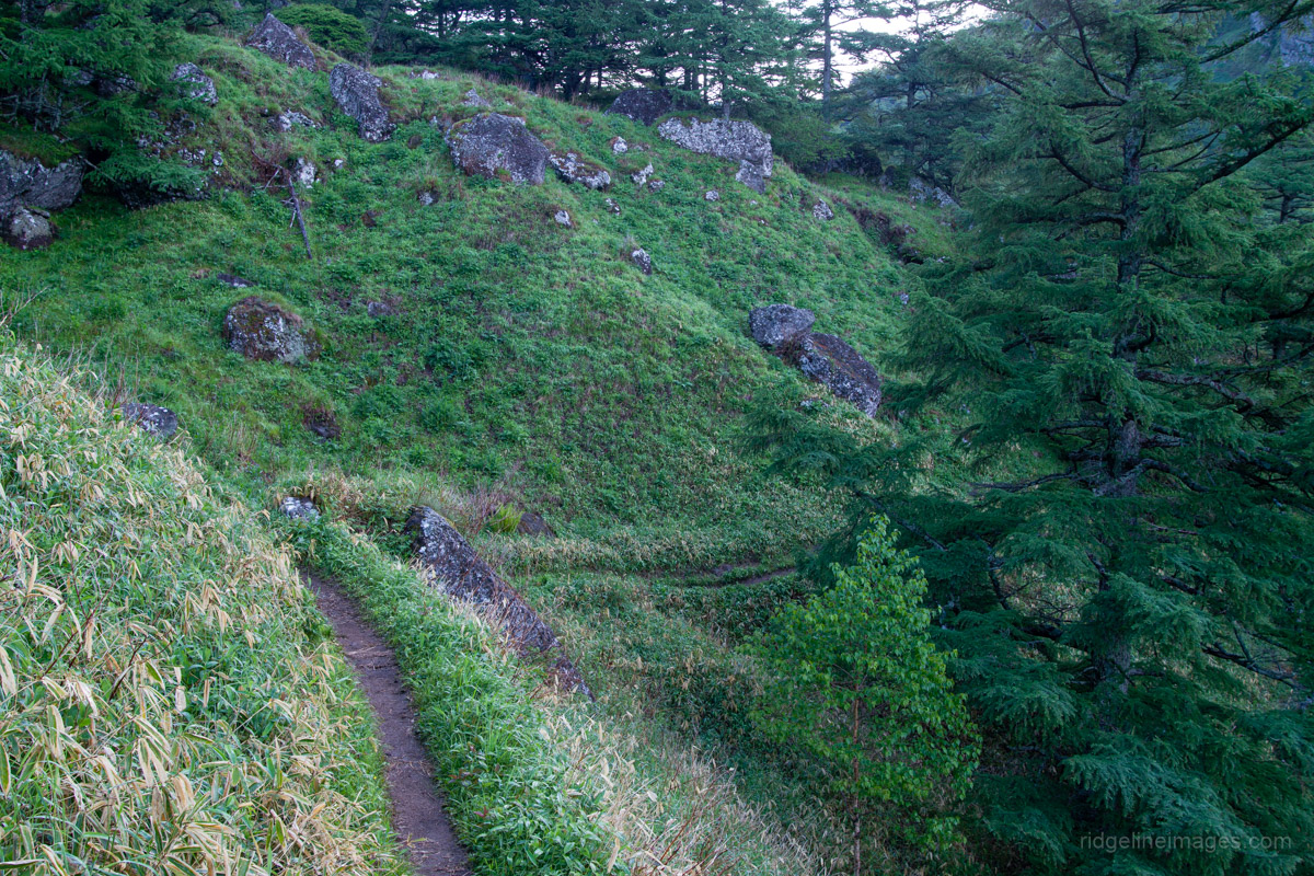
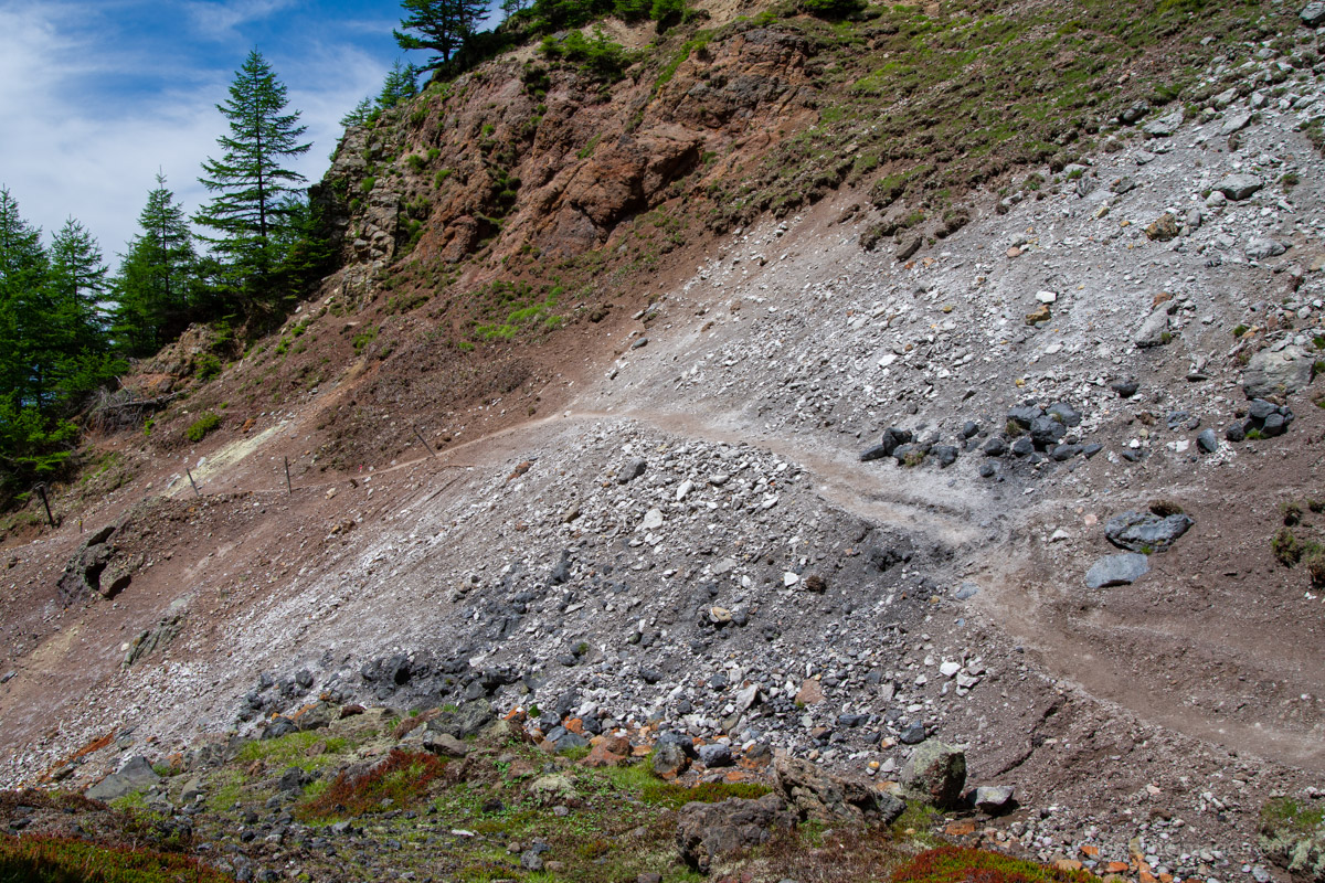
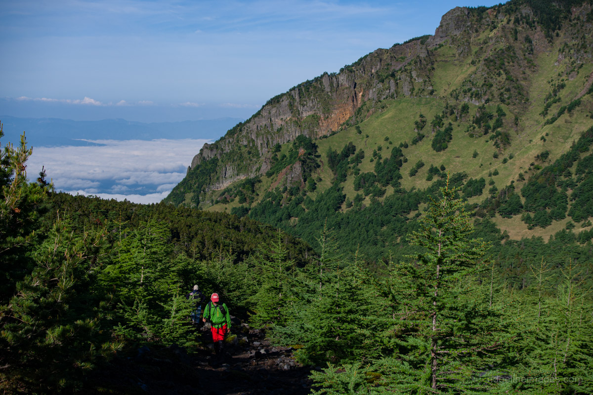
The trail starts off gently, crossing a bridge where reddish-brown water flows through the valley below. This distinctive colouring is due to the presence of hot spring water, and a faint sulphurous smell hangs in the air. About 30 minutes into the climb, you’ll arrive at the first torii gate. The trail splits here, giving you two options. Heading straight leads to a waterfall called Fudotaki 不動滝, while veering left cuts around the valley. Both paths rejoin a little further along, so it is worth taking one route on the ascent and the other on the descent. I took the waterfall route on the way up and the alternative path on the way back.
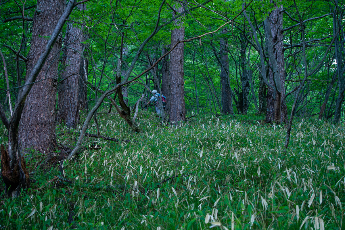
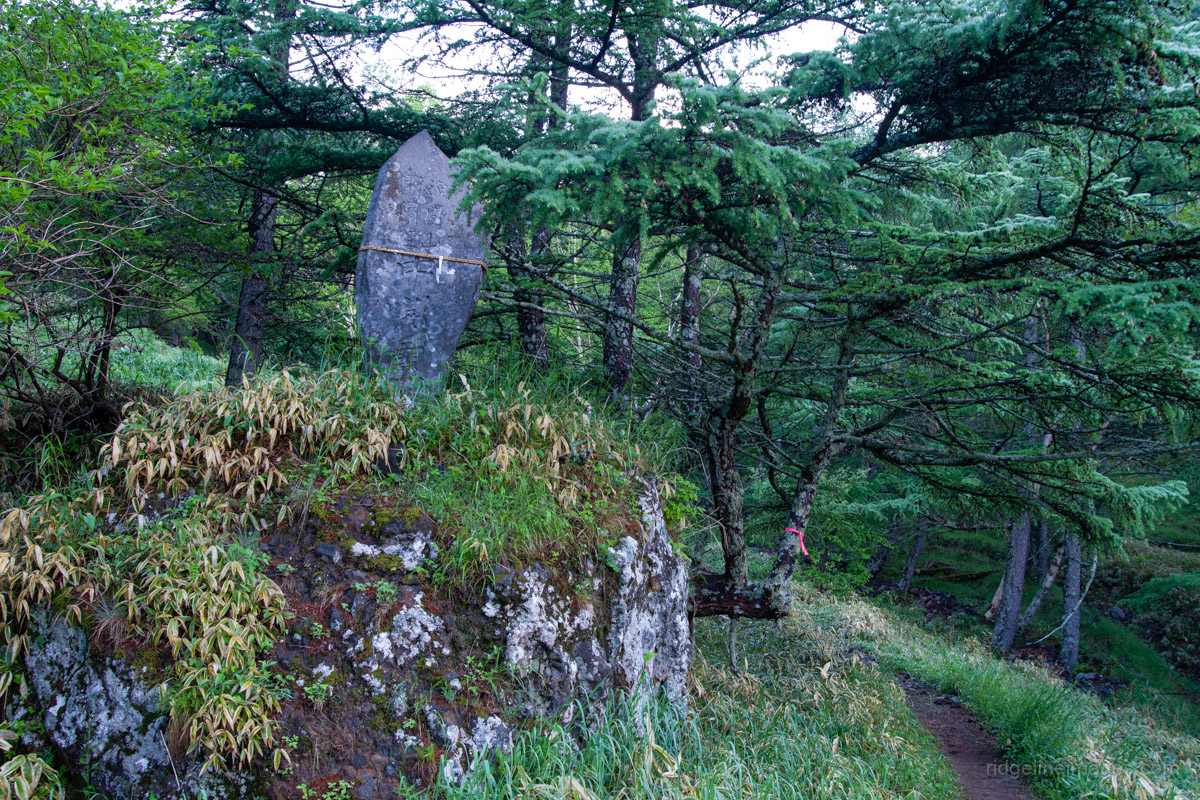
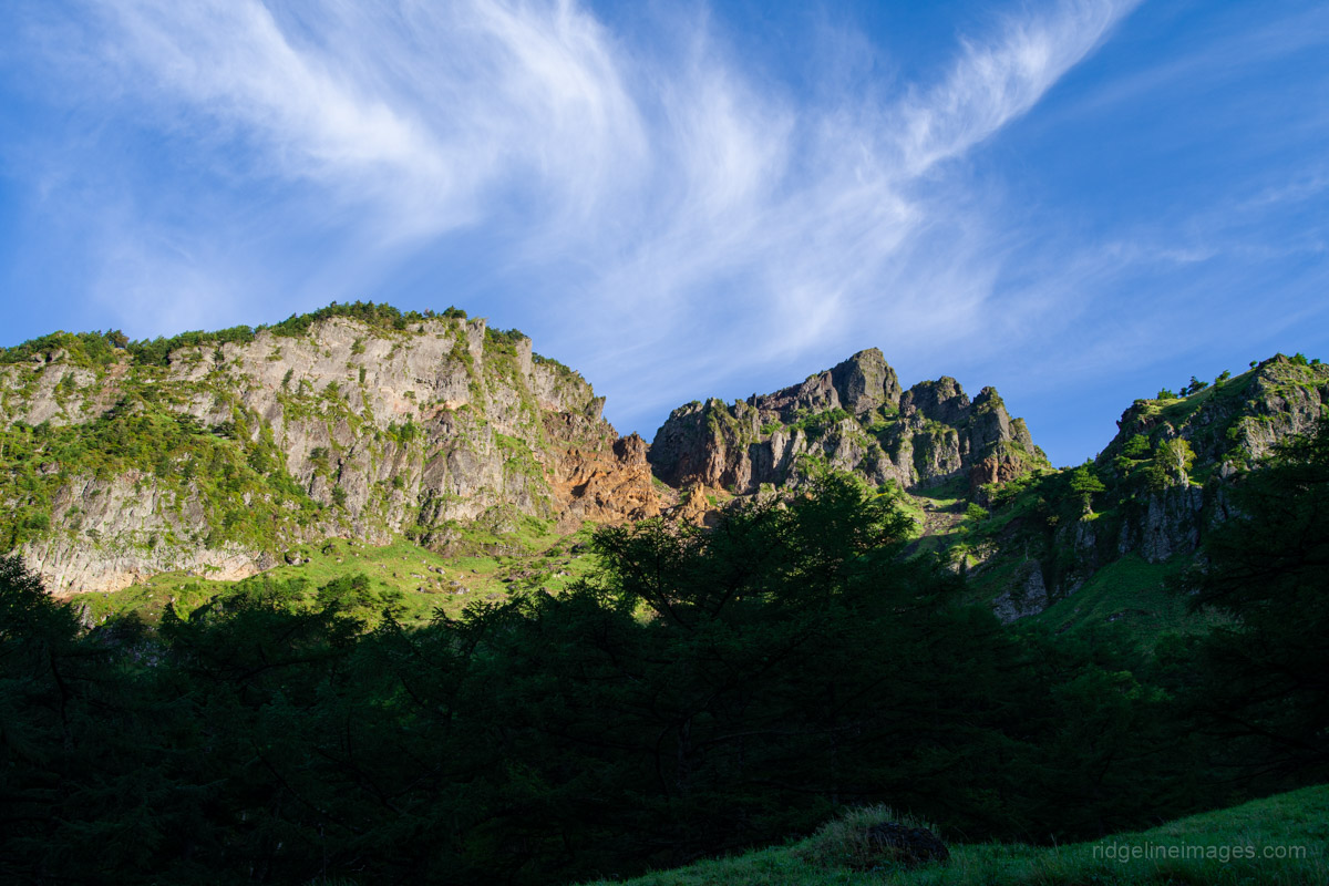
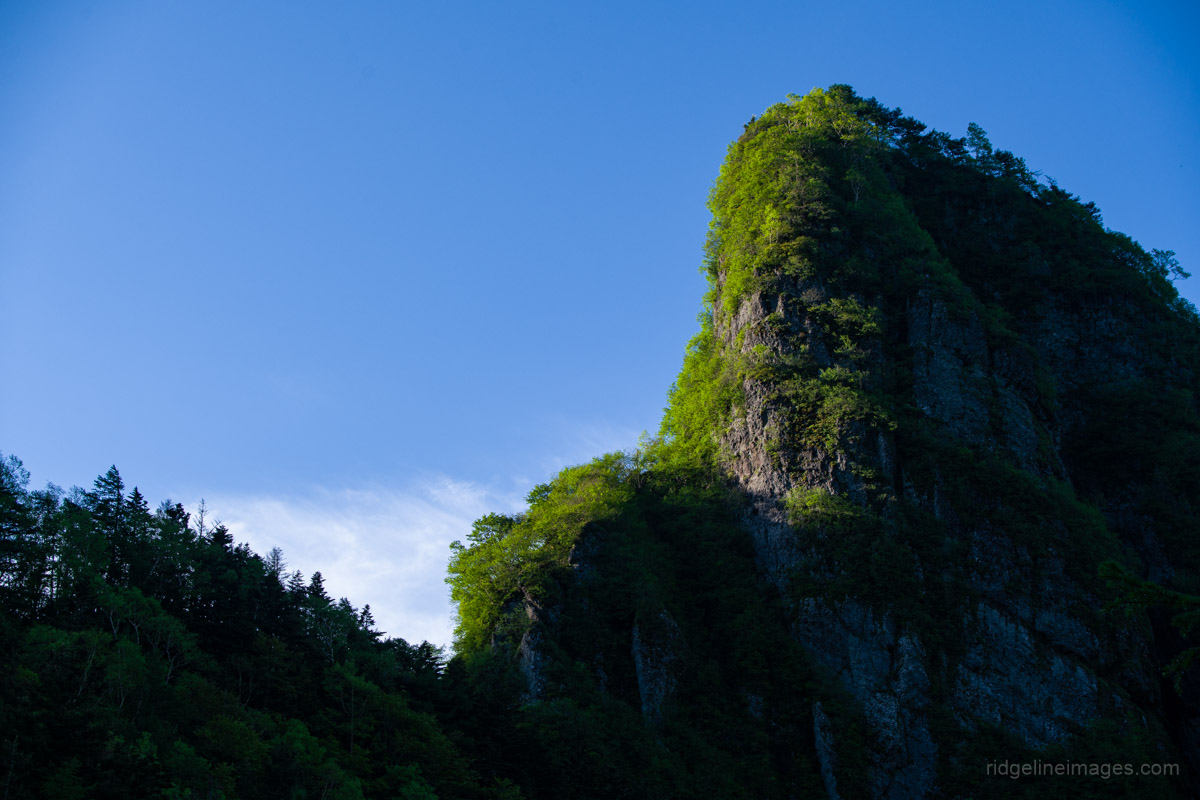
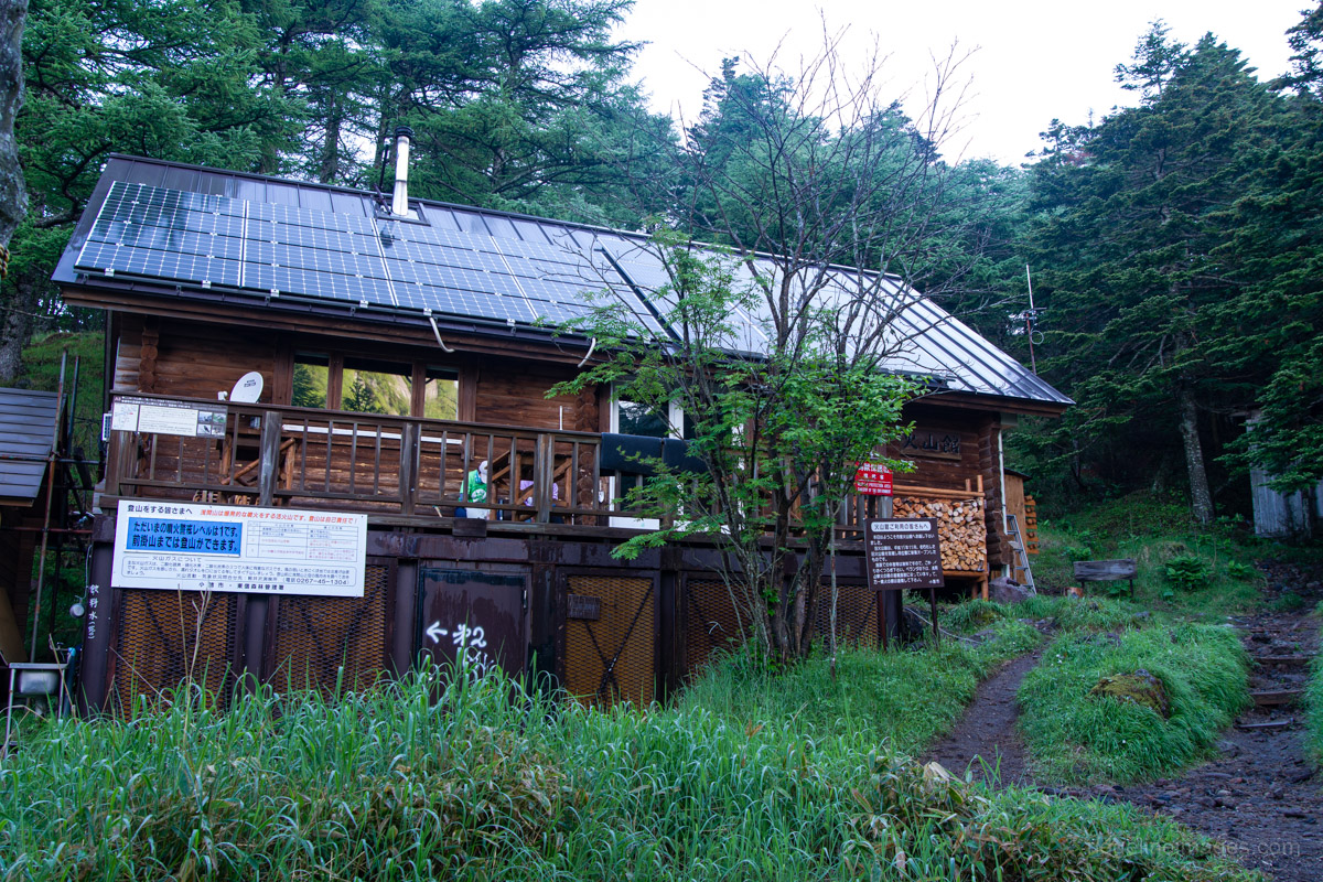
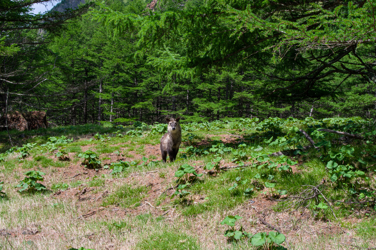
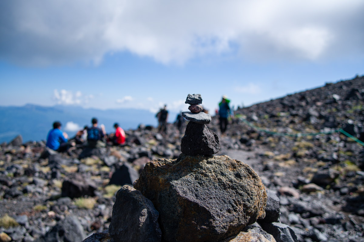
After passing through another torii gate, the views begin to open up, revealing the sheer cliffs of the caldera’s outer rim. A little further along is Kamoshika-daira カモシカ平, reputedly a good place to catch a glimpse of the Japanese serow, although my own sighting came later on the Yunodaira 湯ノ平 above the rest house. There is also a monument inscribed with a poem before the trail enters an open area where warm water seeps out from the cliffs. Soon after, you reach Asama Kazankan (Rest House) 浅間火山館, a free rest area managed by Komoro City. It is not a mountain hut, so overnight stays are not permitted. Here you will find toilets (200 yen) and a reliable water source.
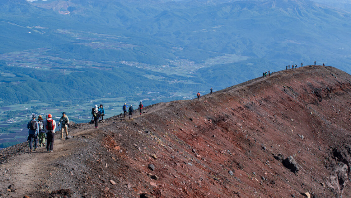
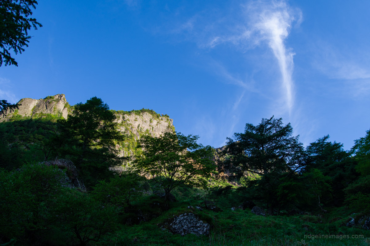
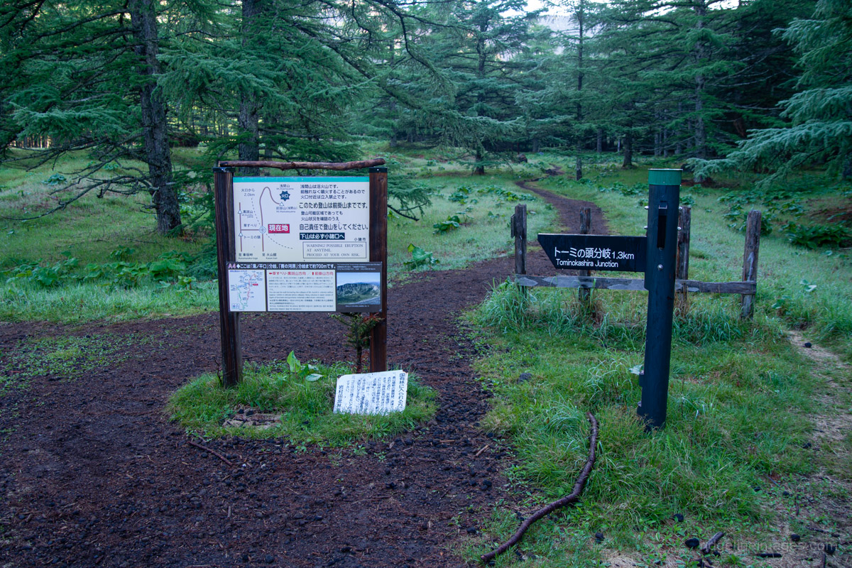
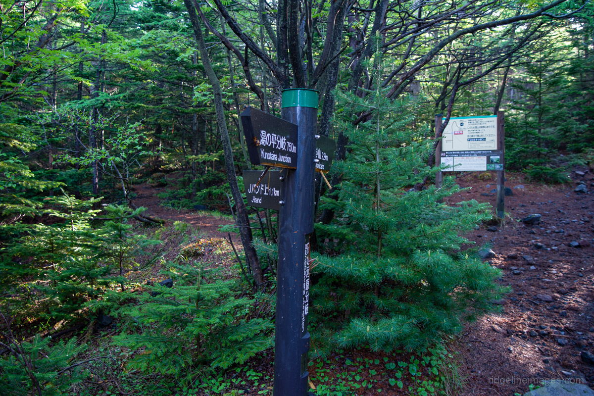
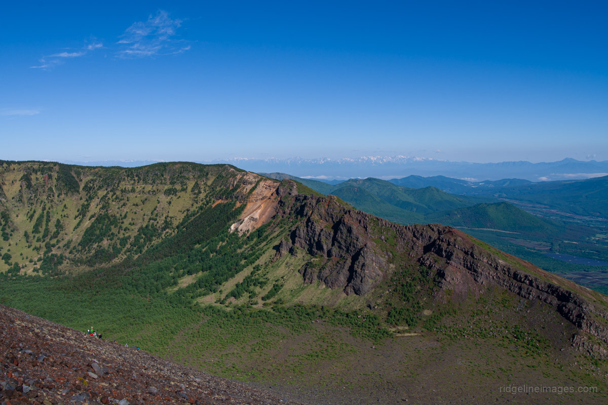
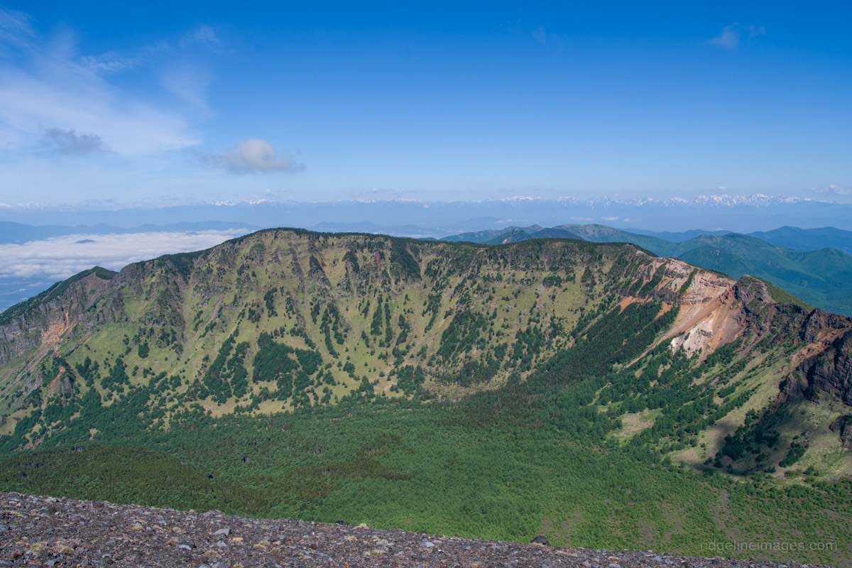
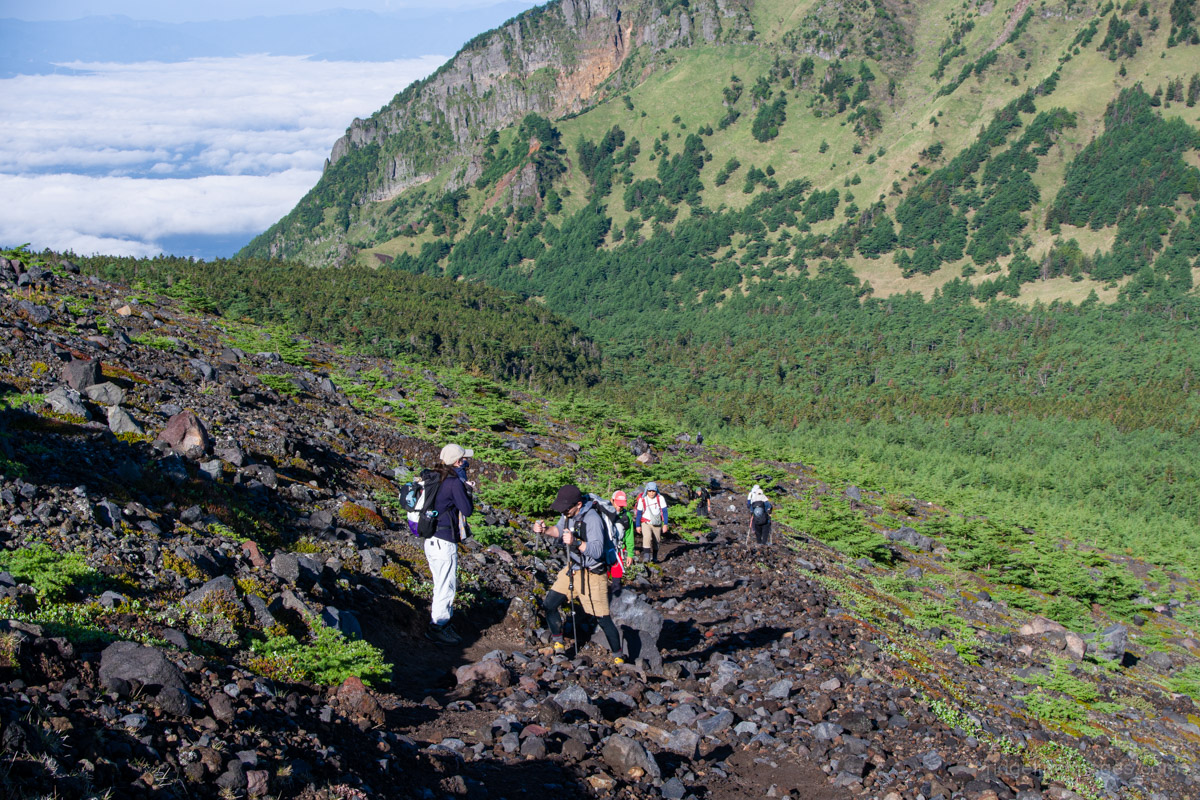
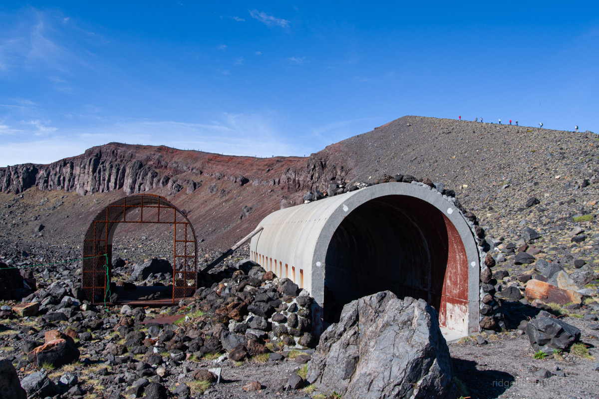
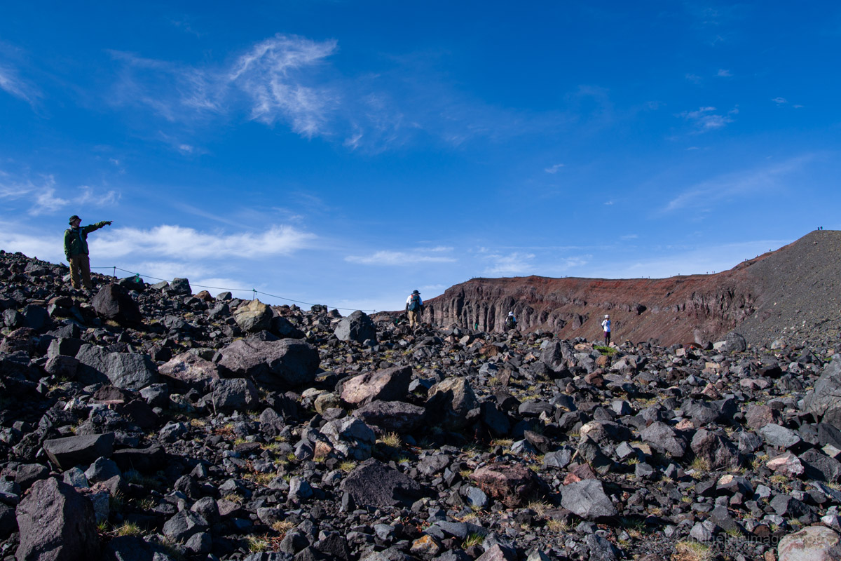
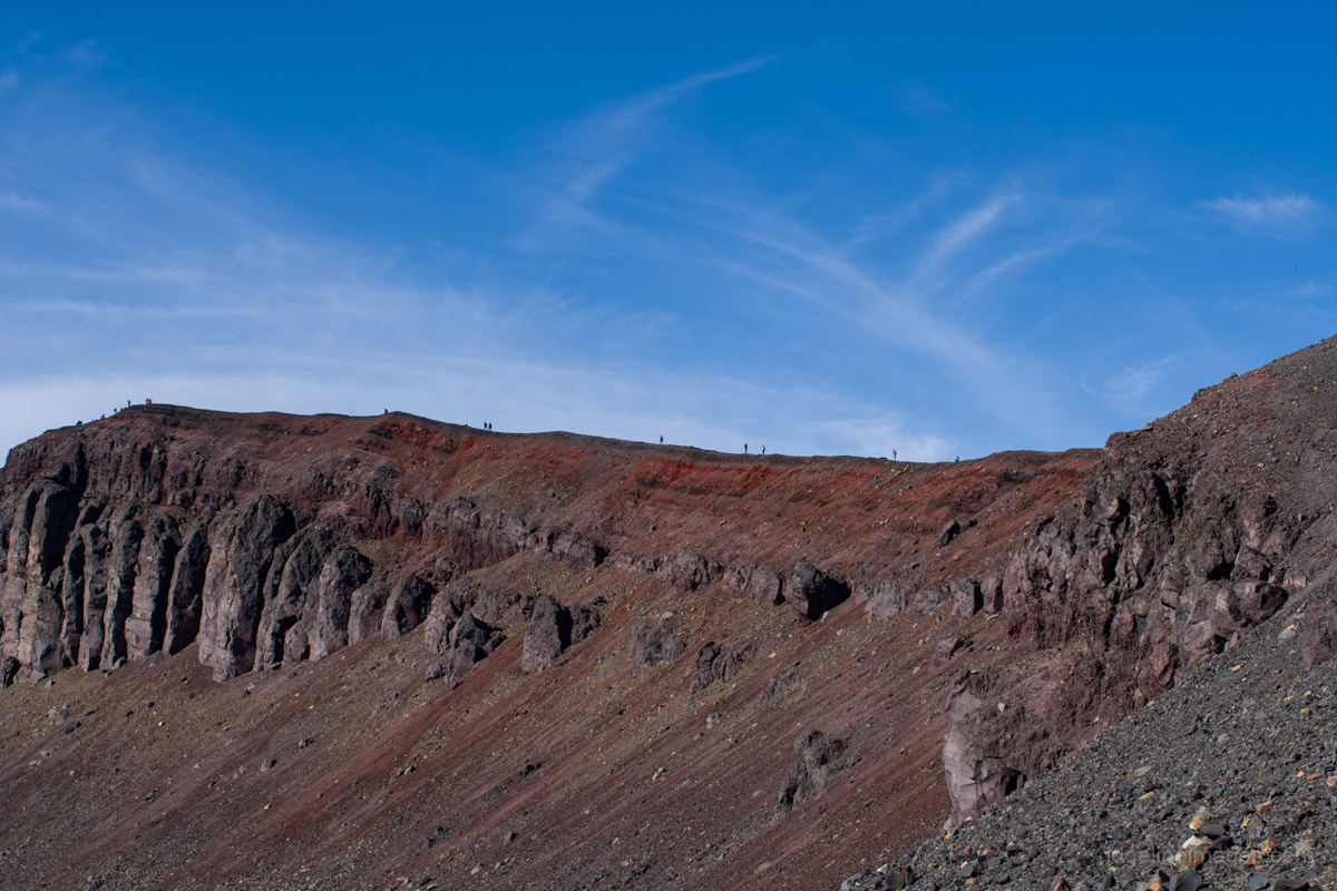
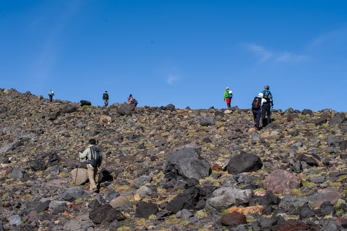
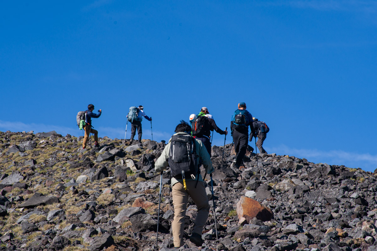
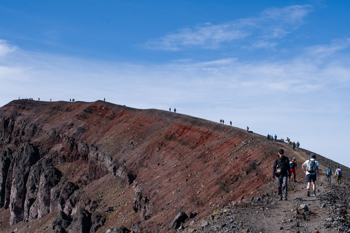
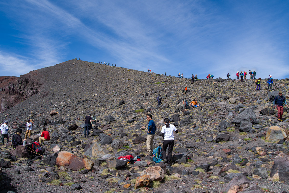
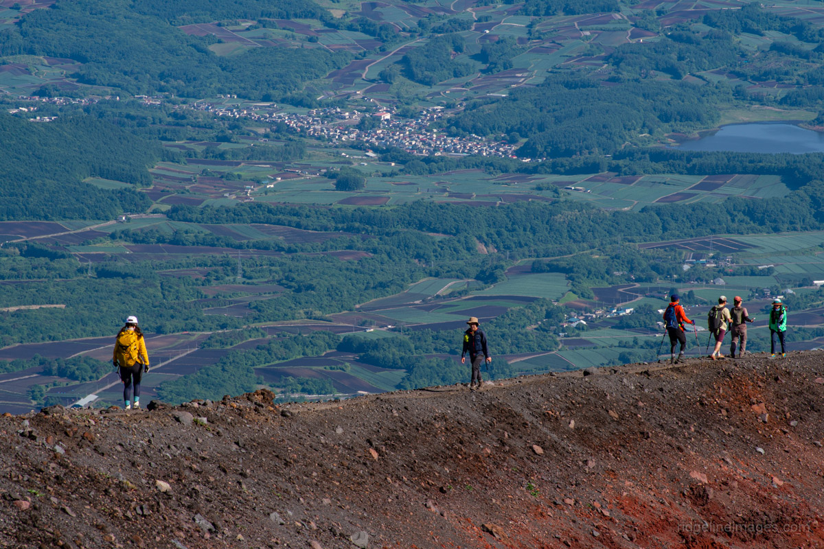
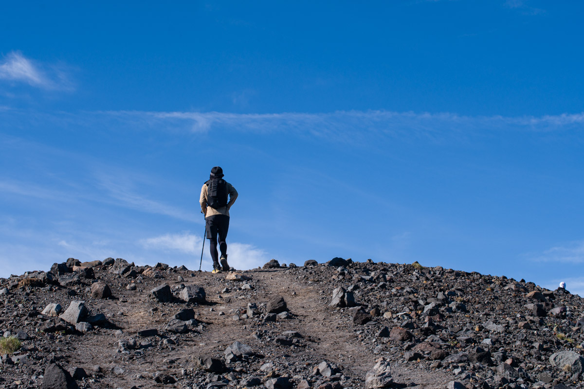
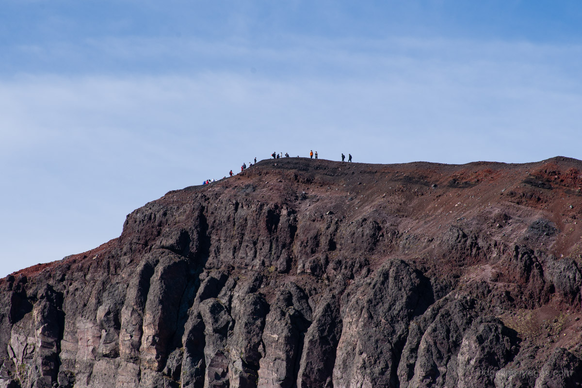
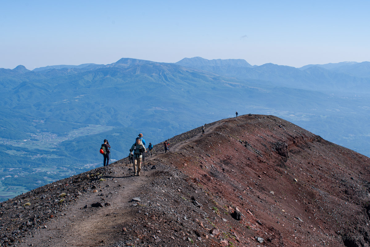
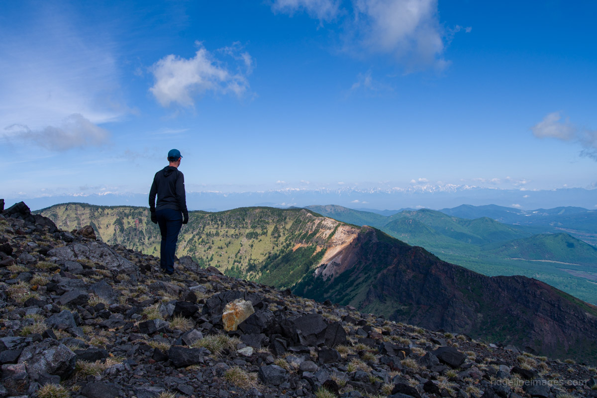
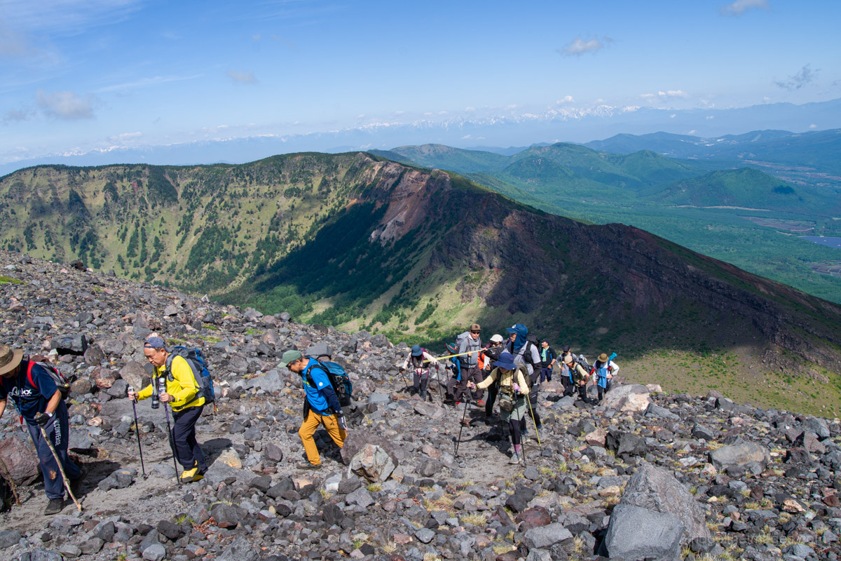
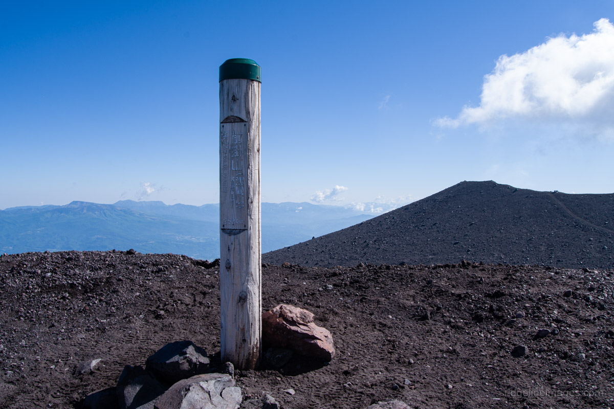
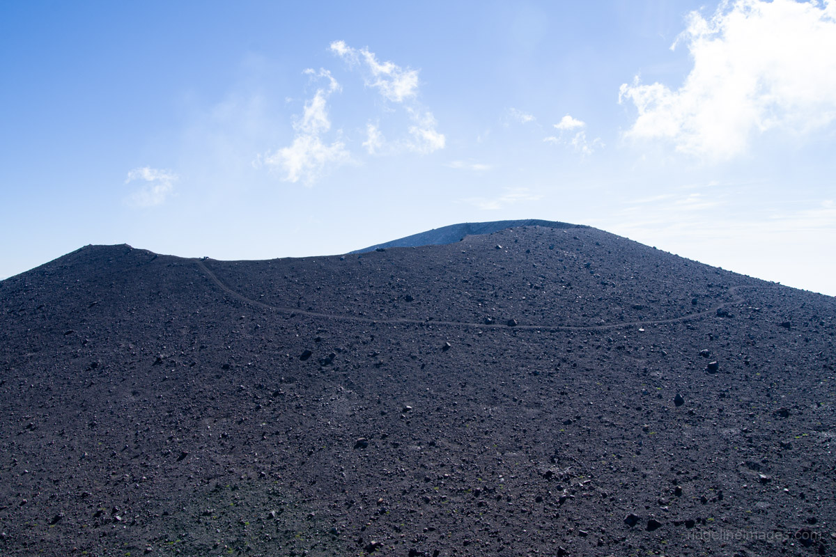
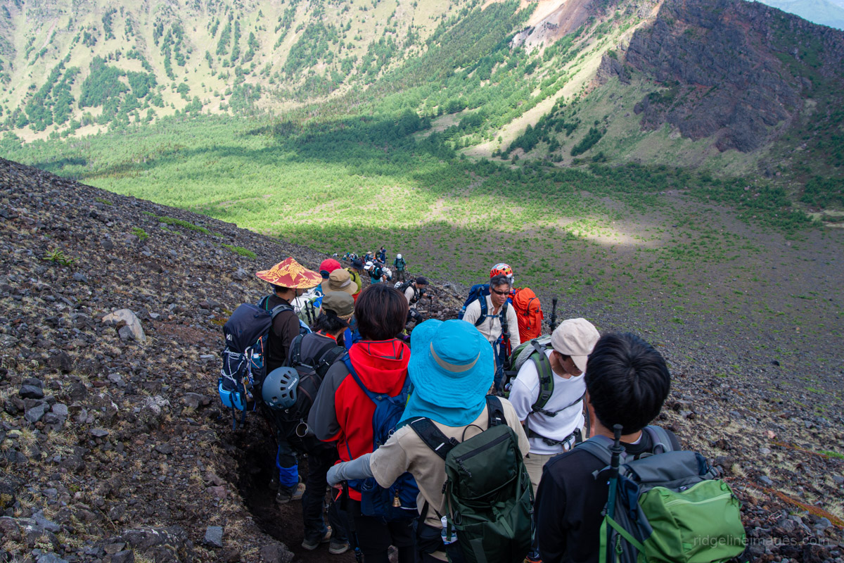
The vast plateau of Yunodaira is particularly picturesque and includes two trail branches: the first leads to Mt. Kurofu 黒斑山, while the second heads towards J-Band. Ignore those and steel yourself for what lies ahead – a long, steep slog up to the outer volcanic rim wall. Even at this early hour, despite making an early start, hikers had begun arriving in increasing numbers, making the trail feel a little like a miniature Mt. Fuji. Reaching the rim makes the effort well worthwhile, rewarding you with an incredible view along the crater rim towards Mt. Maekake 前掛山, the closest permitted point to Mt. Asama’s active crater. Near the cordoned-off route towards Mt. Asama itself are a couple of concrete emergency shelters.
One nice by-product of the crowds was the perspective they added. From a distance, the steady line of hikers resembled ants crawling over a giant boulder, providing a surprisingly good sense of just how vast the caldera really is. A nice little bonus was that an image from this blog post was selected as Japan Today’s ‘Picture of the Day’.
Arriving at Mt. Maekake at 7:30 am, there was a short wait for a commemorative summit snap, although even 30 minutes later, after lounging around and taking in the sweeping views – including Mt. Fuji and Mt. Azumaya – the queue had grown considerably, as had the number of hikers still making their way up. From the summit, retrace your steps and enjoy a well-earned soak in the iron-rich Tengu Onsen back at Asama Sanso. The return bus from Asamayama Tozan-guchi departs at 4:38 pm, leaving plenty of time to relax at the campsite before making the long trip home.


Well-done, David. It’s too bad that we can’t get to the top of Mt. Asama proper and get a view of the crater.
I wish I knew you were coming. I live within sight of Asama.
That’s interesting there were campsites. It’s been so packed up there. I heard one person say they waited an hour for a picture at the top!
Thanks, Pat.
I knew you lived in the area but didn’t realise it was quite that close! You’re right, even from Maekake, the view across to Asama proper doesn’t reveal any of the actual crater. The campsite is a great option and I was surprised more people weren’t basing themselves there, given it’s right next to the trailhead. I was glad of the early start; there weren’t many people at the summit when I arrived, but looking at photos on Yamap afterwards, it’s clear that wait times of an hour or more were entirely believable later in the day. Completely nuts, isn’t it?
A belated thanks for this informative and well-illustrated post. It made me realise that we were lucky with our timing in the 1990s, when Asama was so quiet that few hiking restrictions were in force or none. A consolation for the present situation is that, even from the crater rim, your view of the crater floor is quite restricted, because the slope of the rim itself cuts off your sightline. Herbert Ponting dealt with this awkwardness by bringing up a stepladder when he climbed Asama to take photos in 1903. Today, of course, it would be better to save yourself the hassle, stay on Maekake-yama and simply send a drone over to inspect the crater…. Just suggestin’, of course…
Many thanks, PH. You certainly picked a good era to visit, as the much better access to the crater must have made for a memorable experience.
Interesting side note about ol’ Mr Ponting bringing his stepladder. He sounds like quite a character, but it was certainly a creative solution nonetheless.
As for the drone… some intrepid souls have already tried that, based on a quick search. Besides, I rather enjoy having an excuse to come back if the restrictions are ever eased again.
Excellent review and nice pictures. I want to go when no one is there and don’t mind if it’s snowing.
Thanks! You’ll certainly have it much more to yourself in winter; just be sure to check the weather and any access restrictions before heading up.