.
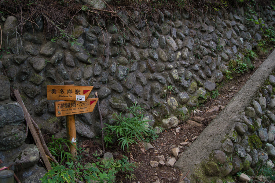
Mizugaki-sansou 瑞牆山荘 to Okutama Station 奥多摩駅
73.5 km
2248 metres
Highest point: 2599 metres
Start: Mizugaki-sansou bus stop
Finish: Okutama Station
Difficulty: ▅▅▅▅▅▅▅▅▅▅ ❺
Map: Yama to Kogen Chizu 山と高原地図 [No.28 金峰山・甲武信 KINPU-SAN·KOBUSHI][No.27 雲取山・両神山 KUMOTORI-YAMA·RYOKAMI-SAN][No.25 奥多摩 OKUTAMA]
GPX TrackKML TrackGSI MAPPDF Topo Map
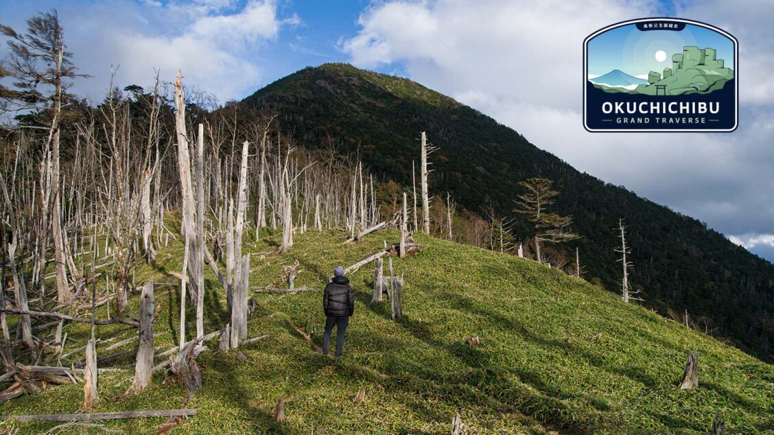
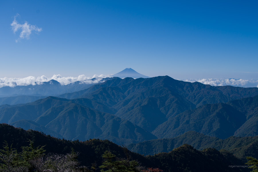
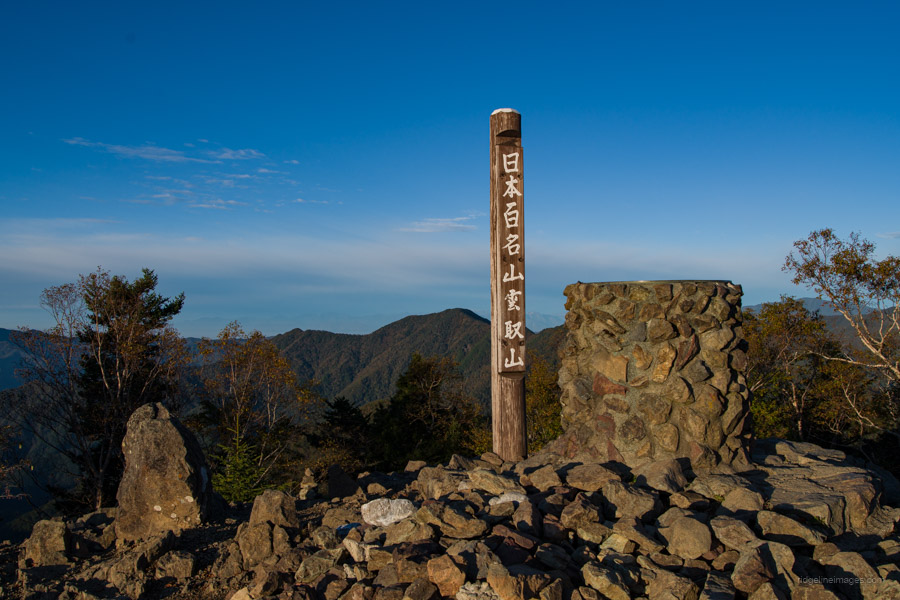
From October 10th to October 14th, 2023, I completed a 5-day traverse of the Okuchichibu Mountains located in the in the Chichibu-Tama-Kai National Park, starting at Mizugaki-sansou in Yamanashi Prefecture and finishing at Okutama Station in Tokyo. The length of the hike was approximately 74 km. Excluding traverses in the Northern and Southern Alps, this route is one of the longest in Japan. It included scaling three hyakumeizan: Mt. Kinpu, Mt. Kobushi, and Mt. Kumotori (optional side trip to Mt. Mizugaki at the beginning of the hike).
In Japanese, the traverse is known as 奥秩父主脈縦走 (Okuchichibu shumyaku jūsō), which translates to something like ‘Okuchichibu main mountain range traverse’. Among the foreign hiking community, it remains virtually unknown. This sparked my interest in hiking it first and introducing it to others seeking a challenging multi-day adventure. I consider it to be the Greater Tokyo Area’s premier long-distance trail. Although I had hiked most parts of the trail over the years, this was my first time completing it in one go. Similar to the Southern Alps Traverse I did in the summer, I was fortunate to have great weather, except for the first day when it started raining just as I reached the summit of Kinpu-san.
Okuchichibu Grand Traverse October 10th to October 14th, 2023
Mizugaki-sansou to Okutama Station (5 days approx. 74 km)
Day 1: Mizugaki-sansou 瑞牆山荘 ➩ Fujimidaira-goya 富士見平小屋 (water available) ➩ Kinpu-san 金峰山 ➩ Odarumi-goya 大弛小屋 (campsite 1,000 yen) (water available). 6hrs / 10.4 km
http://oodarumi.jp/
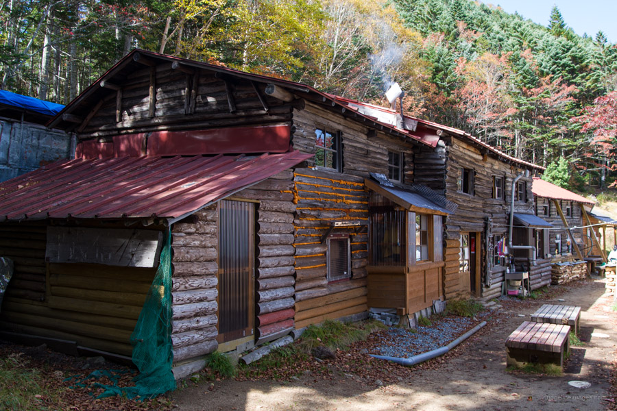
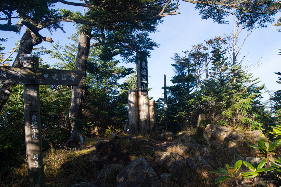
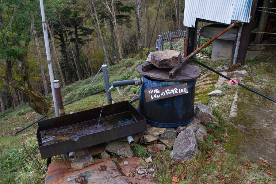
Day 2: Odarumi-toge 大弛峠 ➩ Kobushiga-take 甲武信ヶ岳 ➩ Kobushi-goya 甲武信小屋 (water available 1 litre 100 yen) ➩ Hafusan hinan-goya 破風山避難小屋 (unofficial campsite free) water source, 20 mins return. 7hrs 30mins / 12.4 km
https://www.mountain-times.com/hafuzan-hinangoya/
Day 3: Hafusan hinan-goya 破風山避難小屋 ➩ Karisaka-toge 雁坂峠 (water available) ➩ Mt. Kasatori 笠取山 ➩ Karamatsuo-yama 唐松尾山 ➩ Shougen-goya 将監小屋 (campsite 1,000 yen) (water available) 9hrs 30mins / 16.4 km
https://yamagoya.info/syogen-koya/
Day 4: Shougen-goya 将監小屋 ➩ Kamuro-iwa 禿岩 ➩ Kumotoriyama hinan-goya 雲取山避難小屋 ➩ Kumotori-sansou 雲取山荘 (campsite 1,500 yen) (water available) 6hrs / 13 km
http://kumotorisansou.com/
Day 5: Kumotori-sansou 雲取山荘 ➩ Takanosu-yama hinan-goya 鷹ノ巣山避難小屋 (water source, 10 mins return) ➩ Okutama Station 奥多摩駅 7hrs 30 mins / 21.3 km
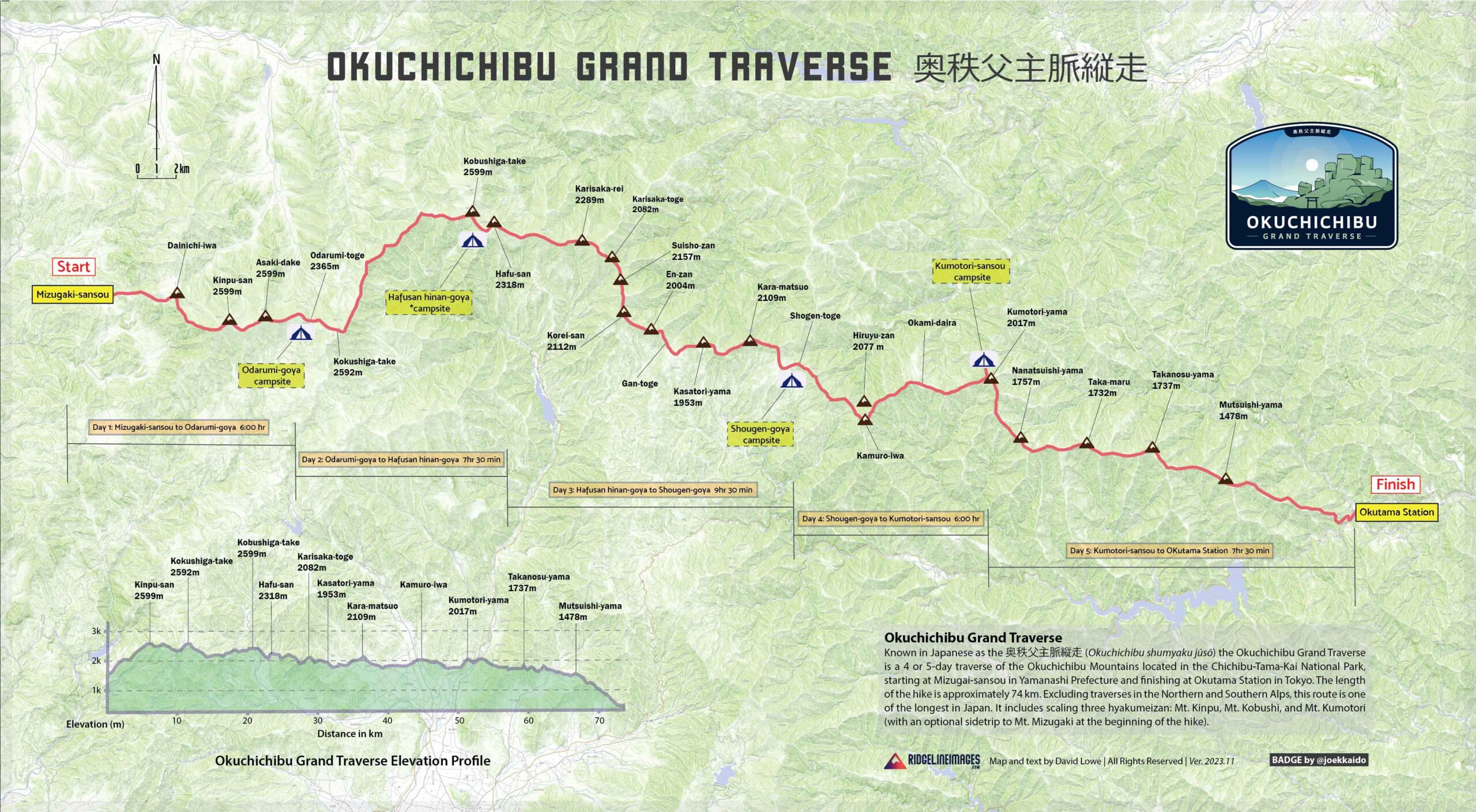 Okuchichibu Grand Traverse overview map.
Download Hi-res PDF version
When to Go
While the traverse can theoretically be done year-round, a lack of public transport and deep snow-covered mountains make it impractical for all but the most experienced alpine climbers. If you’re in any doubt about what you’ll be up against look no further than Tokyo Hikeographer’s Snowpocalypse. For most people, the two best times of the year to undertake the hike are from Golden Week (late April) until mid-June and from September until late-October. Hiking during these times allows you to avoid the rainy season (mid-June to mid-July) and finish before the first snowfall, which typically occurs towards the end of October. In April, there can still be significant snow cover, and from mid-July to the end of August, the heat and humidity are intense, even above 2000 metres.
Can it be Done in Fewer Days?
In general, I believe 5 days is a comfortable duration to complete the hike. However, if you consistently walk faster than the estimated time on maps and don’t mind long days, compressing it into 4 days is feasible. In this scenario, the first and last days would remain unchanged, while the middle three days would be condensed into two. To achieve this, on the second day, aim to reach at least the Karisaka-goya (10 hours), or even better, the Kasatori-goya (13 hours). Then, proceed to the Kumotori-sansou the following day (13 hours from the Karisaka-goya and 10 hours from the Kasatori-goya). The advantage of starting from the Yamanashi end is that the altitude from Mt. Kinpu gradually decreases, making it a little easier.
Access
Getting to and from the respective trailheads is possible via public transportation. From Tokyo, take a JR Chuo Line train bound for Takao. Train changes are generally required at Takao, Otsuki, and Kofu, and you should get off at Nirasaki Station 韮崎駅. For 2023, minibuses from Nirasaki Station to Mizugaki-sansou 瑞牆山荘 run from April 1st to November 23rd, with additional daily buses available from April 29th to May 5th and from July 24th to August 27th (no booking required). The fare is 2,100 yen (cash or PayPay), and the journey takes approximately 1 hour and 20 minutes.
Huts, Campsites and Costs
Camping helps keep costs to a minimum. However, post-COVID, most huts have increased their campsite fees, if not doubled them. If you plan to stay in huts, it will be significantly more expensive, as the huts have also raised the cost of accommodation, with the average hovering around 10,000 yen per person per night, including dinner and breakfast. Apart from the Kumotori-sansou which is open year-round, all other huts are open only seasonally, and in some cases, hut caretakers are only present on weekends. The cost breakdown was as follows:
• Bus to the trailhead: 2,100 yen
• Campsite fees: 3,500 yen
• Miscellaneous expenses (water, toilet, drinks, and snacks, approx. 1,200 yen)
Total: 6,800 yen vs. (staying in huts) 38,300 yen
Cut and Run
If, for whatever reason, you can’t continue with the hike, it’s necessary to figure out where to cut and run. Case in point: I attempted the same route a couple of years ago but conceded defeat on the second day due to both the snow depth and my lack of preparation. Thankfully, this hike offers opportunities each day to do so. I will draw attention to what the options are in the daily trail reports.
Food and Gear
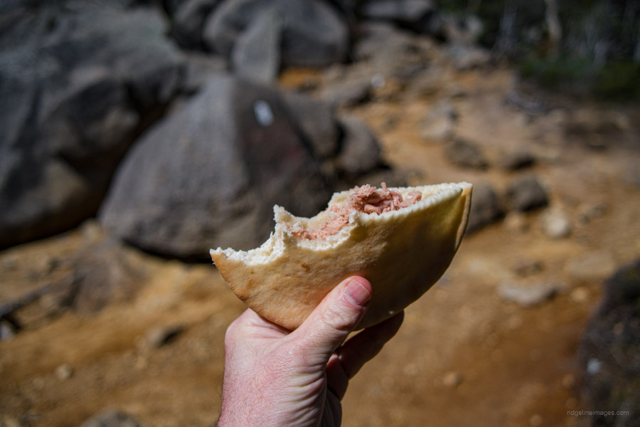
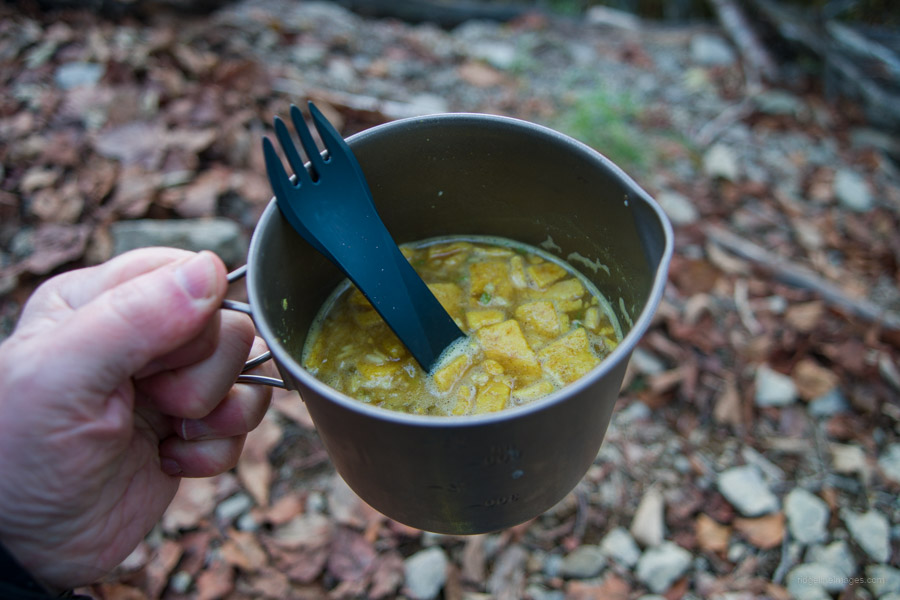
As with any overnight hike, it’s essential to strike a balance between bringing the absolute essentials and those little extras that add weight but enhance safety and comfort. If you plan on undertaking this hike during the shoulder seasons, make sure to pack sufficient warm clothing. Aside from the summer period, anticipate temperatures dropping to near freezing overnight. The gear and food I brought were similar to what I carried on the Southern Alps Traverse preparation. The mountain huts along the traverse only provide meals to paying guests, though most sell basic foodstuffs such as instant noodles and snacks. In total, the pack weighed just over 12 kg, including food. With water added to the mix, it made for a moderately heavy pack, especially during the initial stages.
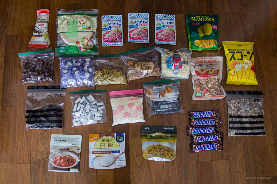 Food carried on the Okuchichibu Grand Traverse.
The Badge
![]()
To complement this multi-day hike, I was eager to include an eye-catching logo or badge that would be instantly recognisable to those familiar with the hike and the area. Thanks to the skills of Hokkaido-based designer and illustrator Joe Scott, I was able to achieve just that.
Okuchichibu Grand Traverse
Day 1: Mizugaki-sansou to Odarumi-goya
Day 2: Odarumi-goya to Hafusan hinan-goya
Day 3: Hafusan hinan-goya to Shougen-goya
Day 4: Shougen-goya to Kumotori-sansou
Day 5: Kumotori-sansou to OKutama Station
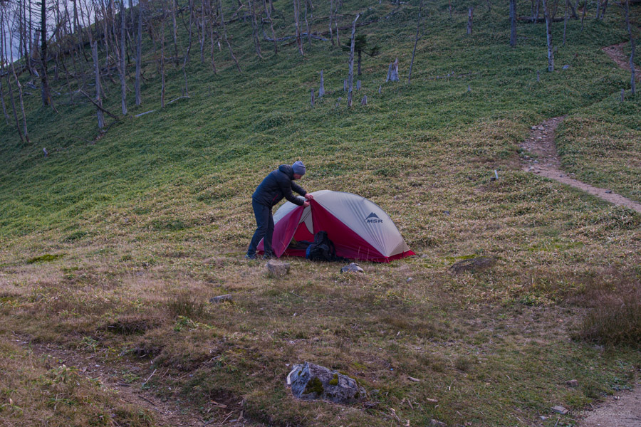
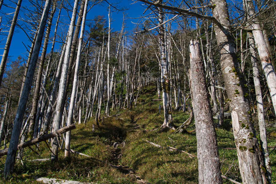
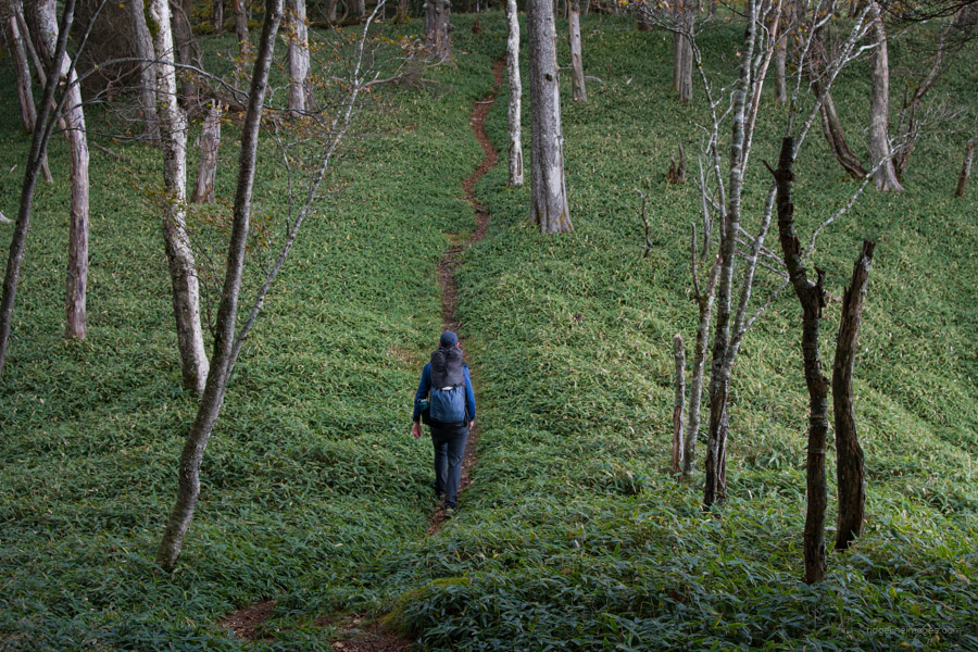
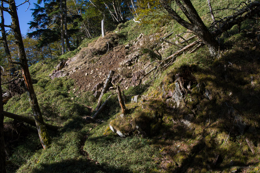
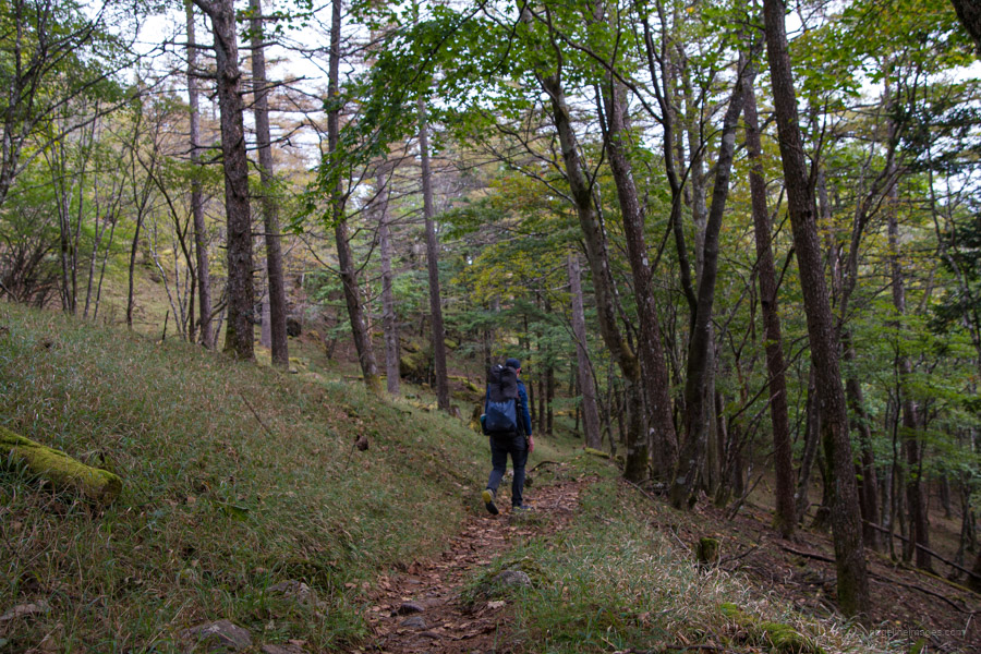
Day 1: Mizugaki-sansou 瑞牆山荘 to Odarumi-goya 大弛小屋
6hr 10.4 km 1223 m 401 m Oct 10, 2023
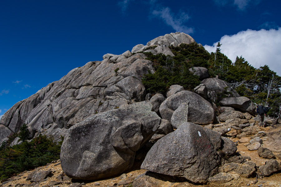
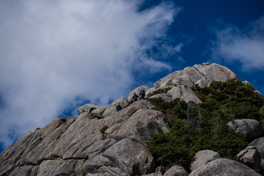
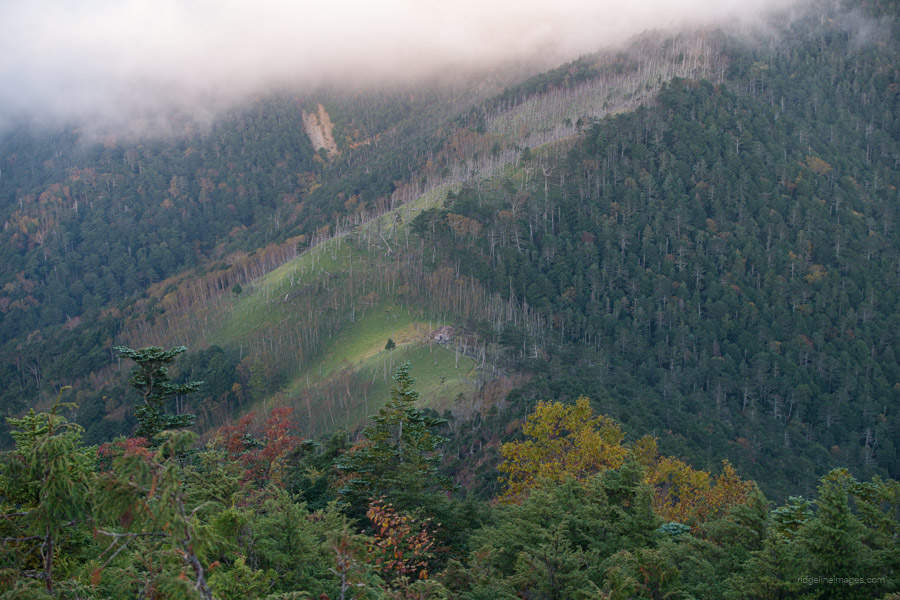
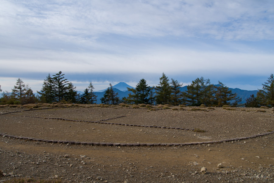
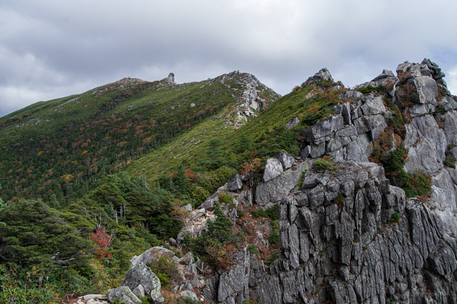 Magnificent ridgeline stretching to the Gojo-Iwa.
Route:
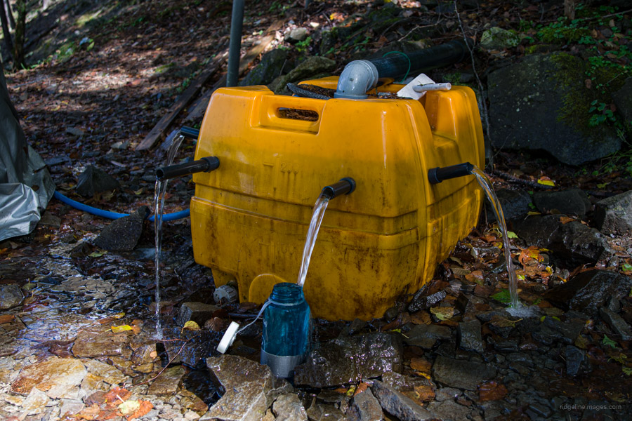
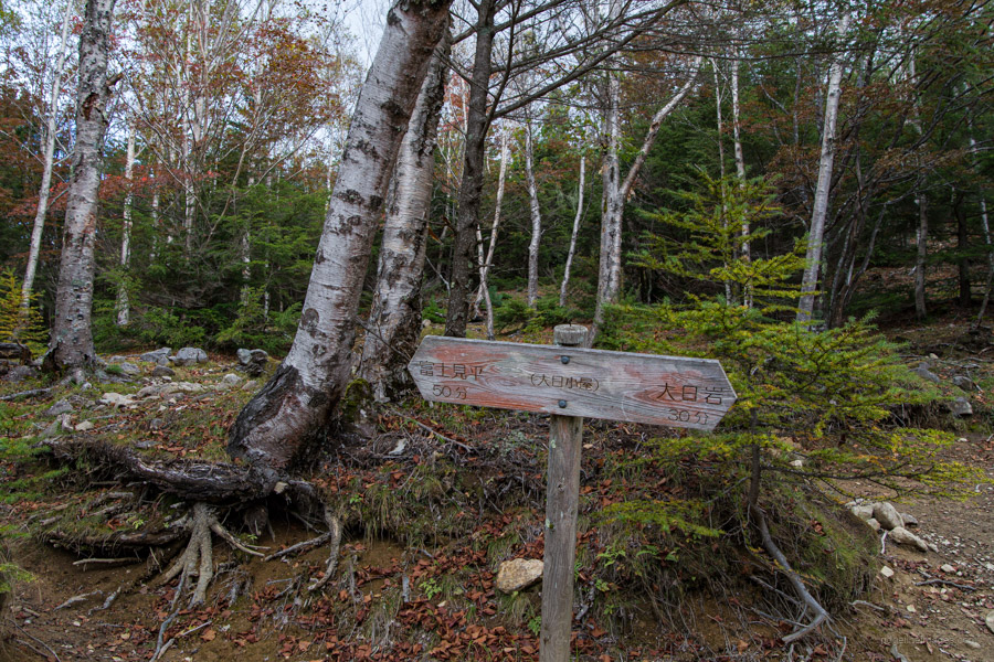
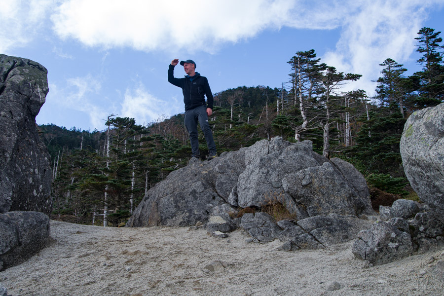
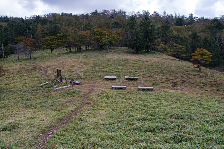
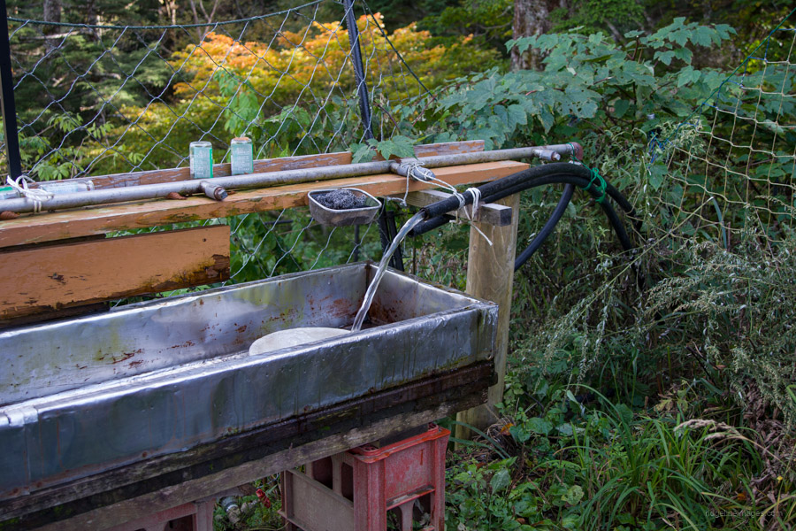
The trail begins at the front of Mizugaki-sansou, leading you to a pleasant resting spot with a panoramic view of the rugged peaks of Mt. Mizugaki 瑞牆山 after approximately 20 minutes. Further along, before reaching Fujimidaira-goya 富士見平小屋, you’ll find a trail branching off on the left for an optional side trip to Mt. Mizugaki. Near the hut, keep an eye out for a short detour to a water hole. Fujimidaira-goya is conveniently located and serves as an excellent base for exploring Mt. Mizugaki and Mt. Kinpu.
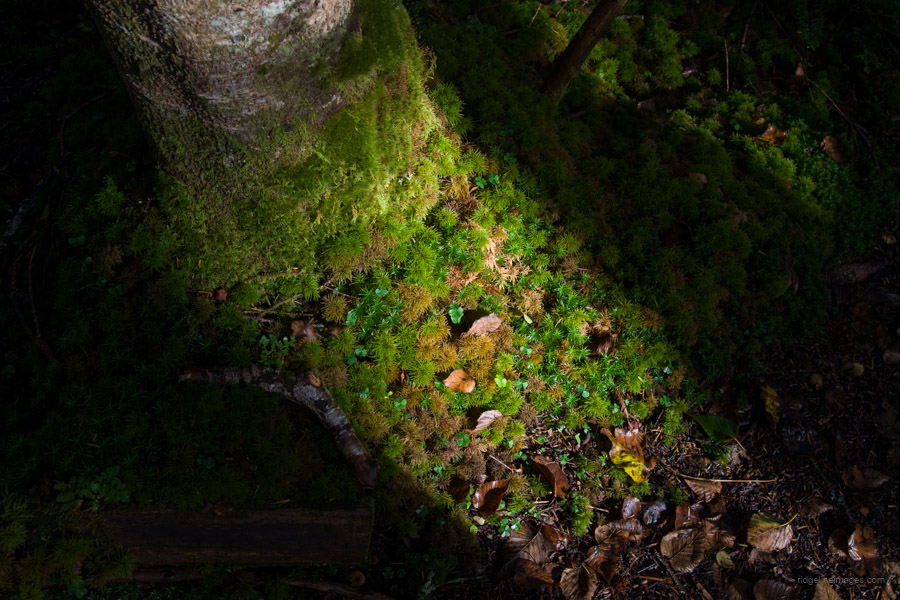
From Fujimidaira-goya, the trail passes through a dimly lit forest with a mossy floor. Just before reaching the campsite, which rests above the ramshackle Dainichi-goya, there’s a branch off to Takami-iwa Rock 鷹見岩 (2,092 m), which is worth a visit if you’re making good time. Next up is the Dainichi Boulder 大日岩, similarly worth scaling for its impressive view. Beside it is a flat area perfect for lunch.
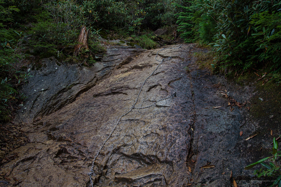
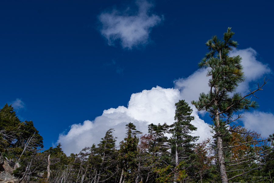
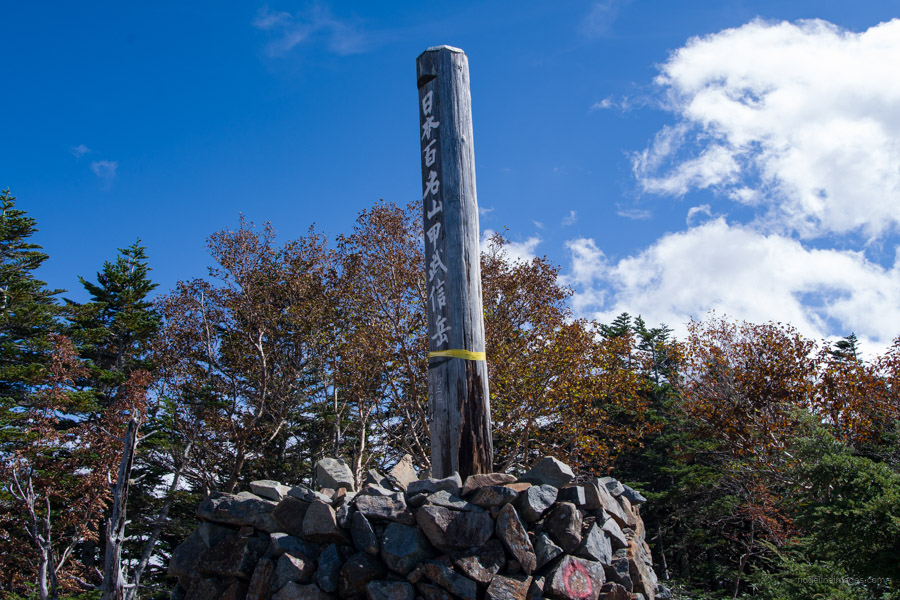
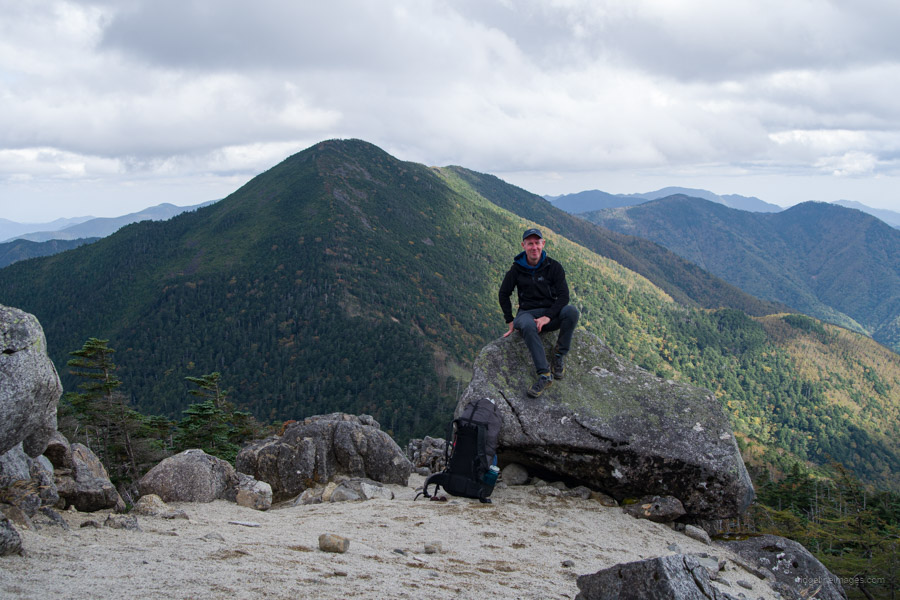
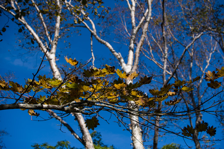
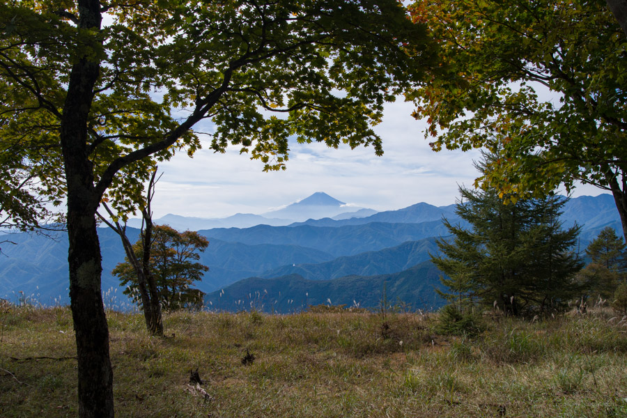
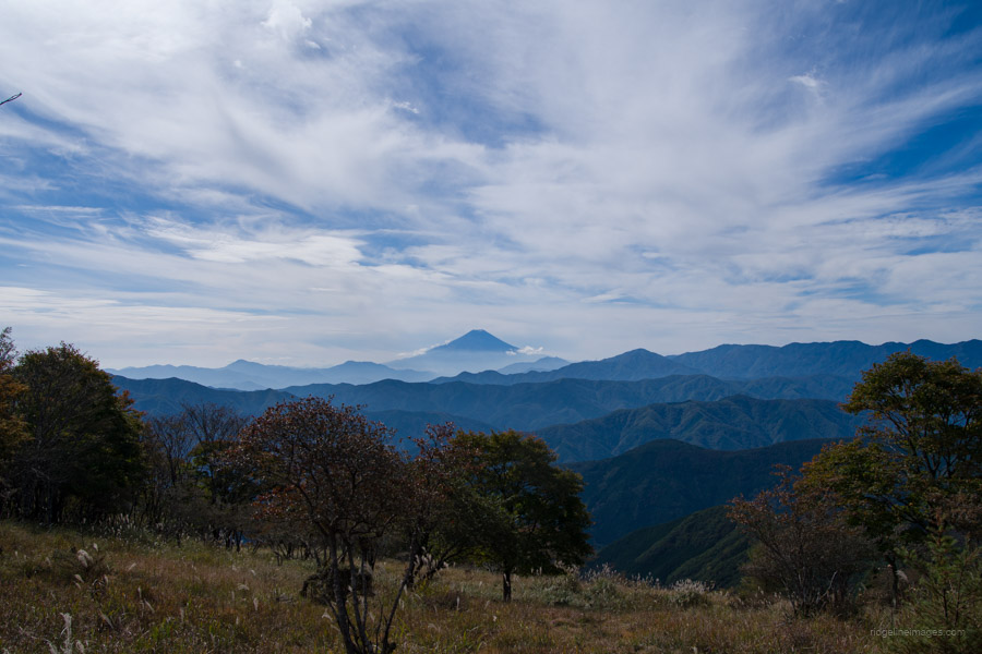
The following section involves a relatively steep ascent, taking approximately 90 minutes to rise above the tree line. Several vantage points reveal the majesty of Mt. Kinpu 金峰山 at 2,599 metres. Be cautious as you manoeuvre over boulders, especially in snowy conditions. In fine weather, enjoy captivating views of Mt. Fuji against the stunning backdrop. As you near the summit, you can glimpse Kinpu-goya 金峰小屋 on your left side. From the bus stop, it takes 4 hours of steady climbing to reach Gojo-Iwa 五丈岩, a 15-metre-high granite obelisk and symbol of Mt. Kinpu.
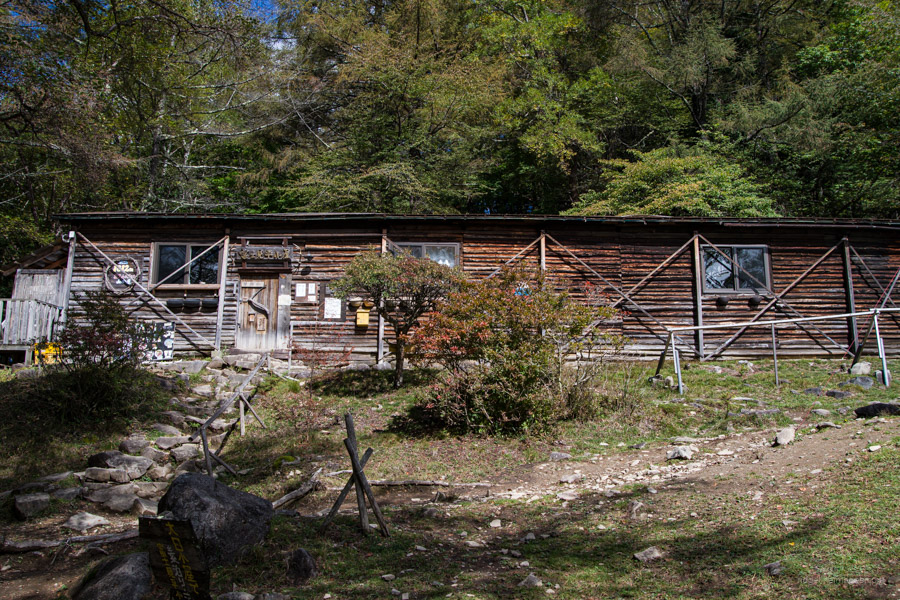
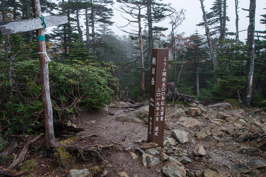
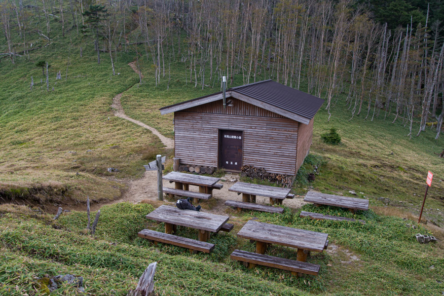
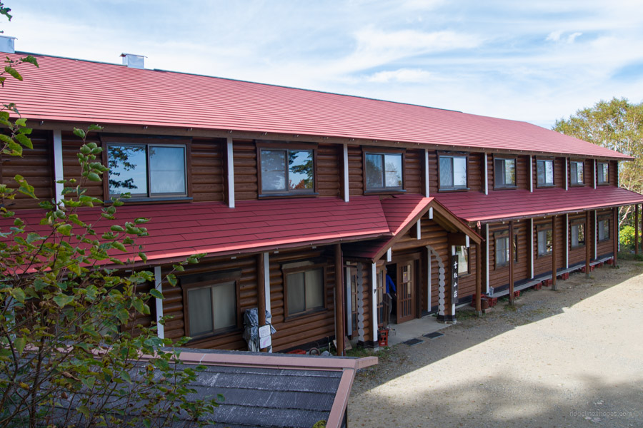
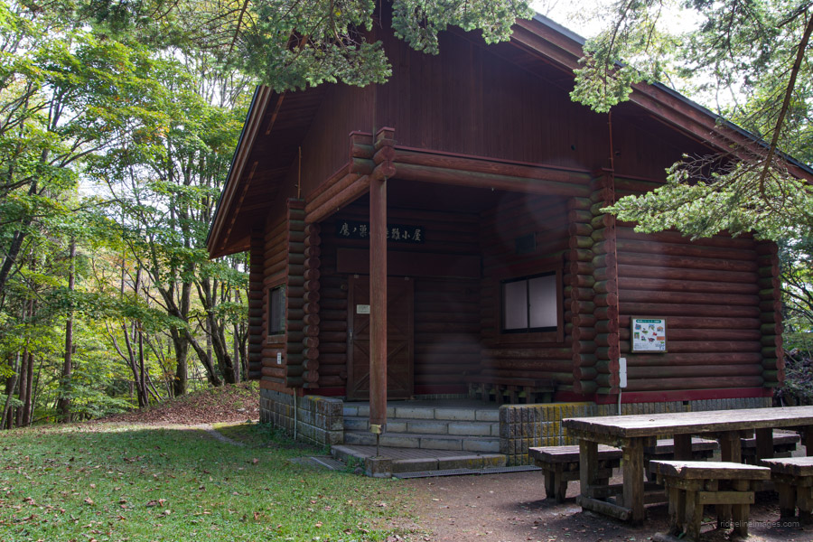
Continue your journey towards Odarumi-toge 大弛峠, which incidentally is Japan’s highest accessible road pass at 2,365 metres, approximately two hours away. From the true summit, which is a few minutes walk from the torii gate, the trail continues north for 30 minutes before veering right over Mt. Tetsuyama 鉄山 (2,511 m) and Asahi-dake 朝日岳 (2,579 m). Odarumi-goya 大弛小屋 offers a sheltered place to camp with a nearby water source. Restrooms are located in the parking area.
Diary:
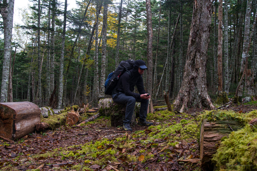
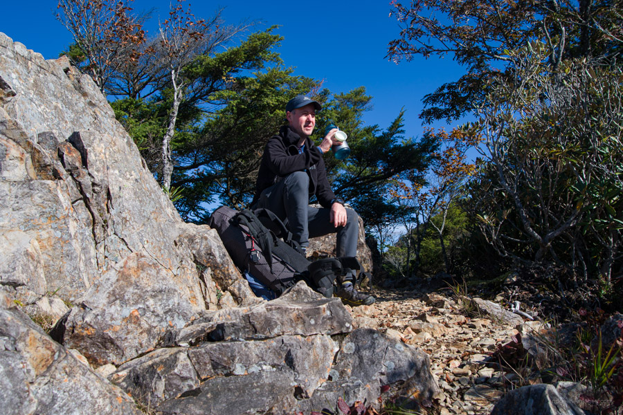
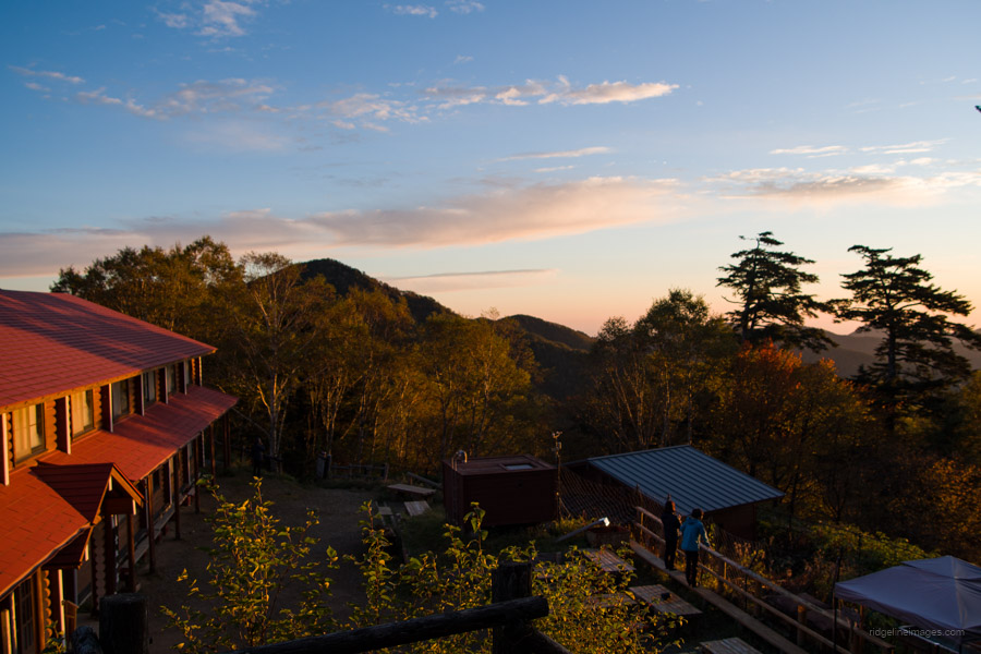
While waiting for the bus to Mizugaki-sansou at Nirasaki Station, I found myself reminiscing about my last unsuccessful attempt at this hike two years ago, when I had to give up after the first day. This time, fortunately, things were different. Firstly, the weather forecast looked promising for the most part, and my successful completion of the Southern Alps traverse last summer boosted my confidence in my abilities. When the bus finally arrived, only one other hiker and I were waiting, likely due to the previous day’s continuous rain and today’s cloudy conditions. By the time the minibus reached the forlorn-looking mountain lodge, the sun was shining brightly, hopefully indicating better weather ahead.
This being my sixth visit to these peaks, there was no need for final checks of the map. After quickly taking a couple of customary photos at the trailhead, I set off. Given the limited daylight in autumn, catching the first-morning bus is crucial to reaching Odarumi-toge before nightfall. Mizugaki-san looked stunning against the backdrop of the clear autumn skies, and the normally bustling Fujimidaira campsite had only a few tents. During a brief lunch break at the Dainichi Boulder, I noticed a group of hikers admiring the view from a beautiful vantage point.
As the afternoon progressed, so did the darkening of the skies. A couple of hikers returning from Kinpu-san mentioned the chilly wind, and upon reaching the summit, visibility had reduced to zero. I briefly commiserated about this situation with the only other lone soul unlucky enough to face the same bad timing. If only the first-morning bus was scheduled to leave an hour earlier, that could have made all the difference. Moreover, by the time I reached the official summit marker, the cold rain had decided to accompany the wind. I wasted no time in putting on my wet weather gear. In the back of my mind were the four climbers who had tragically lost their lives only a week earlier after encountering extreme winds and low temperatures at Mt. Asahi in Tochigi Prefecture.
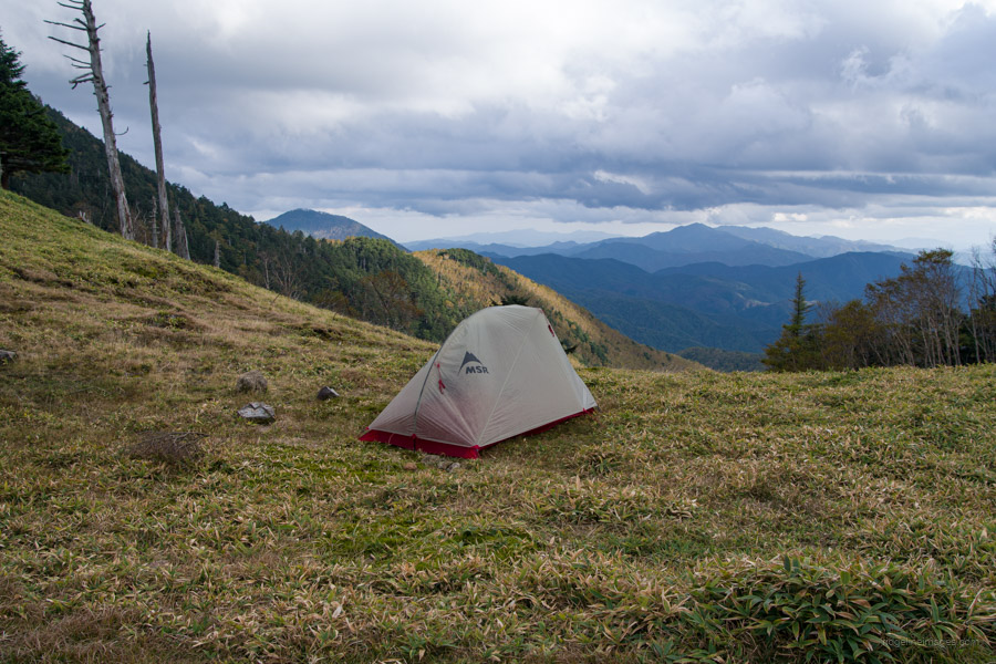
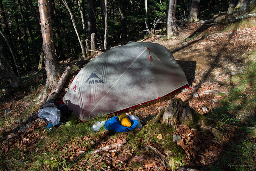
It was nearly 5 o’clock when I finally arrived at Odarumi-goya. At the campsite, there was only one other couple who had chosen the considerably easier way to the mountain lodge – by car. The good news was that I managed to grab my old campsite, probably the flattest and most pleasant one of them all. After being on the move all day, I was more than happy to scoff down dinner and snuggle deep into my sleeping bag.
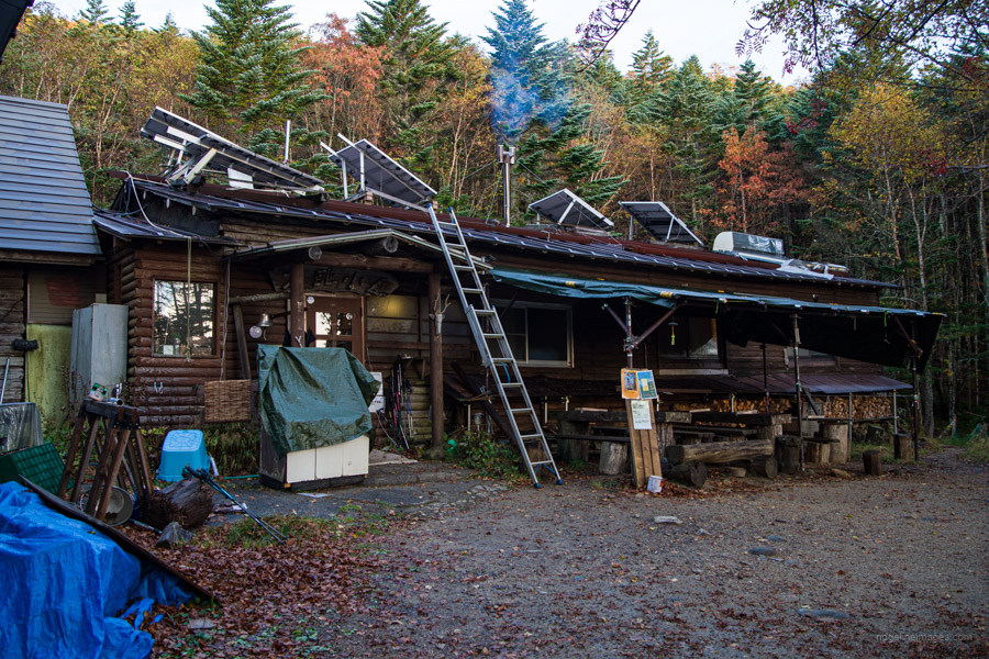 Odarumi-goya mountain hut.
.
.
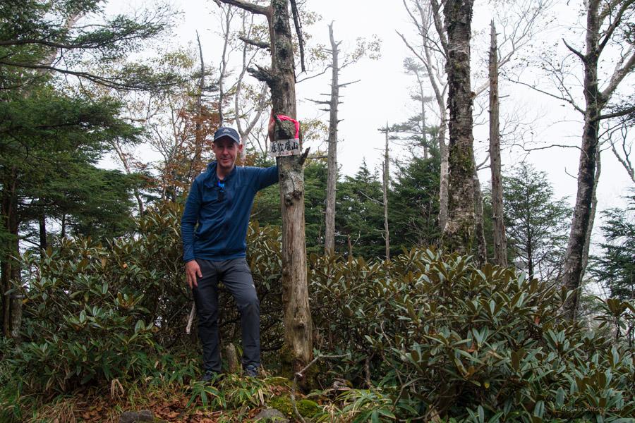
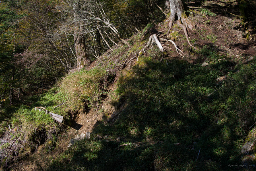
Day 2: Odarumi-goya 大弛小屋 to Hafusan hinan-goya 破風山避難小屋
7hr 30min 12.4 km 648 m 1006 m Oct 11, 2023
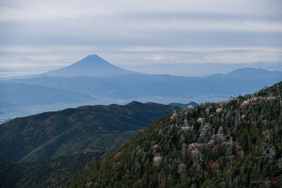
 Stunning panorama from Kobushiga-take.
Route:
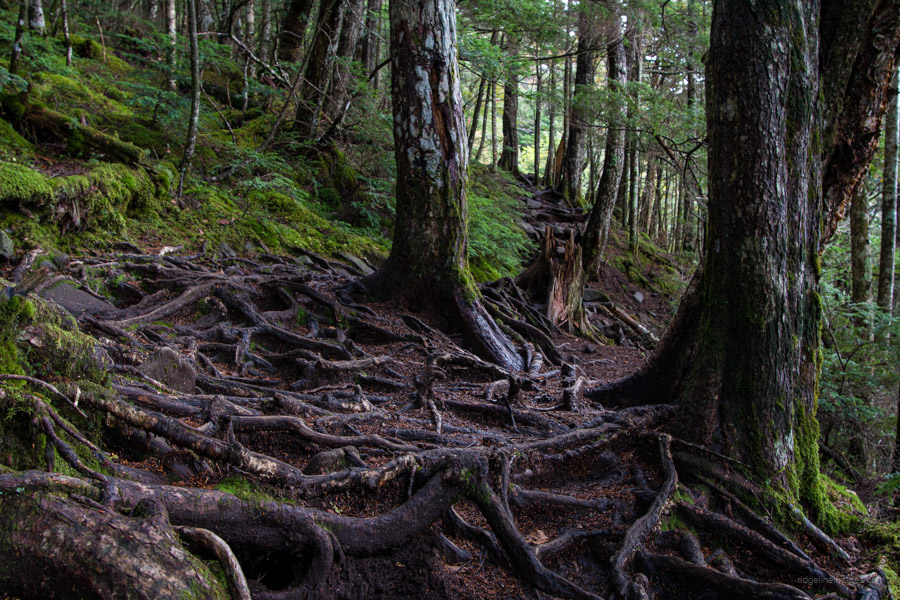
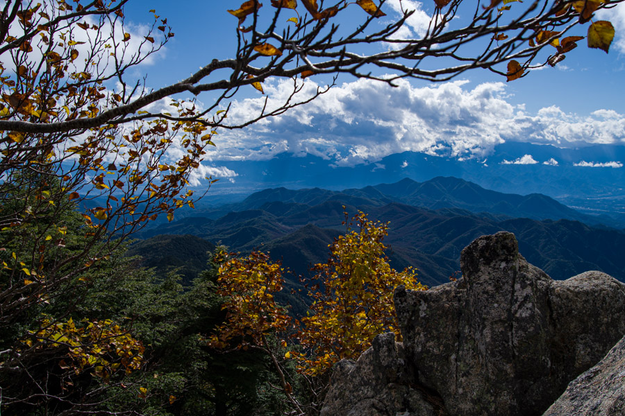
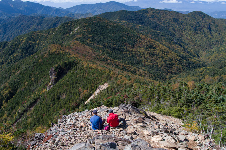
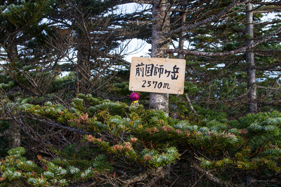
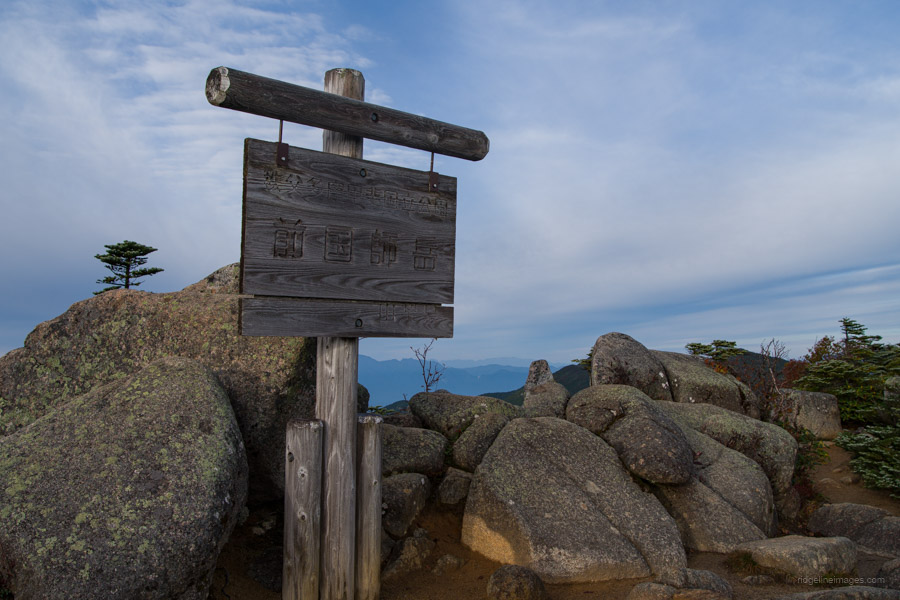
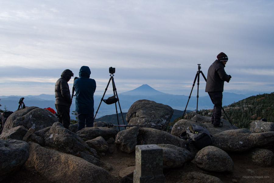
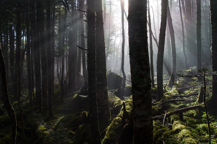
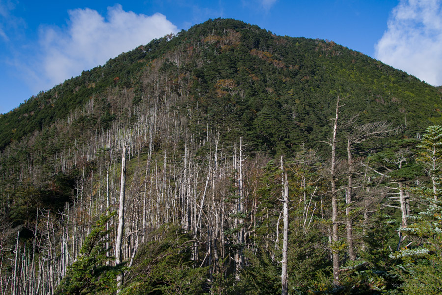
The morning’s first point of call is Mae-Kokushigatake 前国師岳, and 10 minutes later, Kokushigatake 国師ヶ岳 standing at 2,592 metres, which is also one of Japan’s 300 famous mountains. On a sunny morning, the view from this peak is truly spectacular. The trail then leads through a magnificent primordial forest with minimal elevation changes, taking approximately 2 hours to reach Higashi Azusa 東梓 (2,272 m). After another hour of hiking, you’ll reach a clearing known as Ryo-mon-no-atama 両門ノ頭, offering the first glimpse of Kobushiga-take. Continuing, you’ll pass Fujimi 富士見 (2,373 m) and Mizushi 水師 (2,396 m) and encounter a trail fork leading down to Moukidaira 毛木平, which goes past the headwaters of the Shinano River.
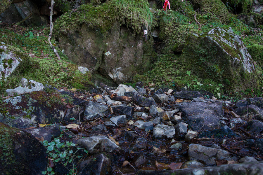
The final ascent to Kobushiga-take 甲武信ヶ岳 (2,475 m) involves navigating loose rocks to reach the summit. Your efforts will be rewarded with a magnificent view of Mt. Kinpu, Mt. Mizugaki, and the Yatsugatake mountains. After soaking in the scenery, descend to Kobushi-goya 甲武信小屋 for lunch. Water is available at the hut, although it comes at a steep price of 100 yen for 1 litre. whilst there is a water source a 20-minute walk away at the Hafusan refuge hut, it is advisable to carry water as a precaution.
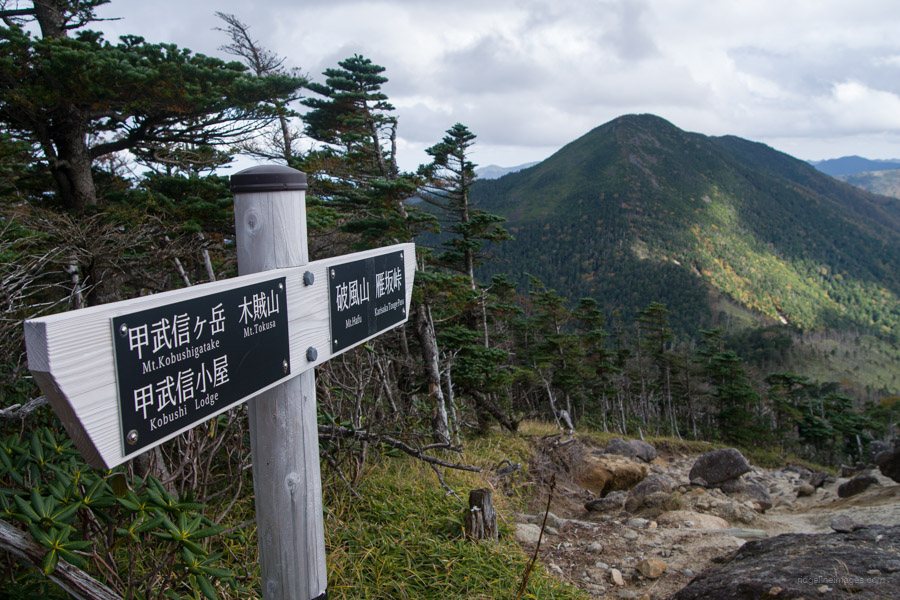
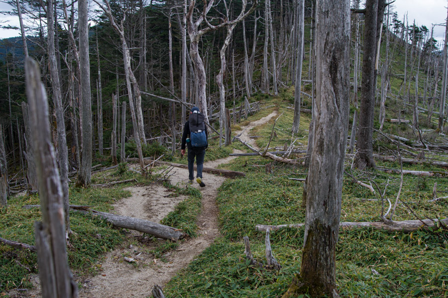
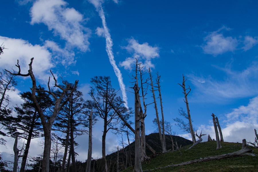
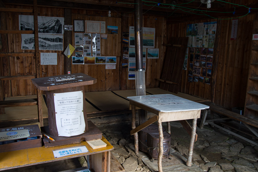
From Kobushi-goya, you can either turn right and head towards Mt. Tokusa 木賊山 (2,468 m). However, unless you are determined to summit this peak, it’s recommended to take the maki-michi まき道, or winding path. After an initial steep downhill part, the landscape opens up to a sandy expanse, with Mt. Hafusan 破風山 gracefully rising in the distance. The descent to the saddle and Hafusan hinan-goya 破風山避難小屋 passes clusters of withered Veitch’s silver fir (shirabiso), likely the result of past logging and wildfires. The refuge hut is well-maintained, can accommodate up to eight people if needed, and even has blankets and sleeping bags for emergencies.
Diary:
Two aspects I truly appreciate about multi-day hikes are the ability to disconnect from the stresses of everyday life and catch up on sleep. Even in the height of summer, it’s rare that I’m not cozied up in my sleeping bag by 6:30 pm, and during the shoulder seasons, I can easily retire an hour earlier. While I do wake up and shift positions occasionally, I can usually count on a solid 9 to 10 hours of uninterrupted sleep. The last time I camped at the pass, the ground was blanketed in white, with snow flurries angrily lashing against the tent. This time, though it was the chilliest morning of the trip, I woke up to clear skies.
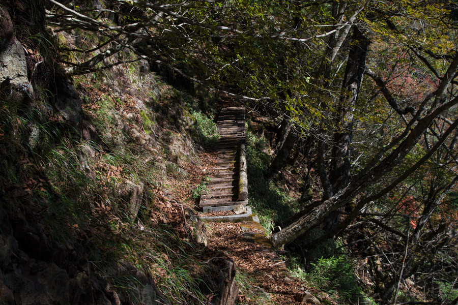
The day began with a challenging series of ice-laden wooden steps determined to trip me up. Several times, I found myself resorting to climbing on all fours due to the absence of balustrades. It must have appeared comical, but it was a better option than a humiliating end to the hike. I was utterly surprised upon reaching Kokushigatake, where I encountered four seniors, each equipped with a full-sized tripod, capturing the formidable panorama at 7 am. I couldn’t help but wonder how they managed those steps without injuring themselves. If I can do half as well as them at their age, I’d consider it a great achievement.
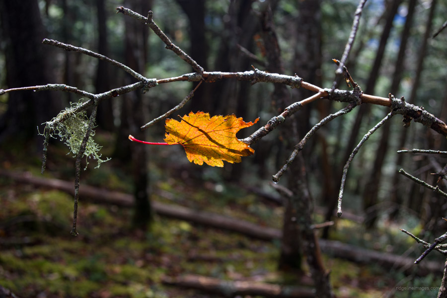
During the subsequent four hours to Kobushiga-take, I only encountered one other hiker. This pattern recurred throughout the hike: long stretches, even entire days, with no one in sight, and then suddenly, a gathering of people on a 100-famous mountain. Along the way, the weather shifted from light rain to komorebi, (scattered light filtering through the trees) and eventually to warm sunshine as I reached the summit. This marked my third ascent of Kobushiga-take and the only time greeted by sunny weather. I felt vindicated.
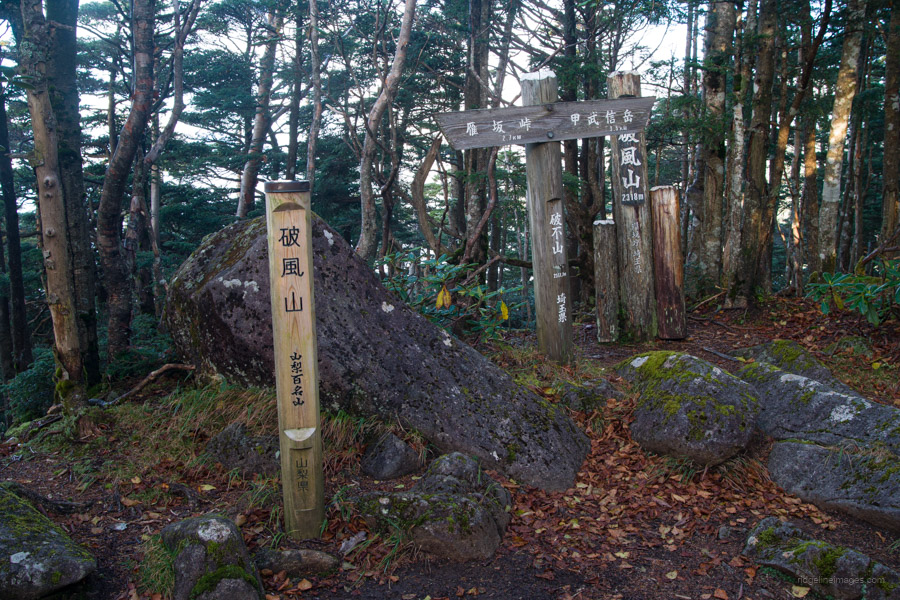
After a satisfying lunch on the wooden benches outside the Kobushiga-goya, I found myself torn: whether to press on to Karisaka-toge or stay at the Hafusan Refuge Hut and face a longer hike the following day. Ultimately, the latter option won after I descended from the hut and spent time admiring and photographing the view from a sandy area adorned with enormous boulders. The deciding factor was the sight of Mt. Hafu’s steep slopes, a challenge that demanded fresh legs. Nevertheless, reading about the tragic history of Hafusan Refuge Hut, including a family of four who took their own lives in its earlier incarnation and the unexpected demise of a couple of female hikers on the saddle, convinced me to set up my tent outside. The hut is otherwise situated in one of the most picturesque spots in Chichibu-Tama-Kai National Park.
 Hafusan Refuge Hut.
.
.

Day 3: Hafusan hinan-goya 破風山避難小屋 to Shougen-goya 将監小屋
9hr 30min 16.4 km 1117 m 1442 m Oct 12, 2023
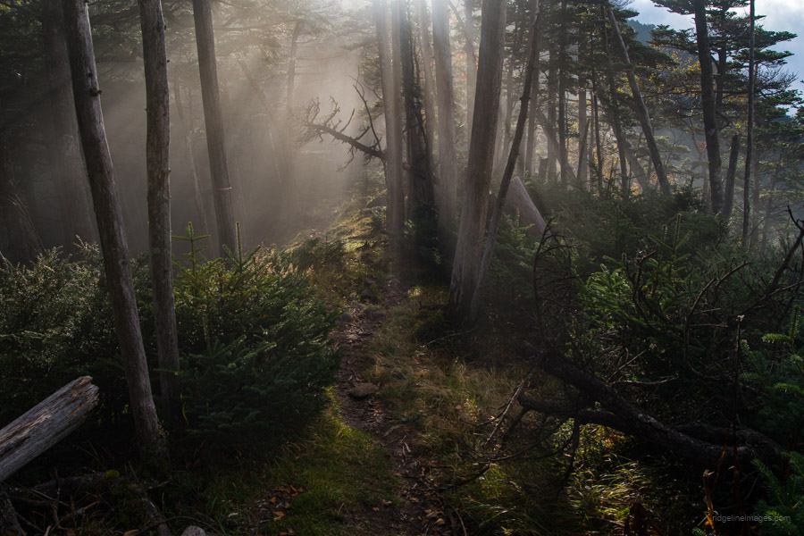
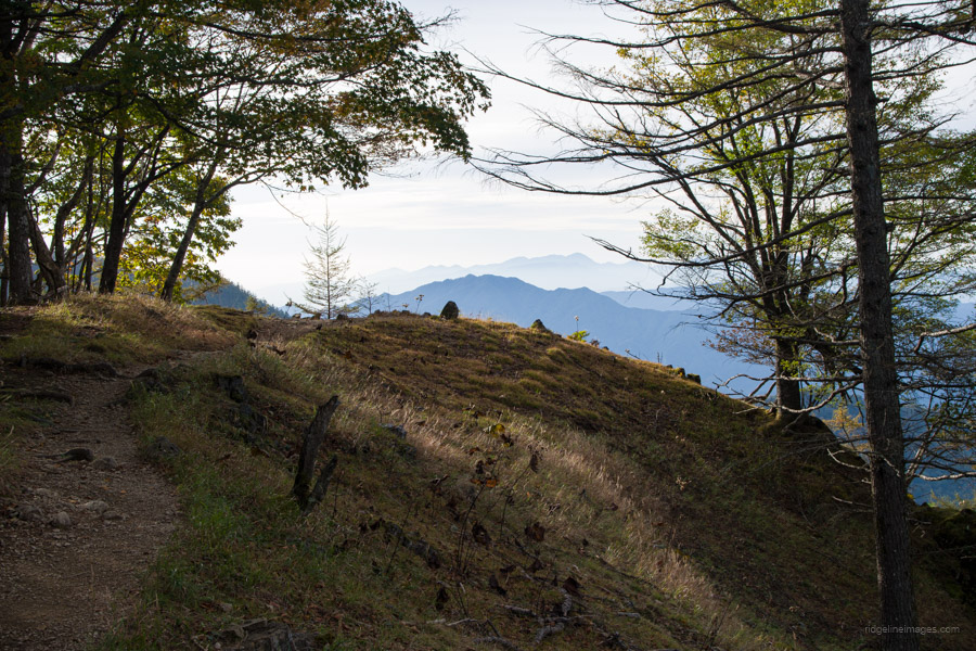
 Brocken spectre as seen from Mt. Hafusan.
Route:
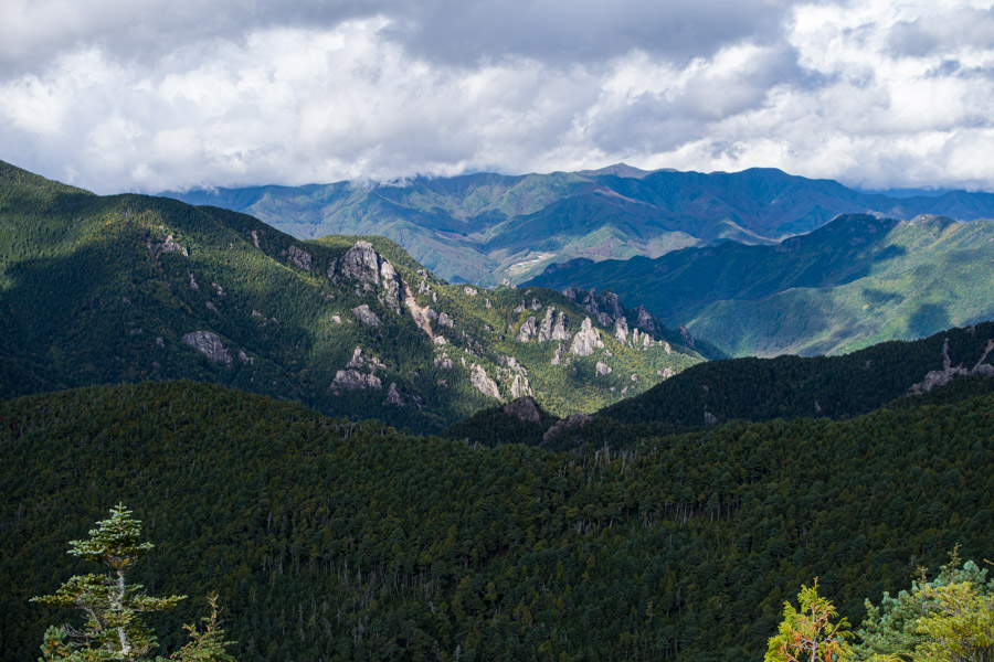
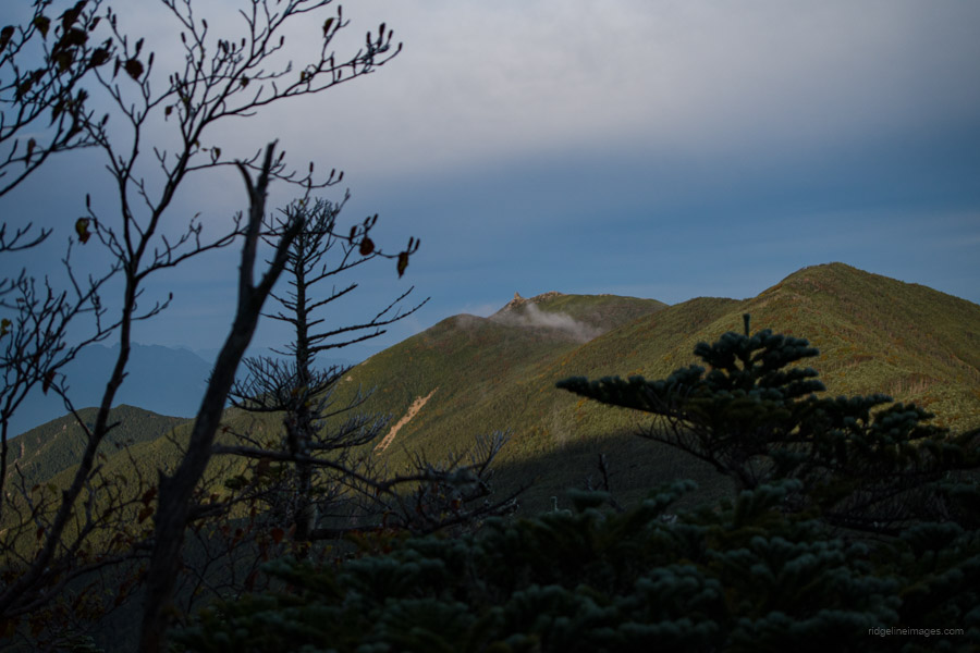
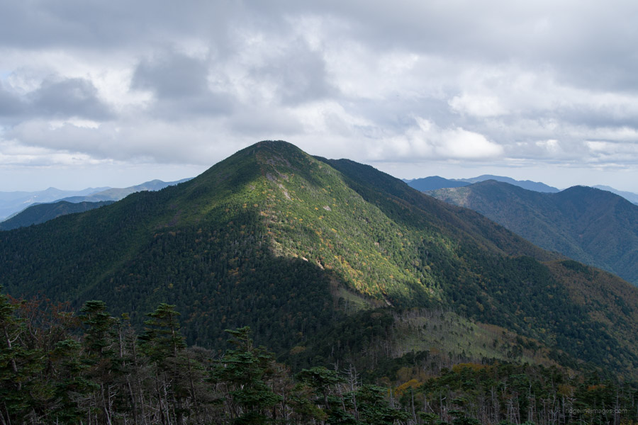
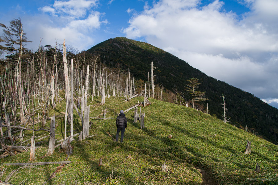
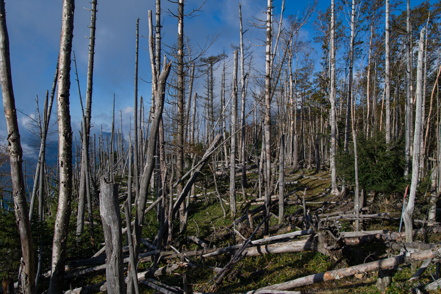
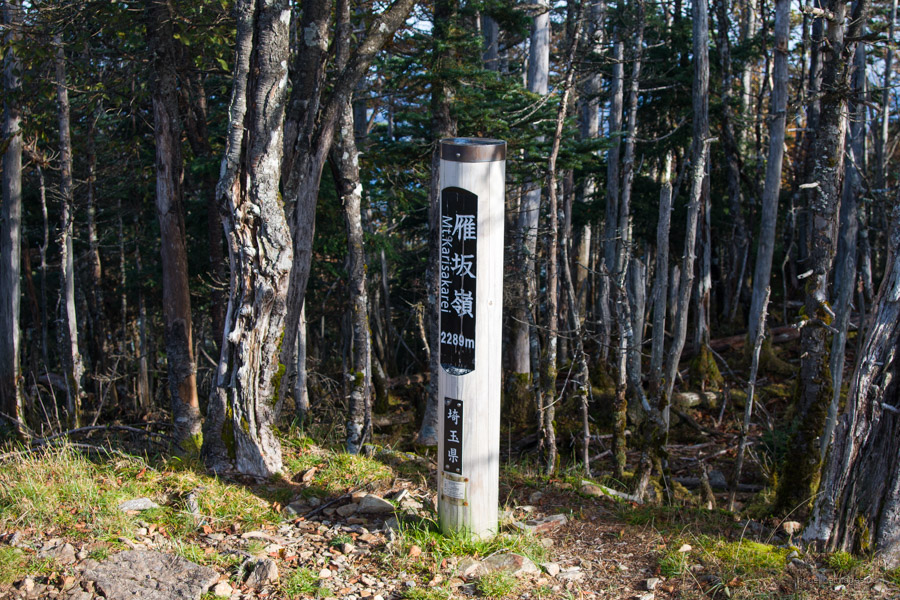
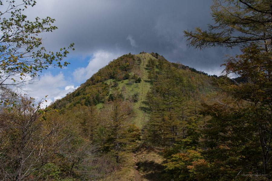
This day marks the longest and most challenging leg of the traverse. As you depart from the Hafusan refuge hut, the trail wastes no time, immediately embarking on a steep ascent towards the summit of Mt. Hafusan 破風山 (2,318 m). This mountain is primarily visited by those travelling between Kobushiga-take and Karisaka-toge, as there is no specific path leading directly to Mt. Hafusan. At various points, the trail offers panoramic views, such as the precipitous Bushin Shiraiwa 武信白岩 along the ridge stretching from Mt. Sanpo to Jumonji-toge.
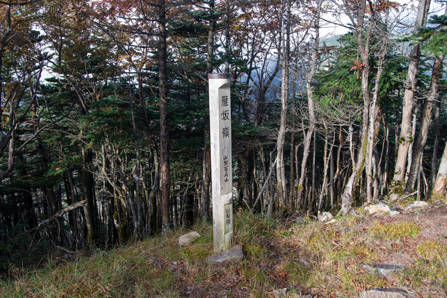
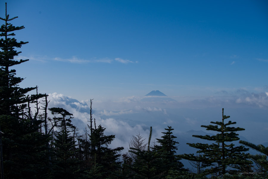
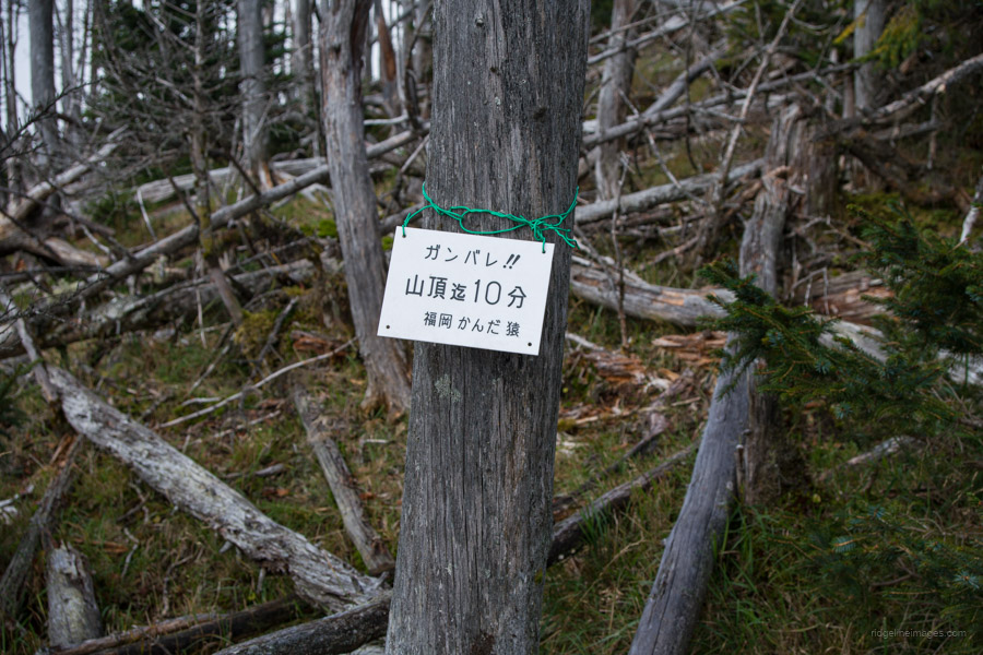
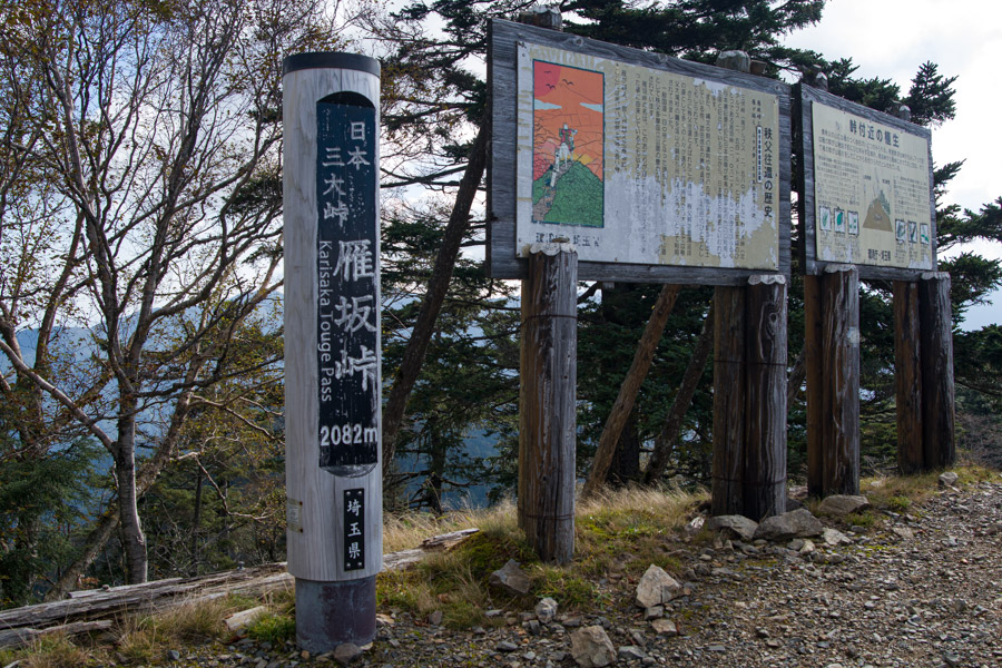
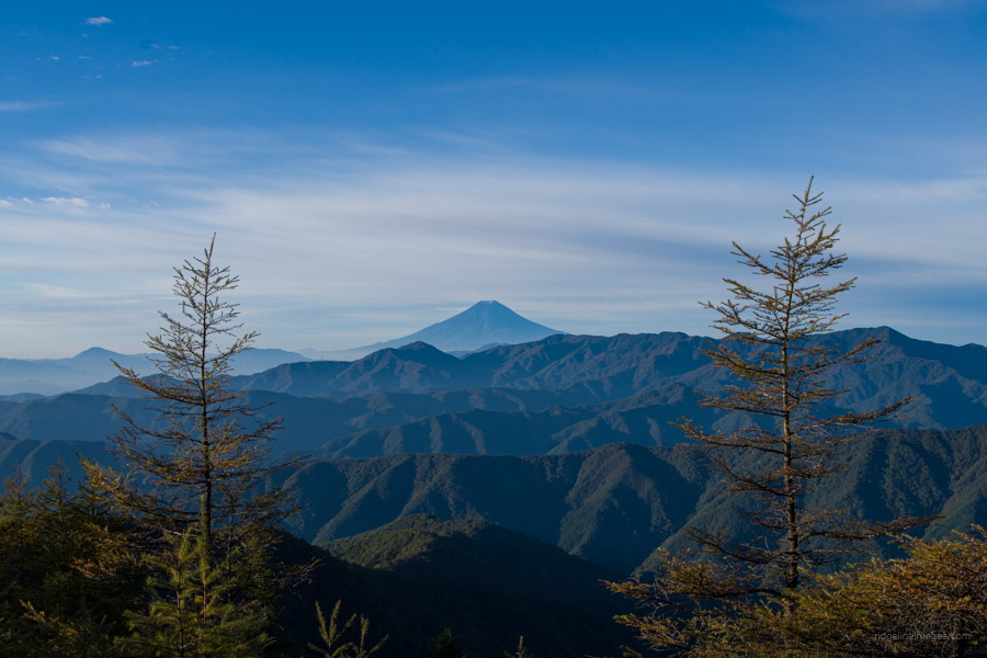
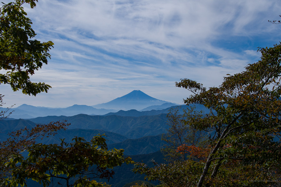
After a well-deserved rest at the summit, proceed with caution through the boulders towards the next destination, Mt. Higashi-Hafusan 東破風山 (2,260 m). Continuing along the ridgeline, you’ll pass more withered trees before reaching Karisakarei 雁坂嶺 (2,289 m). Descend from there to Karisaka-toge 雁坂峠 (2,082 m), one of Japan’s three major mountain passes. Along the way, keep an eye out for quaint signs that encourage you with messages like ガンバレ!! 山頂迄10分 (Keep going; just 10 minutes to the summit). From Karisaka-toge, you’ll be treated to splendid views to the south, including Mt. Fuji and Mt. Kentoku. Directly below, the Karisaka Tunnel runs, serving as a vital road connection between Saitama and Yamanashi prefectures.
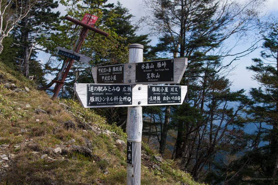
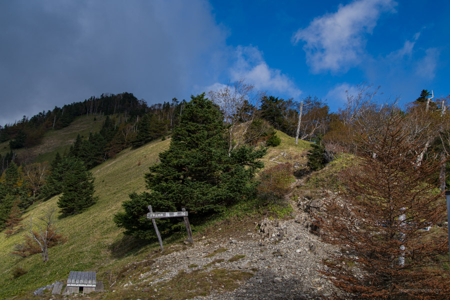
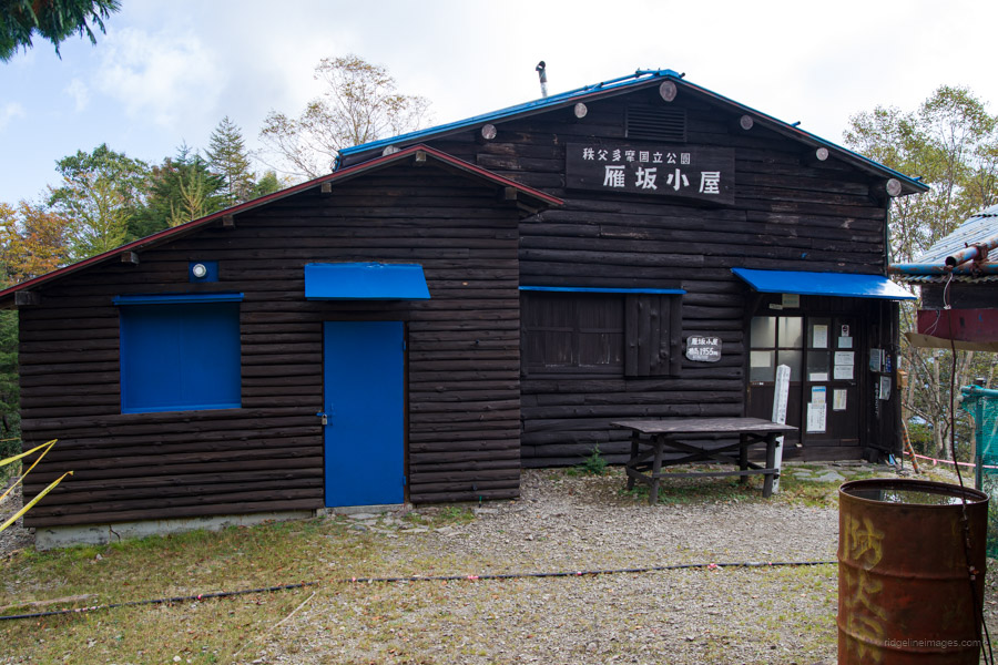
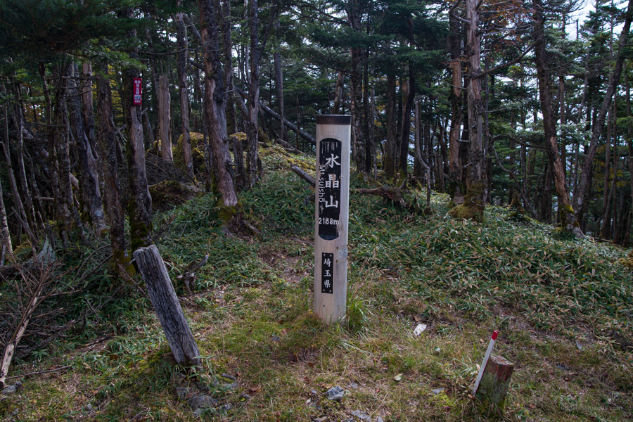
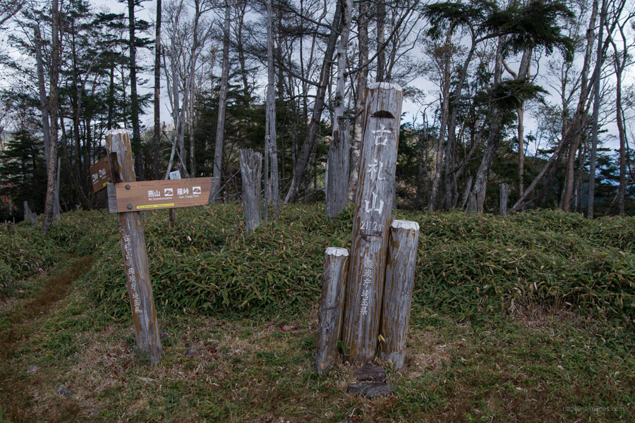
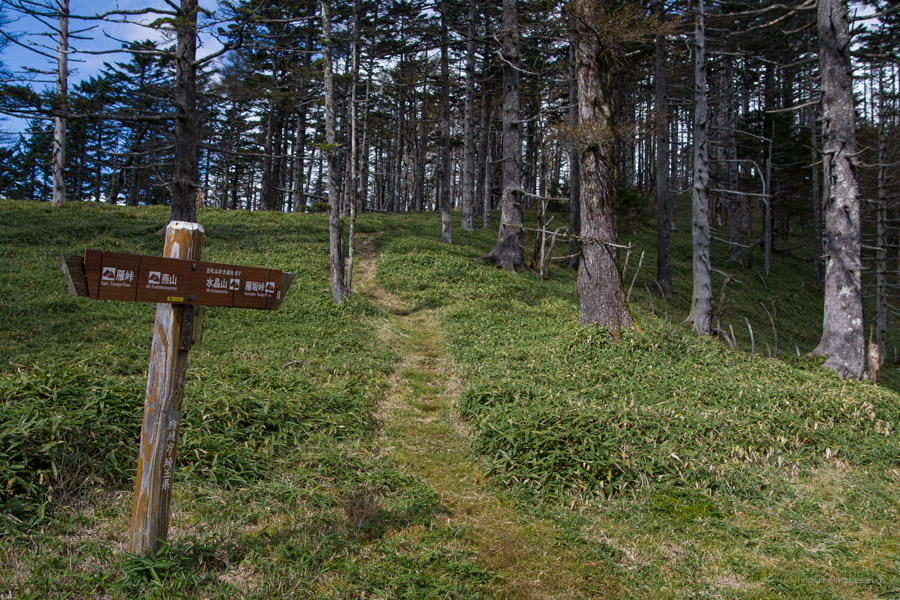
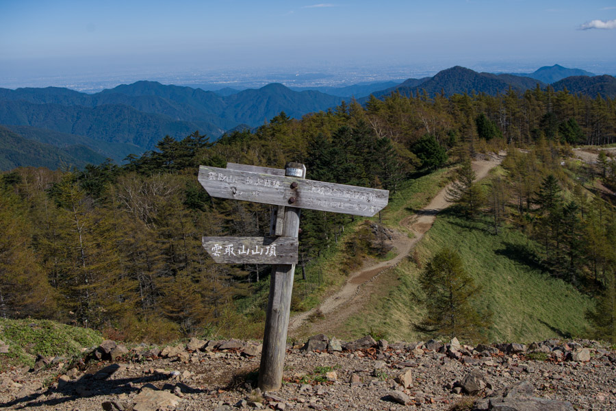
A 10-minute detour here leads you to Karisaka-goya 雁坂小屋, where you can replenish your water supplies. From the hut, return to the main ridge, passing the minor peaks of Mt. Suisho 水晶山 (2,157 m), Mt. Korei (古礼山 (2,112 m), and Mt. Enzan 燕山 (2,004 m), before descending through numerous switchbacks to the clearing at Gan-toge 雁峠. Take a break on the benches, then ascend to a clearing with Mt. Kasatoriyama 笠取山 (1,953 m) rising before you. Climbing the steep slopes of Mt. Kasatori requires effort, but the breathtaking views from the summit in fine weather of the Southern Alps and Mt. Fuji make it worthwhile. A second official summit marker is a little further along the narrow, rocky ridge.
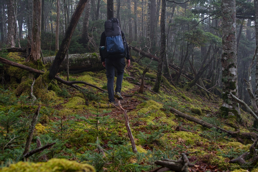
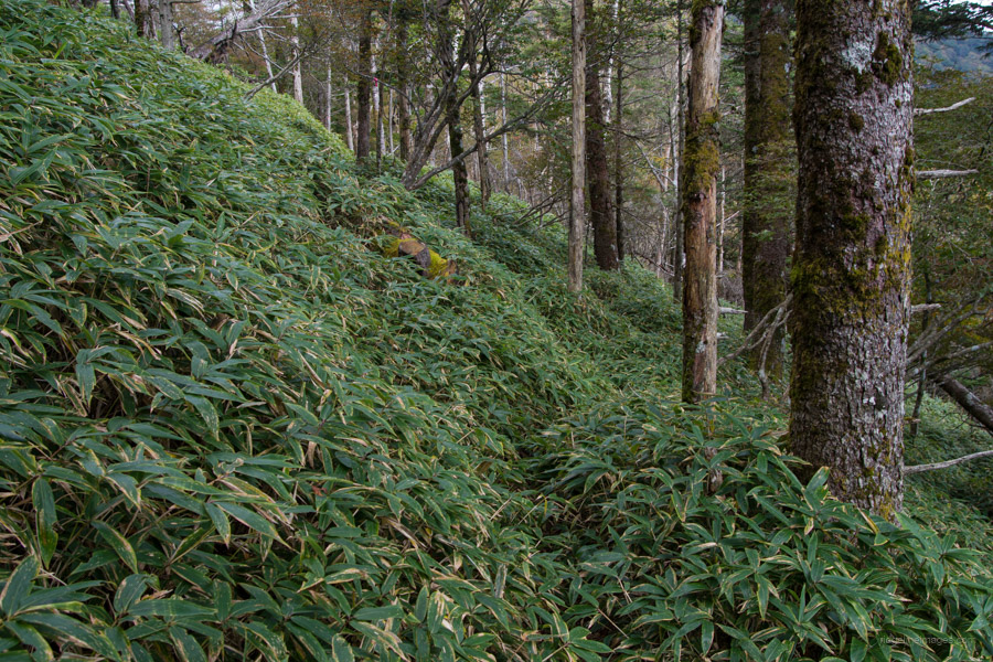
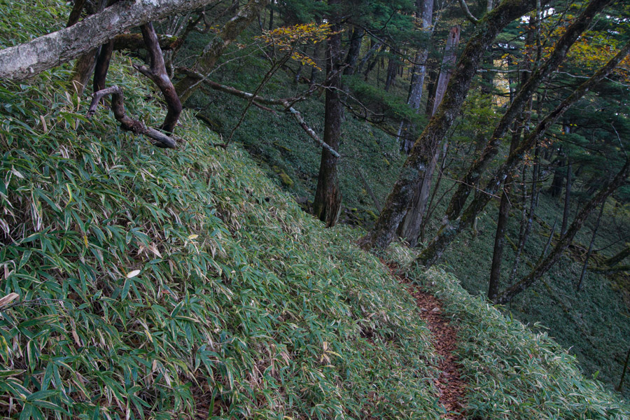
If you’re running low on water, a refreshing spring, which happens to be the headwaters of the Tama River, is worth a visit. In this case, when you head back to the trail fork, turn right for a 5-minute walk. Turning left and heading towards Mt. Karamatsuo, you enter a dense area of kuma-zasa bamboo, which continues for about 1 kilometre. At times, it reaches head height, making it challenging to discern the trail. Losing the trail without a GPS device could lead to difficulties. The hike from the trail fork to the summit of Mt. Karamatsuo 唐松尾山 (2,109 m) takes around 2 hours. Unfortunately, the summit doesn’t offer any views. Look for pink tape and start descending towards Shougen-toge 将監峠. The trail winds around the mountain slope before crossing a rockfall. At Shougen-toge, turn left to walk around to Shougen-goya 将監小屋, which has numerous campsites dug out on terraces with a nearby water source.
Diary:
As I drifted off to sleep, the slight breeze faded, and for mid-October, the night-time temperature remained unusually warm. Apart from occasional grunts and bleats from nearby sika deer at varying intensities, it was still. Breakfast, as usual, was consumed before sunrise in the vestibule of the tent, sitting cross-legged in my sleeping bag. I had powdered milk made from spoonfuls of Morinaga Creap Creamy Powder, along with muesli and dried mangoes. Before stowing away my food supplies, I would also grab a protein bar and some Morinaga Salt Plus tablets to eat on the go.
As expected, Mt. Hafusan got my heart pumping, and it took a solid 45 minutes to reach the summit. The view back down to the refuge hut was breathtaking, as was the Brocken spectre within the multicoloured rings. This was my first time hiking this remote section of the traverse from Kobushi-goya to Karisaka-toge and was a real treat. After Mt. Hafusan, the trail passed through a rocky section to Mt. Higashi-Hafusan with more lovely komorebi. At Karisaki-toge, I decided to stop by the Karisaka-goya to collect some water. Just like the last time I visited it on a weekday, it was deserted.
Not long after leaving the Karisaka-goya, I tripped on the most innocent-looking rock. Most of the impact was felt on my lower leg. Thankfully, it didn’t result in any serious injury, just some localised swelling, which I treated with my cold water bottle after reaching the campsite. Another reason why I tend not to push too hard on my hikes is to avoid these types of slips and falls. It wasn’t until I reached Mt. Kasatori that I met another hiker, apparently on a day hike. The view from the summit was clouded over, so I didn’t linger, especially since it looked like it could rain at any moment.
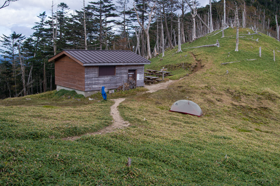
The trail from Mt. Kasatori to Mt. Karamatsuo is arguably the least used on the entire traverse. Thanks mostly to its remoteness, it is primarily frequented by those undertaking longer, multi-day trips. Upon reaching Mt. Karamatsuo, I was surprised to encounter the second hiker of the day setting up his tent not far from the summit. He mentioned that there wasn’t anyone staying at the Shogen-goya. I thought, “Nice”, as the last time I stayed there was during Golden Week, and it was bursting at the seams.
 Shougen-goya campsite.
.
.
.

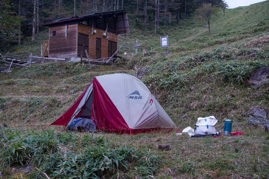
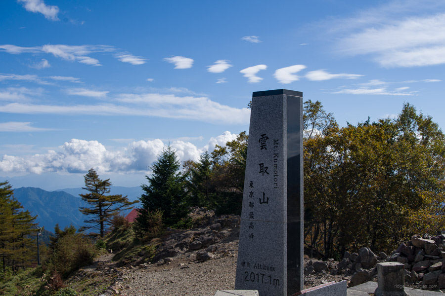
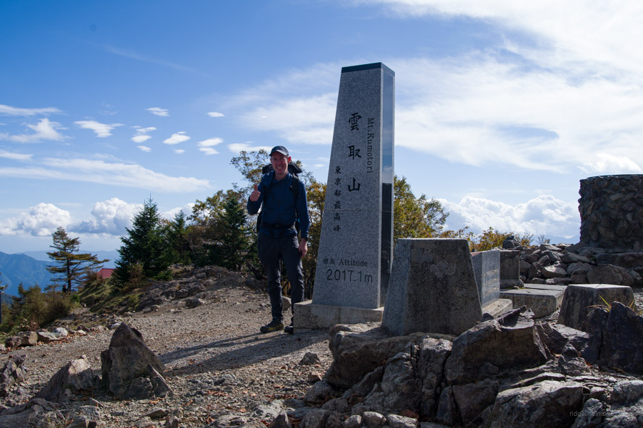
Day 4: Shougen-goya 将監小屋 to Kumotori-sansou 雲取山荘
6hr 13 km 719 m 603 m Oct 13, 2023
 Kumotori-yama the roof of Tokyo.
Route:
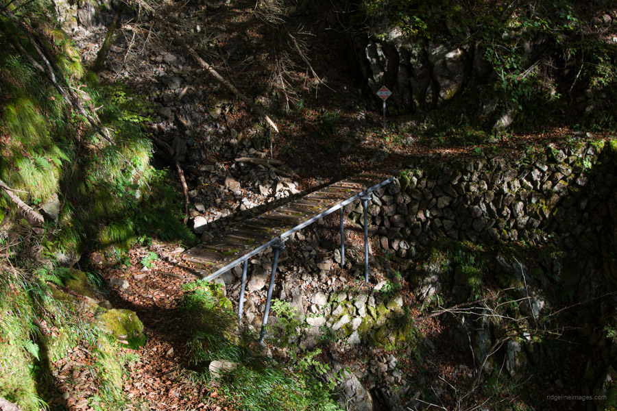
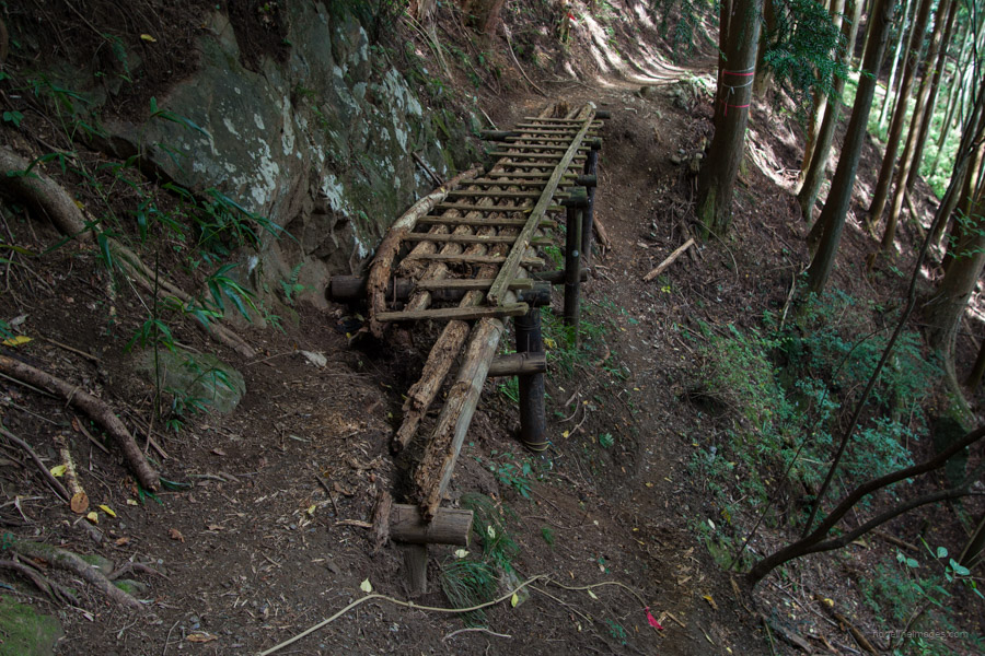
From the campsite, look for a sign pointing to Mt. Kumotori and Mt. Hiryuzan that leads up a steep slope. After reaching the trail fork, turn right. From here, the trail remains relatively flat as it traverses the mountainside. Elevated wooden walkways are positioned in eroded gullies that would otherwise make the trail impassable. Be mindful of two landslides: the first one requires you to manoeuvre around its top, while the second can be passed underneath. Approximately 2 hours into the hike, you’ll find a water source near Odaru 大ダル, although it’s little more than a trickle of water and not the easiest to collect from. Shortly after, keep an eye out for a turn-off to Kamuro-iwa 禿岩. This rocky outcrop offers a sweeping panorama of the Okuchichibu Mountains.
At the four-way trail junction, it’s possible to make a detour for Mt. Hiryuzan 飛龍山 (2,077 m), although allow 45 minutes for the return trip. Alternatively, continue in the direction of Sanjounoyu 三条の湯. This trail doesn’t seem to be frequently used and is sometimes overgrown with kuma-zasa bamboo. The next landmark to look out for is a delightful open clearing at Okami-daira 狼平, where the trail widens for several hundred metres. A great spot for lunch can be found at Sanjoudarumi 三条ダルミ. After this point, a final 40-minute push will take you to the summit of Kumotoriyama 雲取山 (2,017 m).
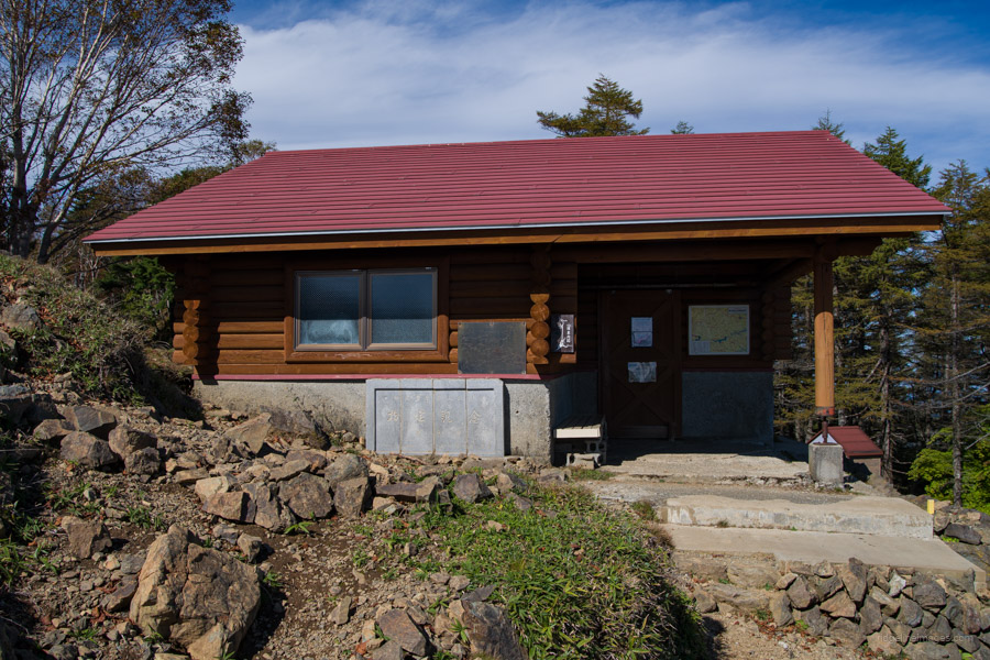
After enjoying the stunning vista towards Tokyo, the trail passes by the spacious and unmanned Kumotoriyama refuge hut 雲取山避難小屋, which can accommodate up to 20 people. From the summit proper, located just behind the back of the hut, it’s a leisurely 20-minute hike downhill to the Kumotori-sansou 雲取山荘 and campsite.
Diary:
Since it was the shortest hiking day of the traverse, I decided to start a bit later, just after 6 am. As I did every morning, I inserted the batteries into my Garmin Oregon and loaded the GPX track. It seemed fine at first, but when I zoomed in, the screen froze. This had happened occasionally before and was usually fixed by taking out and replacing the batteries. However, this time it proved more stubborn. When I attempted to navigate to a track using “Where To?” it resulted in a blank screen with only the directional pointer arrow. While everything else looked to be functioning properly, the topographic map wouldn’t display. Fortunately, the trail was easy to follow, and I had my paper maps as a backup. Still, not having the ability to easily check my exact position did mess with my head.
Weather-wise, it was another beautiful day, and I had a fantastic view of Mt. Hiryu from nearby Kamuro-iwa. At the trail fork for Sanjounoyu, I encountered a couple who had just come from there. I asked them about the trail, as I recalled it being a challenging descent when I did it a few years ago. They mentioned it was narrow at times but didn’t seem overly concerned. From here to my lunch spot below Mt. Kumotori, I decided to pick up the pace. I attribute this to feeling a bit anxious due to my Garmin GPS being out of action. After lunch, I sluggishly made my way up the steep bamboo-covered slope. It was about halfway up when I heard some rustling close by and instantly, of course, thought of the very worst based on the commotion I was witnessing. Mercifully, when it finally reared its head, it turned out to be a Japanese boar! It was an enormous relief.
At the summit, I had a conversation with a group of university students who claimed they had walked up from Okutama Station in 5 hours. I couldn’t help but marvel at their speed, considering the map time is closer to 9 hours. Finally, I arrived and secured a spot at the Kumotori-sansou campsite. The campsite was smaller than I remembered, with very few flat spots. I managed to set up my MSR Freelight 1 with only centimetres separating me and some unyielding tree roots. As one of the most popular campsites in Tokyo, it unfortunately attracts crows. I should have been more cautious, but while waiting for my dehydrated meal to rehydrate, I briefly stepped away from my campsite, only to return and find one of the little bugger’s head in my food sack. Shortly thereafter, it flew away with a Ziploc bag full of salt tablets!
 Kumotori-sansou campsite.
.
.
Day 5: Kumotori-sansou 雲取山荘 to Okutama Station 奥多摩駅
7hr 30min 21.3 km 766 m 2215 m Oct 14, 2023
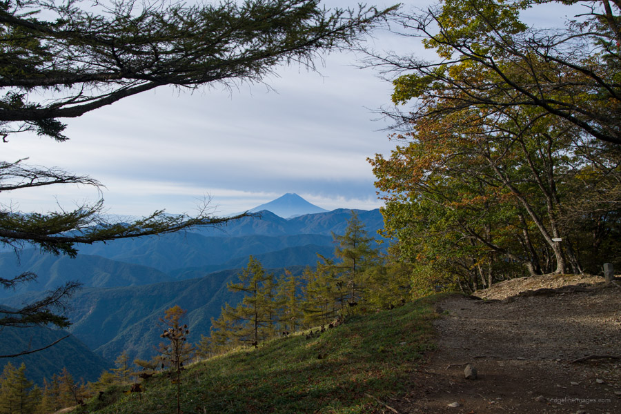
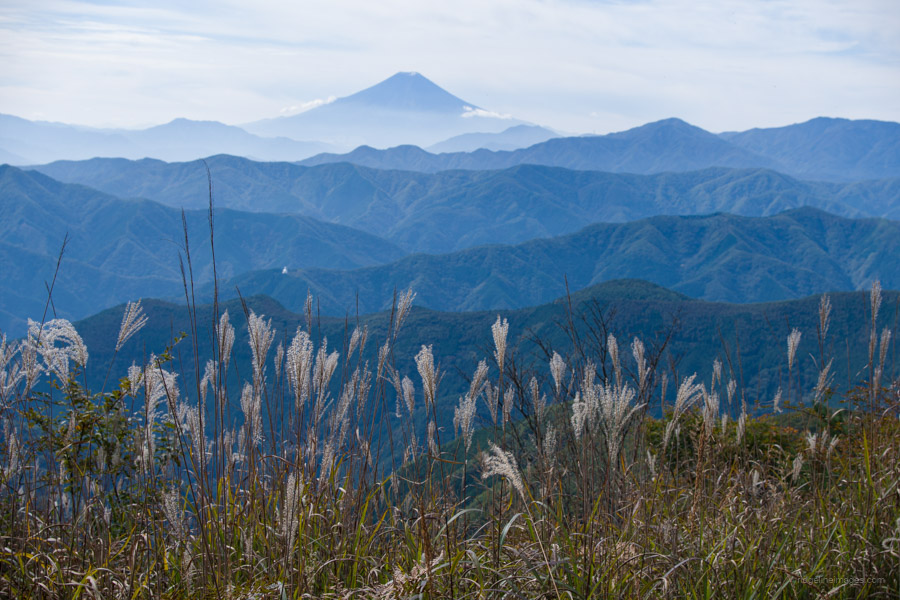 Susuki (pampas grass) with Fujisan in the backdrop.
Route:
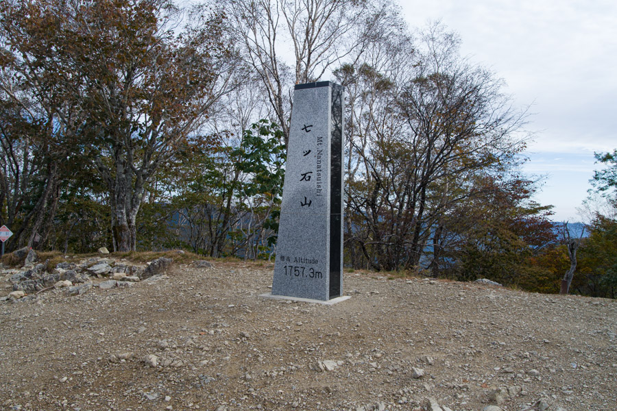
From Kumotori-sansou, the trail back to the summit takes approximately 30 minutes. Arguably, the best 180-degree views can be experienced at sunrise. Thus begins the lengthy descent along the Ishione Ridge 石尾根 to Okutama Station. The first point of interest after the refuge hut near the summit is the vicinity of the old Okutama-goya 奥多摩小屋, which ceased operations in March 2019. Park authorities request visitors not to camp there anymore, as the toilets have also been closed. The trail maintains its width until reaching Mt. Nanatsuishiyama 七ッ石山 (1,757 m), where the first exit option emerges by descending to Kamosawa 鴨沢.
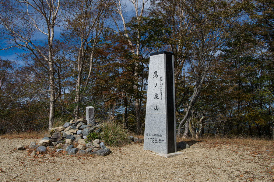
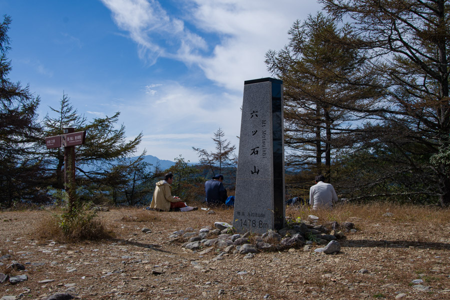
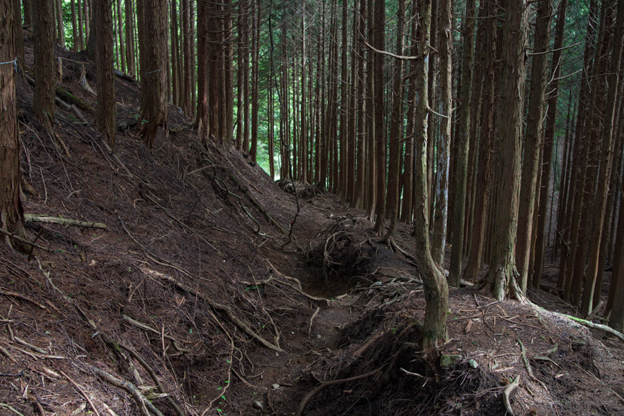
Following this, the trail passes through a quiet stretch with few hikers to Mt. Takanosuyama 鷹ノ巣山 (1,736 m) via Mt. Takamaru 高丸山 (1,732 m) though if the clouds are in, it can be bypassed by taking the maki-michi. At the base of this mountain, there is an emergency hut offering a pleasant rest spot, and nearby, there is a water source if needed. The final hurdle is Mt. Mutsuishiyama 六ッ石山 (1,478 m), after which the seemingly endless slope leads down to Okutama Station 奥多摩駅 through dark plantation forests. For those seeking a hot spring, Moegi no Yu Onsen もえぎの湯 is an excellent choice, located a 10-minute walk from the station along the Tama River.
Diary:
Rumbles in nearby tents began early, long before I had planned to wake up, which, as it happened, turned out to be a blessing in disguise since today was going to be a long one. It was also going to be the second time I hiked from Tokyo’s highest mountain to Okutama Station. Ten years ago, I hiked up from the Mitsumine Shrine and stayed at the Kumotori-sansou. During breakfast, I recall asking about people’s plans for the day. If I remember correctly, there was only one other person going the whole way to Okutama Station, and for a good reason, as the hike is rather interminable.
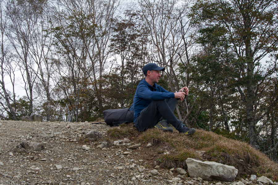
The first surprise of the morning was returning to the summit to find only one other person. I figured the other guests must have started much earlier. Anyway, from this point, I was on a downhill trajectory, and by the time I reached Okutama Station, I would have dropped almost 1,700 metres in elevation. Unlike the previous occasion, this time I would be making side trips to Mt. Takamaru, Mt. Takanosuyama, and Mt. Mutsuishiyama. And why not? The weather was perfect–slightly overcast with little to no breeze.
The first landmark I spotted was the prominent white Okutama Bussharito, or Tokyo Peace Pagoda, on Mt. Odera at the far end of Lake Okutama. It wasn’t long before I started passing hikers making their way to the summit in the opposite direction, although there were fewer than one might expect, considering the forecast for rain the following day. It should be mentioned that, except for the most dedicated climbers, Kumotoriyama is best enjoyed over two days. From Mt. Nanatsuishi until I reached the Takanosu Refuge Hut, I didn’t encounter anyone. This was because most hikers focus their efforts on either climbing Mt. Takanosuyama or Mt. Kumotori, and very seldom both in one go, thus leaving this section as a sort of no man’s land.
All morning, Fujisan stood gracefully in the background, offering plentiful photo opportunities amidst autumn leaves and susuki (pampas grass). The final challenge, after soaking in the sunshine on Mt. Mutsuishiyama, was a steep and sometimes slippery descent on eroded trails through the plantation forest. Here, I managed to slip and bang my knee heavily on one of the pine tree roots. It hurt, though by this stage, I was close to finishing the hike and was determined not to let any late mishaps prevent me from completing it.


Thanks for this exemplary write-up, with its combination of travelogue and practical advice. I always wondered, when living in Tokyo, how far one could walk through Chichibu without crossing a road or railway, and now you’ve provided a detailed answer …. great stuff!
Hi PH, thanks for reading and for the compliment.
As you can probably guess, I really enjoyed this hike, and in many ways, it was just as enjoyable and scenic as the full traverse I did of the Southern Alps back in the summer.
It’s only the road to Odarumi Pass that spoils the fun. That road, in and of itself, is a bit of an oddity. While the sealed road winding up to the pass from Yamanashi is a well-funded prefectural road, the same unfortunately can’t be said for the Nagano approach, which is basically a 4WD gravel track funded by the local municipality.
Great write up and pictures. Was looking forward to this post. I’ve always had a soft spot for those mountains despite my rather soggy experiences in them.
Thanks for the comment, Willie.
I can certainly relate. It was my third go at climbing Kobushigatake the previous occasions had been in mist and rain. But what a view it was from the summit!
This is awesome. I tried to comment before, but something went wrong.
Anyway, that is quite a trip. It took me probably 6 months or a year to do what you did in 5 days!
Great memories!
Cheers, Pat.
It is one of the best multi-day hikes, and I feel privileged to have been able to do it in one shot. If you ever have a chance to try it yourself, I couldn’t recommend it enough.
This is incredible and helpful planning info! Thank you for this entire site, amazing.
You’re very welcome! I’m glad you found the information helpful.
Thank you for always posting these great thru hikes. You probably can’t remember but you helped me out quite a bit when I did the Minami Alps thru hike a couple of Summers ago.
I will do this thru hike in GW just after the official holidays. I will take the bus and add Mizugaki mountain to the traverse as I haven’t done that Hyakyumeizan yet? Will I be able to make the campsite? If I can’t Kinpusan doesn’t have a campsite does it. I would like to hike further than the Mizugaki/kinpusan junction if I can on the first day.
If I have to stay there do you recommend adding an extra day?
Thanks for the comment, Chris. Even if you catch the first bus, and with the longer daylight hours, you’d likely reach Odarumi-goya in the dark, as that bus from Nirasaki Station just doesn’t leave early enough.
A better option would be not to rush Mizugaki-san and instead camp at Dainichi-goya. It’s a nice spot, and I’ve camped there myself before.
The next day to Hafusan hinan-goya is a long one, but still more manageable than trying to do both Mizugaki-san and Kinpu-san in a single day and make it to Odarumi-toge.
This way, you shouldn’t need to add an extra day — just expect a longer second day.