.
Mt. Odake 王岳 – Mt. Kagikake 鍵掛 – Mt. Settogatake 雪頭ヶ岳
Distance: 10.4 km
Elevation change: 828 metres
Highest point: 1738 metres
Start: Saiko Iyashi-no-Sato Nenba bus stop
Finish: Saiko Iyashi-no-Sato Nenba bus stop
Difficulty: ▅▅▅▅▅▅▅▅▅▅ ❹
Map: Yama to Kogen Chizu 山と高原地図 [No.34 富士山 FUJI-SAN]
GPX TrackKML TrackGSI MAPPDF Topo Map
Mt. Odake–Onigatake Loop, Fuji Five Lakes
This traverse hike between Mt. Odake and Mt. Onigatake rises above Lake Saiko, and both peaks are renowned for their views of Mt. Fuji. The mountains are located in the western part of the Misaka Mountains, which lie between the Kofu Basin and the foot of Mt. Fuji. It’s a rewarding loop course with some minor rock scrambling, aided by fixed ropes and a short ladder section. Mt. Odake is also one of the 100 Famous Mountains of Yamanashi.
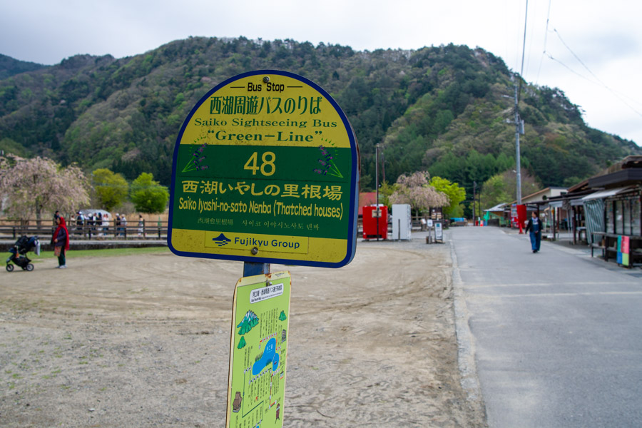
To reach the trailhead, take the Fujikyu Railway Line from Otsuki Station to Kawaguchiko Station 河口湖駅, then transfer to the Saiko Sightseeing Bus (Green Line) just outside the station exit. The only drawback is that the first bus doesn’t depart until 9:10am, making this the earliest possible connection to the trailhead. The 40-minute journey to the Saiko Iyashi-no-Sato Nenba 西湖いやしの里根場 (Traditional Japanese Village) bus stop costs 810 yen, and Pasmo and Suica cards can be used.
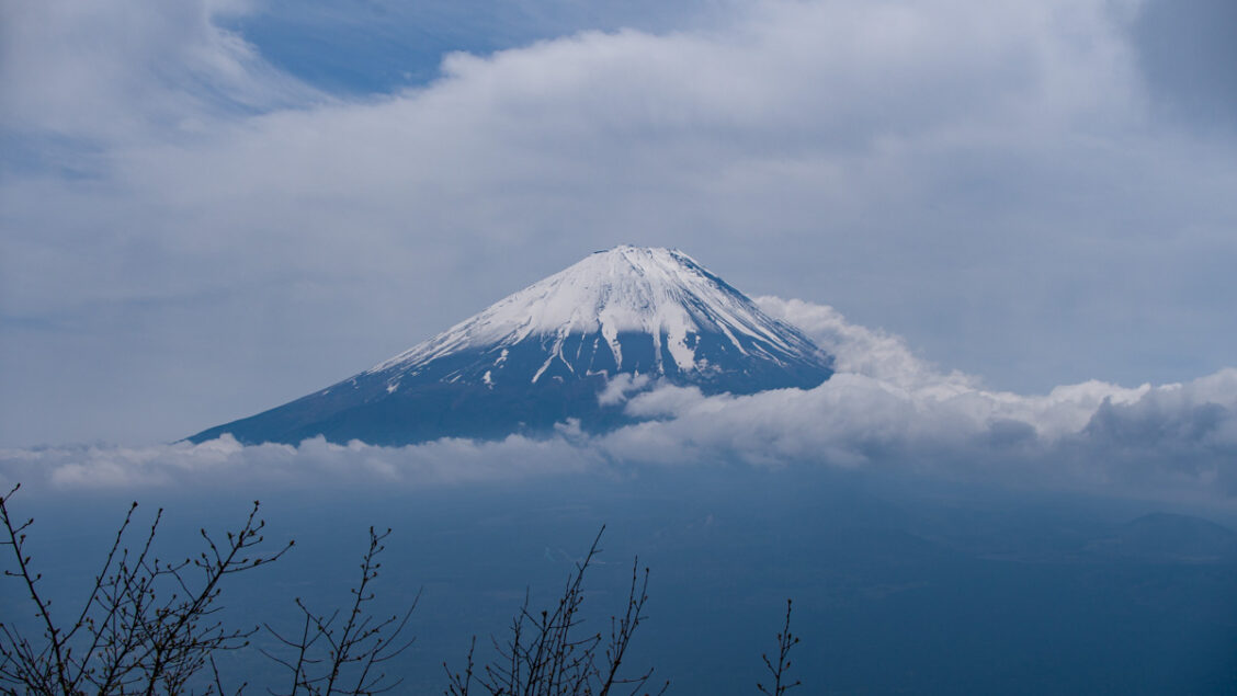
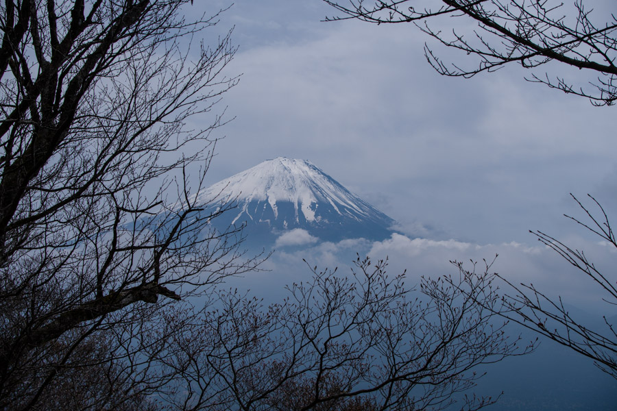
It’s becoming a not-uncommon occurrence to be recognised as the writer of this blog – whether on the trail or, in this case, by a fellow reader on the Fujikyu Line. It’s always a nice surprise and a good chance to exchange a yarn or two. The foreign hiking community here is actually quite modest. What concerned me most that day, however, was the rather gloomy-looking weather. At the trailhead, Fujisan was partly visible, which was more than could be said for the upper ridgeline, still cloaked in mist.
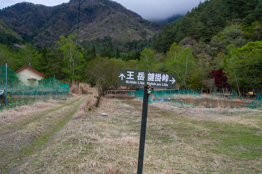
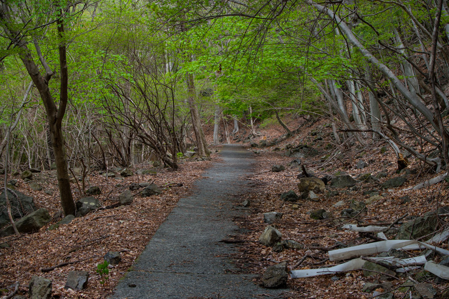
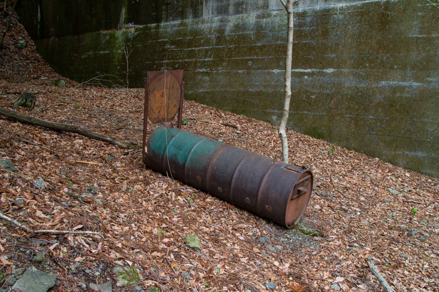
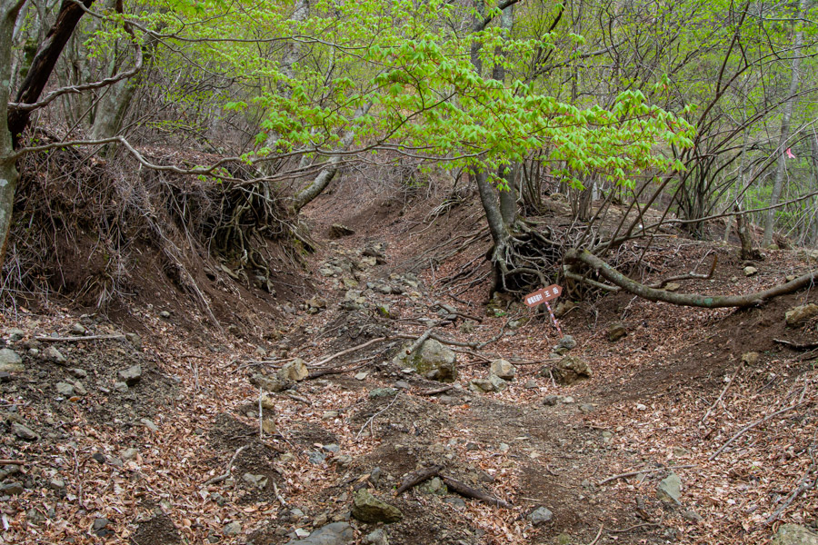
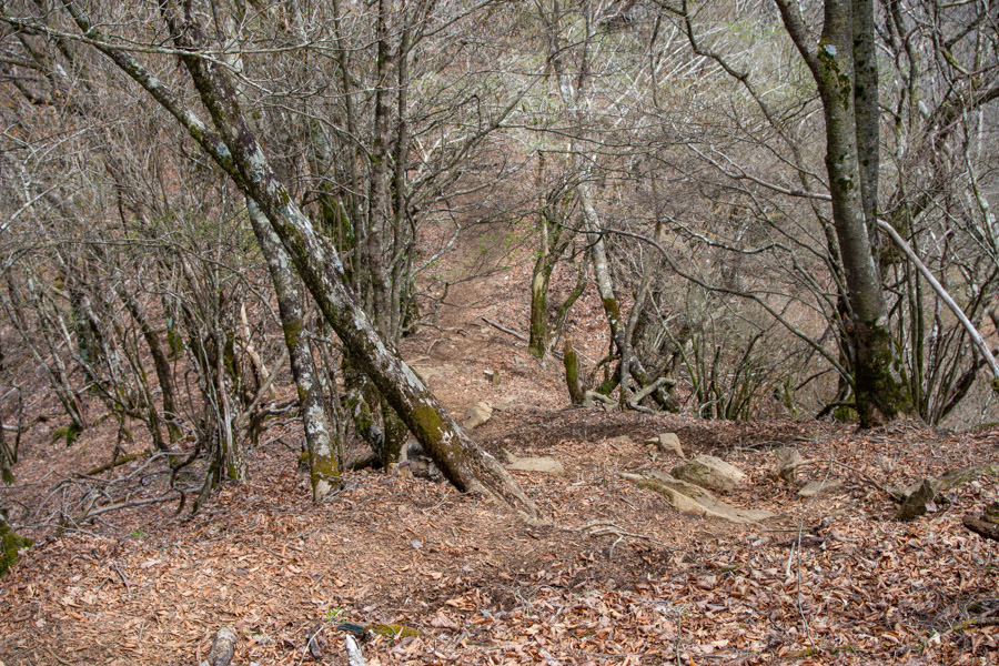
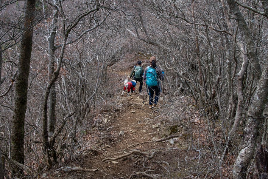
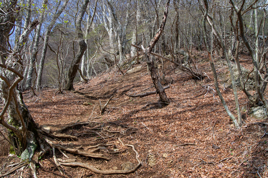
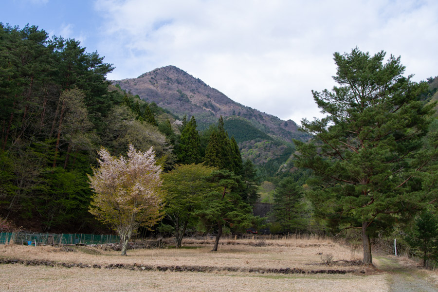
In clear weather, the pointed peak of Mt. Onigatake 鬼ヶ岳 is clearly visible, as is the flat summit of Mt. Odake 王岳. From the bus stop, head back in the same direction the bus came from; a sign indicates Mt. Odake is 3.5 km away. The standard course time to the summit is a little over two hours. The first part of the climb follows a forestry road, presumably once used to construct the sediment dams lining the stream, though now littered with fallen rocks in its upper section. I also passed a decrepit-looking animal trap. It takes around 30 minutes to reach the trailhead proper from the bus stop.
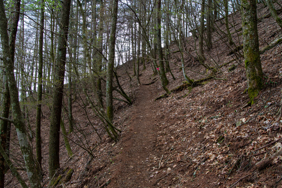
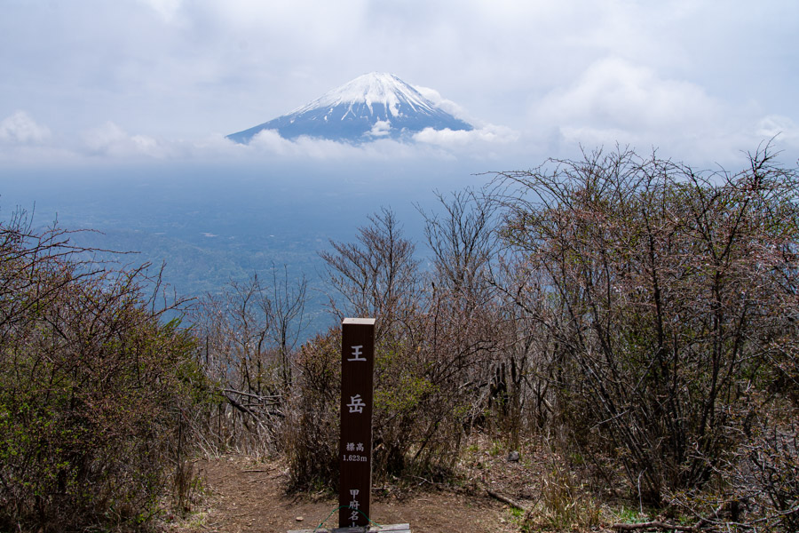
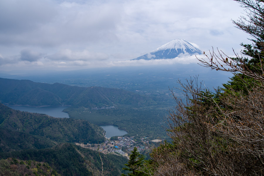
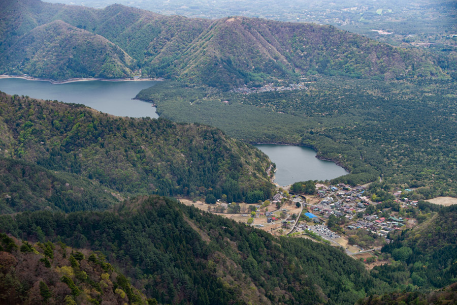
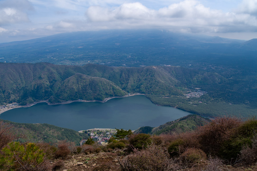
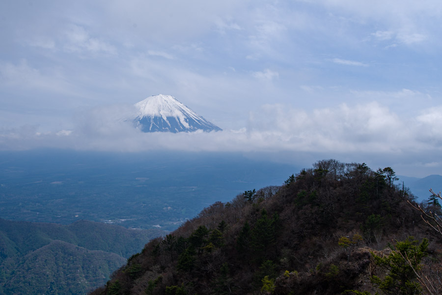
The trail starts out quite steep, and you gain elevation rapidly. By the time I reached Mt. Odake (1,623 m), the sunshine had finally started to break through, with Fujisan at last revealing itself. From the remarkably quiet and unassuming summit – with views only to the south – the entirety of Lake Saiko can be seen.
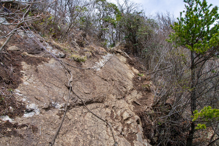
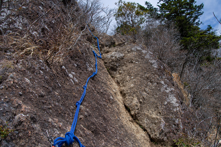
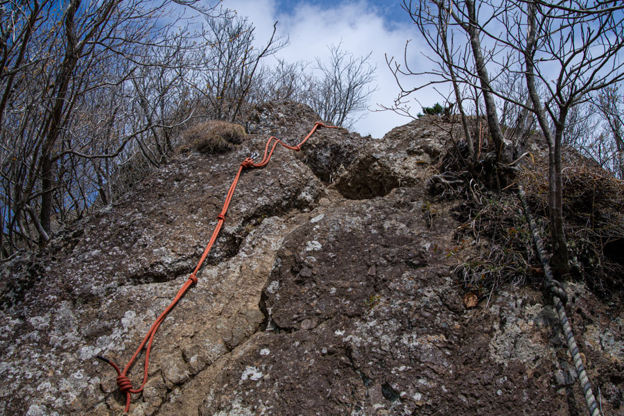
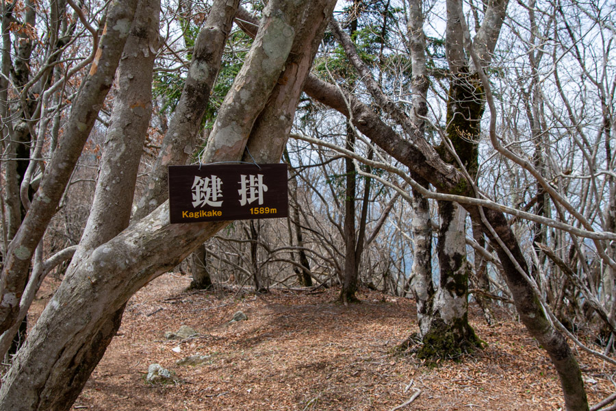
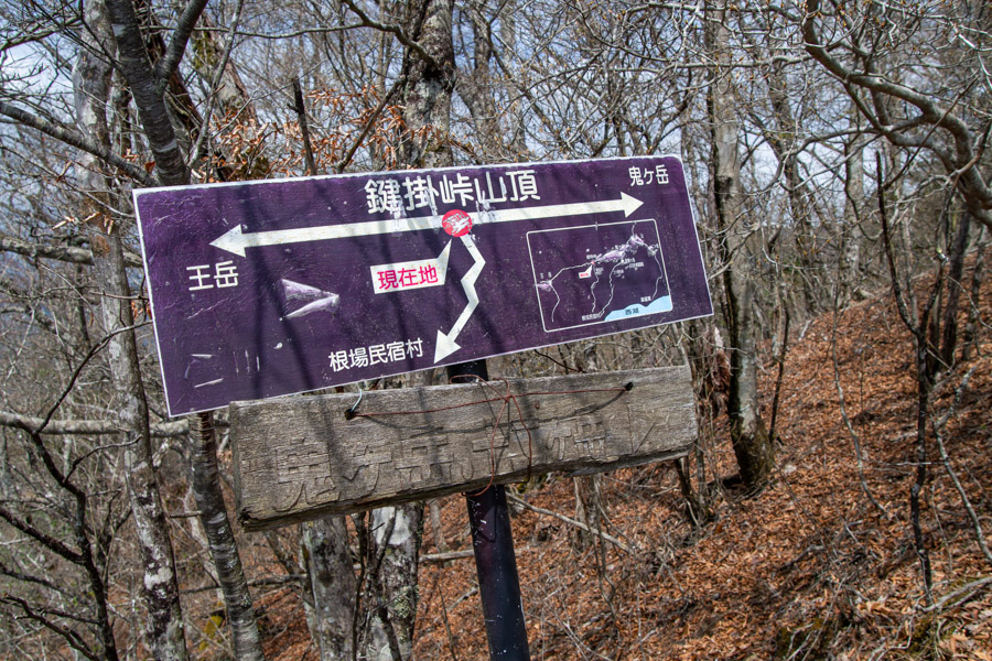
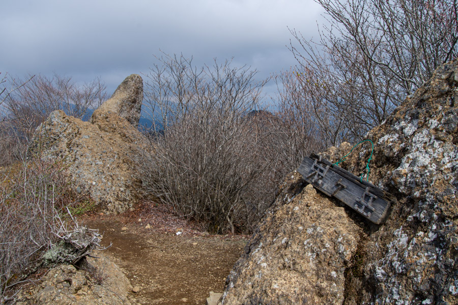
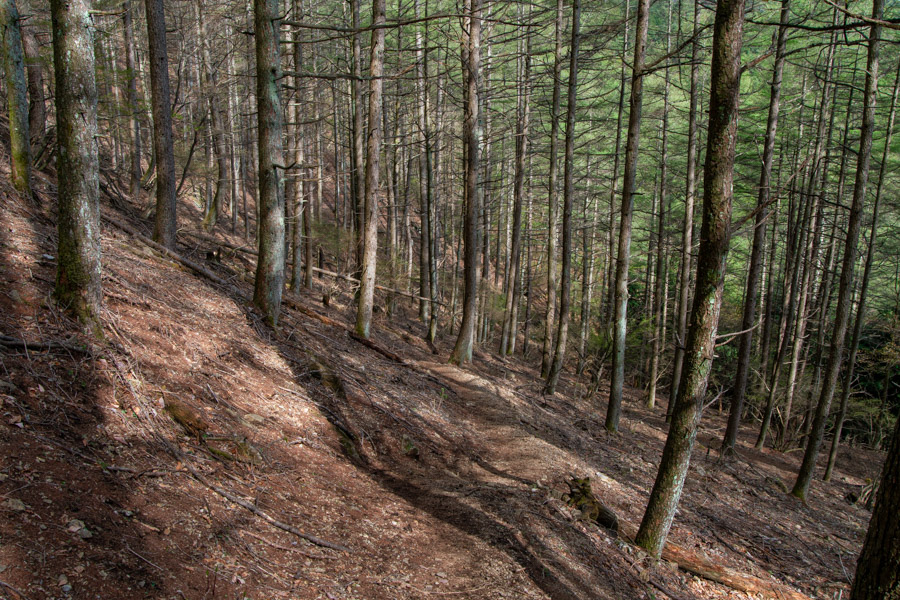
When you’re ready to head off, the traverse across to Mt. Onigatake begins. Along the way there are rocky sections and landslide zones where the views open up, though the route is mostly tree-covered. A little further on, a rock face requires careful manoeuvring, aided by fixed ropes, and blink and you’ll miss Mt. Kagikake 鍵掛 (1,550 m). The trail then continues with gentle ups and downs and, apart from a few traverses, is wide and easy to walk on, passing through thorny scrub. Almost smack bang in the middle is a slightly steep shortcut back down to the traditional Japanese village.
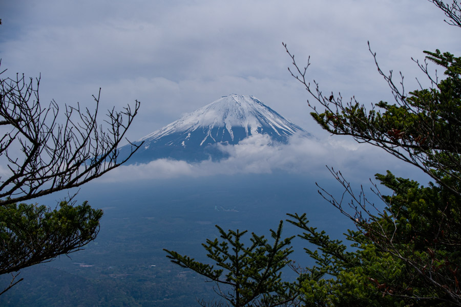
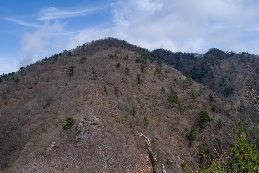
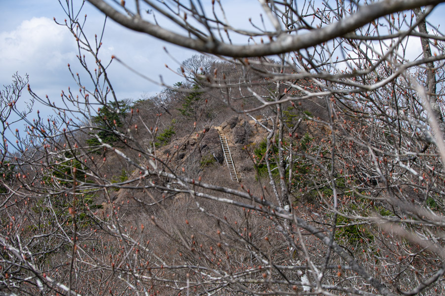
As you approach the main peak of Mt. Onigatake (1,738 m), the terrain gradually steepens, with the final push proving quite a challenge. A single rock resembling a demon’s horn juts out from the summit and, although it’s a narrow spot, it offers panoramic views of the mountains surrounding the Kofu Basin, including the Southern Alps and the Yatsugatake range.
For those with a little more fuel in the tank, you may also consider bagging Mt. Settogatake 節刀ヶ岳 another of Yamanashi’s 100 Famous Mountains, not to be confused with a different peak of the same name but with alternate kanji, which appears a little further along the trail.
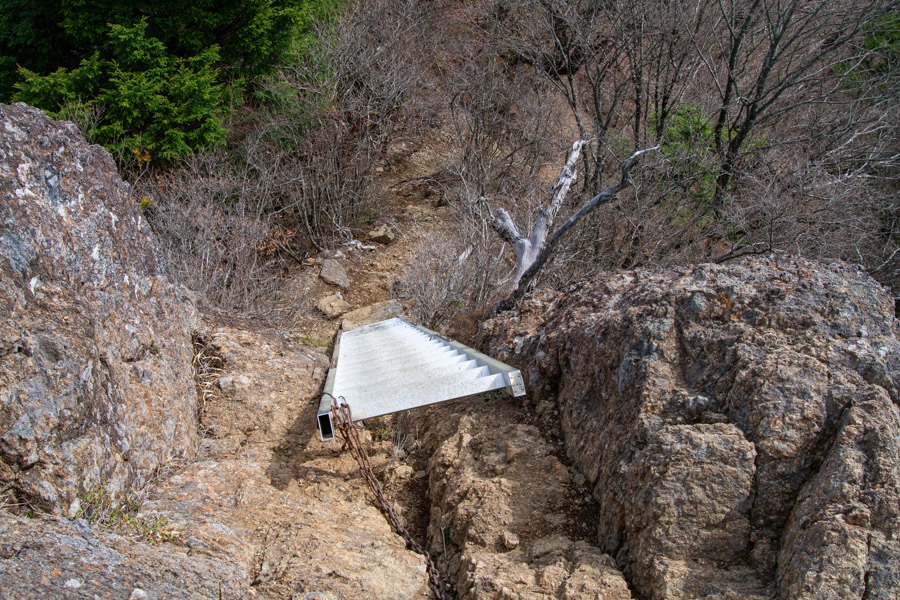
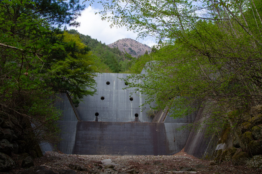
After lunch, an aluminium ladder must be descended to reach Settogatake 雪頭ヶ岳 (1,710 m), after which the trail opens up to a surprisingly expansive viewpoint. Unfortunately, by this stage Fujisan was hidden from view – a shame, as this is one of the better vantage points over Lake Saiko and the broad, unobstructed foothills of Mt. Fuji. From here, the trail descends steeply before easing off upon reaching a cedar forest. The final landmark near the opposite trailhead is a colossal sediment control dam. The last bus to Kawaguchiko Station departs at 5:40pm.


Glad to finally meet you in person after all these years 😄 Seems like you had a fun day despite the weather!
Great to meet you on the train, Alain! Glad the weather came good in the end. Hope you got some Fuji views from Mishotai-san too. 😄
Hi David,
Thanks for the report. I have so many nice memories of all those mountains around the 5 Lakes. I always got a kick out of the sign for the Saiko Bat Cave in that area. It made me expect Adam West to pull out of the Aokigahara Forest in the Batmobile every time I drove through there.
Keep on trekking!
Thanks for reading, Pat. Slowly knocking off some of the more well-known peaks around those lakes – just Settogatake and Junigadake to go. Nice to see you getting some good hikes in too, despite the topsy-turvy weather we’ve been having.