
A Pocket Guide for Climbing Mt Fuji in 2026
Hot on the heels of the Japan Hiking Field Guide comes its first companion: a pocket reference built for one mountain and one mountain only. If you’re climbing Mt Fuji this season, this pocket guide is intended to make things a whole lot easier.
The Japan Hiking Field Guide was designed to cover the Japanese mountains in general including the vocabulary, signage, and situations you’ll run into on just about any trail. But Mt Fuji is its own beast. It has its own rules, its own fees, its own transport puzzle, and enough year-to-year changes that even seasoned climbers get caught out.
The Mt Fuji Field Guide (2026 Season) brings together routes, rules, buses, huts, altitude, and emergency information on a single card that fits in a shirt pocket.
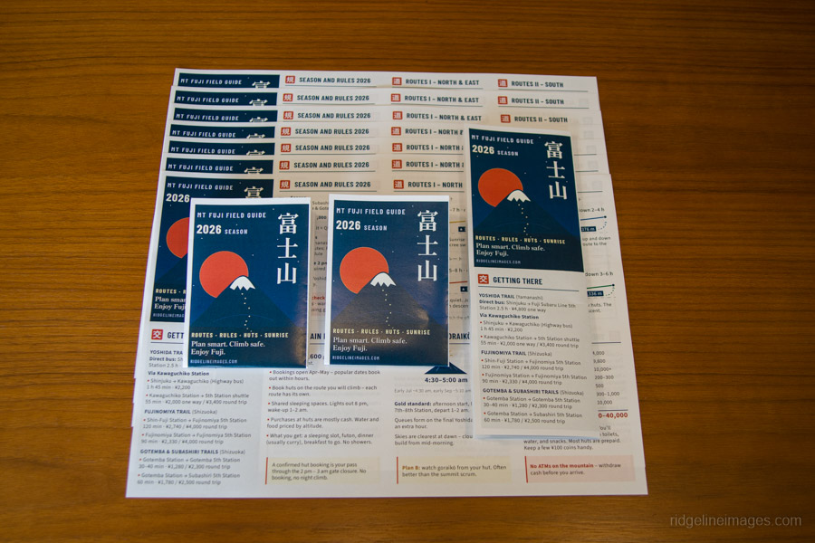
The Mt Fuji Field Guide prints double-sided on A4 and accordion-folds down to A7.
What it is
It’s organised into two layers. Side A is the planning layer: the 2026 season rules and entry fee, all four climbing routes with their official trail colours, public transport access, mountain huts, catching the goraiko (sunrise), and what the whole trip is likely to cost. Side B is the on-mountain layer: altitude sickness, weather and essential gear, trail etiquette, the descent (including the infamous Yoshida–Subashiri fork that catches climbers out every year), the summit, useful Japanese phrases, and emergency contacts.
Why it exists
Here’s the thing about climbing Mt Fuji: none of the information is secret. It’s all out there, but it’s scattered across dozens of different websites. The entry fee and gate hours are on the official climbing website. Bus fares and timetables are spread across half a dozen operators, many of them only in Japanese. The rest of the practical information is dotted across official pages, booking sites, and blog posts of wildly varying age and accuracy. By the time you’ve found the information you actually need, you’ve got fifty browser tabs open and no real confidence that any of it is still current.
That last point matters more than ever. Mt Fuji’s climbing rules have changed considerably in recent years. The current system includes a ¥4,000 entry fee across all four routes, trail gates closed from 2 pm to 3 am for anyone without a mountain hut reservation, a daily cap of 4,000 climbers on the Yoshida Trail, mandatory gear checks on the Yamanashi side, and app registration requirements for the Shizuoka-side routes. If you last climbed Mt Fuji even a few years ago, you’ll find it’s a very different mountain administratively.
Every figure on this card – bus fares, hut costs, fees, altitudes, and opening dates – was checked against the official Japanese websites. When different sources conflicted (and they often did), I trusted the transport operators and the official Mt Fuji pages.
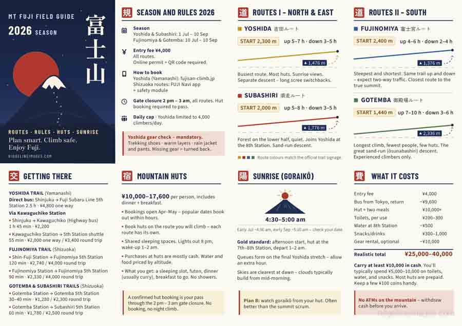
Side A – the planning layer.
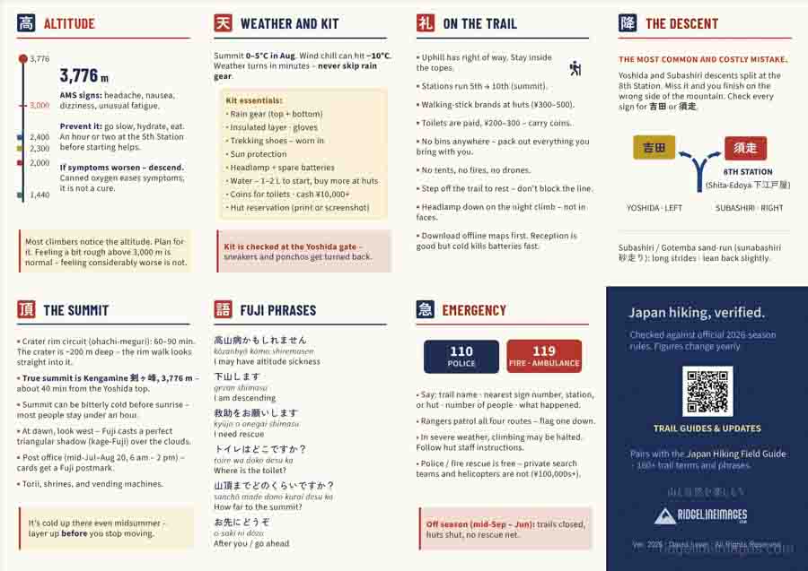
Side B – the on-mountain layer.
Built by hand
Like the Japan Hiking Field Guide before it, this one was created entirely in Adobe Illustrator from the text layout and vector artwork to the descent fork diagram and final design. Every element was built by hand, with a lot of careful thought about what deserved a place on a card this size.
Squeezing an entire mountain onto sixteen A7 panels meant being ruthless. There’s an enormous amount that could be said about Mt Fuji; the challenge was deciding what to leave out. The aim wasn’t to produce another comprehensive guide but a practical reference containing the information you’re most likely to need presented in a form you can absorb at a glance while standing at a bus stop or a trail junction.
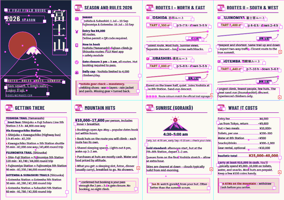
Built from the ground up using Adobe Illustrator.
Design
The cover takes its cue from traditional woodblock prints: a geometric Mt Fuji silhouette beneath a deep indigo night sky, a vermillion sun disc, and 富士山 set vertically in Shippori Mincho. Inside, the panels sit on a warm washi-cream background, with each section introduced by its own hanko-style kanji seal in vermillion.
The four climbing routes are colour-coded to match the official trail signage, so the yellow used for the Yoshida Trail on the card is the same yellow you’ll be following on the mountain. It’s a small detail, but exactly the kind of thing that helps when you’re at 3,000 metres on three hours of sleep.
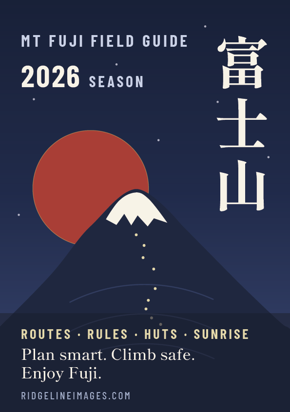
The cover a modern take on Japan’s woodblock tradition.
How to get it
The guide is available on Ko-fi with a minimum price of ¥300 and pay what you want enabled. If you find it useful and would like to support the work, anything above that is genuinely appreciated and helps fund future updates and projects including next season’s edition.
Patreon supporters can download it free from the feed as a small thank-you for helping keep this blog going.
And if you’re heading beyond Fuji this year, the Japan Hiking Field Guide makes a natural companion – the two cards were designed to work together.
If you spot an error or have suggestions for the 2027 edition, I’d be glad to hear them.
Sixteen panels · double-sided A4 · 2026 season rules, routes, fares, and phrases · PDF Print-ready
From 300 yen · pay what you want · free for Patreon supporters
Instant download
One-time payment. No Ko-fi account required.
I’m sure this guide will prove immensely useful – a very good call pointing out that devious Yoshida-Subashiri fork. But your observation, that “If you last climbed Mt Fuji even a few years ago, you’ll find it’s a very different mountain administratively” – this makes my heart sink, even though the warning must be fully justified. Is it still possible to climb the mountain “out of season” (but before any serious snowfall) and avoid the crowds and the, um, “administration”?
Thanks PH, hopefully it will help out a few. I guess the big one for this year is that climbers are being checked for the three essentials, including trekking shoes, warm layers, and a rain jacket and pants, or they’ll be turned back, which is probably something that really shouldn’t need to be done in the first place. As for the second point, no, there aren’t any specific restrictions currently in place, though there has been some talk about it, including consideration of a system requiring stranded climbers to pay the full cost of rescue operations during periods when prefectural roads are closed.