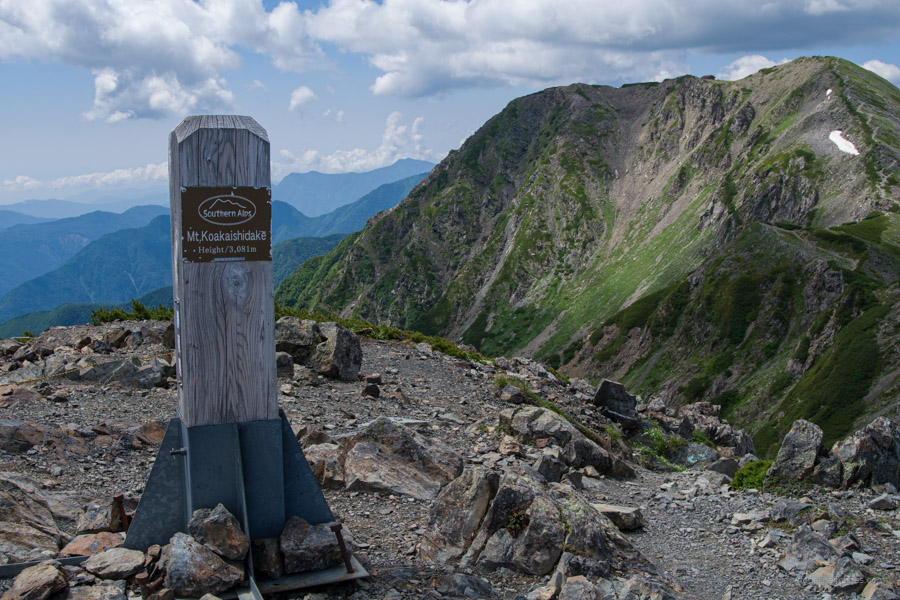
.
Hirogawara 広河原 to Akaishi Onsen Shirakabaso 赤石温泉白樺荘
94.3 km
2315 metres
Highest point: 3193 metres
Start: Hirogawara bus stop
Finish: Akaishi Onsen Shirakabaso bus stop
Difficulty: ▅▅▅▅▅▅▅▅▅▅ ❺
Map: Yama to Kogen Chizu 山と高原地図 [No.44 北岳・甲斐駒 KITA-DAKE·KAIKOMA][No.45 塩見・赤石・聖岳 SHIOMI·AKAISHI·HIJIRI-DAKE]
GPX TrackKML TrackGSI MAPPDF Topo Map
Japan’s Toughest Yet Most Rewarding Multi-day Hike
The Southern Alps Traverse 南アルプス縦走 (Minami Arupusu Jūsō) is a multi-day hike through the Minami Alps National Park that spans Yamanashi, Nagano, and Shizuoka prefectures. While the approximate 94-kilometre route can be undertaken in either direction, I started at Hirogawara and finished at the Akaishi Onsen Shirakabaso. The hike includes six Hyakumeizan, one Nihyakumeizan, and one Sanbyakumeizan or 100, 200, and 300 Famous Japanese Mountains. Convenient access means the northern end of the national park sees the most visitors compared to the southern portion, which has vastly fewer. The trails are some of the most rugged and remote in Japan, with extremely changeable weather conditions. For a rundown on my preparation, food, and gear for this hike, see here.
Rather than a ball-by-ball trail description for each of the seven days, I have provided a brief overview of each day’s route, including water sources, along with daily diary entries, as was done on the Northern Alps Traverse. For a more detailed account of the hike, I highly recommend picking up a copy of Cicerone Press Hiking and Trekking: The Japan Alps and Mount Fuji by Tom Fay and Wes Lang.
Southern Alps Traverse
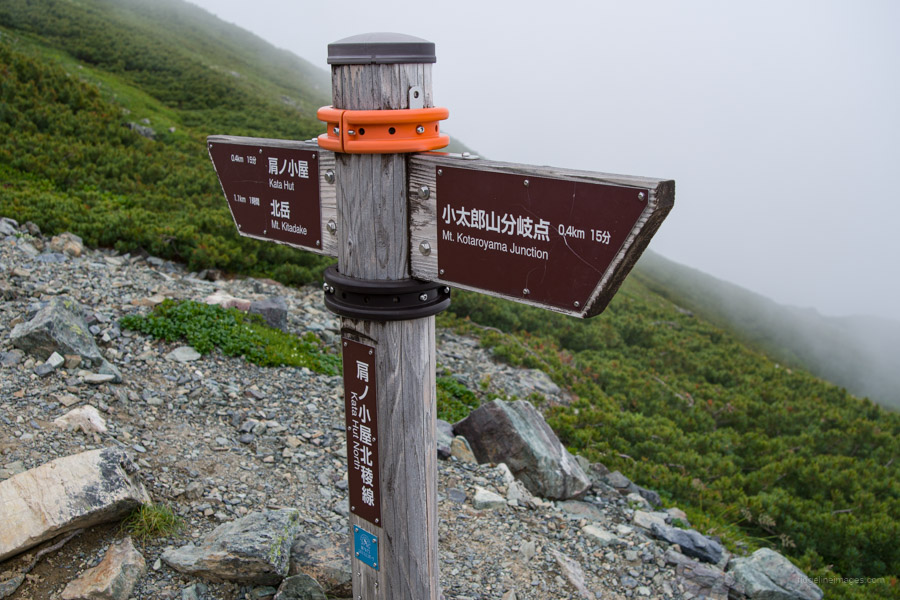
Day 1: Hirogawara to Kitadake Katano-koya
Day 2: Kitadake Katano-koya to Kumanodaira-goya
Day 3: Kumanodaira-goya to Sanpukutoge-goya
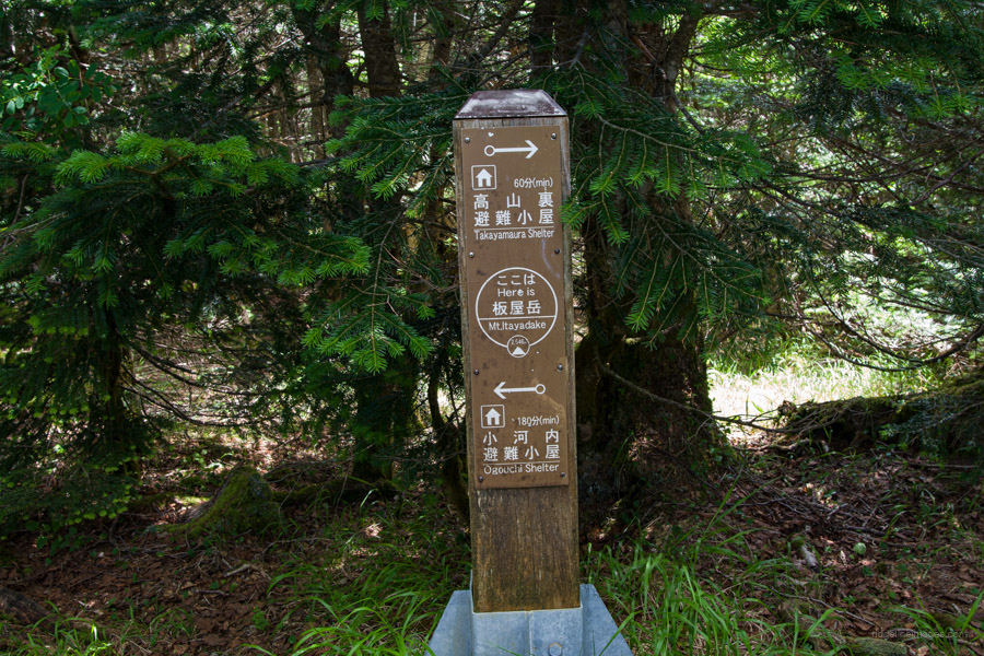
Day 4: Sanpukutoge-goya to Takayamaura hinan-goya
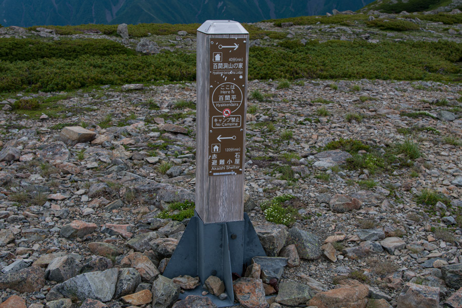
Day 5: Takayamaura hinan-goya to Hyakkenborayama-no-ie hinan-goya
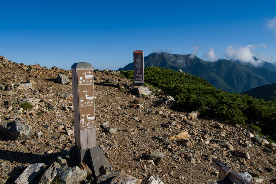
Day 6: Hyakkenborayama-no-ie hinan-goya to Hijiridaira-goya
Day 7: Hijiridaira-goya to Chausu-goya
Day 8: Chausu-goya to Tekari-dake (return)
Day 9: Chausu-goya to Akaishi Onsen Shirakabaso hot spring
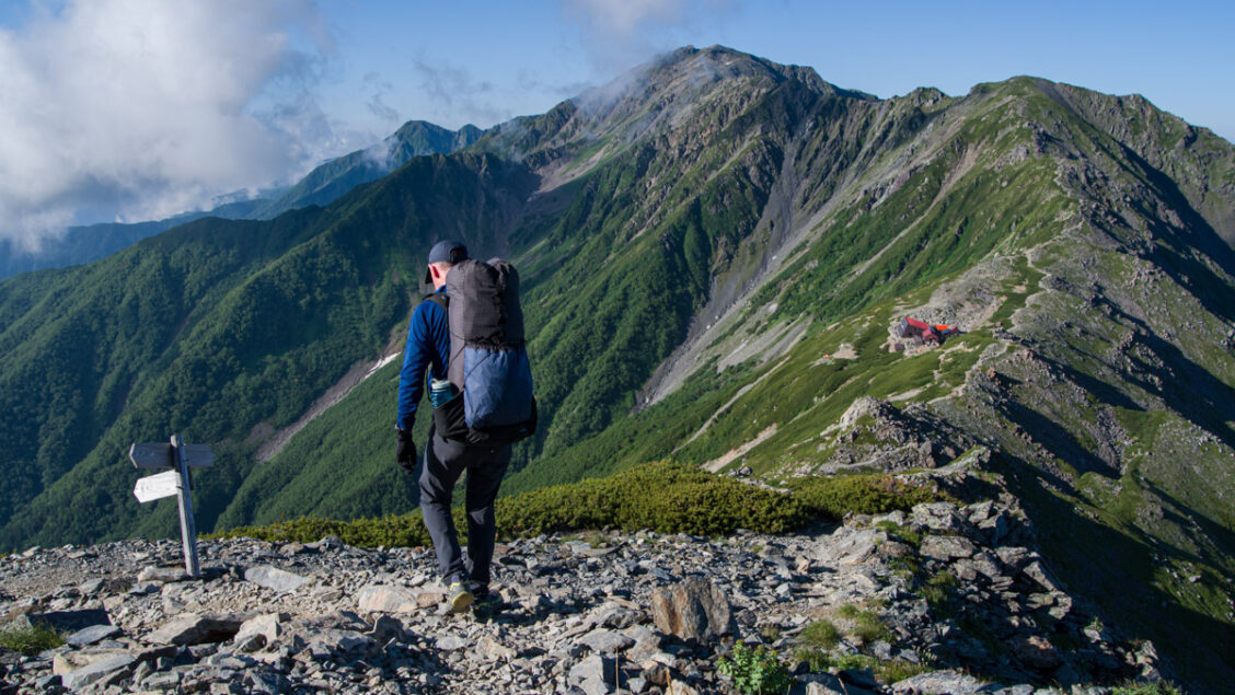
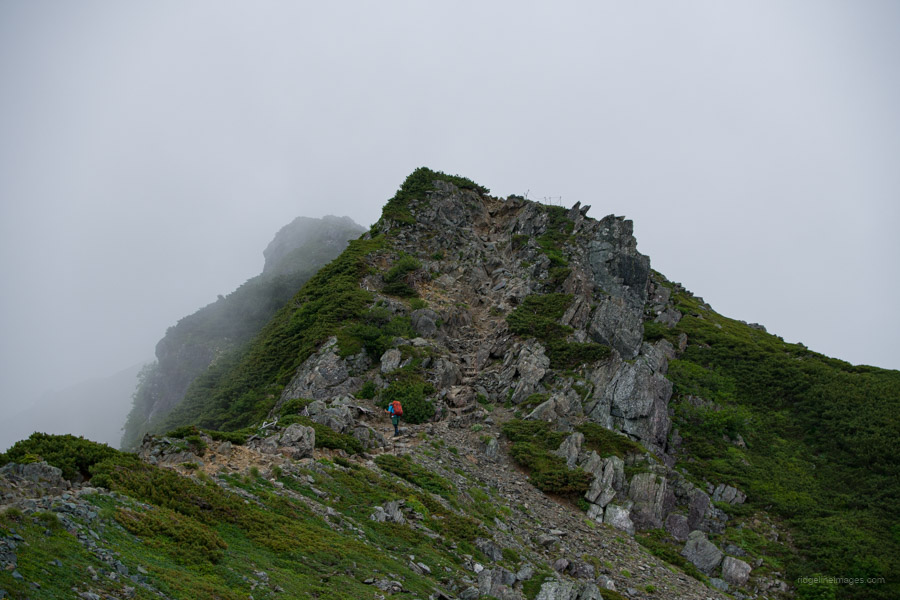
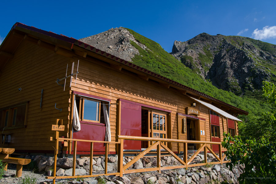
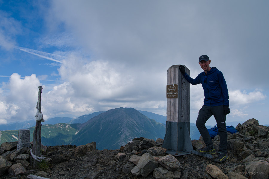
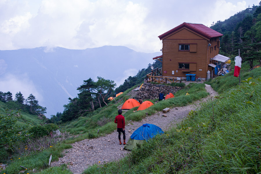
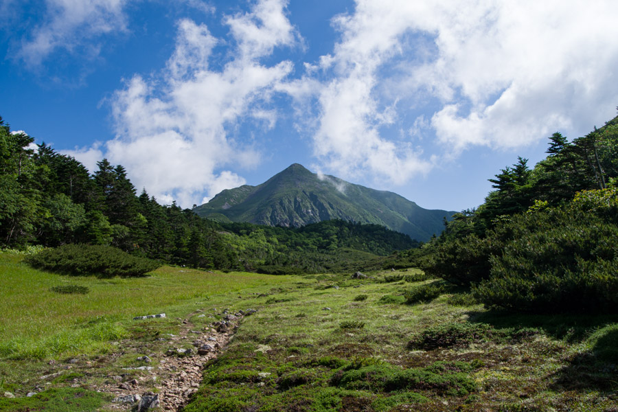
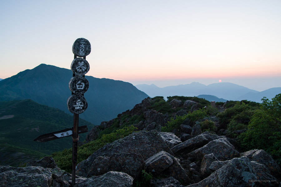
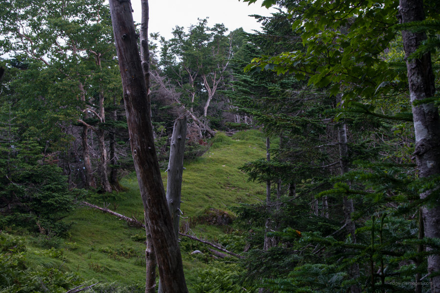
Day 1: Hirogawara 広河原 to Kitadake Katano-koya 北岳肩ノ小屋
5hr 30 min 5.2 km 1464 m 2 m Jul 21, 2023
Route:
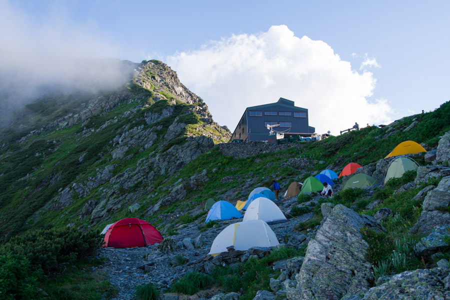
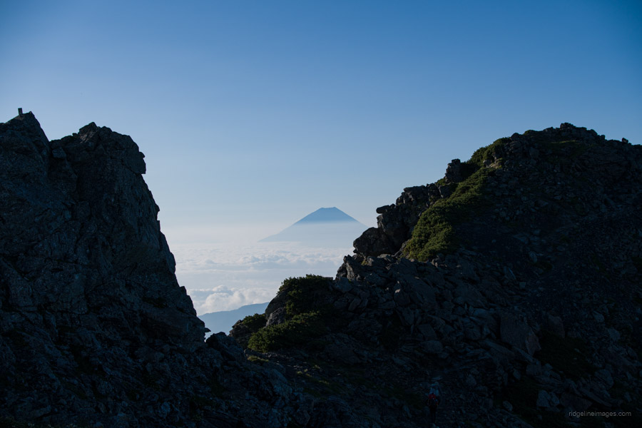
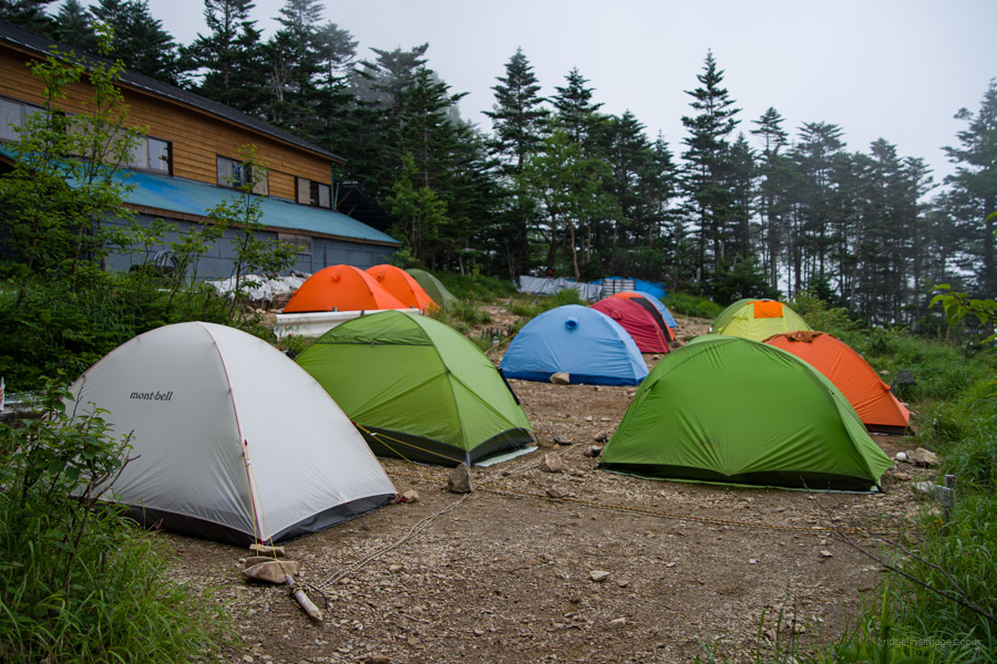
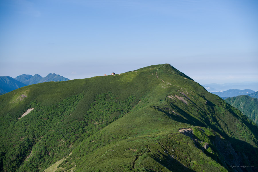
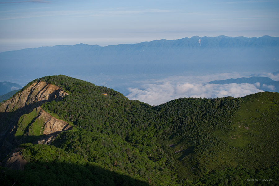
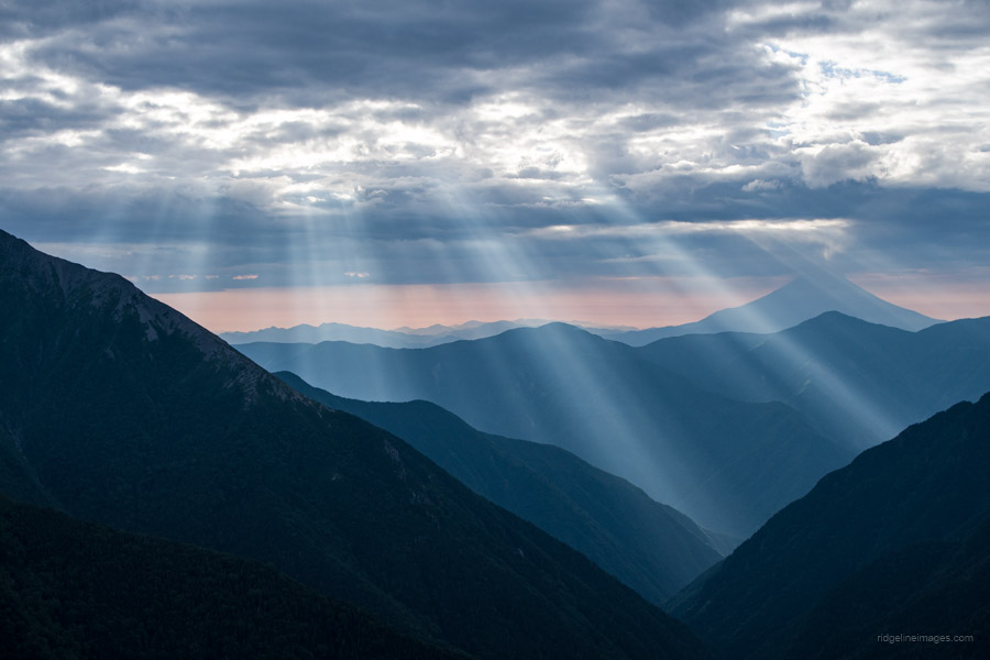
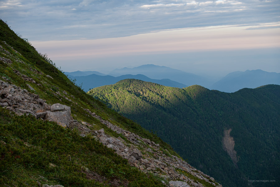
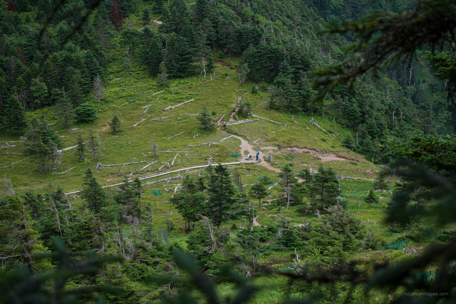
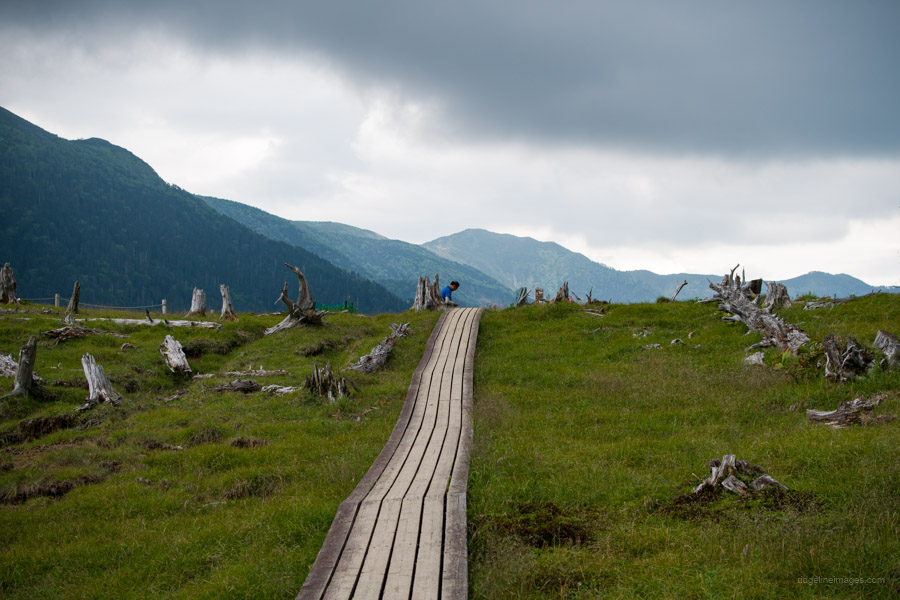
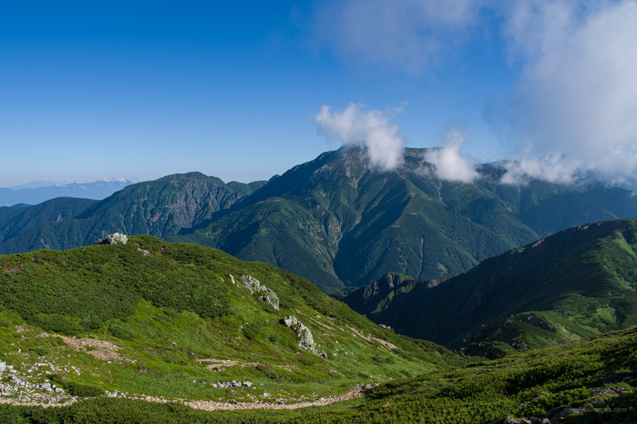
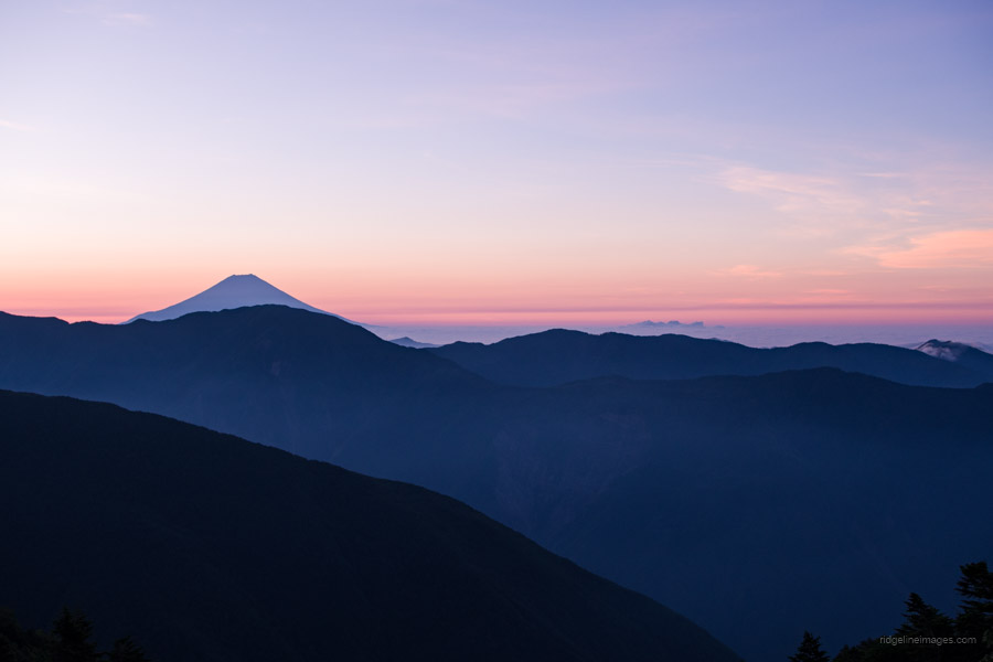
The hike sets off from Hirogawara, at the northern end of the Southern Alps. An unrelentingly steep climb transports you to a small plateau at Shiraneoike-goya. After taking lunch on the benches by the pond, the trail soars above the tree line as it inches closer to Kitadake Katano-koya one of the highest campsites in Japan, at 3000 metres. Enjoy a mesmerising view of Fuji-san as you settle back into your first night out on the trail.
Diary:
I hatched the idea of going on this hike back in January. My wife and I were celebrating my birthday in Chichibu, and after 30 minutes of gorging on all-you-can-eat strawberries, we headed up to Urayama Dam. I rubbed my hand on a statue that supposedly offered good luck and made a wish. From that moment on, I gradually started preparations, such as stocking up on dehydrated foods when I could. No matter how much you prepare, nothing brings it all home until the alarm rings at 3:30 am on that first morning. The hike was no longer a figure of my imagination but was really happening.
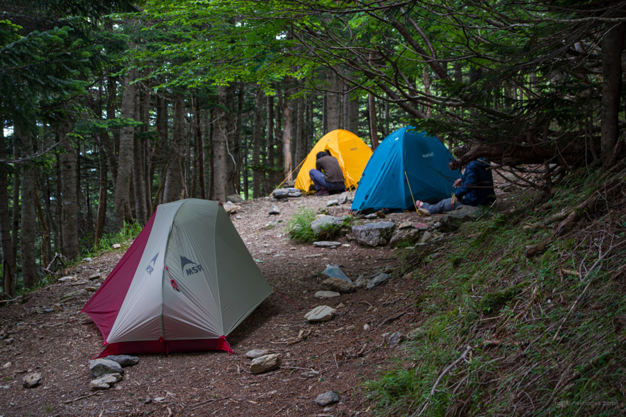
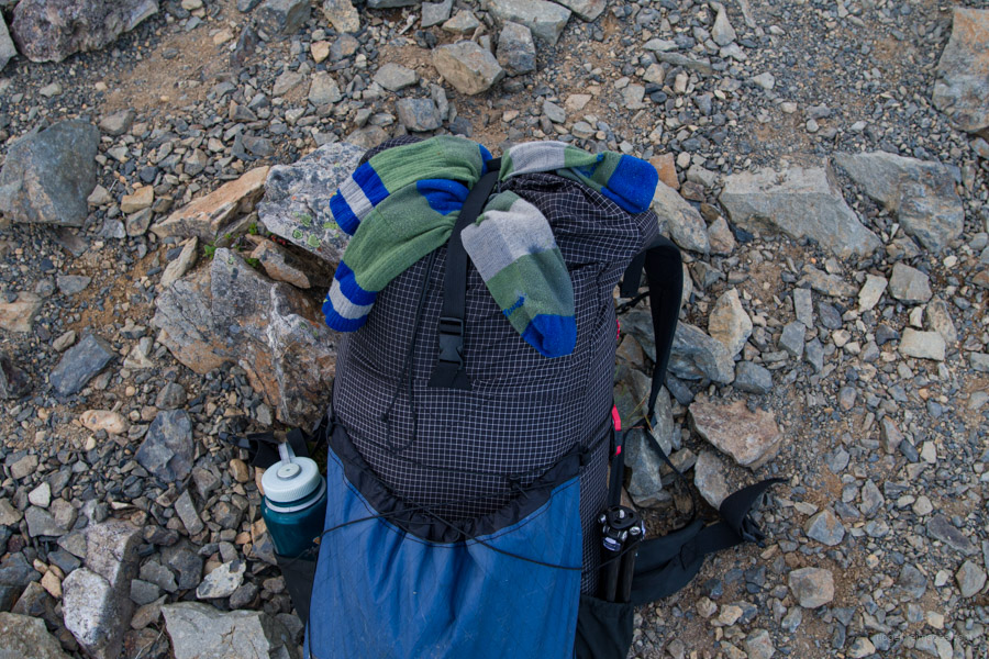
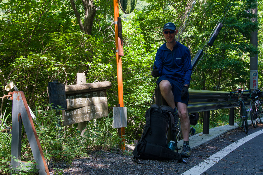
By catching the first train out of Tokyo, I could be in Hirogawara around 9:00 am and not have to rush it. The overarching theme of his hike was to take it slowly and carefully; there was no need to push the throttle; I had nine days after all. Importantly, I was going to enjoy it as much as I could. I had hoped to leave a few days earlier, but thanks to the lingering rainy season, I thought it best to hang off a little while longer. Anyway, it allowed a little extra time to make any final arrangements. A major chore was squeezing everything into my 48-litre KS Ultralight Gear KS50. The food bag was particularly hefty, weighing in at almost 5 kg, and overall, the pack weighed 14 kg (without water). On my slim 60-kg frame, it was about as much as I was willing to lug around.
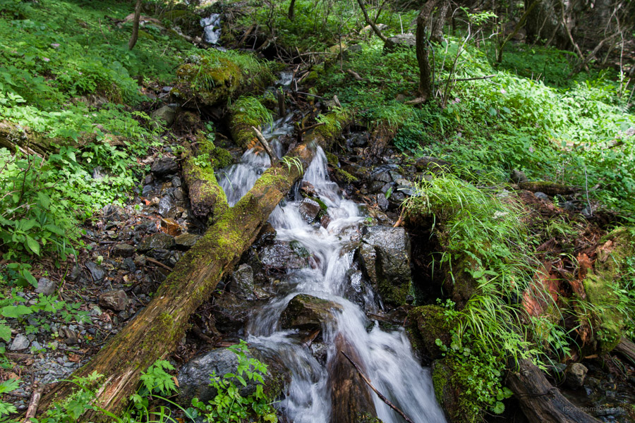
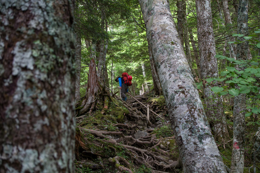
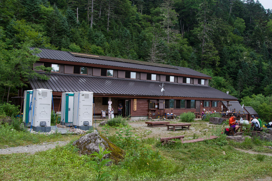
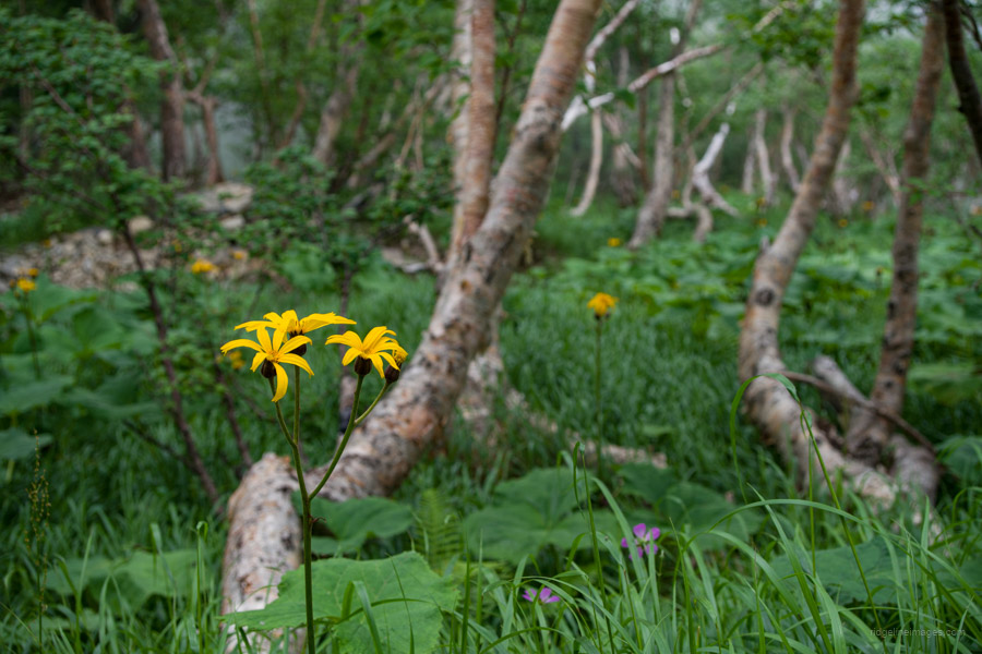
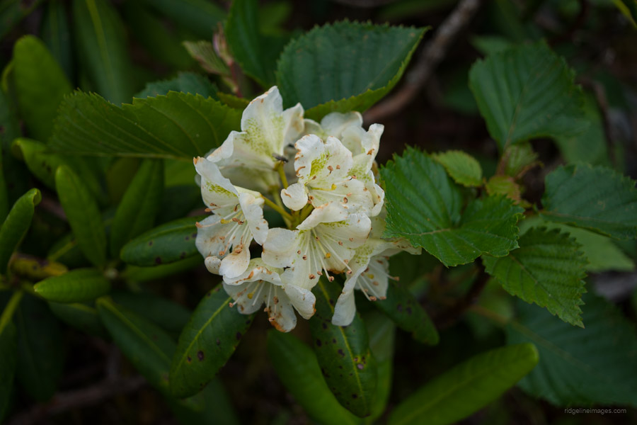
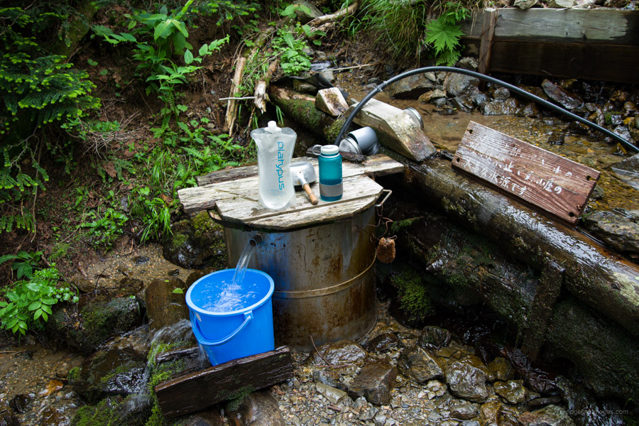
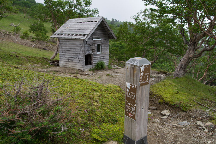
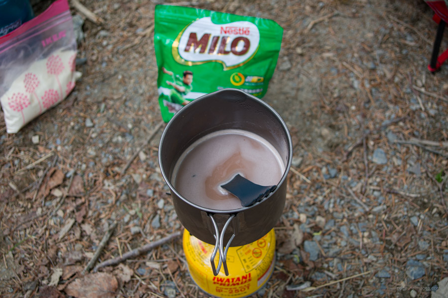
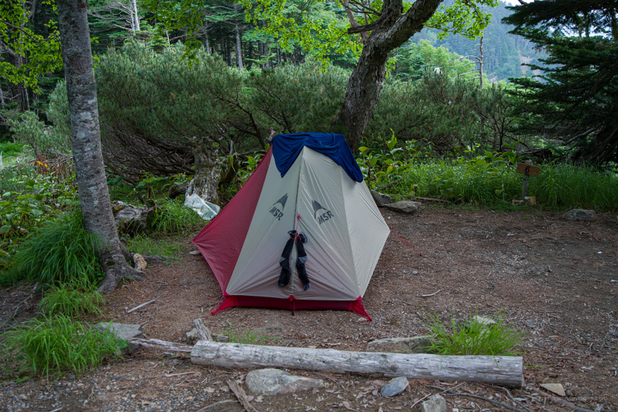
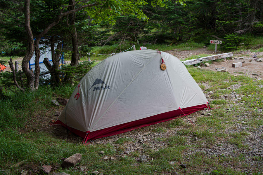
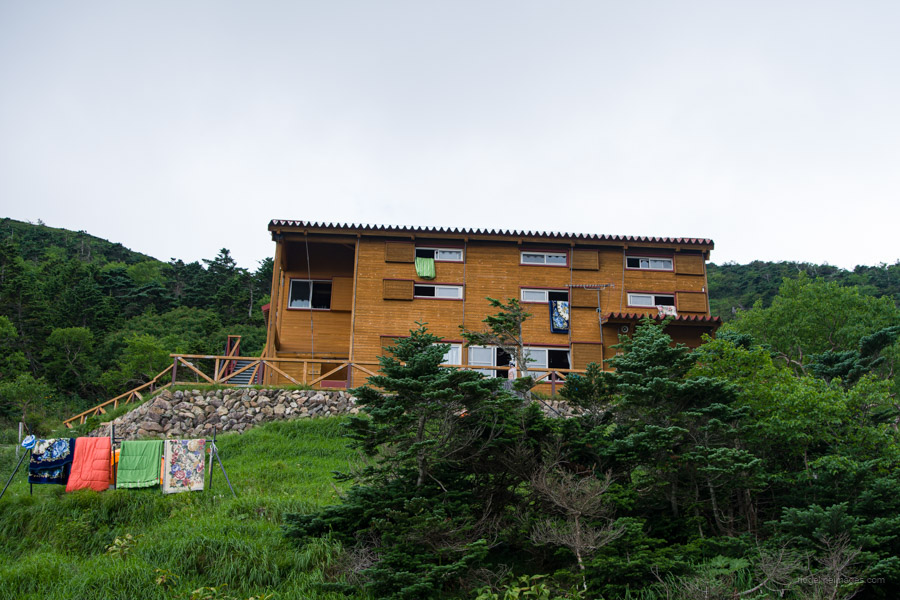
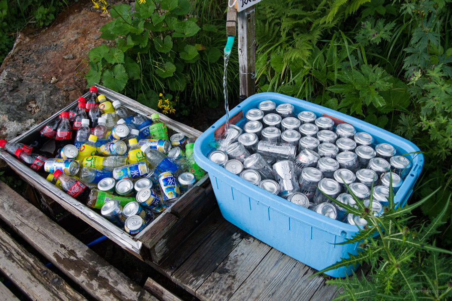
The trail up to Kita-dake Katano-koya 北岳肩ノ小屋 was much as I remembered it from six years ago: sheer and well-trodden. At Shiraneoike-goya 白根御池小屋, the clouds hung low, threatening to rain, so I didn’t stick around long. The upside was that the misty weather meant I didn’t have the scorching midday sun on my back. The yellow wildflowers contrasted nicely with the gloomy weather nonetheless. After setting up the tent at the Kita-dake Katano-koya, I momentarily thought about doing a water run but thought differently after seeing the steep trail heading in its direction. The last time I stayed there, filling up your water bottles worked on the honor system. It looks like it wasn’t too effective, as not only had the price doubled to 200 yen per litre, but the hut caretaker was on the look out for any transgressions. I told him I wanted to fill up my 2.5-litre bottle and handed him 500 yen. He appeared to do a quick calculation in his head and handed me back 50 yen in change! I don’t think math was his strong point at school.
After dinner and with a stubborn Fuji-san refusing to materialise thanks to the cloud cover I shifted my attention to getting some kip.
.
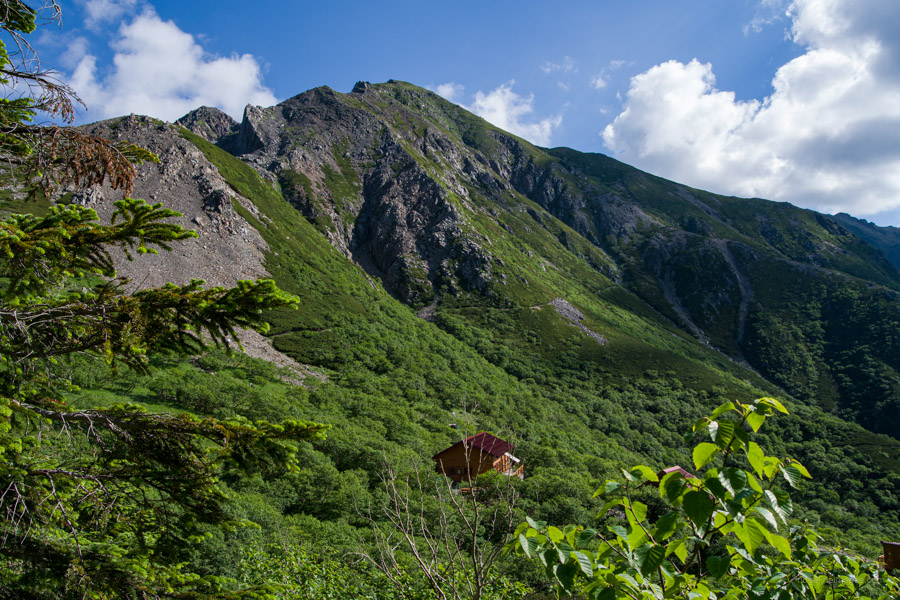
Day 2: Kitadake Katano-koya 北岳肩ノ小屋 to Kumanodaira-goya 熊ノ平小屋
6hr 7.7 km 456 m 871 m Jul 22, 2023
Route:
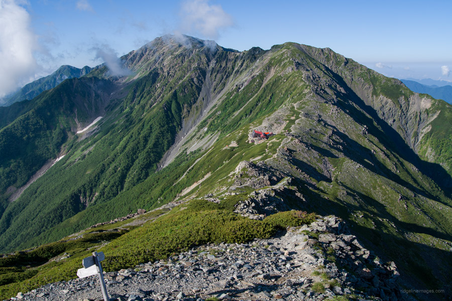
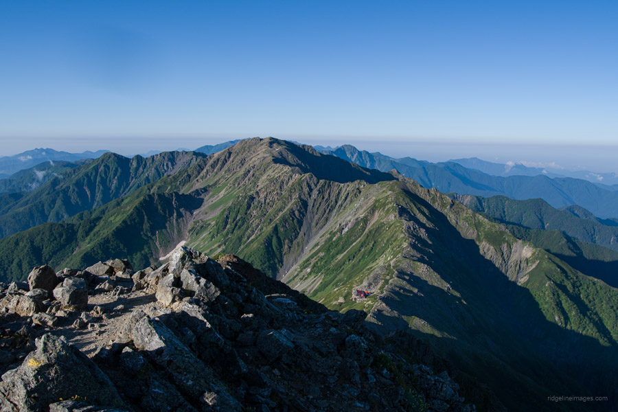
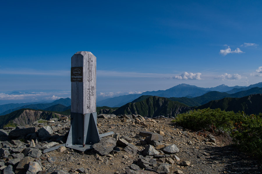
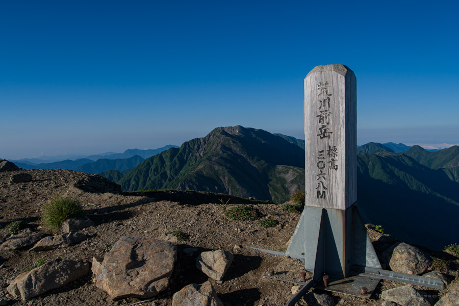
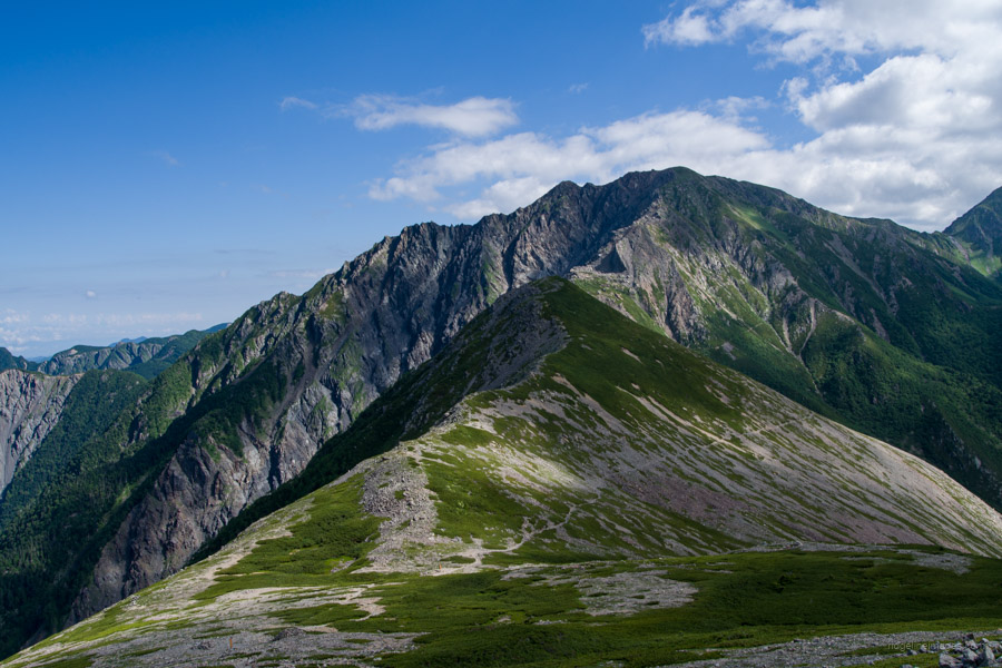
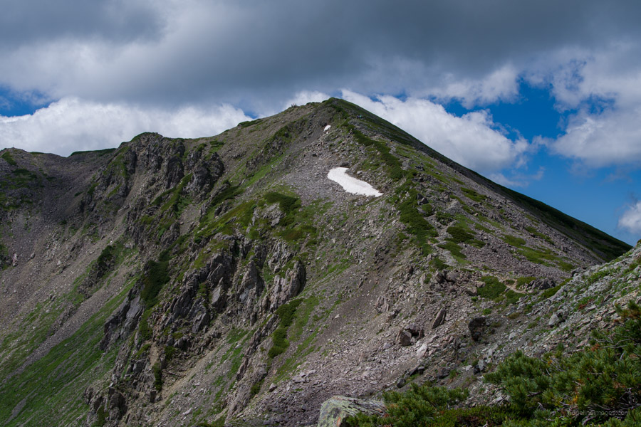
The day begins with scaling Kita-dake, the second-highest mountain in Japan. After a short rocky descent past the Kita-dake sansou route, it rises to Aino-dake, the equal third-highest, and Mibu-dake, which misses out on the 3,000-metre club by barely a metre. The day finishes at the rather charming Kumanodaira-goya, nettled in a sheltered spot below the tree line.
Diary:
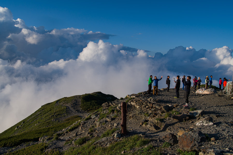
The first mutterings at the campsite began well before sunrise. For those unaccustomed to hiking in Japan, it comes as quite a shock how early everyone starts to get ready. I’ve said it before: Japanese hikers prioritise early starts, and mostly for good reasons. Many cling to the idea (justifiably) that the weather is better in the morning than in the afternoon, and leaving early means a better chance of bagging a good campsite at the next hut. For myself, it wasn’t one of my most glorious moments, thanks mostly to carelessly changing the world time on my watch. When I thought I was doing well leaving the campsite at 4:30 am, it was in fact 5:30 am. Opps!
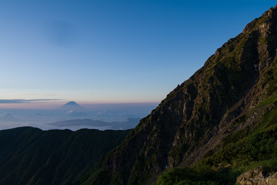
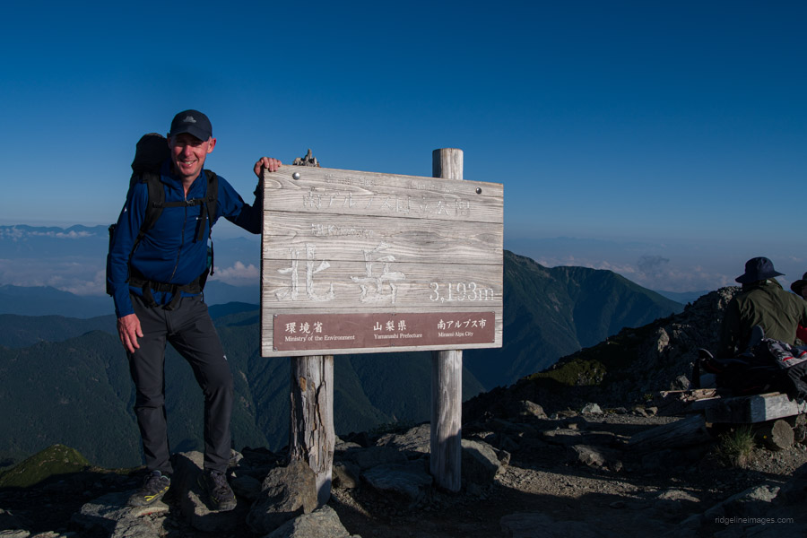
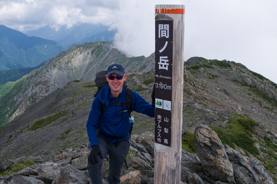
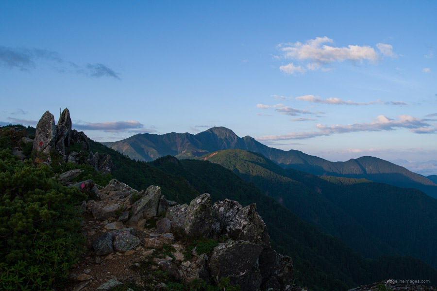
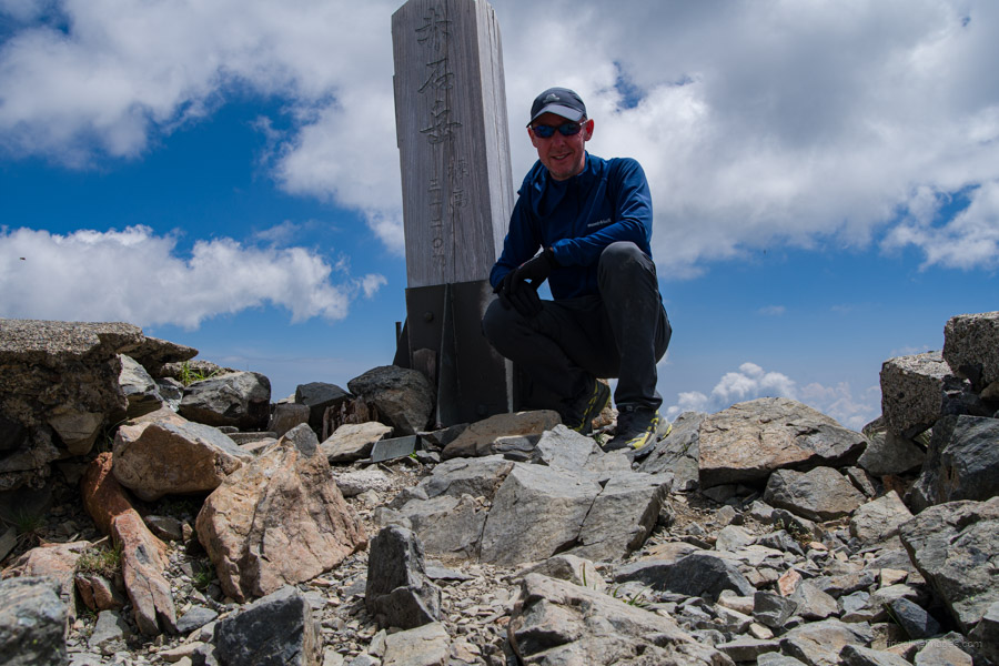
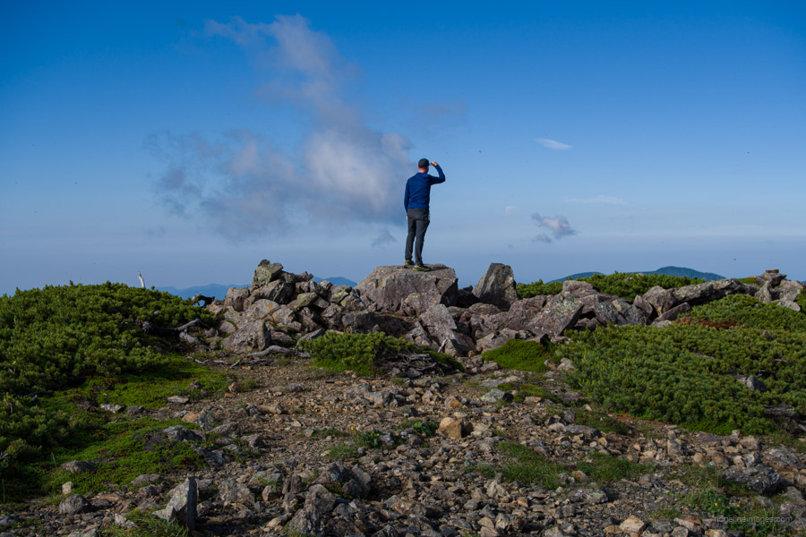
This, as it turned out, wasn’t such a bad thing, as I had a chat with a friendly couple at the summit of Kita-dake 北岳 (3193 m) and at various points as we trekked across to Aino-dake 間ノ岳 (3189 m). I think in the end they were a little captivated by me and insisted on getting a commemorative group photo before we went our separate ways. As expected, the descent off Kita-dake down to Kitadake-sanso 北岳山荘 was pretty rough, with the occasional fixed chain to assist with a safe passage. Unlike the previous evening, Fuji-san was cooperating and provided a nice vista across to Aino-dake.
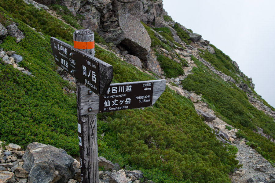
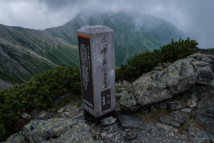
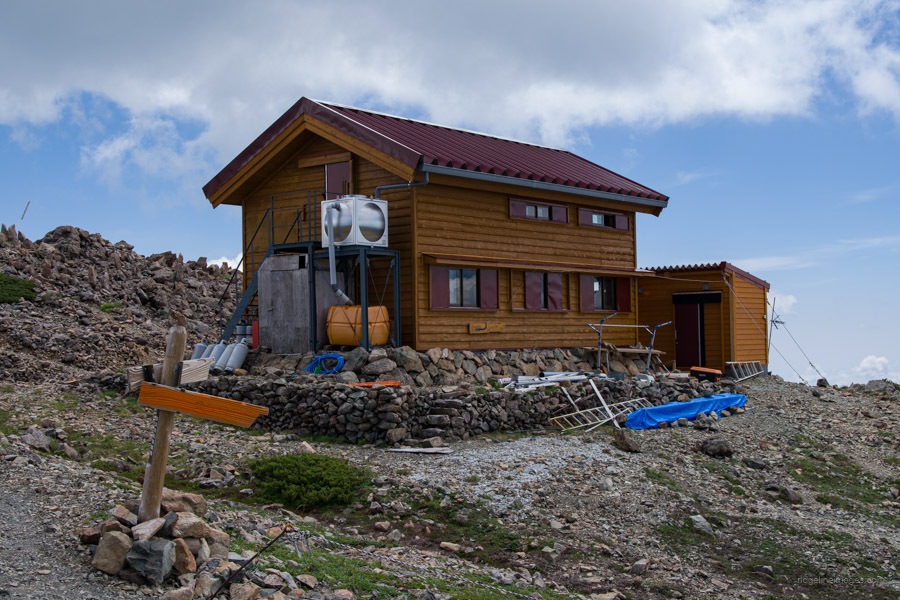
At least on the outside, Kitadake-sanso looks like one of the nicest mountain huts in the Southern Alps, and even better, it dispenses free water. The map indicates the mizu-ba is some distance away from the hut, so I’m not sure what all that is about. By the time I paused for a rest at Naka-shirane 中白根山 (3055 m), the cloudiness had returned and only got worse after passing by Mibu-dake 三峰岳 (2999 m), which marks the boundary of Nagano, Yamanashi, and Shizuoka prefectures.
In the end, it took longer than expected to reach Kumanodaira-goya 熊ノ平小屋. I could have blamed it on the less-than-ideal weather conditions, but in actual fact, I had a headache, was tired, and couldn’t wait to just set up the tent and fall sleep. Arriving at the hut and paying the campsite fee, I had to provide a ball-to-ball description of the entire itinerary; this became somewhat of a recurring theme over the ensuing days. The authorities in Shizuoka are obsessive about drilling you for this information, in contrast to Yamanashi, where they only require your name and contact details.
.
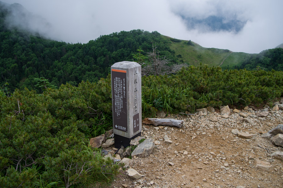
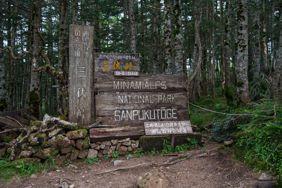
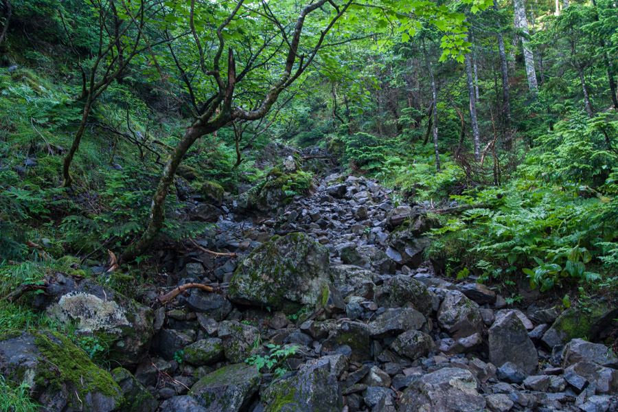
Day 3: Kumanodaira-goya 熊ノ平小屋 to Sanpukutoge-goya 三伏峠小屋
10hr 30 min 14.1 km 813 m 841 m Jul 23, 2023
Route:
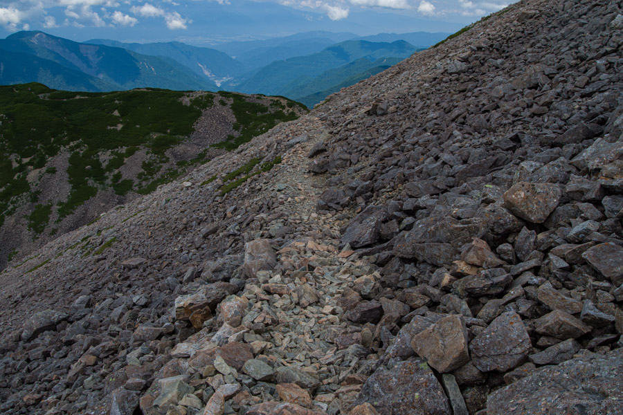
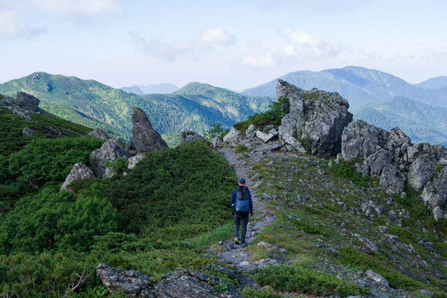
This is the longest and toughest day of the hike. It could possibly be broken up by staying at the Shiomi-goya, but a better strategy is to hit the trail early and just get it done. It begins with a leisurely approach through a primaeval forest before a very steep ascent to Shiomi-dake and an equally rocky one on the opposite side, before settling into a gentle pace down to the perennially popular Sanpuku-toge hut.
Diary:
Oh boy, did I get a good night’s sleep after zipping up the tent at 5:40 pm I was asleep not much later. The previous evening, I made a tentative plan with another hiker to set off in the morning together. The idea was to meet at the trailhead before 4:00 am. By the time it came, she was ready and raring to go. I wasn’t and said I would catch her up, which I eventually did. While solo hiking may give the impression of a lonely and forlorn experience, that’s often not the case. With even the smallest amount of effort, it’s easy to find and chum up with other hikers, many of whom find themselves in the exact same situation.
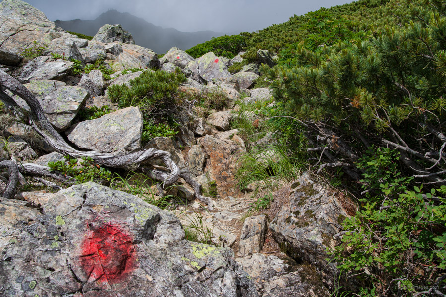
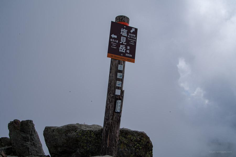
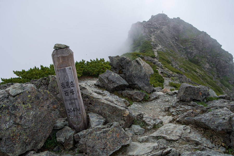
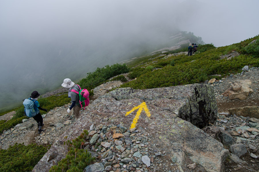
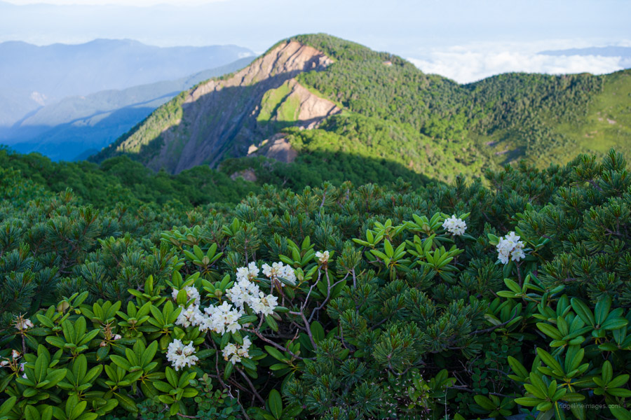
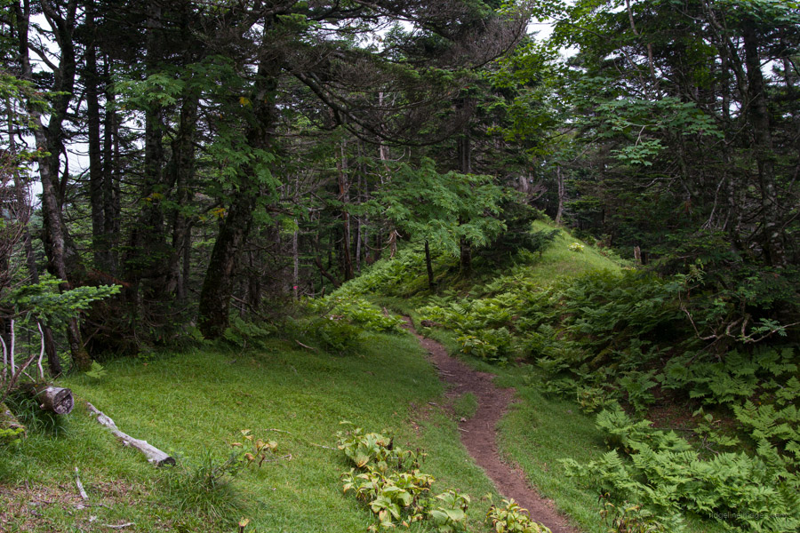
In contrast to the previous two days, the trail from Kumanodaira-goya to Shiomi-dake 塩見岳 (3052 m) is almost devoid of hikers. This is for good reason, as this route and the trail from Hyakkenborayama to Hijiri-dake are arguably the two toughest you’ll encounter on the entire hike. Fewer hikers allow one to better appreciate the remote and pristine forests on hand. Occasionally, the trail climbs high enough to offer a fine view of Shiomi-dake’s twin peaks.
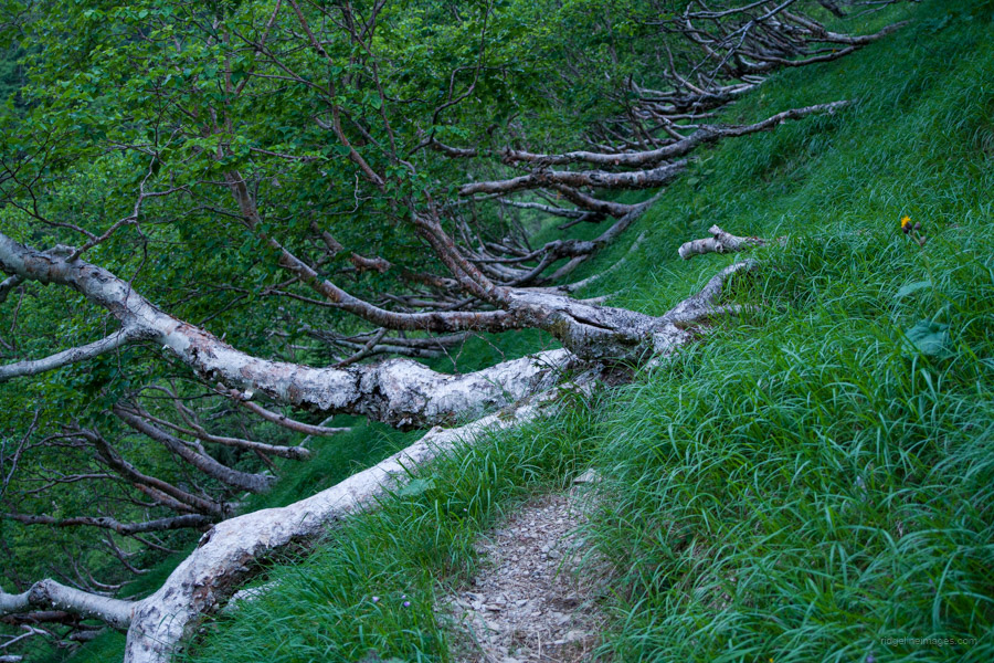
A highlight was cutting across a former campsite surrounded by Erman’s birch, complete with a ramshackle wooden hut. Back in the day, it must have been a brilliant spot to camp. From here on, the trail rapidly steepened and at times required climbing on all fours just to maintain adequate traction. Just when the persistent low-lying cloud was intent on thwarting the best vistas, it suddenly lifted like some magical curtain. Even though it was only a brief respite, its timing couldn’t have been better.
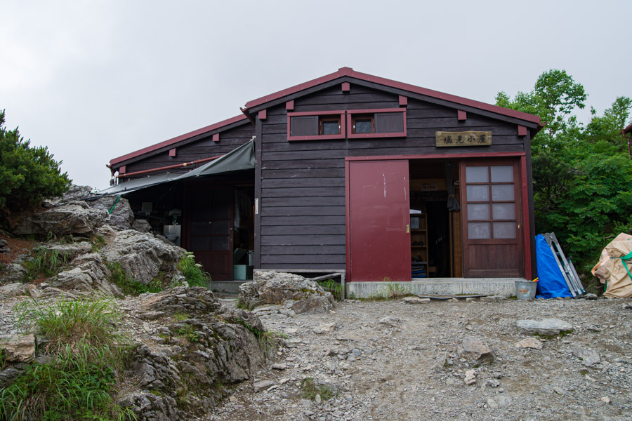
With care, I descended from the summit and reached Shiomi-dake goya 塩見小屋. Finding myself running low on water, I had two options. Filter non-potable water or fork out for the exorbitantly priced bottled variety. I reluctantly went for the latter and, in the process, learned a handy new word. He asked if my hike was a day trip or Jūsō 縦走 (traverse) which meant I could thankfully leave the empties behind. The final undertaking of the day was the interminable ridge that led down to the Sanpuku-toge hut 三伏峠小屋.
.

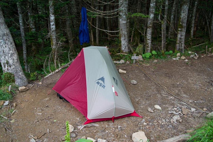
Day 4: Sanpukutoge-goya 三伏峠小屋 to Takayamaura refuge hut 高山裏避難小屋
6hr 8.9 km 441 m 611 m Jul 24, 2023
Route:
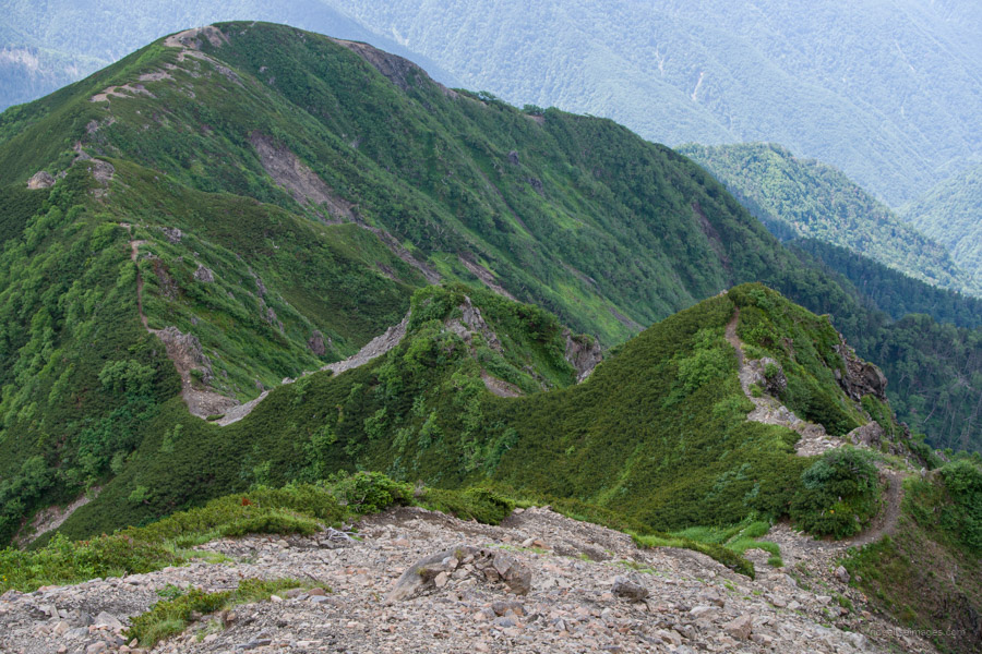
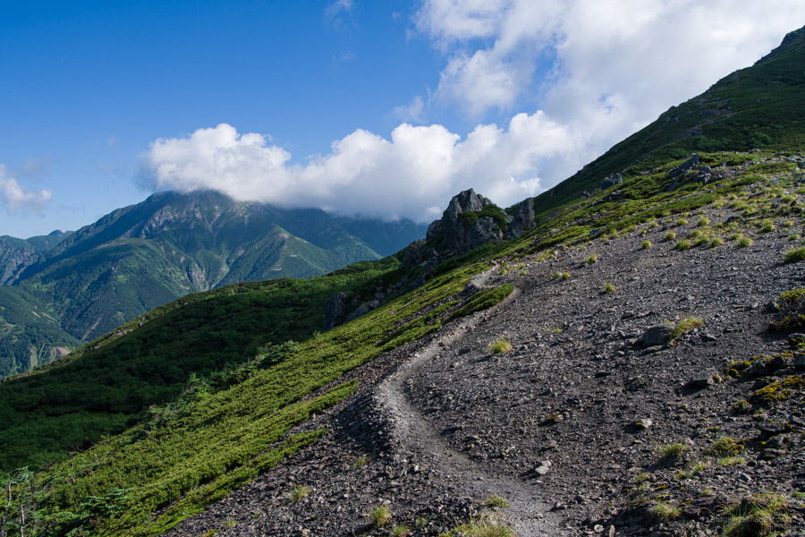
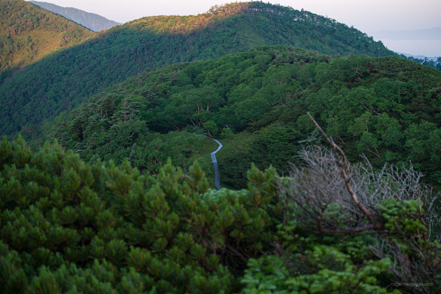
After yesterday’s long day in the saddle, relax into a more tempered pace as you scale Eboshi-dake and Kogochi-dake, which both afford unobstructed 360-degree views. Rest up in the picturesque surroundings at the Takayamaura hinan-goya, nestled in a sheltered spot below the ridgeline.
Diary:
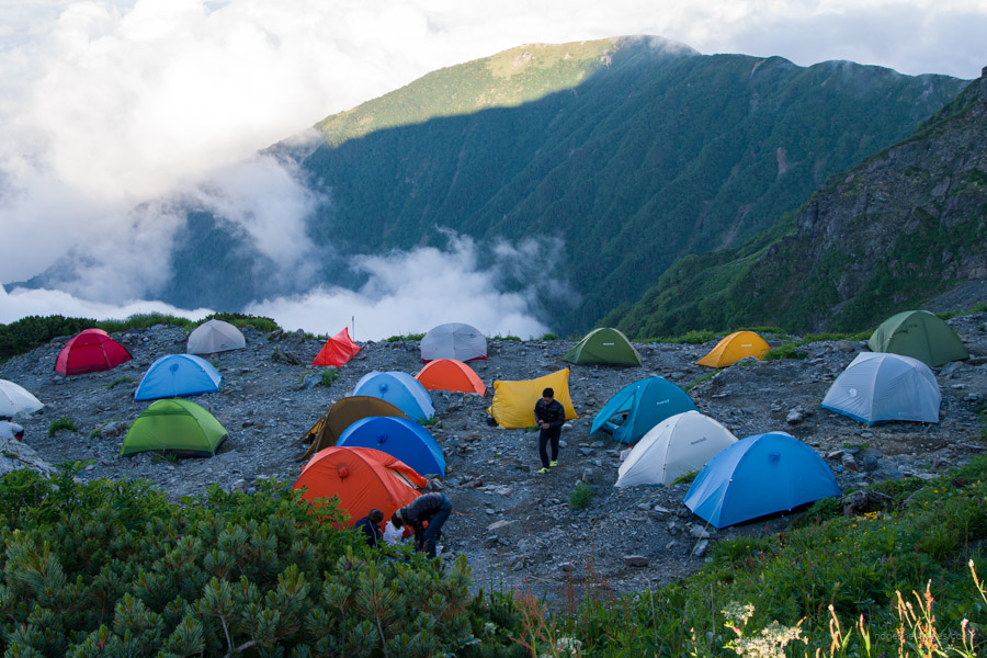
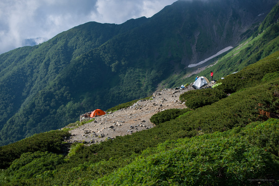
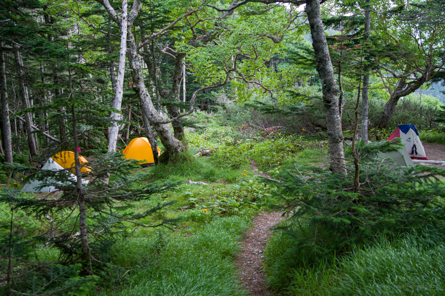
The previous afternoon, when I arrived, I noticed that of the four tiers where you set up your tent, everyone had squeezed into the top one. I thought it somewhat odd and even double-checked with the hut staff. No, it was kosher; you could set it wherever you liked within the designated space. While you want to pitch your tent far enough away that you’re not subject to an onslaught of snoring and other deeds associated with confined spaces, you also want to be close enough that the early morning grumbles function as a natural alarm clock.
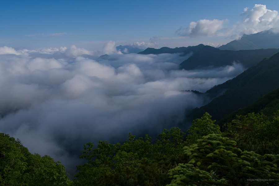
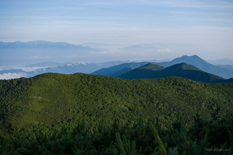
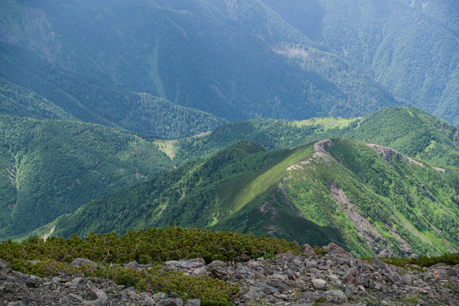
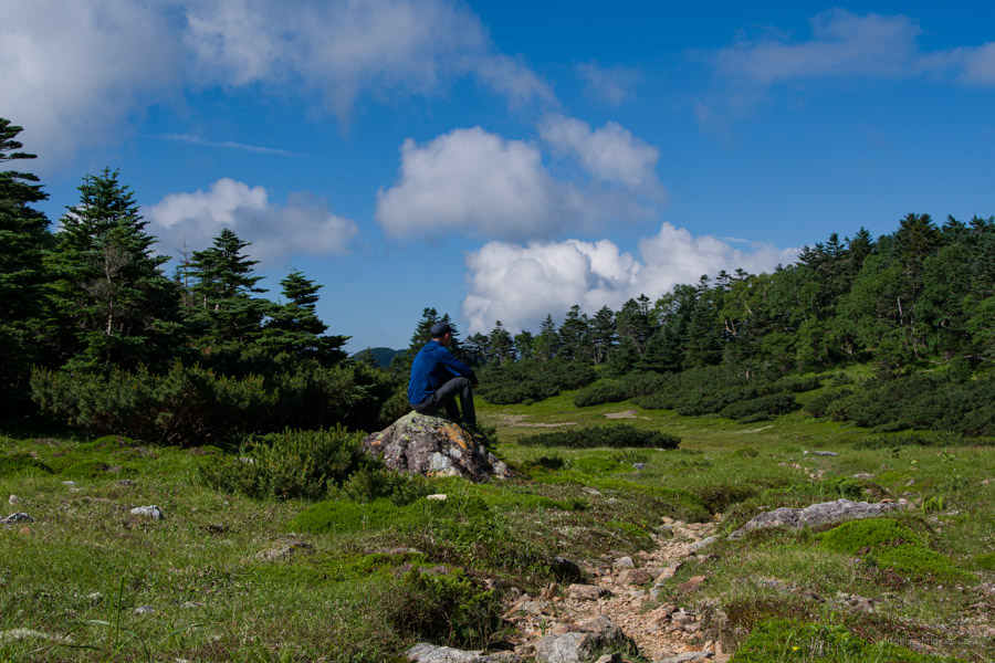
After yesterday’s lengthy jaunt, I have to say I was very happy that I didn’t have to contend with another long, back-to-back one. Instead, I could take my sweet time getting to the Takayamaura hinan-goya 高山裏避難小屋. The morning’s first call was Eboshi-dake 烏帽子岳 (2726 m), which offered a stunning view with Fuji-san in the backdrop. Four years ago, when I walked this exact route but in reverse, I was subject to heavy wind and rain whipped up by an unseasonably early typhoon. This time, I was paid back in spades.
Today was up there with the best weather day of the hike, archetypal of the kind of days you see sprawled across the pages of Peaks Magazine. Yes, those views do exist; you just need a bit of luck and to be out on the trail for long enough to glimpse them. From here, one particular landmark piqued my interest: the absolutely charming hut at Kogachi-dake hinan-goya. Perched on a green, treeless plain, it looked like something straight out of Heidi’s Village in the Swiss Alps. The hut caretaker was in a relaxed mood and up for a chat, especially since his last charges for the morning had just left. A resident of Kobe City, he tends to the hut and its guests for a fleeting six weeks each summer and appears to reveal in it – half his luck.
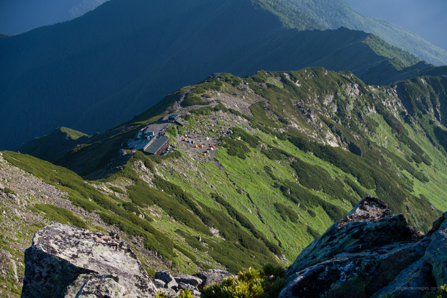
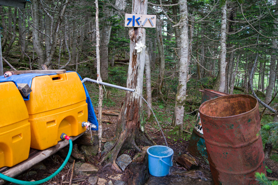
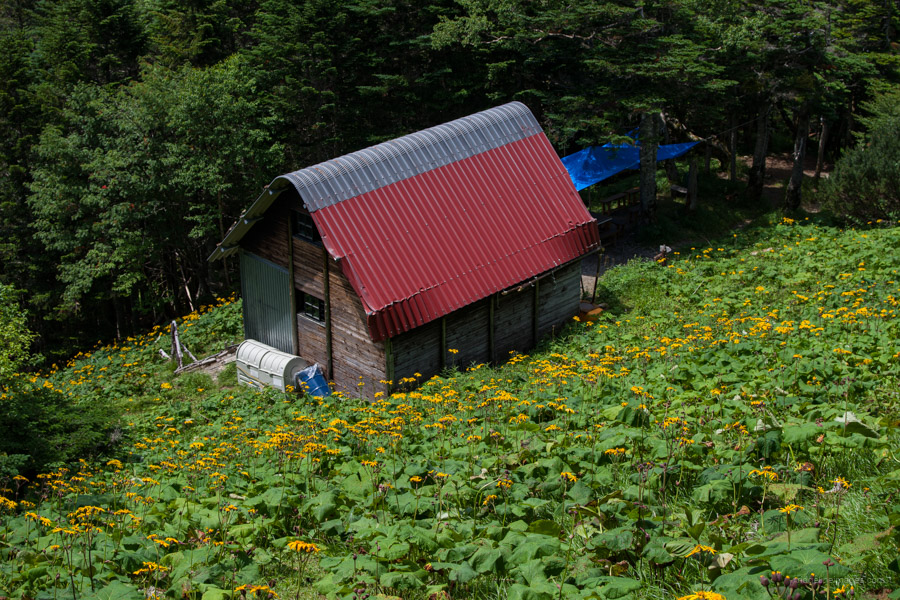
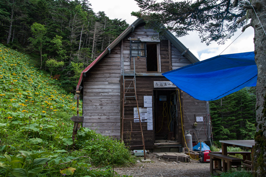
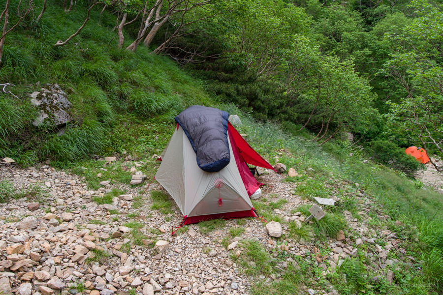
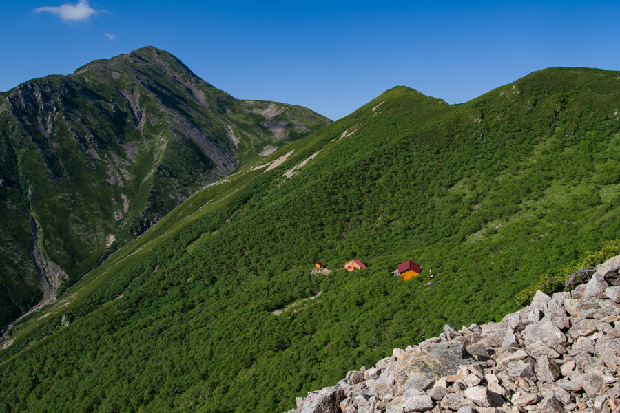
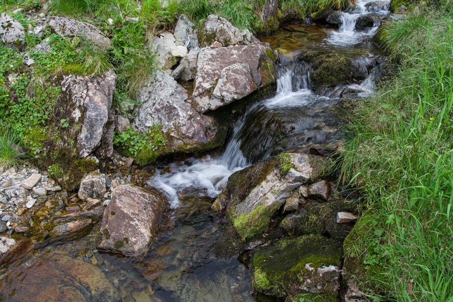
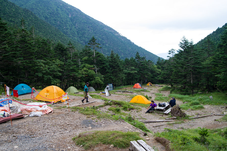
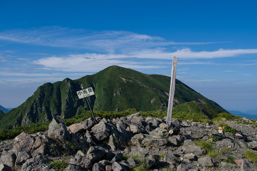
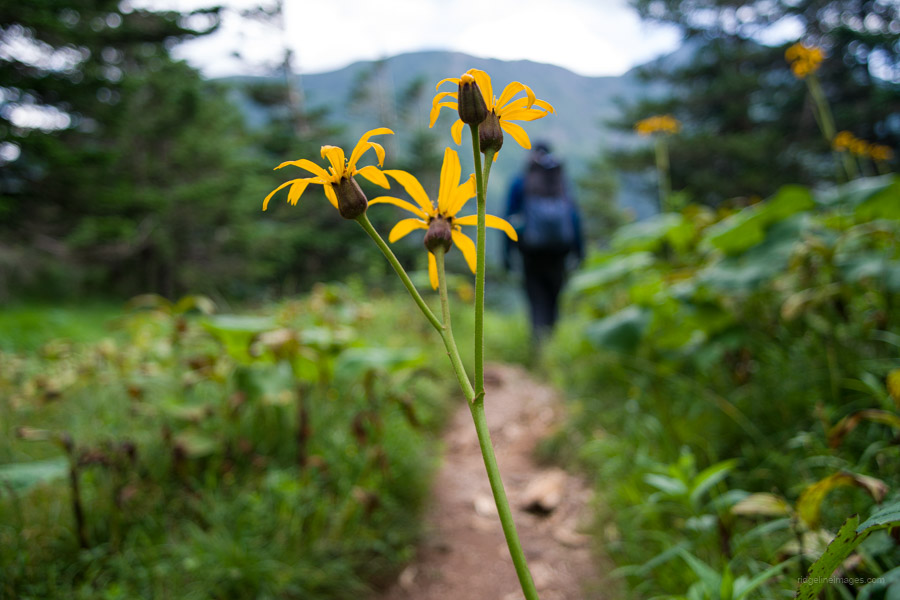
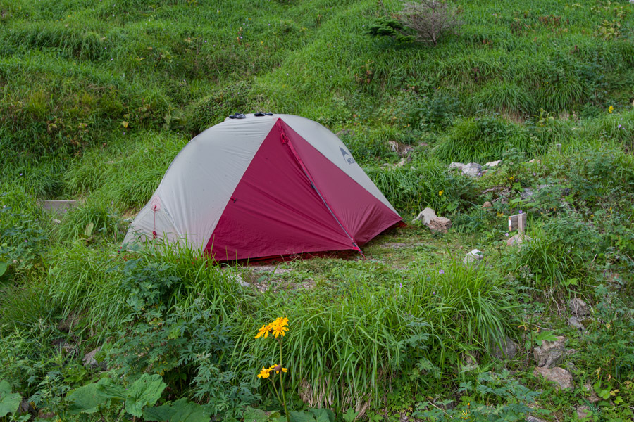
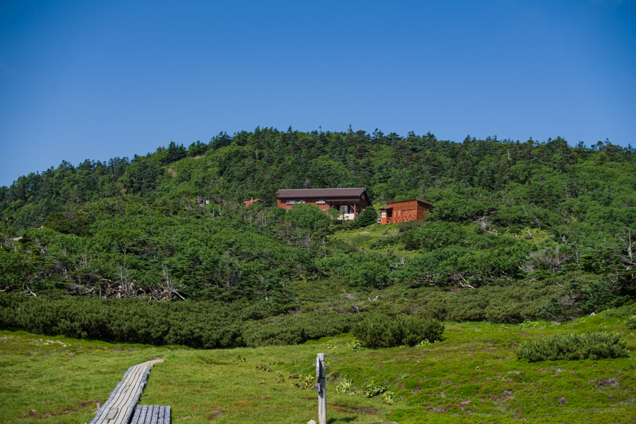
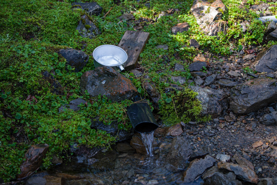
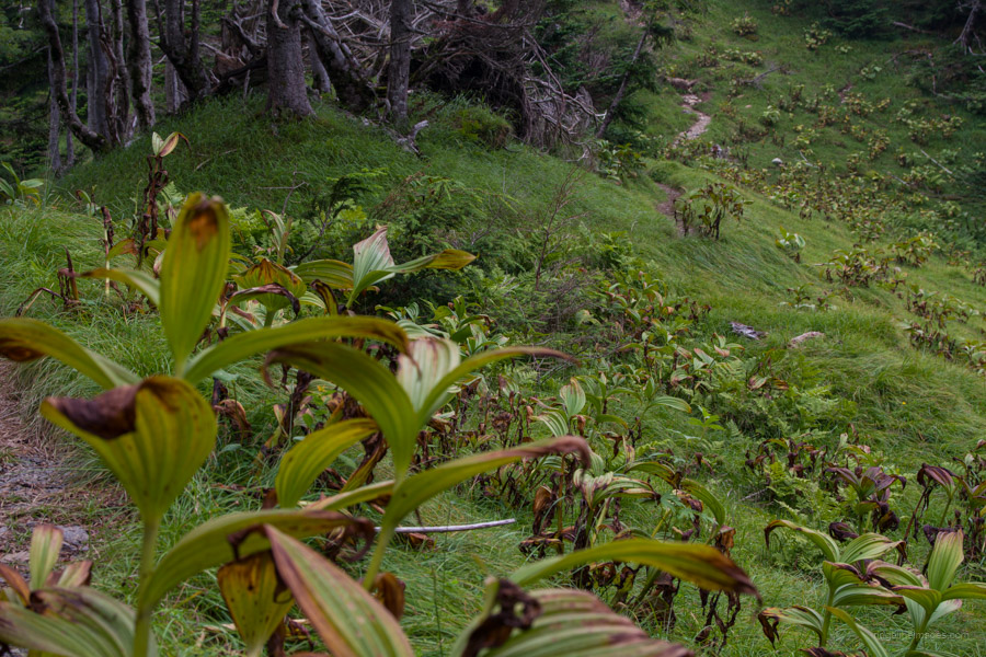
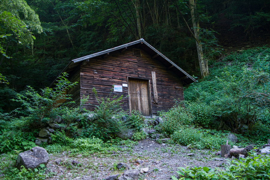
At nearby Kogochi-dake 小河内岳 (2802 m), I met another hiker doing much the same journey but the opposite way. It was nice to get some intel on what lay ahead and similarly reciprocate. Fields of wildflowers livened up the scenery as I crossed Itaya-dake 板屋岳 and onwards to the Takayamaura hinan-goya 高山裏避難小屋. It was my second time camping here, and I didn’t mind one bit arriving before midday to rest in the ample shade on offer. At first, the hut caretaker thought I would be better off pushing on to Arakawa-goya 荒川小屋 but after I explained my plan, he concurred. It was also a good chance to have a wash at the waterhole and rinse out my clothes.
.
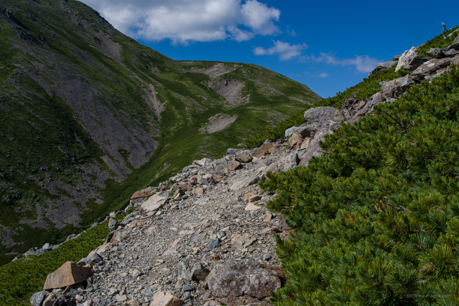
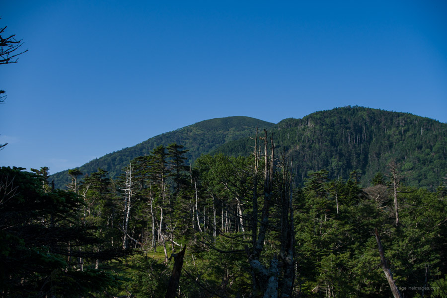
Day 5: Takayamaura hinan-goya 高山裏避難小屋 to Hyakkenborayama-no-ie hinan-goya 百間洞山の家
10hr 12.5 km 1137 m 1051 m Jul 25, 2023
Route:
Another long but rewarding day has you snaking your way up a rock field and skirting precariously close to a crumbling ridgeline. Your efforts are compensated with stunning views from Arakawa-Maedake and Akaishi-dake. Camp in tranquil surroundings at Hyakkenborayama-no-ie, another of the Southern Alps top locations. Time and energy permitting, it is possible to include a detour to Warusawa-dake, though note this will add an additional 3 hours.
Diary:
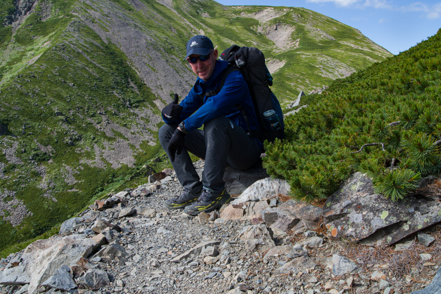
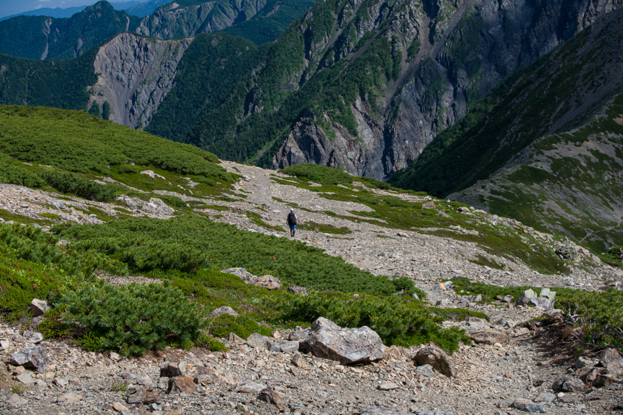
Each night before dozing off, I decided on a rough time I needed to wake up and be gone by, and for day 5, it was 3 am. Thankfully, my neighbours made the task easier as they began rustling around in their tents before 2 am. Once you’re awake, the temptation is, of course, to nap just that little bit longer, though this is rarely a good idea. Having packed up and been on the trail just 15 minutes past my target time, I was pretty happy. The headlight was on for the first hour of the morning as I scampered along a rocky trail to an enormous rock field.
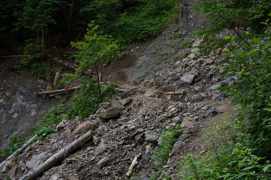
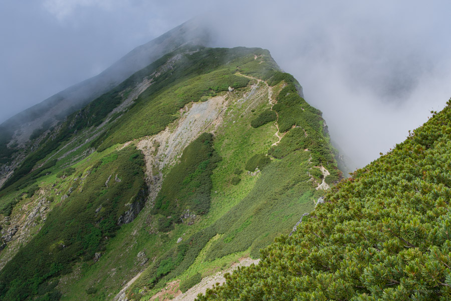
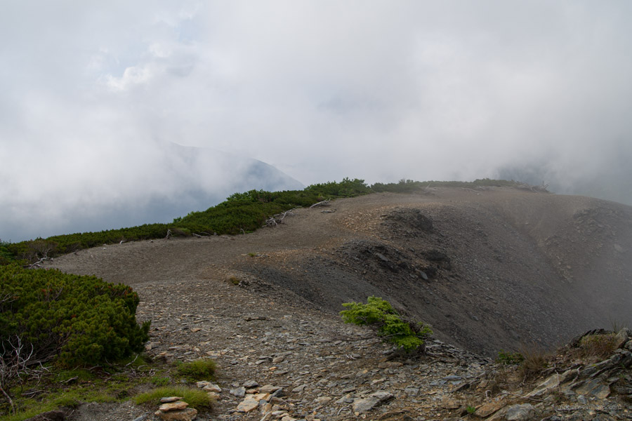
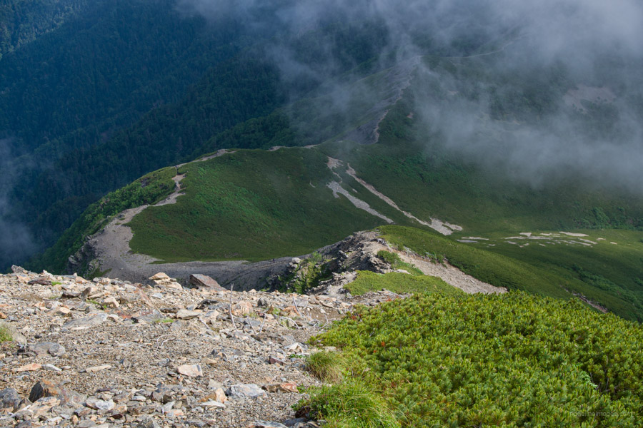
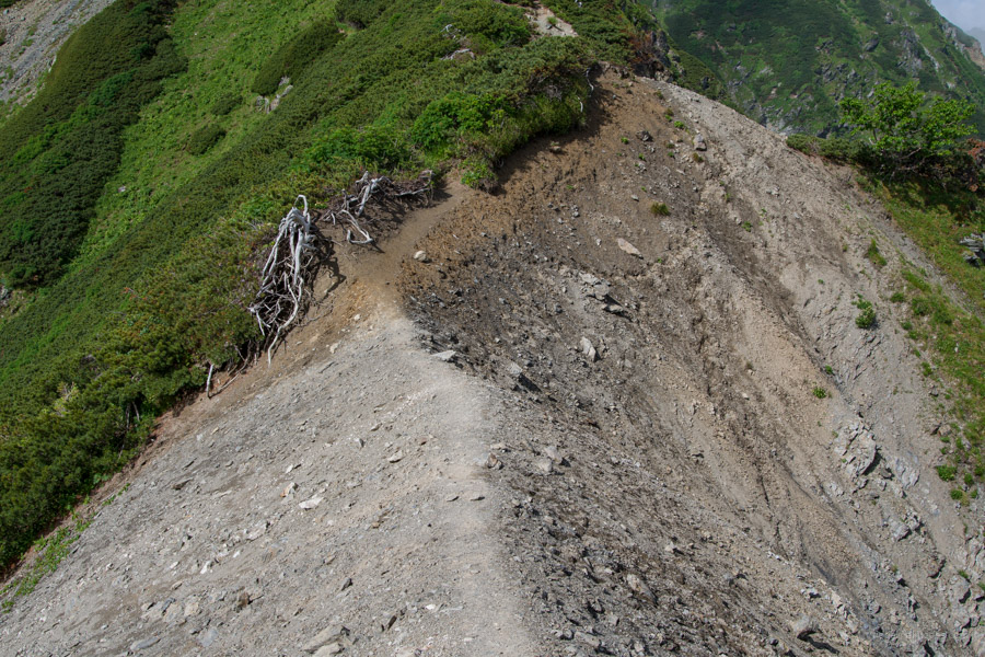
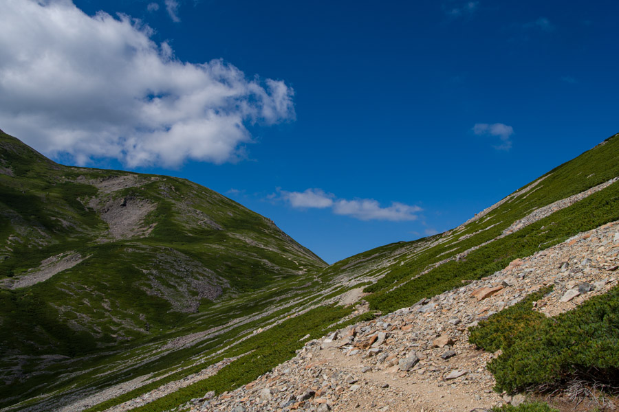
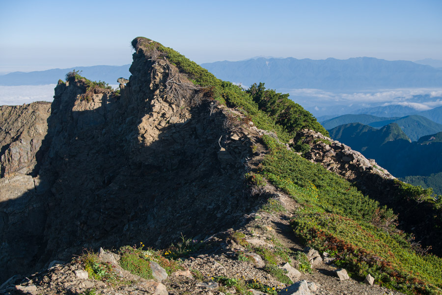
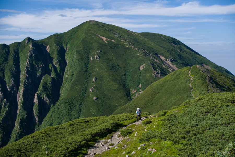
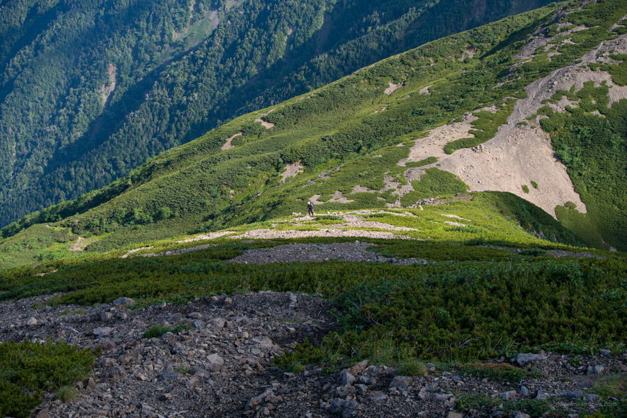
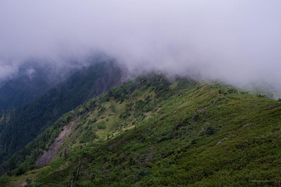
Here I noticed two ladies who had been staying at the Takayamaura hinan-goya zigzagging their way up the rocks. It’s a rather laboured climb (about 500 metres of elevation gain) as you inch towards Arakawa-Maedake 荒川前岳. The rock field isn’t the problem; it’s what comes after. Of the entire 94-kilometre traverse, there is about 1 kilometre, denoted as a dotted line on the Yama Chizu, and of that, about 200 metres I would deem dangerous. When I hiked here four years ago, I thought it was a little dicey; however, this time it appeared much worse. The crumbling cliff keeps eating away at the trail, and to avoid ending up in the abyss below, great care is needed to safely pass. Why the park authorities continue to ignore this safety issue is anyone’s guess.
With the climbing out of the way for the time being, I headed down to the Arakawa-goya 荒川小屋. This would have been a wonderful spot to camp, with plenty of secluded and shaded campsites. With the sun out, my wet socks soon dried. A camp hack I came up with was to wash out my socks and sun hoodie each day and cinch them to the outside of my pack. I would start the day with a thermal top, but once the sun came out, I would switch to the still damp sun hoddie. Putting that on after raising a sweat was very refreshing, and by lunchtime each day, the socks were usually dry.
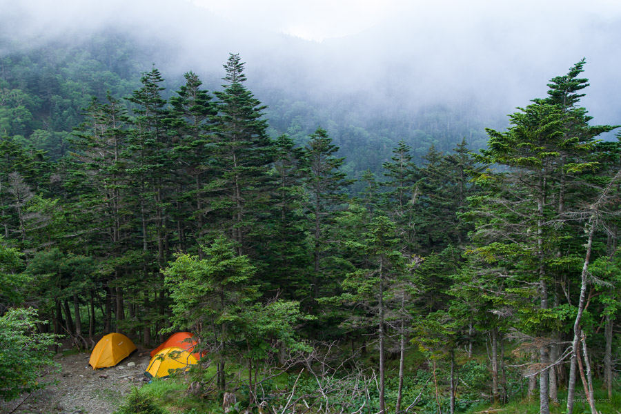
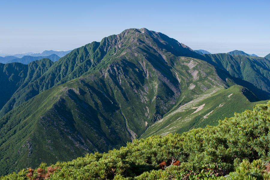
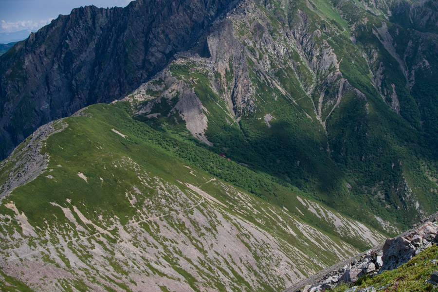
This was another long day and required climbing Akaishi-dake 赤石岳 (3120 m), which included scaling a few false summits before arriving at the top. The snow patches on the mountainside I caught sight of yesterday were now within hand’s reach. The summit was a hive of activity with folk who had made their way up from Sawarajima. Yet with the sky rapidly changing to grey, I was keen to start heading down to Hyakkenborayama-no-ie 百間洞山の家. This was another excellent campsite nestled in a valley with a running stream and a daunting Hijiri-dake 聖岳 looming in the background.
.
Day 6: Hyakkenborayama-no-ie hinan-goya 百間洞山の家 to Hijiridaira-goya 聖平小屋
7hr 30 mins 9.6 km 851 m 1044 m Jul 26, 2023
Route:
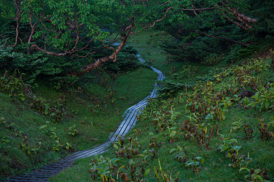
To take full advantage of the morning views, an early start is vital. The climb to the summit of Hijiri-dake is a long one, and care is needed passing along the knife-ridges. Enjoy the wildflowers on the descent to the quaint campsite at Hijiri-goya.
Diary:
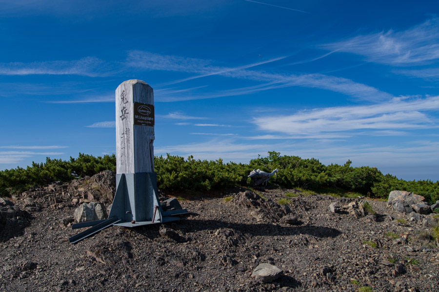
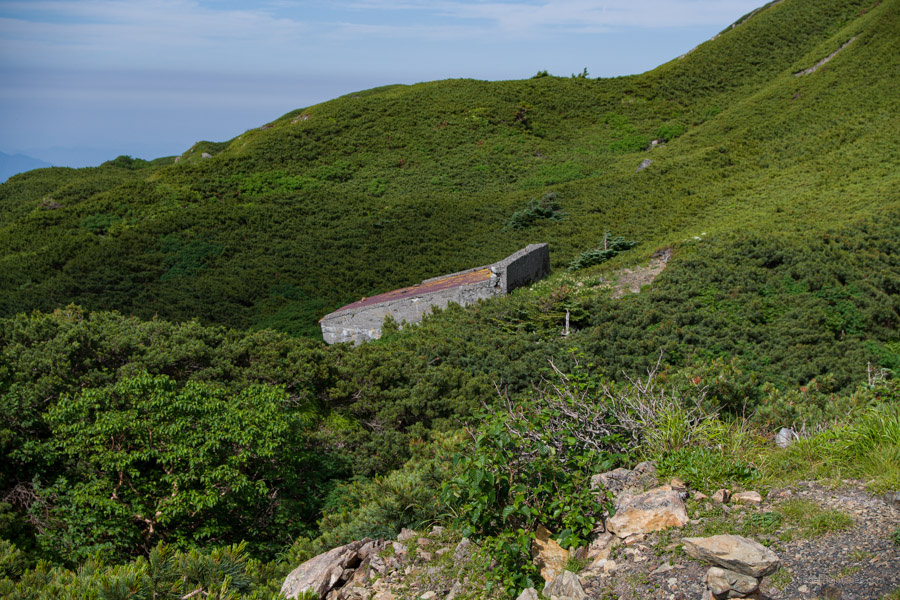
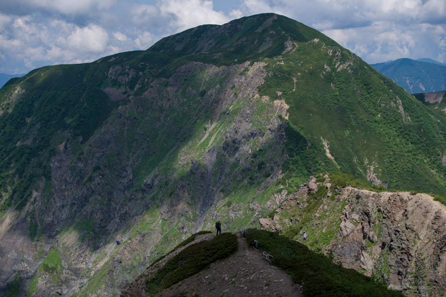
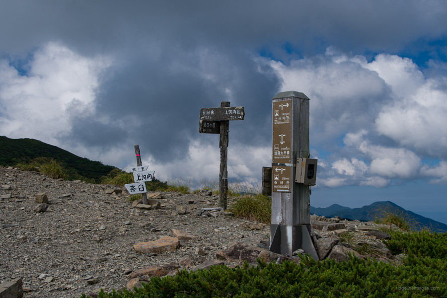
When I did the early planning for the hike, I’m very pleased I didn’t foresee climbing Akaishi-dake and Hijiri-dake in one shot. Not only would it have been taxing to do so, but both are prodigious mountains that deserve your full, unadulterated attention. Leaving the camp at daybreak, I made a quick reckoning of the climb up to Naka-moriyama 中盛丸山 (2807 m). And might I say good timing too, as I was met with some stunning rays of light filtering through the clouds. Next up was Usagi-dake 兎岳 (2818 m), which sapped a bit of energy. From the summit, staring right in front of me was Hijiri-dake. A little disconcerting was the fact that I couldn’t see the path to the summit.
After grinding away at my daily morning treat, a near-indigestible mega protein bar, I sheepishly headed down past the Usagi-dake hinan-goya and along the knife edge. It was a slow affair getting to the summit of Hijiri-dake; in fact, it took five and a half hours from Hyakkenborayama-no-ie. The final rock scramble was the hardest, and like the approach to Shiomi-dake, it occasionally had me on all fours. At 10 am when I arrived, the clouds had just started to roll in, anyone arriving much later would be shut out of any potential vista.
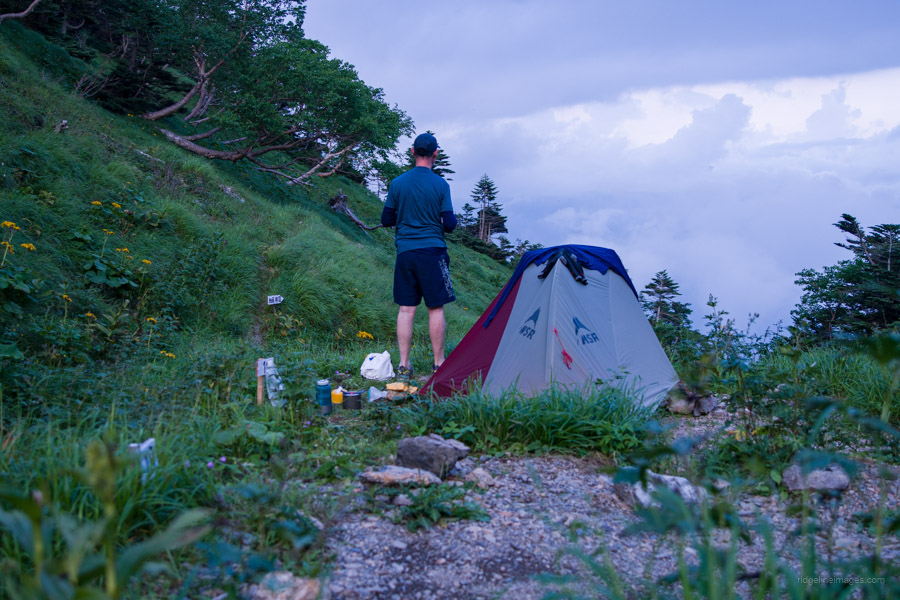
The good news was that from the summit, I could see my objective for the day, the Hijridaira-goya 聖平小屋 a drop of some 700 metres below. It would take the better part of two hours to get there. This campsite, like the Chausu-goya 茶臼小屋 is popular and requires an advanced online booking. It also simplifies things, as in both cases, the staff knew who I was before I ever uttered my name. A downside of this campsite is that the sites don’t drain well, especially after a heavy downpour like the one I had, which really tested the integrity of the tent’s bathtub floor. It’s also the only campsite where you have to carry out your used toilet paper (in the plastic bag provided). Apart from that, the staff is very friendly, and lunch is served daily.
.

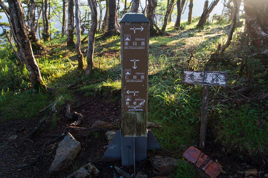
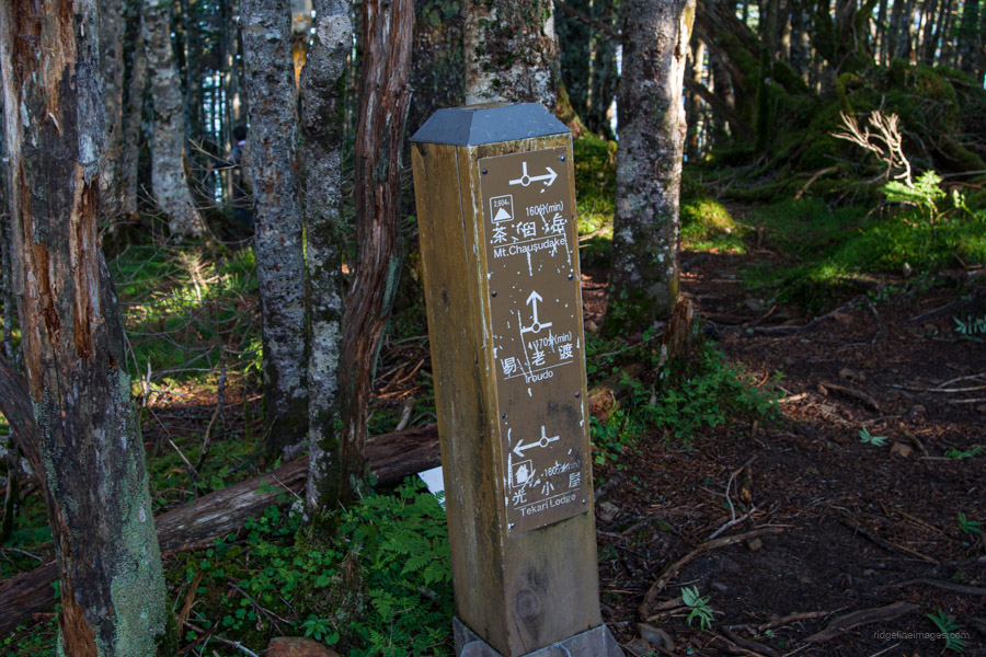
Day 7: Hijiridaira-goya 聖平小屋 to Chausu-goya 茶臼小屋
4hr 30 mins 6.4 km 554 m 593 m Jul 27, 2023
Route:
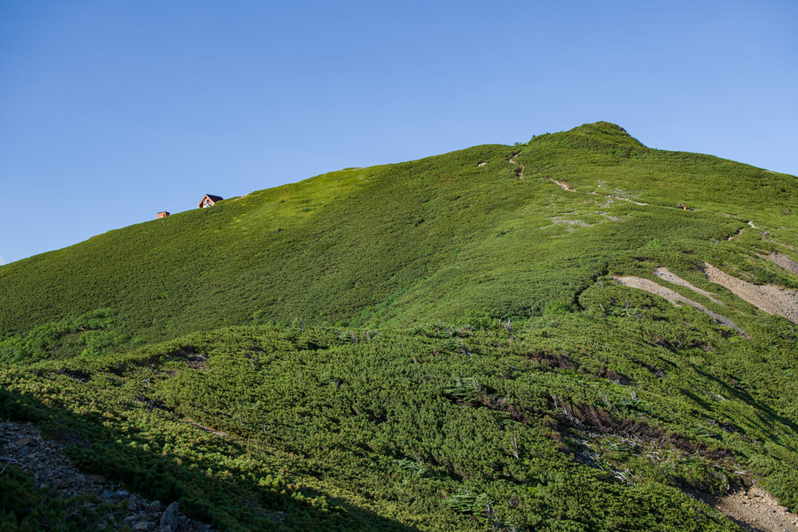
The hike’s shortest and most straightforward day. Still, get a move on early, as 360-degree views are to be had from the summit of Kamikochi-dake, a 200 famous Japanese mountain. Enjoy the generous hospitality on hand at the well-appointed Chausu-goya.
Diary:
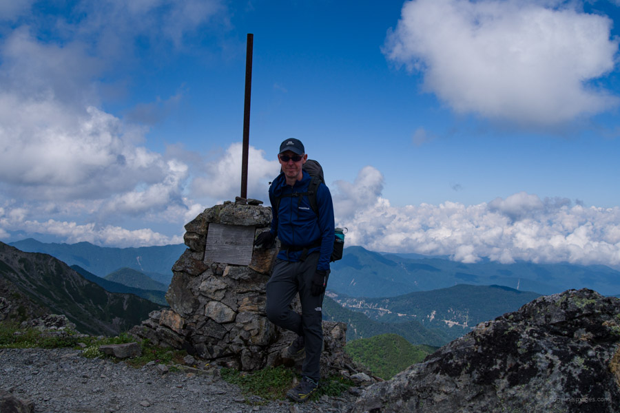
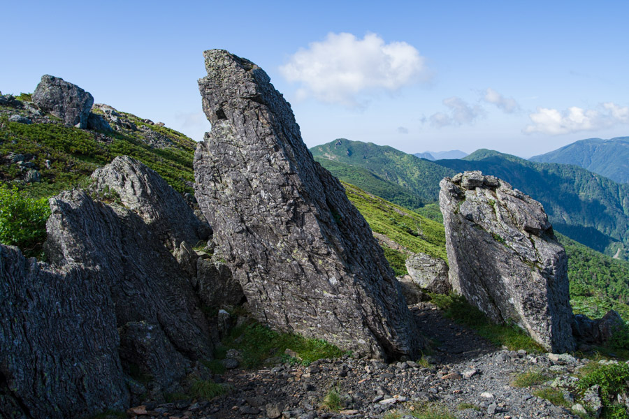
It was a nice feeling to fall asleep knowing that the hardest part of the hike was now behind me. Today marked a week since I started this thru-hike of sorts, and both mentally and physically, I felt pretty good. The body was now fully accustomed to being punished each day, which was good as there was still some distance to go. From Hijridaira-goya, the first mountain I faced was Minami-dake 南岳 (2702 m), a prelude if you like to nearby Kamikochi-dake 上河内岳 (2803 m). This mountain claims a spot among the 200 Famous mountains of Japan and is a 15-minute return trip from the main trail. Don’t miss it, as it will be the easiest famous mountain you will ever come across.
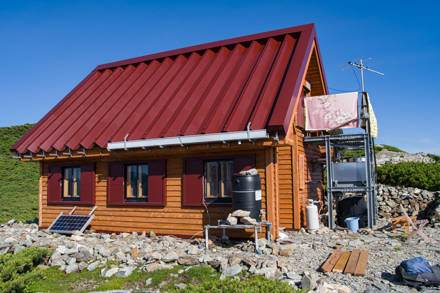
Exiting the summit, I passed some interesting rock formations bearing some resemblance to giant Sarsen stones. Really interesting stuff and made for a great photo op. Next, I passed through a beautiful meadow before veering right down to the Chausu-goya. Upon arrival at 9:30 am, I was treated to a cup of coffee (my first in a week!) and a delicious slice of Baumkuchen cake. Completely out of the blue and very much appreciated. The caretaker who runs the Chausu-goya, as you might have guessed, is a really lovely fella. As I was getting low on food, he offered to make me curry rice for dinner. This is pretty rare, I might add, as most huts will only provide meals to guests who stay overnight. He even called out my name when dinner was ready – like I said, an absolute legend.
.

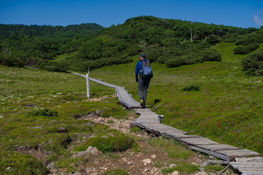
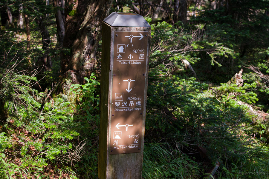
Day 8: Chausu-goya 茶臼小屋 to Tekari-dake 光岳 (return)
9hr 30 mins 18.3 km 1269 m 1225 m Jul 28, 2023
Route:
Pack only the bare necessities for this return hike to the southernmost tip of the Southern Alps. Don’t let the lack of views from the summit put you off, as the trail leads to quiet plateaus of Japanese white birch and is a great place to spot Rock ptarmigan.
Diary:
The previous afternoon, the campsite came under siege thanks to a massive thunderstorm that passed through. Thankfully, the drainage at the Chausu-goya campsite was sufficient; otherwise, it could have been a disaster in the making. The same couldn’t be said for one elderly hiking group that appeared to take the worst of it. They trudged back into camp like the walking wounded.
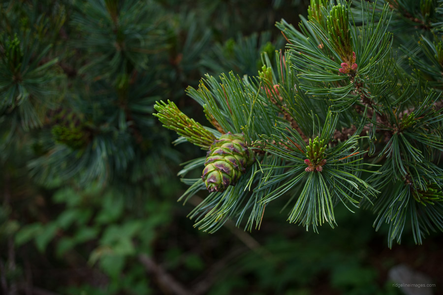
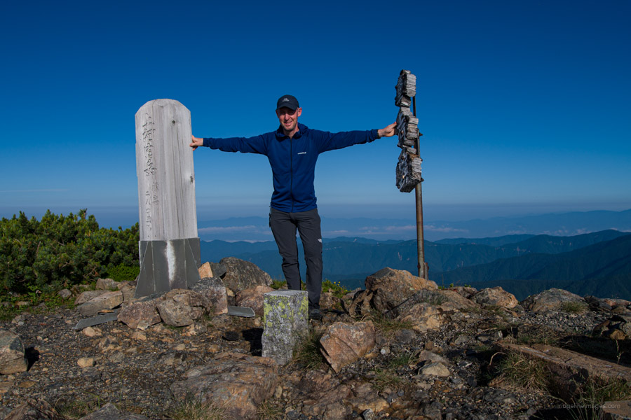
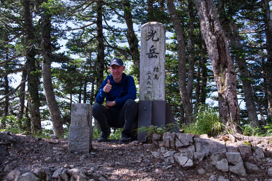
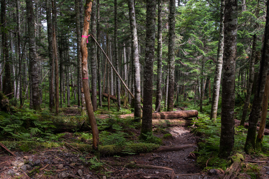
As usual, I was up early for what I imagined was going to be another longish day in the saddle. The plan was to leave my tent at the Chausu-goya, taking only the bare essentials with me for an out-and-back piston to Tekari-dake 光岳 (2592 m), a remote 100 famous mountain in the deepest part of the Southern Alps. It also happens to be the southernmost habitat of Pinus pumila, or creeping pine, in the world.
Rather fortuitously, I made it to the summit of Chausu-dake 茶臼岳 (2604 m) a 300 famous mountain, right at sunrise. Here I had a chat with another hiker who I had parked next to at Hijiridaira-goya a couple days prior. I asked if perhaps she was also heading to Tekari-dake, but she wasn’t. In the same vein as the hike to Shiomi-dake, the hike crosses large tracts of unspoilt virgin forest, which is simply divine to walk through. It wasn’t until I reached Iro-dake 易老岳 (2354 m) some two and a half hours into the hike, that I would meet another hiker on his way back from the Tekari-goya 光岳小屋. It would certainly be the first time I’ve bagged a Hyakumeizan without another sole within a bull’s roar of it. In essence, the antithesis of Kita-dake.
Although I made it to the summit in a little over four hours, I was feeling it on the way back. Even with the high likelihood of rain, it wasn’t enough to help quicken my pace. Upon returning to the Chausu-dake, the window of the hut slid open, and I was greeted by none other than the affable hut caretaker, who was keen to find out how I got on.
.
Day 9: Chausu-goya 茶臼小屋 to Akaishi Onsen Shirakabaso hot spring 赤石温泉白樺荘
6hr 30 mins 15.7 km 116 m 1497 m Jul 29, 2023
Route:
Congratulations! You made it to the final day, and for the most part, it’s downhill. The trail is steep and gnarly at times, so proceed with caution. Enjoy a well-deserved soak and feed at the Shirakabaso hot spring before jumping on the bus back to Shizuoka Station.
Diary:
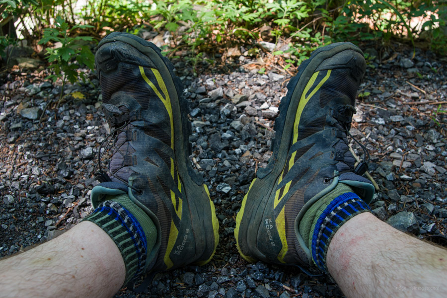
To be perfectly honest, I have to pinch myself to believe I’ve made it this far. Remarkably, I have yet to put on either my jacket or rain pants. I haven’t had any foot issues or blisters, and the ol’ bod hasn’t ceased up, although there is still one more day for any of these happenstances.
One thing that is a little surreal about the Chausu-goya is how quickly the tree line falls away. If you were none the wiser, it would be easy to imagine the hut parked near the edge of a cliff. The truth is that it’s pretty close to that, with very similar steepness to day one, except the trail is in worse shape.
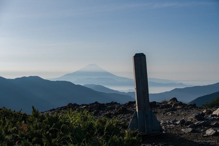
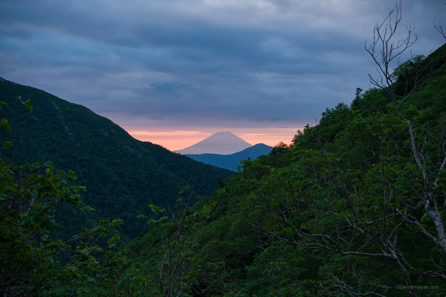
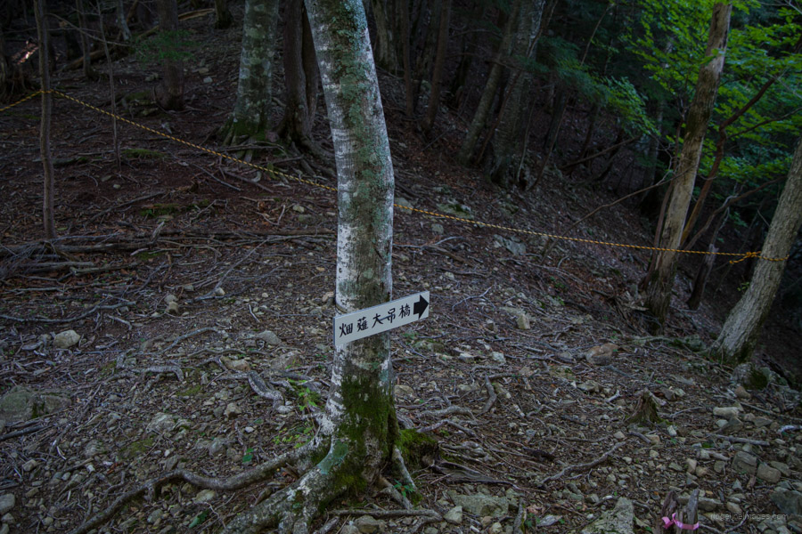
Having packed up, taken a couple of Fuji-san pictures from the terrace, and said my goodbyes, I started the long descent to the Hatanagi Suspension Bridge 畑薙大吊橋. The first stage to the Yokokubozawa-goya 横窪沢小屋 is only moderately steep. Here I met another hiker on his way up who shared some information on what lay ahead. He said to take care as the trail is narrow at times, which happened to be right on the mark.
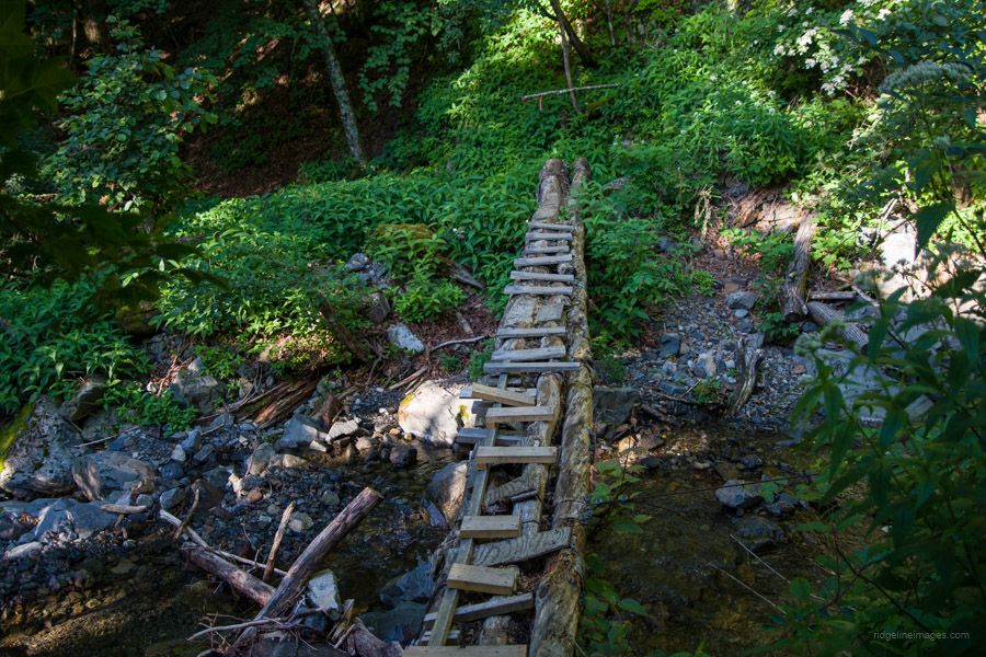
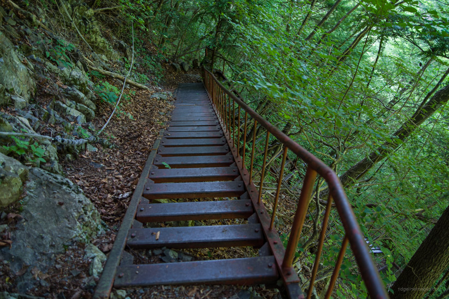
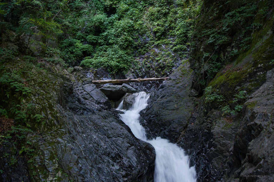
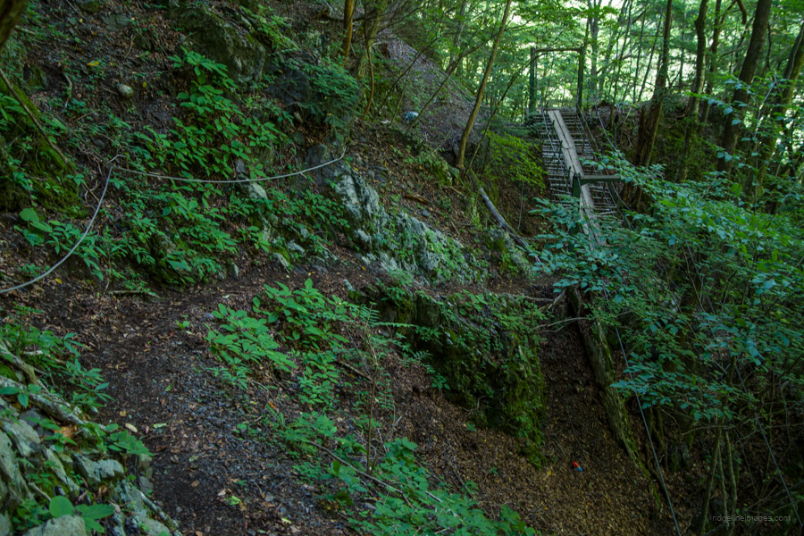
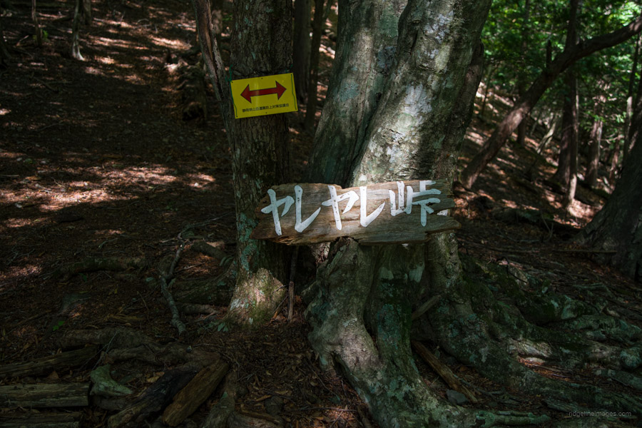
A crudely derived log bridge crosses the clear stream before a series of tightly laced switchbacks shepherd you down to a gorge, where you negotiate a rusted metal staircase past a waterfall. The trail up to this point wasn’t so bad, but from the Usokkozawa-goya ウソッコ沢小屋 onwards, it ups the ante with crumbly and washed-out sections, sketchy traverses, and, to my surprise, a couple of newly constructed bridges. It’s a real hodgepodge, to be honest. The traverses are the ones to watch out for because if you slide down, you’ll have great difficulty extricating yourself. The last hurrah is Yareyare-toge ヤレヤレ峠 or loosely translated as ‘Thank goodness! Pass’.
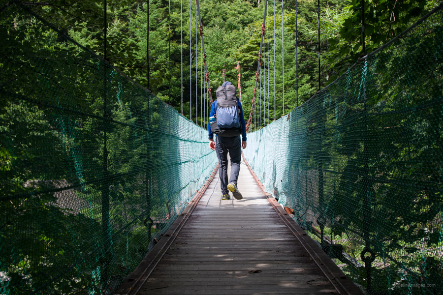
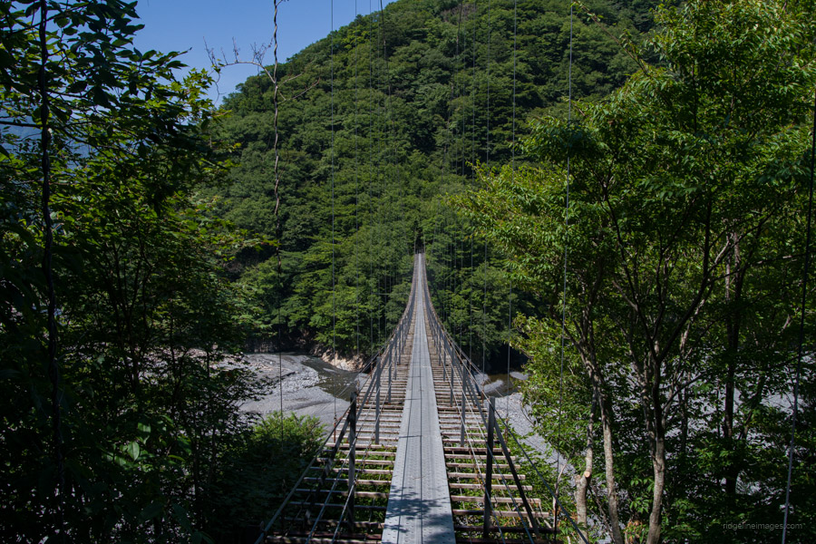
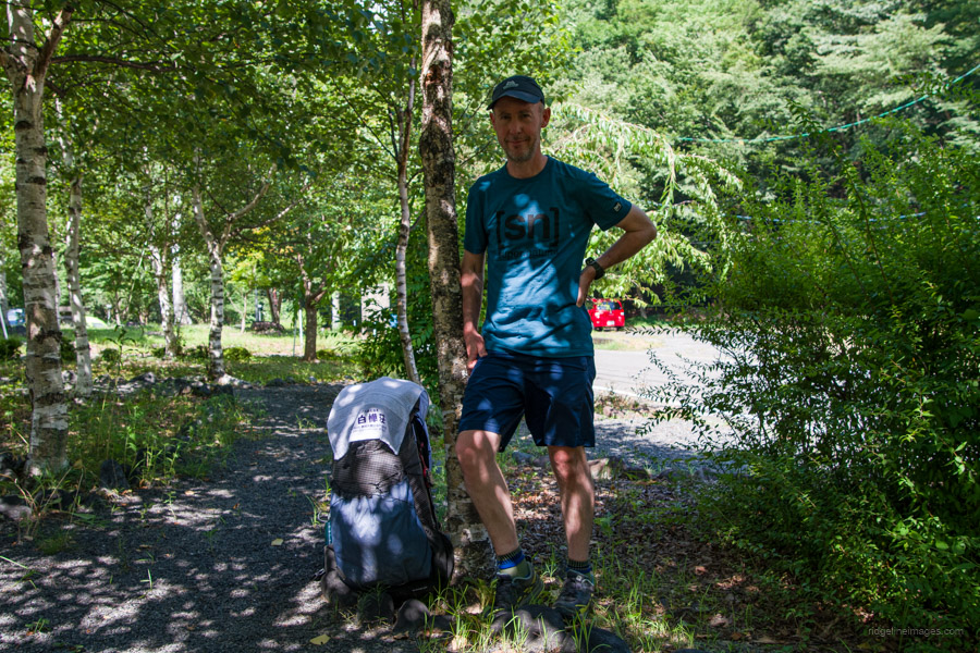
At last, I reached the 182-metre-long Hatanagi Suspension Bridge, apparently a top spot to view the changing fall colours. It hangs some 30 metres above the river below. From here, it is about a 40-minute walk to the Hatanagi Dam and another 40 minutes thereafter to the Akaishi Onsen Shirakabaso hot spring 赤石温泉白樺荘 where I washed away nine days’ worth of sweat and grime. It’s an absolutely transformative experience. After which I demolished a katsu curry, a coke, and ice cream before the long 3.5-hour bus ride back to Shizuoka Station.
Thanks for reading!
.


Did you consider aborting Day 5 heading up, now, dangerous Arakawa-Maedake 荒川前岳? Press on or live to fight another day? Sad to hear trail has eroded so much over the years, even lightly hiked.
No, I didn’t, as I was pretty determined not to quit. While it’s dangerous, it’s still doable, provided you’re extra careful. In some areas, to avoid the crumbling cliff, hikers have unfortunately had to trample on the vegetation so as to steer clear of the edge. I’ve now uploaded a picture of one spot (the first one in the gallery on day 5).
Thank you again for the abundance of information and again congratulations!
Did i read correctly that the site at Yokokubozawa was free? I have noted the two sites where reservation was required in advance but were there any other sites that require booking?
I agree it’s all a little confusing. From what I understand, for the last two years, Yokokubozawa hasn’t had a hut warden, though it can apparently be used as an evacuation hut (for free with a donation box). When I passed by, there was no one there, and all the shutters were down. I didn’t go inside, but I presume it was unlocked. There are also plenty of places to camp around it, and water can be easily collected from the nearby river. Both Chausu-goya and Hijiridaira-goya campsites as well as all the huts I listed require advanced online reservations. Thanks a lot for the Kofi! Enjoy yourself, and I hope it all goes well.
Thanks David. To confirm the reservation in advance were for the lodge or tent sites as well?
No problem, Thomas. All lodges (mountain huts) require reservations. You can still just show up at the huts; however, many will now charge an inconvenience fee, usually an extra 1000 yen. As for the campsites, only the Chausu-goya and Hijiridaira-goya need a reservation, which you should do online at least a couple of days in advance.
Hello! Just came across your blog and it’s very very helpful especially the water sources since I can’t seem to find a lot of details regarding this and I thank you for this. I got some questions though. For context, Me and a friend are from the Philippines, planning to do this hike for 7 days on August next year. Here are my questions:
1. Is there a bus schedule from Akaishi Onsen to Shizuoka Station or do I have to reserve a ticket?
2. Will we be able to get by not being able to speak Japanese?
3. Will alltrails be enough for Navigation? I read somewhere about Yamap but I can’t seem to use it pretty well since it’s in Japanese,
4. Is it ok to do some wild camping? Or you really have to camp on designated campsites?
Sorry for having too many questions, thank you again for this great blog!
Hi Gerwin. Thanks for your comment and questions.
First up, if you haven’t already done so, please take a look at this post: Southern Alps Traverse: Preparation, Food, and Gear, which includes some extra information about the hike.
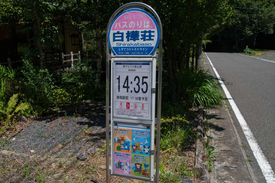
1. There is one daily bus that leaves the Hatanagi Temporary Parking Lot at 2:30 pm (arrives at Akaishi Onsen Shirakabaso hot spring bus stop at 14:35) to Shizuoka Station and runs from July 15th to August 27th (2023). This bus needs to be booked online prior to departure (3,500 yen, 3hrs and 30mins).
2. Yes, to an extent, but I would encourage you to study some basic Japanese before you leave. On this blog, be sure to check out the Hiking Kanji Cheat Sheet and Reading Japanese Hiking Maps.
3. AllTrails is not commonly used in Japan. Yamareco and Yamap (Japanese only) are two main mountain-climbing community sites to find out the latest trail conditions. You should also carry the two Yama to Kogen Chizu maps that are listed above. If you’re interested in the GPX track data, I have provided it for free and it can be uploaded to your GPS device.
4. Wild camping is not permitted. Only camp at designated campsites.
I hope this is helpful.
Thank you for this great information. I’m also thinking of doing the same hike from August 3rd to August 15th
I have a couple of questions why doesn’t the hike cover Mount warusawa? I apologize if I missed it in the blog.
Also is there a ridgeline or a trail which includes Mount Houou, Mount Senjo and Mount Kailomagatake. This is where I’m thinking of starting then following your hike from Kitadake.
Cheers Chris, I appreciate that, and it’s good to hear you’re planning something similar.
I didn’t climb Warusawa-dake for a couple of reasons. First, I had climbed it previously, and secondly, as it’s quite a detour off the main course, it would have added an extra day to the trip, which I didn’t want to do. Unless you want to hike for 13 hours on day 5, you’ll need to spend a night at the Arakawa-goya. If however, you have the time and energy, it’s well worth the effort.
As for a plan which includes Mt. Houou, Mt. Senjo, and Mt. Kaikoma, there is a loop trail that includes the trio starting at Yashajintoge 夜叉神峠; however, it eventually merges with the Southern Alps traverse near Aino-dake, so you will miss Kita-dake without a lengthy backtrack. I would be inclined to leave these mountains for a separate trip.
Hi David
I’m thinking of starting my hike from here actually and finishing at Mount Kita.
Would you happen to know what time leaves Shizuoka station in the morning.
Also do you have the contact numbers for the bus so I’m able to book it
Thank you
Sure, here are the details:
Please note that there have been some minor changes from last year:
+ The bus departs Shizuoka Station at 10:00 am and arrives at the Hatanagi Temporary Parking Lot at 1:20 pm (about a 15-minute walk from the Hatanagi Daichi Dam).
+ You need to reserve the bus online: https://bit.ly/3Lqcxda. The reservation deadline is 7:00 pm the day before your travel date.
+ For 2024, the scheduled operation period has been shortened to July 13th (Sat) – August 18th (Sun).
Also, be sure to check out my Southern Alps Traverse: Preparation, Food, and Gear post.
Thanks so much.
I decided to do it in reverse in case I want to continue and do Senjo and the other two mountains
Hi David
Thanks so much for helping me out with this trip. I have one last question before I go. I will be doing it in reverse to the way you went. Will I be able to make it to Chausu Goya on the first day as the bus from Shizuoka station to Hatanagi Dam arrives at 1:20 pm
Hi Chris,
I just checked the map times, and it’s not possible to reach Chausu-goya based on your arrival time. Instead, I’d aim for Yokokubozawa-goya, which is a nice spot to camp (around 5 hours), or even Usokkozawa-goya, the one before it, and just start earlier the next day. Note that the trail from Hatanagi Suspension Bridge to Chausu-goya is steeper and more difficult than the climb to Kita-dake from Hirogawara.
This is amazing!
I’m planning a trip to Japan in July and am a keen thru hiker. Hoping the path on day 5 hasn’t completely crumbled by now and is still doable!
Is there any sections to the north or south I could extend this route?
Sounds like a good plan. If you wanted to extend the route, you could start at Mt. Kaikoma, which would add about a day at the beginning. As for the finish, the trail kind of peters out around Mt. Tekari (read: it becomes quite challenging), so there aren’t many options beyond that.