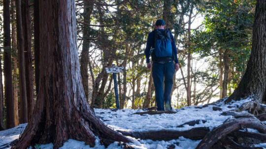
Hiked on May 25, 2023 . Mawarime-daira 廻り目平 – Hacho-daira 八丁平 – Fujimidaira-goya 富士見平小屋 Do not attempt this hike unless you have experience in route-finding, and make sure you carry a topographic map and handheld GPS device. Duration: 2 days ...
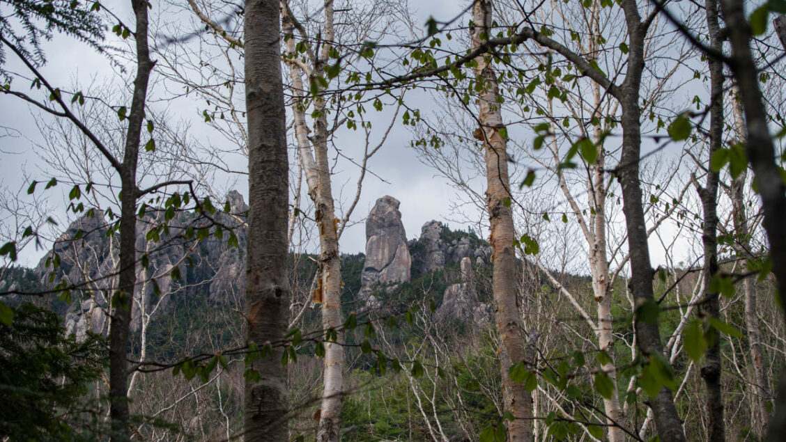
Hiked on May 25, 2023 . Mawarime-daira 廻り目平 – Hacho-daira 八丁平 – Fujimidaira-goya 富士見平小屋 Do not attempt this hike unless you have experience in route-finding, and make sure you carry a topographic map and handheld GPS device. Duration: 2 days ...
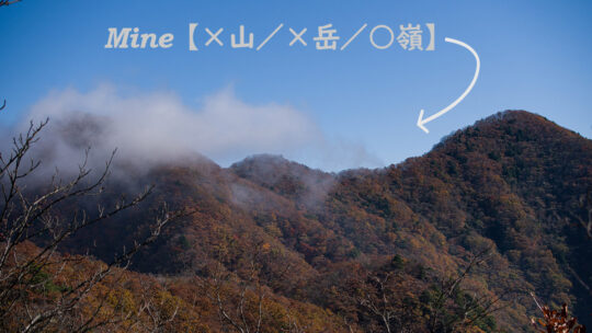
What’s in a Name? Japan’s Mountain Kanji Explained Studying kanji, or Chinese characters used in the writing of Japanese, can leave even the most ardent student exasperated at the best of times, and that’s before they ever open a hiking map. Place...
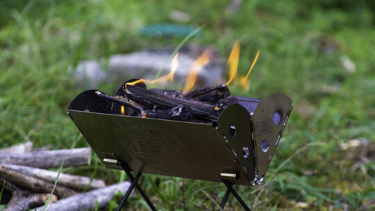
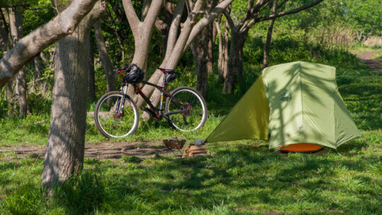
A Compact, Packable, Flatpack Grill Hauling along a BBQ grill on a hike may not be everyone’s cup of tea; but hear me out. I’m not suggesting bringing one on any old hike, where weight is a major consideration, but rather on shorter solo camping...
Hiked on Apr 28, 2023 Feb 16, 2025 . Nishi Tanzawa Visitor Center 西丹沢ビジターセンター – Mt. Komotsurushi 菰釣山 – Mt. Takazasu 高指山 Duration: 2 days Distance: 23 km Elevation change: 839 metres Highest point: 1379 metres Start: Nishi Tanzawa...
Tokyo’s Best Public BBQ Spot As far as hassle-free BBQ spots in Tokyo go, they don’t get much better than Fuchu Kyodonomori BBQ Park. Believe me, I’ve been to many over the years. So, what sets it apart from the likes of Showa Memorial Park...
Hiked on Apr 3, 2023 . Wado Ruins 和銅遺跡 – Minoyama Park 美の山公園 Duration: 3 hours Distance: 6.3 km Elevation change: 412 metres Highest point: 582 metres Start: Wado-Kuroya Station (Chichibu Main Line) Finish: Oyahana Station (Chichibu Main...
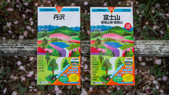
2023 Release of Maps of Mountains and Plateaus The map images and contents of this article have been obtained with the permission of the publisher (株式会社昭文社 Shobunsha Publications, Inc.). As is customary, Shobunsha Publications, Inc. (MAPPLE)...
Hiked on Feb 26, 2023 . Oni-no-iwaya 鬼の岩屋 – Mt. Iwadono 岩殿山 – Yosuike 用水池 A variation of this hike includes a loop course over the neighbouring mountains of Mt. Tenjin and Mt. Chigootoshi, though it involves several areas with fixed chains. ...
Hiked on Feb 11, 2023 . Hachioji Jouseki 八王子城跡 – Sugisawa-no-Atama 杉沢ノ頭 – Mt. Karasawayama 唐沢山 Duration: 4.5 hours Distance: 10.9 km Elevation change: 389 metres Highest point: 556 metres Start: Takao Station (Chuo Main Line) Finish:...
Deciphering Fact From Fiction Over the years, social media, guidebooks, including Lonely Planet’s Hiking in Japan, as well as various Japanese and foreign websites have kept alive a number of myths about hiking in Japan. In this post, we bring to...
Celebrating 10 Years Blogging in Japan This month, RIDGELINEIMAGES.com celebrates its 10th anniversary. For a decade now, I’ve been snapping pictures, sharing my hikes, adventures, gear selections, and how-tos. It’s hard to believe I’ve been...
100 Things You Should Know About Hiking Japan In spite of the fact that blogging is often thought of as a solitary pursuit, most of us count on the support, wisdom, and good deeds of others to cobble things together. This blogger included. I don’t...
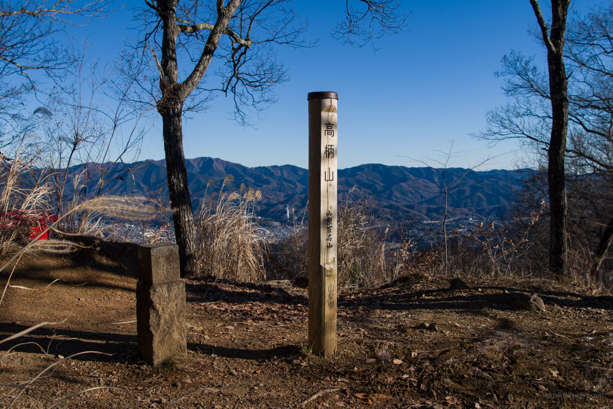
Hiked on Dec 19, 2022 . Senzoku-toge 千足峠 – Shinyanone-toge 新矢野根峠 – Gozenyama 御前山 Duration: 5 hours Distance: 10.5 km Elevation change: 493 metres Highest point: 733 metres Start: Shiotsu Station (Chuo Main Line) Finish: Uenohara Station...
Hiked on Dec 7, 2022 . Mt. Hizure-kongozan 日連金剛山 – Mt. Yasaka 八坂山 – Mt. Takara 宝山 Duration: 3.5 hours Distance: 10.4 km Elevation change: 297 metres Highest point: 460 metres Start: Fujino Station (Chuo Main Line) Finish: Fujino Station...
10 Mountains In Tokyo Worth Climbing As this blog approaches its 10th anniversary, it’s time to do what any self-respecting Tokyo hiking blogger would; rate from 1 to 10, Tokyo’s best mountains – specifically the list focuses on mountains within the...
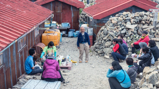
Hiked on Nov 12, 2022 . Mitsumine Shrine 三峯神社 – Mt. Shiraiwayama 白岩山 – Mt. Tenso 天祖山 Do not attempt this hike unless you have experience in route-finding and make sure you carry a topographic map and handheld GPS device. Duration: 2 days ...