2023 Release of Maps of Mountains and Plateaus
As is customary, Shobunsha Publications, Inc. (MAPPLE) released their annual Yama to Kogen Chizu (2023 59th ed.) in two halves: February 24 (41 maps) and March 8 (20 maps). Listed below are the entire suite of 61 maps. The copy price remains unchanged at 1,210 yen, including tax. For more information about reading Yama to Kōgen Chizu topo maps check out this how-to guide.
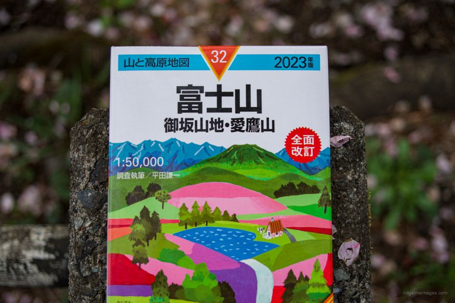
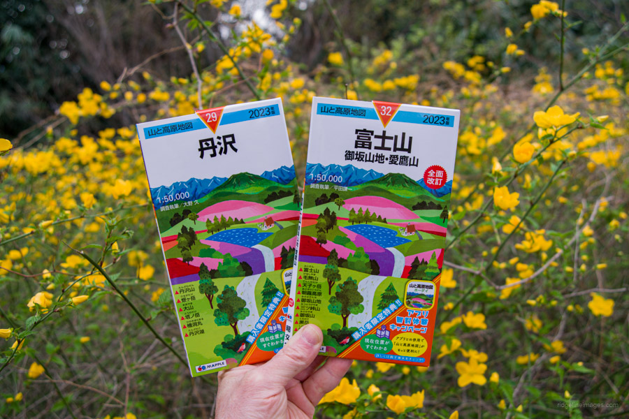
FUJI-SAN one of two maps fully revised for 2023.
Once more this year, Shobunsha Publications continues its online mapping campaign. If you install Shobunsha Publications Yama to Kōgen Chizu Hōdai app, you receive six months of free digital map access corresponding to the paper map you purchased. Simply install the Hodai app, and to launch the app version of the map, scan the QR code at the back of the accompanying booklet.
A notable difference is that the free period has been whittled down to six months, rather than twelve months as it has been previously. Not to mention, in-app purchases of individual maps have risen by 150 yen and are now 650 yen, while access to all online maps has increased to 500 yen per month (6,000 yen annually).
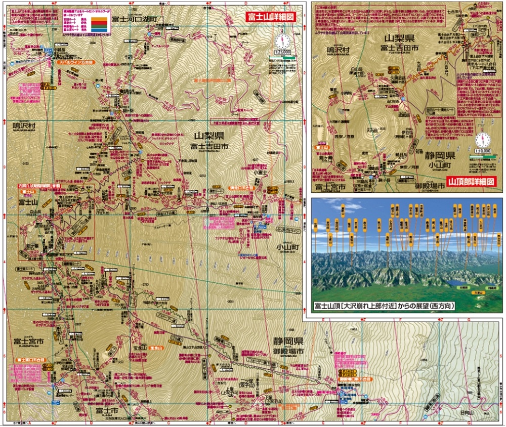
富士山 御坂・愛鷹山 FUJI-SAN includes colour coding for climbing trails. Image: Shobunsha Publications, Inc.
There are full revisions of Maps 32 (FUJI-SAN) and 60 (KIRISHIMA·KAIMON-DAKE). For Map 32, the Yoshida Trail, Subashiri Trail, Gotemba Trail, and Fujinomiya Trail, as well as the trails set aside for descending, are color-coded, making it easier to take in at a glance. In Map 60, the scale of the Kirishima Mountains, which include Mt. Karakunidake, Mt. Shinmoedake, and Mt. Takachiho, has changed from 1:50,000 to 1:25,000. In addition to this, Sakurajima, one of Japan’s 200 famous mountains, and Takakumayama, one of Japan’s 300 famous mountains, are included for the first time.
Map 18 (MYOKO·TOGAKUSHI·AMAKAZARI) and Map 51 (KOYA-SAN·KUMANO-KODO) also receive modest updates. Map 18 includes a new trail from Mori-Miyanohara Station ~ Miyanohara ~ Nakago ~ Yuto as part of Section 08 of the Shin-Etsu Trail. In addition, in Map 51 the Kumano Kodo Iseji route a pilgrim’s ‘path of prayer’ that connects Ise Jingu and Kumano Sanzan, has been added.
Simplified direction-finding now featured in 50 of the 61 maps. Image: Shobunsha Publications, Inc.
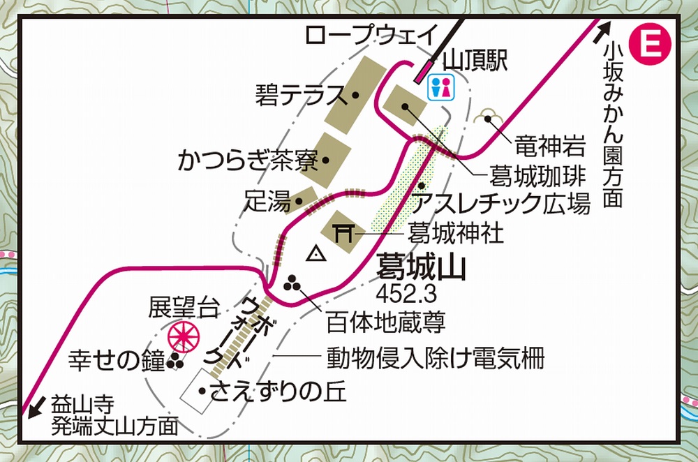
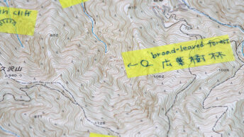
Finally, minor revisions, including magnified map inserts at confusing trail branches and road junctures to simplify direction-finding and at dangerous spots, are now featured in 50 of the 61 maps.
Yama-to-Kōgen Map List 2023 【山と高原地図 2023年版】
| Map No. | Mountain or Area Covered | Available at Amazon Japan |
|---|---|---|
| 1. | 利尻・羅臼 知床・斜里・阿寒・礼文 | RISHIRI·RAUSU |
| 2. | ニセコ・羊蹄山 暑寒別岳・駒ヶ岳 | NISEKO·YOTEI-ZAN |
| 3. | 大雪山 トムラウシ山・十勝岳・幌尻岳 | DAISETSU-ZAN |
| 4. | 八甲田・岩木山 白神岳・十和田湖・田代岳 | HAKKODA·IWAKI-SAN |
| 5. | 岩手山・八幡平 秋田駒ヶ岳・姫神山・森吉山・和賀岳 | IWATE-SAN·HACHIMANTAI |
| 6. | 栗駒・早池峰 焼石岳・神室山 | KURIKOMA·HAYACHINE |
| 7. | 蔵王 面白山・船形山 | CHOKAI-ZAN·GASSAN |
| 8. | 鳥海山・月山 羽黒山 | ZAO |
| 9. | 朝日連峰 以東岳・摩耶山 | ASAHI-RENPO |
| 10. | 飯豊山 朳差岳・二王子岳 | IIDE-SAN |
| 11. | 磐梯・吾妻 安達太良 | BANDAI·AZUMA |
| 12. | 那須・塩原 高原山・八溝山 | NASU·SHIOBARA |
| 13. | 日光 白根山・男体山 | NIKKO |
| 14. | 尾瀬 燧ヶ岳・至仏山・会津駒ヶ岳 | OZE |
| 15. | 越後三山 平ヶ岳・巻機山 | ECHIGO-SANZAN |
| 16. | 谷川岳 苗場山・武尊山 | TANIGAWA-DAKE |
| 17. | 志賀高原 草津白根山・四阿山 | SHIGA-KOGEN |
| 18. | 妙高・戸隠・雨飾 火打山・高妻山・信越トレイル | MYOKO·TOGAKUSHI·AMAKAZARI |
| 19. | 浅間山 軽井沢・長野原の山々 | ASAMA-YAMA |
| 20. | 赤城・皇海・筑波 榛名山 | AKAGI·SUKAI·TSUKUBA |
| 21. | 西上州 妙義山・荒船山 | NISHIJYOSHU |
| 22. | 奥武蔵・秩父 武甲山 | OKUMUSASHI·CHICHIBU |
| 23. | 奥多摩・奥秩父総図 ※(1:120000) | OKUTAMA·OKUCHICHIBU |
| 24. | 奥多摩 御岳山・大岳山 | OKUTAMA |
| 25. | 大菩薩嶺 | DAIBOSATSU-REI |
| 26. | 雲取山・両神山 | KUMOTORI-YAMA·RYOKAMI-SAN |
| 27. | 金峰山・甲武信 | KINPU-SAN·KOBUSHI |
| 28 | 高尾・陣馬 | TAKAO·JINBA |
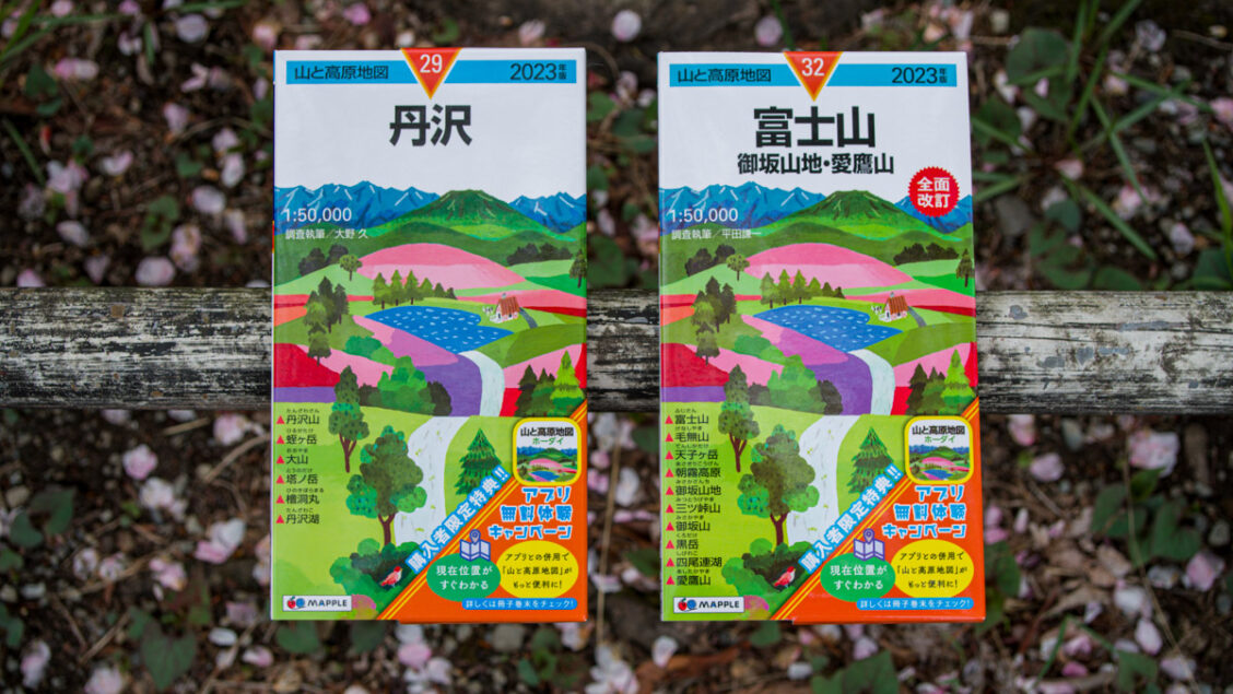
| 29. | 丹沢 | TANZAWA |
| 30. | 箱根 金時山・駒ヶ岳 ※(1:25000) | HAKONE |
| 31. | 伊豆 天城山 ※ 1:80000) | IZU |
| 32. | 富士山 御坂・愛鷹山 | FUJI-SAN |
| 33. | 八ヶ岳 蓼科・美ヶ原・霧ヶ峰 | YATSUGA-TAKE |
| 34. | 日本アルプス総図 ※(1:150000) | JAPANESE ALPS |
| 35. | 白馬岳 | SHIROUMA-DAKE |
| 36. | 鹿島槍・五竜岳 | KASHIMAYARI·GORYU-DAKE |
| 37. | 剱・立山 | TSURUGI·TATEYAMA |
| 38. | 槍ヶ岳・穂高岳 上高地 | YARIGA-TAKE·HOTAKA-DAKE |
| 39. | 乗鞍高原 | NORIKURA-KOGEN |
| 40. | 御嶽山 小秀山・奥三界岳 | ONTAKE-SAN |
| 41. | 木曽駒・空木岳 | KISOKOMA·UTSUGI-DAKE |
| 42. | 北岳・甲斐駒 | KITA-DAKE·KAIKOMA |
| 43. | 塩見・赤石・聖岳 | SHIOMI·AKAISHI·HIJIRI-DAKE |
| 44. | 白山 荒島岳・能郷白山・金剛堂山 | HAKU-SAN |
| 45. | 御在所・霊仙・伊吹 | GOZAISHO·RYOZEN·IBUKI |
| 46. | 比良山系 武奈ヶ岳・赤坂山 ※(1:30000) | HIRA-SANKEI |
| 47. | 京都北山 | KYOTO-KITAYAMA |
| 48. | 北摂・京都西山 箕面・妙見山 | HOKUSETSU·KYOTO-NISHIYAMA |
| 49. | 六甲・摩耶 須磨アルプス ※(1:25000) | ROKKO·MAYA |
| 50. | 金剛・葛城 生駒山・紀泉高原 | KONGO·KATSURAGI |
| 51. | 高野山・熊野古道 伯母子岳 ※(1:80000) | KOYA-SAN·KUMANO-KODO |
| 52. | 大峰山脈 | OMINE-SANMYAKU |
| 53. | 大台ヶ原 高見山・倶留尊山 | ODAIGAHARA |
| 54. | 氷ノ山 鉢伏・神鍋 | HYONO-SEN |
| 55. | 大山・蒜山高原 三瓶山・比婆山・道後山 | DAISEN·HIRUZEN-KOGEN |
| 56. | 石鎚・四国剣山 東赤石山・三嶺 | ISHIZUCHI·SHIKOKUTSURUGI-SAN |
| 57. | 福岡の山々 宝満山・英彦山 ※(1:25000・1:50000) | FUKUOKANO-YAMAYAMA |
| 58. | 阿蘇・九重 由布岳 | ASO·KUJYU |
| 59. | 祖母・傾 大崩山 | SOBO·KATAMUKI |
| 60. | 霧島・開聞岳 市房山 ※(1:25000) | KIRISHIMA·KAIMON-DAKE |
| 61. | 屋久島 宮之浦岳 | YAKUSHIMA |
Fully revised for 2023
Modest upadates
Thank you for your list. I have used some om this maps back in time, however would very much like to have a overview map (graphical) what the individuel maps cover.
Yama-to-Kōgen Map List 2023 【山と高原地図 2023年版】
Thanks for your comment. As many of us unfortunately know, the map coverage overview is only provided as a tiny graphic on the back sleeve of each map, making it difficult to see exactly what areas are covered. In practice, the only reliable way to confirm whether a particular area is included is to inspect the physical map itself – the front cover does at least list the main mountains and hiking areas covered. Worth knowing, though: Shobunsha now provides regional index maps on their dedicated site at yamachizu.jp/maparea, which gives a reasonable overview of what each regional group covers, even if a single comprehensive map of the full series still doesn’t seem to exist.