.
Mitsumine Shrine 三峯神社 – Mt. Shiraiwayama 白岩山 – Mt. Tenso 天祖山
Distance: 22.5 km
Elevation change: 1341 metres
Highest point: 1921 metres
Start: Mitsumine Shrine Bus Stop
Finish: Higashi Nippara Bus Stop
Difficulty: ▅▅▅▅▅▅▅▅▅▅ ❺
Map: Yama to Kogen Chizu 山と高原地図 [No.25 奥多摩 OKUTAMA]
GPX TrackKML TrackGSI MAPPDF Topo Map
Nagasawa Hairyo: Tokyo’s Far-flung Mountain Chain
Mt. Nagasawa is a remote and seldom visited peak deep in the mountains of Okutama. The Nagasawa Hairyo on which it lies, forms part of the Tokyo and Saitama Prefectural boundary, offering some of the quietest trails in the metropolis. Its access is compounded by being smack bang between the Mitsumine Shrine and Nippara, necessitating a 5-hour hike in from either approach. It should be said that of the countless trekkers wandering towards Mt. Kumotori, hardly any go to Nagasawayama. Outside of trail runners who pull off this herculean feat in a day, you will need to either collect water from the Shiraiwa-goya which is a mission in and of itself or spend a night at the Toridaniyama Refuge Hut which has a reliable water source. The second option adds 3 hours to the hike (90 minutes each way) and will be a struggle later in the year with short daylight hours.
Day 1: A Path Less Travelled (12.3 km)
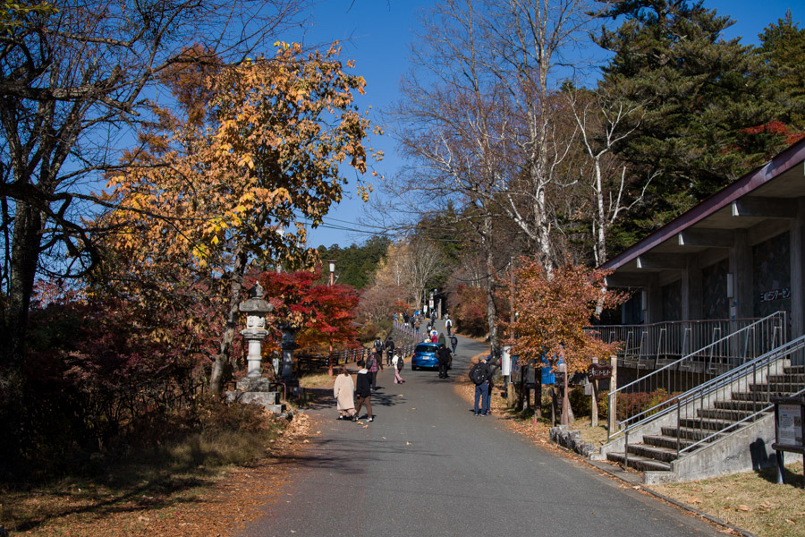
To get to the trailhead take a bus from Seibu-Chichubu Station 西武秩父駅 bound for the Mitsumine Shrine 三峯神社. The first morning bus departs at 8:30 am on weekends and 9:10 am on weekdays (1hr 20 mins, 950 yen). Given Mitsumine Shrine’s popularity the timetable is crying out for a bus that departs an hour earlier especially on weekends. When I arrived at Seibu-Chichubu Station around 7:15 am, several people were already waiting in line. The bus (one of two that departed at 8:30 am) was chock-full and didn’t arrive at that shrine until 10:00 am. The driver asked everyone to alight a couple hundred metres below the main carpark on account of the traffic bottleneck.
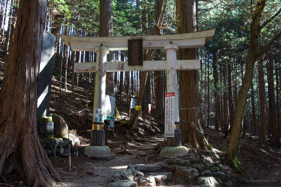
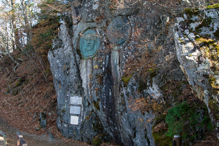
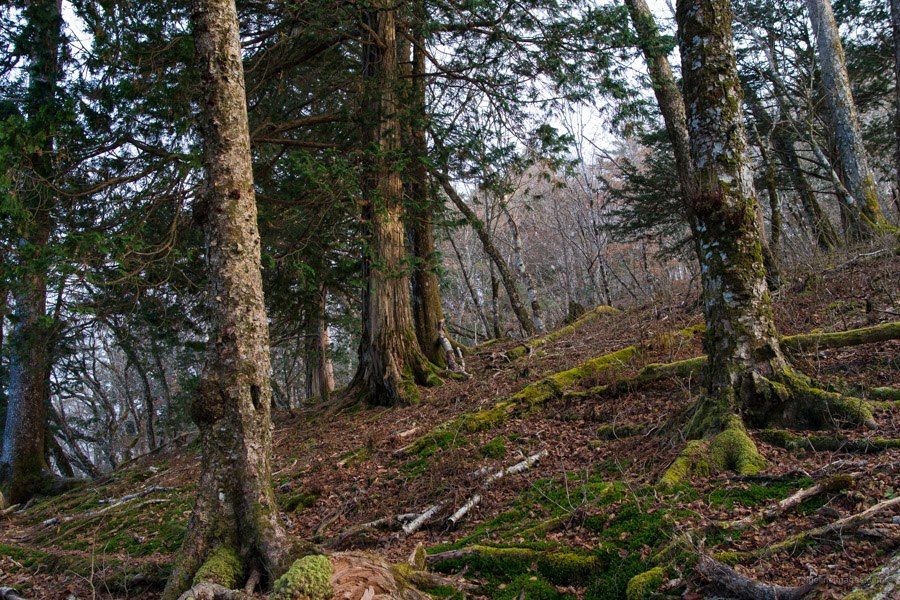
It was nine years ago I last visited the shrine, this time I gave the place a wide berth and instead made a beeline for the trailhead, a 5-minute walk away. From late October onwards you need to be wary of the short daylight hours so wasn’t time for dilly-dallying. The directions from the trailhead proper until Imonoki Dokke are much the same as the Mt. Kumotori hike. At the white torii gate you can fill out and post your hiking plan at the trailhead mailbox. The trail climbs gradually through Japanese cedar plantation that shifts to broadleaf species such as Abies firma (momi fir) and Japanese hemlock (kometsuga). First up along the ridgeline is Jizo-toge 地蔵峠 followed by Kirimogamine 霧藻ヶ峰 (1,523 m). Near the bronze relief of Yasuhito, Prince Chichibu and his wife is a mountain hut which serves drinks during busy periods.
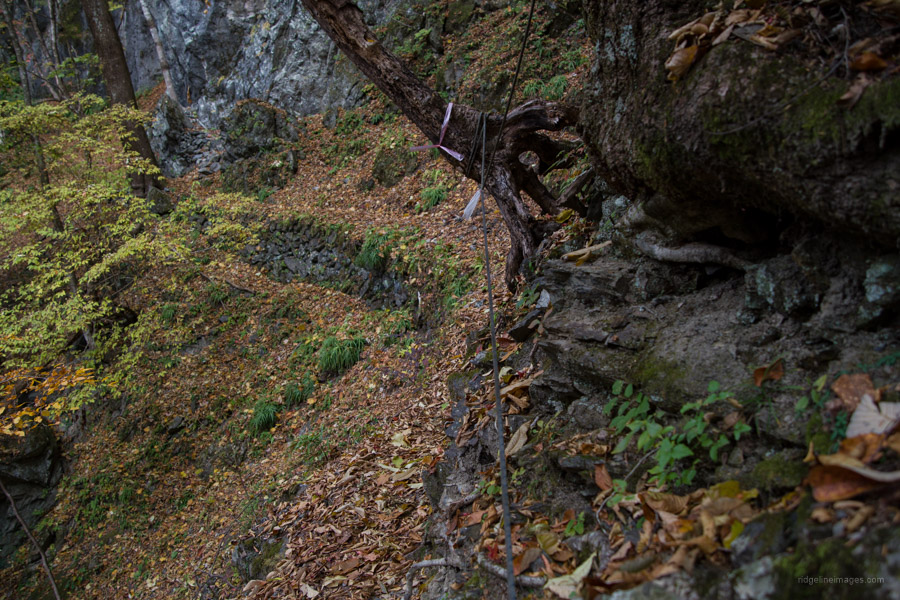
Continuing along the hilly ridgeline finds Maeshiraiwa 前白岩 (1,776 m) and shortly after the bombed-out Shiraiwa-goya 白岩山小屋. Here I faced the make-or-break of the hike. Collect enough water to see me through to Nippara or capitulate and head for Mt. Kumotoriyama. According to a recent Yamareco report it was about 10 minutes’ away. What it failed to mention was, it required a good dose of doggedness and some fixed rope to get you down to the water course. Not dangerous, but honestly not something worth inconveniencing yourself if you aren’t planning to camp out. When you’re ready to head off, make your way from the hut ruins up to Mt. Shiraiwayama 白岩山 (1,921 m).
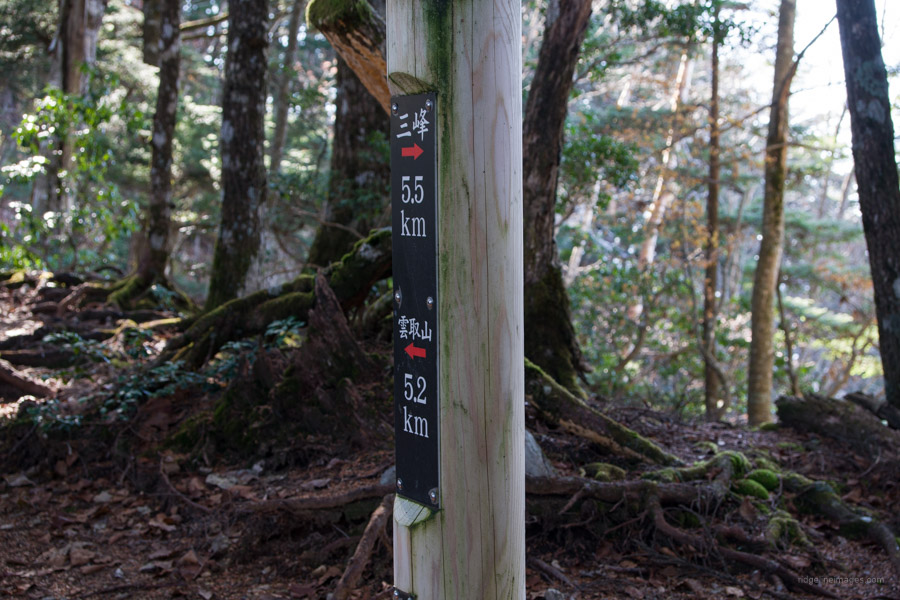
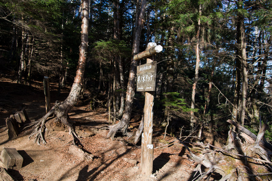
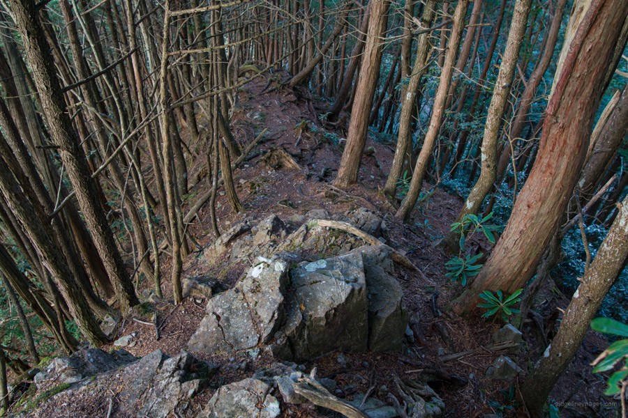
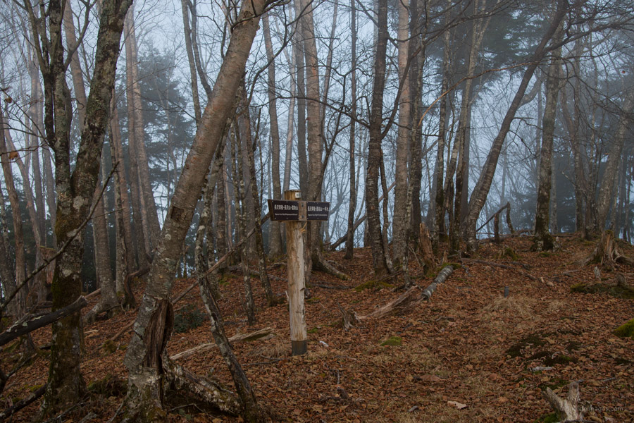
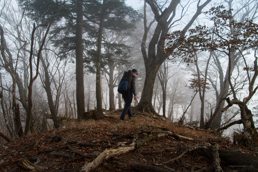
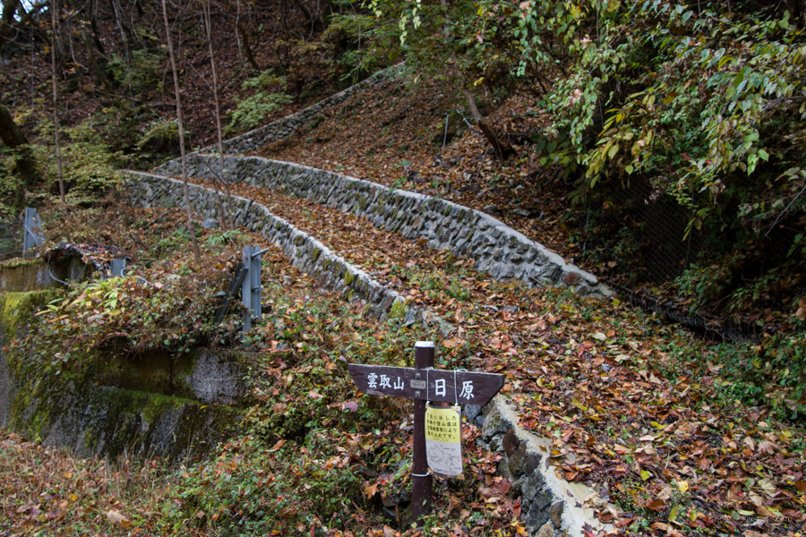
At the junction and sign that warns about frequent slipping accidents in winter, veer left and up the steepish slope to the Nagasawa Hairyo 長沢背稜. A short detour can be made to Imonoki Dokke 芋ノ木ドッケ (1,946 m) that claims Tokyo’s second highest mountain. The surrounding moss creates a fantastic atmosphere. It should be said that from the time I strayed from the main drag, until I reached Nippara I didn’t see anyone and that was on a weekend in fine weather. The trail is faint in places so make sure you carry a topographic map and GPS.
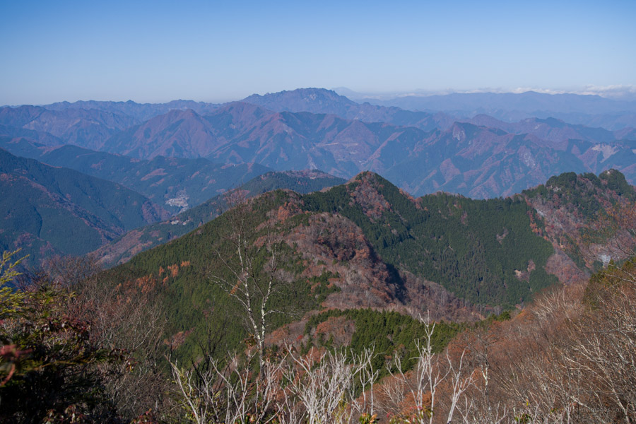
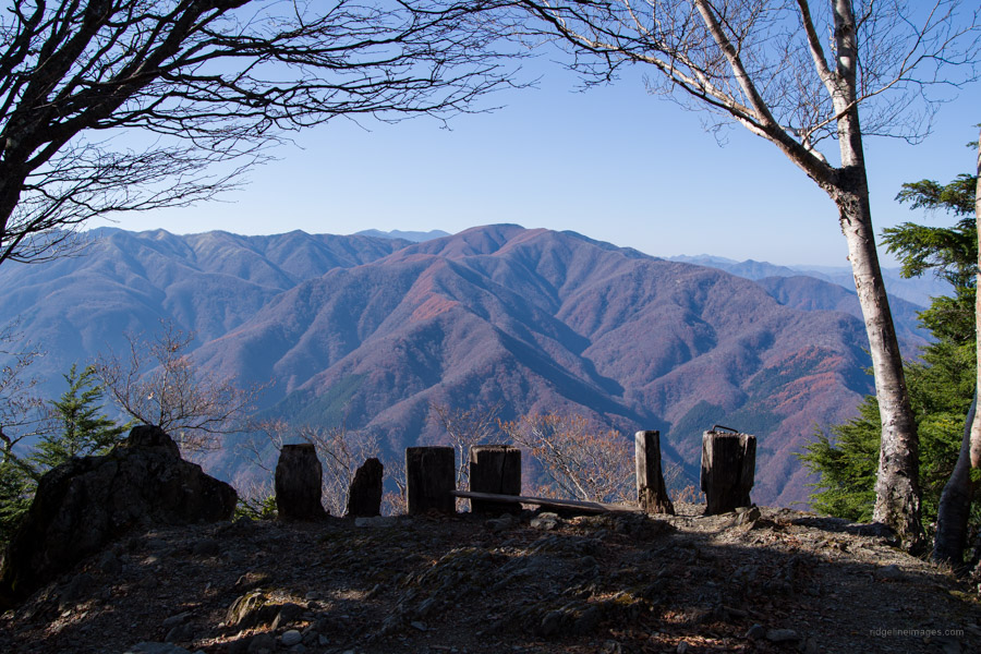
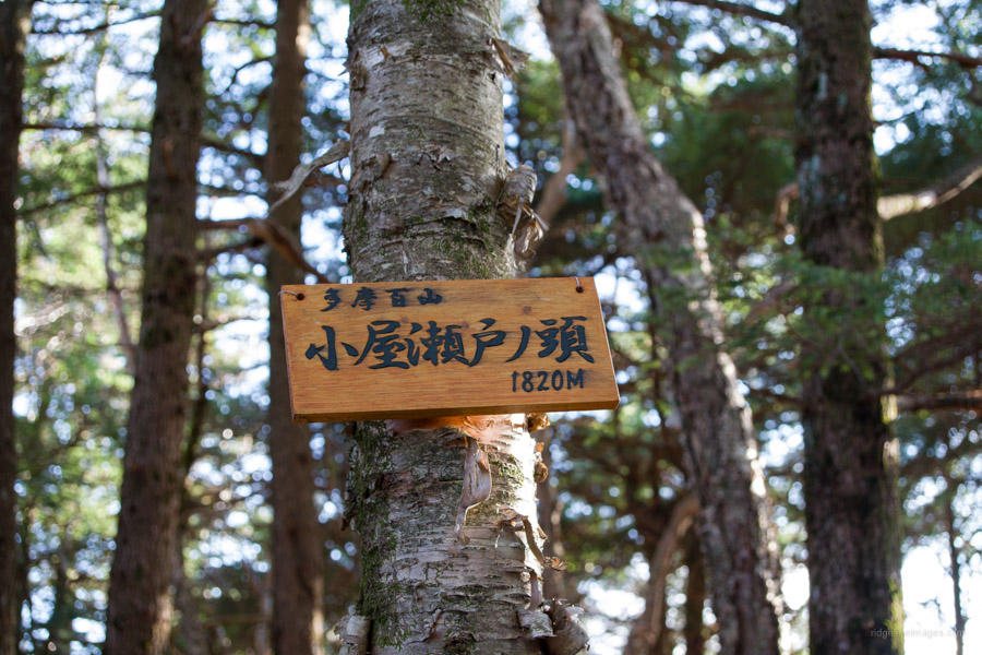
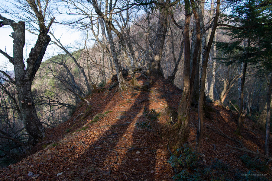
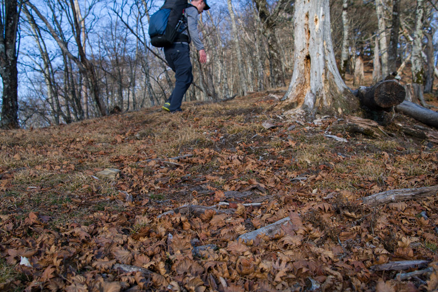
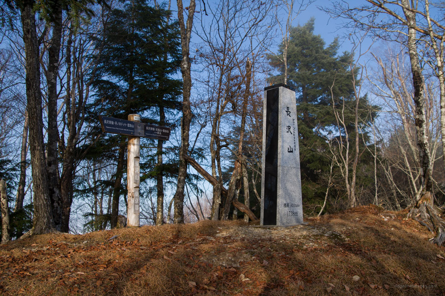
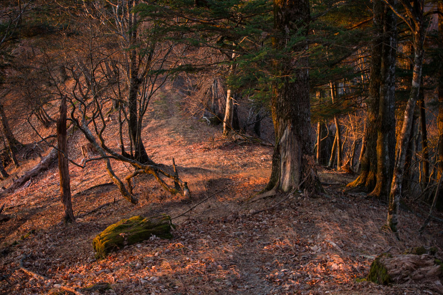
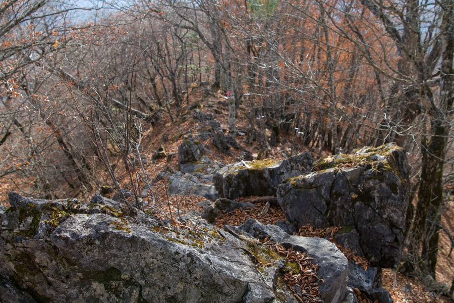
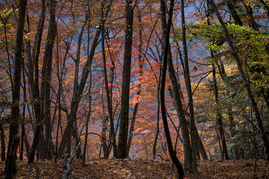
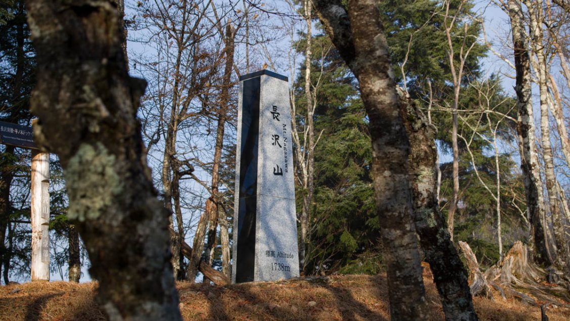
The first 30 minutes along the Nagasawa Hairyo is relatively flat and offers some stunning views to your right. Clusters of dead trees look to be the result of former logging and wildfires. From Goyasedo-no-atama 小屋背戸ノ頭 (1,820 m) until Futsukoya-no-atama 仏小屋ノ頭 the narrow rocky ridge is fought with tree roots that makes for slow progress. A nice time to tackle this path is in June when Rhododendrons (tsutsuji) are in bloom. It takes around 90 minutes from the trail branch to get to Mt. Nagasawa 長沢山 (1,738 m). The mountain is adorned with a granite plinth like the ones found on Mt. Mito, Mt. Kawanori and Mt. Kumotori. A bit of a surprise given it’s such a lowkey mountain. And would have cost a bundle given it had to be choppered in!
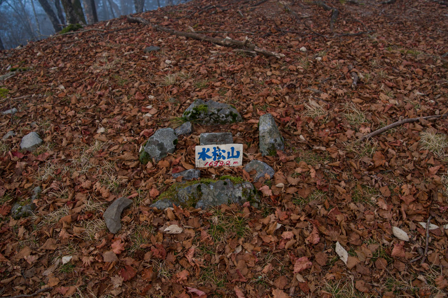
With the hardest part out the way, the trail from Mt. Nagasawa descends then deviates away from the prefectural border before arriving at a key intersection. Mt. Araragiyama 水松山 (1,699 m) is a short distance away. By the time I arrived and pitched the tent it was already getting dark. A nice spot to camp is in a sheltered space beneath the exposed ridgeline.
Day 2: Brace for Long Steep Descent (10.2 km)
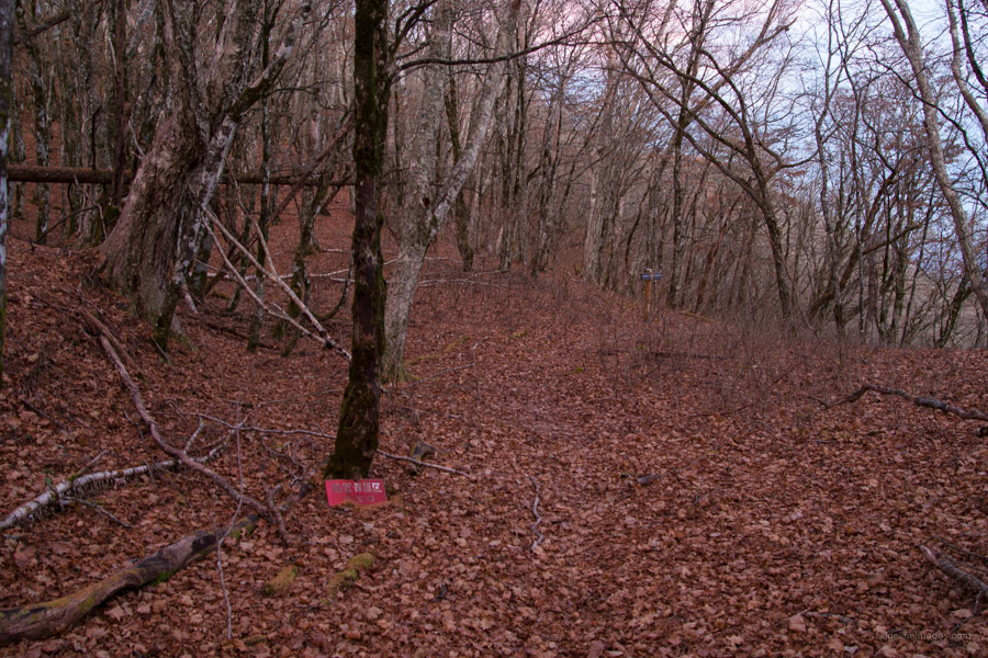
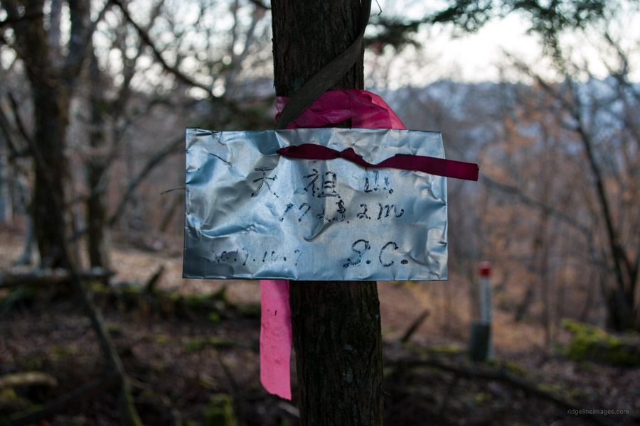
During the night the wind picked up however the protected campsite handled it well. Today we say goodbye to the Nagasawa Hairyo and start heading down on the Tokyo side. The Nagasawa Hairyo continues all the way around to Mt. Tenmoku 天目山. At the trail branch look for a signpost signalling the way to Tensozan 天祖山 and Nippara 日原. At first the trail cuts a path around the mountainside. In the distance you should be able to make out the Hikawa limestone quarry 氷川鉱山 in an adjoining valley. The route from the campsite to Tensozan is indistinct now and then though generally follows the broad ridge. As you approach the summit of Mt. Tenso (1,723 m) pink tape becomes more regular.
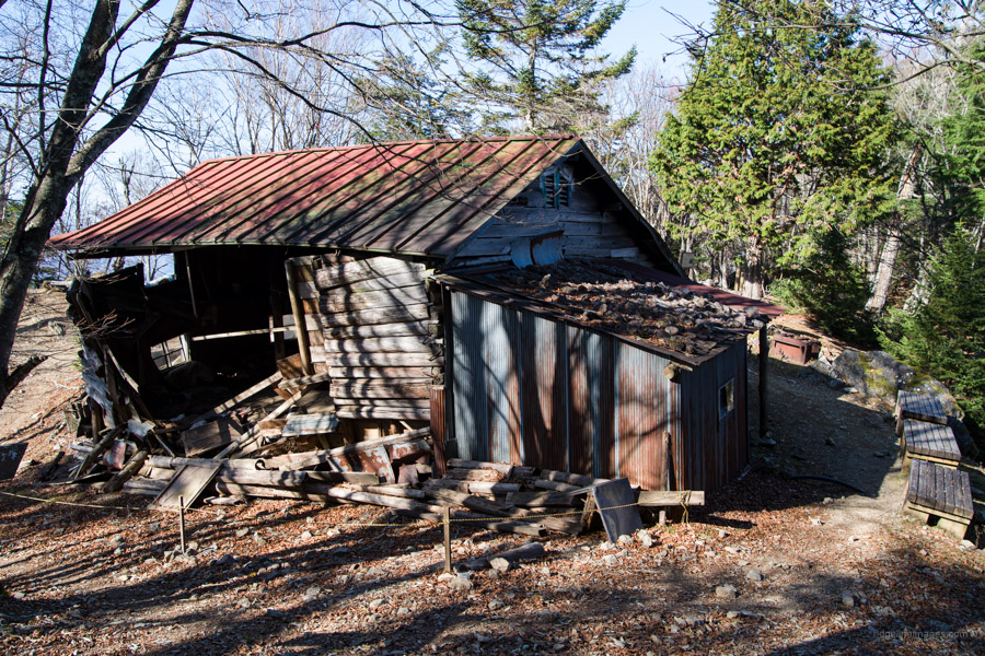
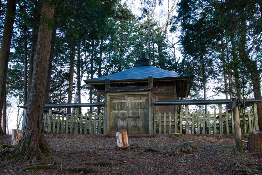
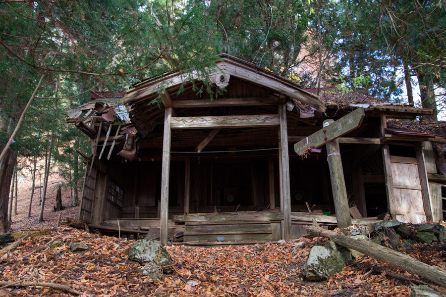
Mt. Tenso is wooded with little in the way of a view though there are plenty of flat spots to rest. It’s noteworthy however for its oddly sited shrine. Tensozan Shrine 長沢山神社 is apparently connected to the Tengaku Church in Yokohama. Traditionally from August 1st to 15th believers from this esoteric Shinto sect gather and climb up together. The Shrine entrance has a fine wooden gate and is bounded by a timber fence. Downhill from the shrine is their Kaisho 会所 or assembly hall now in a state of disrepair.
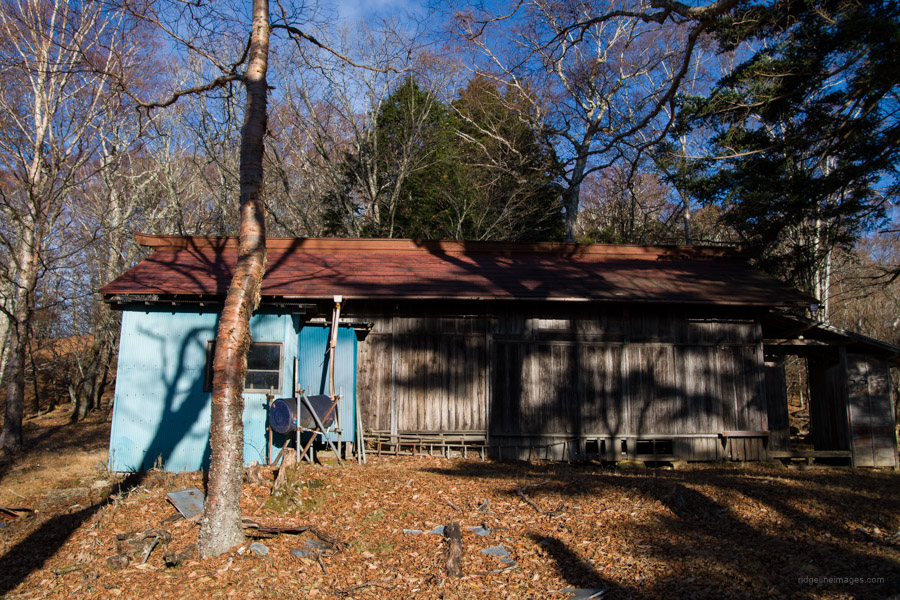
Time to brace yourself. From the Shrine to the bus stop entails over 1,100 metres of descent along what is known as the Tensozan Omotesando 天祖山表参道. The first part is quite rocky, and care is needed to avoid all manner of tripping hazards concealed under the leaf debris. Pink tape keeps you on the right track and rather convenient as there are more than a few interconnecting spurs to mess up your direction finding. About halfway is the Dainichi Okami 大日大神 another building on its last legs and seemingly linked to the same outfit.
The last landmark to watch out for is a weather station with a solar panel. This forewarns the final and at times precarious descent to the Hacho-bashi 八丁橋 trailhead. Take particular care as there is some exposure, and one dangerous area although rope is on hand to manage this gnarly section. Don’t rush it and you’ll be fine. From Hacho-bashi to the Higashi Nippara Bus Stop 東日原 allow around 50 minutes. Here you can take a bus to Okutama Station (27 mins, 480 yen).