.
Mawarime-daira 廻り目平 – Hacho-daira 八丁平 – Fujimidaira-goya 富士見平小屋
Distance: 14.7 km
Elevation change: 1062 metres
Highest point: 2418 metres
Start: Kawahake bus stop
Finish: Mizugaki-sansou bus stop
Difficulty: ▅▅▅▅▅▅▅▅▅▅ ❹
Map: Yama to Kogen Chizu 山と高原地図 [No.28 金峰山・甲武信 KINPU-SAN·KOBUSHI]
GPX TrackKML TrackGSI MAPPDF Topo Map
Venturing Deep into the Okuchichibu Mountains
The area surrounding Mt. Ogawayama, one of the 100 famous Yamanashi Mountains and westernmost mountain in Okuchichibu, consists of granite and has been a mecca for free climbing and bouldering since the 1980s. It is colloquially known as the Yosemite of Japan. This marks my fourth visit to Mawarime-daira, a picturesque campground that acts not only as a springboard to the aforementioned boulders and multi-pitch routes but also to the mountains that tower and jut along the border between Yamanashi and Nagano prefectures. Given the long travel time from Tokyo, it is recommended to spend a night at the Mawarime-daira before setting off for either an out-and-back or loop hike the next morning. Otherwise, as was done on this hike, traverse across the Fujimidaira-goya and head back to Tokyo the following day.
Day 1: A World Away from the Crowds at Mizugaki-san (13.3 km)
To pull off this traverse in a day requires catching the first Takao-bound train of the morning. For myself, this meant getting to my local station at 4:30 am. Train changes are required at Takao, Otsuki, Kofu, and Kobuchizawa. All going well, you’ll arrive at Shinano-Kawakami Station 信濃川上駅 at 8:27 am, which coincides nicely with the bus that departs outside the station 10 minutes later. Note that Shinano-Kawakami Station is still without an IC card reader, so you’ll need to prepare a regular paper ticket in advance. Take the bus to Kawahake 川端下 the final stop (40 minutes; 580 yen cash only). As one might expect on a weekday morning, I was the only passenger.
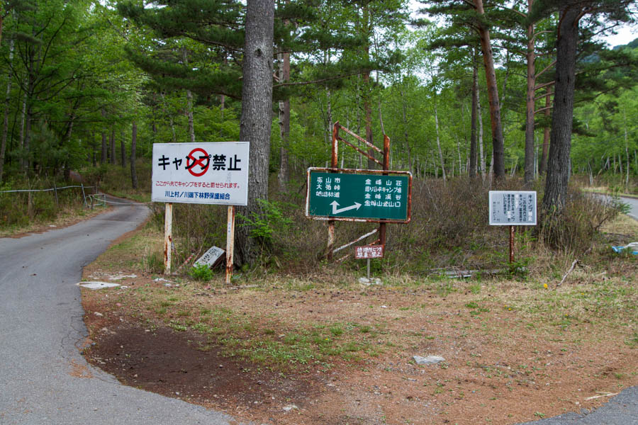
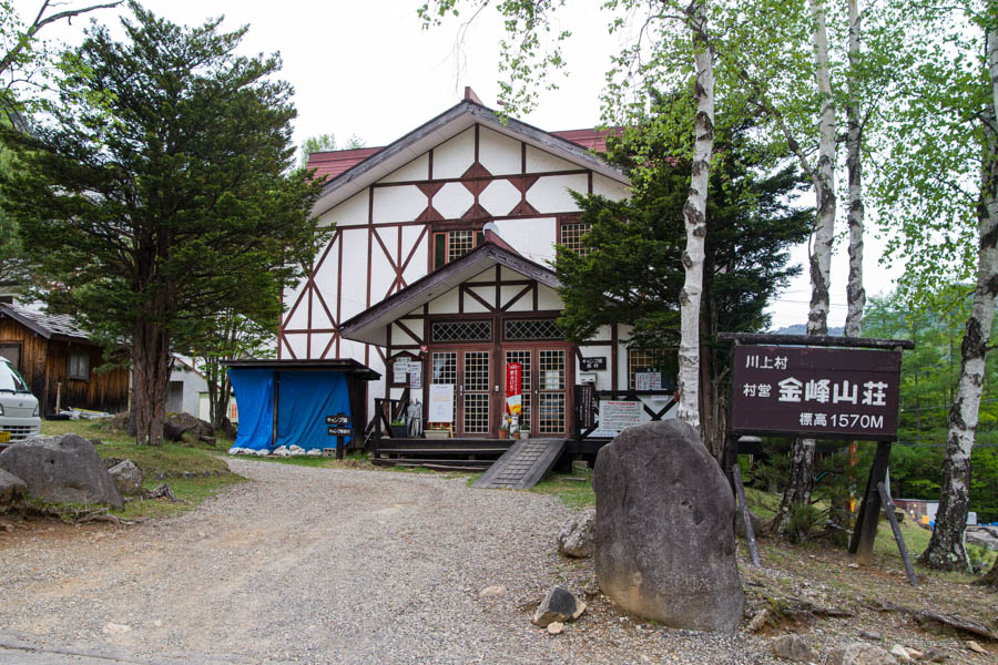
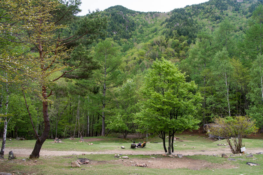
From the bus stop, turn right and mosey up the quiet back street. Turn left after about a kilometre onto a road that serves as the main thoroughfare to the Mt. Kinpo Villa 金峰山荘. Regarding naming conventions on the Nagano side, Mt. Kinpu is read as “Mt. Kinpo”, hence the Kinpo-sansou. The farmland that surrounds the craggy granite peaks is home to Japan’s richest farmers, with a median annual income of 25 million yen. Kawakami is considered Japan’s premier lettuce-producing village. A little further on, the road splits, so here, proceed right. To the left, the road winds its way up to Odarumi-toge 大弛峠 which I came down a couple of years ago on an aborted hike. From the bus stop to the Mawarime-daira Campground 廻り目平キャンプ場 it takes around an hour. It’s a very popular spot to camp, and for good reason, as it’s nestled in a particularly beautiful pocket nearby the Kinpu River.
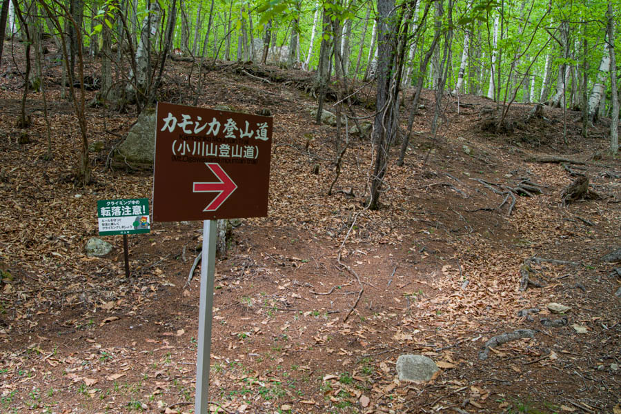
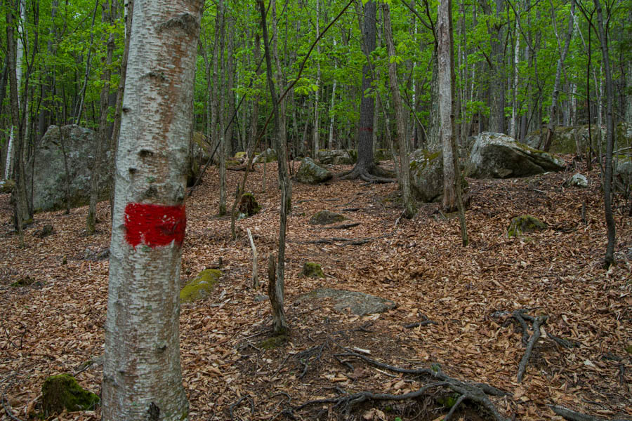
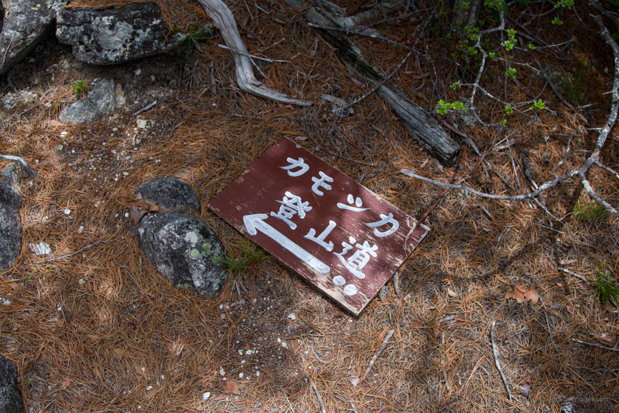
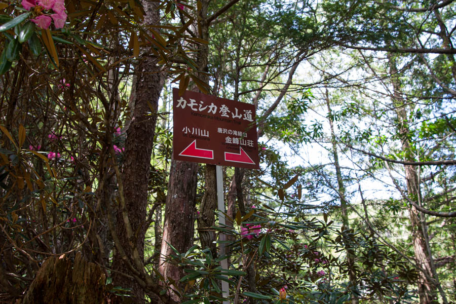
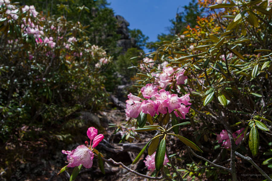
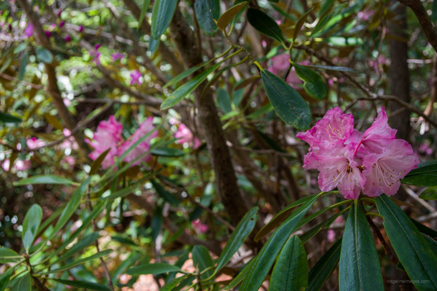
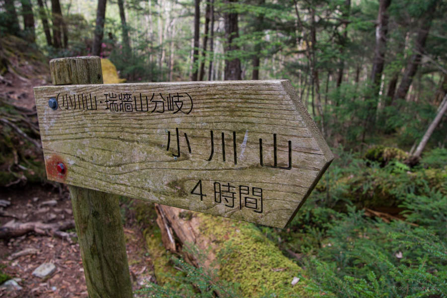
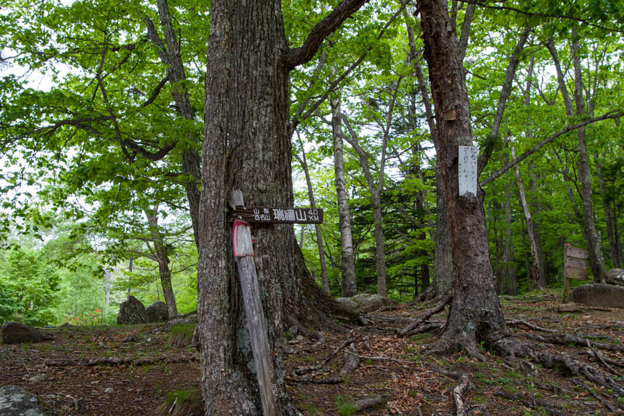
The trailhead proper is to the right of the road, which runs alongside the campground. Look for a brown sign: Kamoshika Mountain Trail カモシカ登山道. Next to it is a notice board stating it’s an advanced hiking course 上級コース and shouldn’t be undertaken lightly. The trail starts out gently through forest covered in Shirakaba (white birch) and Karamatsu (Japanese larch). A great time to undertake this hike is in late May and June when the pink and red Shakunage rhododendrons are in bloom.
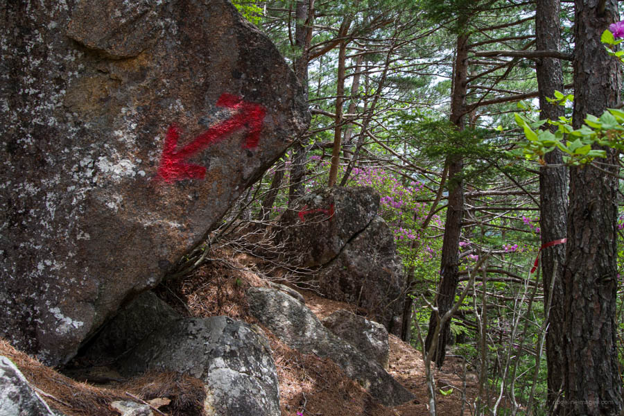
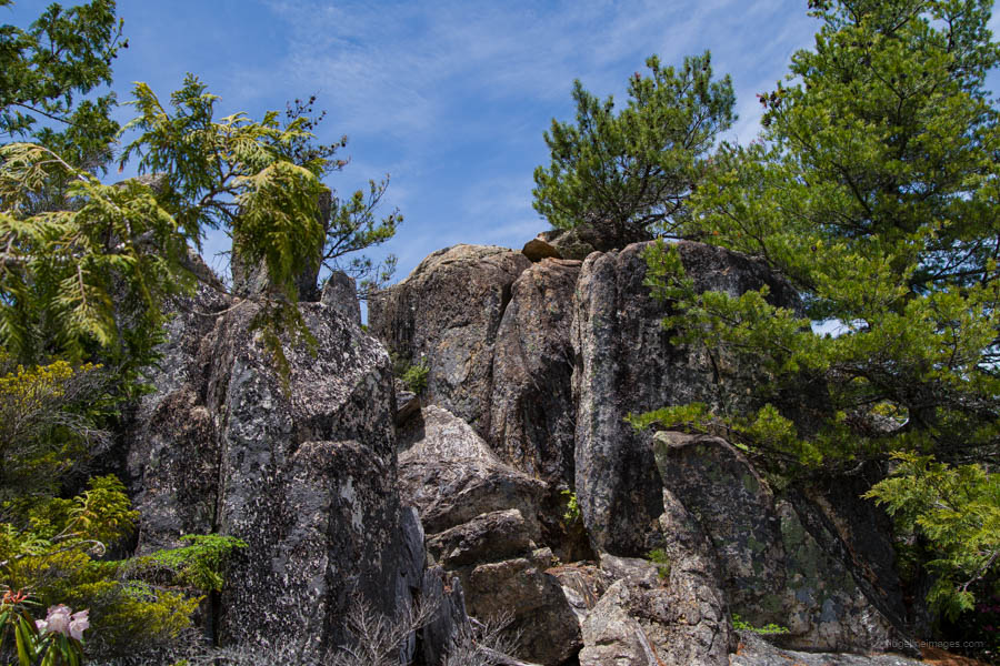
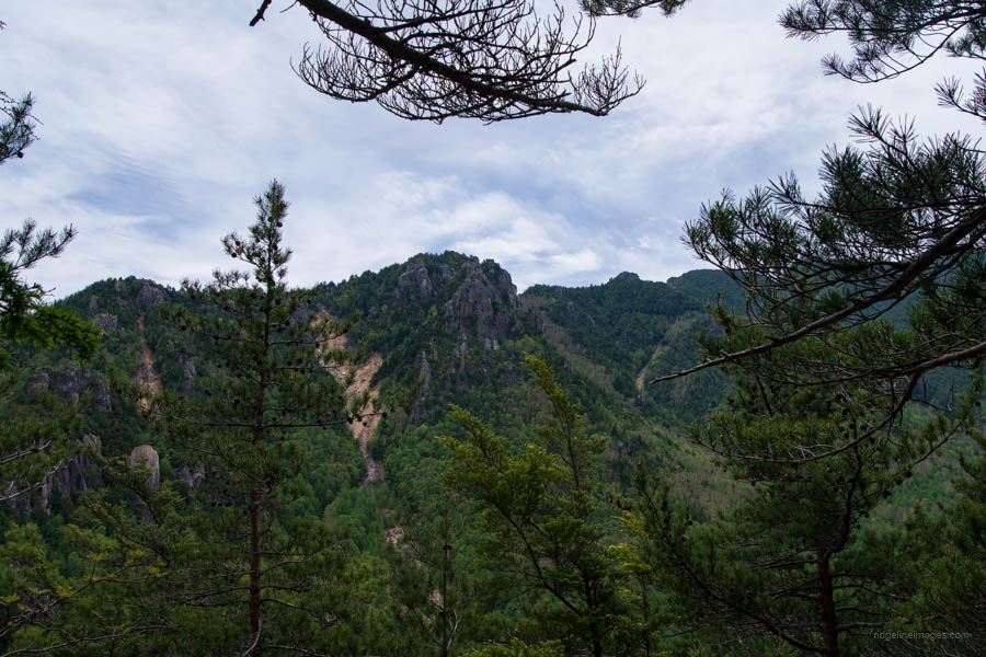
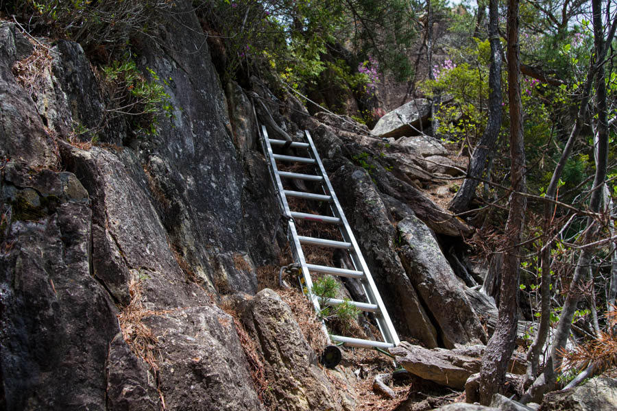
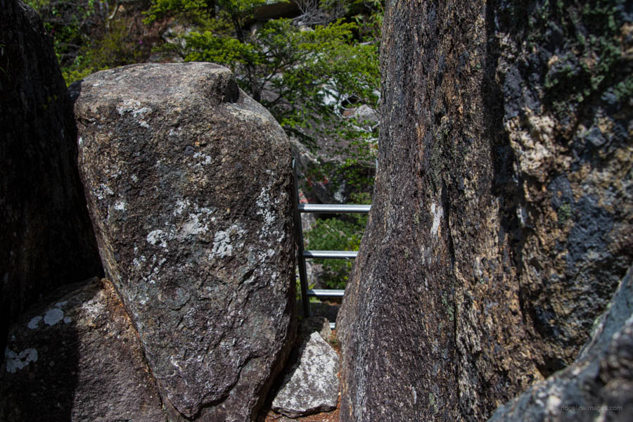
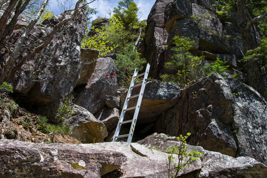
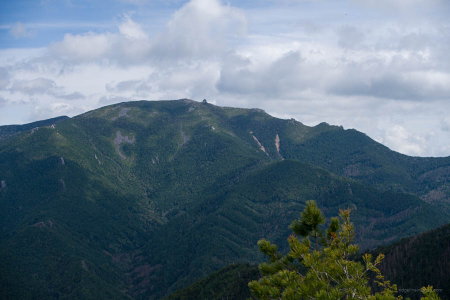
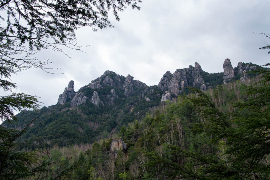
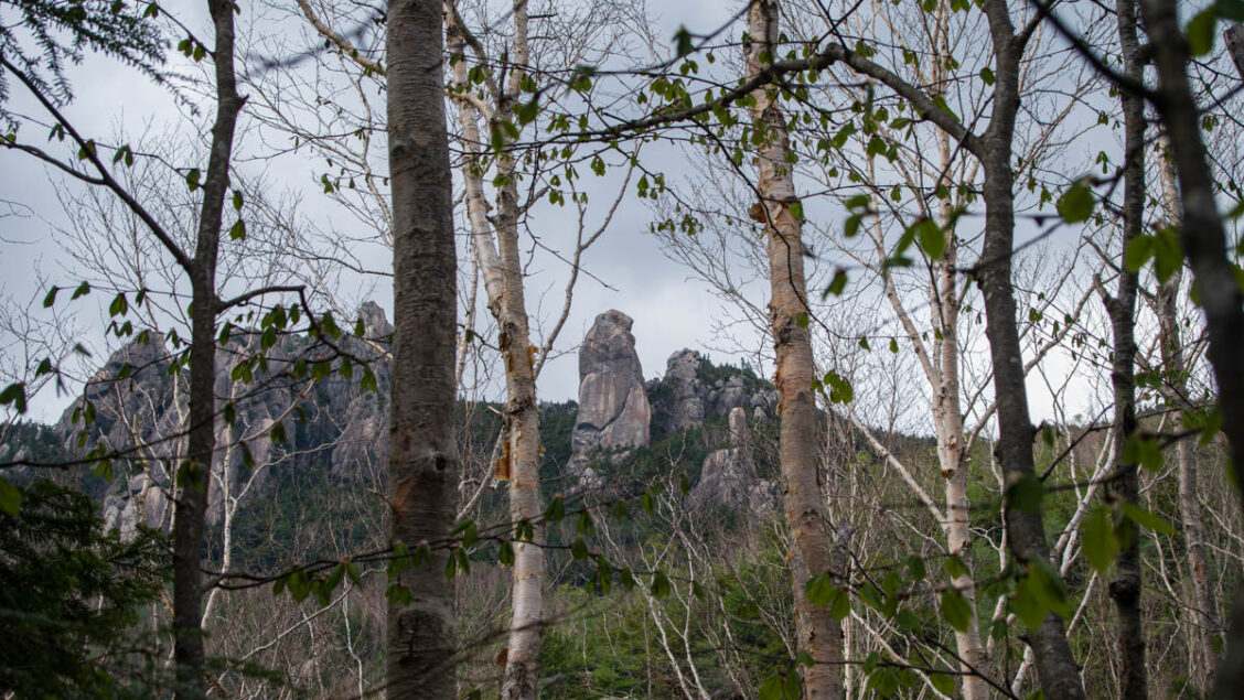
At various points, there are rocky outcrops providing sweeping views through the valley and surrounding mountains, such as Kinpu-san. Though for the most part the view is hemmed in by forest. After 45 minutes of climbing, there are a series of judiciously placed aluminium ladders to deal with two rock tiers. The area where Ogawayama is located is known as Ura-Mizugaki 裏瑞牆 and the climbing certainly bears a resemblance to Mt. Mizugaki, albeit with far fewer hikers. Over the entire day, I only met one other person. The trail is well marked with red arrows painted on rocks and pink tape, though beginners should be accompanied by someone more experienced.
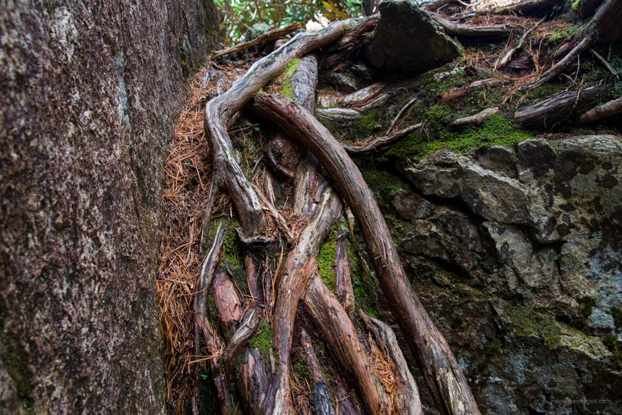
Soon thereafter, you’ll arrive at a junction. Veering right, one heads to the Karasawa Falls and back around to the Mawarime-daira Campground. If you are doing the hike in reverse, consider using this route for the descent. After passing the trail fork, there is a section of trail that has you moving upward on all fours. Next, the trail passes precariously close to a cliff face, though thankfully buoyed by trees. You also have to climb up some tree roots sandwiched between two large rocks. The view here soon opens up, with the summit of Ogawayama glimpsed in the distance. It’s worth mentioning that the entire route until you reach the turnoff for Mizugaki-san is denoted as a dotted line on the Yama to Kogen Chizu.
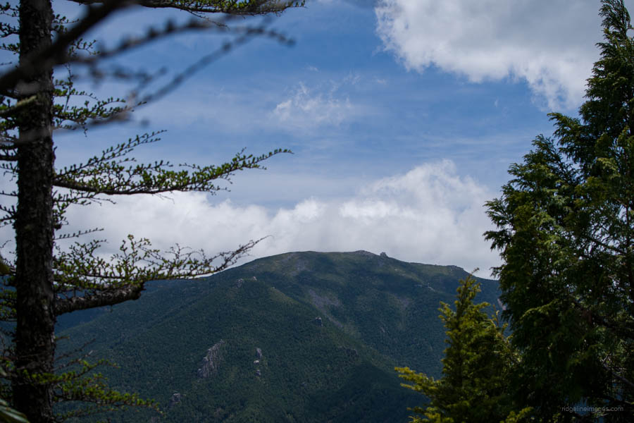
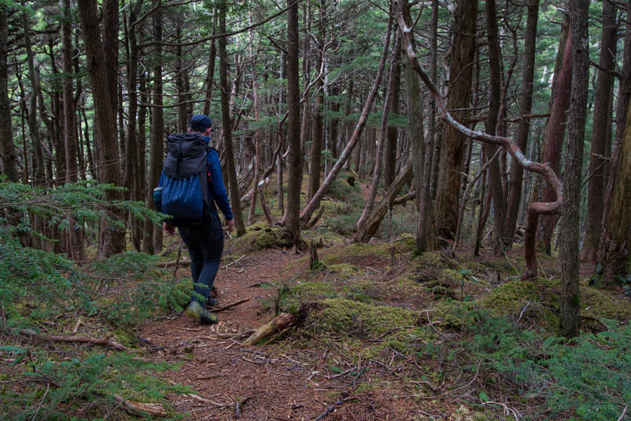
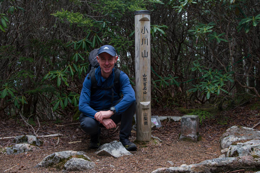
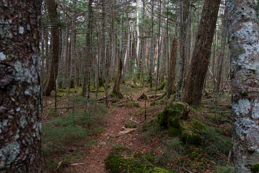
The trail descends to a saddle, and through a veritable tunnel of rhododendrons with their petals shining lavishly in the sunlight. Soon the understory shifts to a primordial mossy forest floor akin to Mt. Wanakurayama. As you push onward to Ogawayama 小川山 (2,418 m), the forest canopy becomes decidedly denser. The summit unfortunately affords no view and is a short detour off the main trail. In total, it should take around 3 hours from the trailhead to reach it. After having a well-deserved lunch, return to the trail branch and begin heading down in the direction of Mt. Kinpu.
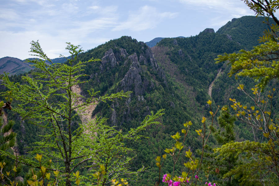
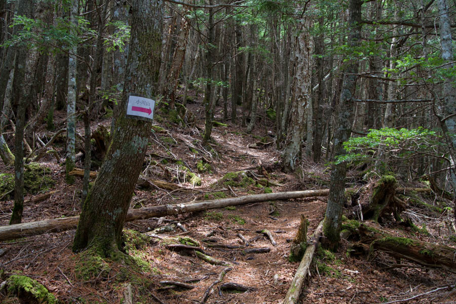
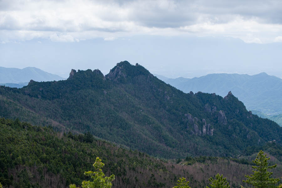
Unlike on the way up, which was regularly challenging, the trail that descends on the Yamanashi side is measured, and the moss-covered forest is easy to walk and follow. The view suddenly opens up with a superb panorama at Shiosabu シオサブ where you can clearly make out the Gojoseki upon Kinpu-san and the Dainichi Boulder straight ahead. The slightly less impressive obverse side of Mizugaki-san can also be seen. After passing the lookout, the trail continues its slow descent through the forest belt to Hacho-daira 八丁平.
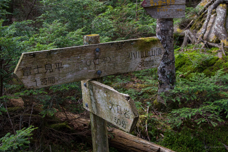
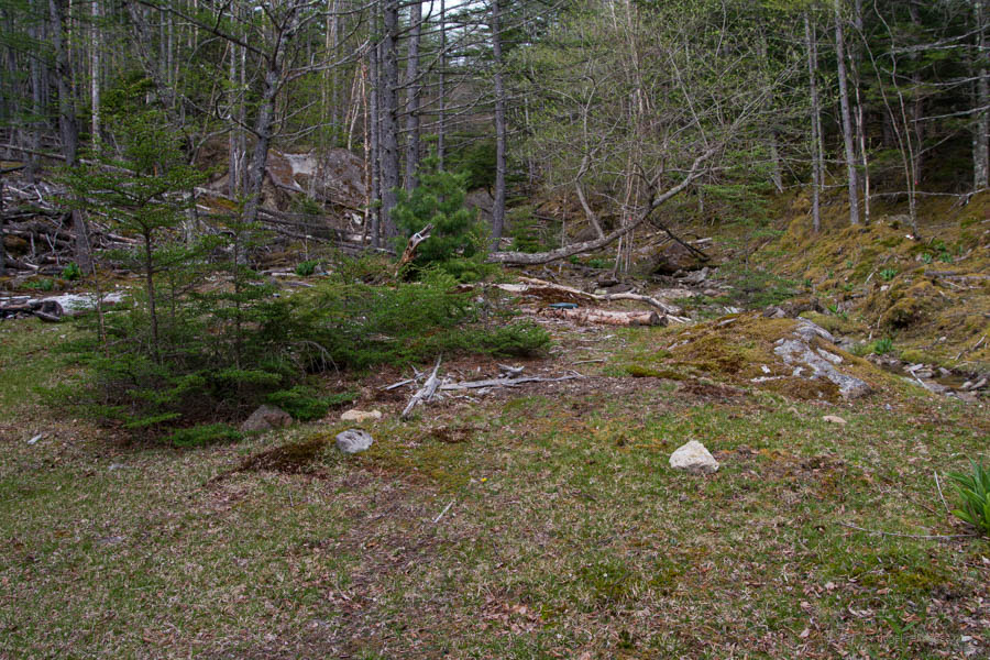
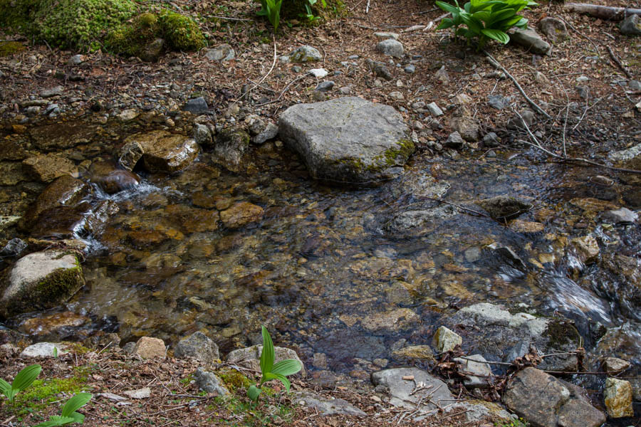
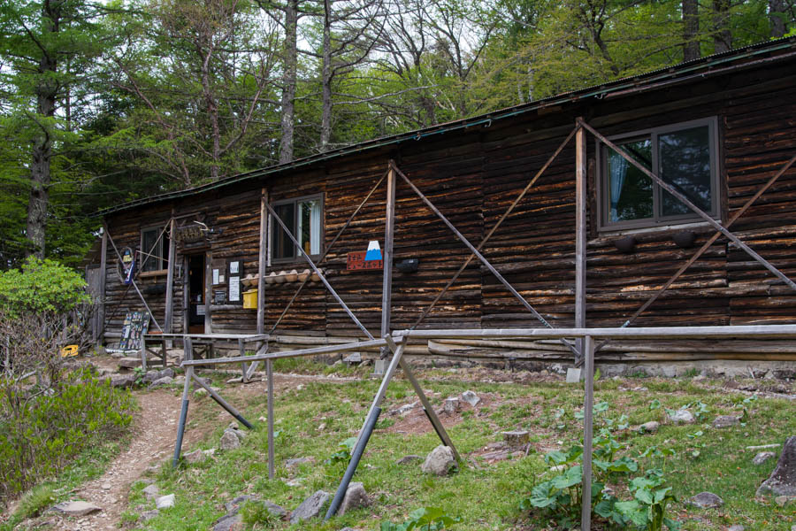
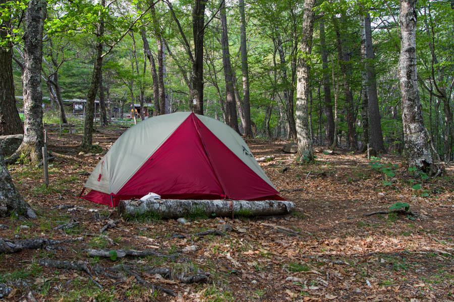
Swing right at the trail junction in the direction of Fujimidaira-goya 富士見平小屋. The trail soon passes over a very clear and beautiful stream next to a clearing, which would suffice as a makeshift campsite if you’re hiking later in the year when the daylight hours are shorter. To the right are the precipitous granite crags of Mizugaki-san. Around 40 minutes from Hacho-daira, the trail joins the Mt. Mizugaki trail. The dotted line ends here and is a standard mountain trail back to the charming Fujimidaira-goya campground (1,000 yen). Thanks to its location burrowed between Mt. Mizugaki and Mt. Kinpu, it is a sought-after location to camp. Cold and delicious water from a mizu-ba is also close at hand. If you’re doing this as a masochistic day hike, continue onto the bus stop to catch the final bus that departs at 3:20 pm on weekdays and 4:30 pm on weekends and public holidays; otherwise, find a nice spot to pitch your tent.
Day 2: Short Stroll to the Mizugaki-sansou (1.4 km)
The previous day must have completely worn me out, as after passing out at 7 pm I didn’t arise from the tent until after 6 am. Unfortunately, the first morning bus from Mizugaki-sansou 瑞牆山荘 doesn’t depart until 10:30 am on weekdays and an hour earlier on weekends, which at least affords you a leisurely breakfast. When you’re ready to head off, the 30-minute hike down to the bus stop commences on the trail that services the waterhole. The bus ride back to Nirasaki Station 韮崎駅 is relatively expensive (1 hour, 20 minutes; 2,100 yen).