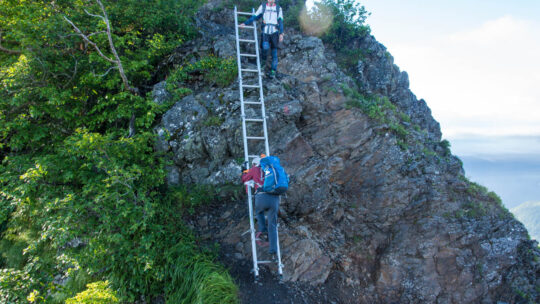
Hiked on Nov 3, 2022 . Mt. Yonezawa 米沢山 – Mt. Oboyama お坊山 – Ojika-toge 大鹿峠 Do not attempt this hike unless you have experience in route-finding and make sure you carry a topographic map and handheld GPS device. Duration: 7 hours Distance: 13.5...
Hiked on Nov 3, 2022 . Mt. Yonezawa 米沢山 – Mt. Oboyama お坊山 – Ojika-toge 大鹿峠 Do not attempt this hike unless you have experience in route-finding and make sure you carry a topographic map and handheld GPS device. Duration: 7 hours Distance: 13.5...
Hiked on Oct 29, 2022 . Mt. Ryugadake 竜ヶ岳 – Hashita-toge – 端足峠 – Mt. Amagadake 雨ヶ岳 Duration: 2 days Distance: 16.5 km Elevation change: 1154 metres Highest point: 1964 metres Start: Lake Motosu Iriguchi Bus Stop Finish: Asagiri Green...
Hiked on Sep 16, 2022 . Mt. Nishiyamatakatori 西山高取 – Koroyama-santaki 黒山三滝 – Koburi Pass 顔振峠 Duration: 6 hours Distance: 15.7 km Elevation change: 520 metres Highest point: 580 metres Start: Ogose Station (Tobu Ogose Line) Finish: Agano...
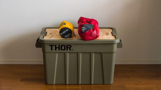
Choice Storage Container for your Backpacking Gear Hiking by its very nature almost guarantees that over time you’ll acquire a range of gear that requires a home when not stuffed in a backpack. Easier said than done, until you remember you live in...
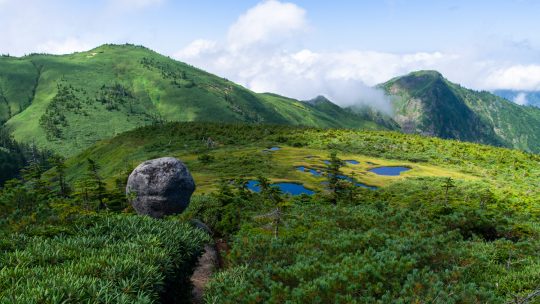
Hiked on Aug 22, 2022 . Mt. Shimodaikura 下台倉山 – Ikeno-dake 池ノ岳 – Tamago-ishi 玉子石 Duration: 12 hours Distance: 24.6 km Elevation change: 1326 metres Highest point: 2141 metres Start: Takanosu Kogen Campground Finish: Takanosu Kogen...
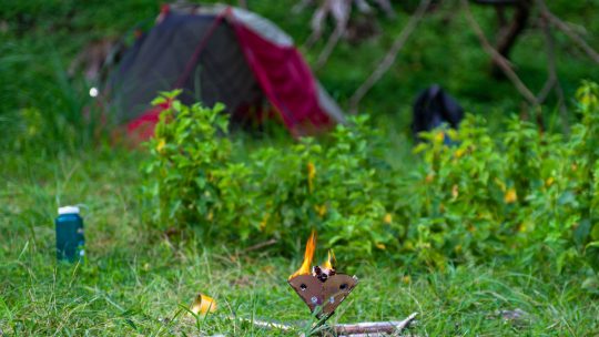
Spending 24 hours in Nature If one overnight summer camp and BBQ isn’t quite enough, you can always head back for more. That was the maxim I clung on to this week as I again sought refuge from the hustle, bustle, and heat of Tokyo. Camping at 1,000...
Hiked on Aug 7, 2022 . Hotaka-jinja 武尊神社 – Kengamine 剣ケ峰山 Duration: 7.5 hours Distance: 13 km Elevation change: 1058 metres Highest point: 2158 metres Start: Urami-no-taki carpark Finish: Urami-no-taki carpark Difficulty: ▅▅▅▅▅▅▅▅▅▅...
Hiked on Jul 25, 2022 . Hibara-toge 日原峠 – Dohyo-dake 土俵岳 – Koyuzuri-toge 小棡峠 Duration: 2 days Distance: 12.3 km Elevation change: 813 metres Highest point: 1098 metres Start: Shin Sannobashi Bridge Bus Stop Finish: Sanbongi Bus Stop ...
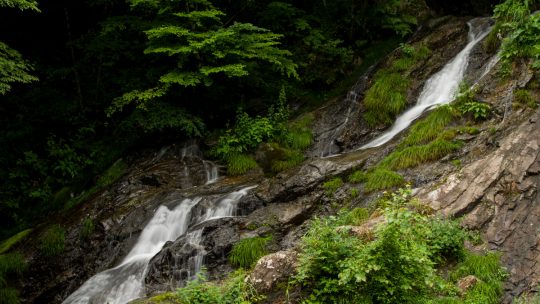
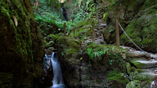
Hinohara Village ‘Takimeguri’ Waterfall Tour Continues This blog post continues my Hinohara Falls Tour Hinohara Takimeguri ひのはら滝めぐり a photographic journey of the 13 main waterfalls in Hinohara Village, Tokyo. Apart from the four waterfalls...
A Nature Fix Without Leaving the City With Tokyo in the grip of the worst June heatwave since 1875 means hiking nearer to the city will have to take a back seat thanks to the searing sun, sky-high temps, and pea-soup humidity. As I write, central...
Hiked on Jun 18, 2022 . Daimyojin Observation Deck 大明神展望台 – Lake Sagami 相模湖 The trail via Kenkyoji Temple has been repaired, and it is now possible to undertake the hike as a loop course, starting and finishing at the Sekrozan Iriguchi bus stop. ...
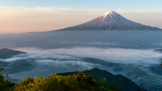
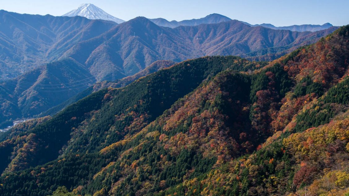
Hiked on May 24, 2022 . Jinzasan 神座山 – Mt.Shakagatake 釈迦ヶ岳 – Shindo Pass 新道峠 Duration: 2 days Distance: 18.4 km Elevation change: 1028 metres Highest point: 1793 metres Start: Himine jinja mae Bus Stop Finish: Kawaguchiko Natural Living...
Planning and Managing Risks on the Trail During my formative days hiking in Japan, I must confess I didn’t devote much time to planning my hikes even the overnight ones. My usual approach back then was print out a hike some random person posted on...
Hiked on May 5, 2022 Jul 3, 2022 . Nanahaneyama 七跳山 – Hinatadani-no-atama 日向谷ノ頭 – Toridaniyama Refuge Hut 酉谷山避難小屋 Duration: 2 days Distance: 30.4 km Elevation change: 1098 metres Highest point: 1718 metres Start: Higashi Nippara Bus...
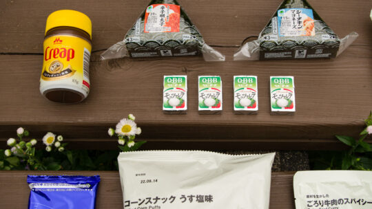
Backpacking Food Ideas and Meal Planning A common question I get is what food I pack for an overnight hike. The simple answer is foodstuffs that I enjoy eating and not too much as food is heavy. In stark contrast to my first overnight hike, when I...
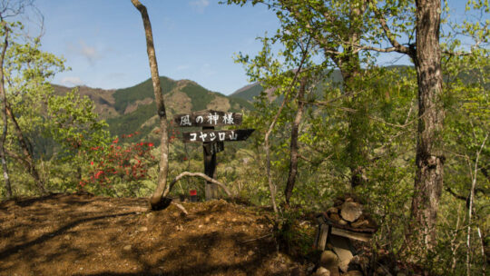
Hiked on Apr 19, 2022 . Kaze no Kamisama 風の神様 – Mt. Koyashiro コヤシロ山 – Mt. Minashi 実成山 Duration: 3 hours Distance: 8.5 km Elevation change: 402 metres Highest point: 609 metres Start: Arai Bus Stop Finish: Arai Bus Stop Difficulty: ...