.
Nishi Tanzawa Visitor Center 西丹沢ビジターセンター – Mt. Komotsurushi 菰釣山 – Mt. Takazasu 高指山
Distance: 23 km
Elevation change: 839 metres
Highest point: 1379 metres
Start: Nishi Tanzawa Visitor Center Bus Stop
Finish: Yamanakako Hirano Bus Stop
Difficulty: ▅▅▅▅▅▅▅▅▅▅ ❹
Map: Yama to Kogen Chizu 山と高原地図 [No.31 丹沢 TANZAWA]
GPX TrackKML TrackGSI MAPPDF Topo Map
West Tanzawa Longitudinal Traverse
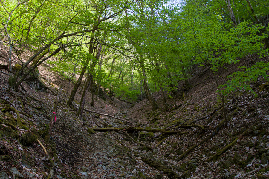
Mt. Azegamaru and Mt. Komatsurushi lie on the Koso Border Ridge, which forms the boundary between Kanagawa and Yamanashi prefectures. The area is covered in deep, almost unspoilt primeval beech forest, limpid streams, and stunning waterfalls. The best time to visit is from May to June, with the new green leaves. In contrast to Higashi Tanzawa (eastern), which offers good access and excellent views and sports the likes of Mt. Tonodake, Mt. Nabewari, and Mt. Hirugatake, the Nishi Tanzawa (western) area sees fewer visitors and requires long and, in some cases, multiple bus rides. The hike can be completed in one day, but to do so, you will need to be fit and fast, as the map time is over 10 hours. Most people would be better served by breaking up the hike and spending a night at the Komotsurushi Refuge Hut.
Day 1: Beech Forest, Limpid Streams, and Stunning Waterfalls (11.9 km)
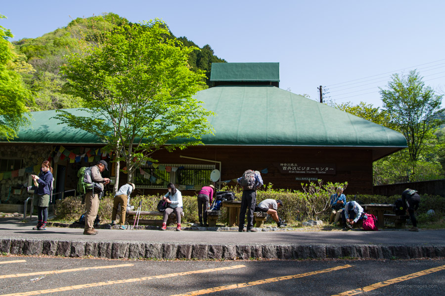
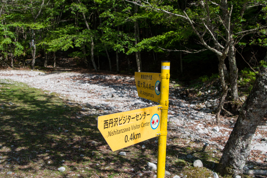
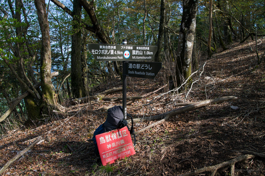
Access to the Nishi Tanzawa Visitor Center 西丹沢ビジターセンター, which marks the beginning of the hike, requires taking a bus from Shin-Matsuda Station 新松田駅 (71 minutes, 1360 yen) on the Odakyu Odawara Line. Aim for the first bus, which departs at 7:15 am from bus stop 1 outside the north exit. From Shin-Matsuda Station to the Nishi Tanzawa Visitor Center, the bus partially runs parallel to the JR Gotemba Line, with a stop at Yamakita Station. For those driving, there is a free parking lot at the Nishi Tanzawa Visitor Center, with an overflow car park available at a nearby campground for a fee.
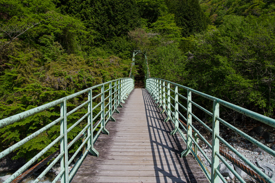
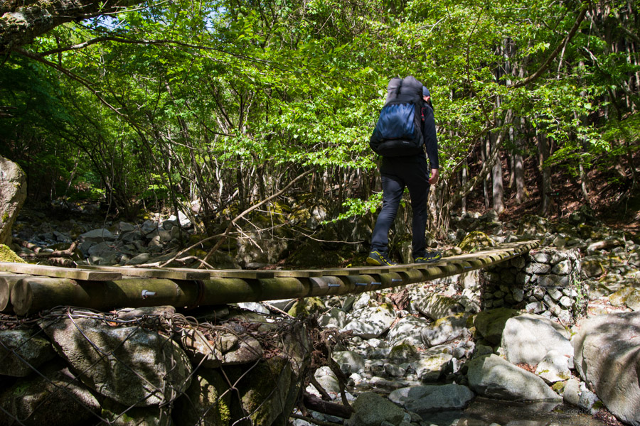
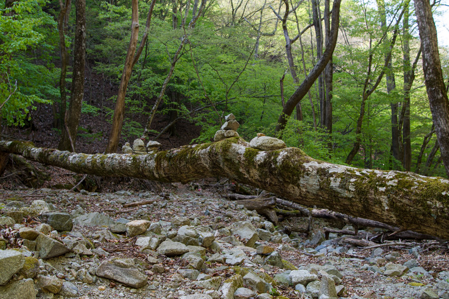
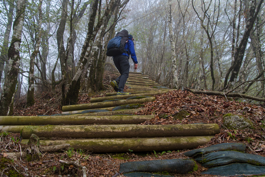
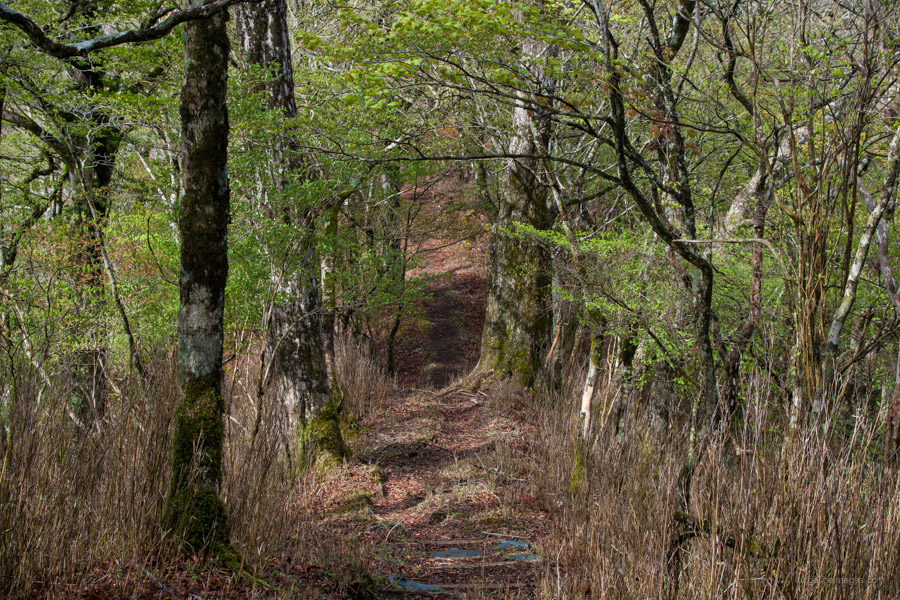
From the visitor center, cross the bridge, which spans a crystal-clear river. After dealing with a series of dam walls by way of steel staircases, there are a number of minor stream crossings with makeshift bridges. While the route as a whole is well signposted, it’s unclear at times on the first stretch to the waterfalls. After 40 minutes, you will reach the trail junction to Shimodana Falls 下棚の滝. The 40-metre-high falls are a 5-minute detour and well worth stopping by. At these falls, I met another hiker, and thanks to our engrossed conversation, we somehow managed to miss the nearby Hondana Falls 本棚の滝 which at 60 metres is the highest waterfall in Tanzawa.
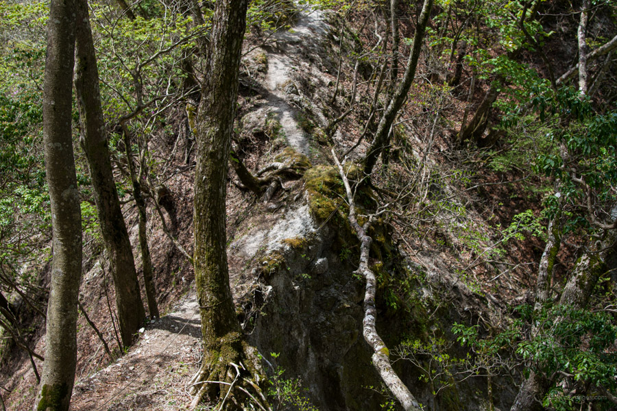
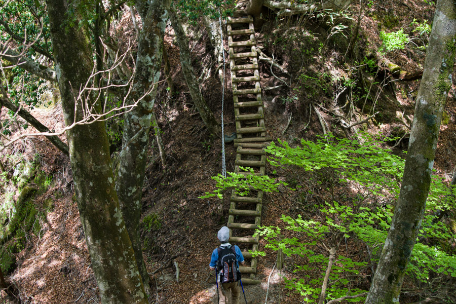
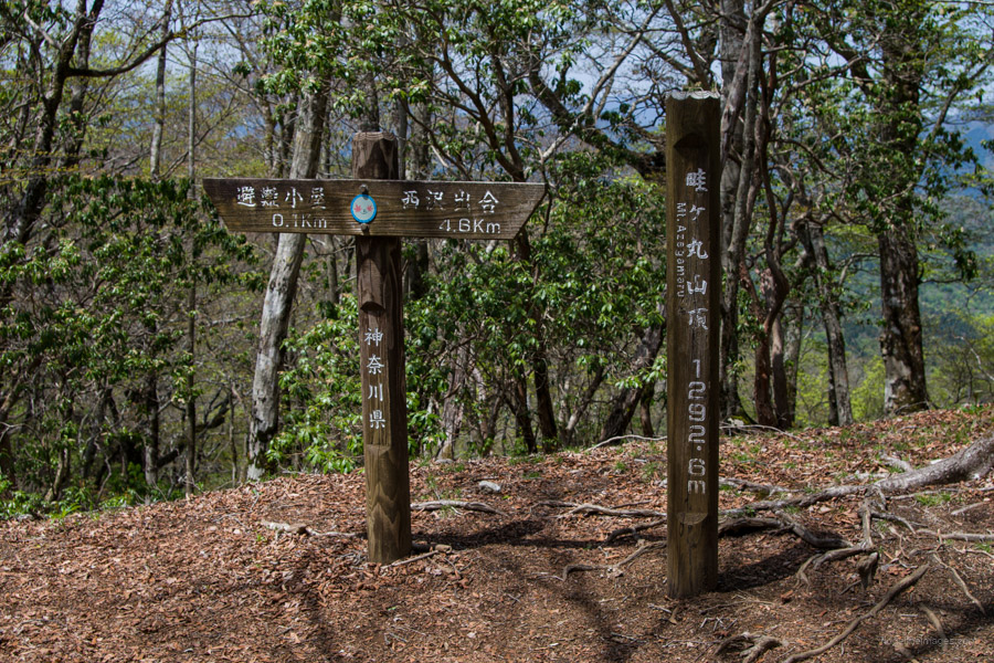
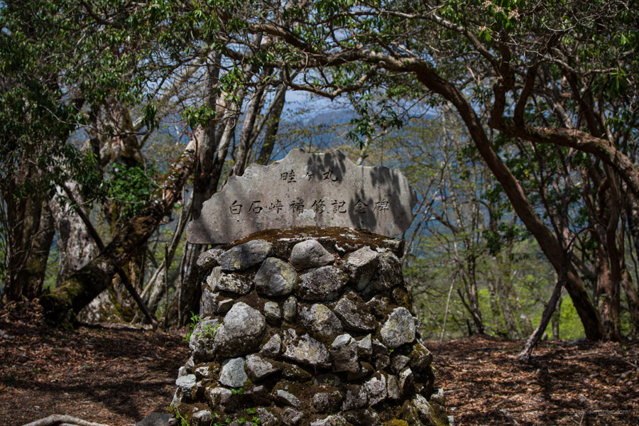
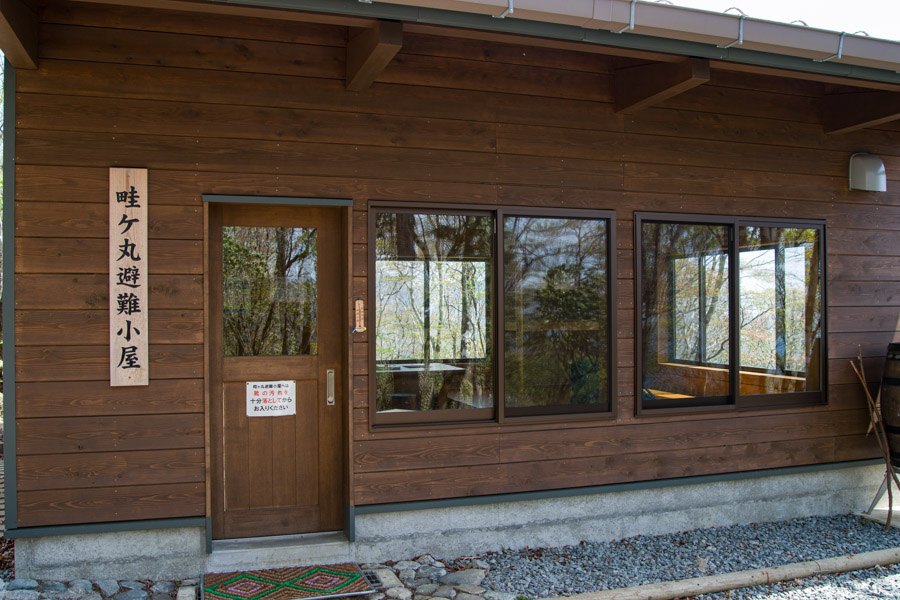
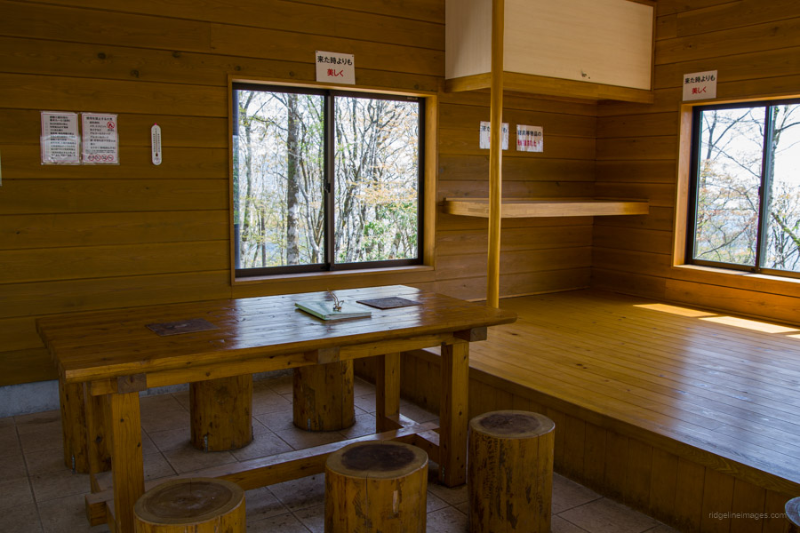
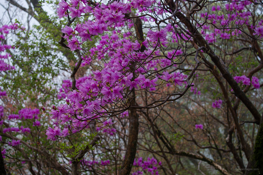
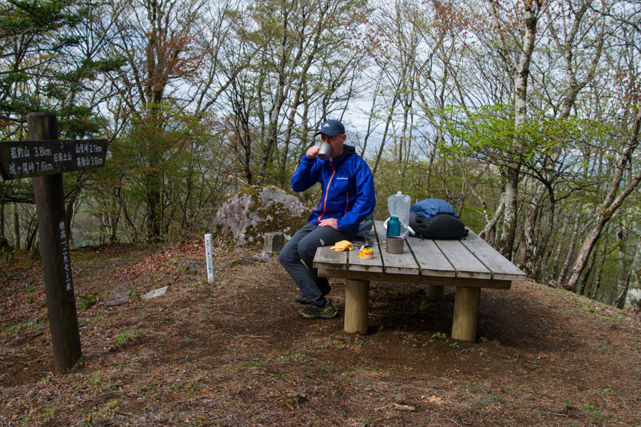
After lapping up the waterfalls, the real hiking kicks off in earnest with a steepish ascent to the viewless summit of Azegamaru 畦ヶ丸 (1,293 m). Take care passing by Zenroku-no-tawa 善六ノタワ the site of a fatal slip-and-fall accident. There is also a long wooden ladder that climbs up from a saddle. There are no particularly dangerous areas, though the wooden ladders are slippery when wet and pay heed to loose gravel underfoot during descents. A popular time to visit the summit is late May to early June, when the white flowers of the shiroyashio (azalea) are in bloom and before the onslaught of leech season from June through September. Lunch can be enjoyed on one of the rough-hewn benches or anywhere around the expansive summit. On the leeward side of the mountain finds the recently rebuilt and rather lovely Azegamaru Refuge Hut 畦ヶ丸避難小屋 which houses an adjoining toilet.
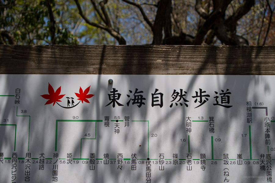
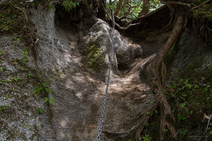
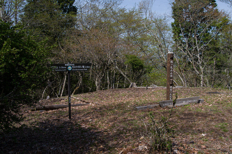
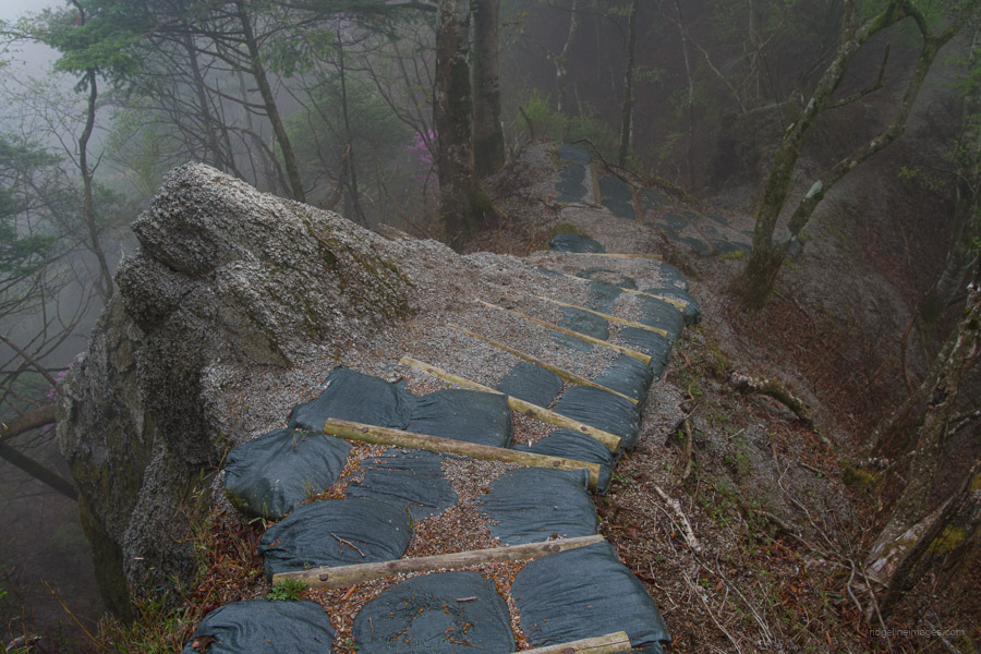
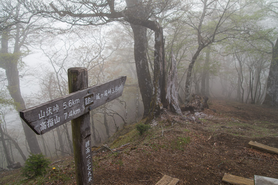
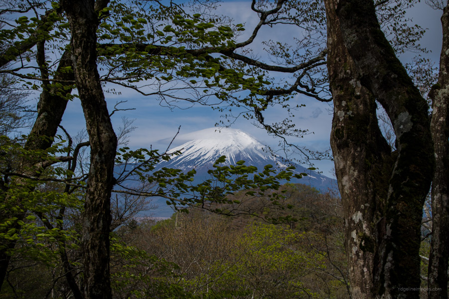
A reason the trail is so well-maintained and signposted is that it’s part of the long-distance Tokai Nature Trail 東海自然歩道. From Azegamaru the trail follows the Koso Border Ridge 甲相国境尾根. When you’re rested up, start heading in the direction of Morokubosawa-no-atama モロクボ沢ノ頭 a key trail branch. Along the way is a scree slope fixed with a chain and, if you’re lucky, a fleeting view of Fujisan. It should be mentioned that from here onwards, the route enters some of the most remote areas of Tanzawa. From Azegamaru to Mt. Takazasu, I only passed one other hiker. While there are places one can escape off the ridgeline on the Doshi side, the transport options are few and far between.
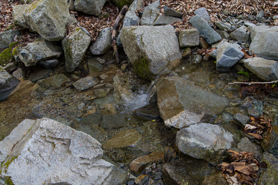
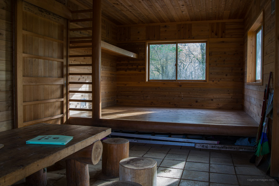
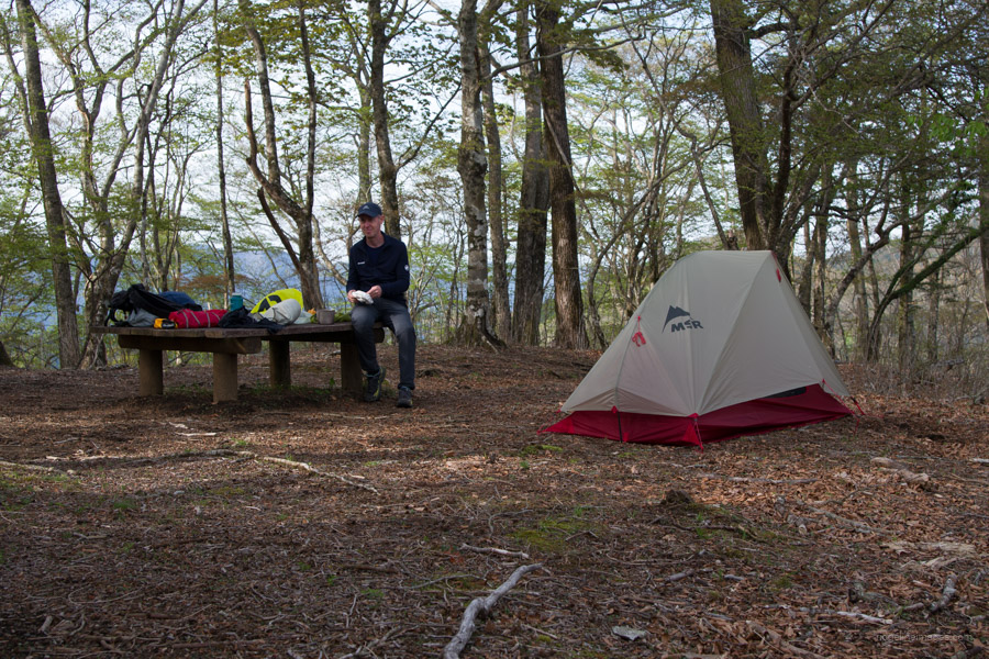
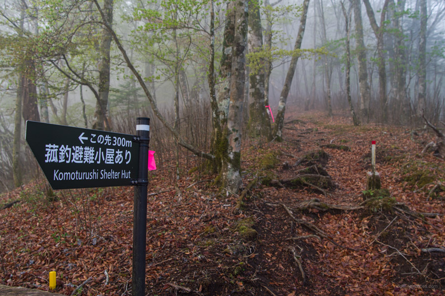
The final chore of the day before reaching the Komotsuriyama Refuge Hut is a water run from Bunasawanorikoshi ブナ沢乗越. Drop your pack at the junction and only carry your empty water bottles. A round-trip to the water source takes approximately 40 minutes and may not run in the wintertime. The clean and well cared for hut is 5 minutes from the trail junction. Alternatively, there is a flat area to the side of the hut to pitch a tent. The night I stayed there, there wasn’t anyone else, but based on entries in the log book, it appears to be used quite a bit.
Day 2: From Clouds and Mist to Fujisan Views (11.1 km)
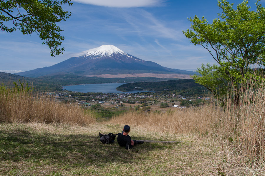
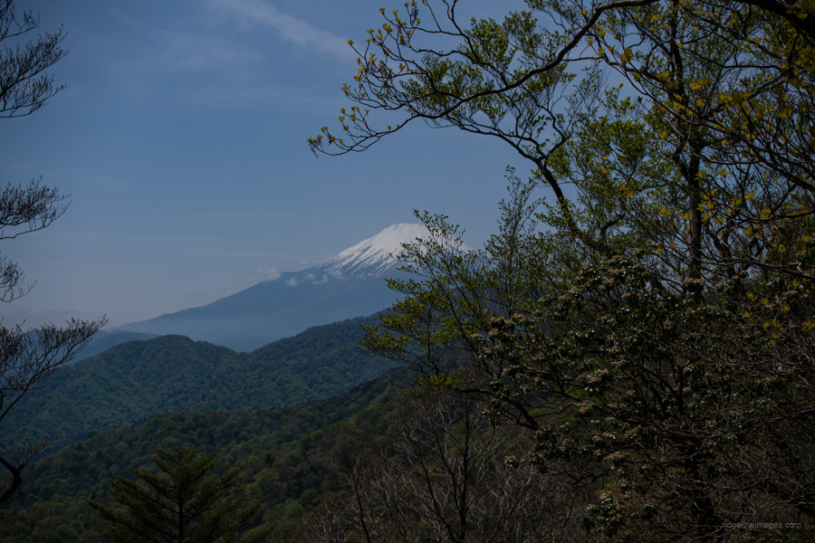
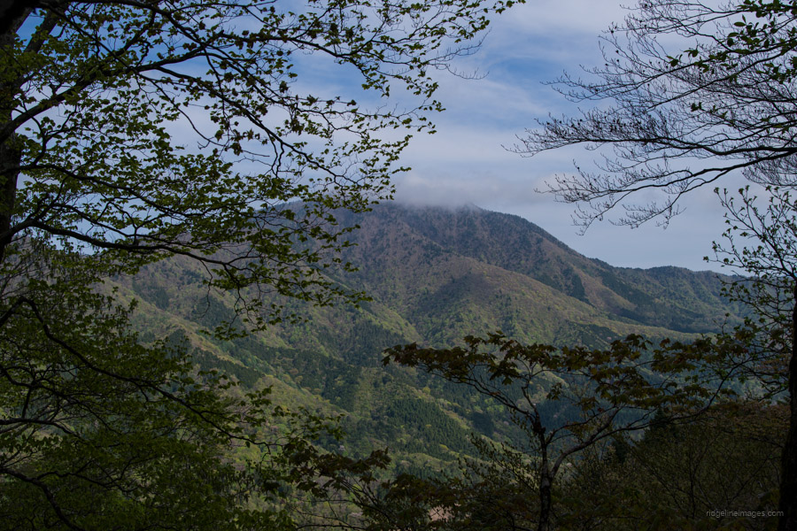
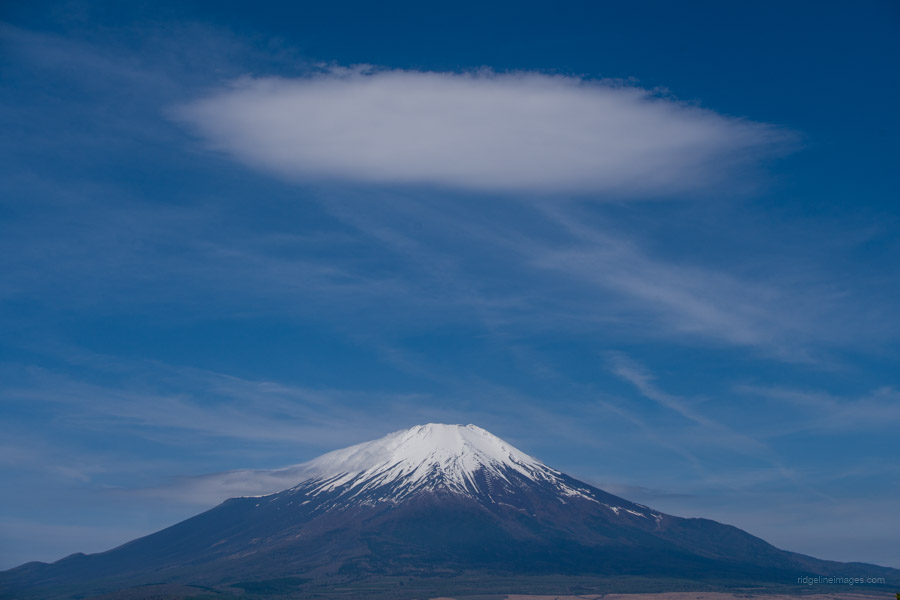
The fine evening weather predictably switched and it proceeded to rain much of the night. I ate breakfast in the tent but repacked everything inside the hut. From the refuge hut, it takes 25 minutes to reach Mt. Komotsurushi 菰釣山 (1,370 m). Ordinarily, the summit affords a generous view of Mt. Fuji and Lake Yamanaka, but I would have to put up with misty weather for the first part of the morning. As Mt. Komotsurushi is the highest point along the Koso Border Ridge, it’s basically downhill, notwithstanding a procession of ups and downs. Next, you pass the two ‘heads’ of Yusawa-no-atama 油沢ノ頭 and Mominokisawa-no-atama 樅ノ木沢の頭. I finally took a rest at Mt. Ishiyasu 石保土山 (1,297 m) after a couple of hours of hiking.
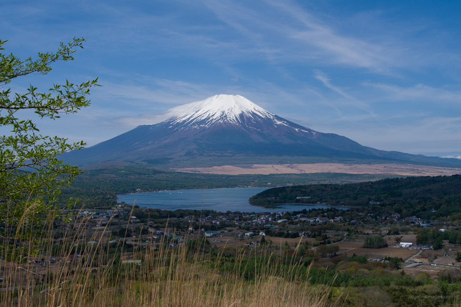
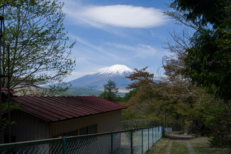
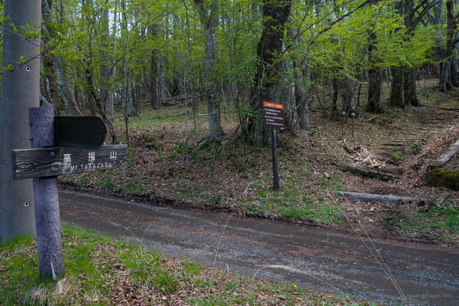
Up to this point, the ridgeline was swathed in clouds and mist until the sun eventually broke through and blue skies returned. Mt. Ishiyasu also marks the end of the gruelling undulations. After passing under the transmission tower, find the turnoff for Yamabushi-toge 山伏峠. From Yamabushi Pass, you can catch a connecting bus to the Yamanakako Hirano bus stop 山中湖平野 otherwise, continue on towards Fujimisaki-daira 富士岬平 and Mt. Takazasu 高指山 (1,174 m). In fine weather, Mt. Takazasu offers up an incredible view of Fujisan and Lake Yamanaka below. From Mt. Takasasu, it’s a 50-minute walk to the Yamanakako Hirano Bus Stop 162, where you can catch a bus to Mt. Fuji Station 富士山駅, 47 minutes, 810 yen, or Shinjuku (advanced booking required).


Great write up and pics as always David!
Thanks for reading Stefan 🙂
I did this hike back in late June of this year. First hike in Japan and it was a great experience. Highly recommend to bring water filtration gear or tablets because 3L and a bit lasted me about 3/4 of the hike. Mind you it was well over 30 degrees out when I did it. You live and you learn. Thanks for the write up and I have used your site for many hikes over the last few months.
Thanks for the comment, Adam.
Unfortunately, once you move away from the waterfalls, the only place to collect water is a rather lengthy effort from the Komotsuriyama Refuge Hut.