.
Oni-no-iwaya 鬼の岩屋 – Mt. Iwadono 岩殿山 – Yosuike 用水池
Distance: 7.7 km
Elevation change: 270 metres
Highest point: 634 metres
Start: Otsuki Station (JR Chuo Main Line)
Finish: Otsuki Station (JR Chuo Main Line)
Difficulty: ▅▅▅▅▅▅▅▅▅▅ ❶
Map: Yama to Kogen Chizu 山と高原地図 [No.29 高尾・陣馬 TAKAO·JINBA]
GPX TrackKML TrackGSI MAPPDF Topo Map
A Mighty View from a Towering Cliff Face
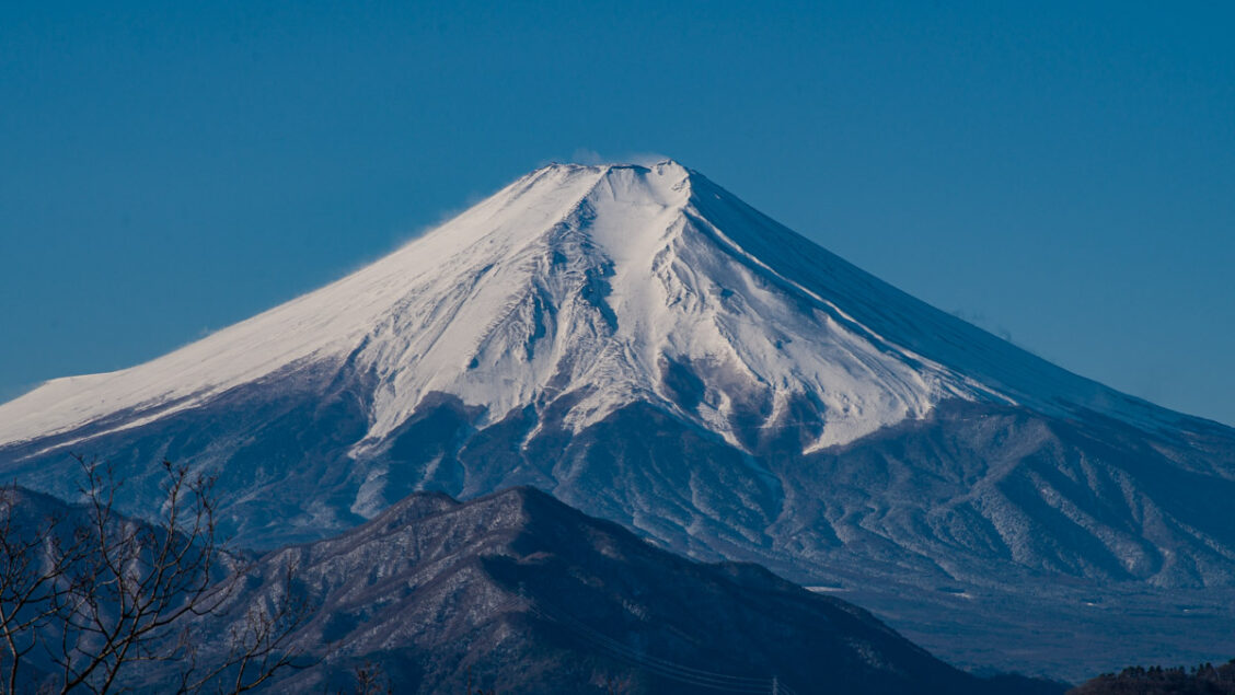
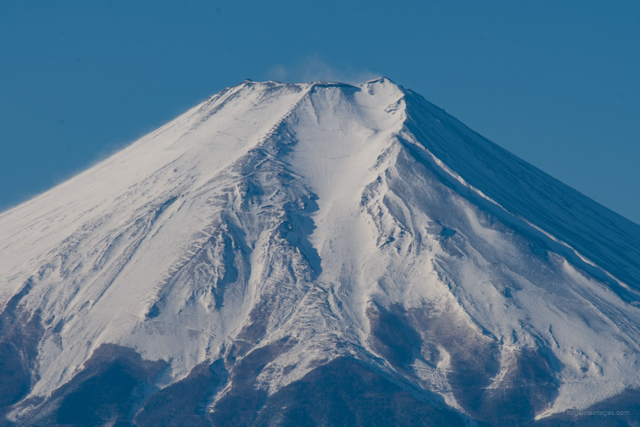
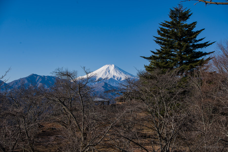
Mt. Iwadono has a few things going for it: historical roots, excellent access right next to Otsuki Station, and a prodigious view of Mt. Fuji in clear weather. It is also recognised as one of the 100 famous mountains in Yamanashi. Traveling by train through Otsuki Station, it’s hard to miss its impressive rock face. From the station to the summit, it takes a little over an hour, making it suitable for beginners as well as families.
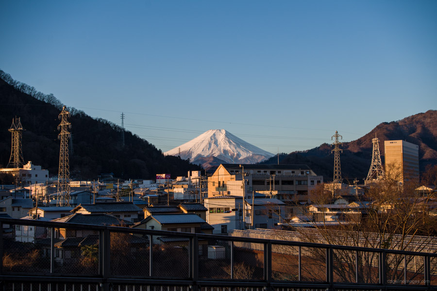
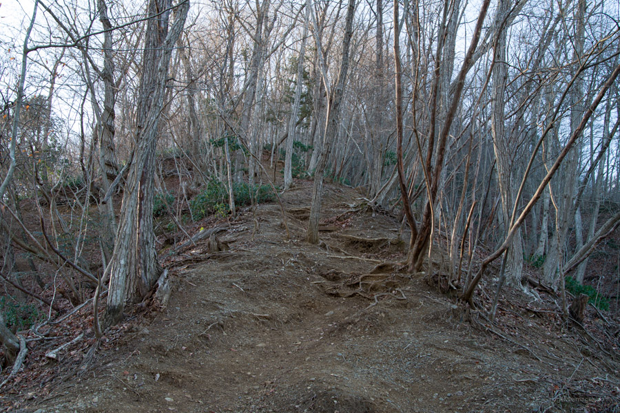
Access-wise, you’re looking at 1 hour, 45 minutes (1,340 yen) from Shinjuku Station to Otsuki Station 大月駅 on the JR Chuo Main Line. After exiting the ticket gate, turn left and walk along the street lined with shops. Cross the train line and turn left at the Tokyo Electric Power Company (TEPCO) building, which takes you across a bridge and onto National Route 139. The old Iwadonosan parking area is on your left. Typhoon Hagibis in 2019 damaged the previous trail via the Kagami-iwa 鏡岩. Walking up the steps of the former trail, however, affords a nice view of Fujisan. The new Hatakura trailhead 畑倉登山口 is a further 20-minute walk from here just past the ‘Driving school’ bus stop.
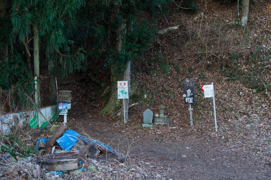
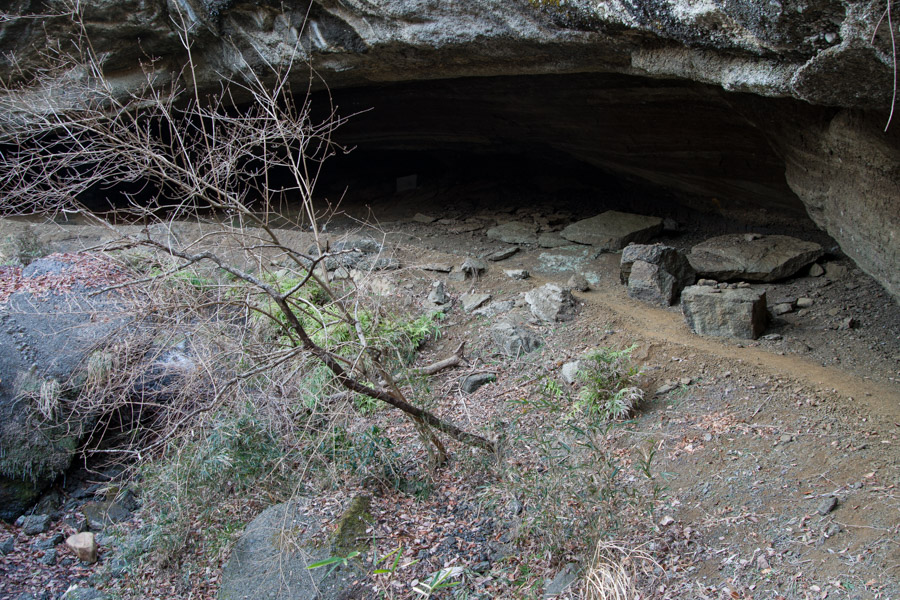
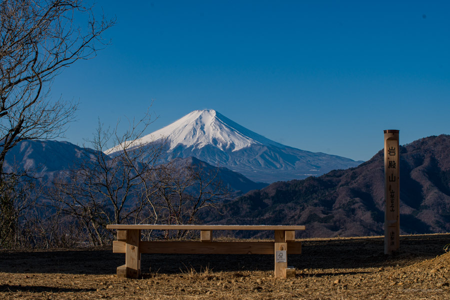
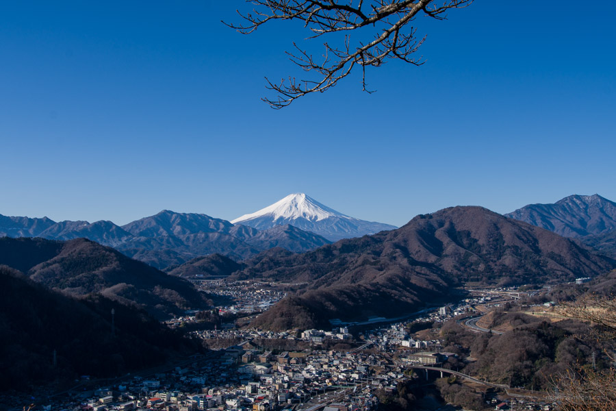
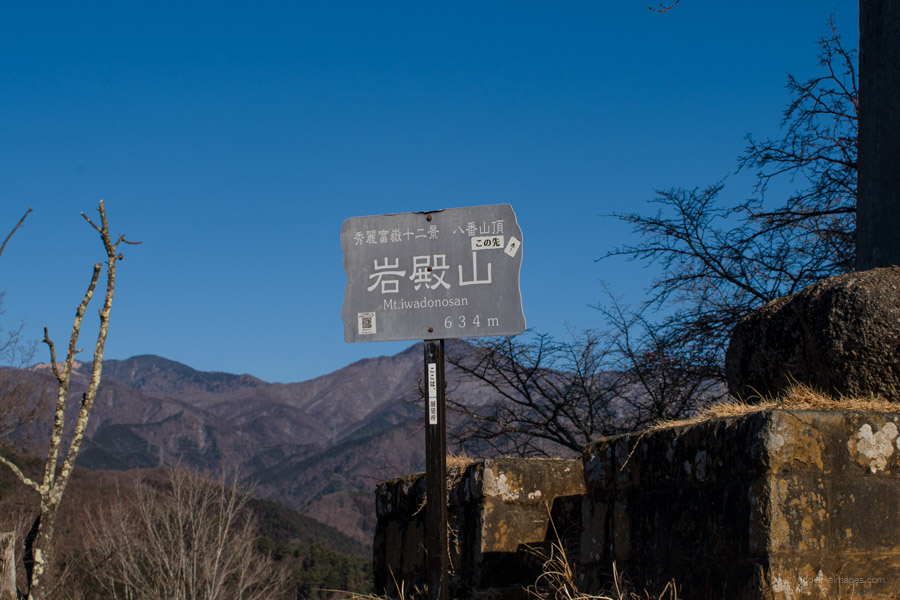
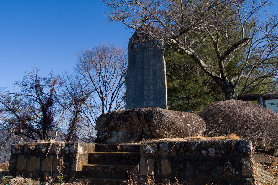
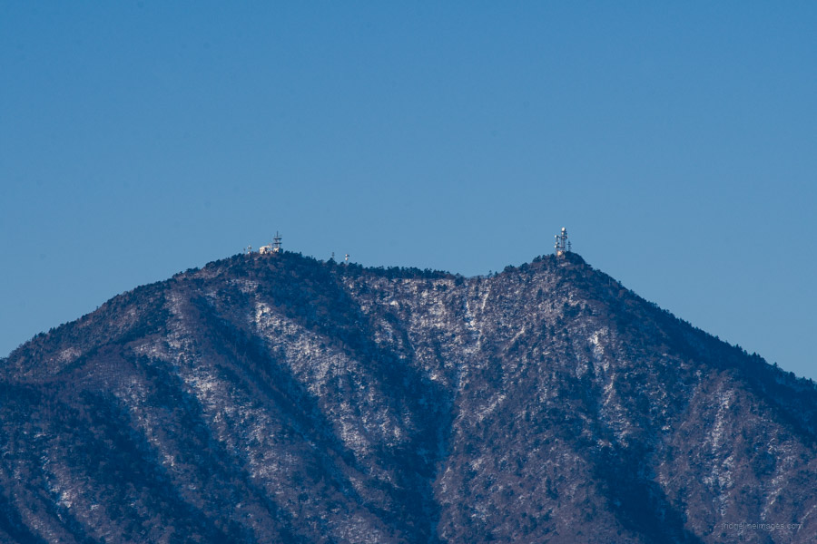
A short distance from the trailhead finds a junction. Turn left for the Oni-no-iwaya 鬼の岩屋, a limestone cave where the ogre of Mt. Iwadono lived. It is usually hidden behind the waterfall, but in winter, when the waterfall freezes, the entrance to the cave can be fully seen. From the cave, it’s about a 30-minute hike to the summit. Halfway up the trail, it steepens, and the gravel surface underfoot makes it hard to get traction at times. At an altitude of 634 metres Iwadonosan 岩殿山 is the same height as the Tokyo Skytree, and the unobstructed view of Mt. Fuji is spectacular. During the Warring States period of 1467–1568 CE, the Iwadono Castle 岩殿城 was built here and guarded the border regions of Kai (present-day Yamanashi), Sagami, and Musashi provinces. Prior to that, it was the site of a famous thirteenth-century Buddhist temple complex known as the Iwadono Gongen 岩殿権現.
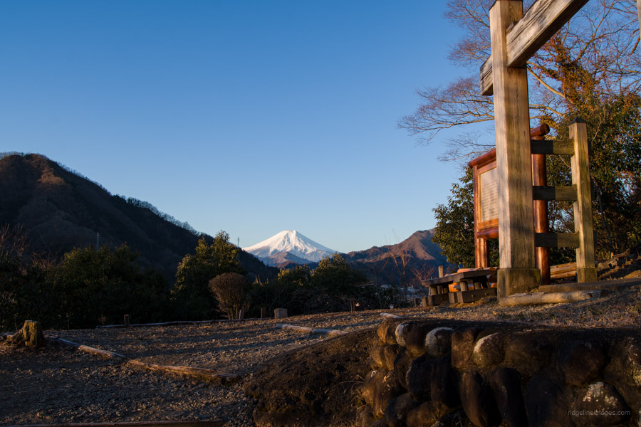
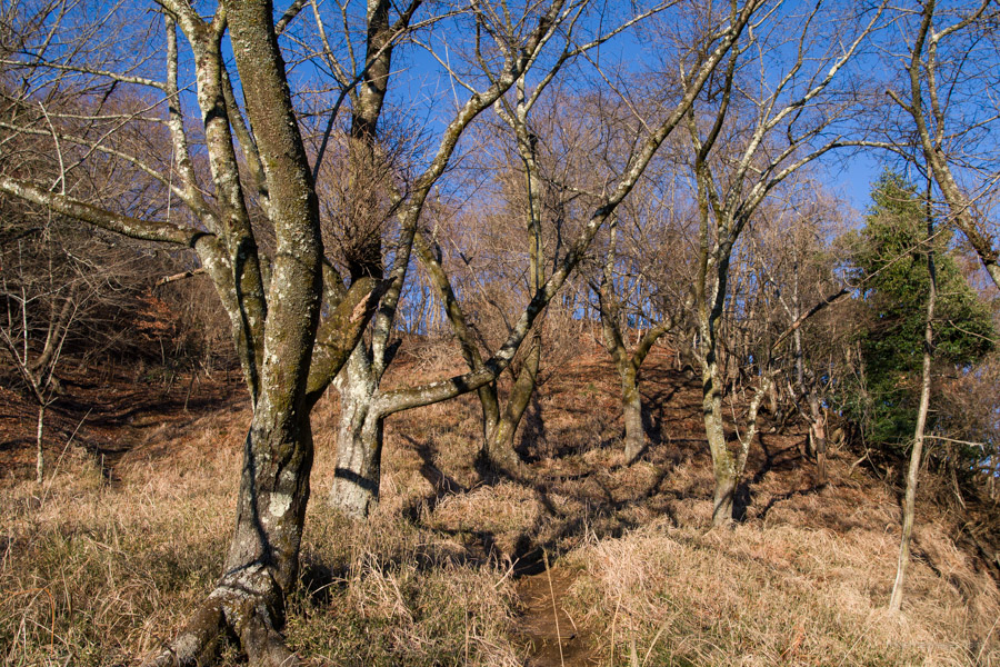
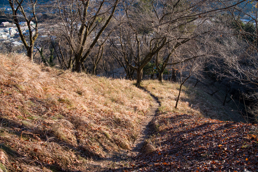
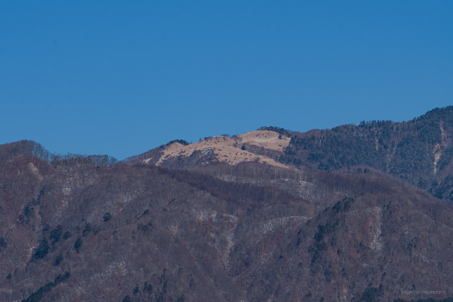
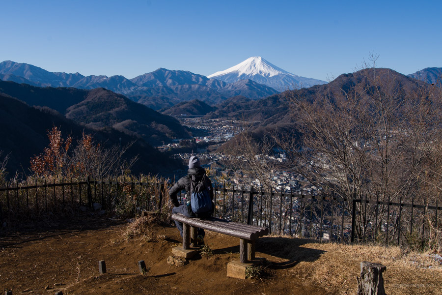
An equally impressive panorama of Fujisan can also be had from an observation spot just down from the summit, past an area known as Yosuike 用水池. To the north-west, you can make out Shirayanomaru, a picturesque open grassland reminiscent of a high alpine pasture. After soaking up the views, it’s simply a matter of retracing your steps all the way back to Otsuki Station. For those looking for something more, the hike can be extended to the nearby Chigootoshi 稚児落とし and Mt. Tenjin 天神山. Be warned, though: to climb these peaks, you will need to negotiate some fixed chains. Look out for a future installment when I challenge the full-loop course in the coming months.


Nice write-up. Next you time you go try the regular route up which has fixed chains and a couple of fun little scrambles.
Cheers for that. Yes, I will. The view from the top was much better than I had expected.
Another excellent writeup.
This place is beautiful kouyo too.
Pity the old route via the large rock-face got damaged a few years ago and is out of bounds now.
That’s what I was thinking—to return and do the loop course in the fall. Yes, the detour around to the trailhead on the opposite side of the mountain isn’t the best.
I’ve done it several times since it was out of bounds following Typhoon Haggis and it’s fine – there’s no danger anywhere. Always a fun day out and cracking views of Mt,Fuji. If you’re into these scrambler types then Okukuji Nantai up in Daigo, Ibaraki (健脚コース) is well worth a crack.
That’s a nice one to bag! Every time you go out on the Chuo Line you can see it.
And might I say a very easy one. Though it’s well worth climbing if the weather cooperates.
Yeah, I agree.
I did that one day after climbing something else in the area. I was glad to have the chance because it has always looked so cool from Koshu Kaido or from the train.
Great views of Mt Fuji – a classic north profile. What about a post that compiled a list of “great viewpoints for Mt Fuji”, which could then link into all these individual hikes that lead to such viewpoints? This would be great resource for would-be Okada Koyo types ….
That is a fine idea, PH! I think I have enough great viewpoints now to make it work. I’ll give some thought to how best to present such a post. Thanks also for the heads-up about Okada Koyo. He captured some real beauties of the big fella.
Hi David, looks nice but any tips for combining / extending it to make it more worth the long journey? My general rule of thumb is the hike should always be longer than the round trip travel to get to it!
I tend to agree with you about hike length and travel time. As I mention in the writeup, the hike can be extended to nearby Chigootoshi and Mt. Tenjin, where you can then loop around and head back to Otsuki Station. Doing this should extend the hike to around 4.5 hours.
Great, I should have read more properly! Will give that a go tomorrow 🙂