.
Mt. Hizure-kongozan 日連金剛山 – Mt. Yasaka 八坂山 – Mt. Takara 宝山
Distance: 10.4 km
Elevation change: 297 metres
Highest point: 460 metres
Start: Fujino Station (Chuo Main Line)
Finish: Fujino Station (Chuo Main Line)
Difficulty: ▅▅▅▅▅▅▅▅▅▅ ❷
Map: Yama to Kogen Chizu 山と高原地図 [No.29 高尾・陣馬 TAKAO·JINBA]
GPX TrackKML TrackGSI MAPPDF Topo Map
Half Day Hike Through the Low-lying Hizure Alps
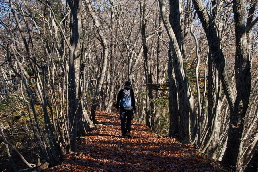
The Hizure Alps 日連アルプス is a general term for a band of mountains with an altitude of 300 to 400 metres located in Sagamihara City, Kanagawa Prefecture close by Fujino Station. A loop course starting and finishing at Fujino Station with a detour to Mt. Hachioka takes 3 to 4 hours making it suitable for hikers of all abilities. While there is almost no view from the highest point a nice outlook can be had from Mt. Mine and for the most part the hike stays in mixed species-woodland. The two hazards to watch out for are land leeches yama-hiru in the warmer months and piles of slippery leaf debris in the autumn.
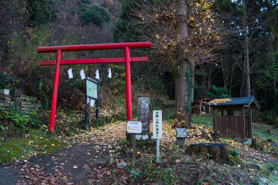
From Shinjuku Station, take the JR Chuo Line to Takao Station where you can change to an Otsuki or Kofu bound train and get off at Fujino Station 藤野駅 – two stops from Takao Station (1 hr 10 mins, 990 yen). Leaving by the only exit, walk down the steps, turn left at the main road then right shortly thereafter. After crossing the Hizure Bridge that marks the confluence of the Akiyama and Sagami rivers the trailhead proper is on your left a further 500 metres at the side of a red torii gate. The walk from the station takes around 20 minutes. Technically it’s also possible to ride a bus from Fujino Station to the nearest bus stop at Kongozan 金剛山 (3 mins, 180 yen). The first morning bus departs at 8:08 am.
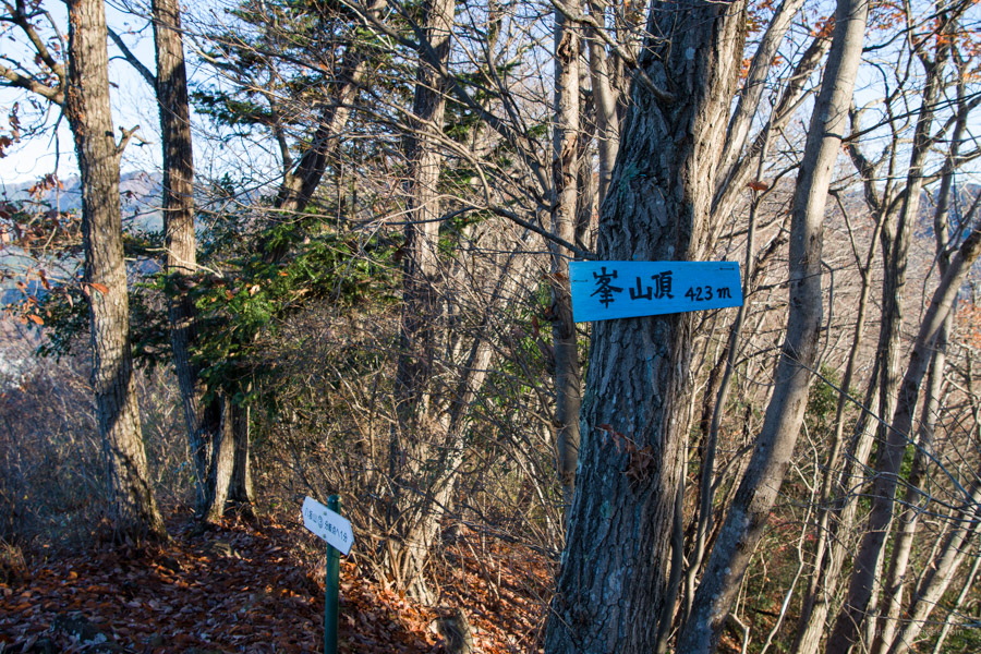
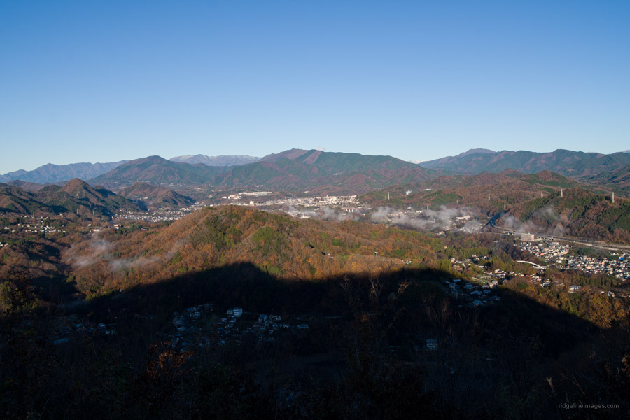
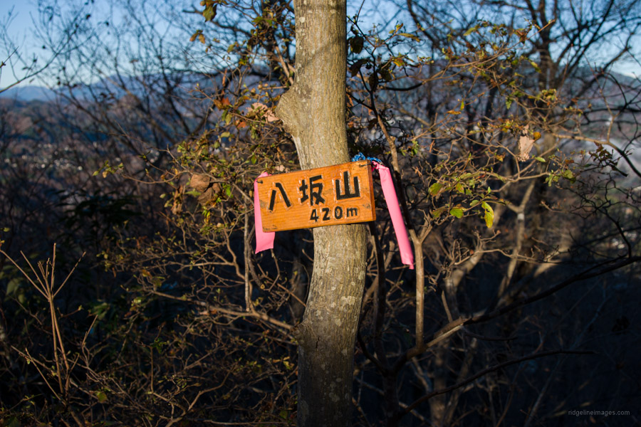
After the torii gate the trail quickly gains elevation before reaching an open area where you can spot Mt. Jinba and Mt. Shoto that rise above the Chuo Expressway. Near the fork on the ridgeline finds the summit of Mt. Hizure-kongozan 日連金剛山 (410 m) together with a small shrine dedicated to fire prevention as a consequence of a large fire that tore through the village during the Meiji Period. The next mountain to look out for along the gentle undulating ridgeline is Mine 峰 (423 m) after about 10 minutes. It also happens to have best view in the Hizure Alps in the direction of Otsuki City, Mt. Kumotori, and Mt. Takigoyama. Descending further bring you to Mt. Yasaka 八坂山 (420 m) a simple peak with its name plate attached to a tree.
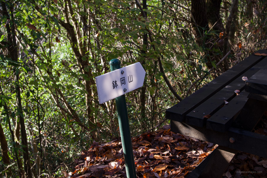
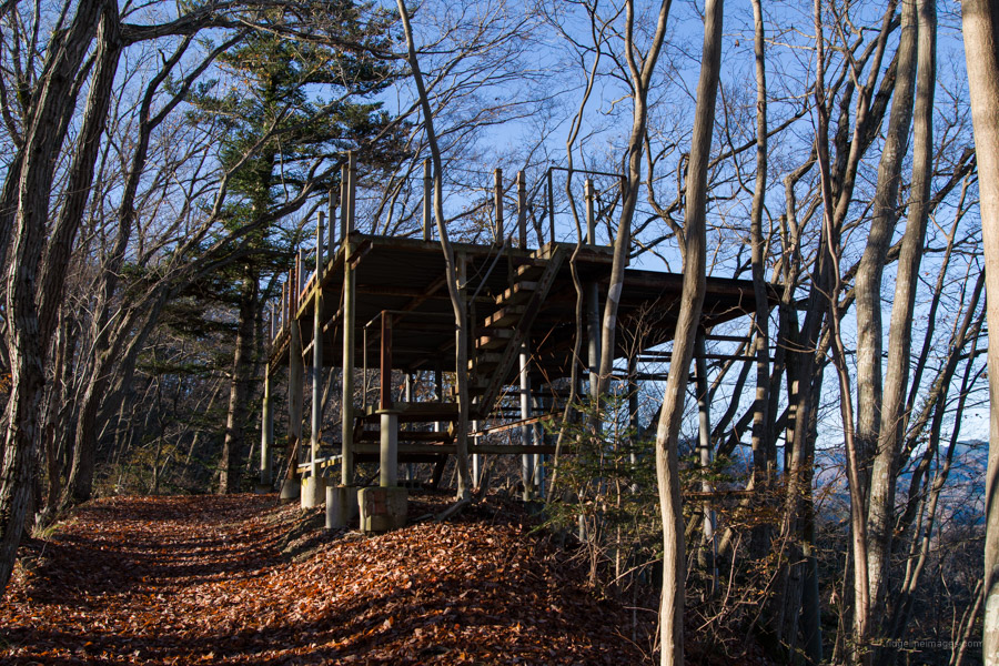
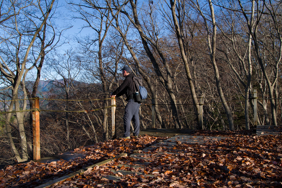
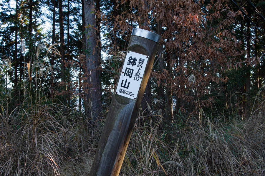
After taking in the splendid panorama return to the trail fork and continue on. At a junction named Sugi-toge 杉峠 you can head south to Mt. Hachioka 鉢岡山 (460 m) the highest point in the Hizure Alps. As for whether it’s worth the 50-minute round trip is debatable as the summit is hemmed in with meagre views. If you’re pushed for time I’d give it a miss. If your keen to check it out, follow the flat path which briefly turns into a paved road that passes an oddly sited observation deck obstructed with trees. Even more baffling is a Subaru GT that ingloriously skidded off the narrow forestry road. The road soon reverts to a mountain trail before arriving at the summit home to an unsightly antenna facility.
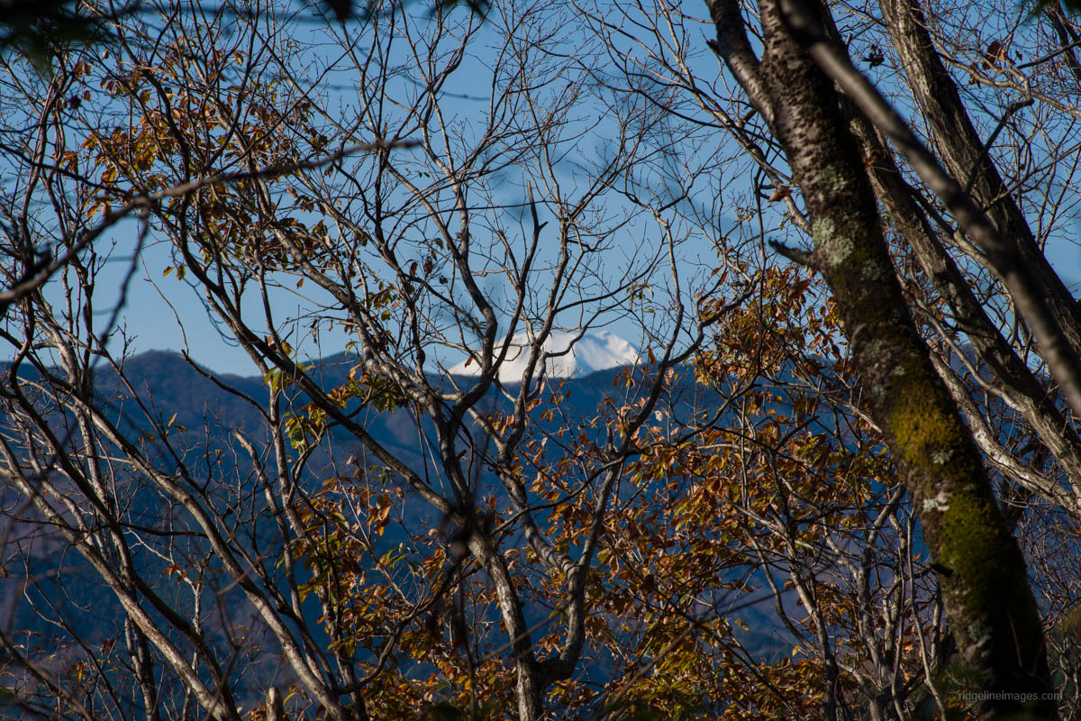
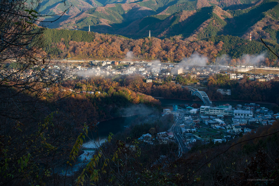
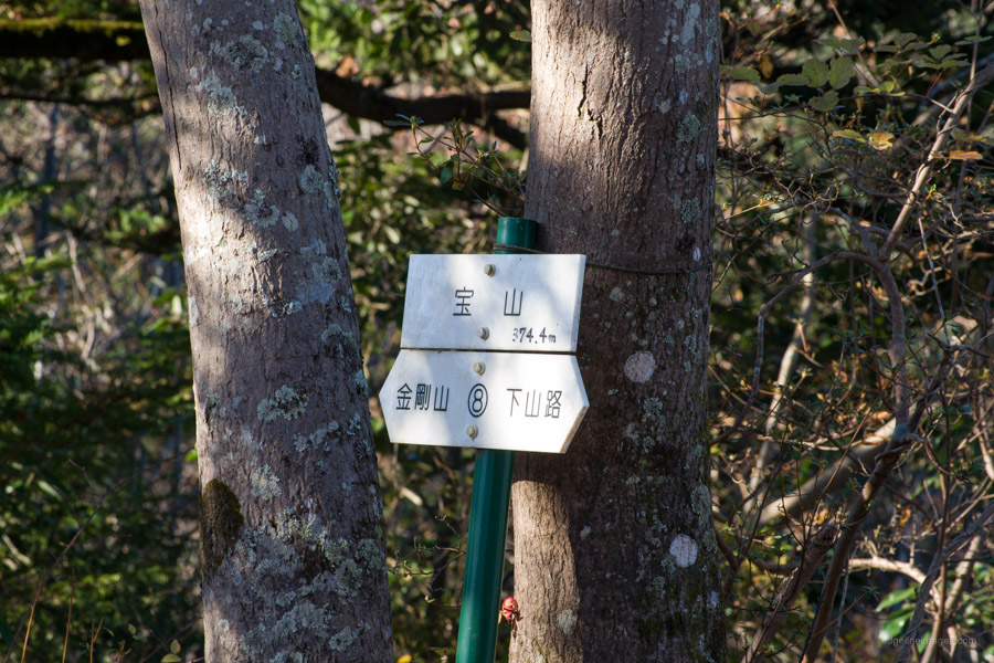
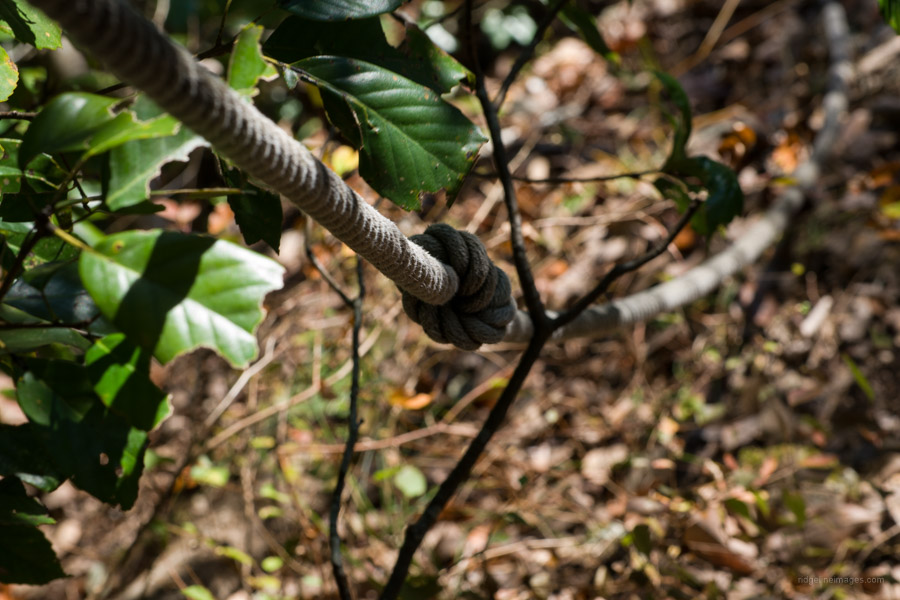
From Mt. Hachioka return to Sugi-toge Pass using the same route. The next goal is Mt. Hizure 日連山 (374 m) which like many spots along the ridgeline comes complete with a picnic bench. If you’re lucky you can behold Fujisan poking its head out. The six and final peak of the day is Mt. Takara 宝山. All that lies ahead is a short steep drop with fixed ropes which poses no problem provided you take it slowly. A gentle descent after that brings you to the township at the foot of the mountain. From here veer left and follow the road back to Fujino Station. Alternatively, there is a route known as the Oda Komichi Hiking Course おおだ小径ハイキングコース which grips Lake Sagami finishing at Sagamiko Station 相模湖駅.


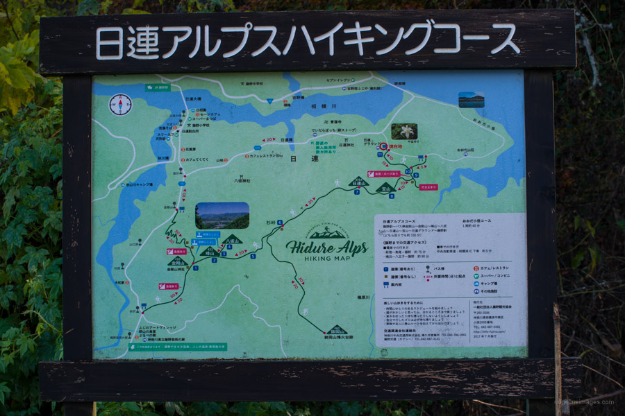


Did this hike last week. It goes by pretty fast, firstly because after the initial ascent there’s not much slowing you down (aside from the slippery leaves as noted), and secondly because there aren’t many great views worth hanging around to admire (aside from the very nice panorama from Mt. Mine; if you have a snack, here’s the place to sit and eat it). That said, it’s a nice woodsy walk. I got down the final descent and still felt like moving, so I opted to check out the “Oda Komichi Hiking Course”. It takes a good 45 minutes to get around, eventually offering some decent lake views, and ending behind a seemingly abandoned hotel, where you link up to the roads. The catch is, if you do want to finish at Sagamiko Station, you can’t walk along route 20 in this area. The best (only?) way there is to follow the old Kyu Koshu Kaido, which will take about an hour from the hotel where the Oda Komichi Course ends. In other words, at the end of this hike you will come to a fork in the trail (map sign number 10), where you can either go left (back to Fujino), or go right (for Oda Komichi and to Sagamiko Stn), and turning right at sign #10 is signing yourself up for ~1.5-2 hours of walking to Sagamiko, half of that on roads. It’s a nice enough walk, but must not get much foot traffic from non-locals, as a very nice man on a scooter stopped to ask if I was lost. No sir, just enjoying this historical road!