My Personal Top Fuji-View Hikes in Japan
After 13 years of hiking and writing about the trails of Kanto and beyond, I’ve put together this guide to the best hikes in Japan for Mt. Fuji views – twenty-one personal favourites spanning prefectures from Tokyo to Yamanashi. Choosing a single “ultimate” spot is nearly impossible – there are simply too many incredible options – so this list brings together a mix of classic viewpoints and quieter trails that showcase Japan’s most iconic peak.
I’ve grouped these into easy, moderate, and challenging routes, so whether you’re after a leisurely half-day walk or a full mountain traverse, there’s something here for every level. Some are well-known classics; others are genuinely off the beaten path. All of them offer a front-row seat to Japan’s most iconic peak.
For the best visibility, aim for early morning or late afternoon. Winter and late summer – especially after a typhoon clears the air – tend to deliver the sharpest views, while midsummer can be hit-or-miss due to haze. For the ultimate experience, camping or staying in a mountain hut often provides the best chance of catching Mt. Fuji at its finest.
21 Beautiful Hikes With Views of Mt. Fuji
Hike #1: Mt. Takao 高尾山 (Tokyo) Easy
Hike #2: Mt. Ono 大野山 (Kanagawa) Easy
Hike #3: Mt. Jinba 陣馬山 (Kanagawa) Easy
Hike #4: Mt. Iwadono 岩殿山 (Yamanashi) Easy
Hike #5: Mt. Myojinyama 明神山 (Yamanashi) Easy
Hike #6: Mt. Ashiwada 足和田山 (Yamanashi) Easy
Hike #7: Mt. Kintoki 金時山 (Kanagawa) Moderate
Hike #8: Mt. Sanpobun 三方分山 (Yamanashi) Moderate
Hike #9: Mt. Takagawa 高川山 (Yamanashi) Moderate
Hike #10: Mt. Ougiyama 扇山 (Yamanashi) Moderate
Hike #11: Mt. Takamatsu 高松山 (Yamanashi) Moderate
Hike #12: Mt. Kurodake 黒岳 (Yamanashi) Moderate
Hike #13: Mt. Shakushi 杓子山 (Yamanashi) Moderate
Hike #14: Mt. Daibosatsu 大菩薩嶺 (Yamanashi) Moderate
Hike #15: Mt. Kenashi 毛無山 (Shizuoka) Challenging
Hike #16: Mt. Tonodake 塔ノ岳 (Kanagawa) Challenging
Hike #17: Mt. Mitsutoge 三ッ峠山 (Yamanashi) Challenging
Hike #18: Mt. Takigoyama 滝子山 (Yamanashi) Challenging
Hike #19: Mt. Mishotai 御正体山 (Yamanashi) Challenging
Hike #20: Mt. Koganezawa 小金沢山 (Yamanashi) Challenging
Hike #21: Mt. Gangaharasuriyama 雁ヶ腹摺山 (Yamanashi) Challenging
*Difficulty ratings assume the routes described on this blog, in snow-free conditions, and are based on distance, elevation gain, and navigation difficulty rather than technical climbing.
Hike #1 Mt. Takao 高尾山 (599 m) Easy
Mt. Takao is Tokyo’s classic doorstep mountain, rising to 599 m and reachable in about 40–50 minutes by train from Shinjuku. Despite its modest height, it punches well above its size, with multiple ridge trails, temple-lined paths, and a surprisingly varied landscape.
One of the most enjoyable ways up is via the Inariyama Trail, which climbs through a forested ridge and opens out to views over Hachioji and, on clear days, Mt. Tsukuba and the Tokyo Skytree. There are several well-marked routes to choose from, including a cable car and chair lift partway up – making Takao an easy year-round hike, though weekends are best tackled early or avoided altogether.
On a clear winter morning, Mt. Fuji is visible from the summit observation deck – a reward that surprises many first-time visitors. From here you can extend the walk along the ridge to Mt. Jinba or Mt. Kobotoke-Shiroyama and finish at Sagamiko Station, or simply head back down the way you came.
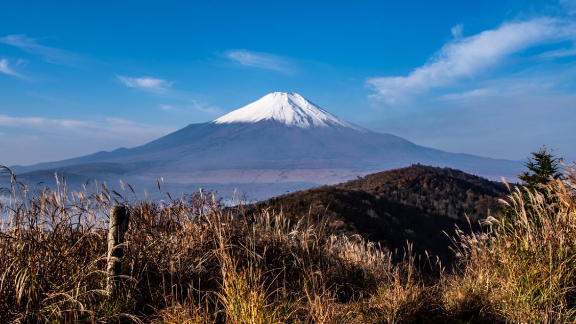
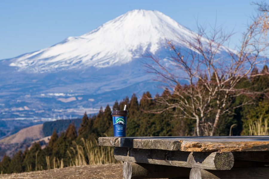
Hike #2 Mt. Ono 大野山 (723 m) Easy
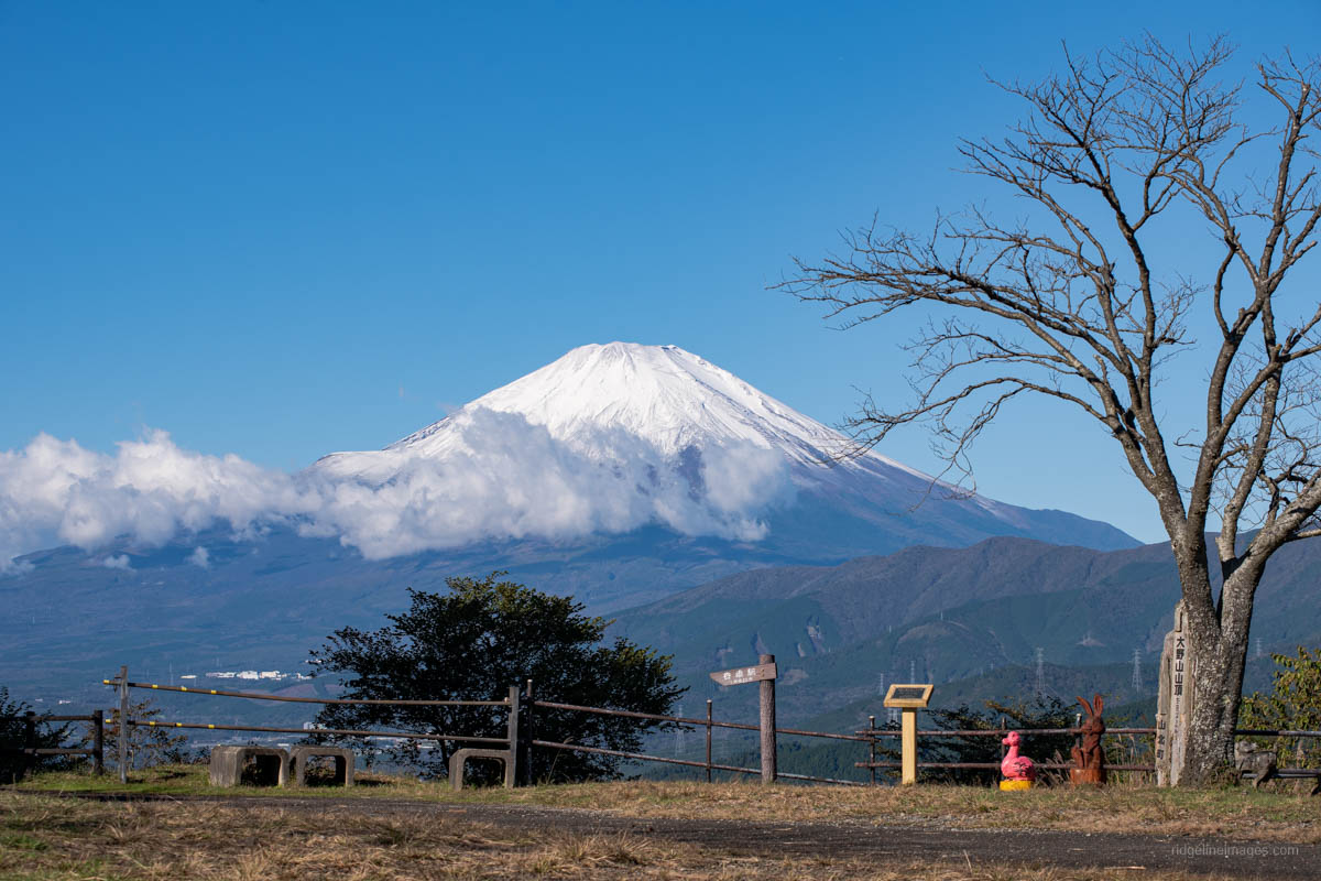
Mt. Ono is an easygoing hike in the Tanzawa–Oyama Quasi-National Park, with a broad grassy summit and excellent Mt. Fuji views on clear days. The route works best as a clockwise loop from Yaga Station, climbing gently at first before breaking out of the forest onto open slopes with early views of Mt. Fuji.
For such an accessible peak, the summit is often pleasantly quiet, with wide views across the Tanzawa range, Hakone, and even Izu Oshima in good conditions. The descent towards Yamakita Station is a little narrower in spots but manageable, making Mt. Ono a relaxed close to Tokyo.
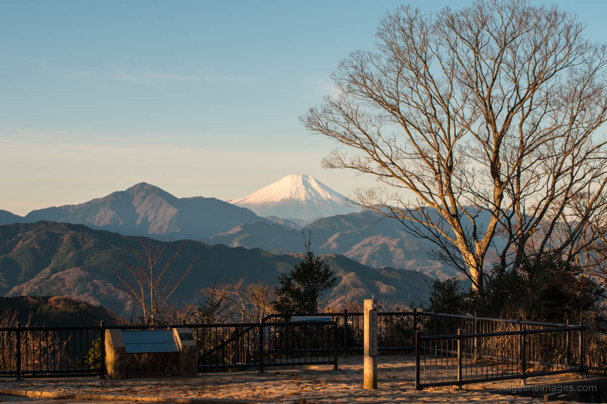
Hike #3 Mt. Jinba 陣馬山 (855 m) Easy
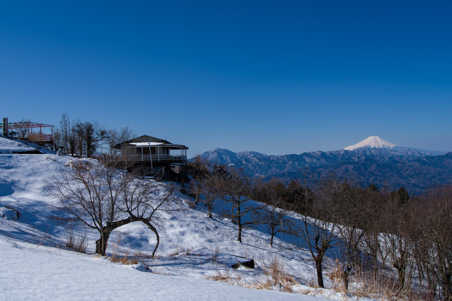
Mt. Jinba is one of the most popular and beginner-friendly hikes on the Tokyo–Kanagawa border, known for its wide, flat summit, white horse statue, and often excellent Mt. Fuji views. Easily accessed by bus from Takao Station, the standard route from Jinba Kogen Shita has a few steeper sections but is well maintained, making it suitable year-round in snow-free conditions.
From the summit, Mt. Fuji is framed by the Tanzawa Mountains, and on clear days the view stretches as far as Enoshima. For a longer outing, the hike can be extended along the ridgeline towards Meio-toge, or continued all the way to Mt. Takao, Mt. Mito, or Sagamiko – making Mt. Jinba a flexible and rewarding Fuji-view hike close to Tokyo.
Hike #4 Mt. Iwadono 岩殿山 (634 m) Easy

Mt. Iwadono is a brief but dramatic hike rising directly above Otsuki Station, known for its sheer rock face and excellent views of Mt. Fuji. The well-marked trail climbs past a small limestone cave before steepening near the top.
From the 634-metre summit – matching the height of the Tokyo Skytree – views of Mt. Fuji are wide and unobstructed, with extra viewpoints just below the summit. Short, accessible, and rich in history, Mt. Iwadono is a straightforward Fuji-view hike, with optional extensions to nearby peaks for those seeking more challenge.
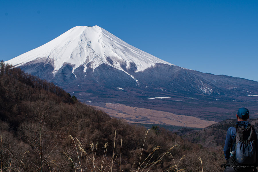
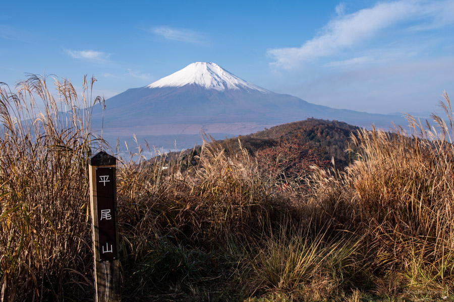
Hike #5 Mt. Myojinyama 明神山 (1,291 m) Easy
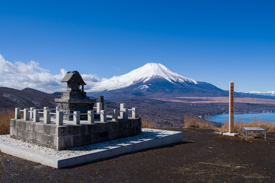
Mt. Myojinyama rises above Lake Yamanaka and offers one of the finest panoramic views of Mt. Fuji in the Fuji Five Lakes area. While many visitors stop at nearby Panorama-dai, the open, grassy summit of Myojinyama provides a far more impressive outlook, with Mt. Fuji towering directly above the lake below.
The hike follows a gentle ridgeline linking two nearby peaks, with wide paths and long stretches of open grassland. Beyond Myojinyama the trail quickly becomes quieter, making this an excellent half-day Fuji-view hike with a truly commanding backdrop.
Hike #6 Mt. Ashiwada 足和田山 (1,355 m) Easy
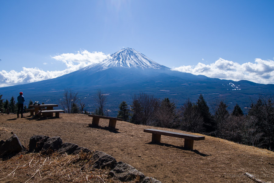
Mt. Ashiwada rises above the southern shore of Lake Saiko, forming the high point of a scenic ridgeline linking Koyodai and Sankodai. This well-maintained hike follows the Tokai Nature Trail and is one of the quieter options in the Fuji Five Lakes area.
The standout highlight is Sankodai, where a wide clearing and observation deck offer a superb panorama over the Aokigahara forest and three of the Fuji Five Lakes – Saiko, Shojiko, and Motosu – with Mt. Fuji dominating the backdrop. The ridge walk toward Mt. Ashiwada’s summit is gentle and undulating, with optional bypass trails, and recent tree thinning near the top has further opened up the views.
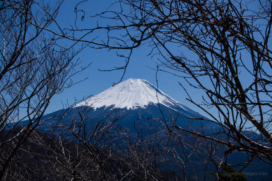
Hike #7 Mt. Kintoki 金時山 (1,212 m) Moderate

Mt. Kintoki is a classic, beginner-friendly Hakone hike that blends folklore, open ridgeline walking, and some of the region’s best views of Mt. Fuji. Starting from Kintoki Shrine, the route climbs steadily through forest before steepening near the top.
The broad summit of Mt. Kintoki delivers a close-up, unobstructed view of Mt. Fuji, along with teahouses and the chance to get your photo taken with Kintaro’s oversized axe. The descent follows a gentle ridgeline, with views of Lake Ashi, Owakudani, and the Gotemba Plain before looping back to the trailhead.
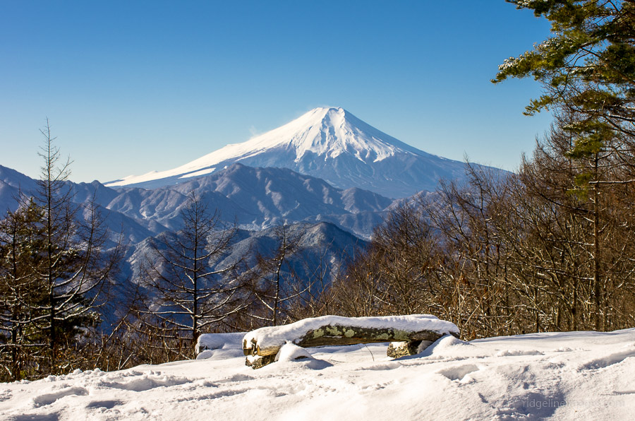
Hike #8 Mt. Sanpobun 三方分山 (1,422 m) Moderate
Mt. Sanpobun rises above the quiet waters of Lake Shoji, the smallest of the Fuji Five Lakes, and offers a rewarding ridge walk in the Misaka Mountains. The trail climbs steadily to the wooded summit before continuing across a scenic ridgeline with occasional Fuji views.
The highlight comes at Panorama-dai, where an open viewpoint reveals one of the finest panoramas of Mount Fuji, rising beyond Aokigahara forest and the surrounding lakes. A satisfying point-to-point hike, Mt. Sanpobun combines quiet forest walking with a spectacular Fuji finale.
Hike #9 Mt. Takagawa 高川山 (976 m) Moderate

Mt. Takagawa is an easily accessible ridge hike along the JR Chuo Line and one of the area’s best options for clear views of Mt. Fuji. The popular point-to-point route runs from Hatsukari Station to Otsuki Station, following a well-marked ridgeline.
From the station, the route climbs steadily to Takagawa’s open summit, where wide views take in Mt. Fuji, Mt. Mitsutoge, and Mt. Jinba. The descent is steep initially before settling into a more relaxed ridgeline walk down into Otsuki City.
Hike #10 Mt. Ougiyama 扇山 (1,138 m) Moderate
Mt. Ougiyama and Mt. Momokurayama form a quiet ridge hike with two excellent viewpoints of Mt. Fuji. The point-to-point route runs from Torisawa Station to Saruhashi Station, linking both peaks along a mostly forested ridgeline.
The route gains height at an easy pace before reaching Mt. Ougiyama’s open summit and its expansive Mt. Fuji views. The trail then dips before a short, steeper push to Mt. Momokurayama, where small openings near the summit offer another fine Mt. Fuji outlook above Otsuki City.
Hike #11 Mt. Takamatsu 高松山 (801 m) Moderate
Mt. Takamatsu is a long but gentle ridge hike in the southern Tanzawa range, offering some of the area’s most expansive Mt. Fuji views for relatively modest effort. Starting near Matsuda, the trail climbs gradually through forest before opening onto a broad, grassy summit with views of Mt. Fuji, Sagami Bay, and the Izu Islands.
From the summit, the route follows easy ridgelines, passing several Mt. Fuji viewpoints before finishing at Nishihirabatake Park, where early-blooming Kawazu cherry blossoms make this hike an especially good choice from February to early March..
Hike #12 Mt. Kurodake 黒岳 (1,793 m) Moderate
Mt. Kurodake is the highest peak in the Misaka range north of Lake Kawaguchi and offers one of the finest ridge hikes in the Fuji Five Lakes area. The route climbs steadily from Misaka Pass before following an exposed, undulating ridgeline with occasional rocky sections and wide-open views.
While the wooded summit itself is enclosed, a short walk beyond leads to Kurodake Tenbodai, where Lake Kawaguchi, Mt. Fuji, and even the Southern Alps come into view. The traverse then continues toward the Fujiyama Twin Terrace – two dramatic observation decks that provide a spectacular final panorama of Mt. Fuji before the descent to the lakeshore.
Hike #13 Mt. Shakushi 杓子山 (1,598 m) Moderate
Mt. Shakushi is a rewarding ridge hike north of Lake Yamanaka, best known for its expansive, unobstructed summit views of Mt. Fuji. The route climbs steadily before a final push to the broad summit, where a 360-degree panorama takes in Mt. Fuji, the Southern Alps, and the surrounding Doshi and Okuchichibu ranges.
Beyond the main peak, the traverse continues along a rugged ridgeline toward Mt. Takazasu, with repeated ups and downs and a few steep, slippery sections. Despite its moderate rating, the length and sustained elevation gain make this a satisfying full-day hike, finishing with an easy road descent into a quiet local village.
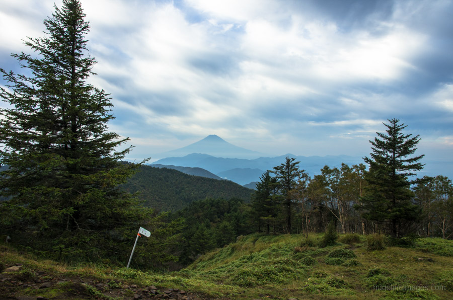
Hike #14 Mt. Daibosatsu 大菩薩嶺 (2,056 m) Moderate
![]()
Mt. Daibosatsu is one of Yamanashi’s most celebrated hikes, known for its sweeping ridgeline views of Mt. Fuji and the Southern Alps. Starting near Daibosatsu-toge, the route quickly reaches Kaminari-iwa, where the scenery truly opens up, before a short detour to the forested summit of Daibosatsurei. The broad ridge beyond is the highlight, combining open vistas with deep historical significance as an Edo-period mountain pass – views are at their best in the shoulder seasons.
Continuing west toward Tabayama Village, the trail gradually leaves the crowds behind, descending through remote forest and crossing several streams. While the traverse can be done as a long day hike, it lends itself well to an overnight trip, finishing deep in the upper reaches of the Tama River valley.
Hike #15 Mt. Kenashi 毛無山 (1,964 m) Challenging
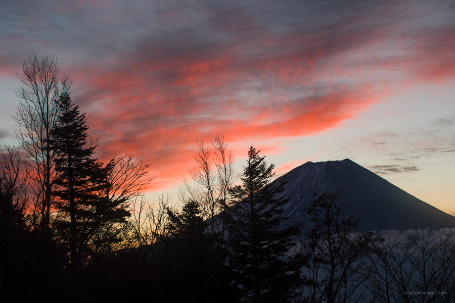
Mt. Kenashi offers one of the most intimate Fuji-view ridge walks, with far fewer hikers than better-known routes. This two-day traverse links Mt. Ryugadake, Amagadake, and Mt. Kenashi via a rolling ridgeline above Lake Motosu and the Asagiri Plateau, with the approach from the lakeside climbing steadily through forest and bamboo grass and offering frequent Fuji viewpoints.
Timed well, the ridgeline offers striking dawn and dusk light on Fujisan, while the summit of Mt. Kenashi provides a commanding view over the sprawling Fumotoppara campground below. The final descent is steep and rugged, making this a standout route best suited to experienced hikers seeking peace, quiet, and close-quarters Fuji scenery.
Hike #16 Mt. Tonodake 塔ノ岳 (1,491 m) Challenging
Mt. Tonodake is the most popular peak in the Tanzawa range. Starting from Yabitsu Pass, the route undulates over several minor peaks before settling into an open ridgeline walk, with frequent views of Mt. Fuji, Sagami Bay, and the surrounding Tanzawa mountains. Despite heavy foot traffic – especially on weekends – the constantly changing terrain and regular viewpoints keep the hike interesting throughout.
Just before the summit, the trail steepens with rocky sections and some fixed chains, leading to the broad summit of Mt. Tonodake. The descent down Okura Ridge – famously nicknamed Baka One – is long, stair-laden, and punishing on tired legs, but well broken up by tea houses along the way. With sustained elevation gain, this is a full-day hike best suited to fit hikers.
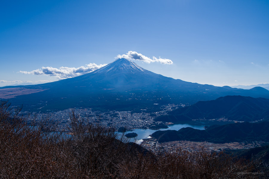
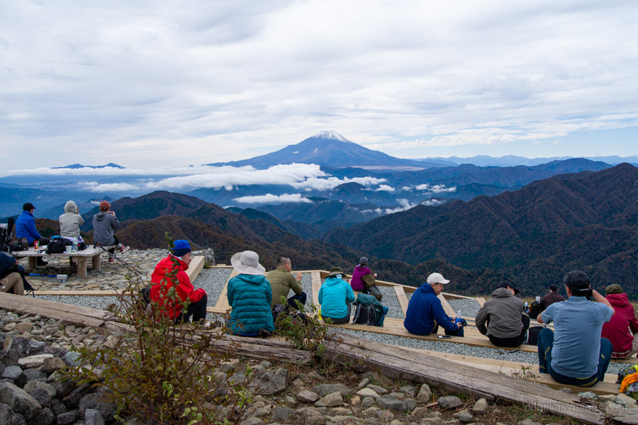
Hike #17 Mt. Mitsutoge 三ッ峠山 (1,785 m) Challenging
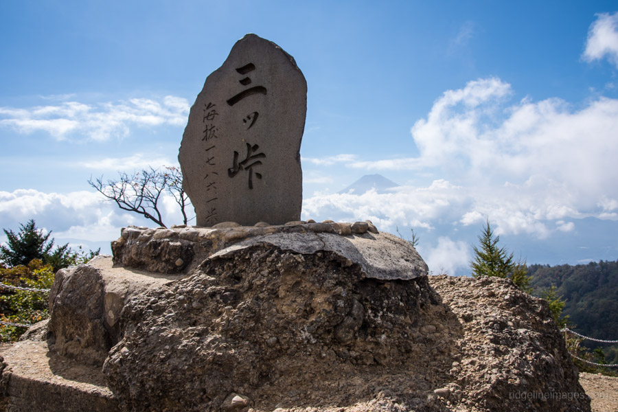
Mt. Mitsutoge is one of the best Mt. Fuji-view hikes within easy reach of Tokyo, with expansive summit panoramas. Starting from Mitsutoge Station, the trail climbs through forest to Mt. Kaiun, the highest of the Mitsutoge peaks, where broadcast towers mark a viewpoint that on clear days spans Mt. Fuji, the Southern Alps, and Yatsugatake. Winter is especially rewarding, with crisp air and often excellent visibility.
From the summit area, the route follows a long, gentle ridgeline toward Kawaguchiko, passing mountain huts and open viewpoints along the way. The descent via the Fuji Panoramic Ropeway delivers terrific views over Lake Kawaguchi, finishing near the lakeshore as a classic point-to-point traverse with good access at both ends.
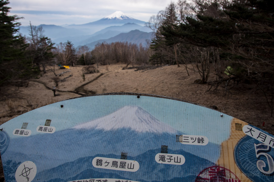
Hike #18 Mt. Takigoyama 滝子山 (1,620 m) Challenging

Mt. Takigoyama, at the lower end of the Daibosatsu range, is a demanding hike combining shaded riverside walking, waterfalls, and sustained climbing to a broad, Fuji-facing summit. The route follows the river past cascades and occasional steep detours before a long ascent to the summit ridge.
From the open summit, Mt. Fuji rises directly to the south, framed by Mitsutoge and Daibosatsu-toge, with the Southern Alps visible in clear weather. The descent via Hinoki-daira is longer but less punishing, passing a quiet ridge-top rest area before dropping through cedar forest to Hatsukari Station. It’s a solid step up in difficulty, ideal for hikers ready for longer days and more varied terrain.
Hike #19 Mt. Mishotai 御正体山 (1,681 m) Challenging
Mt. Mishotai is a little-known peak on the 200 Famous Japanese Mountains list, long revered in Shugendo mountain worship. With approaches from all four directions, it works well as anything from a straightforward day hike to a longer overnight traverse.
Autumn is an especially good time to visit for the foliage, with buses serving most trailheads outside of winter. While the summit itself is wooded, nearby Mt. Ishiwari offers superb close-range views of Mt. Fuji. The full ridge traverse continues on to Lake Yamanaka, making for an unhurried route well off the beaten path.
Hike #20 Mt. Koganezawa 小金沢山 (2,014 m) Challenging
Mt. Koganezawa is a quiet overnight traverse in the Daibosatsu range, following a gently undulating forested ridge. The route climbs steadily via Yunosawatoge before passing Kurotake, with occasional breaks in the trees offering brief views along the way.
Camping near Mt. Ushiokuno-Gangaharasuriyama puts you right on the ridgeline, where clear conditions can bring striking dawn views of Mt. Fuji. Day two continues over Mt. Koganezawa before descending towards Kamihikawa-toge, rounding out a low-key but deeply satisfying traverse best suited to experienced hikers looking for quieter trails.
Hike #21 Mt. Gangaharasuriyama 雁ヶ腹摺山 (1,874 m) Challenging
Mt. Gangaharasuriyama delivers some of the Daibosatsu range’s biggest Mt. Fuji views on a relaxed two-day walk, without the crowds even during busy periods like Golden Week. Starting from Hamaiba-mae, the route begins with a long but gentle road climb, before a steady ascent to the summit. Despite being relatively close to Tokyo, the surrounding mountains feel surprisingly remote.
Camping near the summit delivers one of the region’s finest dawn views of Mt. Fuji, famously featured on the old ¥500 note. Day two includes a side trip to Mt. Ubakoyama, followed by a steepish descent. With limited water and poorly maintained trails in places, this traverse is best suited to experienced hikers comfortable with a degree of uncertainty on the ground.


