.
Naka-no-dake 中ノ岳 – Mt. Ishiwari 石割山 – Mt. Hirao 平尾山
Distance: 25 km
Elevation change: 1214 metres
Highest point: 1681 metres
Start: Tsurushi Station (Fujikyuko Line)
Finish: Mt. Fuji Yamanakako Hotel Bus Stop
Difficulty: ▅▅▅▅▅▅▅▅▅▅ ❹
Map: Yama to Kogen Chizu 山と高原地図 [No.34 富士山 FUJI-SAN]
GPX TrackKML TrackGSI MAPPDF Topo Map
Autumn Leaves, Mt. Fuji and All-Round Great Hiking
Mt. Mishotai is a little-known 200 Famous Mountain in Yamanashi Prefecture that rises above Lake Yamanaka. It has been a sacred place for Shugendo mountain worship since ancient times. Hiking courses extend from north, south, east, and west, making it perfect for day trips or as an extended overnight outing. With the exception of winter, there are regular buses to the five disparate trailheads apart from the difficult to access Ikenodaira entrance. Autumn is an especially beautiful time to visit with the fall foliage. While the summit is covered with trees Mt. Ishiwari affords a dazzling up-close-and-personal view of Mt. Fuji. This longitudinal trekking course commences at Miwa Shrine finishing at Lake Yamanaka.
Day 1: Climb Through Tracks of Beech Forest (17.9 km)
Getting to the trailhead entails taking a train to Tsurushi Station 都留市駅 (Fujikyuko Line) and picking up a bus bound for Mishotai-Iriguchi 御正体入口 (20 minutes, 380 yen). On weekends and public holidays there are two early morning buses. During weekdays you will need to pony up for a taxi fare (3,000 yen) or hot-foot it to the trailhead as I did, taking around 75 minutes. A nice limbering warm-up, though you’ll have to mix it with large-sized trucks along footpathless sections of bitumen. A Lawson is handily located about halfway up.
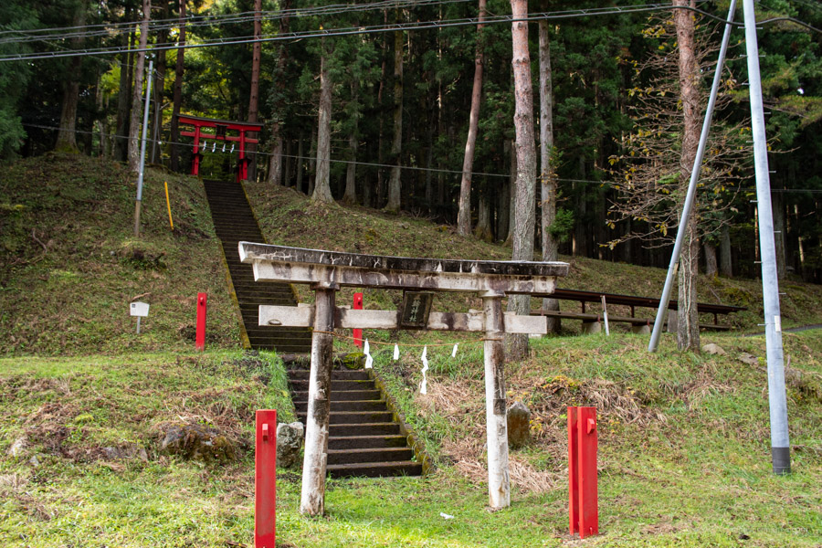
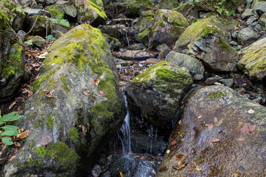
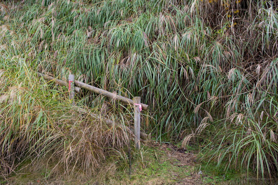
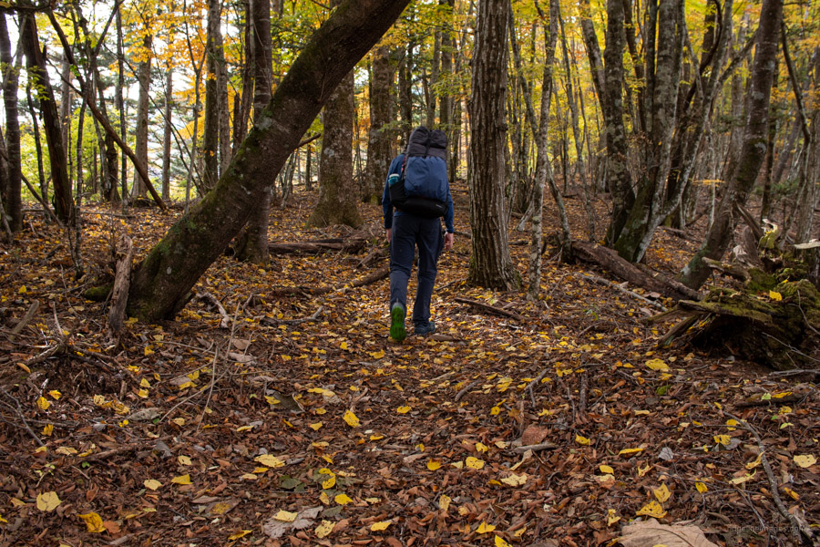
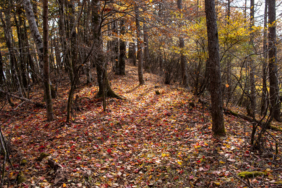
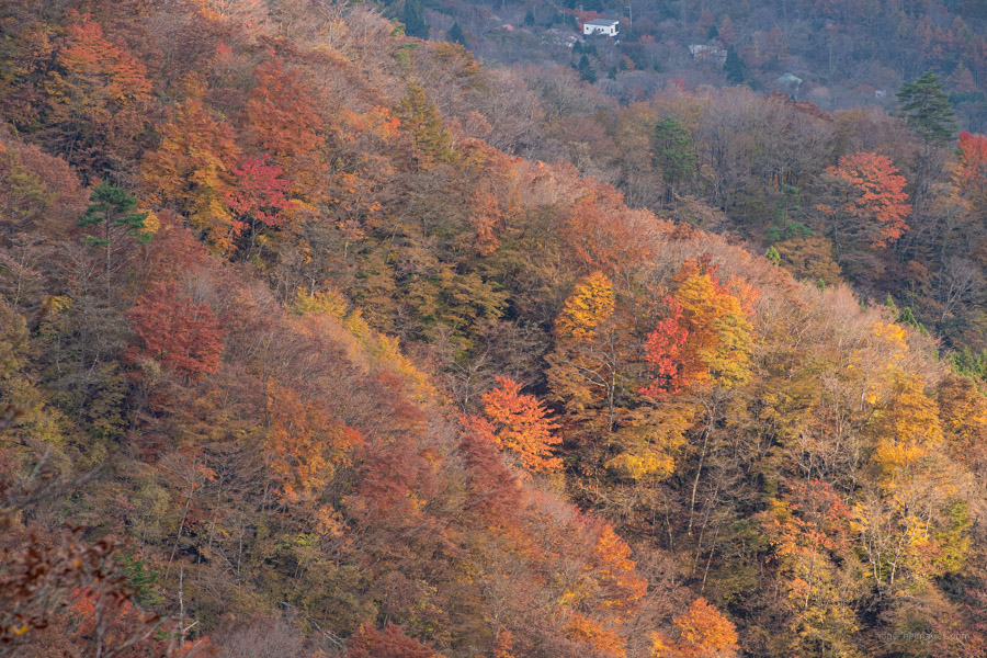
The hike officially kicks off beside the vermillion coloured torii gate of the Miwa Shrine 三輪神社 founded in the early Heian period. Head up the paved forest road, first to a yellow locked gate and after 50 minutes you’ll come to the first and only water source on the hike. If you intend on camping out fill up your bottles. As a point of reference, I carried six litres which was plenty to hold me over until the next morning. The road steepens with the horizon opening out nearer to the trailhead proper. The entrance is overgrown and is in no way obvious – look for pine railing decked with pink tape. The trail climbs steeply along the ridgeline through beautiful tracks of beech forest arriving at a trail branch and view of Mt. Fuji in clear weather. A further 30 minutes of ups and downs brings you to the summit of Mt. Mishotai 御正体山 (1,681 m).
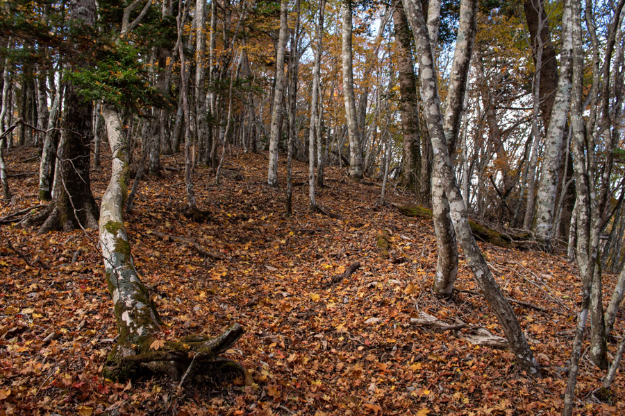
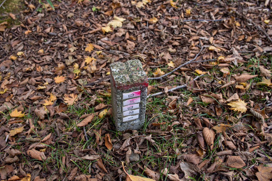
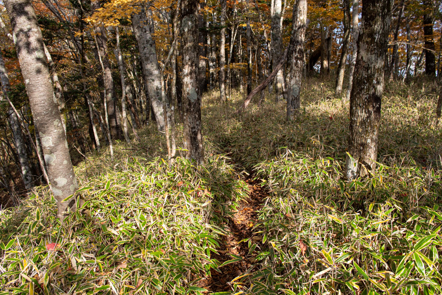
If the weather is fine, enjoy basking on the expansive sunbathed summit. There are some rough-hewn benches and plenty of open areas to relax. When you’re ready to head off, look for a signpost pointing to Lake Yamanaka 山中湖. From here to the campsite the trail is at times faint, poorly signposted and can be difficult to discern thanks to accumulated leaf matter. Make sure you bring along a handheld GPS device and keep an eye on the concrete trig markings adorned with ceramic kanji tiles. First up along the undulating ridgeline is Mae-no-dake 前ノ岳 (1,471 m) follow by Naka-no-dake 中ノ岳 (1,411 m) both bereft of any view. Following Naka-no-dake you pass through an understory of dwarf bamboo (kuma-zasa) and underneath the first of two transmission lines.
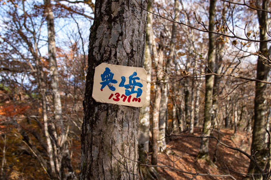
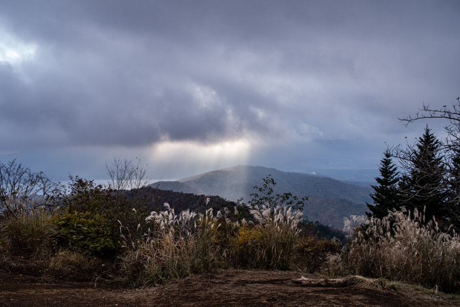
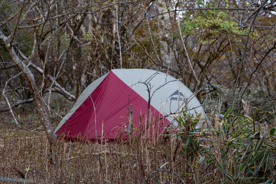
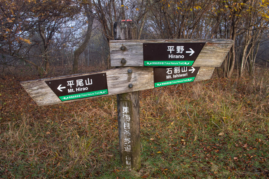
Next the path tracks south-west with occasional open plateaus that would otherwise proffer an outlook of Mt. Fuji, the Southern Alps, and the Tanzawa Mountains if it hadn’t been cloudy. A little after Oku-no-dake 奥ノ岳 (1,371 m) I started thinking about where I would pitch my tent, pushing on past Hinatazawa-no-mine 日向峰 (1,446 m) I decided I would camp on or near Mt. Ishiwari 石割山 (1,412 m). Given Mt. Ishiwari’s sloping orientation, I managed instead to find a flat area around one hundred metres before the second transmission line. It fitted the bill perfectly, both away from the trail and protected from the elements. There is a minor collapsed area approaching Mt. Ishiwari so take care with your footwork but on the whole, there aren’t any particularly dangerous spots.
Day 2: Bask in Early Morning Fujisan Views (7.1 km)
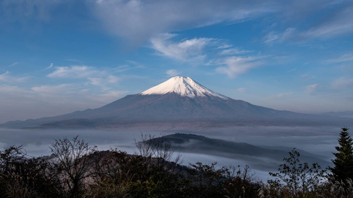
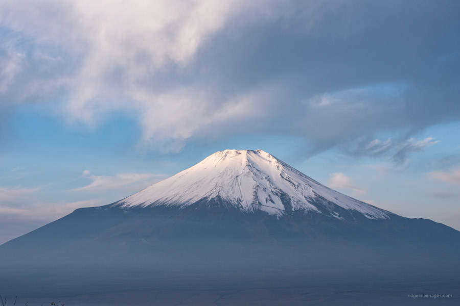
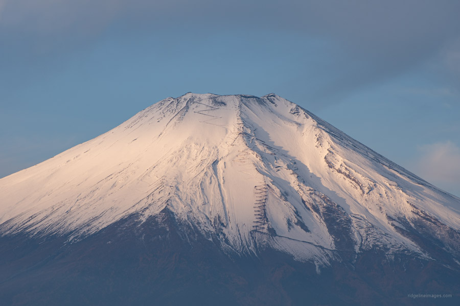
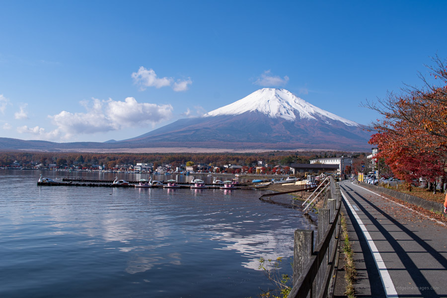
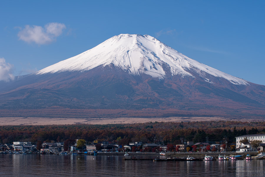
Around 4:30 am I was awakened by the sound of bells. They didn’t sound like traditional bear bells more like the type that mountain priests or Yamabushi might carry. I was utterly dumbfounded to be honest. I got up at 5:00 am, my usual mountain rousing time. It was still misty and had pretty much given up any hope of seeing Mt. Fuji let alone any mighty vistas. Scoffed down a quick breakfast, broke camp and returned to Mt. Ishiwari. What awaited me was not only the aforementioned bell carriers – a husband and wife duo but probably the best view I’ve ever had of Fujisan. In the Southern Alps, Mt. Kitadake and Mt. Ainodake could be spied far off to the right. The photos don’t do justice at all. The view was quite surreal, the clear crisp air really unmasked its true majesty. It wasn’t long before some other groups arrived to partake in the spectacle.
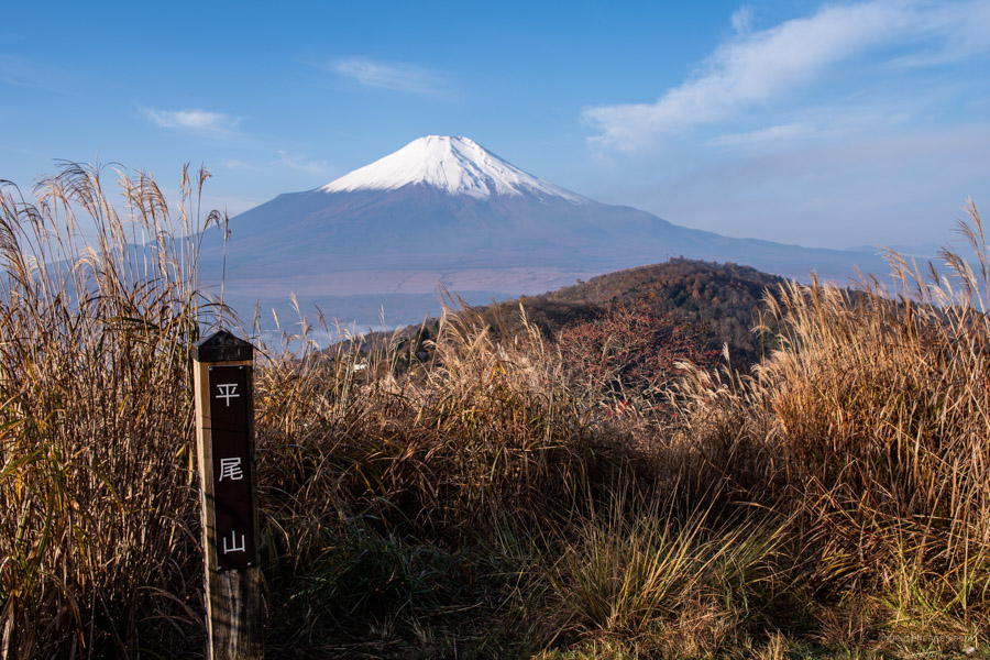
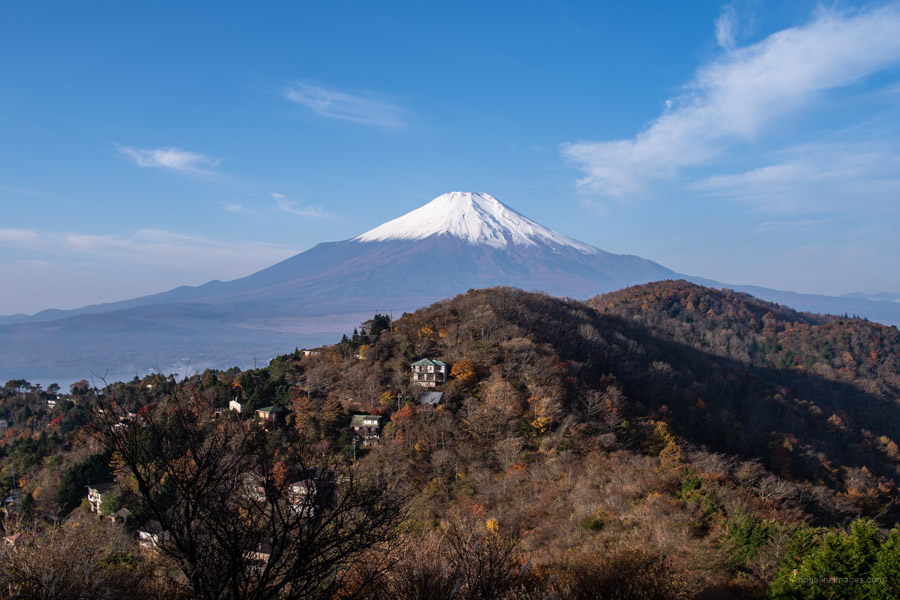
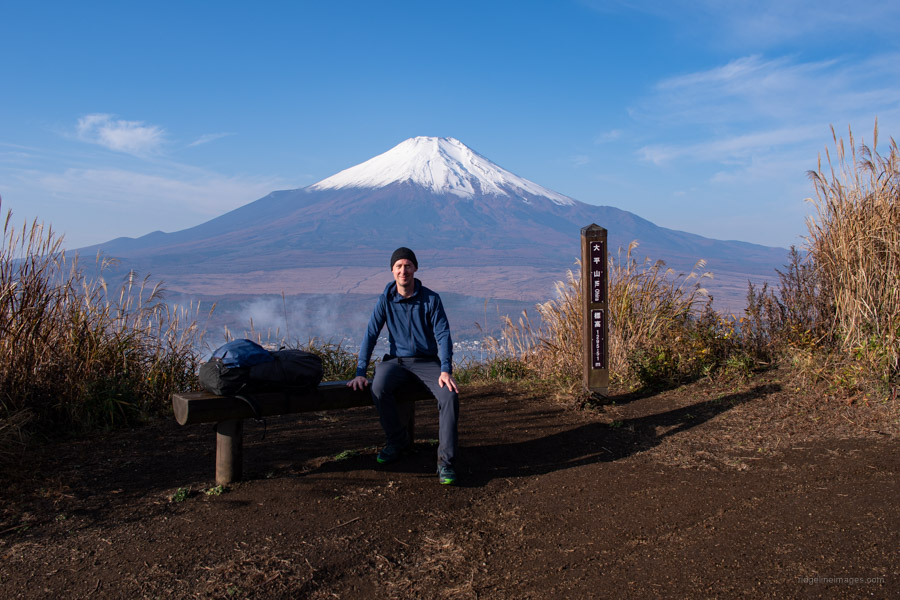
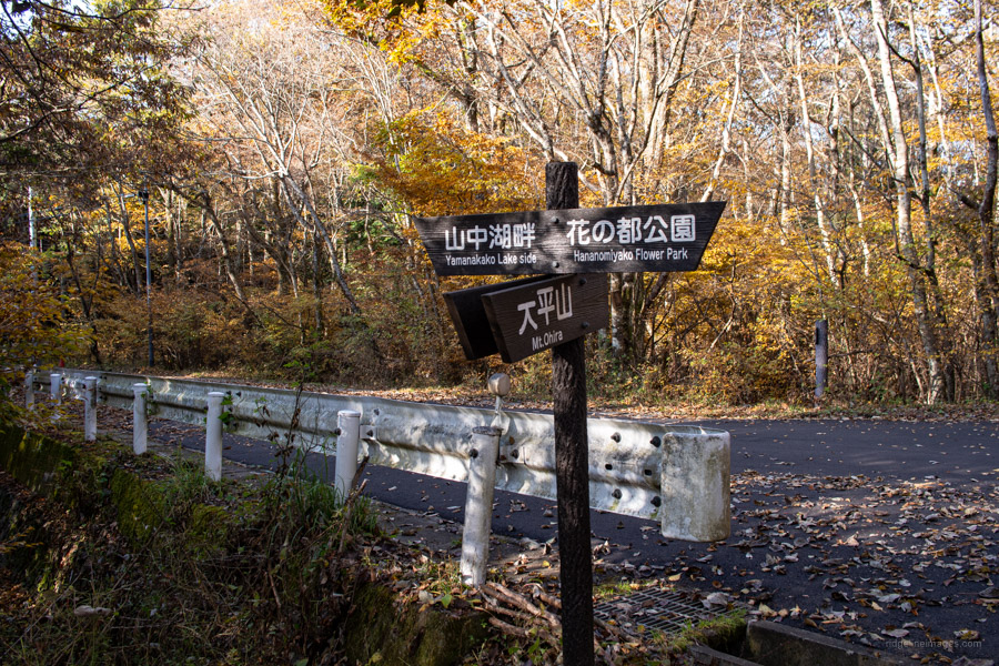
From Mt. Ishiwari the trail descends sharply before flattening towards Mt. Hirao 平尾山 merging into a short segment of the Tokai Nature Trail 東海自然歩道 between Mt. Hirao and Mt. Ohira 大平山 (1,295 m). This latter mountain is literally in the foreground of Fujisan and another picture-perfect spot to soak up. Surprisingly on what was a magnificent morning there were very few hikers out and about, due I suspect to the dearth of carparking spots. The eroded track assumes a V-shape before reaching a paved road on the Lake Yamanaka trailhead side. Steer left down to Lake Yamanaka and the Mt. Fuji Yamanakako Hotel Bus Stop 富士山山中湖. The bus timetable is a bit hard to decrypt but basically jump on an ‘A-Line’ bus for Mt. Fuji Station (25 mins, 500 yen).


Nice trip. I’ll try it sometime.
Great minds think alike. I’m on my way home from the same area. I did a one day hike up Mitsutoge today.
Really enjoyed this one. Always helps having ‘akibare’ weather. If you catch the bus to the trailhead it’s probably just slightly longer and tougher than the Mitsutoge hike.
Some nice pics! Are you bringing along a lightweight tripod for your camera?
Thanks Ian, with the weather being so nice it was hard not to take a good shot. Yes, I do. It’s reasonably lightweight at around 750 grams.