.
Yaga Station 谷峨駅 – Mt. Ono 大野山 – Yamakita Station 山北駅
Distance: 11.3 km
Elevation change: 557 metres
Highest point: 723 metres
Start: Yaga Station (Gotemba Line)
Finish: Yamakita Station (Gotemba Line)
Difficulty: ▅▅▅▅▅▅▅▅▅▅ ❷
Map: Yama to Kogen Chizu 山と高原地図 [No.31 丹沢 TANZAWA]
GPX TrackKML TrackGSI MAPPDF Topo Map
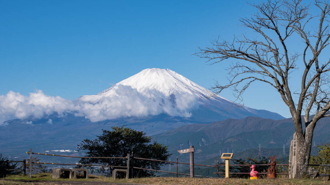
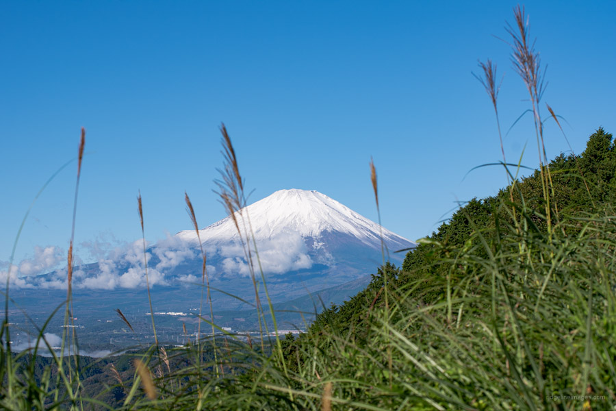
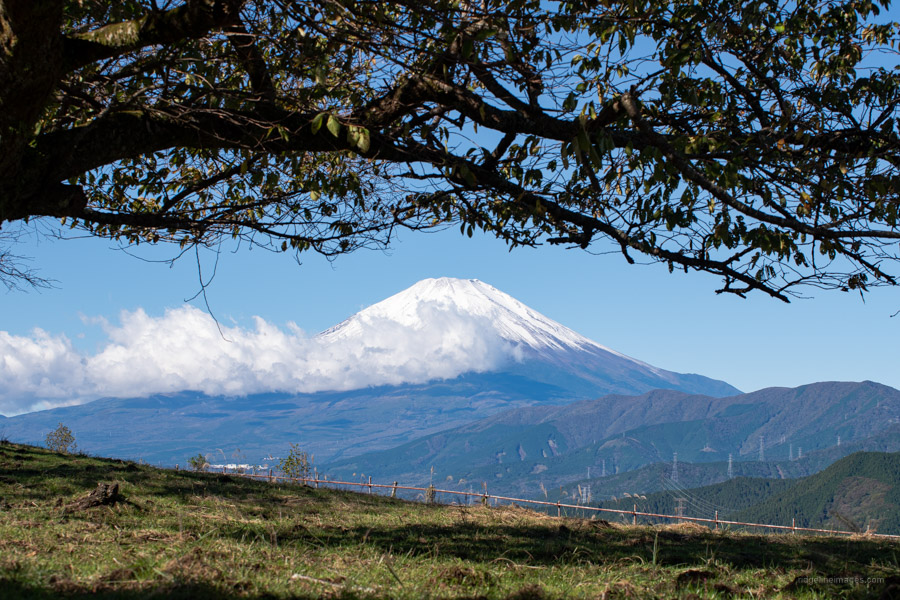
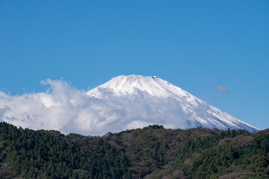
Low Lying Mountain with Wonderful Fujisan Views
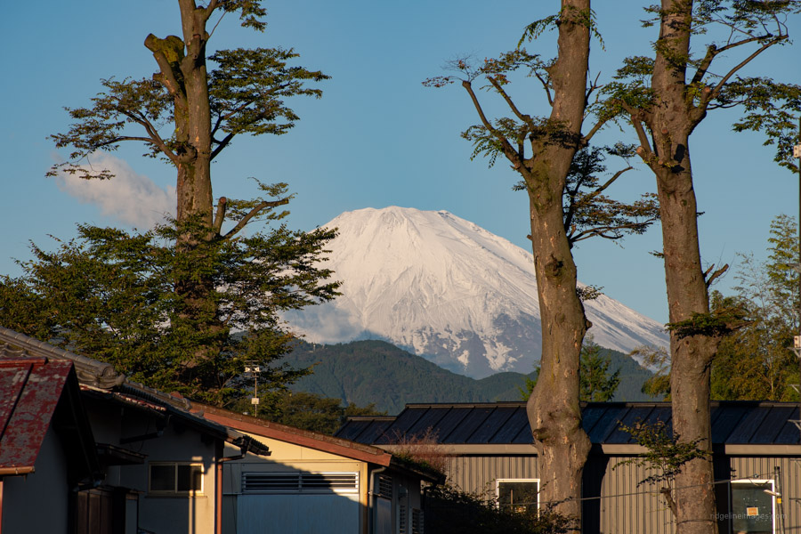
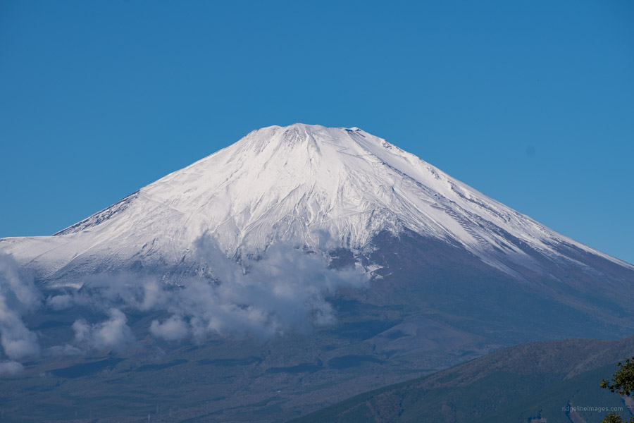
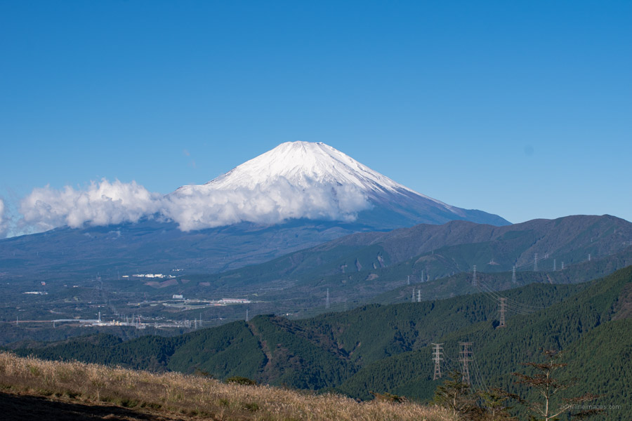
Mt. Ono located in the Tanzawa-Oyama Quasi-National Park is a popular year-round hiking destination. It is suitable for beginners and families with elementary school aged children. In fine weather the broad sunbathed summit offers up a spectacular view of Mt. Fuji. The hike can be undertaken in either direction though moving in a clockwise fashion ensures the best Fujisan views are gotten in the early morning and the gradient is also gentler.
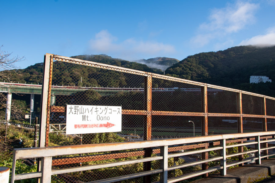
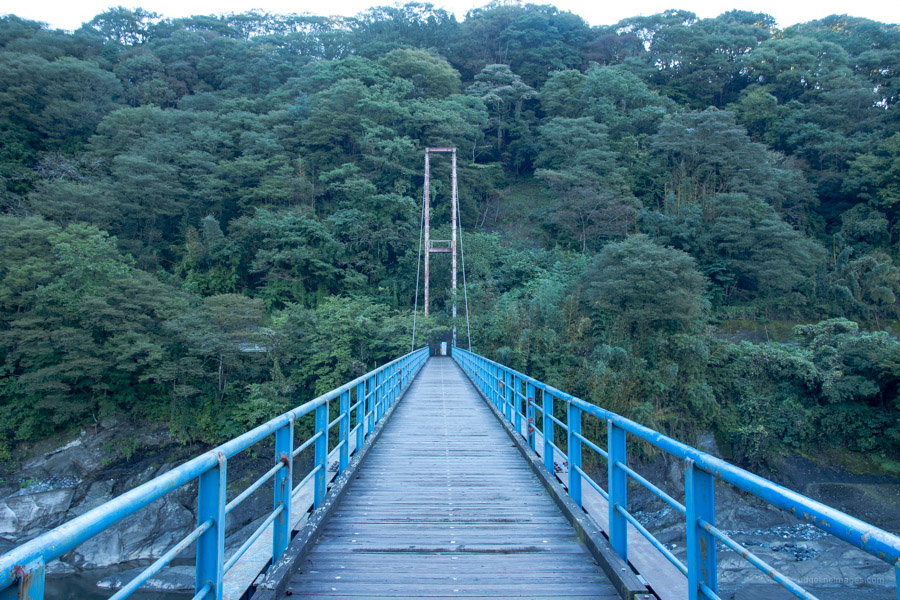
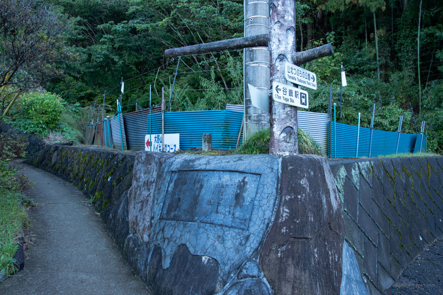
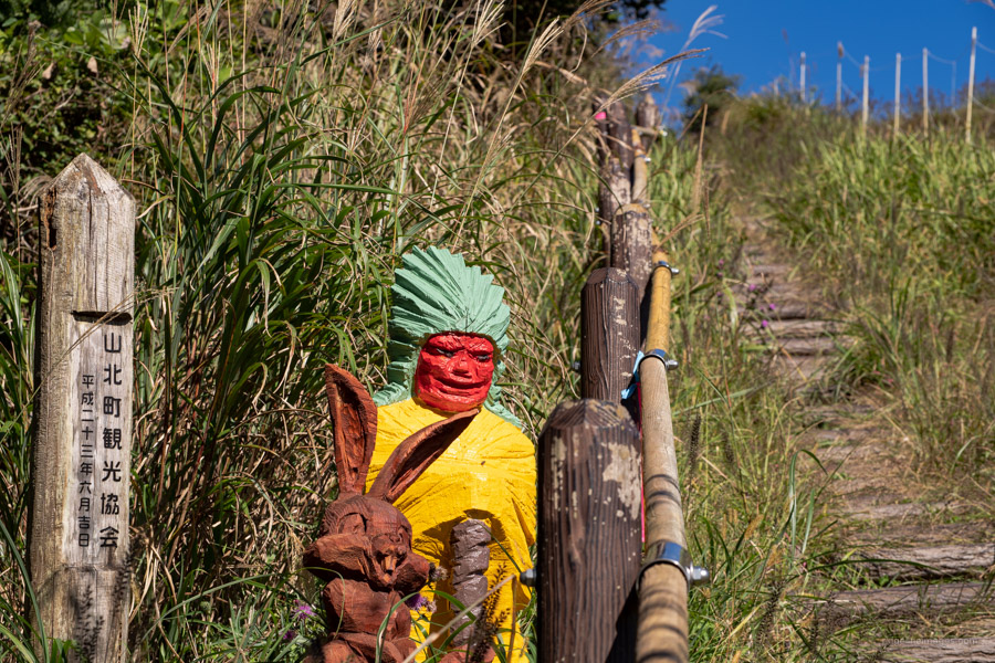
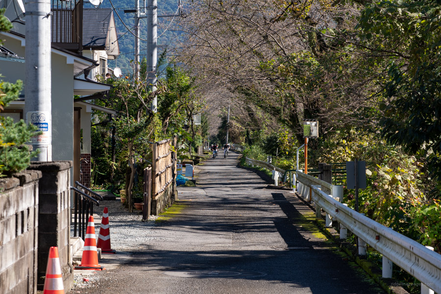
The hike sets out from Yaga Station 谷峨駅 on the Gotemba Line around 90 minutes from Shinjuku. Exit the station turn right and mosey up the street. Go across the highway and look out for the sign Onoyama chikamichi (shortcut) 大野山近道 which passes through some rice fields. After crossing the blue railed suspension bridge turn left and begin meandering up the bitumen. The trailhead proper 大野山ハイキングコース入口 is a 25 minute (1.7 km) walk from Yaga Station. On the whole, the hike is adequately signposted albeit mostly in Japanese though easy enough to follow.
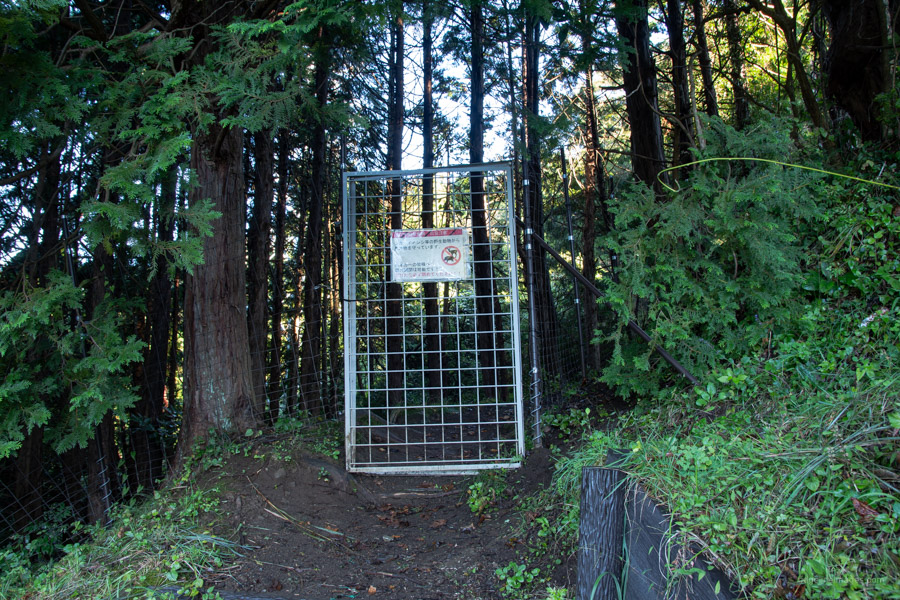
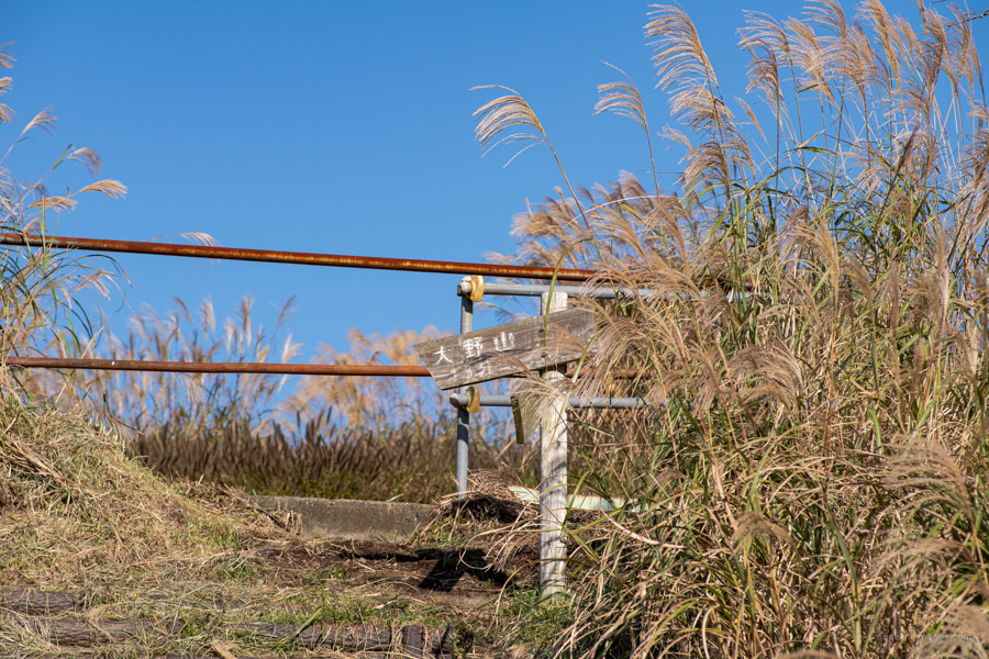
Proceeding through a deer gate which you need to untie and retie the trail cuts across a paved road nearby a bio toilet. From here on the path re-enters the forest along a gentle and easy to walk slope. After a second road crossing and gaining elevation, the view opens out with sweeping unobstructed views of Fujisan. In the autumn Chinese silver grass (Japanese susuki) only adds to the spectacle. Following some animal wood carvings along with a handmade sign at 634 metres (the same height as the Tokyo Skytree), it’s about 100 metres to the top. Closer to the summit signs of the mountain’s former life as a cow breeding ranch become evident with remains of agricultural fencing, ramshackle barns and windbreaks.
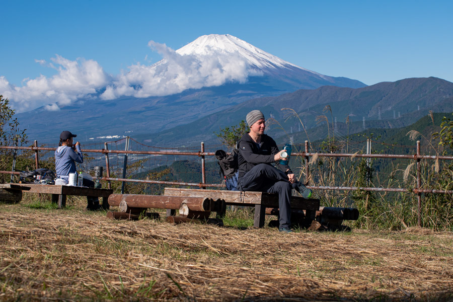
On what was an absolutely gorgeous weekend morning I had expected Mt. Ono 大野山 (723 m) to be teeming with hikers though surprisingly there was only a couple of others resting on the rough-hewn benches. Apart from Mt. Fuji, good views can be had of the Tanzawa Mountains, Mt. Hakone, and Izu Oshima Island in Sagami Bay. When you’re ready to head off, keep going on the footpath to the far side of the mountain, past the carpark veering right at the gated road. Here I managed to catch a glimpse of some cows grazing on lush pastures in a fenced off paddock.
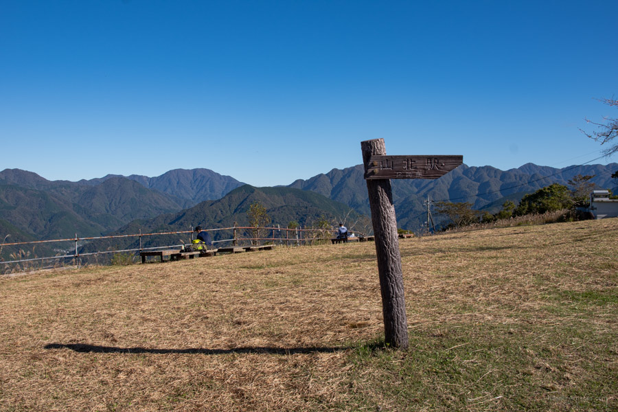
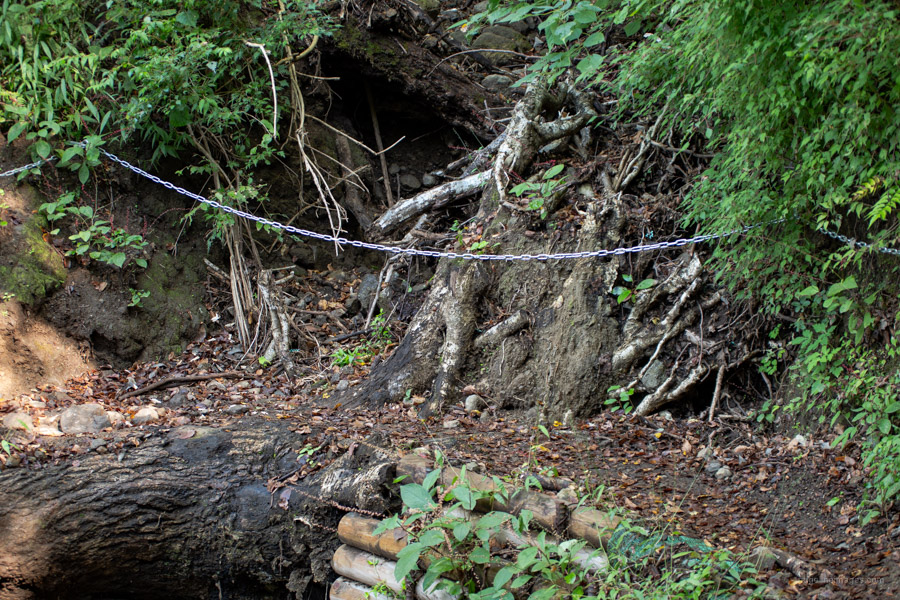
The descent to the trailhead on the Yamakita Station 山北駅 side is narrow in places so take care with your footwork. From the summit it’s around an hour to the paved road and a further 50 minutes thereafter through a residential area to reach the station. Unfortunately for myself this wasn’t quite the end of the story. Just before hitting the main road a suzumebachi (Japanese hornet) managed to fly unnoticed straight into my black hoodie. I suspected it was such, and before I could let it loose, it had stung me on the left side of my neck. Hurt like crazy though consider myself fortunate I didn’t go into anaphylaxis. If you have better luck then enjoy a dip at Sakura Hot Spring (400 yen for 2 hours), a public run onsen on the south side of Yamakita Station.


Did this hike sometime last year. I moved it but then again felt a bit frightened over the narrow ridge. Then again, the descent was one pleasant hike that I can do a hundred times.
Please take care of that nasty looking bite.
Thanks ka for always sharing your adventures and your hikes and stunning photos.
Thanks for reading Mari. It’s quite a lovely hike isn’t it. I hope you also had some amazing views.
Chatting to a hiker, she told me Xmas and cherry blossom time on the summit was like Shinjuku Station (LOL) — you can see why, with its open grassy area ideal for picnics. You went at a good time. She also said you can visit the dairy farm across the summit for milk, it that’s your thing.
For the bite, so unlucky, and such a rare event. Sorry to hear about that, David. After getting anaphalaxis only once 10 years ago in a UK supermarket (its air con system reaction?), I carry an epipen when I hike (for myself and others). I carry also for safety in the backcountry a tiny signalling mirror (weight 1 gram). It is a long handled dental mirror, handle snapped off, bought in Daiso 100 yen store. When hiking in certain areas, esp. around and north of Okutama Lake, I bring a small bear spray (Amazon) and learned how to properly use it in concert with voice tone and body language from ranger videos on YouTube. Just me 2 cents
Never imagined I’d ever get stung. What I won’t be doing anytime soon at least in the autumn is wearing my black hoodie. Apparently they are attracted to darker colours. In your case carrying an EpiPen is a sensible decision. One other thing you might like to add to your safety arsenal is a Cocoheli transmitter it definitely provides some extra peace of mind.
Great suggestions, Thank you. “around and north of Okutama Lake” is really special.
Hiked this last week. Takes 3 – 3.5 hrs leisurely. If you’re not in the mood for long train trips / buses, this is a pleasant hike with quite a bit of variety
https://hikingtokyo.com/2020/04/05/mt-hinata-404m-mt-mijo-237m-isehara-atsugi-cities-kanagawa-prefecture/
Oyama area with leaves changing colour is super busy now, so if hikers do this on a weekend, I suggest taking the cable car at 10.30 — 11 am, not at 9am when it starts (hordes of people, long waits).
Finishes in a quaint onsen village w/ irregular buses, but just walk 10 mins further down the lane til you hit the main road; big bus stop opposite w/ many buses to several Odakyu Line stations — any will do.