.
Mt. Ryugadake 竜ヶ岳 – Hashita-toge – 端足峠 – Mt. Amagadake 雨ヶ岳
Distance: 16.5 km
Elevation change: 1154 metres
Highest point: 1964 metres
Start: Lake Motosu Iriguchi Bus Stop
Finish: Asagiri Green Park Bus Stop
Difficulty: ▅▅▅▅▅▅▅▅▅▅ ❹
Map: Yama to Kogen Chizu 山と高原地図 [No.34 富士山 FUJI-SAN]
GPX TrackKML TrackGSI MAPPDF Topo Map
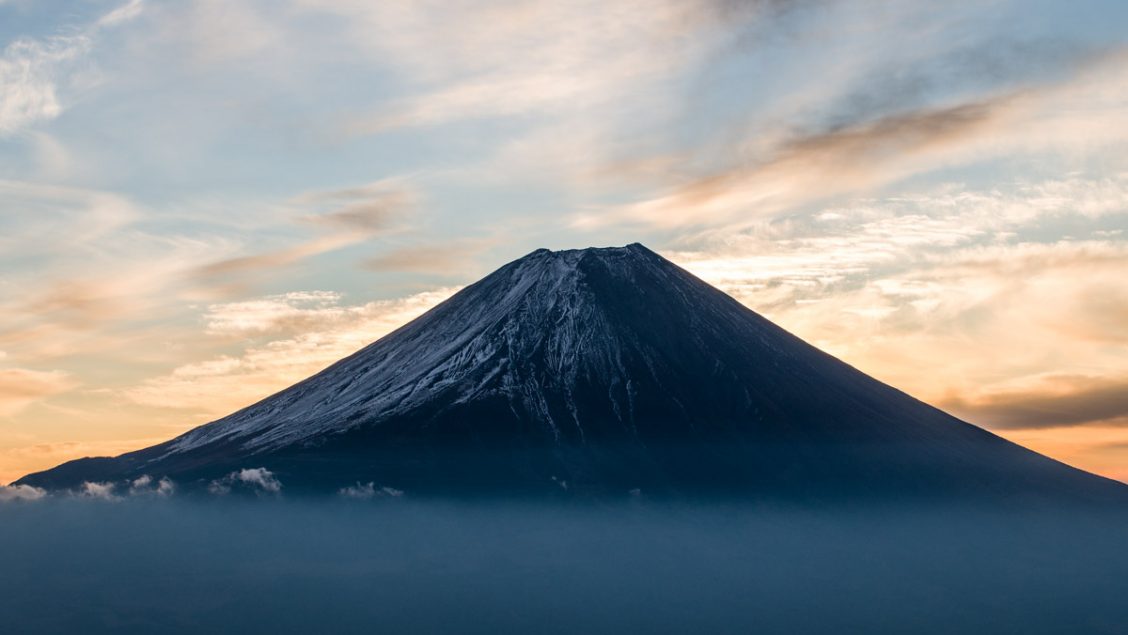
Fujisan at Close Quarters
Mt. Kenashi is a 200 Famous Japanese Mountain that straddles Yamanashi and Shizuoka Prefectures. There are in fact three Kenashiyama’s in the vicinity of Mt. Fuji, this one on the west side being the highest. The Asagiri plateau home to the sprawling Fumotoppara campground rests at the foot of the mountain. The shortest route to the summit is an out-and-back hike or piston from the Kenashiyama carpark. In March this year, I attempted this route but gave up owing to the snow depth. This time, I take a longer approach via Amagatake from Lake Motosuko that included wild camping along the ridgeline. The mountain is relatively unknown, even on a stunning Sunday at the height of the autumn foliage, I counted less than 20 hikers.
Day 1: What goes Down, Must Come Up (10.3 km)
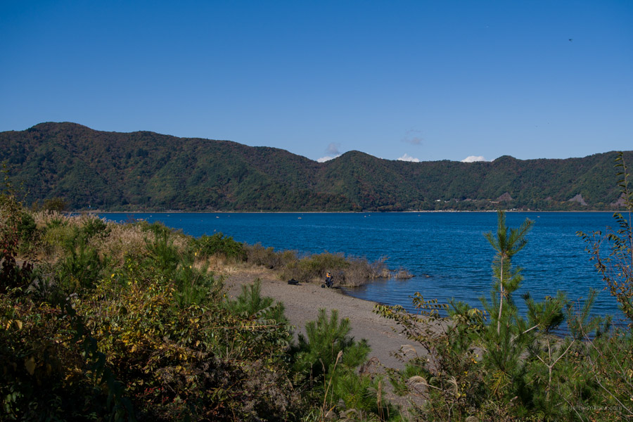
Getting to the Lake Motosuko trailhead entails taking the Motosuko sightseeing bus (Blue Line) from Kawaguchiko Station 河口湖 (47 mins, 1,300 yen). Alternatively take a bus bound for Shin-Fuji Station 新富士駅 operated by Fujikyu Shizuoka Bus (bus stop no.4). Shoot for the Fujikyu Bus as it has the earliest departure time at 09:05. During the summer it’s also possible to take a highway bus directly to Lake Motosuko from Busta Shinjuku. From the Motosuko Iriguchi Bus Stop 本栖湖入り口 head down a flight of stairs adjoining some shops. From here follow the road around to the Motosuko Campground. If you intend on camping out, fill up your bottles here as there isn’t any at the summit nor for the first few hours, the following day.
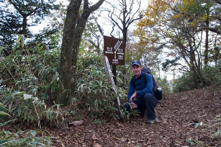
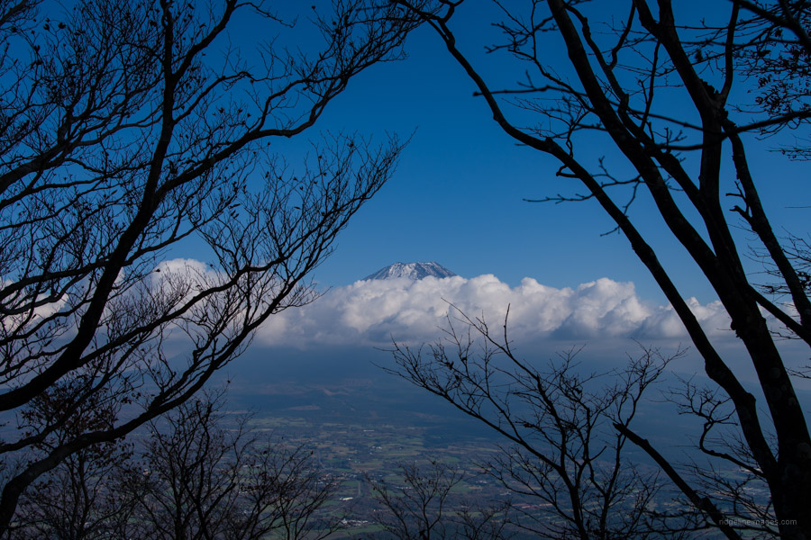
Previously I climbed Mt. Ryugadake via the Ryugatake Tozando Iriguchi 竜ヶ岳登山道入口 this time I opted for the lakeside climbing trail. While the former trail is marginally longer, it’s teeming with Fujisan views. Both routes include numerous switchbacks. The lakeside climbing trail passes through tracks of beech forest with the blue waters of Lake Motosuko visible through the vegetation. Where the trails intersect dense thickets of kuma-zasa (dwarf bamboo) shepherd you a short 10-minutes to Mt. Ryugadake 竜ヶ岳 (1,485 m). True to form, by midday clouds had enveloped Fujisan, thwarting even a fleeting view from its grassy summit. The overcast conditions also made it chilly so after devouring a sliced bagel spread with cream cheese it was time to make haste.
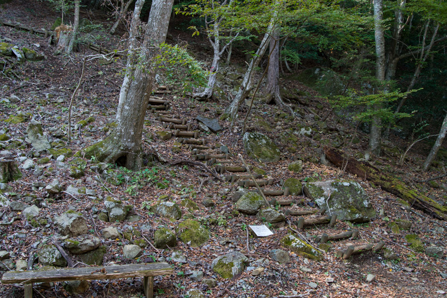
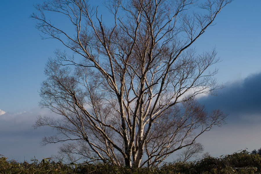
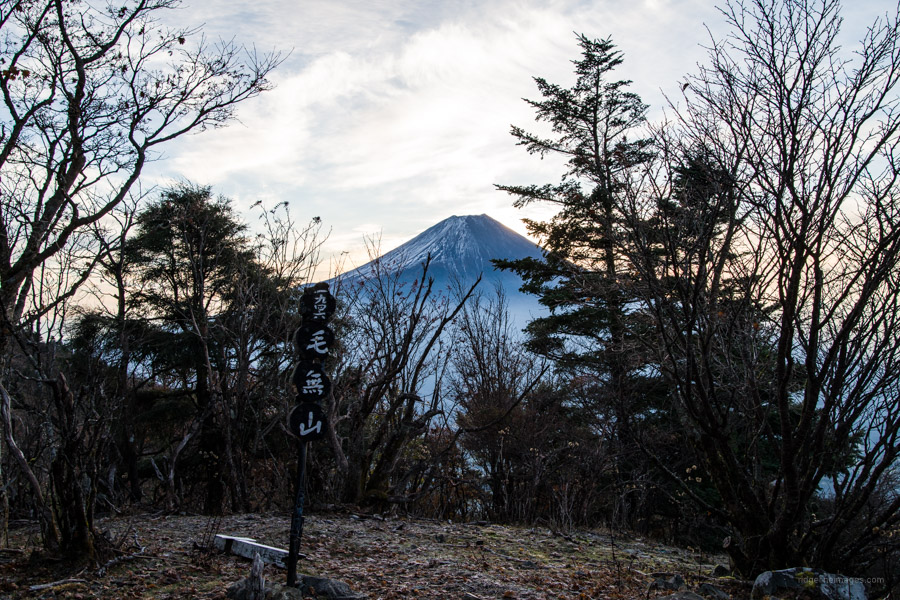
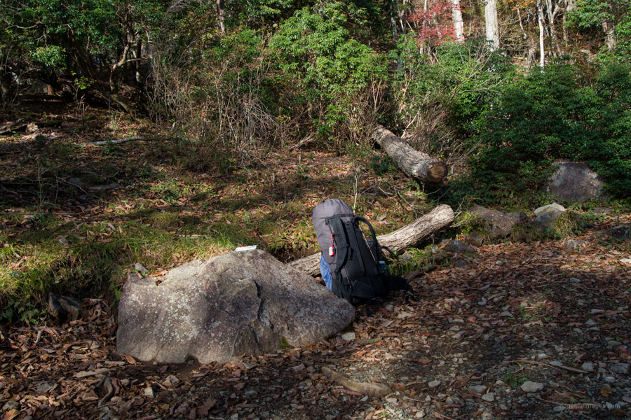
The trail continues over the west side of the summit. Look for a signpost signalling the way to Hashita-toge 端足峠 and Mt. Kenashi 毛無山. The dwarf bamboo reaches its zenith making it difficult to assess what is underfoot as you descend to Hashita-toge (1,272 m). After losing 200 metres in elevation what lies ahead is bang on 500 metres uphill to Mt. Amagadake 雨ヶ岳 (1,772 m). Progress was slow not helped with a backpack ladened with 5 litres of water, definitely one of wild camping’s shortcomings. On the upside autumn colours looked splendid. After 90 minutes of climbing there is an open area bereft of trees. Here the clouds around the summit of Mt. Fuji briefly parted exposing a faint snow-cap.
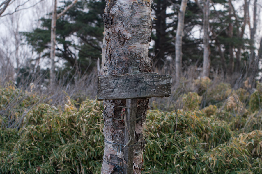
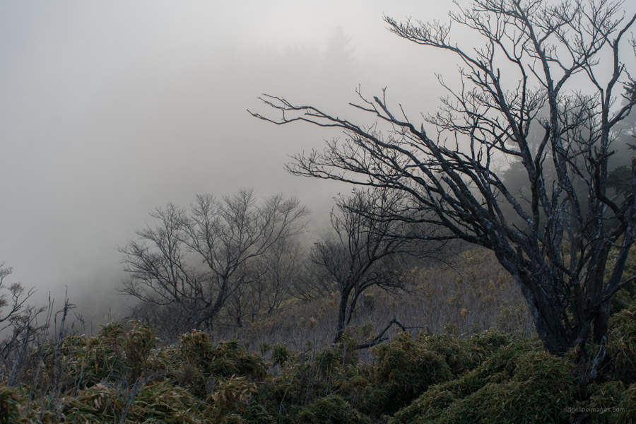
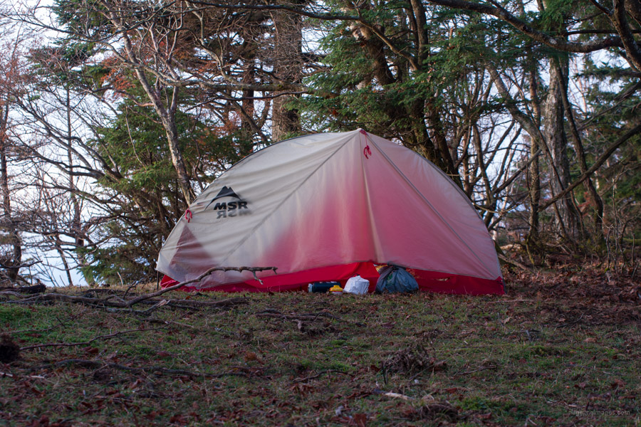
The undulating ridgeline has more fine views of Mt. Fuji. First minor peak to look out for is Takadekki タカデッキ (1,921 m) reached after an hour followed by Omi-dake 大見岳 (1,959 m) another hour thereafter. By this point the ridgeline was shrouded in mist and had become decidedly colder. Somewhere between Omi-dake and Kenashiyama I found a reasonably flat spot to pitch the tent at what I hoped included an unencumbered outlook in the direction of Fujisan. I would have to wait until the morning to find out.
Day 2: Fujisan Delights at Dawn (6.2 km)
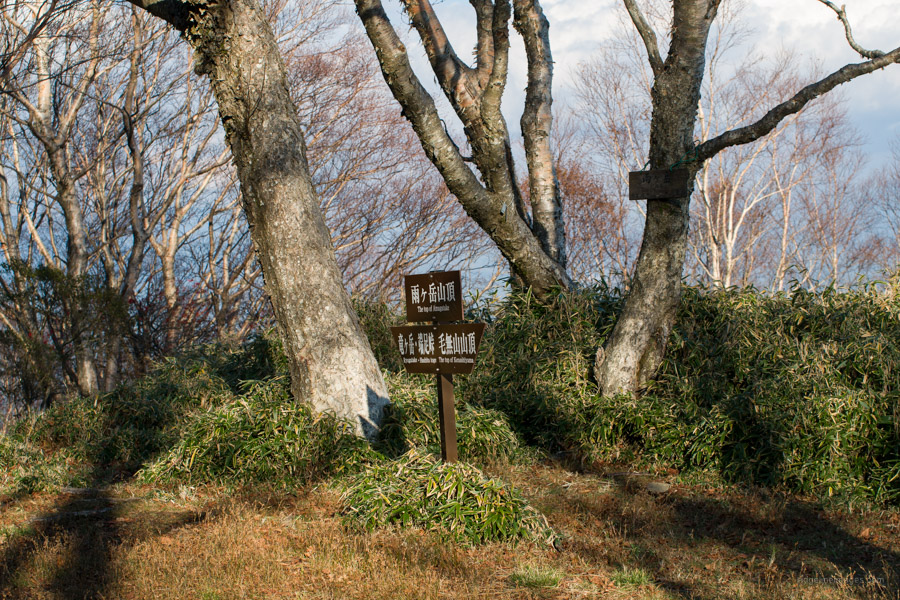
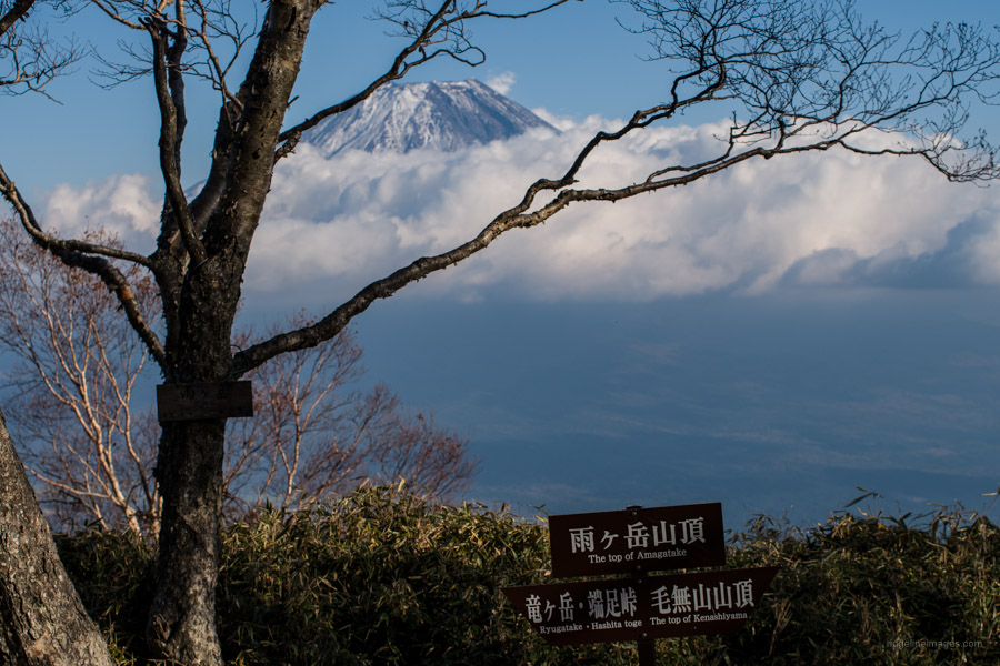
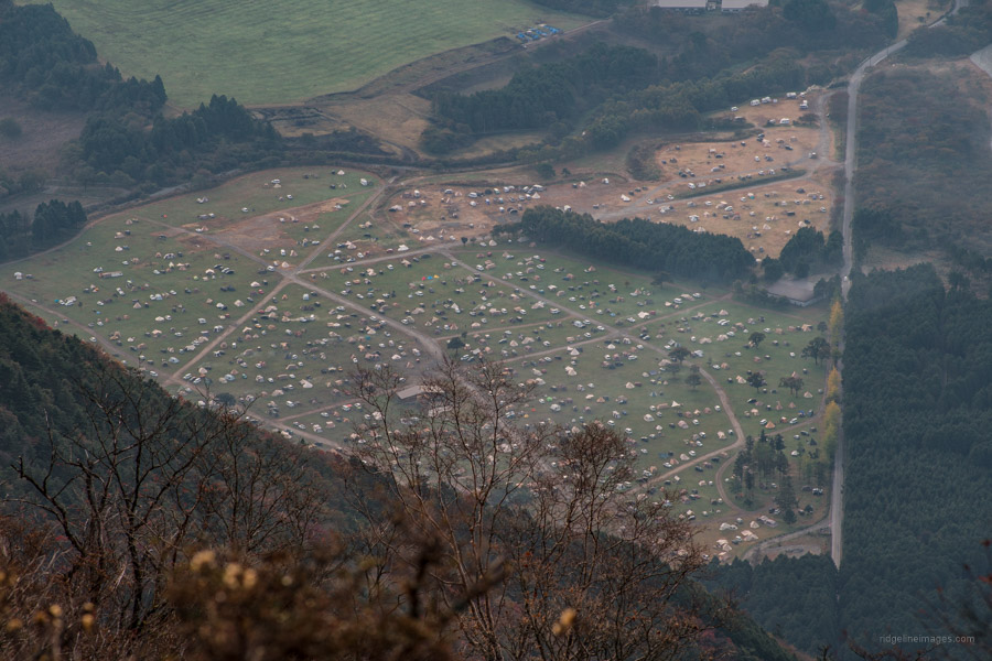
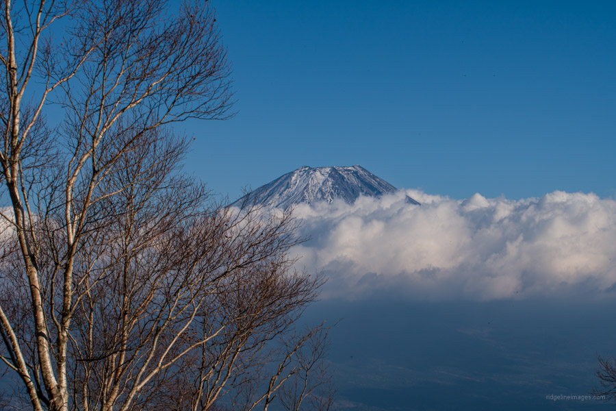
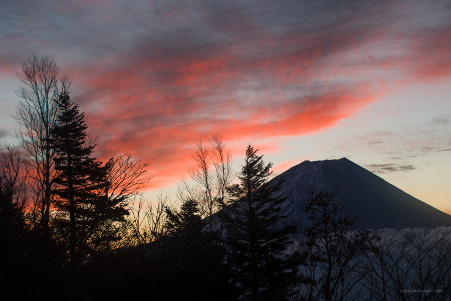
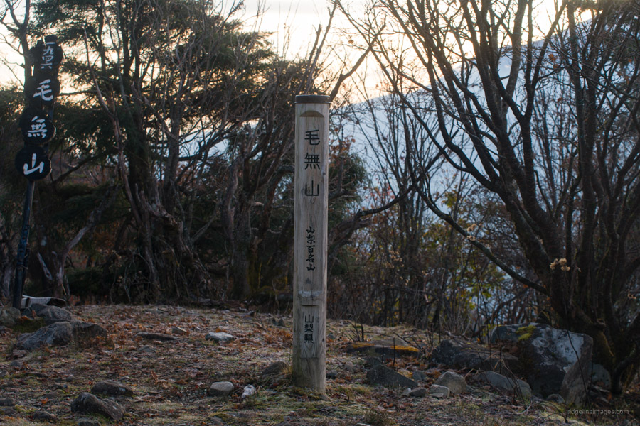
While I slept warmly, the temperature had dipped below zero degrees evidenced by frozen condensation on the tent fly. Emerging from my sleeping bag at first light I was greeted with clear skies and a reddish orange hue that radiated atop Fujisan. Breaking camp, the I set my sights on nearby Mt. Kenashi 毛無山 (1,964 m) which affords a terrific outlook of Fujisan. Along the ridgeline there are several spots where the tree line drops away. Be sure also to keep an eye open for the throngs of campers parked at the Fumotoppara campground below. The summit of Mt. Kenashi has a flat wide area with a view only on the southeast side. A triangulation station is curiously positioned at 1945 m.
There are two ways off the mountain, both finish at the Kenashiyama carpark. The shortest and most direct route is a steep rocky descent via the Fudo-no-taki waterfall. The other option is via Jizo Pass 地蔵峠 which includes about eight stream crossings and shouldn’t be attempted after heavy rain. To descend via the most direct route, veer left at the trail junction a short walk from the summit. The trail is divided into nine stage points 九合目. Around the eighth stage point is the Mt. Fuji Observation Deck 富士山展望台, which was as far as I made it back in March. In fine weather expect a fantabulous panorama from this rock outcrop.
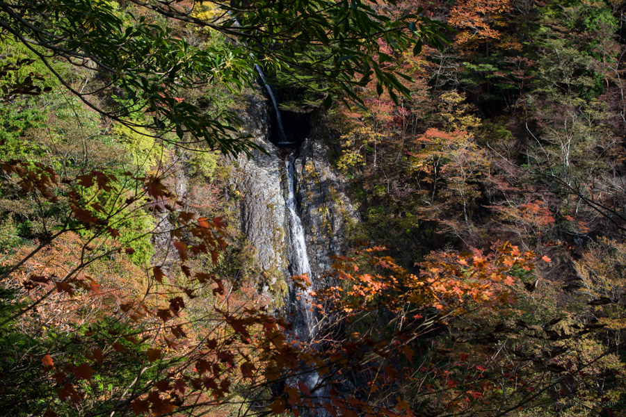
The rocky terrain continues to descend steeply with rope fixed in places to steady your footing. The leaf debris underfoot presents its own set of perils. Prior to arriving at the fourth stage point there is a flat area suitable for taking a rest that doubles as a helicopter evacuation site. About three-quarters of the way down you can see the 100-metre-high Fudo-no-taki 不動の滝 which looks its best in the autumn colours and after that Hasami-ishi はさみ石 a rock formation.
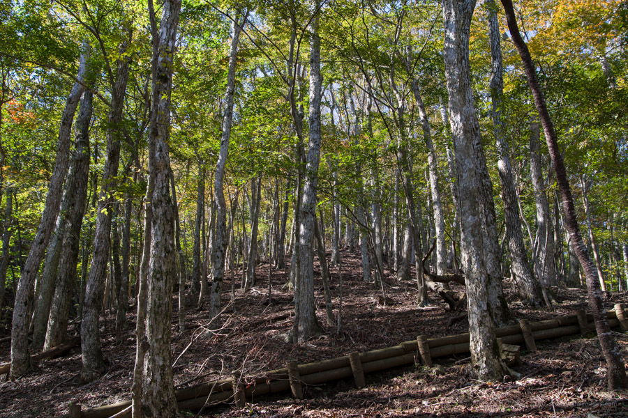
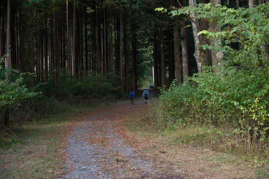
The broadleaf forest shifts to cedar plantation a little before you cross a dry riverbed ahead of the final short walk along a forestry road to the trailhead. From here keep on the paved road turning right at the first corner, past the Fumotoppara campground to the Asagiri Green Park Bus Stop 朝霧グリーンパーク a 40-minute walk from the trailhead. Options include jumping on a Fujikyu Shizuoka Bus bound for either Kawaguchiko Station (59 mins, 1,490 yen) or Shin-Fuji Station (1 hr 8 mins, 1,370 yen).


Great minds think alike. I was thinking of doing this next month. Thanks for the recky.
You won’t be disappointed, it’s a top hike especially in this current season.