.
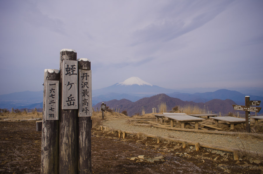
Mt. Tonotake 塔ノ岳 – Mt. Tanzawa 丹沢山 – Mt. Hirugatake 蛭ヶ岳
Distance: 23.7 km
Elevation change: 1383 metres
Highest point: 1673 metres
Start: Okura Bus Stop
Finish: Higashino Bus Stop
Difficulty: ▅▅▅▅▅▅▅▅▅▅ ❸
Map: Yama to Kogen Chizu 山と高原地図 [No.31 丹沢 TANZAWA]
GPX TrackKML TrackGSI MAPPDF Topo Map
Scaling Over the Tanzawa Mountains
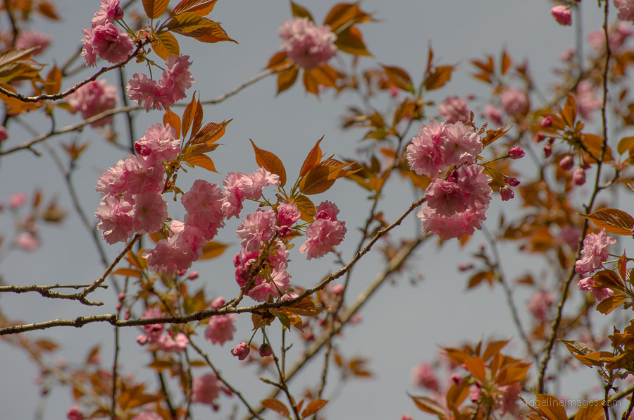
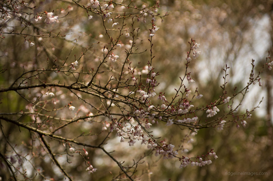
The allure of traversing Mt. Tanzawa has beckoned me ever since I moved to Kodaira City where on clear winter mornings its silhouette is clearly visible from my balcony. Situated within close proximity to Tokyo, the Tanzawa-sanchi 丹沢山地 provides ample opportunity for a variety of overnight jaunts. This hike follows the well-worn trail to Mt. Tonotake and includes bagging the highest point on the range, Mt. Hirugatake.
Day 1: Bring on baka o-ne Stupid Ridge (10.7 km)
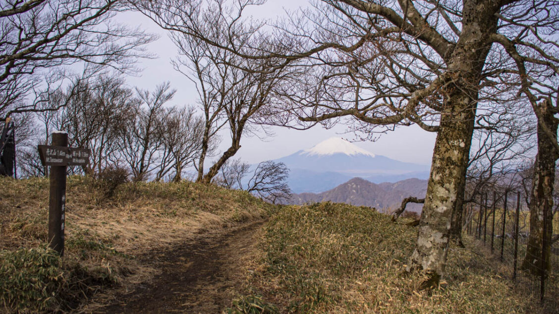
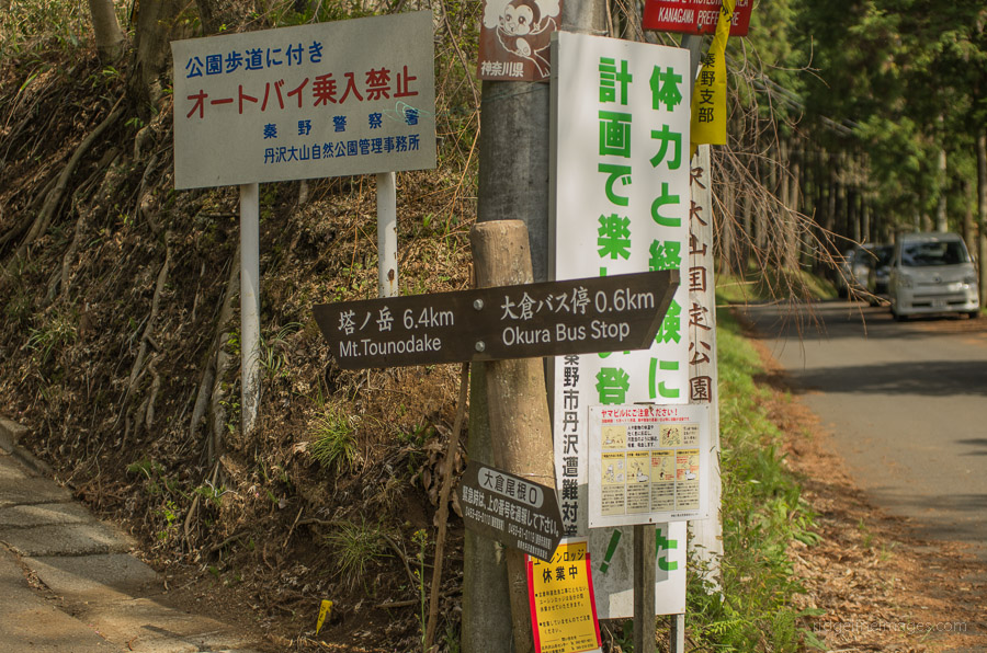
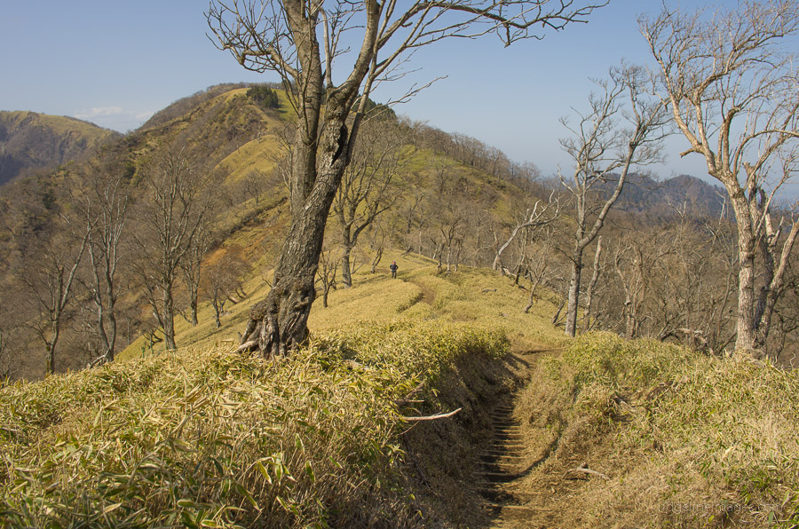
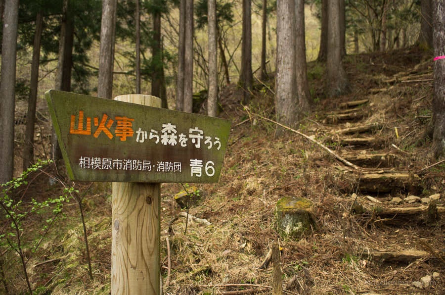
Getting to the trailhead requires taking a train to Shibusawa Station 渋沢駅 on the Odakyu Odawara Line and transferring to a bus for the final leg to Okura 大倉. Buses depart at 30 minute intervals from the north exit (bus stand no.2) click here. After arriving in Ookura, walk up the road for approximately 0.6 km, where a sign points towards Mt. Tonotake 塔ノ岳. The colloquially and appropriately named baka o-ne バカ尾根 ‘stupid ridge’ has a fairly benevolent start with little indication of what lies ahead – a 1,300-metre haul!
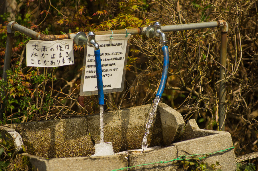
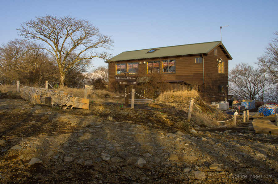
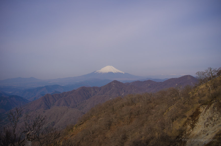
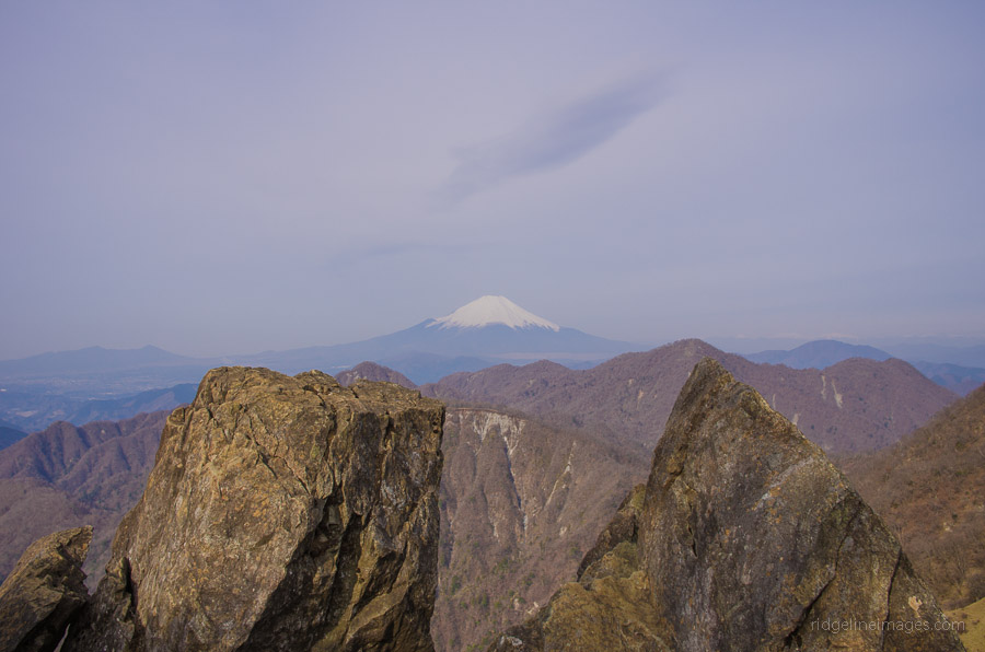
Due to the paucity of water sources, it’s a good idea to pass via the Ookura kougen yama no ie 大倉高原山の家 to top up your water supplies (the hut closed November 2017, and the water supply shut off March 2018). The property is also adjacent to one of the few permitted campsites and is a pleasant spot to take in a short breather. Over the next few hours on baka o-ne you will pass a smattering of sansou or mountain cottages, as you arduously plod onwards and upwards. The Katachi-sansou 花立山荘 makes for a fitting lunch break and provides prodigious views of Mt. Fuji. After filling up on some well-deserved carbs, you will find yourself within one hour of summiting Mt. Tonotake. Apart from a sundial and rock cairn marking its highest point, Mt. Tonotake (1,491 m) is barren, with only the Sonbutsu-sansou 尊仏山荘 standing prominently. The mountain is also notorious for its brutal winds, which were doing their best to blow me to the valley below.
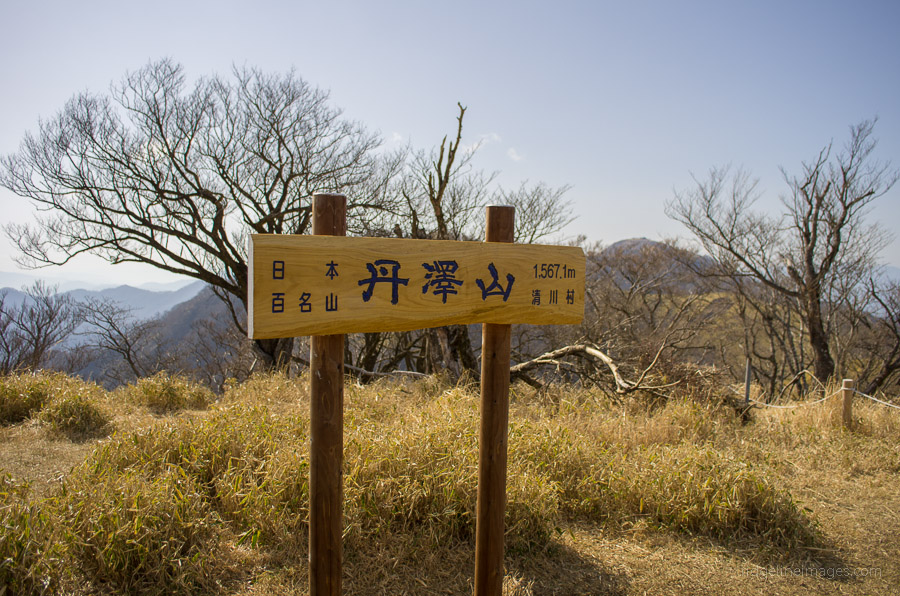
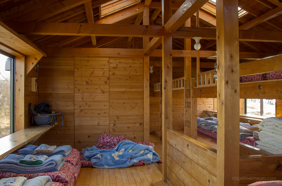
From Mt. Tonotake, there is a watering hole, but it necessitates a 30-minute round trip. The final leg across to Mt. Tanzawa 丹沢山 remains on the ridge as it first descends and then climbs back up. Unlike the trail up to Mt. Tonotake, which attracts a sizeable number of day trippers, they gradually peter out, and you are mostly left to your own devices. Mt. Tanzawa (1,567 m) in contrast, is covered with brush and some gnarled trees, with the Miyama-sansou みやま山荘 aptly fitting into its natural surroundings. This sansou is one of the more ‘deluxe’ huts, setting you back 6,000 yen a night and 9,000 yen including dinner and breakfast. Unlike some other mountain cottages, it isn’t necessary to bring your own bedding.
Day 2: Bagging Mt. Hirugatake (13 km)
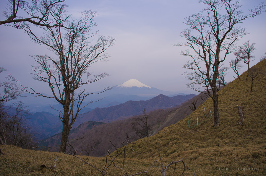
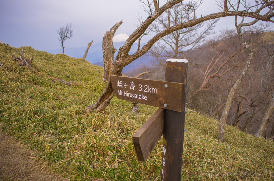
After the lights are unceremoniously switched off at 20:30, the wake-up chorus begins in earnest at 05:00 the next morning. The meals are basic, though they are packed with sufficient calories to ensure you have enough stamina for another day on the trail. After a restful night’s sleep, most of us were back on the trail not long after 6:00 am. Muscle soreness was quickly forgotten as the 3.5 km slog to Mt. Hirugatake 蛭ヶ岳 (1,673 m) commenced. The clear mountain air provided some good snaps of Mt. Fuji and the surrounding landscape. The last push up Mt. Hirugatake was by far the hardest, though the solitude of being alone at the summit was worth the effort.
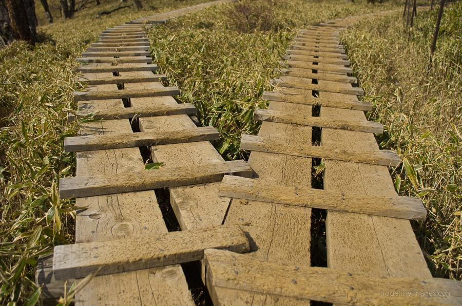
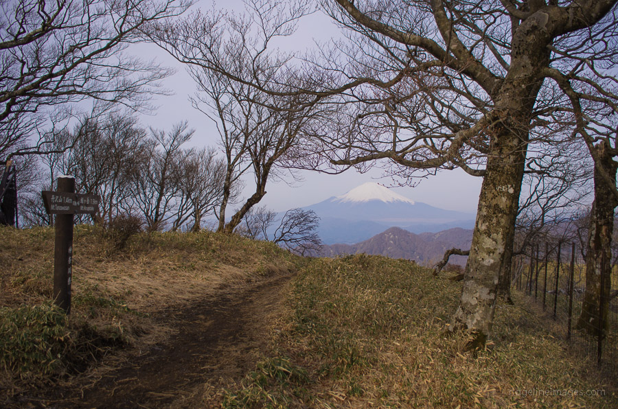
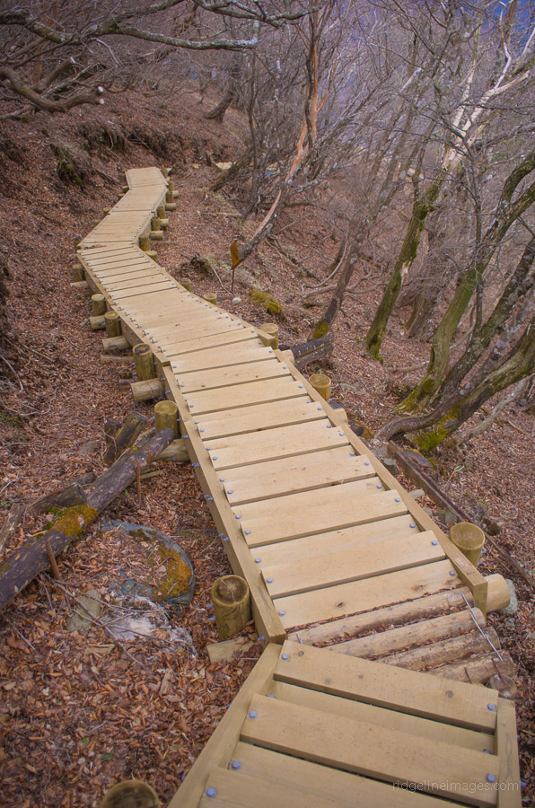
The next section across to hime-tsugi 姫次 entails ambling across pathways with sets of wooden stairs designed with the environment in mind. Apart from one section, the trail is easy to navigate and eventually opens out at hime-tsugi where some purpose-built tables provide a good resting site. The goal for lunch was to reach the Hinankoya refuge hut 黍殻山避難小屋 an emergency shelter with a clearing and toilet amenities.
After lunch, it’s another rather long and steep descent, taking around two hours to reach the Higashino bus stop 東野バス停. It’s a good idea to check the bus timetable before leaving on the second day, as buses tend to run very infrequently on this route. Upon exiting onto the road you pass by a locked gate and follow several signs pointing you towards the bus stop. From Higashino, two buses are required to get back to Hashimoto Station 橋本駅 on the JR/Keio Line. First, take the bus to Mikagi 三ヶ木 then transfer to a bus bound for Hashimoto Station (1 hour, 27 minutes, 960 yen).


Dear David,
My family of 5 (husband, myself, and 3 children aged 21, 18 and 14) will be on Honshu Island from Nov 30 to December 14, We are hoping to do some hiking and would really appreciate any advice you could give us. We are interested in doing the Tanzawa Traverse and possibly Amiga-san Traverse or Mitsu-toge Yama whilst in the Tokyo region, and then we are hoping to hike around the Matsumoto and Kiso Valley, and possibly parts of the Kumano Kodo Trail. However, we are wondering whether there are places we could base ourselves in to do hikes in each of the 3 areas. For example, when we were in Tasmania and New Zealand, we stayed at places like Cradle Mountain Resort and Tongariro Crossing, and New Plymouth and used them as bases to do day hikes in those areas. Where would be a good place to base ourselves for the hikes in the Tokyo region?
Also, if we ended up having time for only one hike, which of the three (Tanzawa Traverse, Amiga-san Traverse and Mitsu-toge Yama) do you think is the most scenic?
Thanks, David! Appreciate any advice from you.
Hi Lyn,
Sounds like you have some great hiking adventures planned. First thing to consider is late November most peaks over 1,500 metres will likely have some snow cover and without light crampons I would be limiting your hikes to under 2,000 metres. Personally I would recommend either the Mt. Tanzawa traverse (2 days) or Mitsutoge which can be done as a day trip. As where to base yourself between hikes it’s a little more complicated as Japan doesn’t really have some type of resort networks. The hikes you mention are also pretty spread out so it’s not practical to remain parked in one location. For Amagi san I would probably stay around Hakone (a beautiful place to visit) or Atami. Around Lake Kawaguchiko there are plenty of tourist hotels near Mitsutoge. In the first instance I would be seeking out a hotel on the outskirts of Tokyo such as Hachioji which is a good staging point to any of the hikes you mention. All the best for your trip 😉
Hi David,
Thanks so much for replying so fast. And thanks for your advice on the impracticability of trying to find one location for the different hikes! It had appeared that way to me but it’s good to be able to confirm that. We will most likely do the Tanzawa Traverse over 2 days, and stay in one of the huts as we’ve never experienced staying in a hut before. I had read somewhere but can’t seem to locate where now that it is more scenic to start from the Minoge end, to Yabitsu-toge, to To-no-take, ,and then to Tanzawa-san, Hiru-ga-take and on to the end at Nishi Tanzawa Shizen Kyoshitsu, instead of starting from Okura. The person said that the way from Okura went through bush/forest with little access to views. Would you be able to advice on whether this route has any advantages over starting from Okura to To-no-take?
Also, I read your post on Nishizawa Gorge. It sounds beautiful, but I gather it would take 2 and a half hours to travel to the start point from Shinjuku Station. Would early December (around Dec 3) be too late for autumn colours, past on last year?
Once again, your advice would be much appreciated.
Lyn
Hi Lyn,
As I haven’t hiked the trail from Minoge through Yabitsu toge I can’t really comment, though could be an alternative as the hike from Okura is quite long and brutal. While the first leg from Okura to To-no-take remains mostly hemmed in, views of Mt. Fuji are definitely possible and also back towards the Sagami Bay area. As for Nishizawa Gorge the peak time for autumn foliage viewing is mid to late November so by early December it’s probably not an ideal time to visit.
Hi David,
Many thanks for your advice. We hope to do both the Mitsu-toge Yama and the Tanzawa Traverse hikes, and will look more into whether or not to take the alternative route for the Tanzawa Traverse. We hope to stay overnight at Miyama Sansou. How long did it take you to go from Okura to Miyama Sansou? Thanks once again!
Lyn
The Miyama Sansou is quite a lovely place to stay though note an advance reservation is necessary. From Okura to Miyama Sansou it takes around 5-6 hours including a lunch break.
Hi David,
We have acted on your advice on Miyama Sansou and have made an advance reservation with Miyama Sansou with the help of a Japanese friend! Really appreciate your taking the time to respond to my queries. I have enjoyed reading your posts!
Thanks once again,
Lyn
Nice work. Thanks for posting this. I’ve been looking for this type of good information. I’m often in Tanzawa but I’m a little worried to venture out too far without good maps. Only Nishi-tanzawa area (wellcamp) and Tonodake are my stomping grounds. This gives me motivation. I will try. Appreciate it.
Good to hear the information has come in handy. Your right carrying an up to date map is essential especially around Tawazawa with trails leading off in every direction. Best of luck with your future adventures on the Tanzawa-sanchi.
David;
Is there any place to do some camping here away from the trail and not at the trail-house? I don’t mind paying the money but it seems really hard to find places to camp in this area of Japan!
Jacob, the only official place to camp is at the Ookura kougen yama house which is around a 40 minute walk from the Ookura bus stop. Unofficially there is a flat open area at the Hinankoya mountain hut with a water hole nearby. If you decide to wild camp elsewhere your biggest impediment is going to be finding reliable places to fill up unless you’re prepared to carry it in yourself. In the past there was a campsite between Mt. Tanzawa and Mt. Hirugatake but due to impacts on soil and vegetation it is no longer permitted.
I just got home from doing this hike. What a great hike! Yesterday’s hike up to Tanzawa was long and difficult. The overnight stay at the Miyama Sensou was nice; the people were great and the food was much better than I expected. I was certain that I’d be fed cheap ramen, but to my surprise I was given a very nice meal of roast duck (yes duck!) rice, soup, pickles, etc. Very tasty! Breakfast was also good.
One thing to note to anyone going here: there is no running water. Bring hand sanitizer or extra water if you want to wash up or brush your teeth.
This morning from Mt. Tanzawa I followed the trail up to Hirugatake. Lots of steps. Slow going but overall very enjoyable. The views were spectacular. From Hirugatake onwards was slightly precarious with bits of ice and mud. I really could have used some trekking poles. The descent was long and painful for me. I find descents harder than climbs.
After exiting the trail onto the road I saw the signs pointing to the bus stop; it was easy, until the signs just stopped. I had to flag down a driver who pointed me in the right direction. I got to the bus stop but had no idea I was there. I stopped in the store across the street and asked where the bus stop was and she pointed to the stop. As I was walking over the bus passed. I couldn’t read the kanji fast enough to be certain it was the right bus. I figured I’d wait for the next one. I got to the schedule and realized I don’t read enough Japanese to make any sense of it. I took pics and sent them to my Japanese wife. Turns out waiting for the bus and then the train would’ve had me home around 7 PM. She drove out and picked me up.
Perhaps if you know enough Japanese to work the bus then this trip could be great. I think next time I’ll do what some friends I made on the trip did. They started at Ookura and hiked to to the Miyama Sensou. The next day they hiked over to Hirugatake, had breakfast there, and then returned all the way back to Ookura. I think this trip makes more sense because the buses to Ookura are frequent, and the bus stop at Ookura is more substantial with a restaurant or two. It’s a more pleasant place to wait for a bus.
Thanks so much for your blog! I’ll post a link to a photo album I made of the trek later tonight.
David it sounds like you had an awesome hike. Though I’m not a big fan of mountain huts the Miyama-sansou is one which stood out, and roast duck for dinner incredible! They really have gone up market. In respect to locating the bus stop, I also remembering having much the same problem and had to ask for directions as I was about to follow the wrong road. The actual bus stop is kind of obscure and hadn’t realized at the time you have to catch two buses to Fujino Station. Again great to hear the trail notes were helpful and look forward to checking out some of your trail pics.
Here are my photos from this trip. Hope you all enjoy them. http://imgur.com/a/hfamm
Loved the photos David especially Mt. Fuji with it’s cloud cap! Looks like you scored some fine weather. It brought back memories with that hard slog up to Mt. Tanzawa and those equally interminable wooden steps heading down from Mt. Hirogatake. Thanks again for sharing and hopefully it will spur you on to try some other overnight hikes.
Yeah, I’ll do other hikes as well. After being up there and studying the maps there, I have a lot more confidence and think I can manage just fine. I have this crazy idea to camp out somewhere along the way. I have a hammock and spotted so many places that would work, especially the pine forrest at the end of the hike.
Hi David,
great blog, great inspiration for me, especially for solo hiking.
I wonder if you think is possible to hike Tanzawa and back to Shibusawa in one day. I’m not a big fan of yamagoya and prefer to pitch a tent but from what i’ve read there is no “official” camp site on this trail. I got a map (bough from IC sport) of the entire area and even going after Tanzawa there are only huts.
Hey Riccardo thanks for the kudos, I really appreciate it and for getting in touch. I completely understand where you’re coming from regarding mountain lodges. Unfortunately for us, Mt. Tanzawa is one of the few mountains where there isn’t much else of a choice. A one-day return hike starting and finishing at Shibusawa would perhaps be a bridge too far unless your fitness level is fairly high as you’re looking at around 7.5 hours actual walking time excluding rest stops, also the scramble up Baka ridge is quite brutal. Personally if you’re intent on doing it in a day, a far better plan would be to set up your tent at the unofficial Ookura kougen camp site about 40-minutes from the bus stop so you wouldn’t have to rush back for the last bus. There is also a toilet and a reliable water source at this hut. This approach is often used by those hoping to catch the first sunrise from Tounotake on New Year’s day.
Hi David, thanks for the amazing write up and pics. I am an avid mountain biker and was wondering if these trails can be ridden on a proper full suspension mountain bike. Of course on staired and super steep sections pushing and walking is necessary but it really looks promising…
Thanks for the kind feedback. The short answer is no well at least on this particularly route. There are simply too many people around to be tearing down these trails at any speed really. Plus as you mention the staired sections are substantial. These mountains are also part of a Quasi-National Park so are mainly geared (no pun intended) towards hiking and mountaineering. If you’re into enduro / all mountain trails I would suggest checking out some of the excellent trails surrounding Ome City (West Tokyo) or perhaps Atsugi City nearby the Tanzawa mountains.
Hi David,
Thanks for the amazing write up! I am planning to do this route this coming Saturday – Sunday. Do you know if there is place where I can pitch a tent or should I say a campsite? I’m kind of a tent guy so staying in a hut is not really in the list but if I don’t have a choice, I can still stay in a hut. Also, I’m trying to find Tono Bus Stop which you point out to be the exit point, but I can’t find it in google maps. I know this post is year 2013 so maybe that bus stop is already gone? haha. Or maybe I’m not that good in looking in Google Maps.
I’m really hoping you can help me in my questions 🙂 Thanks again David!
Hi Cliff,
Thank you for your kind words and and questions. The only place you can pitch a tent is at the Ookura kougen yama no ie, so unless you plan to hike in reverse you will need to stay at one of the mountain huts. From memory Tono Bus stop wasn’t difficult to find and it should be marked on the latest Yama-to-Kogen map which I recommend bringing along.
Best of luck with it!
I just got back (early February 2020) from a Friday / Saturday winter hike from Okura to Tanzawa and back; about 20 km in total. If you like hiking in winter with moderate snow on the peaks, this is one way you can do it : arrive at Okura bus stop around 10.30 a.m. Hike 7 km to Tonodake; takes about 3 hours 30 mins to summit. Stay at the Sonbutsu Lodge on the top of Tonodake. There are great unobstructed views toward Enoshima to your left, and to your right picture-perfect Mt. Fuji (if you’re lucky). 1 night + dinner + breakfast = 7000 yen. Dinner was a basic curry; breakfast was oden and rice. On the Friday night, about a dozen hikers slept overnight. Bedding keeps you warm. On Saturday, after sunrise (about 6.30 am) head over to Tanzawa (2.6 km, one hour), then return to Tonodake. From there, head back down to Okura. You’ll meet scores of day trippers going up as you descend. The second day (Saturday) is nearly 13 km of hiking, so you may be tired, but it’s all worthwhile for the amazing winter views. A final point for safety: if it snows, the Okura Ridge route is better as the snow melts more quickly than on the Yabitsu Toge route. I did the hike without crampons, and it was fine; many other hikers did use them, though.
Thanks for the trail notes Andy. Sounds like the Sonbutsu Lodge is a good place to base yourself without costing too much either. I guess Friday’s night sees fewer hikers than on the weekend reducing the potential for snorers keeping you up half the night. It’s been years since I hiked ‘baka-one’ and keen to check out some of those awesome early morning winter views.
This is a very popular hiking region, so avoiding weekends, even in winter, is best. Earplugs if staying overnight are useful — it only takes one snorer…. For any readers who’ve done the Tanzawa Traverse, there is another intriguing route I noticed. Hike up any route you choose to Mt. Tanzawa and stay at its summit lodge. Next day, from the Mt. Tanzawa summit, instead of taking the left route to Mt. Hirugatake, take the RIGHT route signposted to the Miyagase Lake / Dam. It is 11 km (which is roughly the hiking time back to Okura). From the Dam area, there are very regular direct buses back to Hon Atsugi Station on the Odakyu Line. I will try this route in the near future.
Finally did this hike this weekend. Been eyeing it for a long time. Only now I’ve noticed that this was posted a while ago, so, naturally, some things have changed.
I felt like this hike would be a good start for multi-day hiking and oh man did I learn some lessons from this.
First of all — spontaneous hikes are a bad, bad idea. Although I managed to prepare everything, I had to sacrifice sleep doing so and ended up messing up the trains and starting a lot later than expected (11am from Ookura). No to mention being pretty tired from the start. Not what you want on the baka ridge, trust me. I had to rush in order to stay on (updated) schedule and reached summit of Tanzawa at around 4:30pm. An hour later and the whole thing would be basically on the edge of safety. 2 hours later and it would’ve been plain dangerous, hiking after dark is a no-no. So, had this been not summer, I’d have to scrap the entire thing.
The climb up the baka ridge is really, really bad. In general I felt like the entire route was a very frequent sequence of descents and ascents and every time I’ve seen the trail going down, my mind erupted into a protest imagining a yet another climb ahead.
I’ve made many mistakes prepping for this hike, but the worst one is a part-mistake part-experiment. I wanted to go lighter so instead of doing the usual thing of carrying A LOT of water I decided to rely on the water points and bought one of those squeeze filters in case things really go south but a body of water will be available.
Long story short, the only water point of the ones drawn on the map I’ve seen was the first one at 大倉高原山の家 and even that was non-operational. Ended up buying some water at the huts but even so, ended up severely dehydrated first day to the point of muscle cramps when nearing the end of first day’s route (I suspect the baka ridge was a huge contributor to that but also yeah, water). It’s a bit weird as some water points are marked as being practically on the trail but I swear I’ve seen nothing. Maybe they were a bit off to the side…
In any case, I still want to try and rely on water points more in future, but I guess I’d better scout out those beforehand using other people’s trail records.
Oh, also, that filter — I ended up using near the end of the route because there was actually a river there! Lucky purchase.
The route itself was overall pretty quite these days, practically just like you described: after Mt. Tounotake you’re almost on your own for the rest of the journey. Closer to Mt. Tanzawa the area becomes absolutely gorgeous. Greenery is mostly limited to short bushes so you can look in any direction, enjoying mountainous views, valleys and seas of clouds. Get your camera ready! This is exactly the kind of hikes I’d love to do more, where you get to traverse a more-less flat ridge that is high enough that there are no trees surrounding you.
At Miyama-sansou there were just 4 of us hikers in total. Nowadays the price is 8 thousand yen for a stay with a dinner and a breakfast. Food was superb and just what one needs after climbing this stupid, stupid ridge. Also, the lady in charge of the yamagoya is very kind.
One thing I wish I knew when I got there is that while the area near the hut itself is shored off by the trees, in just 5 minutes on foot in the direction of Hirugatake there is a wide open space with more-less the same mountainous views as before. Useful if you want to capture sunset or sunrise.
Up until hime-tsugi the trail is pretty uneventful, considering you are descending deeper and deeper into the woods. The problems begin shortly after that checkpoint. The trail gradually becomes worse and worse with a lot of fallen trees and plenty of mud on the way. In some places there is practically no trail and you are left guessing using a compass/looking for the cloth stripes on the trees. And it only gets worse closer to the river. Multiple times I almost went into the wilderness because it was really hard to tell where to continue.
Thankfully, at some point the madness ends and you’re greeted with a paved road that takes you to the bus station, but no way I am doing that descent ever again. I am surprised that this route is not marked as beaten up in yama to kogen.
Interestingly, I have considered an alternative route which I’ve seen in the guidebook that comes with yama to kogen. In that route instead of turning to Higashino 東野 you continue straight through Yakiyama exiting at 焼山登山口.
The main issue with both, however, is that at the weekends the buses run twice a day: at 7:20am and 4:20pm. Both areas are devoid of things to do while you wait around 4 hours for a bus (I arrived at Higashino at around 12:35pm, starting from Tanzawa around 6:20am).
Luckily for me, a Japanese couple passing by in a car got very curious about what the hell am I doing there so after a short chat and a round of “eeeeee” when I explained the bus schedule they gave me a lift to Mikage, the next transit point in getting back to the city.
All in all, I think this a great hike and you did a terrific job with a write up as usual. Given the age of this report, maybe it’d be cool to incorporate a warning that things have changed and to everyone else who’s going to attempt this: I suggest you think through that second day route. While Hirugatake is a pretty nice summit, the hike up there is prettier than the summit itself, and given the difficulties that arise from taking that path, maybe it’s a good idea to consider going somewhere else from Tanzawa.
Anyway, thanks as always for this report, David.
P.S. Also I think I found my limit for eating those carb gels and calorie mates. For anything longer than 2 days a gas canister with pocket stove and proper food is probably a must, haha. That food at yamagoya was a breath of fresh air.
Hey Alex, thanks a lot for taking the time to share your experiences from your first multi-day hike. Coincidentally, this was also my first overnight outing in Japan and similarly learned much from it. Like yourself I also found it considerably harder than I had imagined especially that first day. Hiking in Japan is a bit of learning curve in the beginning, though by the sounds of it you managed quite well. If I correctly recall some parts of the trail after hime-tsugi even when I hiked it were a tad vague. As a precaution and to make your life easier in the back country get the Yama to Kogen Chizu App and downloadable map or invest in a Garmin GPS – if you happen to find yourself utterly lost it’s a lifeline. When I originally planned this hike, my intention was to continue to Yakiyama but gave up on this idea when I couldn’t figure out the bus route but seems like a good suggestion to look into. Another idea is following the LP Hiking in Japan route which steers east at Hirugatake going via Hinokihoramaru 檜洞丸 finishing at Nishi Tanzawa Kyoshitsu.
I carry a paper version of Yama to Kogen and it has been invaluable so far. But you are right about a Garmin GPS — it’s practically the next thing on my list of gear improvements.
This hike actually highlighted the weak spots in my current gear very well, from navigation to rations to even apparel. But it’s a lot of fun!
Putting this on your radar : couldn’t find Mt. Nabewari on your site where this post might belong…anyhow — did Omote Tanzawa Forest (No. 7 in Day Walks near Tokyo) — Kokuryu Waterfall — Omote Tanzawa Forest campsite — Mt. Kunugi (800m); back the same way. Kunugi is not part of his route.
Notes : follow the Day Walks route to the picturesque waterfall. Then, crossing the lovely river, follow the sign up to the campiste (10 mins.). You’ll hit a road and wil see the campsite 20m away. Has toilets and running water. There’s a big signboard with the Kunugi route. After 5 mins, you come to a crossroads in the path. The left route (also to Kunugi) is a bit overgrown; I took the route straight ahead. Summited in 1 hour. Nice views. Same route back. A 4 -4.5 hr hike. Was testing out my new Altra Superior 4 trail shoes — each shoe is 272 g. More on that later…
Nice one, just had a look at that hike in Gary Walters book so duly noted. As for Nabewariyama it has been on my hiking radar for literally years so a nice reminder to pencil it in for the New Year.
Apparently, the owner of the lodge on the top of Mt. Nabewari summitted Everest. Don’t know how good your Japanese is (mine prettyb bad), but would be an interesting guy to chat to. And his noodles are pretty famous, I heard.
On the ascent route to Nabewari from Okura, after about 3km, you pass the (easily missed) sign to the waterfall and Omote Forest district.
Hi David,
Thanks a lot for your articles we have been reading religiously since moving to Japan two years ago! We are particularly keen on your advised spots for wild camping as we are not big fans of lodges. Worked a charm around Mt. Daibsatsurei. (It is precious advice as sometimes there is just no flat spot on a hike!). So reading the comments on this one, seems like you wouldn’t recommend to do this at all?
Hi Lou. Thanks for the comment and for following the blog. It’s possible notwithstanding the following caveats. Water sources are few and far between so you’re going to have to carry a lot of it. Also, and probably more importantly sasa (bamboo grass) that grows along the ridges reduces potential spots to wild camp or not at least without impacting the natural environment.
Thanks for your quick answer!
Ok that makes sense. Will probably pass on the camping for this one just in case then. Thanks for your advices!
Hi David!
We are planning to hike the same route (Okura Bus Stop > Mt. Tounotake > Mt. Tanzawa > Mt. Hirugatake > Tono Bus Stop) on the first week of May and we’re wondering which mountain hut is the best hut you advice when staying for the night? We actually don’t mind the food and comfort of the lodging but since 尊仏山荘 is in Mt. Tounotake and みやま山荘 in Mt. Tanzawa, I want to know which mountains are better to combine and which ones are like overkill lol
Okura > Mt. Tounotake > (sleep) > Mt. Tanzawa > Mt. Hirugatake > Tono
or
Okura > Mt. Tounotake > Mt. Tanzawa > (sleep) > Mt. Hirugatake > Tono
Just want to know based on your experience, would mean a lot. Thank you!
Hi Pat. I recommend staying at the Miyama sansou the same as I did. It’s quite a nice hut and marks the approximate mid-way point of the hike. If you start hiking at 9:00 am you should reach Tounotake at midday and Mt. Tanzawa around 3:00 pm which is a good time to arrive.
Sorry to jump in, just to clarify: 東野 is not “Tono” but rather “Higashino”.
Could save some headache when explaining your final point at the lodge registration.
Maybe David can correct the article?
Good luck with the hike!
Thanks Alex. Duly noted and updated.
Hi David,
Going back quite a bit — your 9 March 2015 post mentioned a water source near the Hinangoya (Kibigara Refuge Hut). Thinking of staying there. On phoning Nishi Tanzawa Visitor Centre, they said there is no water source nearby. Where was it? Can you remember? Much appreciated if you can
Andy the water hole is 10-minutes’ walk from the Kibigarayama hinangoya 黍殻山避難小屋 near the 大平分岐 trail branch (it’s marked on the Yama to Kogen map). According to this hike report, it was running a couple of weeks ago https://www.yamareco.com/modules/yamareco/detail-3095849.html. It’s a rather nice hut these days and wouldn’t mind spending a night there myself in the future.
Back from the northern section of the Tanzawa Mountains (Himetsugi — Mt. Yake –Aonahara area). As others have noted, almost no buses to / from the Mt. Yake trailhead, so this was my workaround:
From Sagamiko train station, get a bus to Mikage, (Mine was 8.05am). As there are no buses til 4pm ish, you must road walk 1.5 hours at a brisk pace (1 hour of this is meh, but the last 30 mins picturesque). Route: Mikage Bus Station — Hanbara direction — Doshi direction, just follow the road thru Aonohara District til you see a 7-11 convenience store (the only one on the whole road walk). No need to carry water for this part — vending machines along the way.
Stop for brunch at 7-11, buy water if you like. Take the small road up to the right of the 7-11, 1 minute later, you’ll get to a small intersection with a small red torii gate. This is the trailhead. Sign here straight ahead 3.8km to Mt. Yake ( At the intersection, look to your right — you’ll see Nishinono Bus Stop 30 metres on your right). After hiking 10 mins, you’ll cross a metal bridge. This is the only water til the water source (big kanji sign for this on the main trail) 5 mins. before the Hinangoya (Refuge Hut). From Mt. Yake it’s 2.5km to the Refuge Hut. I did this in May, temp. 22c, and only needed to carry 1 litre of water til I got to the hut. The water source is currently a small steady flow, totally OK.
After taking a rest & going to the water source, you can walk to Himetsugi w/ views of Fuji, and back to the hut. Next day, walk back to Nishinono Bus Stop, same route.
Now the important part : on weekends and holidays, there are currently only 2 buses per day from Nishinono Bus Stop to Mikage, at 8.10am and 4.35pm. To get the 8.10 am bus, and at an average hiking pace, you’ll need to leave the hut by 5.45 am.
You should arrive at 7.30 -45 am, enough time to pop into the 7-ll for a roasted coffee.
The route is well-signposted, sometimes in English, but always w/ distance markers. You can’t get lost (but of course bring a map).
Hi David!
I’am planning to hike the route (Okura Bus Stop > Mt. Tounotake > Mt. Tanzawa > Mt. Hirugatake > Tono Bus Stop) 2 days in early August.
Would please advise on whether this is a good time to hike in the Tanzawa range as I have read on other websites about how during the warm season the Tanzawa range becomes a breeding ground for leeches.
Also could you please tell which (if any) of the mountain huts offer free night accommodation?
Thanks a lot!
Hi Afraz, thanks for your questions. Generally, summer is not the best time to hike the Tanzawa Mountains as apart from the severe heat the area is a haven for land leeches (yama-hiru). If you do definitely pack some salt with you. As for free huts the best by far is the Kibigarayama refuge hut which was rebuilt a few years back. Hope that helps.
Thank you so much for your helpful suggestions David. I know that this particular hike is strenuous and therefore, enjoyable but I don’t have to go out of my way to make it unnecessarily difficult especially in the Japanese summer season. So, thank you once again for your insights.
No problem at all Afraz 🙂 Good decision to wait until later in the year before tackling this overnighter.
Hi David.
Thank you so much for the detailed information about the hike. My boyfriend and I did the hike last weekend from Nishi tanzawa visitor center – Mt. Hirugatake -Mt. Tanzawa -Ookura bus stop.
Your blog helped a lot for planning the hike, ( I usually refer to the ridgelineimages.com while planning a hike, and we always have a wonderful time, and I feel I should say thank you) so … thank you very much ☺️, your blog just made our life in Japan more enjoyable.
Hi Lucia, many thanks for following the blog and so pleased you both enjoyed the hike. BTW nice idea setting off from the Nishi-Tanzawa Visitor Center. And I must say it’s comments like this one that motivate me to keep the blog going so thanks a bunch 😊
Hello,
I am planning to do the hike that you have outlined on Feb 9th-10th. Do you need to hike next to steep cliffs on one/both sides? I get nervous especially if it is slippery. Do you have the link for the Higashino Bus Stop (I was able to find the starting one, but not the finish one)? thank you for any information you can provide!
Hi Sherrie,
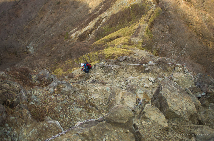
The hike doesn’t have any particular exposure like you mention. There is one rocky descent with some chains, but nothing alarming. Expect there to be snow and ice around, so make sure to carry some 4-point crampons or microspikes. Here is the link for the Higashino bus stop. As it now takes three buses to get to Fujino Station, it is quicker to head to Hashimoto Station on the JR/Keio Line. I have updated the trail notes to reflect this. I hope it all goes well for you 😊
https://www.kanachu.co.jp/dia/diagram/timetable01/cs:0000800243-7/nid:00128774/rt:0/k:
Hi David,
Thank you so much for the quick response — I really appreciate the help. I will let you know how it goes.
Best,
Sherrie
Hi David,
I hope you don’t mind another question. It looks like there is a 70% grade from the Hinankoya Hut down. Is that part harry/dangerous?
Thank you again for your help — I really do appreciate because I don’t want to get in over my head.
Best,
Sherrie
Hi Sherrie,
No worries about asking. The first part of the descent from the Hinankoya Hut (for around 500 metres) is indeed quite steep. As long as you take it slowly and carefully, it isn’t an issue. From memory, I don’t recall anything particularly dangerous. The hike overall is popular and quite safe, so you’ll be fine.