.
Oni-no-iwaya 鬼の岩屋 – Mt. Tenjin 天神山 – Mt. Chigootoshi 稚児落し
Distance: 8.9 km
Elevation change: 270 metres
Highest point: 634 metres
Start: Otsuki Station (JR Chuo Main Line)
Finish: Otsuki Station (JR Chuo Main Line)
Difficulty: ▅▅▅▅▅▅▅▅▅▅ ❸
Map: Yama to Kogen Chizu 山と高原地図 [No.29 高尾・陣馬 TAKAO·JINBA]
GPX TrackKML TrackGSI MAPPDF Topo Map
Don’t Underestimate this Pint-sized Mountain
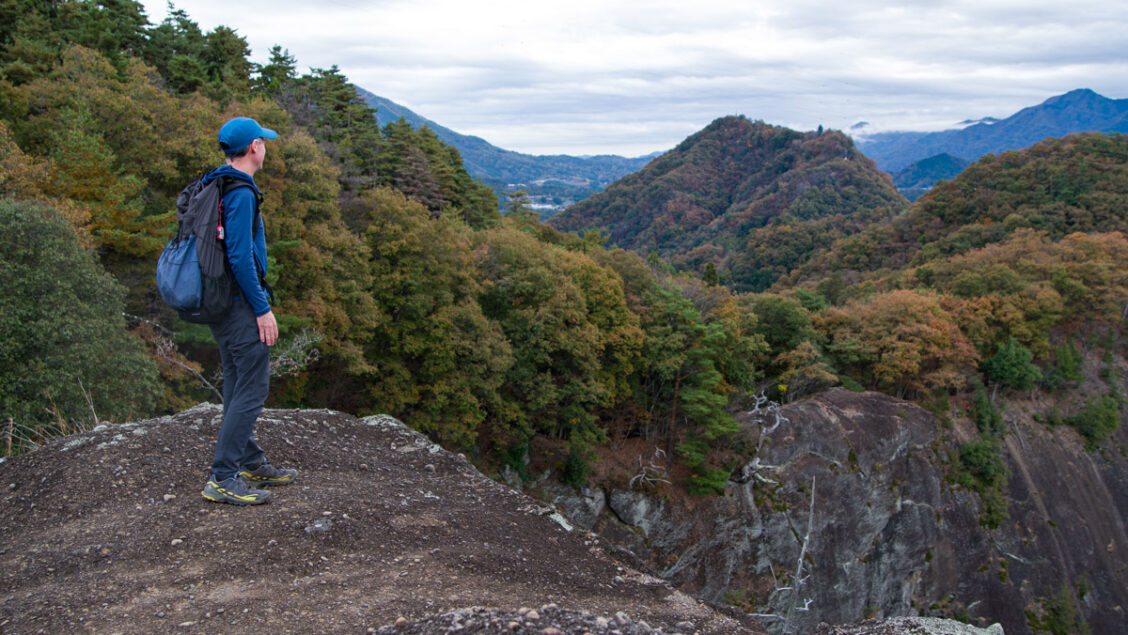
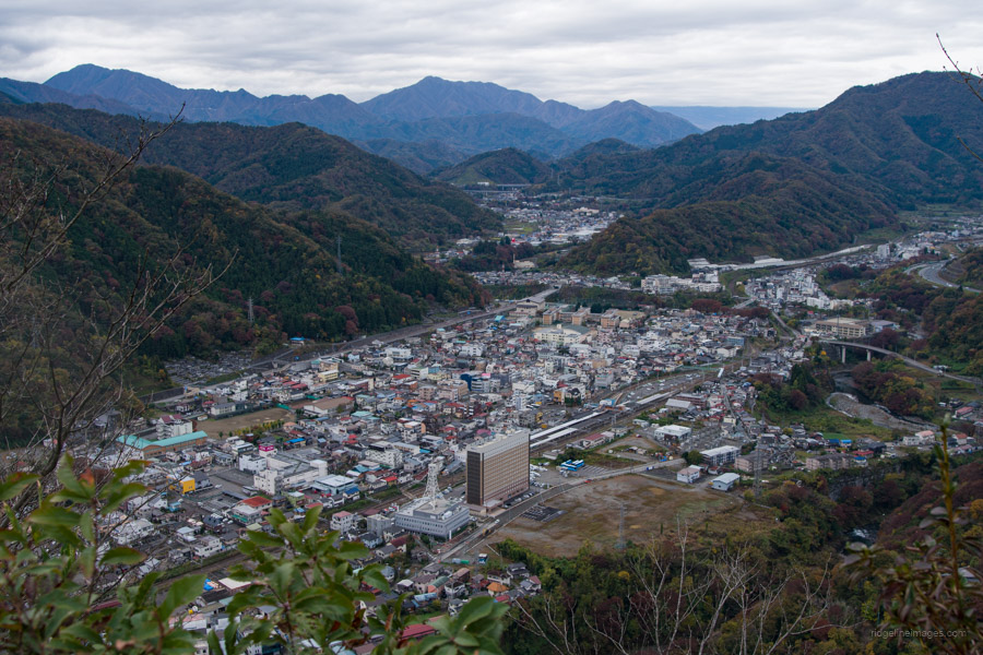
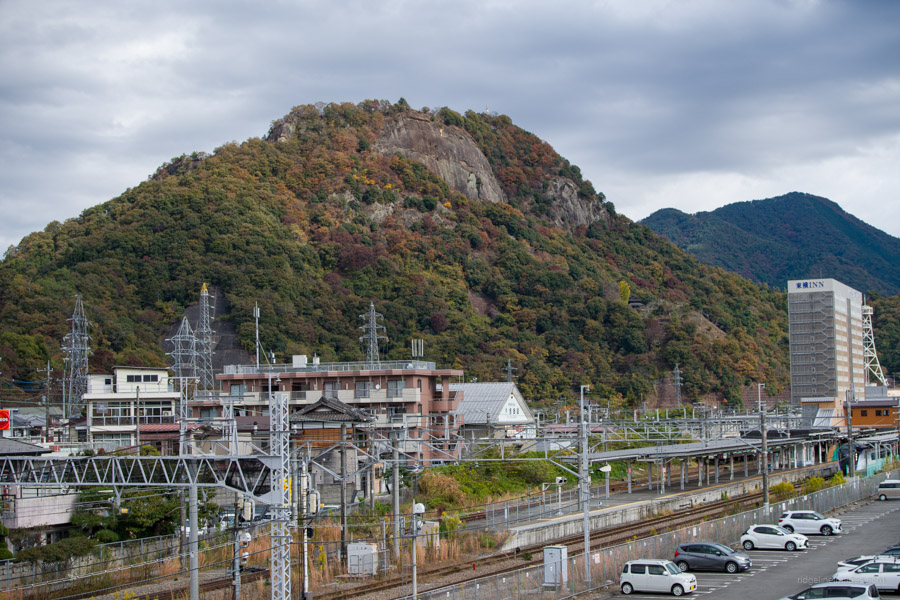
On my previous visit to Iwadonosan, I only made it as far as the summit, albeit blessed with a stunning view of Mt. Fuji. This time, I returned to ‘challenge’ the loop course and discovered that this pint-sized mountain shouldn’t be underestimated. At 634 metres, the exact height of the Tokyo Skytree, the panoramic view from the top is impressive and rightfully earns its place among the 12 beautiful views of Mount Fuji in Otsuki City. However, the loop course has a few surprises up its sleeve, making it a place where you can enjoy stunning scenery and a sense of adventure simultaneously.
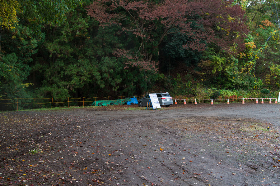
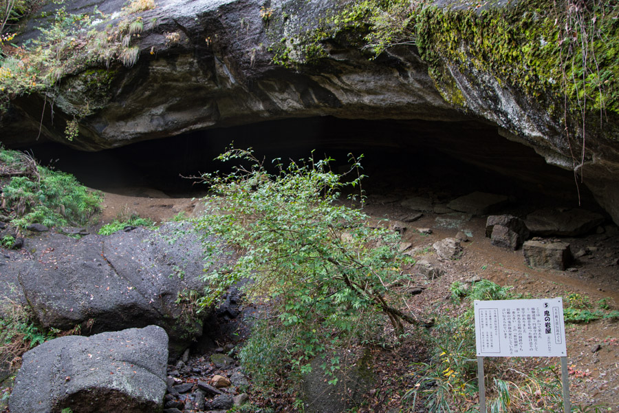
Travelling from Tokyo usually requires transferring at Takao Station to an Otsuki-bound service. At Otsuki Station 大月駅, turn left and follow the road over the level crossing. When you reach National Route 139, turn left, cross the bridge, and continue around to the trailhead proper at the rear of an unsealed car park. It’s about a 25-minute walk from the station. After registering your presence by clicking the tally counter, the first point of interest is a short detour to see the Oni-no-iwaya 鬼の岩屋 limestone cave, just 50 metres off the trail.
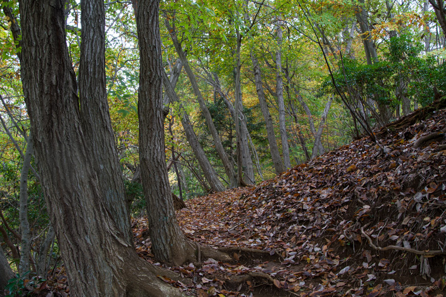
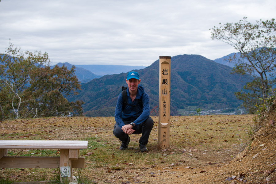
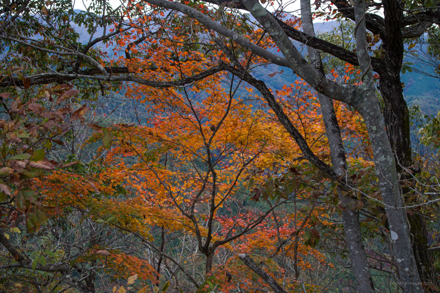
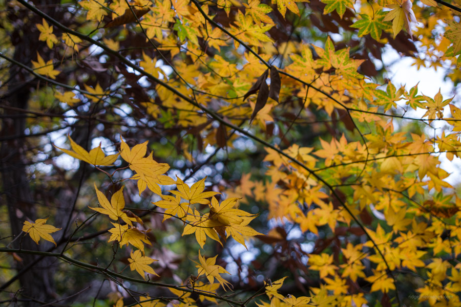
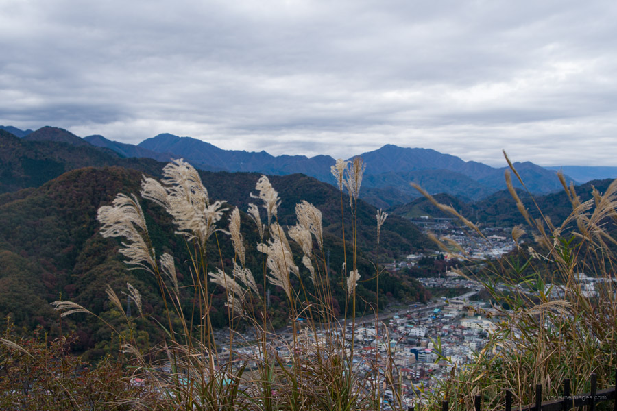
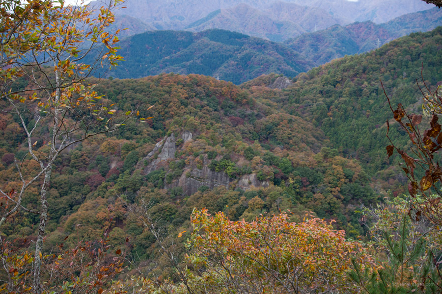
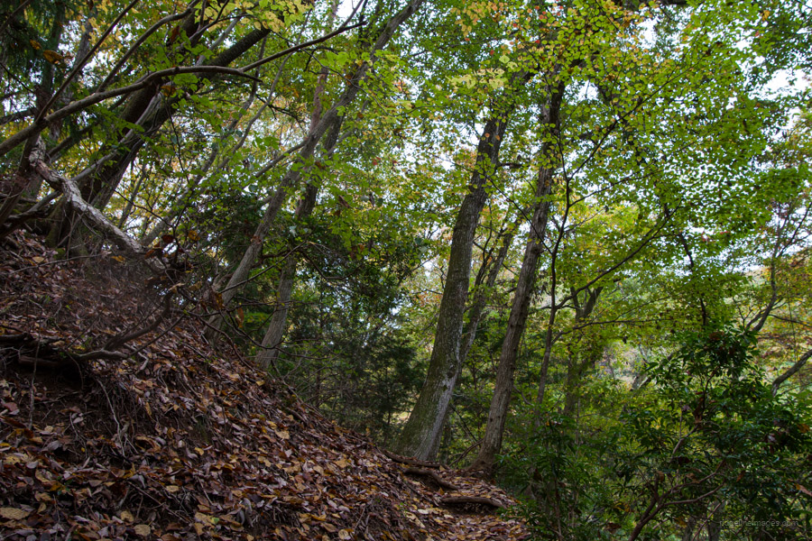
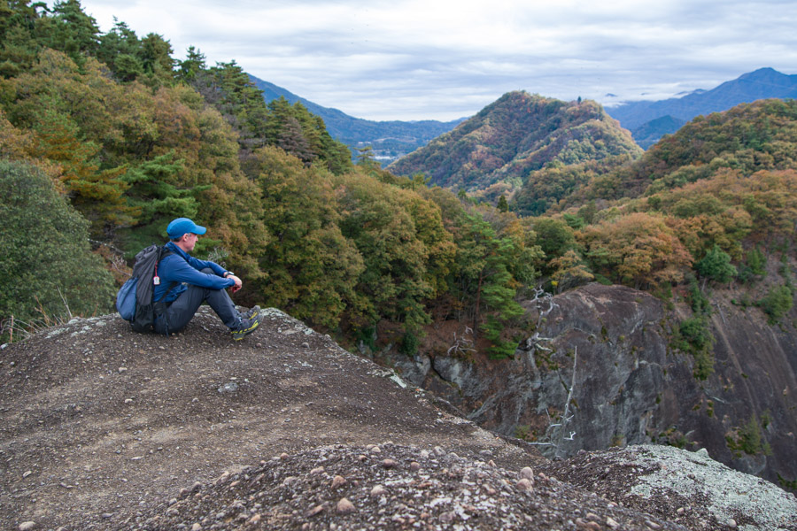
The climb to the summit of Mt. Iwadono 岩殿山 is fairly relaxed, though if you’re returning via this route in wet conditions, the trail can be quite slippery. Unlike my previous visit, Fujisan was hidden behind the clouds; however, on the plus side, the fall foliage was reaching its peak. Iwadonosan’s second summit, located above its imposing rock face, can be found further south, offering a panoramic view of Otsuki City below. To the south-west are Mt. Takagawa, Mt. Mitsutoge, and Mt. Honjagamaru, along with Mt. Takigoyama further to the west. A sheltered rest area is also available here if needed. During the Sengoku period (1467–1615), a mountain castle was built on Mt. Iwadono, serving as an important military base for the Takeda clan, which protected the entrance to Kai Province, now Yamanashi Prefecture.
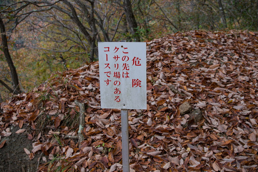
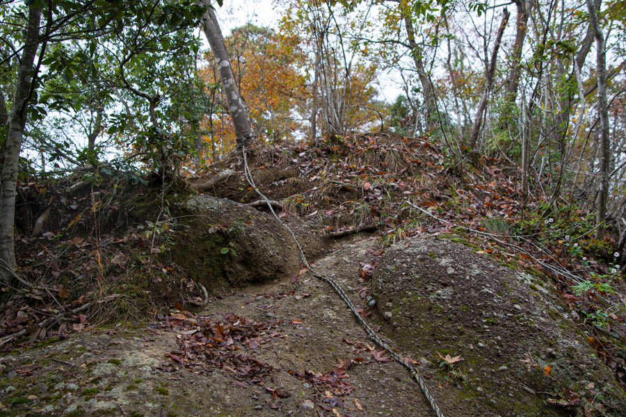
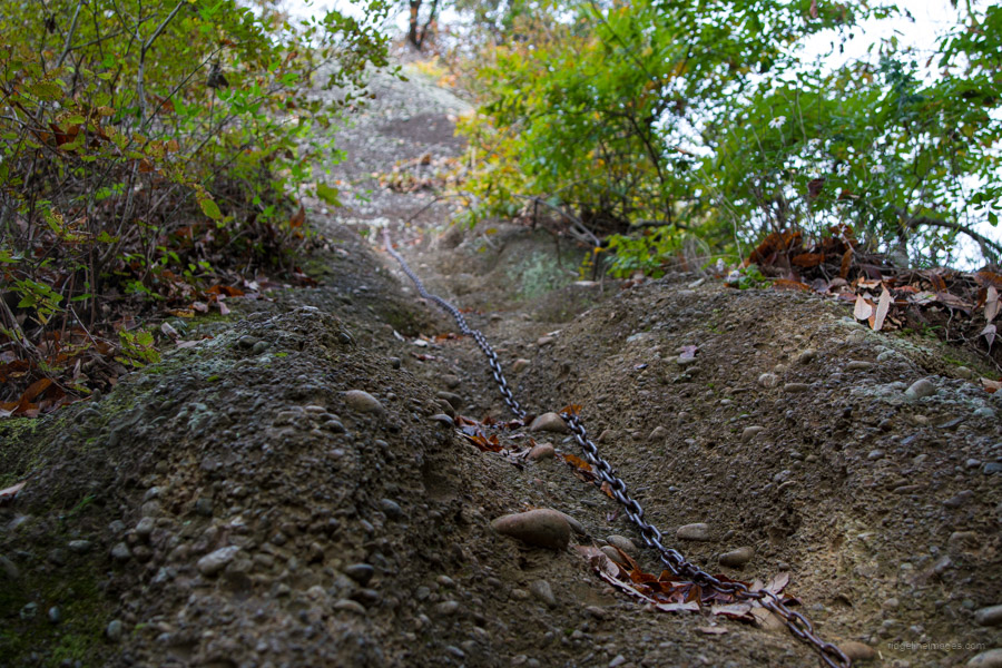
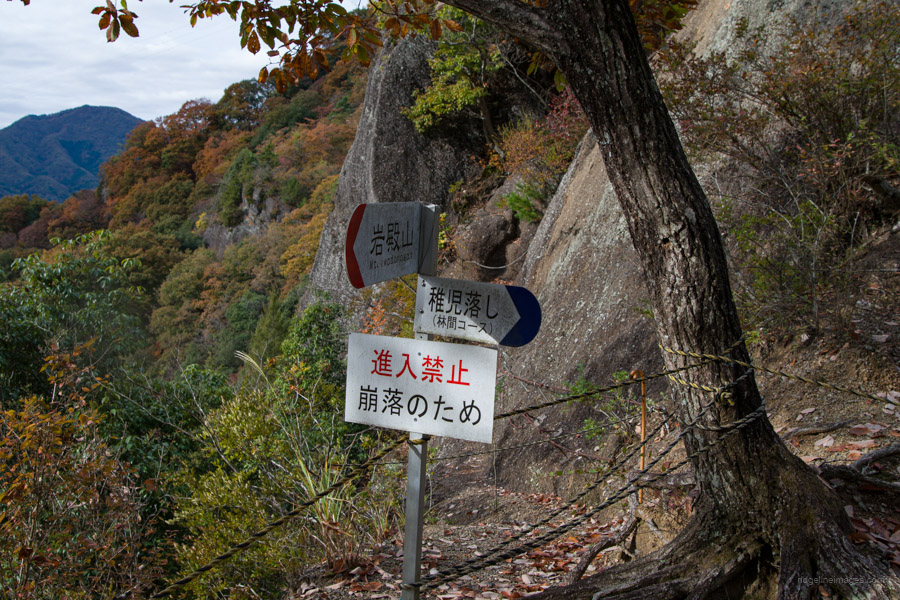
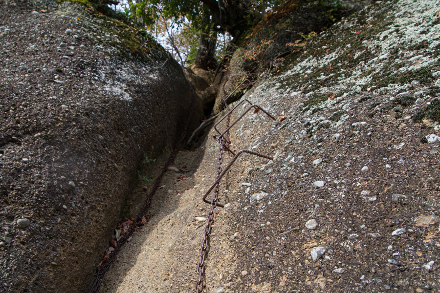
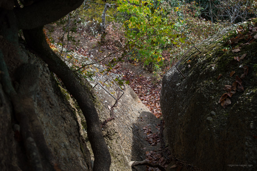
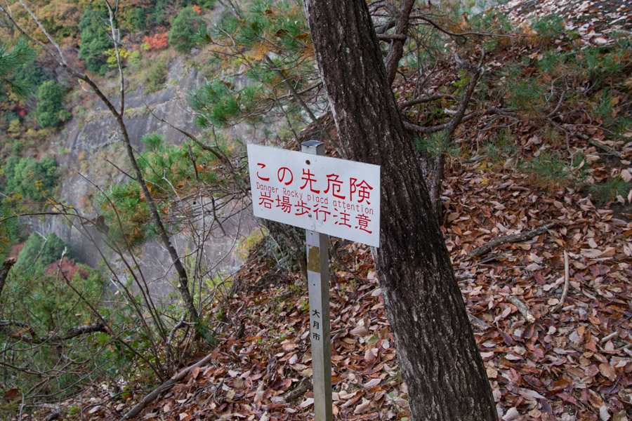
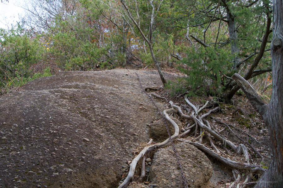
From here, the trail descends, and you navigate a series of stairs with the aid of ‘tiger rope’, to Tsukisaka Pass 築坂峠. Shortly after, a fixed chain is divided into two levels. The first, though steep, is manageable, while the second one ascends almost vertically along a rock crevice. It may appear challenging, but several ladder rungs drilled into the rock (made from rebar) and a chain are there to assist you in hauling yourself up. If this seems daunting, there’s an alternative forest course 林間コース to bypass it altogether. Just beyond this point, a section of the trail is now cordoned off. In the past, you would crab crawl across the short precipice before ascending via chains to the top of Kabuto-iwa 兜岩. The only option now is to detour around, which begins with a steep descent assisted by ropes.
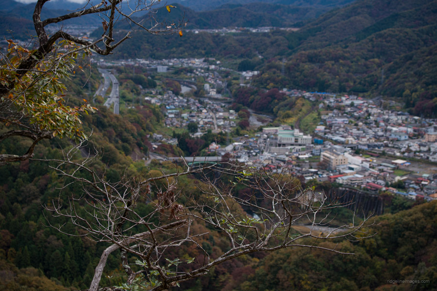
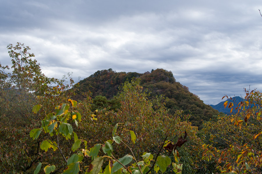
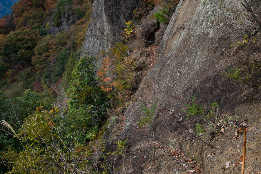
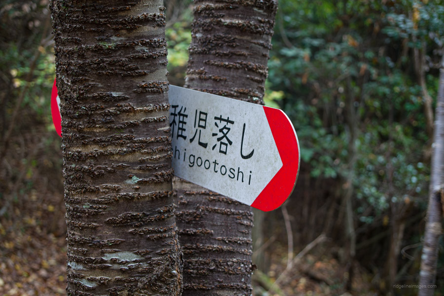
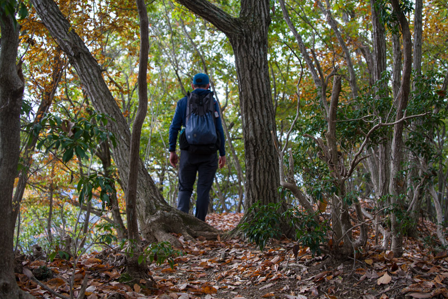
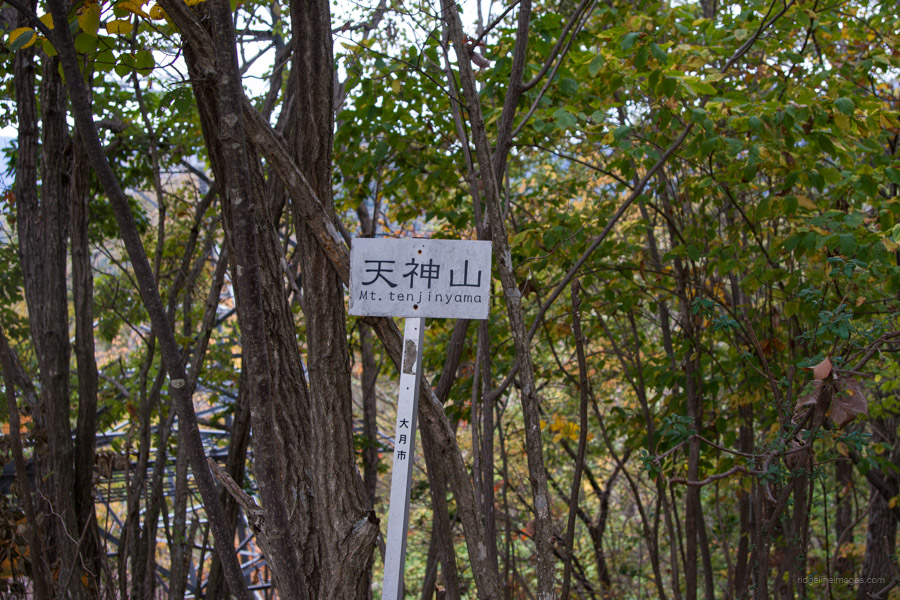
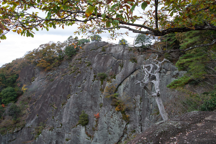
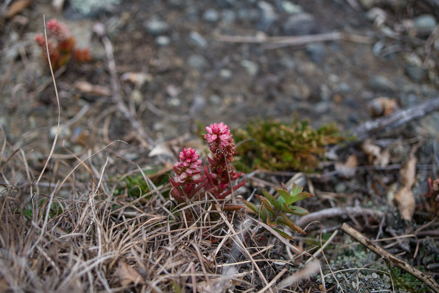
Soon after this, the trail leads to the rather nondescript Mt. Tenjin 天神山 (592 m) and presents another trail fork shortly after that, offering the choice between the rocky route or the forest route. If you opt for the rocky route, be aware that it hugs close to the cliff face, with the striking rock wall of Chigootoshi staring directly in front of you. After a short climb, you’ll reach Mt. Chigootoshi 稚児落し (590 m), offering arguably the best view of Iwadonosan. Here, I met another hiker attentively photographing some Tsumerenge ツメレンゲ, or rock pine flowers.
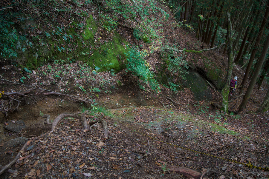
From the summit, a steepish descent awaits, leading down to a paved road. Except for one short section rigged out with a fixed chain, it’s relatively straightforward, although the dry gravel slope can be quite slippery. The trailhead on the opposite approach is situated besides a blue-coloured house and is near a narrow bridge. Once you reach this point, follow the paved road under the Chuo Expressway back to Otsuki Station.


You can also include the Oise-yama お伊勢山 on the loop extending the hike a bit, which I did a couple of years ago. That one also has excellent Fuji-san views and an area with lots of Sakura trees, which might be nice during spring.
Hi Ben, thanks a lot for introducing Oise-Yama. It seems like a top spot for viewing Mt. Fuji. I’m thinking of penciling it in for an easy day hike next spring. Also, a great idea to include it in this loop hike.