.
Mitsumine Shrine 三峯神社 – Mt. Kumotori 雲取山 – Mt. Mutsuishiyama 六ッ石山
Distance: 29.2 km
Elevation change: 977 metres
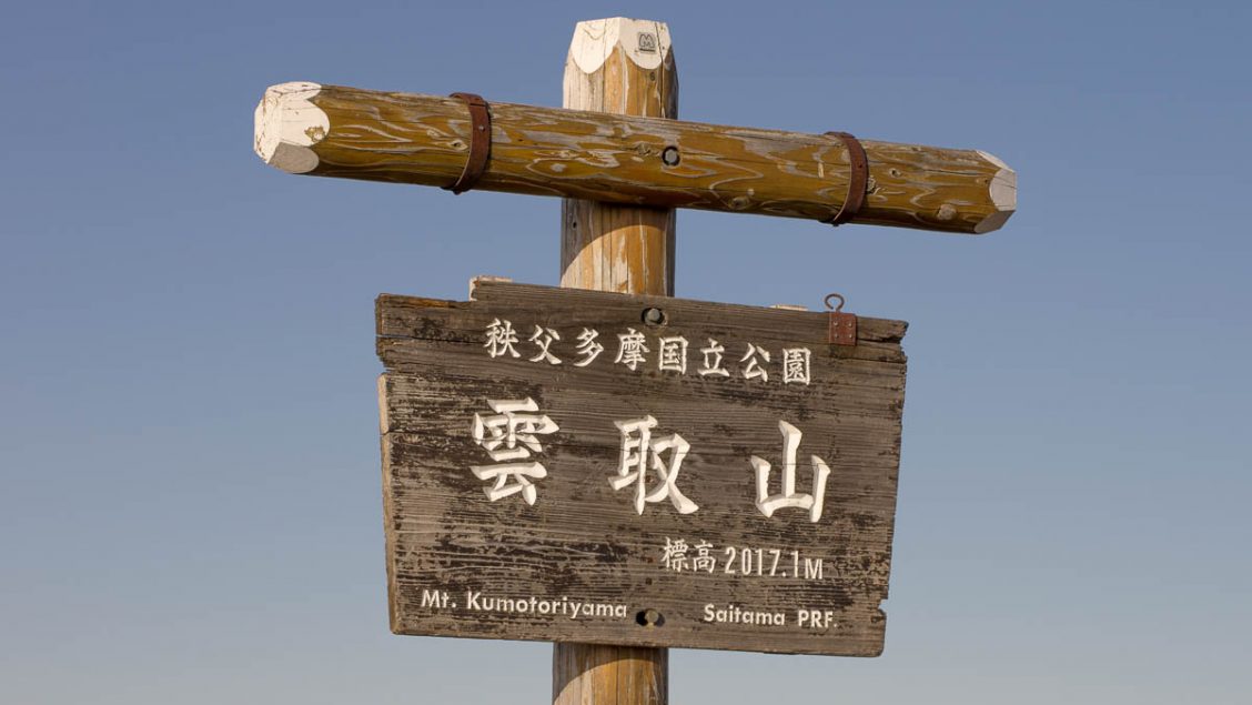
Highest point: 2017 metres
Start: Mitsumine Shrine Bus Stop
Finish: Okutama Station (Ome Line)
Difficulty: ▅▅▅▅▅▅▅▅▅▅ ❹
Map: Yama to Kogen Chizu 山と高原地図 [No.27 雲取山・両神山 KUMOTORI-YAMA·RYOKAMI-SAN]
GPX TrackKML TrackGSI MAPPDF Topo Map
Ascending the Highest Point in Tokyo Prefecture
Situated in the far recesses of Tokyo and bordering on Saitama, and Yamanashi Prefectures, you find Mt. Kumotori 雲取山 2,017 metres the cloud grabber mountain. What’s remarkable about this remote location is that it’s still considered to be within the confines of Tokyo along with being one of the 100 Famous Mountains of Japan. Getting to the mountain generally necessitates an overnight stay at one of the mountain huts, though one day assaults are not unheard of starting along the Ome Kaido (Road) Route 411.
Day 1: Following the Ridge Towards Kumotori-sansou (8.8 km)
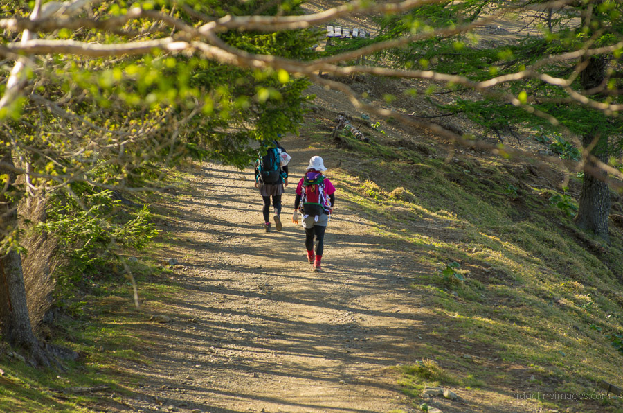
While it is possible to start from either end, this hike commences from the Mitsumine Shrine 三峯神社 traversing across to Okutama Station 奥多摩駅 – the same as described in the Lonely Planet, Hiking in Japan guide. The first goal of getting to the shrine entails taking a train to Seibu-Chichubu Station 西武秩父駅 and transferring to the Seibu bus service which takes you to the Mitsumine Shrine (1hr 20 mins, 950 yen) click here. It is also possible to pick up the bus from Mitsumineguchi Station 三峰口駅. To say that the buses that run this route aren’t the pride of the Seibu fleet would be an understatement, as most seem to be pretty clapped out and are certainly close to being decommissioned altogether. On weekdays, there are six round-trip bus services to the Mitsumine Shrine, with the first morning service departing at 9:10 am (on weekends, there are seven services starting at 8:00 am). It is also worth mentioning that although the Lonely Planet guide suggests taking the Mitsumine Ropeway 三峰ロープウェイ(July 2009 ed.) it has actually been out of service since May 19, 2006, and was officially abandoned on December 1, 2007. For those feeling a little more energetic, there is the option to hop off the bus at Owa 大輪 and stretch the legs shadowing the old ropeway (3.7 km).
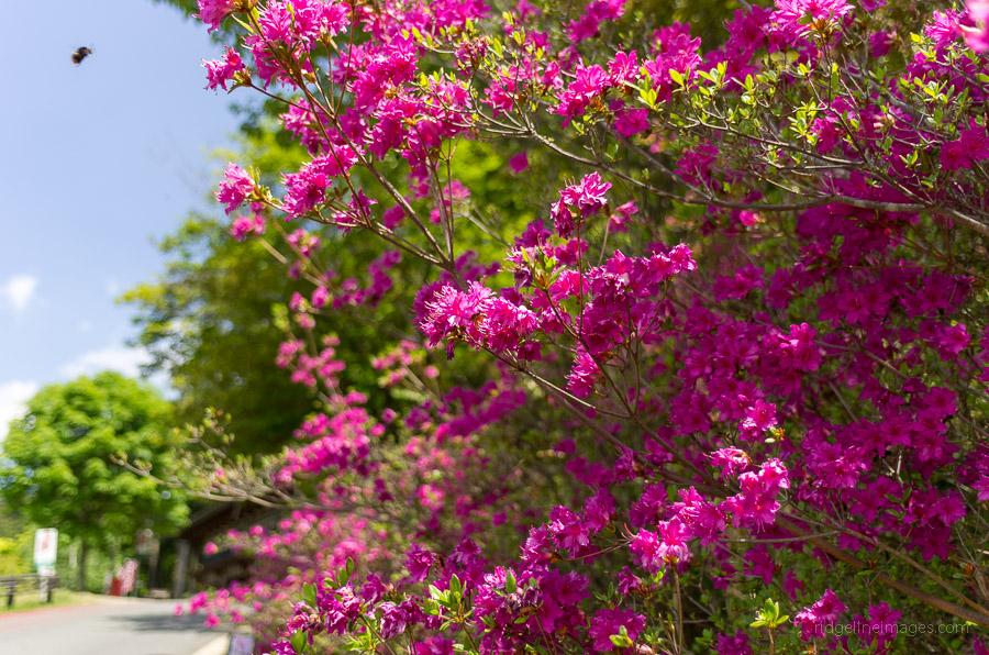
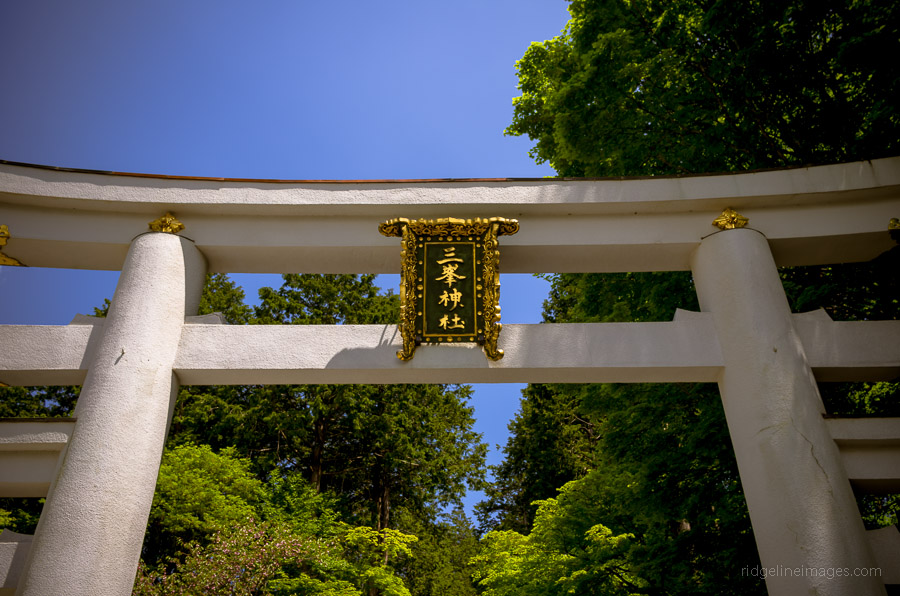
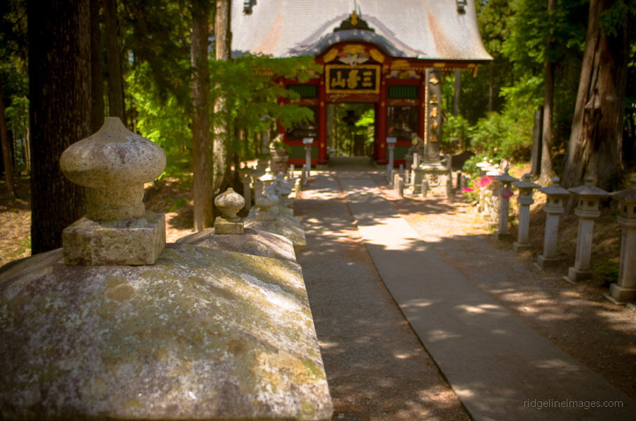
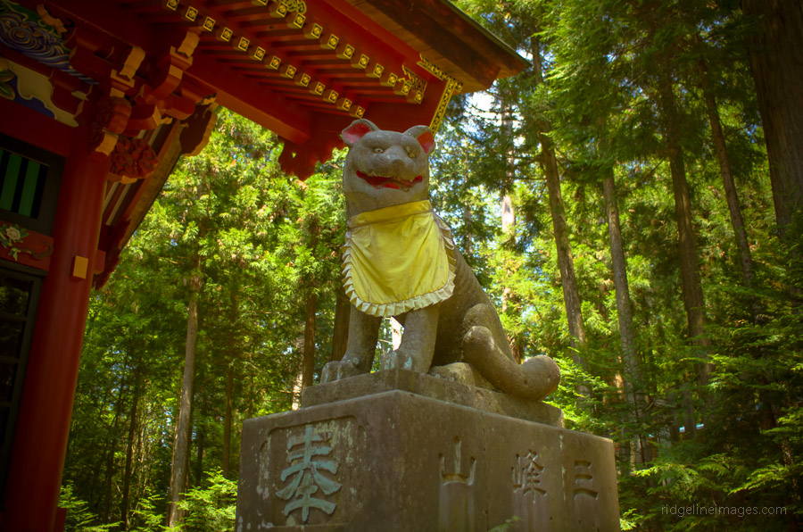
Passing through the Mitsumine Shrine (1,102 m) affords a serenity that is in keeping with its 2000-year-old roots. It is worthwhile taking a little time to roam through the main shrine grounds, if nothing else, to ponder life during the Yayoi period. The shrine is recognised for its wolf worship, though the primary deities worshipped are Izanagi and Izanami, two gods connected with a Japanese creation myth. Being spring the shrine grounds were in full bloom, with manicured gardens complementing the fine weather. After grasping my bearings, the first target I set was reaching Kirimogamine 霧藻ヶ峰 (1,523 m) by lunch. Though I hadn’t read about any baka o-ne style ridges akin to climbing Mt.Tanzawa, I remained sceptical and wasn’t prepared to draw any conclusions based on hazy map contours.
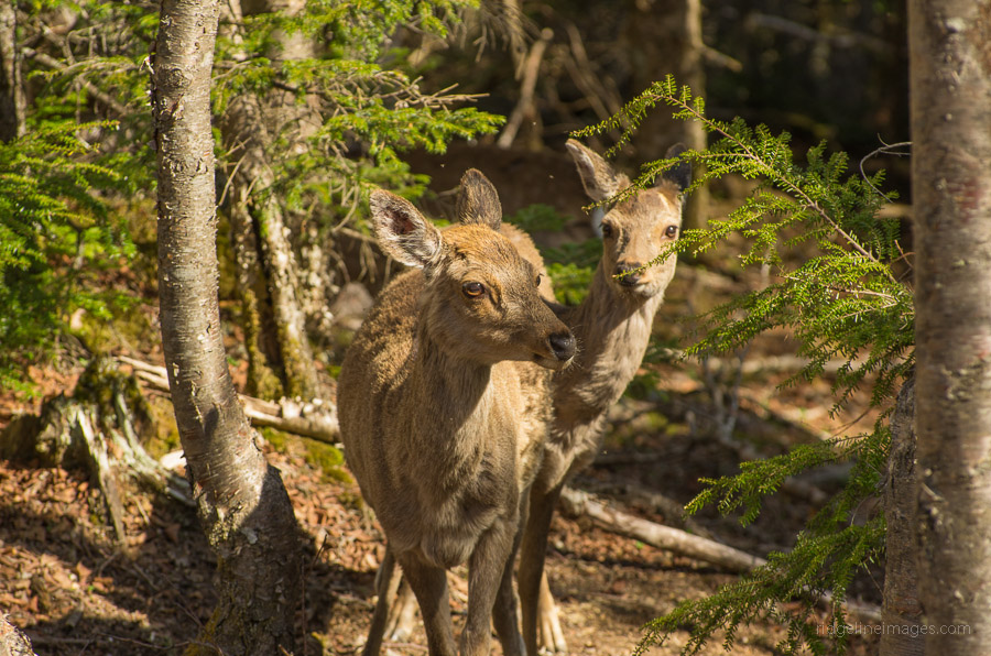
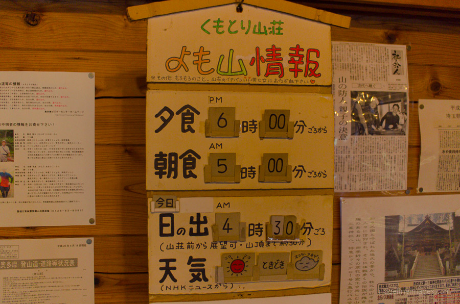
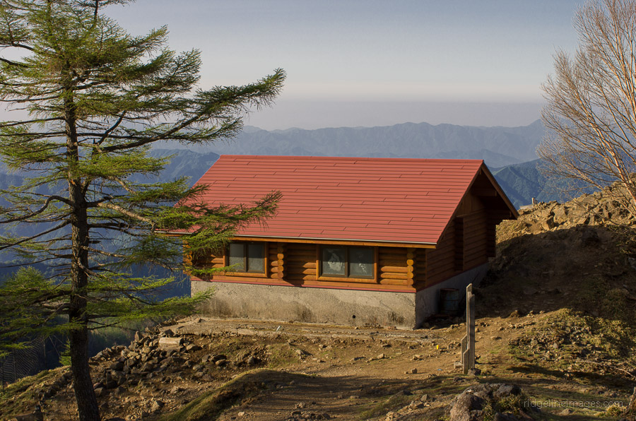
The trail starts out climbing through sugi plantations, but as elevation is gained, it reverts to a broadleaf forest, providing some protection from the elements. The trail is, as expected, well marked, with several benches to rest on along the way. At Kirimogamine, there is a small hut with a nice backdrop, making for an ideal rest stop. After lunch, you remain on the ridge, where you head up to Mt. Maeshiraiwayama 前白岩山 (1,776 m). Shiraiwa-goya 白岩山小屋 is reached 20 minutes later, a ramshackle old hut held together with rusted cladding. Next is a rather steep climb up to Mt. Shiraiwayama 白岩山 (1,921 m) where I startled some deer upon my arrival. The following section of mountain trail heads down through the Imonoki Dokke 芋ノ木ドッケ where it is advisable to bring along crampons from November through April. Before reaching the Kumotori-sansou 雲取山荘 glimpses of the old mountain hut can be spotted to your right. The Kumotori-sansou is a professionally run lodge, that accommodates up to 200 and has friendly staff. A one-night stay will set you back 9,500 yen with dinner and breakfast and 6,800 yen if self-catering. There is also a camping area with 30 sites available for 1,500 yen. The small tatami rooms generally squeeze in four or five, and each has its own Japanese kotatsu table. I was saddled with three other guests, but thankfully there was only one snorer among the ranks.
Day 2: The Gruelling Trail to Okutama Station (20.4 km)
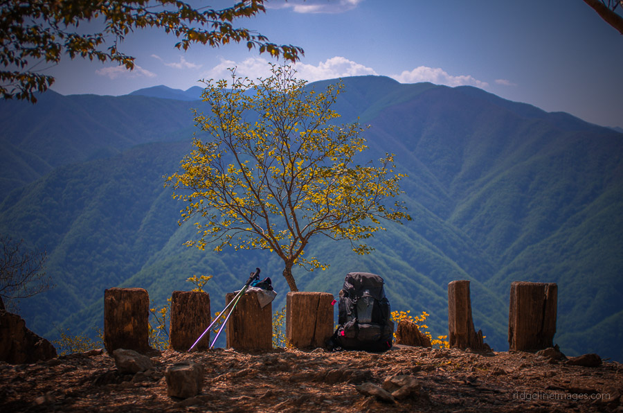
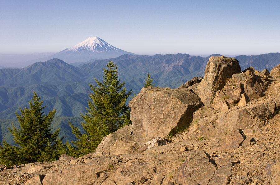
After a good feed and restful night’s sleep, the first rousing took place not long after 04:00, with breakfast served shortly before 05:00. Much of the talk at breakfast was centred on destinations and appearing to be the only person going the full mile to Okutama Station I was starting to have reservations – was this going to be a day of pain and misery after all. Side-stepping a tour group doing their morning callisthenics, I was finally on my way to Mt. Kumotori 雲取山. From the lodge, the trail to the summit takes around 20 minutes. Reaching Mt. Kumotori, I was fortunately blessed with magnificent 360-degree views, and particularly stunning were the still snow-capped peaks of the Minami Alps. It was hard to take it all in, and I can only imagine their brilliance in the winter.
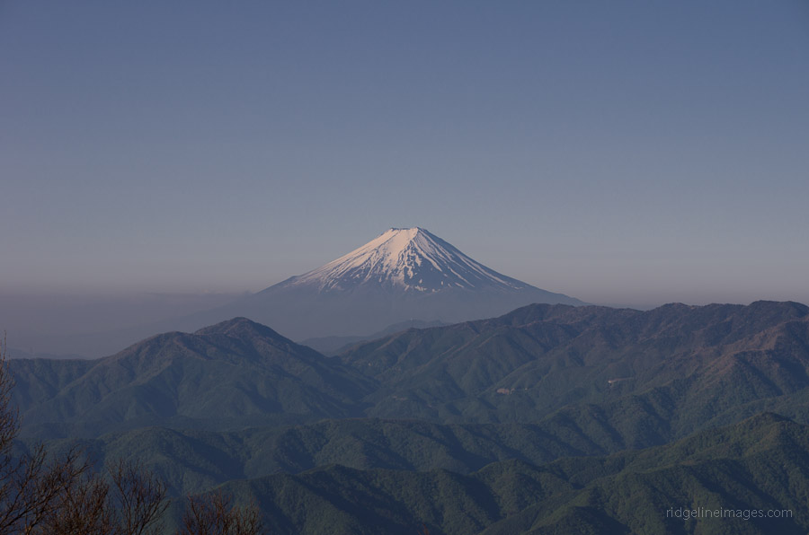
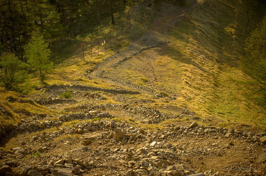
So begins the long descent along the Ishione Ridge 石尾根 to Okutama Station. The first stop after passing the emergency hut near the summit is the Kumotori Okutama goya 雲取奥多摩小屋 overlooking the Mt. Fuji skyline. Note that Okutama goya ceased operations in March 2019. Park authorities ask people to no longer camp there as the toilets have also been shut. The trail continues its wide breadth until hitting Mt. Nanatsuishiyama 七ッ石山 (1,757 m) where the first exit option comes into play by heading down to either Omatsuri お祭 or Kamosawa 鴨沢. Next in line is Mt. Takanosuyama 鷹ノ巣山 (1,736 m) which can be avoided by going right. If you decide to climb to the summit, you have yet another shortcut option by heading up Shonyudo 鍾乳洞 near the Nippara Limestone Cave, where you can take a bus back to Okutama Station. At the base of this mountain there is an emergency hut, which makes for a pleasant rest spot, and there is a place nearby to fill up with water if needed.
The final hurdle was Mt. Mutsuishiyama 六ッ石山 (1,478 m), where I was fortunate enough to find a hiking companion in none other than a 70-year-old Japanese lady who, with spritely vigour, led me back to Okutama Station. There is definitely something to be said for the stamina demonstrated by folk of this age cohort, and with her swiftness, we seemed to make quick reckoning of the final interminable slope. Arriving at the station feeling totally spent, I looked for the first drink machine to rehydrate and then the nearest hot spring to relieve my sorry body.


What a great hike. This looks like a real slog, but worth the effort. I love your site and it’s a valuable tool for me to refer to every time I plan a hike of my own. Thanks for all the effort you’ve gone to, to document your hikes.
Thanks very much! This hike is still one of my favourites after all these years. The only thing I would do differently is camp rather than stay in the Kumotori sansou and perhaps take it more leisurely by spending a second night at the Takanosuyama Refuge Hut. Either way it’s one of the best overnight hikes near Tokyo.
Thanks for all the information you post! I also tend to use your posts as a base to plan my hikes. About camping, where do you think it’s better to camp? Is it possible to camp at the peak? I was initially planning to camp at 奥多摩小屋, but I realized that it closed this year (http://kumotorisansou.com/koya.htm). Also, I am a bit confused about the other option of camping I’ve found at 七ツ石小屋. It seems they are defining a reservation system (http://www.tabayama.jp/nanatsuishi/post-1446/), but I am not entirely sure about what it is written in Japanese. Thank you very much!
Sorry, I just saw the explanation about the reservation system here: http://www.tabayama.jp/nanatsuishi/post-1492/. Anyway, looking forward to your suggestion!
Thanks for posting the information about the Okutama goya closure. It’s sad to see it go as it’s been in operation since the late 1950s. As for other options, you can stay for free at the emergency hut at the summit (sleeps 20) though you’ll need to carry water from near Okutama goya or stay / camp at the Takanosuyama emergency hut (sleeps 10). Alternatively, you can camp at the Kumotori sansou (30 tents) or as you mention the Nanatsuishi hut (10 tents).
This looks like a great hike! Do you know if there is drinking water available at Kumotori-sansou?
It’s long but definitely one of best hikes around Tokyo. There is a waterhole at the hut so problem about getting drinking water.
HI,
Thinking to do this hike in september.
Is there a place where I could buy map for this hike? Or is that not necessary?
thx
jonas from Belgium
Jonas, in the hike information there is a link where you can buy the map online or you can purchase it in Tokyo once your here at any major bookstore. I always recommend bringing a map, compass and either a GPS-capable smartphone or handheld GPS.
oh and I have a second question.
You have any idea around what time I could be back in Shinkuju station on day 2?
thx
Time wise you’re looking at around 8 hours map time. If you left the Kumotori hut at 6:00 am and say arrived at Okutama Station at 2:00 pm you could expect to be in Shinjuku around 4 pm.
Hello David,
thanks for your blogging, without it my solo trip to mt kumotori would never happen. I was sleeping in emergency hut (also read in your blog). Had option to go further and extend trip to mt Obora but after cold night (sleeping bag was very thin, I should buy proper one) I just finished trip the same as you 🙂
Very very helpful!
Whole climb after visiting shrine took about 6 hours to the top
Coming down (with one little trip to mount… F… forgot but about 1750m high) took 3,5h (I walk rather fast), so starting at 6 am on the top, I was in Asakusa about 12:00-13:00 with Bus -> Ome line -> Chuo line
Once again thank you!
Hi Karol, thanks for reading and commenting about your trip. Heading across to Mt. Obora is also a good option though requires an extra night out. You made great time heading down to Okutama Station as I think it took me around 6 hours.
I recently did some hiking around Okutama area and picked up a nice English brochure at a small visitors center at Okutama station and it says to start for Kumotori from the far western end of Lake Okutama. Do you have ant experience with this route?
Sounds like the route from Kamosawa which heads up to Mt. Nanatsuishi which I haven’t personally hiked. A few years back hiked down the neighbouring forestry road to Omatsuri from Mt. Obora. To get a bit of a look-see of the route I recommend watching this terrific documentary from a few years back which should provide some inspiration. https://www.youtube.com/watch?v=5Owqm6lF0gw
Thanks for the YouTube video. I hope to hike Kumotori sometime soon to get back to speed before I head into the Alps. I will tell you though, I miss Colorado terribly and it’s foothills and well designed trails ;( Hiking in Japan has been a slog from day one, my first hike was Mt. Oyama in Kanagawa and little did i know that would set the scene for every trail going forward. Either way, I super appreciate your website and your experience. If you are ever in Kanagawa i’m always looking for a hiking partner 🙂
Hi, I am getting confused. Is Kumotori part of the Three Famous Peaks of Okutama? Some say that it is Odake, Mito and Gozenyama. Please clarify.
I plan to hike all 3 famous peaks. Thank you!
Hi Rob, thanks for your question. The three mountains of Okutama (奥多摩三山) are Odake san, Gozenyama and Mito san. Mt. Kumotori for whatever reason isn’t part of the three even though it’s one of the 100 Famous Japanese Mountains.
Hi, David. Did Kumotori with some variation (because I am not a masochist to your level yet!) peaking Kumotori, Nanatsuishi, Takanosuyama and Kurato instead. One of the hardest but most gratifying weekends of my life. Still sending you a KoFi now because you and the blog are always an inspiration!
Hey Francisco, congrats on scaling Tokyo’s loftiest peak. Making it to Kurato is a fine effort and in real terms probably only a few clicks shy of the hike description. Thanks for supporting the blog 😊
Hi David, I have used your blog for some day hikes already and 2 days ago I did my first 2 days hike (in Japan) thanks to it!
It was cold and windy on the way but not much snow and I didn’t have to use crampons. The second day, as expected, was “long”, but the good weather allowed me to enjoy magnificent views of Mt Fuji on the way!
I finally take this opportunity to thank you for all the precious and accurate information you provide and send you my best wishes for a happy new year, hoping 2021 will be a great year for you with many new hiking discoveries!
Hi Isabelle,
Thanks for the kind words. Well done on completing your first overnight hike! It’s a nice feeling of accomplishment isn’t it 😊 You’re right the clear dry winter weather provides great views and provided it isn’t too windy is a perfect time to hike. Have a wonderful new year. Stay safe!
Amazing site – wanted to check to see if there was water available at Okutama Goya for camping overnight? Or will I have to bring it over from Kumotori Sansou.
Cheers AC. The water hole is apparently a 5-minute walk from the Okutama Goya. However, scouring recent Yamareco reports I wasn’t able to find a photo to confirm if or how much water is currently running. Also be aware that the Okutama goya closed in March 2019. Park authorities ask people to no longer camp there as the toilets have also been shut. I have updated the hike description to reflect this.
Great post!
I’m thinking of doing this in GW, but wondering about pushing through to Nanatsuishigoya to camp on the first day and make day 2 a bit easier. Regarding the difficulty level, would you say it’s more endurance than technical difficulty?
Thanks Martyn. Personally, I feel you would be better off sticking to the hiking guide and camp at the Kumotori-sansou especially during GW. I just checked my notes, and I didn’t arrive at the Kumotori-sansou until 4 pm. Even if you’re quicker than me you probably won’t reach the Nanatsuishi-goya until after 5 pm. Also note from this year (2022) camping at the Nanatsuishi-goya requires a reservation presumably to avoid overcrowding – the campsite only has 20 spots. So aim to arrive as early as possible at the Kumotori-sansou to get hold of one of the better sites. Regarding the difficulty level, yes more endurance as it doesn’t have any particular dangers or technical sections.
Thanks David, I’ll go with that then.
Cheers
As always, hugely appreciate your thorough and inspirational coverage of the hiking around Tokyo. Writing to say that we just completed this exact route, though taking a few of the peak diversion routes that skirt around the sides of the hills on the Ishione ridge. I would advise caution on doing this as though easier, the paths are often seriously narrow with a treacherous drop-off and at the time we hiked it, deep in leaf litter. Not to mention a couple of close calls with falling rocks. I guess it’s a trade-off between slugging it out from peak to peak versus some pretty vertigo-inducing goat tracks…
Thanks so much, Kyle. Really appreciate the kind words and the heads-up for anyone thinking of doing something similar. Those side trails along the Ishione ridge sound pretty intense! Leaf litter and narrow ledges are a sketchy combo. Sounds like you had quite the adventure.
I noticed that my YAMAP hike plan shows the distance as 8.5km from the bus stop near Mitsumine Jinja to Kumotorisansou compared with the 12.2km mentioned here.
Any suggestions anyone about this discrepancy?
I have not been in the area before but will be in early June this year.
Thanks David for maintaining this great site. I look forward to exploring it more.
Hi Piotr,
Good spot – the original figure I had listed was incorrect. The correct distance is around 8.8 km, which aligns with what you’re seeing on YAMAP. I’ve now updated it.
Thanks for pointing it out, and hope you have a great hike.