.
Tenjin-toge 天神峠 – Mt. Mineyama 峯山 – Mt. Musubiyama むすび山
Distance: 8.8 km
Elevation change: 516 metres
Highest point: 976 metres
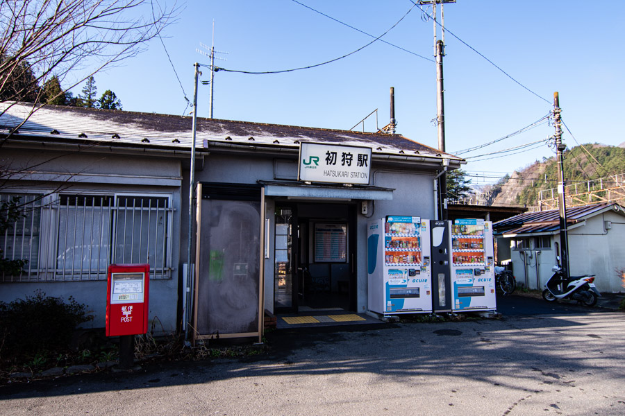
Start: Hatsukari Station (Chuo Main Line)
Finish: Otsuki Station (Chuo Main Line)
Difficulty: ▅▅▅▅▅▅▅▅▅▅ ❸
Map: Yama to Kogen Chizu 山と高原地図 [No.29 高尾・陣馬 TAKAO·JINBA]
GPX TrackKML TrackGSI MAPPDF Topo Map
Revel in Top-notch Views on this Beginner Friendly Hike
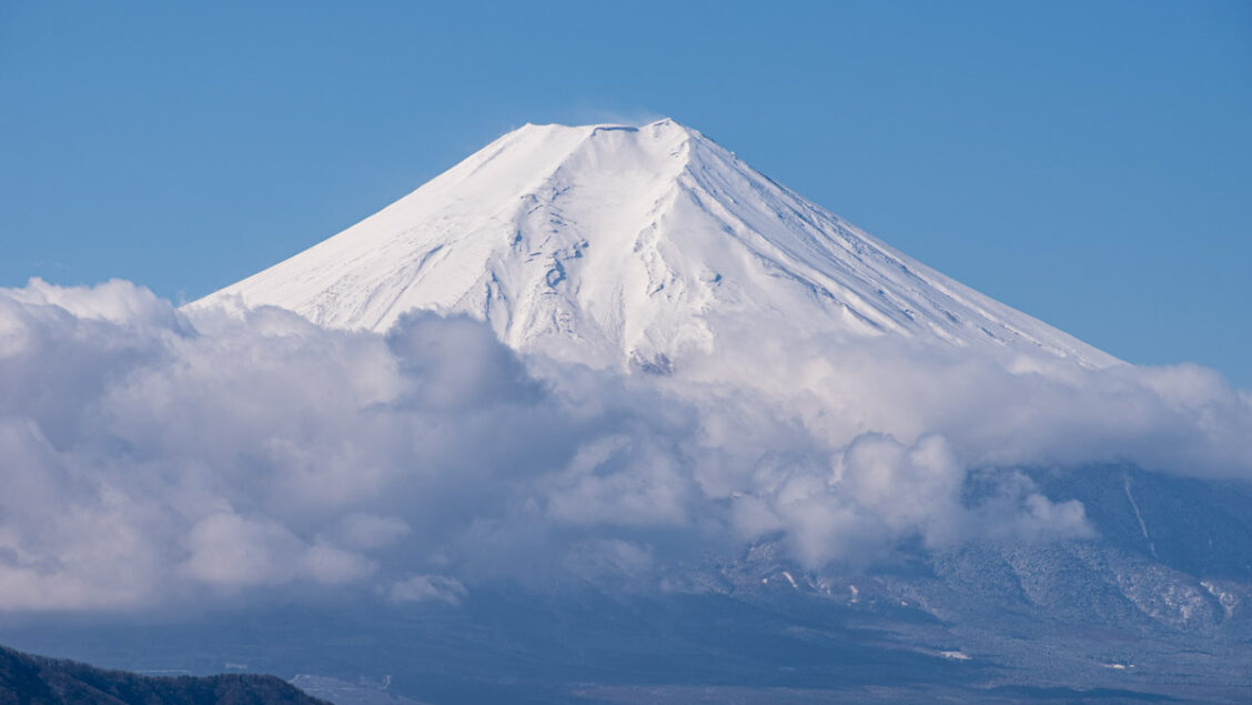
Takagawayama has plenty going for it, for starters it’s relatively easy to access from Tokyo, climbable by beginners and notably offers an impressive view of Mt. Fuji. It also happens to be one of Yamanashi’s 100 famous mountains. While there are several climbing routes the most popular is a longitudinal trekking course commencing at Hatsukari Station and finishing at Otsuki Station on the JR Chuo Main Line. From Shinjuku Station by local trains the travel time is 1 hr 40 mins with one transfer at Takao Station. Note there are numerous trail branches along the hike so pay particular attention, carry a map and a GPS-capable smartphone.
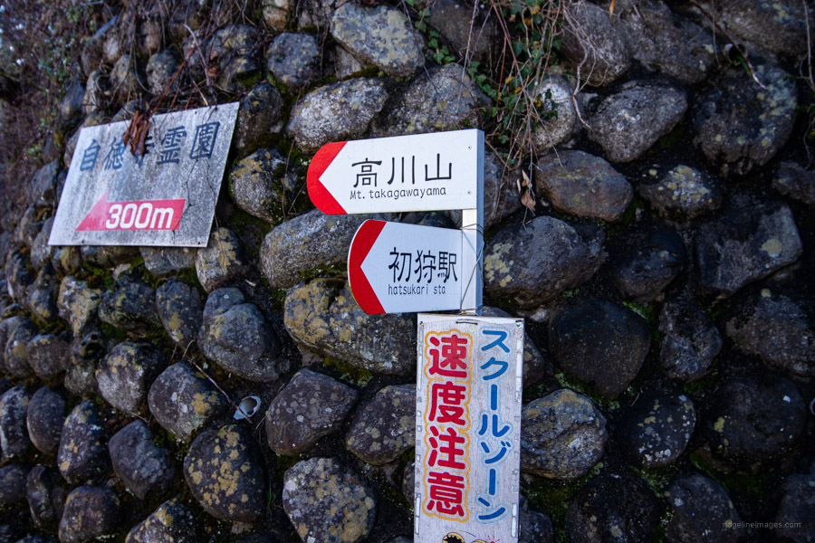
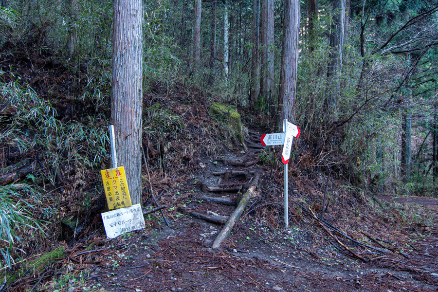
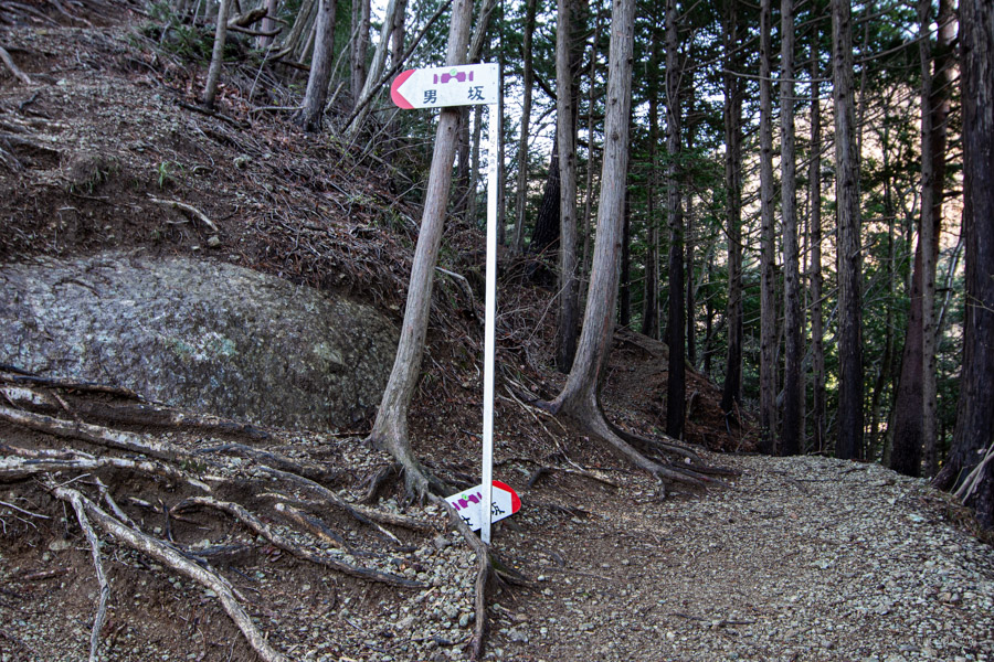
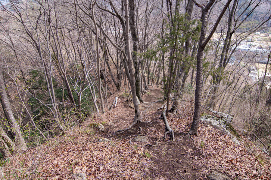
Leave Hatsukari Station 初狩駅 by the only exit, turn right at the entrance of the carpark and follow a small street which runs under the railway line. There is a Lawson’s straight ahead up on the main road if you need supplies. On the far side of the train tracks turn left up a slope, cross the river where there is a red and white signpost signalling the way to Mt. Takagawayama. Follow this minor road uphill past the cemetery to the trailhead proper just past some portaloos. It takes approximately 30-minutes from Hatsukari Station. Start heading up the earthen steps (there is an alternative “sawa course” veering to the right). After 15 minutes of moderately steep climbing there is a Otoko-zaka 男坂 (male) and Onna-zaka 女坂 (female) trail branch. The Onna-zaka is the easier but longer of the two slopes. Take your pick, as they meet further up.
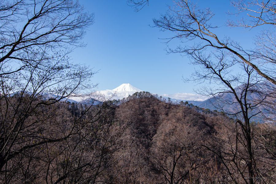
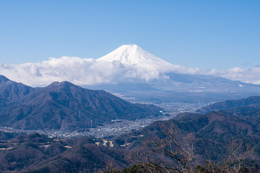
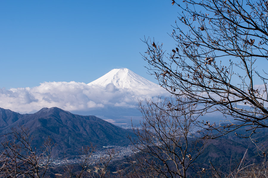
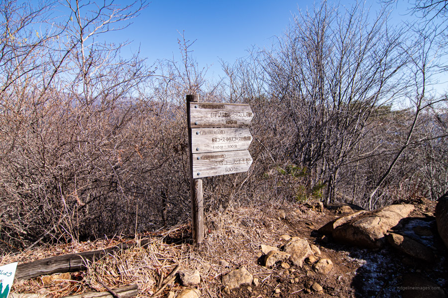
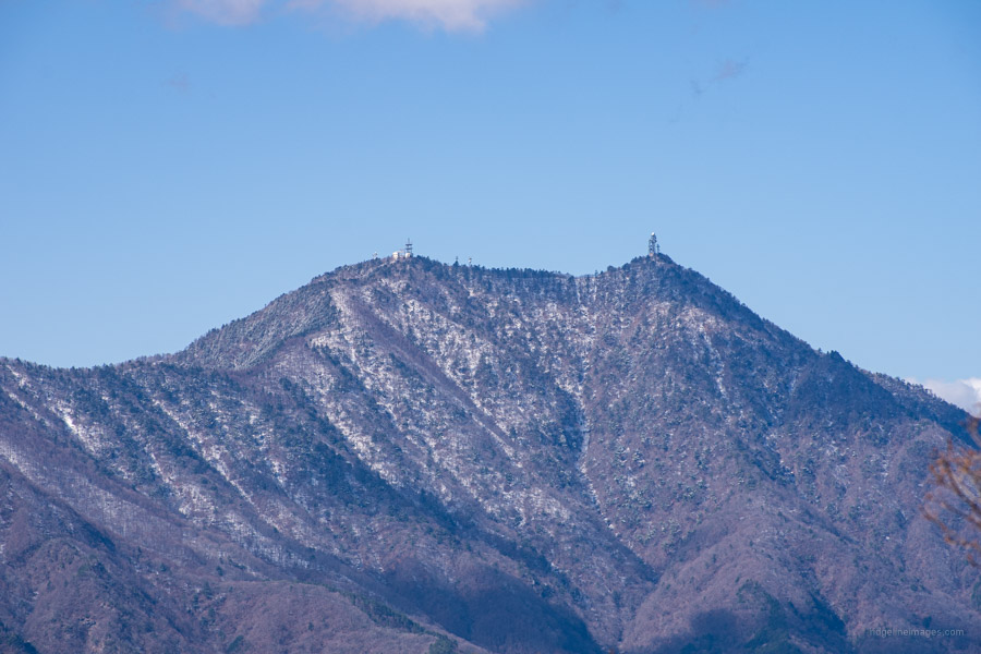
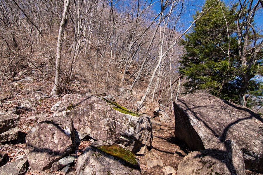
After 90 minutes of hiking from Hatsukari Station including an elevation gain of just over 500 metres you’ll reach the summit of Mt. Takagawa 高川山 (976 m). In clear weather bask in a 360-degree view of Fujisan, the antenna ladened Mt. Mitsutoge and to the east Mt. Jinba. When you’re ready to head off look for the signpost on the summit indicating 160 minutes to Otsuki Station. From here on you’ll be following the Musubiyama course むすび山コース. If you’re looking to shorten the hike there are alternative trails leading off the ridgeline down to Kasei Station 禾生駅 and Tanokura Station 田野倉駅 on the Fujikyuko Line. The first downhill section from the summit is steep, rocky with fixed ropes and was slippery after recent rain.
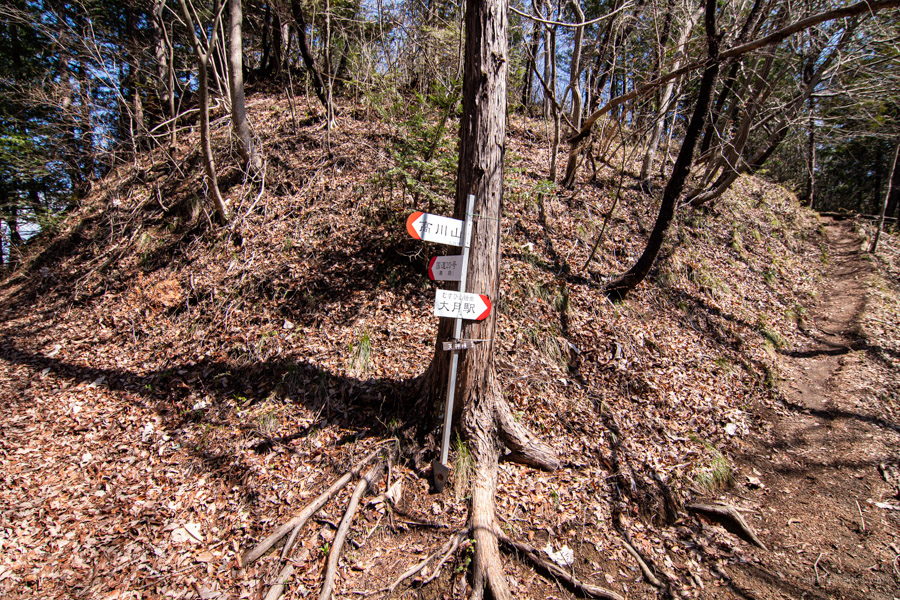
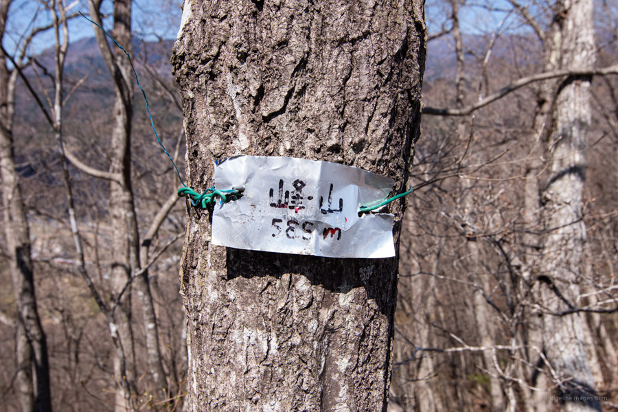
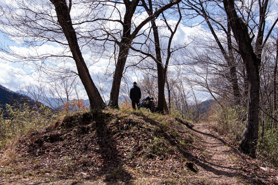
The trail continues along the undulating ridgeline, below which the Chuo Expressway can be seen through the foliage. If there is a downside of this hike it’s the ambient noise generate by traffic and local industry. The next landmark to look for is a trail branch at Tenjin-toge followed by Mt. Mineyama 峯山 (584 m) shown by a metal nameplate tied to a tree and a triangulation point on Mt. Okiyama オキ山 (513 m). The traverse terminates at Mt. Musubiyama むすび山 which overlooks Otsuki City. Remnants remain of the Omusubiyama Observatory – a stone walled pit once used to monitor enemy aircraft during World War II.
The trailhead on the Otsuki side rests beside a house. After passing the Municipal Chuo Hospital cross the bridge, turn right, and follow the National Route 20 back to Otsuki Station. Allow 30 minutes to get to the station from Musubiyama.


Love the details and recommendations. What scares me only in my climbing is when I encounter narrow pathways enough for just a foot to walk over and with one slip I see myself rolling over down. That frightens me to the core.
And that’s what I’m trying to achieve, to fight over this fear.
I would climb over Mt. Ono a million times over as that’s were I got the best view of Mt. Fuji. The descent was pleasant and exhilarating. But this narrow pathway enough for just one person to Walton one way gives me the creeps of slipping😔😢
Thanks
Thanks for reading Marilita, I’m also not a fan of narrow trails with zero margin for error. On this hike there are a couple of minor spots where the trail narrows but provided you don’t rush and think about each step and where to grab onto something if need be, you’ll be fine. I also recommend starting the hike as early as possible to give yourself plenty of time to finish it.
On a Golden Week hike several years ago I battled on a long, narrow, and crumbling trail which only seemed to get worse as I continued. After that experience I lost some confidence and at one point I thought about quitting hiking here as I thought the risks were no longer worth it. These days I research the hike thoroughly before I head out to avoid putting myself in risky situations. I understand everyone has a different threshold regarding exposure and as much as possible I try to highlight any hazards in my trail reports.
I think a little caution is no bad thing.
If I may suggest one thing, it would be to take a hiking pole. For a long time I was a sceptic and thought they were another unnecessary accessory but was convinced by another hiker. They give another point of contact to the trail when footing is unsure. Also they are great to take the pressure off your knees on the descent.
I take them every time. They don’t always come out but it’s good to know they’re there if needed.
From Hatsukari Station, are there signs leading to the trailhead? Thank you!
There aren’t a huge number of signs, but I feel they’re sufficient. Print off the free PDF topo map just in case.
I did this yesterday, thank you for the guidance you provided in this blog. Such a great view of Fujisan at the summit, rivals that of Mt. Ono, in my opinion. I didn’t find that metal nameplate for Mt. Mineyama, maybe I was distracted!
Wanted to thank for this guide – So detailed!! I just finished it starting in Hatsukari and finishing in Ōtsuki. Great Fuji views! This is subjective, but the way down took me more than one hour less, excellent beginner-friendly hike. Will be checking your website often for more suggestions!
Cheers Pili! Sounds like you made great progress getting back to Otsuki. Thanks for commenting. 🙂
Thank you for this amazing resource. We live in Kofu, love to hike but don’t have a car, and your site is been a great help.
Thanks for the comment, Jeremy. Pleased to hear the site has helped you out. All the best, stay safe.
Hi David,
I did this hike this week. I was with one person who hadn’t hiked in a while, so we took it more slowly and went the onnazaka route. A very easy to follow route in my opinion if you can read the kanji for Ootsuki and the hiragana for musubiyama. There was one point only on the onnazaka trail, about 2/3s or 3/4s of the way that it seemed to split to the left and right with no marker. We went a short while on the right and it was more difficult, so we turned around and took the left, which followed the zig zag pattern and soon intersected with the otokozaka. As a result, our distance and elevation gain were different. 10.14 km distance and 1,084m elevation gain. 4;35 on the time. Thanks for sharing your routes and suggestions.
Hi Jackie, thanks for sharing your feedback about the hike. Wise idea backtracking once you found it becoming more difficult. A reason you may find discrepancies between your distance and elevation gain and this blog is that after each hike I ‘clean up’ my GPS route to make my hike data more accurate. It’s amazing how much extra distance you add ambling around a summit or strolling off for an occasional photo op.