.
Hotaka-jinja 武尊神社 – Kengamine 剣ケ峰山
Distance: 13 km
Elevation change: 1058 metres
Highest point: 2158 metres
Start: Urami-no-taki carpark
Finish: Urami-no-taki carpark
Difficulty: ▅▅▅▅▅▅▅▅▅▅ ❹
Map: Yama to Kogen Chizu 山と高原地図 [No.16 谷川岳 TANIGAWA-DAKE]
GPX TrackKML TrackGSI MAPPDF Topo Map
Summertime Hike up One of Gunma’s Finest
Easy to confuse with its similar-sounding namesake in the Northern Alps, the Hotaka-yama of Gunma ilk is a 100 Famous Japanese Mountain with dramatic views as far as Fujisan in clear weather. It’s an independent peak and a sacred mountain known for Shugendo and mountain worship since ancient times. The mountain tends to be overshadowed by nearby Mt. Tanigawa which makes for fewer hikers. Mt. Hokata has a multitude of climbing courses with various degrees of difficulty. In terms of access, buses do not go to any of the trailheads, so day hikers will need to go by car or taxi. There are also no manned mountain huts.
For this hike I stayed the previous night at the rather nice Chalet La Neige and dropped off at the Urami-no-taki carpark by nearest and dearest around 5:30 am. For those travelling by public transport from Minakami Station 水上駅 head to bus stand 4 and take a bus bound for Takaragawa-Iriguchi 宝川入口 and get off at Hotaka-Bashi 武尊橋 (24 mins, 1,000 yen). From the bus stop, it takes 2 hours to walk the 7 km to the Hokata Shrine. A taxi ride from Minakami Station to the Hotaka-jinja 武尊神社 will set you back 8,000 yen. In order to get an early start, it would be a good idea to camp at the Minakami Hodaigi Campground 群馬みなかみ ほうだいぎキャンプ場 (1,710 yen) the night before.
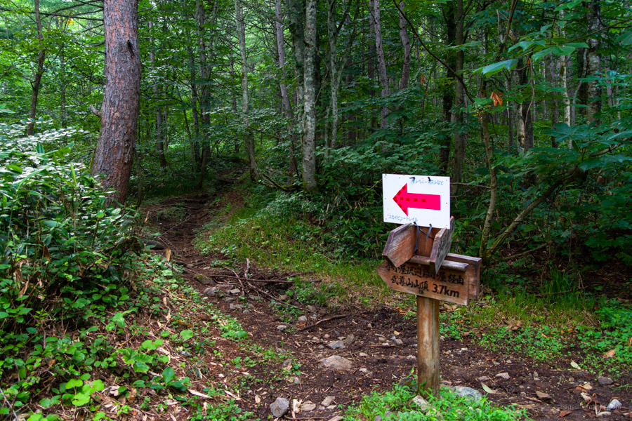
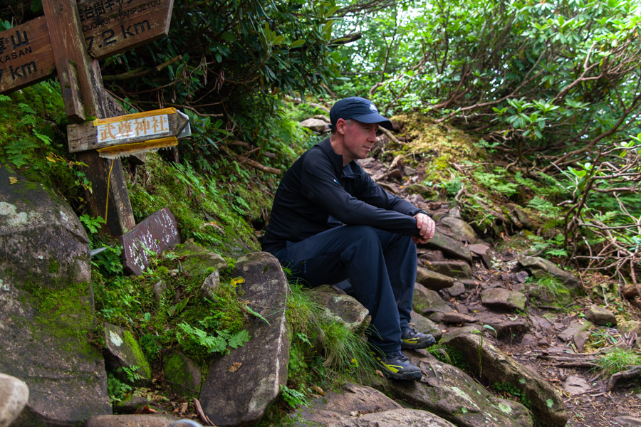
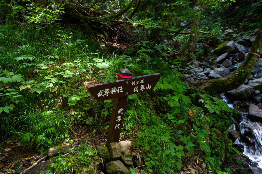
At the Urami-no-taki carpark 裏見ノ滝駐車場 there is a restroom along with a tozan posuto box where you can register your name, date, and hike intentions. If you come by car, it’s also possible to park a little way up the gravel forest road, saving 30 minutes’ walk time. After paying homage at the shrine continue along the Hotaka-sawa Rindo 武尊沢林道 where you will come to a fork after 45 minutes. Going left leads to Mt. Hotaka and heading right, you will reach Mt. Kengamine. To reduce the difficulty, it is advisable to travel in a clockwise fashion. The trail is easy to follow, but be sure to carry a map and GPS device anyhow.
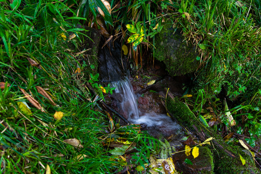
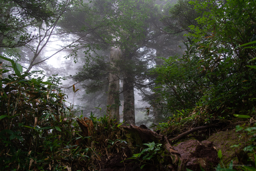
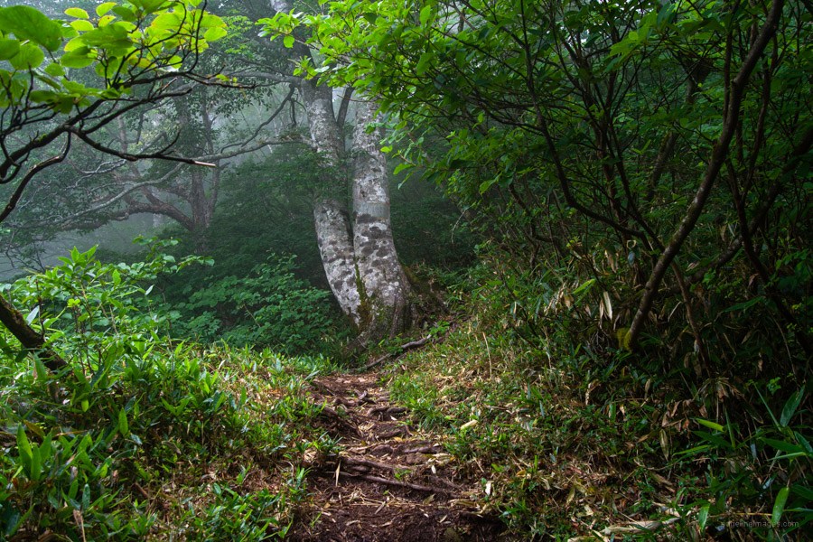
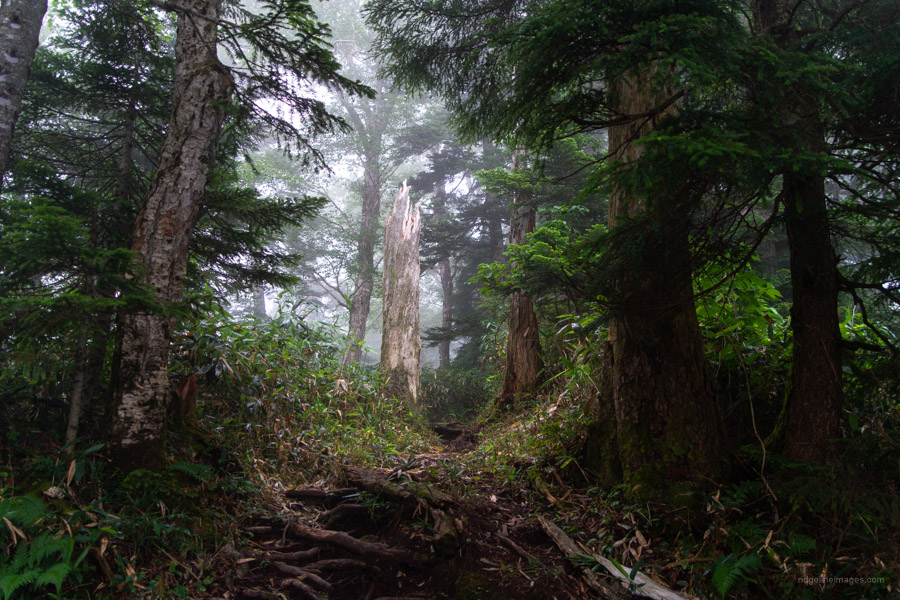
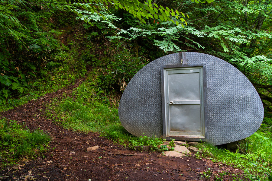
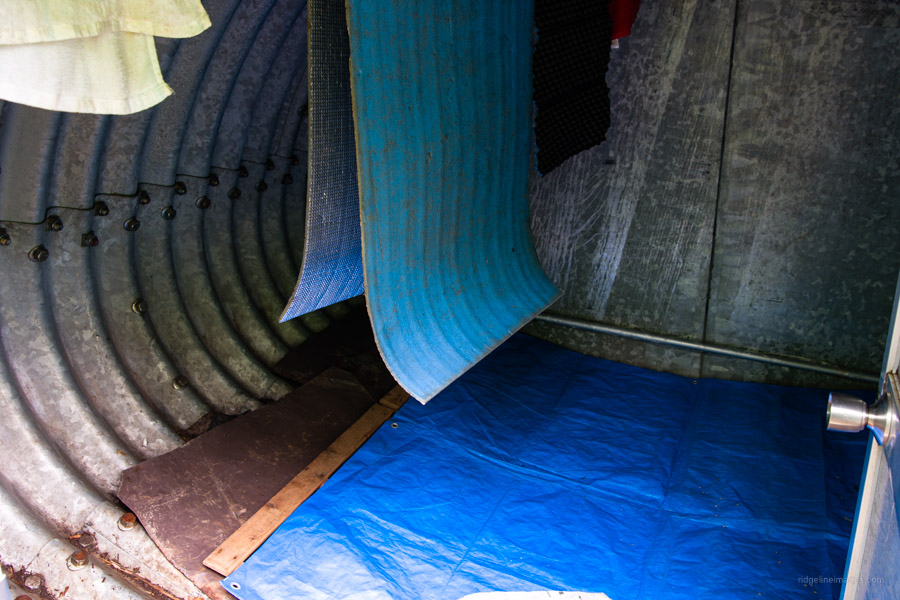
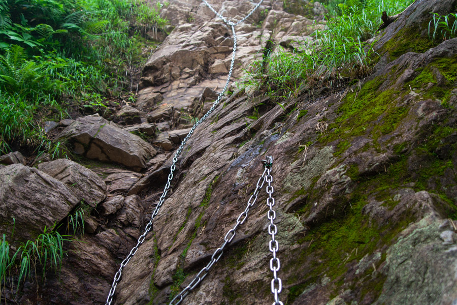
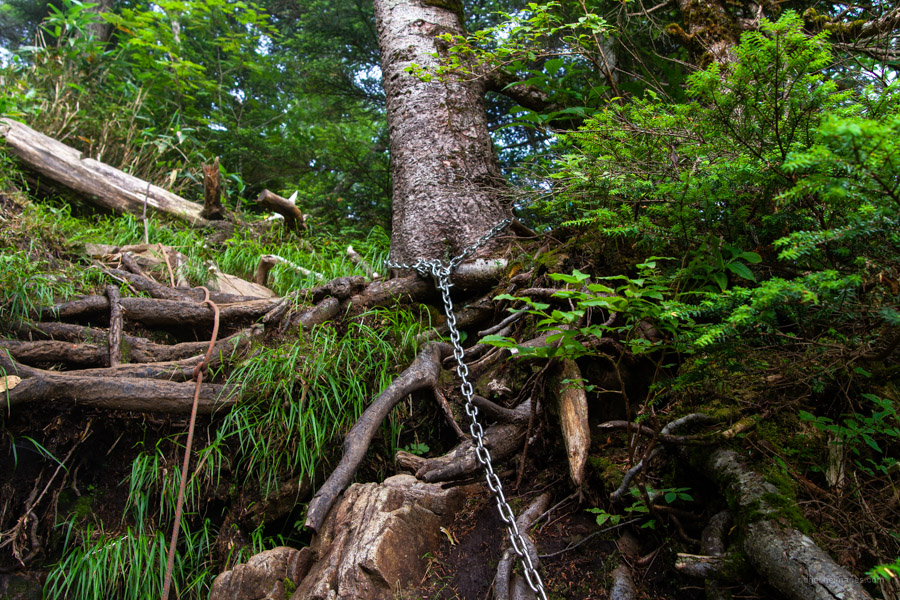
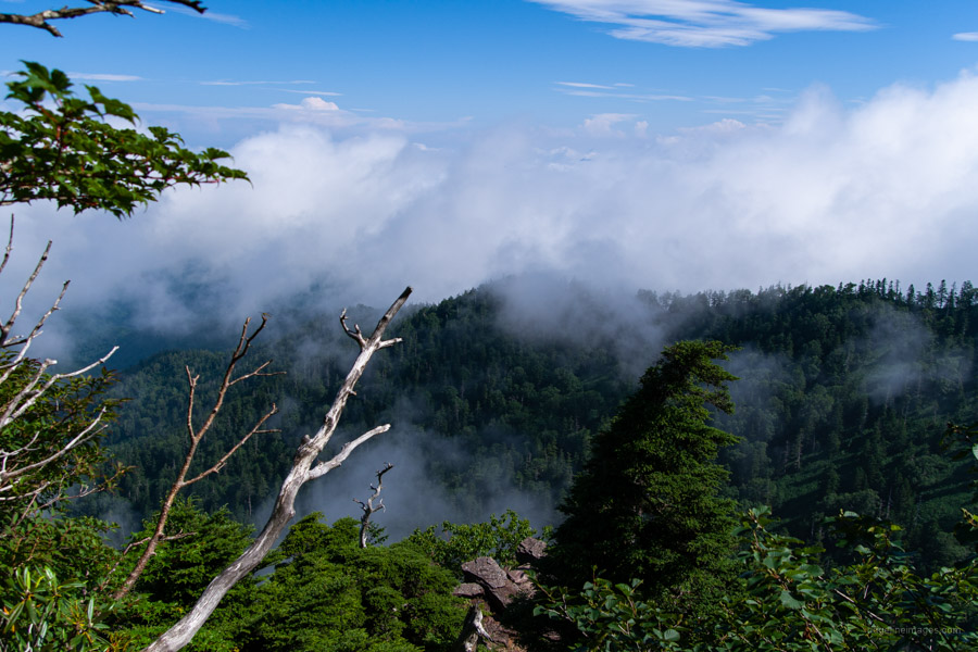
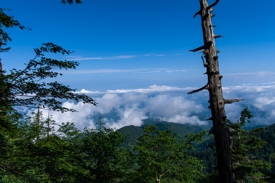
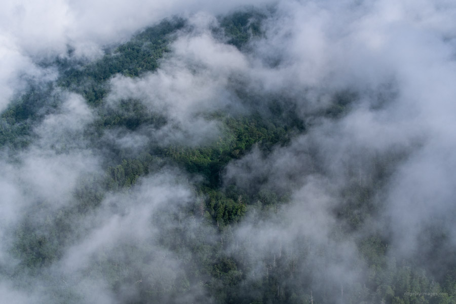
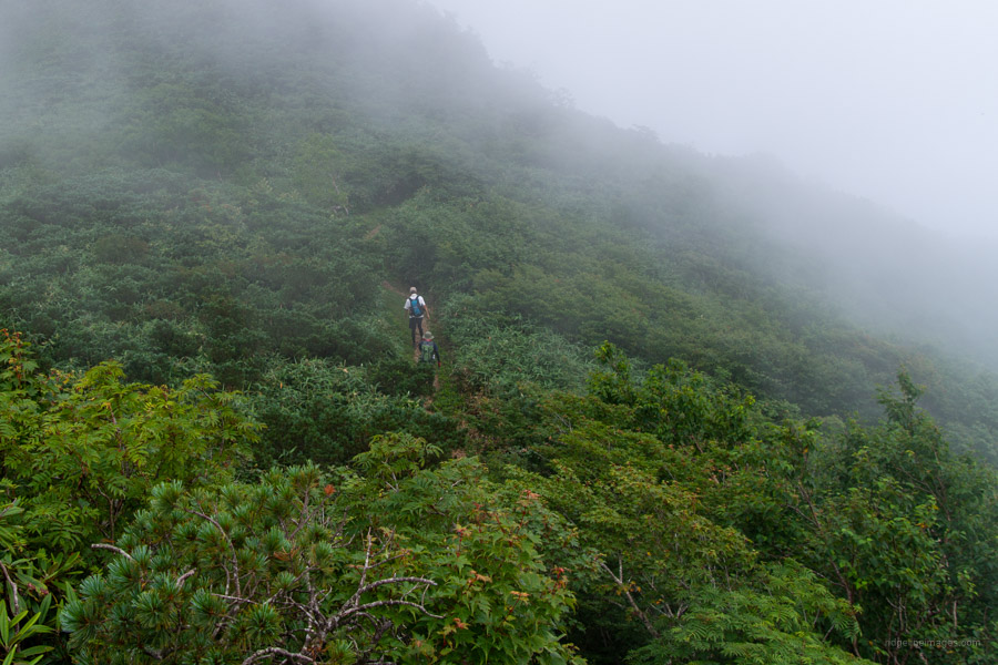
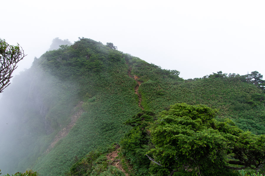
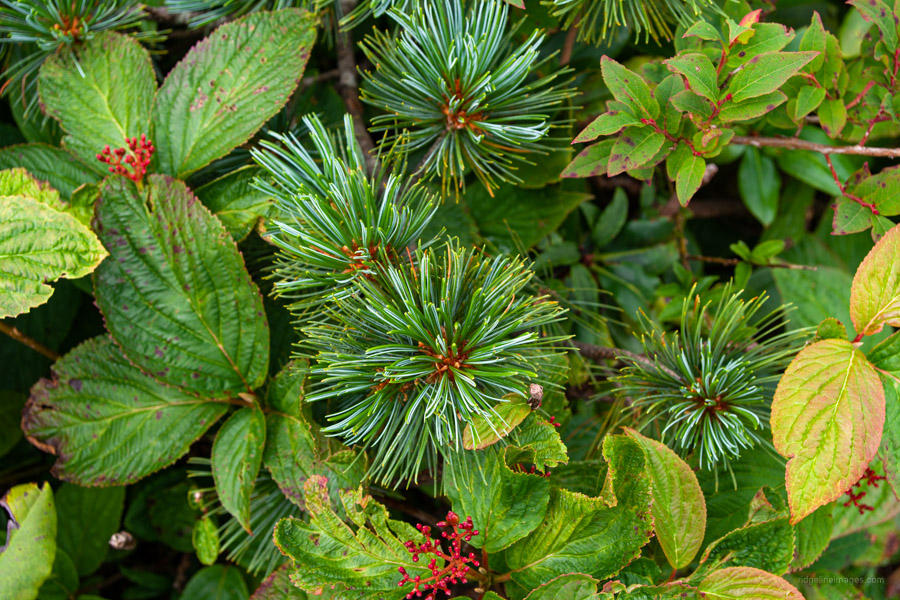
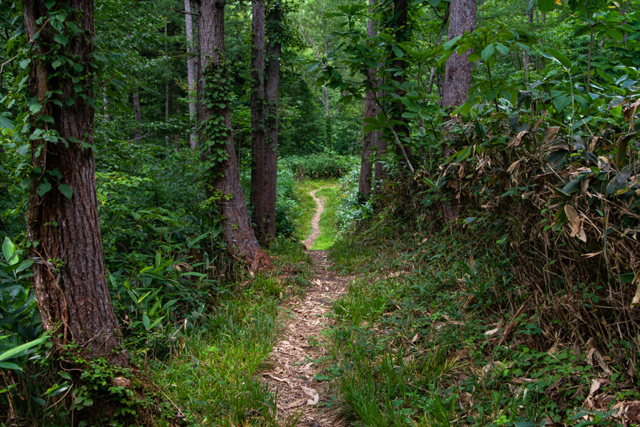
The trail climbs through tracks of Japanese beech (buna) and Abies mariesii or Maries’ fir (Oshirabiso). While the photos go some way towards depicting the misty surroundings, what can’t be conveyed are the chirps and whistles of birds and fragrance emanating from the damp forest. Reaching the ridgeline finds the Hotaka-yama refuge hut 武尊山避難小屋 about 10 metres down a steep embankment left of the trail. This very basic corrugated oval-shaped cabin has an aluminium door and sleeps 2-3. Nearby is a water source. Another 30 minutes of hiking brings you to the first of five fixed chains (kusari-ba). Nothing untoward here provided you take your time, maintain at least three points of contact, and take extra care in the wet. The final chain section is around 20 metres in length.
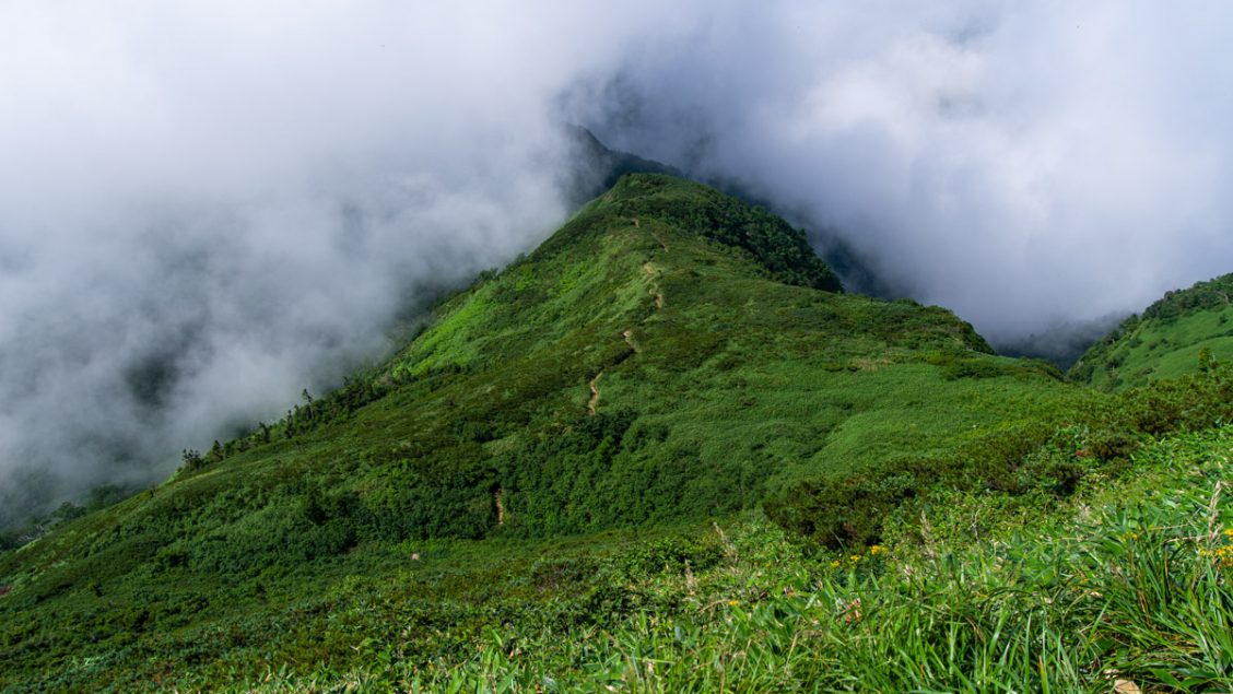
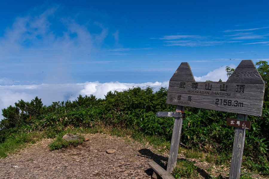
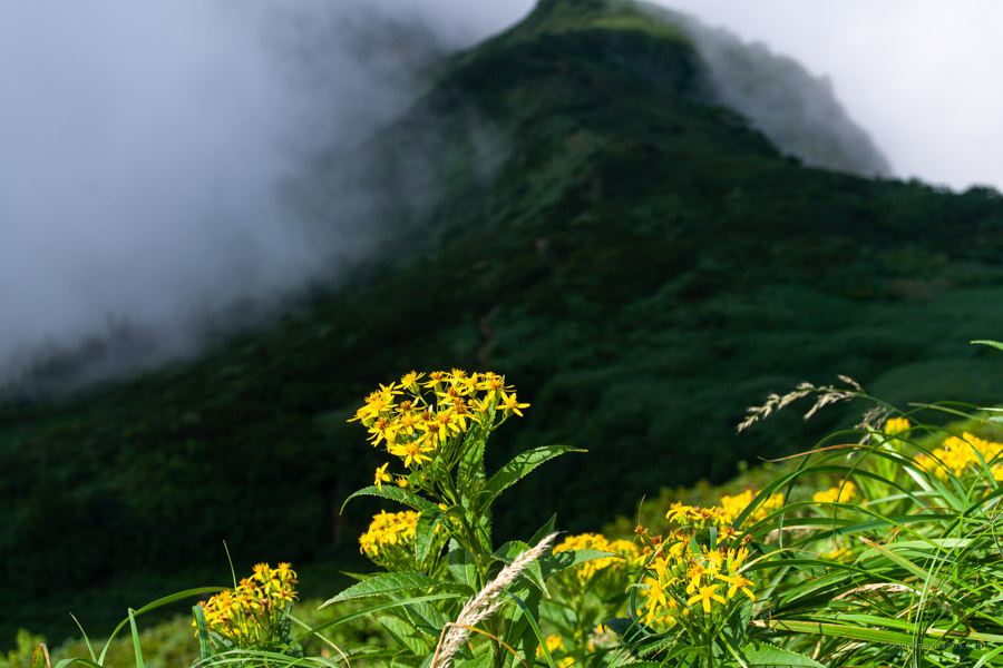
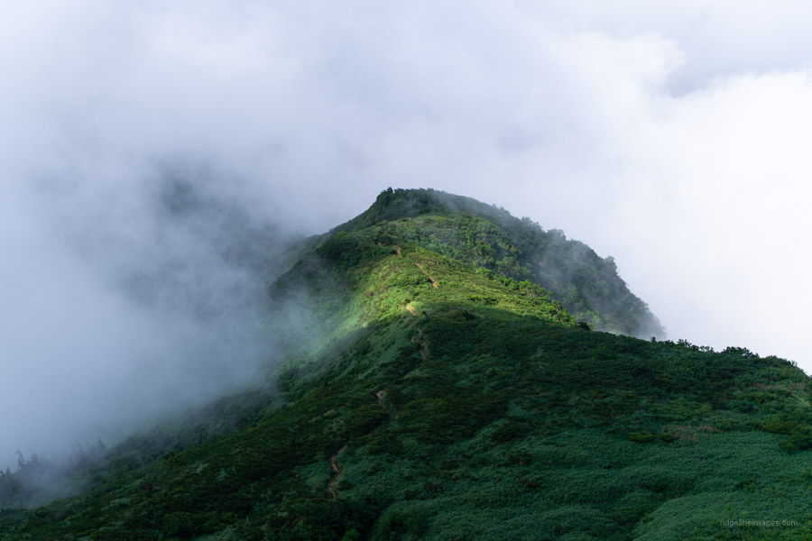
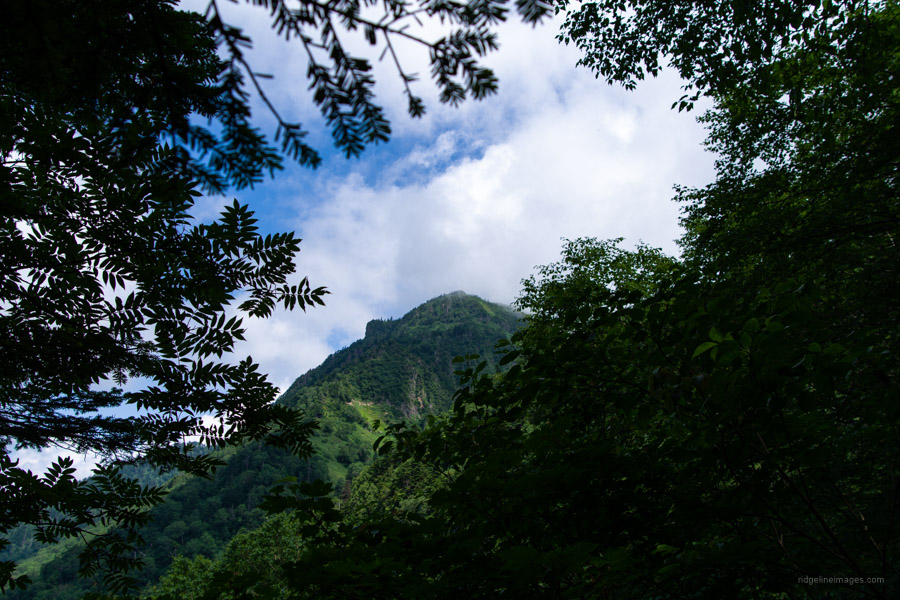
Soon after, your efforts are rewarded with some stunning views as you approach Hotaka-yama 武尊山 (2,158 m). Though the surrounding mountains were shrouded in cloud, the view from the summit was nonetheless mesmerising when the cloud cover intermittently lifted. In fine weather expect views of neighbouring Tanigawadake, Mt. Makihata, and Oze’s duet of Mt. Shibutsu and Mt. Hiuchigatake. When you’ve lapped up the view and are ready to head off, turn right at the three-way trail branch, which drops away through talus bounded by creeping pine (haimatsu-tai). Take care with your footing on the loose rocks. Descending to a saddle, the trail traverses through a couple of ‘false summits’ before reaching the protruding horn of Kengamine 剣ケ峰山 (2,020 m).
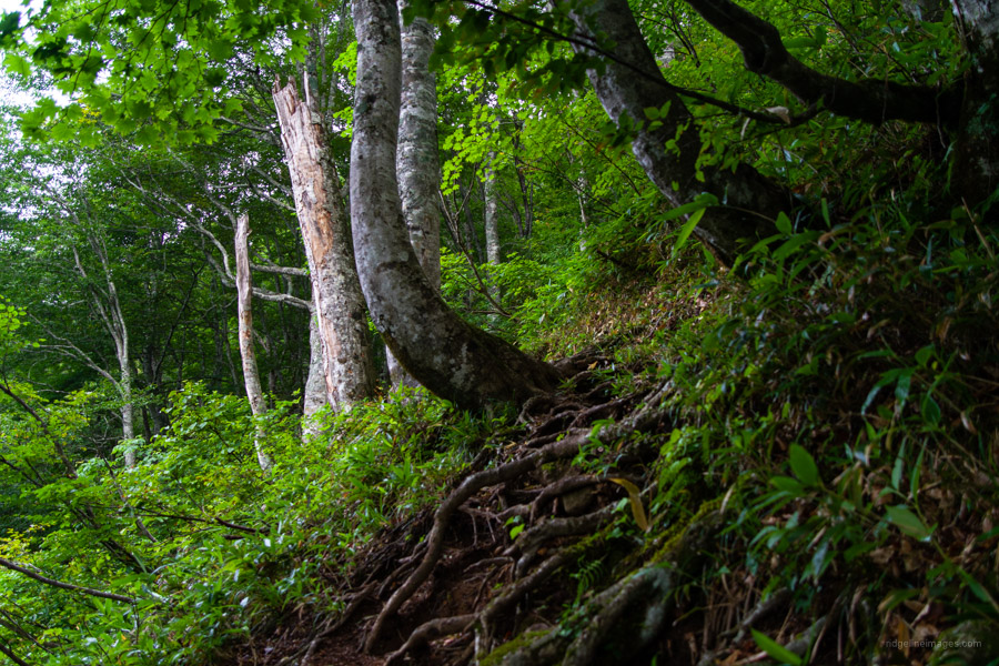
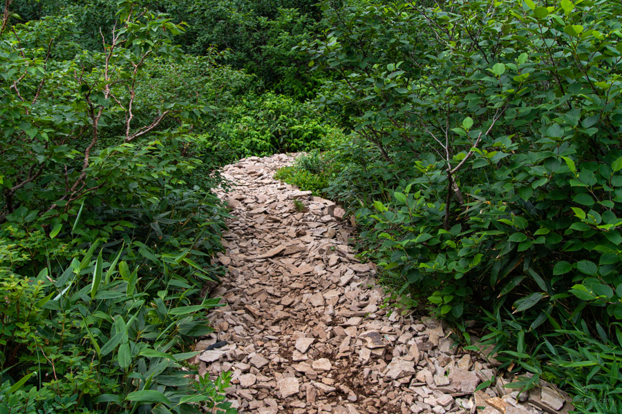
Backtrack to the trail branch where there is a sign pointing to the Hokata Shrine and Hodaigi Campground (7.2 km). The first hour of the descent is rather rough with trail erosion and exposed tree roots ready to bring you unstuck. Along the way there are some water sources, and about halfway to the fork you cross the Hokata River 武尊沢. Not too far from here I encountered my second tsuki no waguma ‘crescent moon bear’ sighting in as many months. Thankfully, we didn’t surprise each other, and it promptly scurried back into the suzu-take bamboo. It took almost 8 hours to complete the circuit so make an early start and avoid the summer if you can, as it’s uncomfortably hot. The best months to climb are September and October.


Exellent.
2 bears in 2 months. Wow.
Not a bad hit rate isn’t it! Could be my scent but really hope it’s just a coincidence.
Minakami environs is bear territory, and you’re going in summer, when they are most active, and looking for water. There are a few encounter-stories if you Google.
It felt a bit like bear territory – close to the river with plenty of sasa about. My impression was the number of bear signs was a bit over the top but perhaps not after all.
Just did this one last weekend in the winter from Kawaba Ski Resort via Mt Kengamine and back. Fantastic winter trek.