.
Mt. Shimodaikura 下台倉山 – Ikeno-dake 池ノ岳 – Tamago-ishi 玉子石
Distance: 24.6 km
Elevation change: 1326 metres
Highest point: 2141 metres
Start: Takanosu Kogen Campground
Finish: Takanosu Kogen Campground
Difficulty: ▅▅▅▅▅▅▅▅▅▅ ❺
Map: Yama to Kogen Chizu 山と高原地図 [No.14 尾瀬 OZE]
GPX TrackKML TrackGSI MAPPDF Topo Map
Granddaddy of Kanto Day Hikes
Hiragatake literally ‘flat mountain top’ sits just outside Oze National Park, on the border of Niigata and Gunma prefectures and is a 100 Famous Japanese Mountain. Much like peaks that surround it, its gentle grassy summit is rich in sphagnum moss and home to a vast wetland scattered with ponds and alpine plants. Beware though, the round-trip course from Takanosu Trailhead is a tough one, with a standard course time of around 12 hours! The mountain has a relatively short climbing season from early July through late October. To protect the fragile environment there are no mountain lodges or refuge huts and camping is not permitted.
Getting to the trailhead is a mission in and of itself. First you need to make your way out to Urasa Station 浦佐駅 on the Joetsu Shinkansen Line. Like my previous hike to Mt. Makihata, I bore local trains from Tokyo though splurged on high-speed ticket on the way home. From the station head out the east exit, down to the bus departure area and take a seasonal bus for Okutadami 奥只見 (1 hr 20 mins, 1,500 yen) no booking required. There are two services a day that depart at 7:50 am and 1:40 pm respectively. For 2022, the bus runs every day from Aug 6-28 and Oct 1-Nov 6. The bus takes the Okutadami Silver Line a labyrinth of tunnels that were constructed for delivering materials to build the dam.
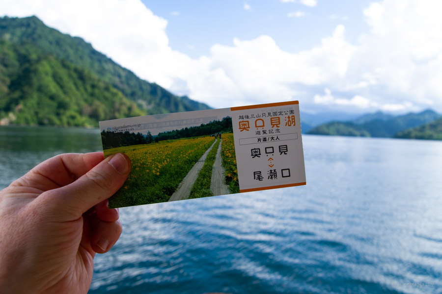
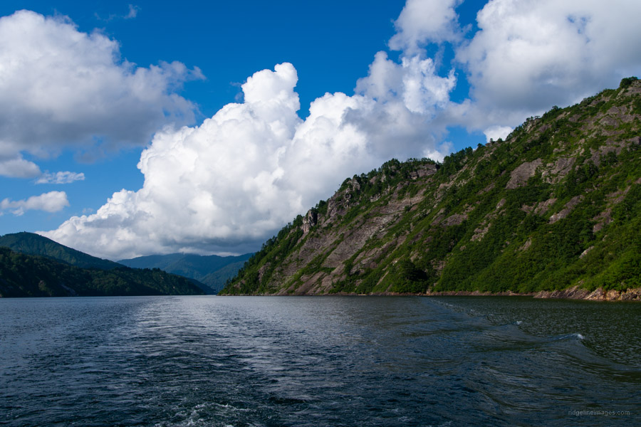
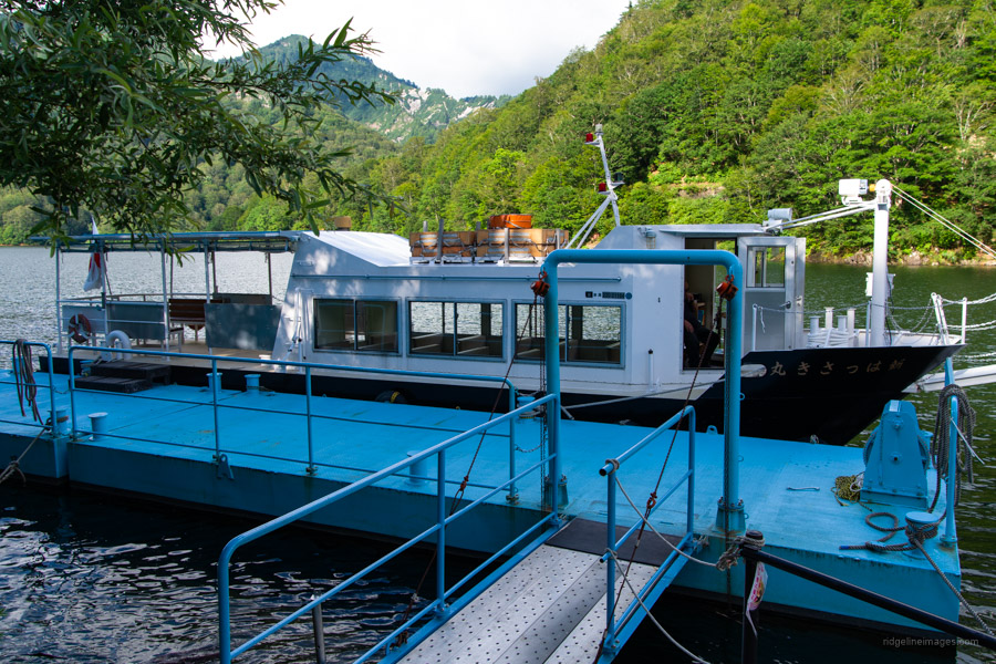
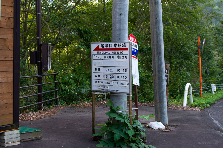
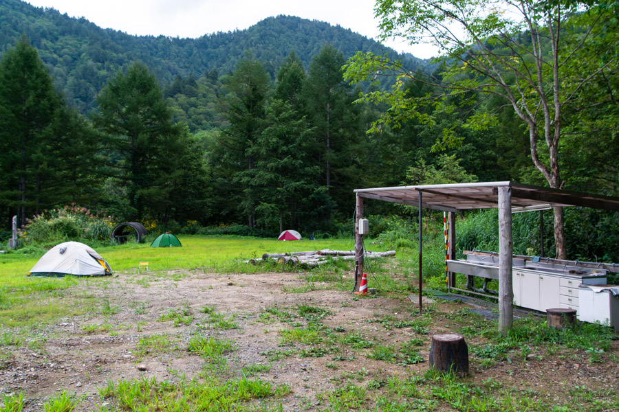
Leaving the bus, it’s not all that intuitive how to reach the Lake Okutadami ferry terminal. You can either take the Okutadami Slope Car (100 yen) or directly behind the bus there is a walking path that also leads up to the dam. Don’t pussyfoot around as the boat departs 20 minutes later. Speaking of which, you need to book the boat for Ozeguchi 尾瀬口 (40 mins, 1,500 yen) at least two business days in advance. It can be done online with payment made at the ferry terminal. While it may be still possible to board the boat if you don’t have a reservation, it becomes an issue if no one else has and the boat isn’t scheduled to run. For 2022, the boat runs every day from Aug 6-28 and Oct 1-Oct 15. The last piece of the transport puzzle is a short bus ride from Ozeguchi (corresponds with the boat timetable) to the 鷹の巣 Takanosu Bus Stop (5 mins, 370 yen). Although the Takanosu Kogen Campground 鷹ノ巣高原キャンプ場 is no-frills i.e., water and toilet (1,700 yen) its conveniently located 20 mins walk from the trailhead.
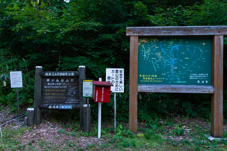
I originally planned the hike a few days earlier but ended up rescheduling to take advantage of the good weather. While the campground is located alongside National Route 352, the road sees little traffic and thus makes it a restful spot to camp out. I set my alarm in earnest at 3:30 am in hope of getting a very early start. The word early is of course subjective as arriving at the Takanosu Trailhead 鷹ノ巣登山口 at 4:15 am found the modest-sized carpark already overflowing. On average it seems to take most hikers around 10-12 hours to complete the hike and for this reason a timely departure is necessary.
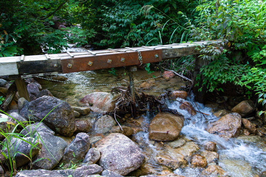
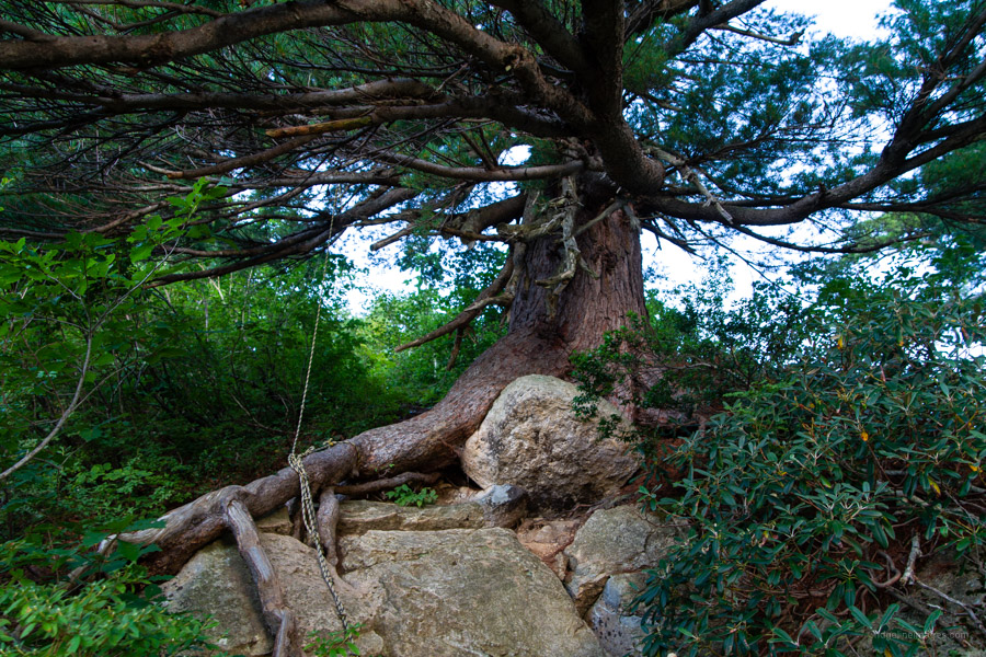
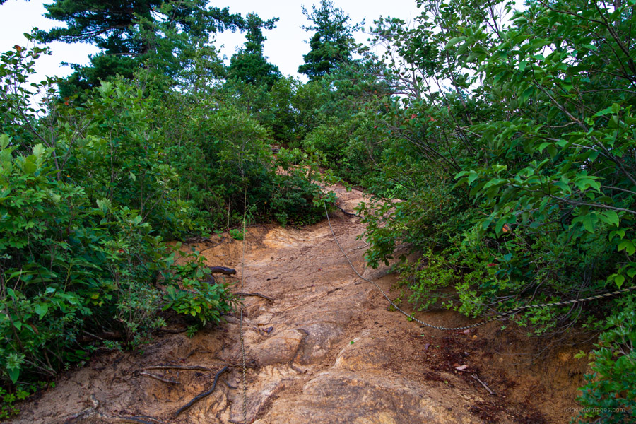
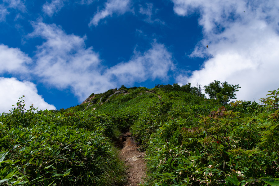
After leaving the trailhead and walking along the forest road for about 10 minutes, you will arrive at a stream. Fill up as needed as it will be your last chance until you reach the marshlands. Even in the late summer I still managed to drink more than five litres of water! With my headlamp guiding me, I began the steep ascent up the Yasa Ridge やせ尾根. Take care as the slope is gravely, loose, and narrow in places but overall, there aren’t any particularly dangerous spots. As is customary, ‘tiger rope’ is on hand to help handle any tricky sections. First highlight of the morning is a silhouette of Hiuchigatake with its characteristic twin peaks.
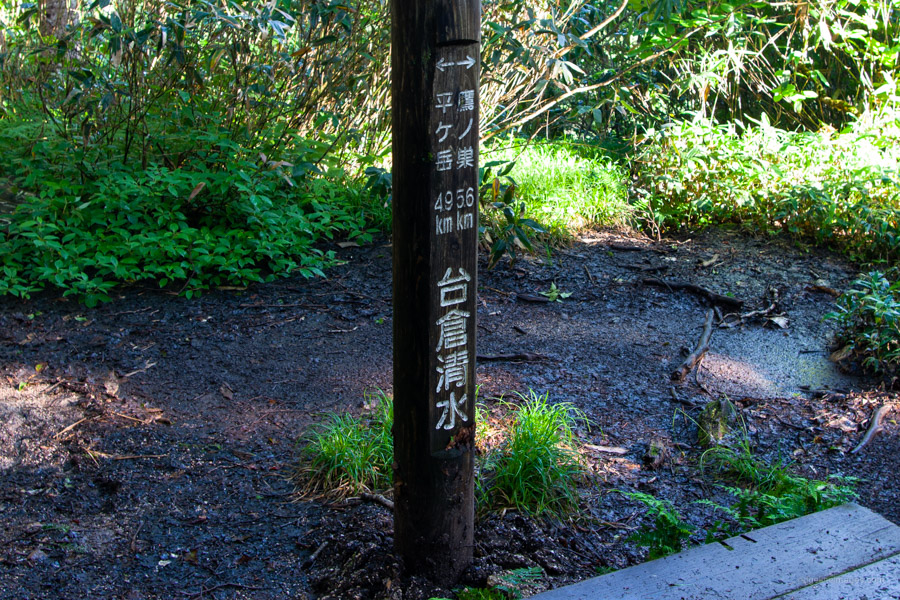
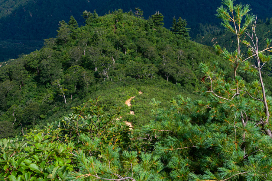
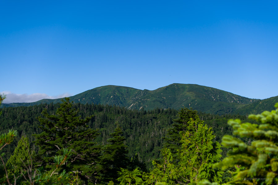
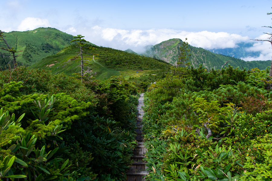
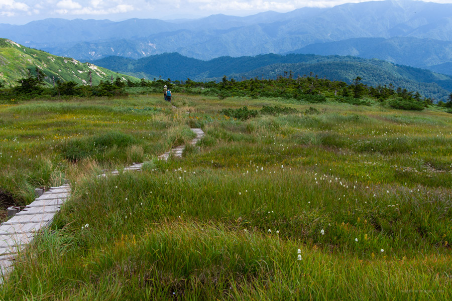
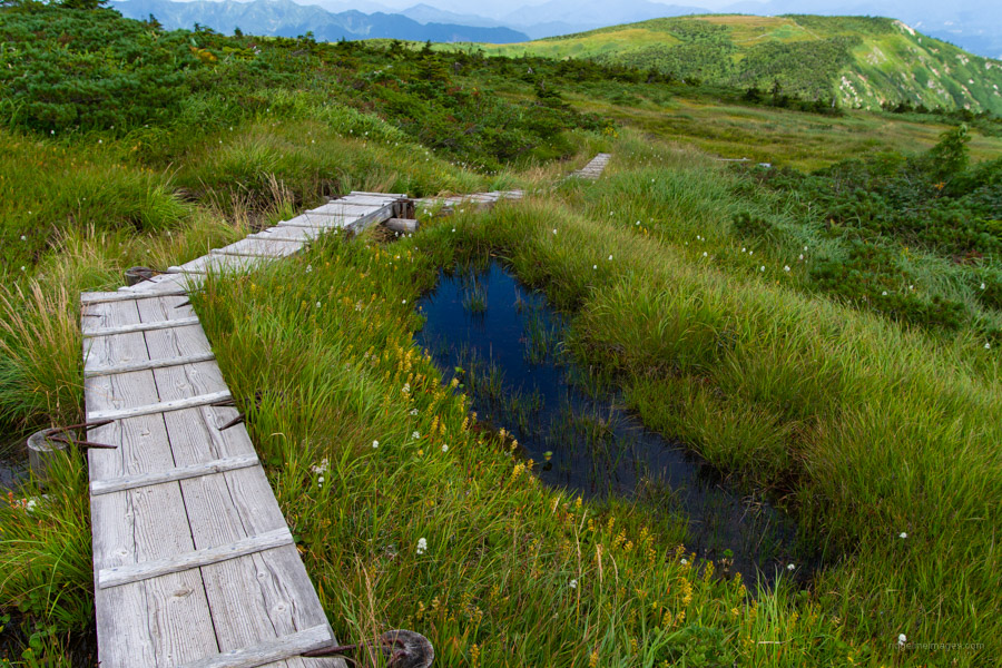
Mt. Shimodaikura 下台倉山 (1,604 m) comes into view below a weaving path through low lying shrubland. It takes about 2 hours from the trailhead to reach this minor summit and concludes the first hard part of the climb. The hike settles into a gentler pace as it passes Mt. Daikura (1,695 m) 台倉山 marked with a trig station along with the first glimpse of Hiragatake. Somewhat dispiriting is Daikura-shimizu 台倉清水 the first of two unreliable water sources and approximate halfway point reached after 3 hours of solid hiking. Here finds some respite from the heat as the trail roams through Japanese hemlock that was quite muddy underfoot. In the wet take care walking along the wooden path that is slippery as a butcher’s apron. From Shirasawa-shimizu 白沢清水 the trail enters dwarf bamboo as you edge towards Ikeno-dake 池ノ岳.
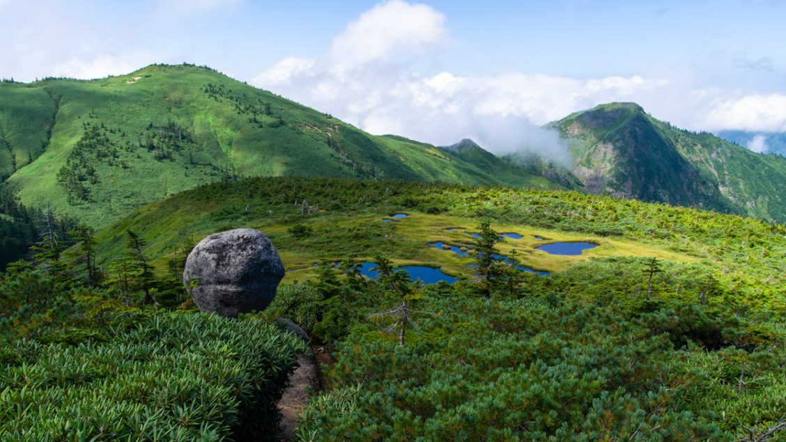
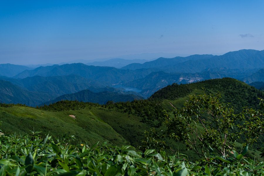
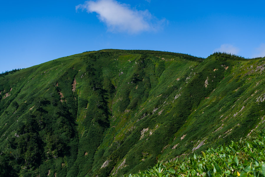
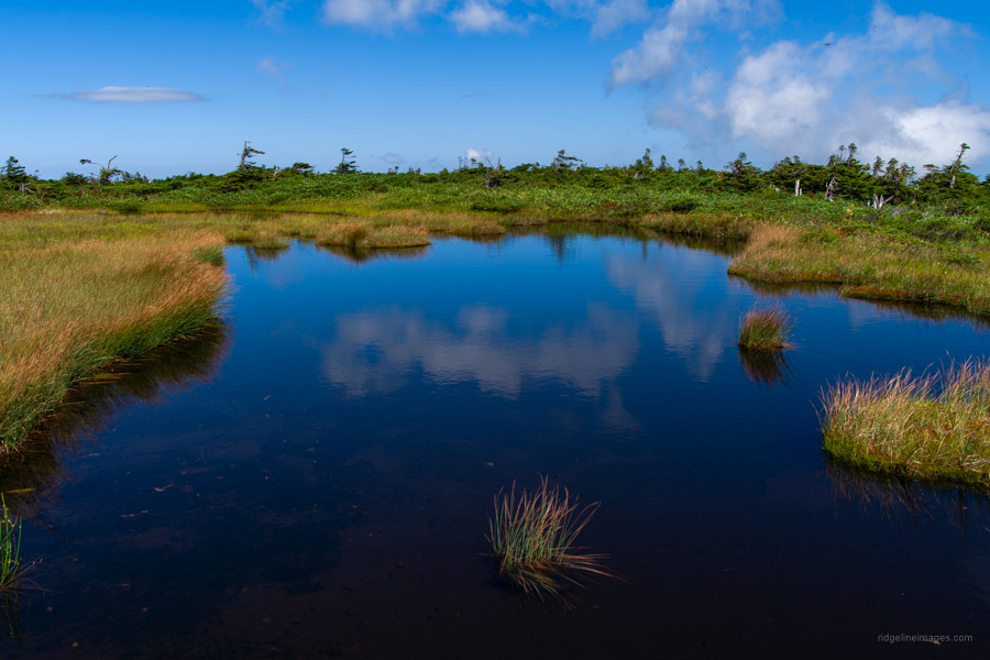
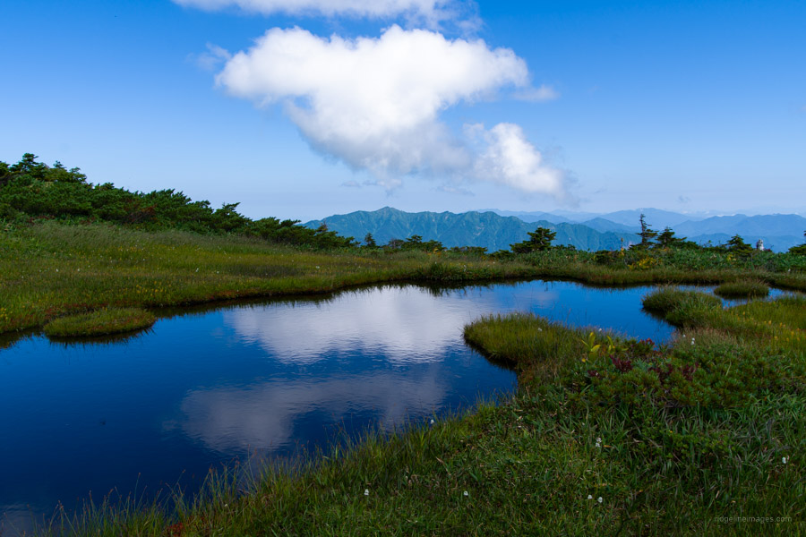
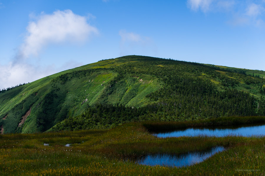
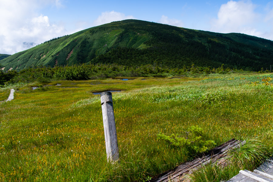
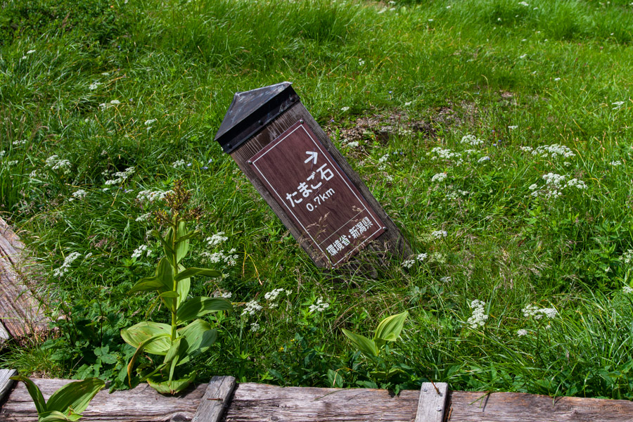
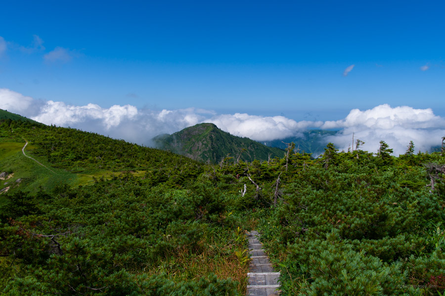
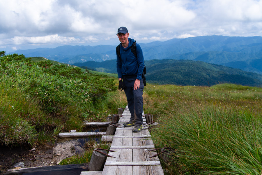
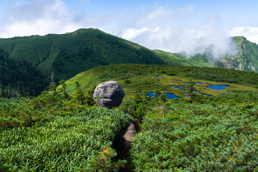
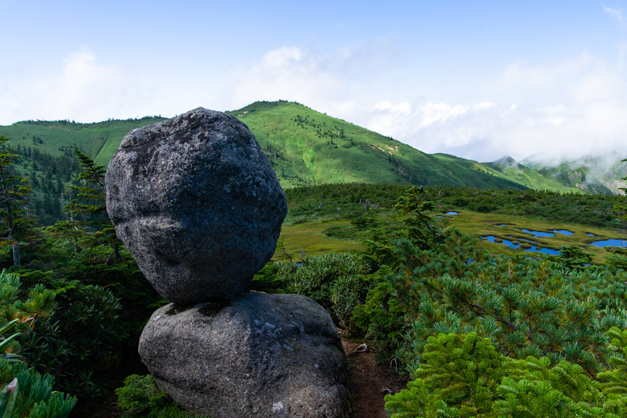
The tranquil marshlands rest at 2,000 metres and offer wonderful panoramic views, lush greenery, and alpine flower meadows in the summertime. The scenery is reminiscent of Mt. Naeba and Mt. Aizu-Komagatake and a worthy reward for the 5 hour slog. Next stop is a short 20 minute walk to the precariously parked Tamago-ishi 玉子石 that symbolises Mt. Hiragatake. It makes for brilliant a photo op and worth swinging by. Continuing counter-clockwise the boardwalk dips down to a reliable water source before veering towards the summit of Mt. Hiragatake 平ヶ岳 (2,141 m). The summit sits in a sheltered nook just off the trail while the ‘true’ summit is a further 200 hundred metres at the terminus of walkway.
After taking a well-deserved rest all that awaits is 4 hours plus of suffering back to the campground. For those aghast of the idea of hiking for 12 straight hours a shortcut option exists. Commonly known as the ‘Prince Route’ on account of former Crown Prince Naruhito who climbed via the shorter Nakanomata River 中ノ又川 route that takes 5-6 hours. There is a catch. To do this course, you are required to spend a night at the Okutadami Sanso 奥只見山荘 at Ginzan-daira (11,000 yen with two meals / 6,600 yen without meals). According to their website the minimum number of participants is five and they will organise a pick up and drop off from the trailhead (check the calendar for availability). Final piece of advice, unless you’re young or masochistic, I recommend spending a second night at the campground.


Many thanks for this write-up, which will undoubtedly save the day (and night) for many a suitor of Hiragatake. Interesting that its reputation for remoteness, as written up in Nihon Hyakumeizan, still stands unblemished. I think Fukada quotes an authority on the Echigo mountains as saying “there’s no mountain with a longer approach from the nearest train station”….
Very true especially now with the daylight hours beginning to dwindle. For those doing the hike from October onwards it will become a battle to get off the mountain before the sun sets.