Otsuki 20: Best Fuji-san Viewpoints
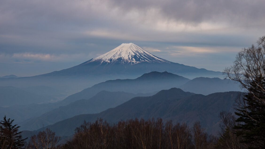
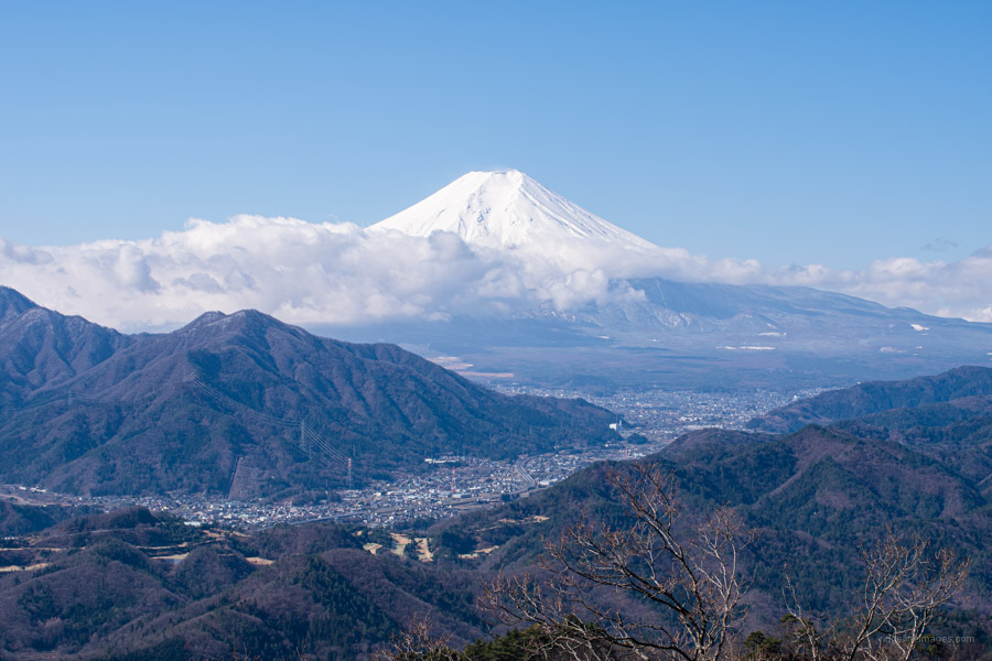
Being a little over an hour away by train from my local station in west Tokyo has meant I have been able to visit Otsuki City frequently over the past decade. This proximity has allowed me to climb many of its most scenic peaks. During the recent Golden Week holiday, I finally achieved a long-held goal: summiting all 20 mountains included in the Twelve Beautiful Views of Mt. Fuji. My final ascent was Mt. Narakura, located in Otsuki City’s northern region.
In 1992, as part of a hometown revitalisation project aimed at promoting tourism and preserving nature, Otsuki City, Yamanashi Prefecture, designated the Twelve Beautiful Views of Mt. Fuji (Shūrei-Fugaku-Jūni-Kei 秀麗富嶽十二景). These 12 mountains, scattered throughout Otsuki City, offer superb views of Mt. Fuji. The selection process was spearheaded by Shiro Shirahata, a landscape photographer from Otsuki City. Not surprisingly, there’s some overlap with the Yamanashi 100 Famous Mountains, with 13 of the Twelve Views also appearing on that list. While the official list designates 12 locations, some include two peaks, bringing the total number of viewpoints to twenty. Shūrei 秀麗 means “graceful” or “beautiful”, Fugaku 富嶽 literally translates to “Fuji Mountain”, Jūni 十二 means “twelve”, and Kei 景 refers to “vista” or “view”.
Twelve Beautiful Views of Mt. Fuji
Summit #1a: Gangaharasuri-yama 雁ヶ腹摺山 May 7 2017
Summit #1b: Ubako-yama 姥子山 May 8 2017
Summit #2a: Koganezawa-yama 小金沢山 September 23 2015
Summit #2b: Ushiokunogangaharasuri-yama 牛奥ノ雁ヶ腹摺山 September 22 2015
Summit #3a: Okurataka-maru 大蔵高丸 August 31 2014
Summit #3b: Hamaiba-maru ハマイバ丸 August 31 2014
Summit #4a: Takigo-yama 滝子山 April 24 2021
Summit #4b: Sasagogangaharasuri-yama 笹子雁ヶ腹摺山 November 3 2022
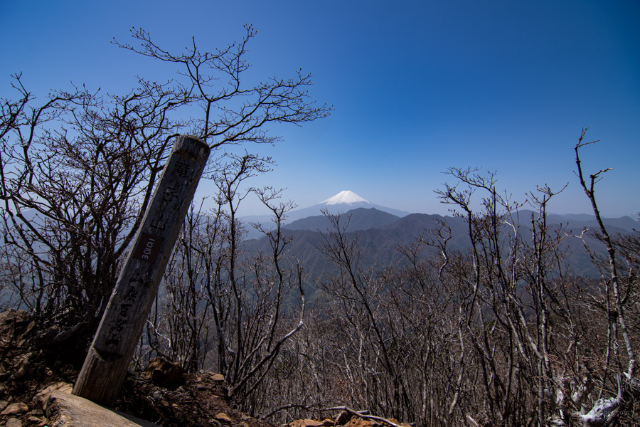
Summit #5: Narakura-yama 奈良倉山 May 4 2024
Summit #6: Ogi-yama 扇山 January 1 2014
Summit #7: Momokura-yama 百蔵山 January 1 2014
Summit #8a: Iwadono-san 岩殿山 February 26 2023
Summit #8b: Oise-yama お伊勢山 April 13 2024
Summit #9a: Kuratake-yama 倉岳山 September 17 2019
Summit #9b: Takahata-yama 高畑山 September 17 2019
Summit #10a: Kuki-yama 九鬼山 May 29 2021
Summit #10b: Gozen-yama 御前山 May 29 2021
Summit #11: Takagawa-yama 高川山 March 24 2021
Summit #12a: Honjaga-maru 本社ヶ丸 November 7 2020
Summit #12b: Seihachi-yama 清八山 November 7 2020
#1a 1b GANGAHARASURI-YAMA & UBAKO-YAMA
.
Gangaharasuri-yama 雁ヶ腹摺山 (1,874 m)
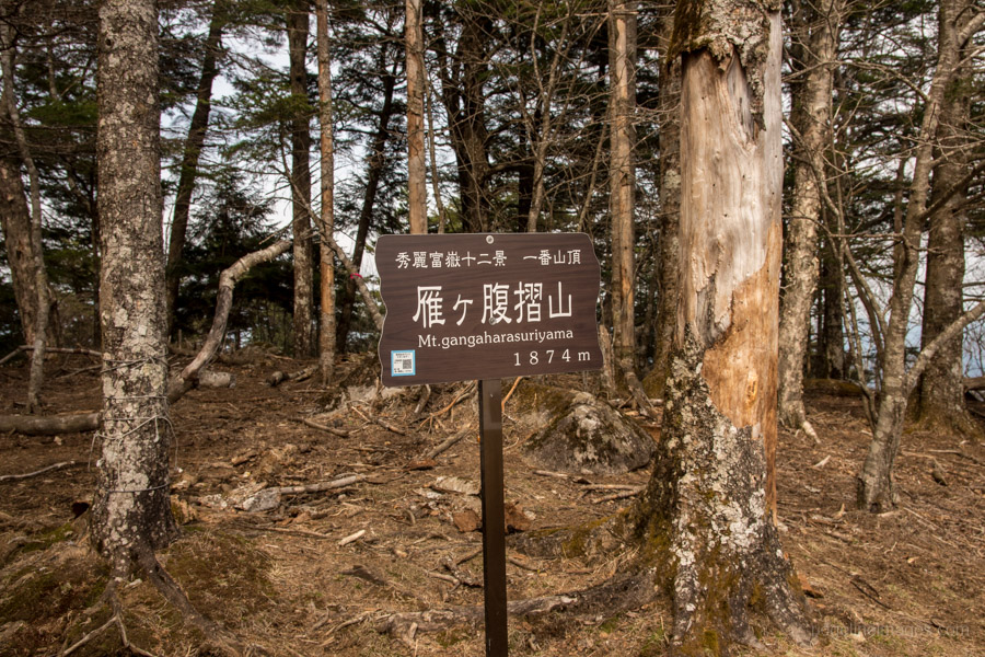
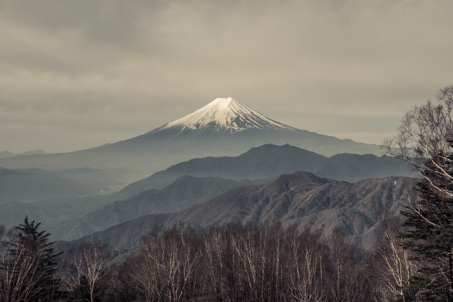
Located in the northern part of Otsuki City, Gangaharasuri-yama (1,874 m) is the least easily accessible on this list, especially when using public transport. From the Hamaiba-mae bus stop, it’s a strenuous climb with an elevation difference of over 1,000 metres. It sits at a higher altitude than the surrounding mountains and is clearly visible from around Otsuki Station. The mountain derives its name from wild geese that can be seen flying over it during the migratory season. In the Okuchichibu mountain range, several place names are derived from geese, such as Gan-toge. Gangaharasuri-yama’s other claim to fame is its appearance on the old 500 yen note.
Ubako-yama 姥子山 (1,503 m)
![]()
Ubako-yama (1,503 m) is the other peak that forms the other half of this pair and is relatively unknown. Rather than being an independent peak, it is more like a small tip on a ridge beside Gangaharasuri-yama. It is almost never climbed alone, and most visitors bag it along with Mt. Gangaharasuri-yama. It is approximately a 2-hour round trip from the summit of Gangaharasuri-yama. The view of Fuji-san from Mt. Ubako is also excellent, as there are no trees blocking the view, allowing you to see the surrounding area more widely.

#2a 2b KOGANEZAWA-YAMA & USHIOKUNOGANGAHARASURI-YAMA
.
Koganezawa-yama 小金沢山 (2,014 m)

Mt. Koganezawa (2,014 m) is a mountain located in the northwest of Otsuki City, on the border with Koshu City. Standing at over 2,000 meteres, it’s the only peak in the Twelve Views of Fuji-san to reach such an elevation, making it the highest point in Otsuki City. Accessible by bus from Kai-Yamato Station, Mt. Koganezawa sits on a long ridge called the Koganezawa Mountain Range, which extends south from Mount Daibosatsu. This spectacular mountain range boasts five mountains that have been selected as one of the 12 Beautiful Views of Fuji-san.

Ushiokunogangaharasuri-yama 牛奥ノ雁ヶ腹摺山 (1,990 m)

A little south of Koganezawa-yama lies Ushiokunogangaharasuri-yama (1,990 m), the mountain with the longest name in Japan. Back in 2015, I had the privilege of camping here during autumn and waking up to a breathtaking view of Fuji-san.
![]()
#3a 3b OKURATAKA-MARU & HAMAIBA-MARU
.
Okurataka-maru 大蔵高丸 (1,781 m)

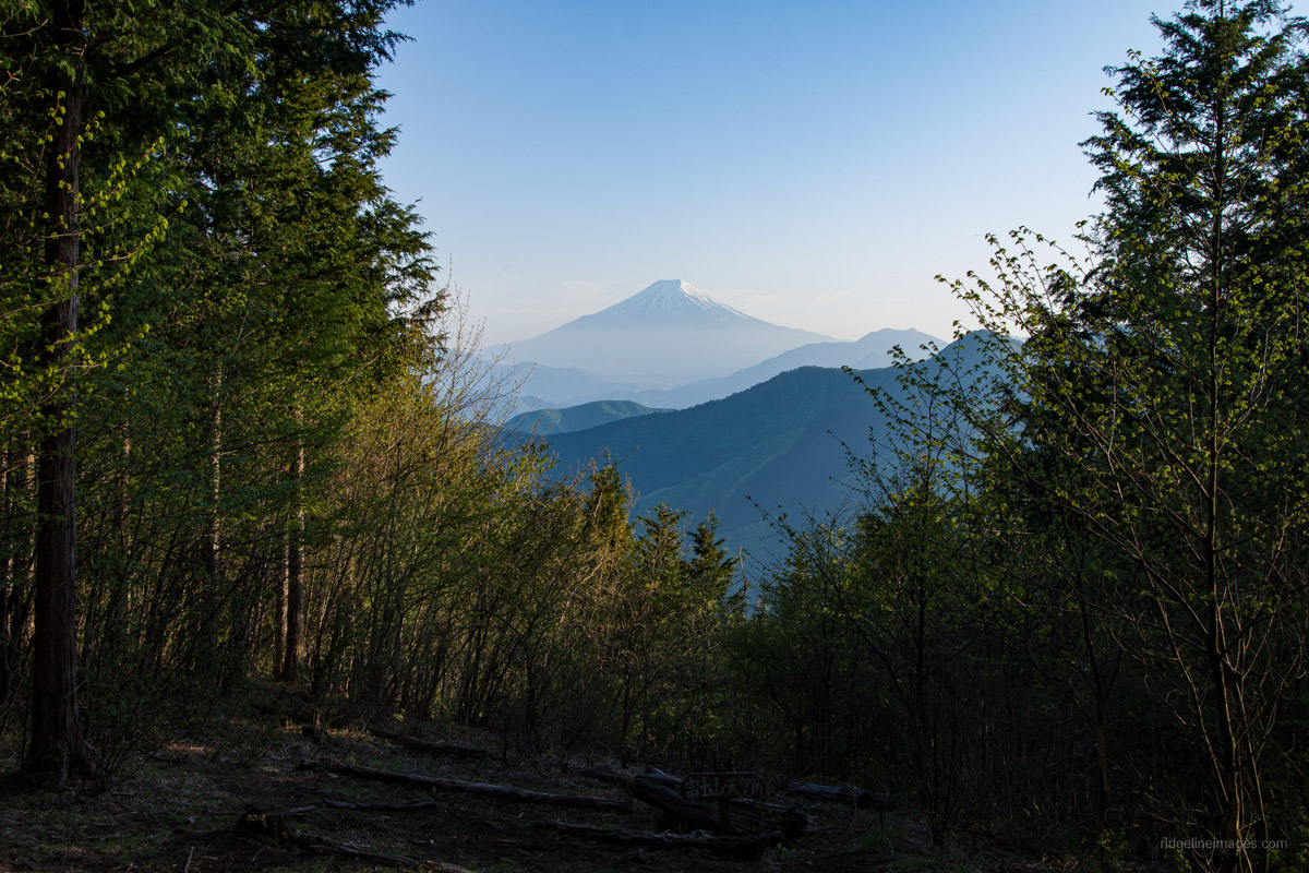
Another peak on the Koganezawa Mountain Range is Okurataka-maru (1,781 m), situated right next to Yunosawa Pass, roughly halfway along the range. The summit of Okurataka-maru offers sweeping views of Fuji-san (in fine weather), where you can not only witness the majestic mountain itself but also take in the surrounding landscapes in almost all directions. Additionally, there is a flower garden on the summit, making early summer a particularly good time to pay a visit.
Hamaiba-maru ハマイバ丸 (1,752 m)

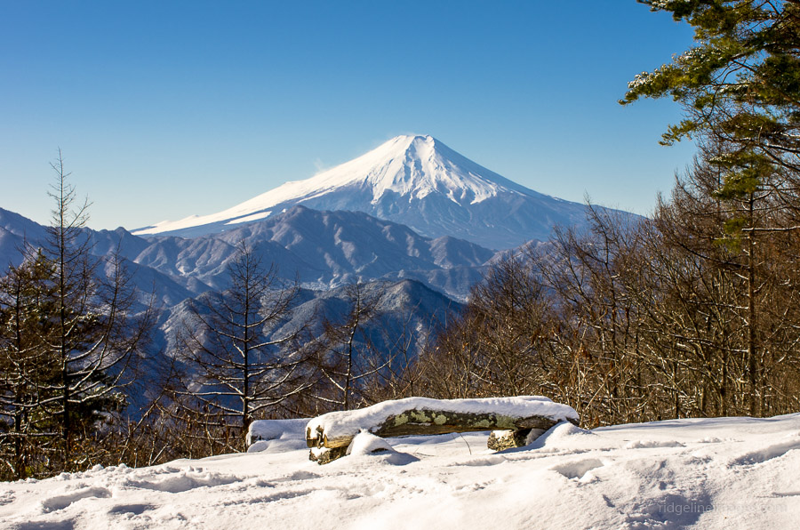
Following the ridge from Okurataka-maru is Hamaiba-maru, connected by a flat ridge with almost no difference in elevation, so it does not feel like an independent peak. The nearest bus stop is Yamato Tenmoku Onsen, but as there is no direct route you need to go via Yunosawa Pass. The view of Fuji-san from Hamaiba-maru is particularly stunning in autumn, when vibrant fall foliage frames the big fella.
#4a 4b TAKIGO-YAMA & SASAGOGANGAHARASURI-YAMA
.
Takigo-yama 滝子山 (1,610 m)
Takigo-yama (1,610 m) sits at the southern tip of the Koganezawa Mountain Range, conveniently located next to the Chuo Main Line. This allows for easy access directly from Sasago or Hatsukari Stations. Standing out prominently, Takigo-yama can even be seen from central Tokyo on a clear winter day. While the summit itself offers rewarding views, the true highlight of Takigo-yama is the trail leading there, which winds past several waterfalls.

Sasagogangaharasuri-yama 笹子雁ヶ腹摺山 (1,358 m)

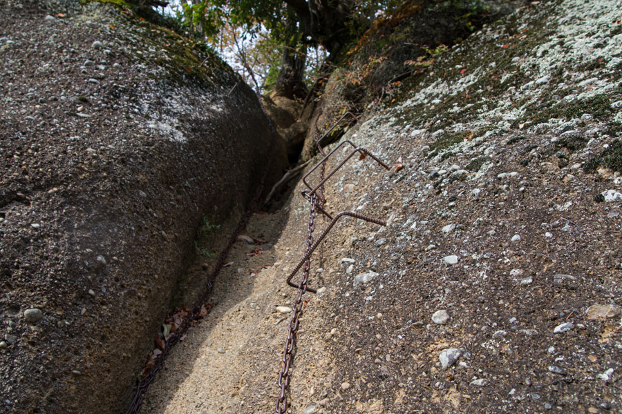
Sasagogangaharasuri-yama (1,358 m) rises dramatically at the northern edge of the Kofu Basin, directly above the Sasago Tunnel of the Chuo Expressway. The hike up Sasagogangaharasuri-yama is challenging and not recommended for beginners, especially if traversing across to Kai-Yamato Station. Steep sections, fixed climbing chains, and the potential for getting lost necessitate a good level of fitness and strong navigational skills. While the view of Fuji-san from the summit isn’t the most expansive on this list, you can still witness the upper slopes of the iconic mountain against the backdrop of the surrounding landscape.

#5 NARAKURA-YAMA
.
Narakura-yama 奈良倉山 (1,349 m)

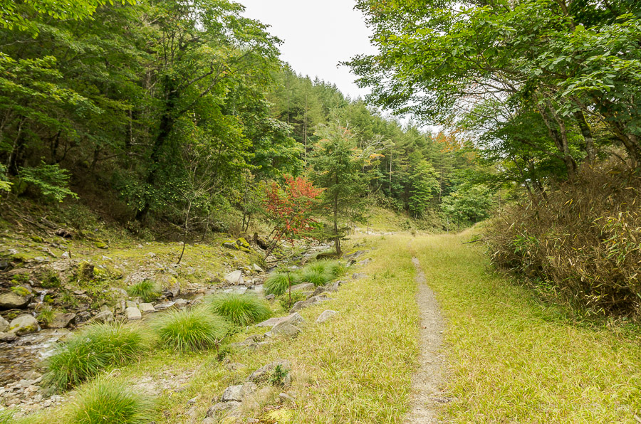
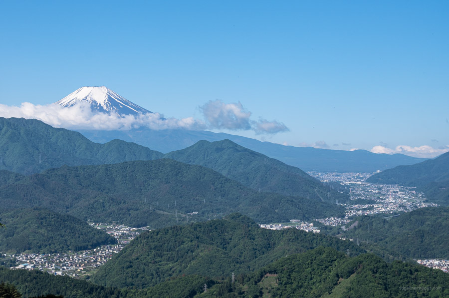
Mt. Narakura (1,349 m) straddles Otsuki City and Kosuge Village in Yamanashi Prefecture. While many of the mountains belonging to the 12 Beautiful Views of Fuji-san are accessible from the Chuo Main Line, Narakura-yama is an exception, as it can also be accessed from the Okutama side. The mountain and connecting ridge are covered in old-growth forest, including towering Japanese beech, and it is especially beautiful during the shinryoku, or “new green” season. It also boasts some of the best autumn colours in the Okutama area. Due to its greater distance, Fuji-san appears slightly smaller when viewed from Narakura-yama compared to the other peaks on this list.
#6 OGI-YAMA
.
Ogi-yama 扇山 (1,138 m)

Ogi-yama (1,138 m) sits just inside Yamanashi Prefecture on the border with Uenohara City. Easily accessible from Torisawa Station on the Chuo Main Line, it’s no wonder this peak is a popular choice among the 12 Beautiful Views of Mt. Fuji. With no dangerous areas and a beginner-friendly trail, it’s a great option for hikers of all levels and is often hiked together with neighbouring Momokura-yama. The view of Fuji-san from the top is also very good.
#7 MOMOKURA-YAMA
.
Momokura-yama 百蔵山 (1,003 m)
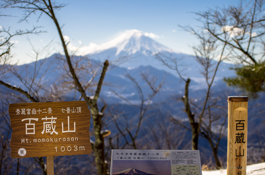
Momokura-yama (1,003 m), a another prominent mountain north of the Katsura River, sits adjacent to Ogi-yama. Together with nearby Gongen-yama, they form the Hokutsuru Sanzan mountain group. Hikers can access Momokura-yama directly from Saruhashi Station on the Chuo Main Line. It’s a popular choice for hikers who want to extend their trek and enjoy a panoramic view by connecting to neighbouring Ogi-yama via a scenic ridgeline traverse. The south side of the summit is more open and offers a slightly better view of Fuji-san than Ogi-yama.
#8a 8b IWADONO-SAN & OISE-YAMA
.
Iwadono-san 岩殿山 (634 m)

If there is one mountain that symbolises Otsuki City, it would have to be Iwadono-san, standing right in front of Otsuki Station at 634 metres tall, the same height as Tokyo Skytree. The summit was once home to a Buddhist temple complex and later a castle. While previously offering a straightforward climb from Otsuki Station, the southern mountain trail is currently closed, and now it needs to be approached from the northern side. For those seeking more adventure, the hike can be extended to the nearby Chigootoshi, though it involves several areas with fixed chains.
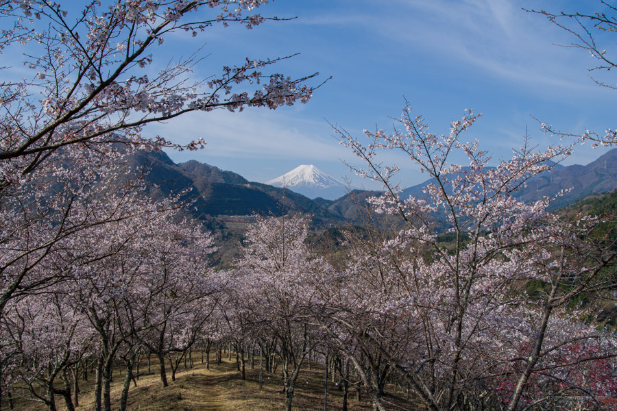
Oise-yama お伊勢山 (561 m)
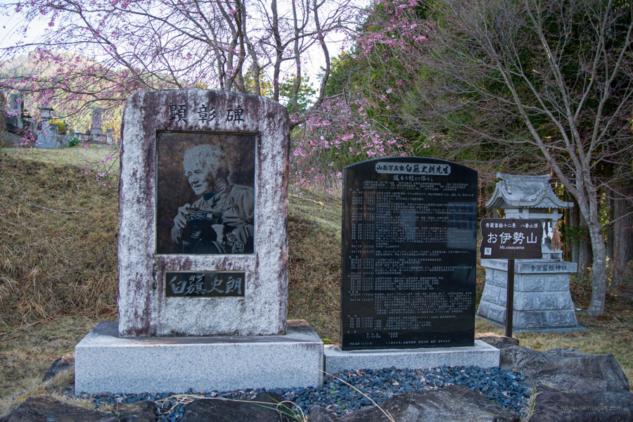
While not really a mountain in the traditional sense, Oise-yama (561 m) encompasses a cemetery located within a shrine in central Otsuki City. Despite its lower elevation, Oise-yama offers a wonderful view of Fuji-san and is a popular spot for cherry blossom viewing, making late April the best time to visit. At the summit stands a monument commemorating Shiro Shirahata the chief architect of this list. You can easily access it by taking the bus bound for Hamaiba from Otsuki Station. Oise-yama also serves as a starting point for hikers looking to explore the nearby mountains, offering the option to traverse back to Otsuki Station or extend the hike to include Iwadono-san.
#9a 9b KURATAKE-YAMA & TAKAHATA-YAMA
.
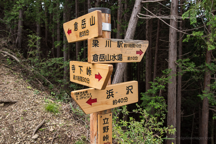
Kuratake-yama 倉岳山 (990 m)
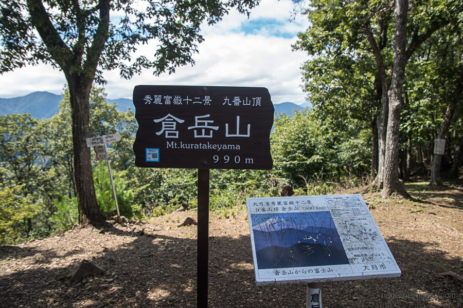
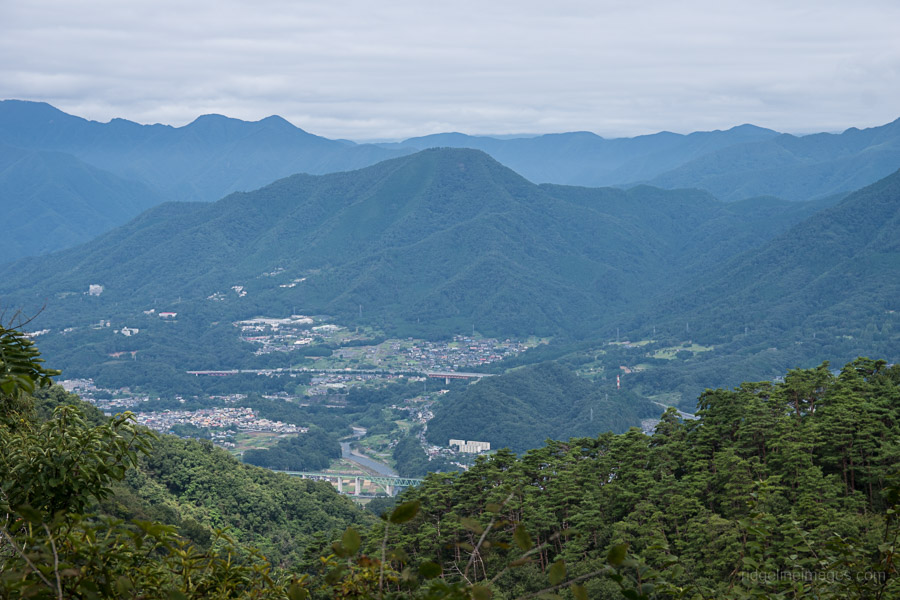
Kuratake-yama (990 m) forms part of the Akiyama Mountain Ridge, a collection of low mountains with an elevation of just under 1,000 metres, which stretches to the south of the Katsura River. Kuratake-yama can be approached by walking directly from Torisawa Station or Yanagawa Station on the Chuo Main Line. People have crossed the various passes since ancient times, and thus there are many mountain trails that can be accessed on either side of the ridgeline. The view of Fuji-san from Kuratake-yama offers a glimpse of the iconic mountain through the trees.
Takahata-yama 高畑山 (982 m)

Like neighbouring Kuratake-yama, Takahata-yama (982 m) sits along the Akiyama Mountain Ridge and is rarely climbed alone; most hikers tackle both peaks together. The view of Mt. Fuji from Mt. Takahata is similar to that from Kuratake-yama, slightly hemmed in by vegetation.
#10a 10b KUKI-YAMA & GOZEN-YAMA
.
Kuki-san 九鬼山 (970 m)
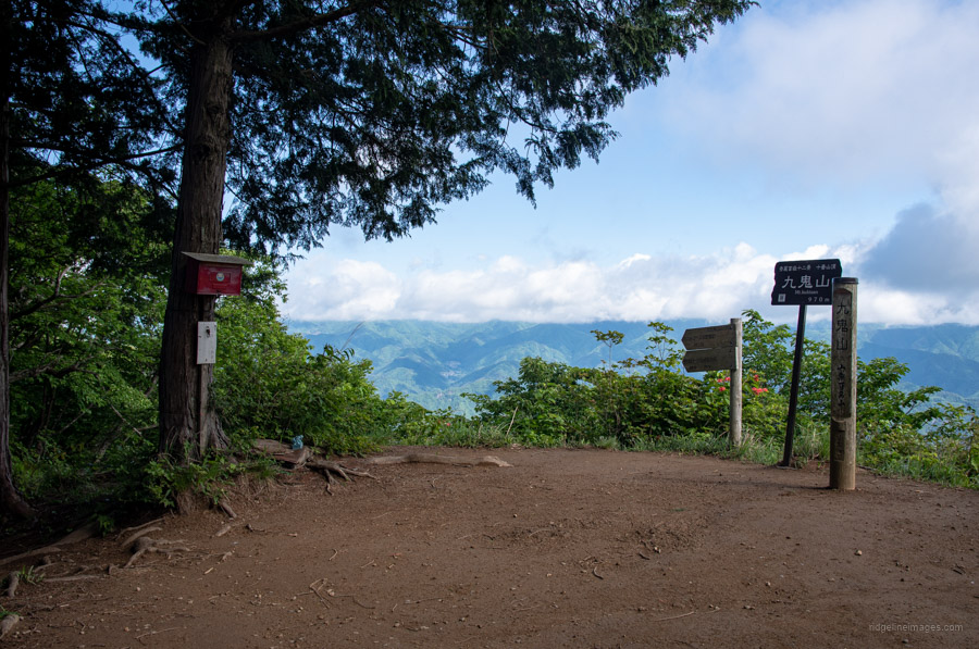
Kuki-yama (970 m) sits at the western end of the Akiyama Ridge. Aside from the Yamanashi Maglev Test Line passing underneath it, Kuki-yama like many on this list is also one of the 100 Famous Mountains of Yamanashi. The nearest stations are Tanokura Station or Kasei Station on the Fujikyuko Line. It takes about two hours to reach the summit no matter which way you climb. The true highlight of Kuki-yama is the view of Fuji-san from Tengui-wa Rock, a viewpoint encountered during the ascent than the summit itself. Adding to its appeal near the Kasei Station trailhead, there is a historic brick aqueduct constructed during the Meiji period.
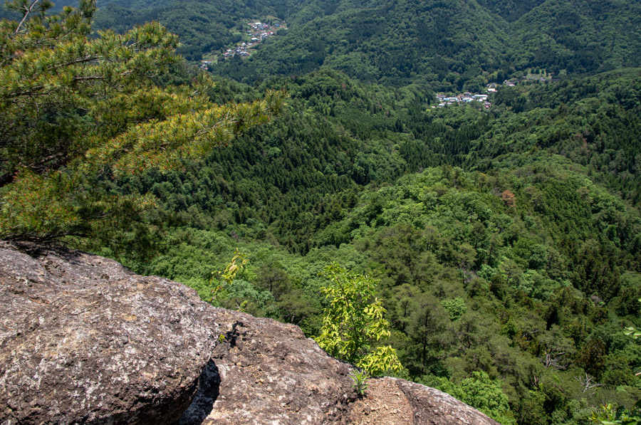
Gozen-yama 御前山 (730 m)
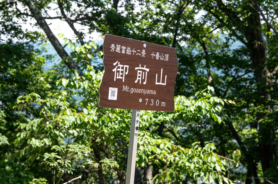
Gozen-yama (730 m) is a minor peak on the ridge extending north from Kuki-yama and does not appear of the Geospatial Information Authority of Japan (GSI) map. Its rock face, similar to Iwadono-san, which rises above Otsuki Station, offers a straight line of sight back to Fuji-san. Hikers can approach Gozen-yama directly from Saruhashi Station or traverse from Kuki-yama, although this route involves many ups and downs. The view of Fuji-san from Gozen-yama is pretty good, especially for a mountain of such modest elevation.
#11 TAKAGAWA-YAMA
.
Takagawa-yama 高川山 (976 m)

Like Iwadono-san, Takagawa-yama (976 m) is another conspicuous peak close to Otsuki Station. Thanks to its good views and relatively easy access from Tokyo, it’s very popular, except during the hot and humid summer months. There are several climbing courses, but the shortest way is to walk directly from Hatsukari Station on the Chuo Main Line, and it takes less than 2 hours to reach the top of the mountain. It’s a good option for those starting out on their Twelve Beautiful Views of Mt. Fuji journey. The summit offers a wide and expansive panorama that includes many surrounding mountains.
#12a 12b HONJAGA-MARU & SEIHACHI-YAMA
.
Honjaga-maru 本社ヶ丸 (1,631 m)
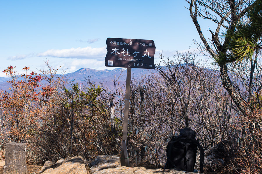
While arguably the toughest climb on this list, Honjaga-maru (1,631 m) offers a rewarding challenge for those seeking a breathtaking view of Fuji-san. Stretching along the south bank of the Sasago River, its steep slopes and 1,000-metre elevation gain make it a challenging climb. Your efforts are rewarded with beautiful beech woodlands and a striking, up-close view of Fuji-san from the upper ridgeline. It is popularly approached directly from Sasago Station on the Chuo Main Line.

Seihachi-yama 清八山 (1,593 m)
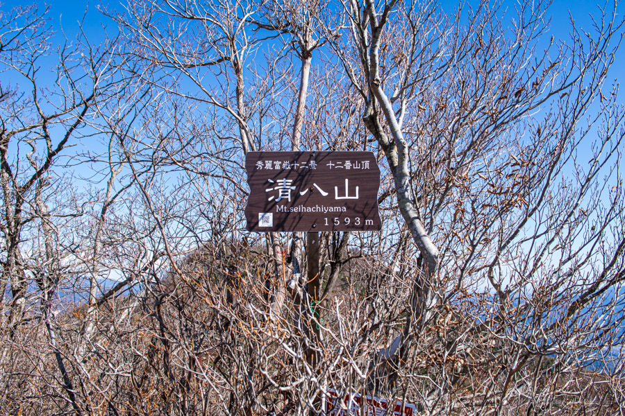
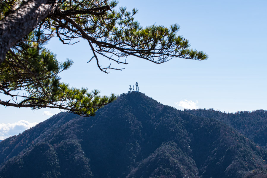
Seihachi-yama (1,593 m) lies adjacent to Honjaga-maru, and most people climb the two peaks together. The view from Seihachi-yama is analogous to its taller neighbour, being large and impressive, thanks to the fact that Seihachi-yama is the closest to Fuji-san among the twelve in this list. You can revel in some fine views of Fuji-san along with Mt. Mitsutoge, which is easily recognisable by its antennas.

At the summit of Mt. Narakura, the final peak on my quest to conquer the Twelve Beautiful Views of Mt. Fuji.


Hi David,
Thank you for the great review of the best views of Mt. Fuji.
Can you order it from the least difficult to the most?
I want to invite my son, 6 yo, this summer to one of the easiest places to see the beauty of Mt. Fuji.
Thanks for the comment! Wonderful to hear you’re going to introduce your son to some of these epic mountains. Just as a caveat, the difficulty is somewhat altered by whether you’re tackling each by public transport or by car. For example, with Gangaharasuri-yama, you can literally save yourselves over 800 metres in elevation gain by parking at Otoge!
Here are my thoughts on the list, ordered from easiest to hardest:
1. Oise-yama
2. Narakura-yama (from Matsuhime Pass)
3. Iwadono-san
4. Ogi-yama
5. Momokura-yama
6. Takagawa-yama
7. Kuratake-yama
8. Takahata-yama
9. Kuki-yama
10. Gozen-yama
11. Gangaharasuri-yama (from Otoge)
12. Ubako-yama (from Otoge)
13. Okurataka-maru
14. Hamaiba-maru
15. Ushiokunogangaharasuri-yama
16. Koganezawa-yama
17. Sasagogangaharasuri-yama
18. Seihachi-yama
19. Takigo-yama
20. Honjaga-maru