.
Tenguiwa 天狗岩 – Mt. Matateyama 馬立山 – Mt. Gozenyama 御前山
Distance: 9.9 km
Elevation change: 550 metres
Highest point: 970 metres
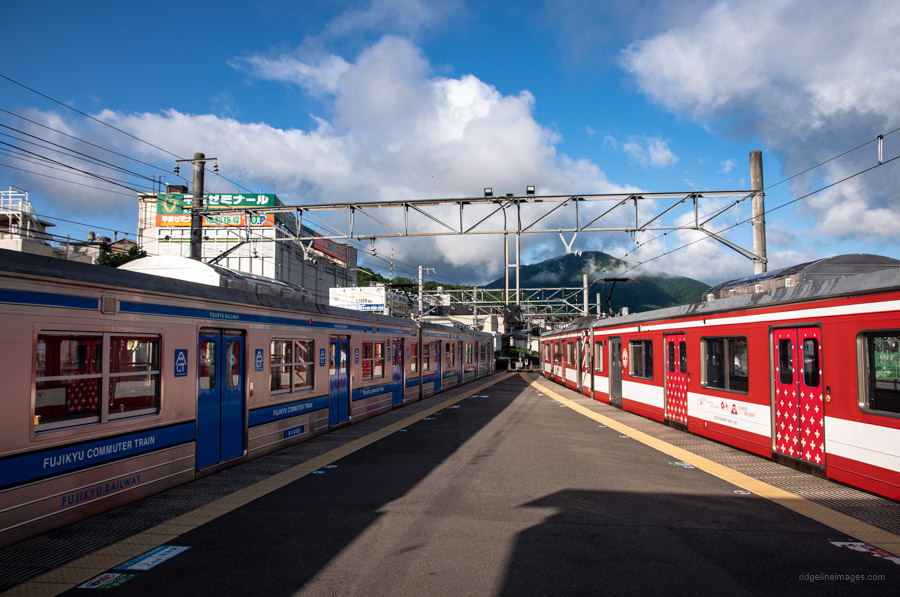
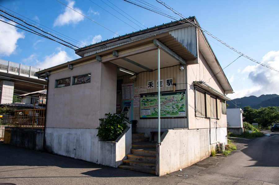
Start: Kasei Station (Fujikyuko Line)
Finish: Saruhashi Station (Chuo Main Line)
Difficulty: ▅▅▅▅▅▅▅▅▅▅ ❸
Map: Yama to Kogen Chizu 山と高原地図 [No.29 高尾・陣馬 TAKAO·JINBA]
GPX TrackKML TrackGSI MAPPDF Topo Map
Beginner-Friendly Trail With Panoramic Views
Sandwiched between the Katsura and Akiyama rivers in southern Otsuki City, finds Mt. Kukiyama. Despite falling under the 1,000-metre ceiling it punches above its weight and is one mountain that Tokyo based hikers should pencil in a visit. Aside from the Yamanashi Maglev Test Line burrowing deep beneath it’s one of the 100 Famous Mountains of Yamanashi, and it offers up top-notch Fujisan views from a number of vantage points. There are several approaches to the summit including an out and back piston from Tanokura Station; following the Koso River or more popularly hiking between Kasei and Saruhashi stations.
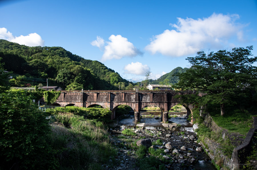
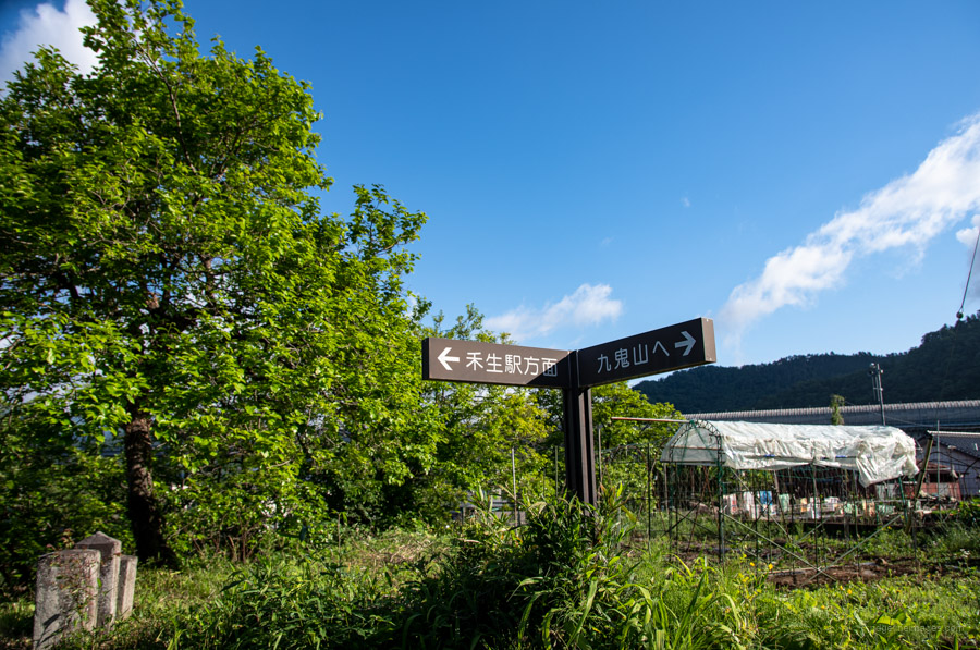
While the hike can be undertaken in either direction I recommend starting at Kasei Station on the Fujikyuko Line and finishing at Saruhashi Station (Chuo Main Line). Doing so will simplify transport arrangements returning to Tokyo and also means you enjoy the best Fujisan views approaching the summit early in the morning. From Kasei Station turn left and walk along National Route 139 past a Lawson’s. The first landmark to look for is the Komabashi Waterway Bridge a historic brick aqueduct constructed in 1907 spanning the Asahi River. Ducking under one of the arches brings you to the Atago Shrine Course 愛宕神社コース and trailhead proper. There is also an alternative Sugiyama Shindo Course 杉山新道コース.
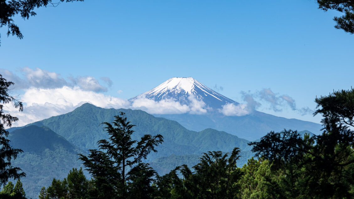
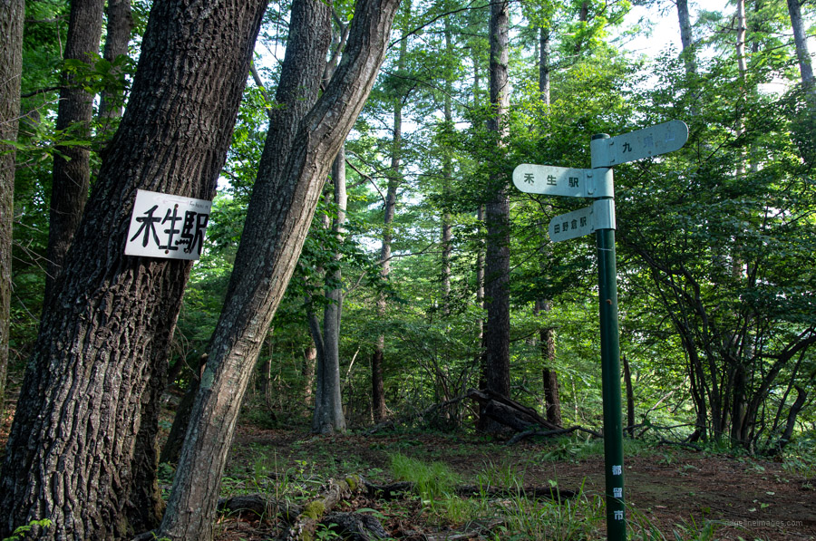
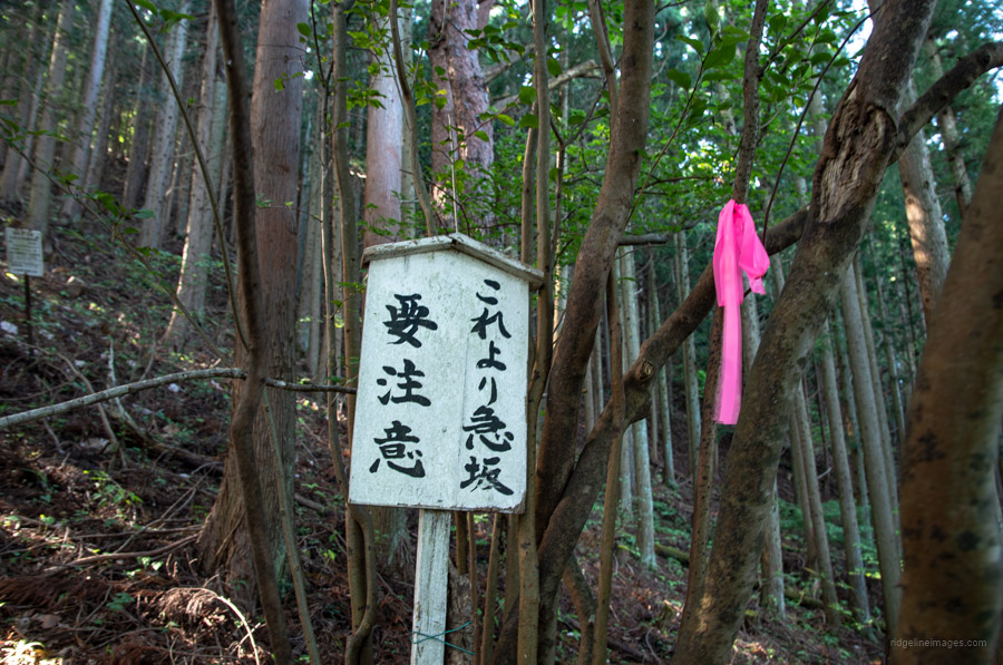
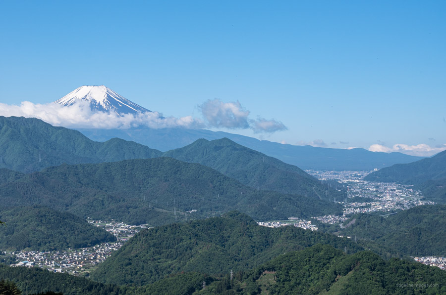
The hike starts gently through the cedar forests meeting a branch that intersects with the trail from Tanokura Station. A little up from the fork, look for a weather-beaten sign that says, “new mountain trail / caution steep mountain trail”. Any vestige of the former steep trail has been lost to the undergrowth so continue along the “new” albeit still steep one. After the trail flattens out there is a short detour to Tenguiwa Rock 天狗岩. The view from Tenguiwa is arguably the finest of the day and includes a terrific outlook of Mt. Fuji along with Mt. Mitsutoge to the right. Return to the trail fork for the final short push to Mt. Kukiyama.
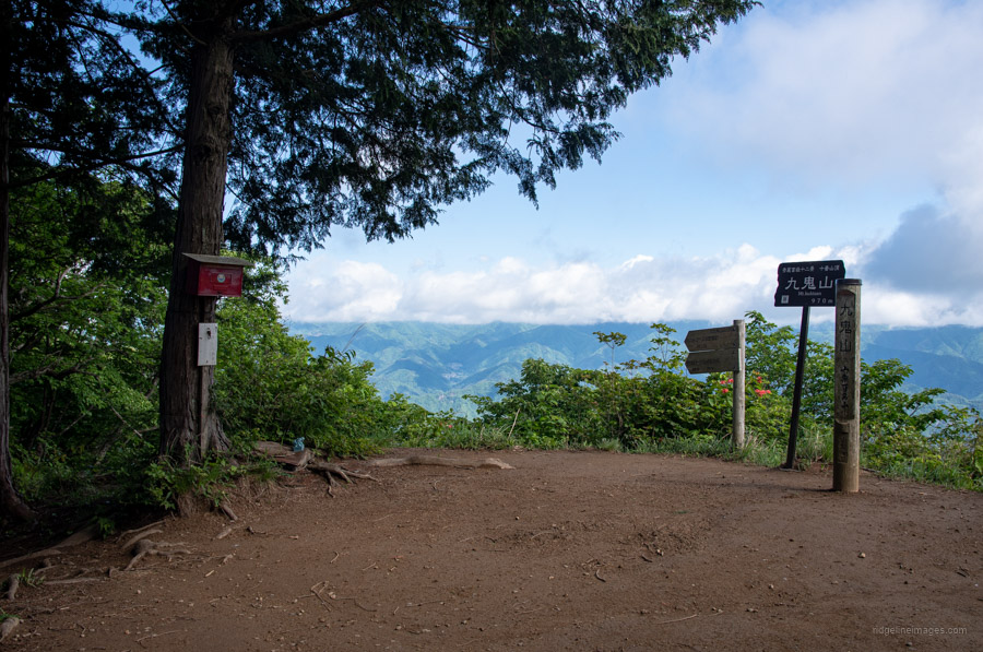
A little shy of the summit Fujimidaira 富士見平 treats you to another spectacle of the big fella. From the summit of Mt. Kukiyama 九鬼山 (970 m) the north side is wide open where you can see Mt. Daibosatsu, Okuchichibu Mountains and out towards Okutama. On the opposite side you can catch sight of Mt. Fuji between the trees. When you’re ready to make tracks the descent off the summit is rocky and narrow with a collapsed section of hillside. Make use of the fixed ropes to maintain your footing. Once you reach an opening the trail remains relatively flat before dropping into a gully and climbing up to Mt. Matateyama 馬立山 (797 m).
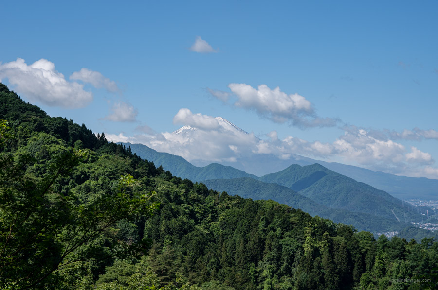
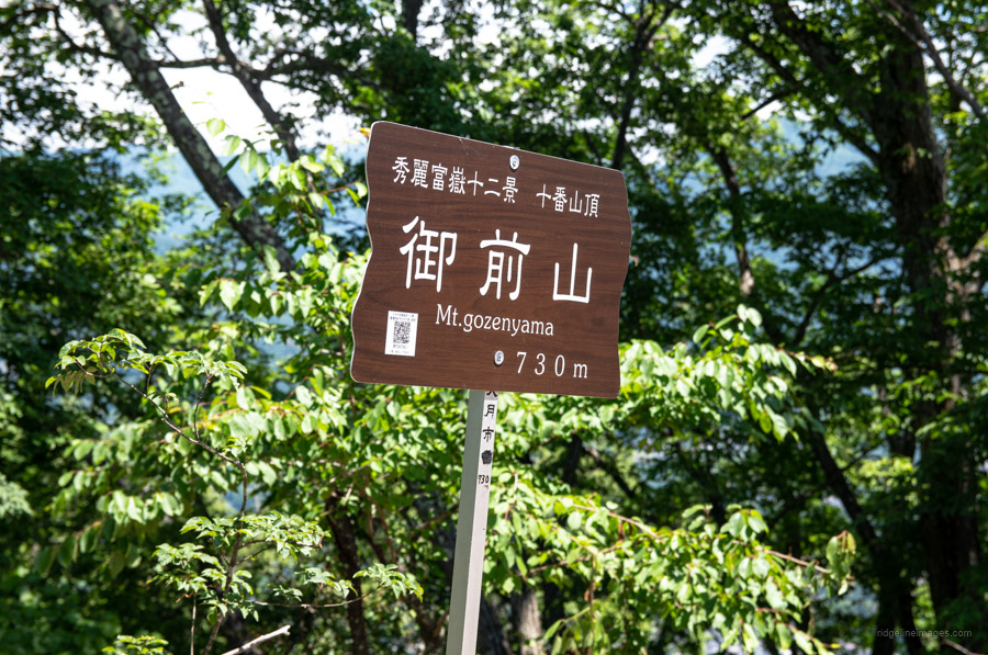
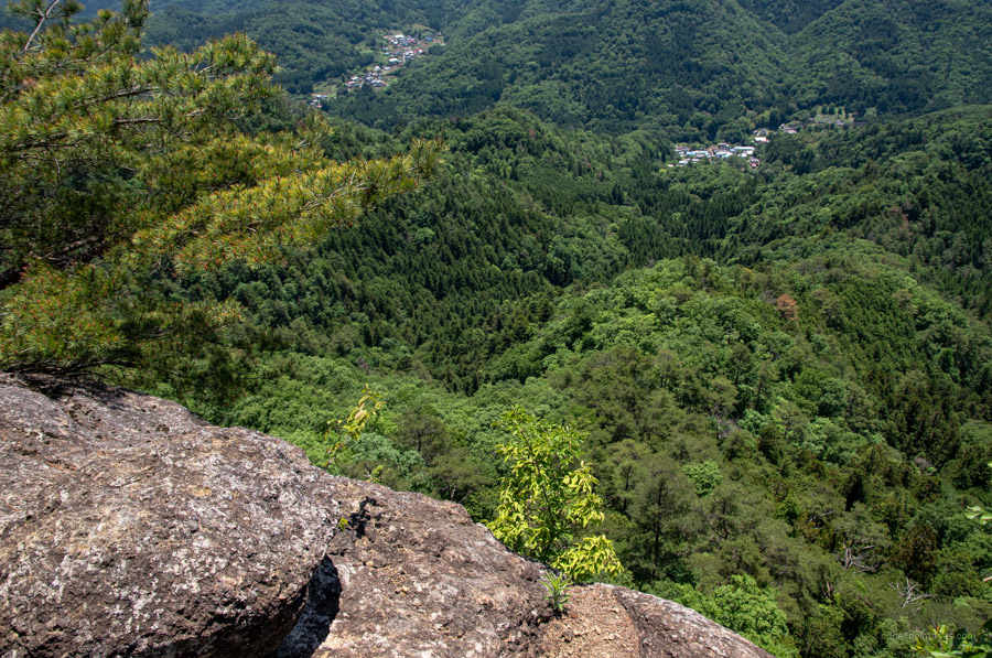
Next up along the undulating ridgeline finds Sawaizawa Noto 沢井沢ノ頭 followed by Mt. Gozenyama 御前山 (730 m) making a good spot to take lunch. The rock face here is not too dissimilar to Iwadonosan that rises above Otsuki Station with a straight line of sight back to Mt. Fuji. The final minor mountain to bag before starting the descent is the viewless Mt. Kagurayama 神楽山 (673 m). From here back to Saruhashi Station 猿橋駅 takes less than an hour however the trail is steepish at times. When you hit the road, swing left and follow it through a short road tunnel to the station.


We did this hike on Friday, 5/20/2022. Thanks to your clear and accurate description this was yet another hike that was right around the length and ascent that I was looking for. The 2 main difference was distance/length, with we had at around 14.68 km. I start tracking when I get off the train and when I get back on the train. I am guessing you start at the trail head proper. You’d said before you cleaned up your data to eliminate the walking around the tops of mountains, taking photos, etc., so I know we have somewhat more with that wandering around bit.
No views for us, but then that has been most of May-overcast.
One in our group had a bad spill on the final descent, but that was more to do with grabbing an unstable (rotting?) tree that broke rather than inherent danger in the trail. It was steep, but not dangerous.
Glad you enjoyed this hike. The only reason I managed a view of Fujisan was because I started early and a bit lucky. The view from the Mt. Gozenyama rock ledge is nice isn’t. I hope that group member of yours who had the spill was alright and not injured. Good idea climbing these lower lying mountains before it becomes too hot. I remember when I did it in late May, it was starting to get getting hot and humid.