.
Kosuge-no-Yu 小菅の湯 – Mt. Omatei 大マテイ山 – Mt. Muko 向山
Distance: 22.8 km
Elevation change: 709 metres
Highest point: 1409 metres
Start: Kosuge-no-Yu Bus Stop
Finish: Kosuge-no-Yu Bus Stop
Difficulty: ▅▅▅▅▅▅▅▅▅▅ ❹
Map: Yama to Kogen Chizu 山と高原地図 [No.25 奥多摩 OKUTAMA]
GPX TrackKML TrackGSI MAPPDF Topo Map
Mt. Narakura and the Giant Tree Road
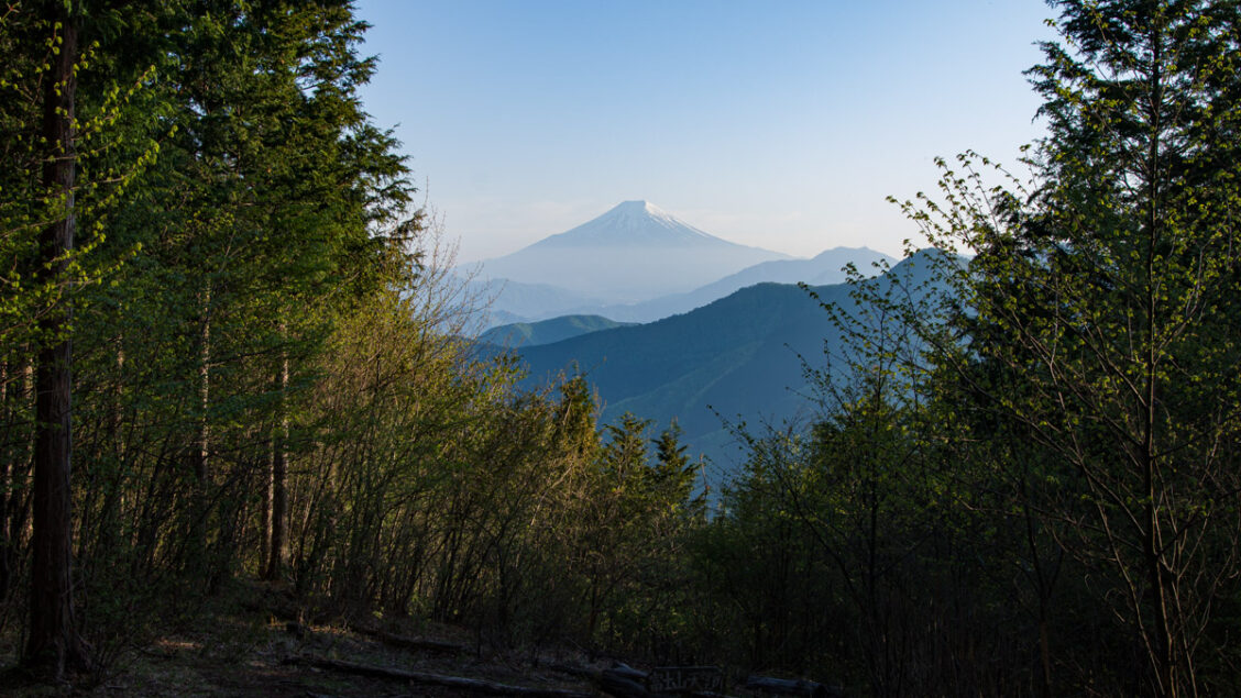
Mt. Narakura, which straddles Otsuki City and Kosuge Village in Yamanashi Prefecture, is located at the eastern end of the Ushi-no-ne Dori, a long ridge that extends from Mt. Daibosatsu. This ridgeline is noted for its giant broad-leaved trees, such as beech and jolcham oak, and it is especially beautiful during the shinryoku, or “new green” season, and has some of the best autumn colours in the Okutama area. It has been nominated as one of the Twelve Beautiful Views of Mt. Fuji by Otsuki City. From the summit, you can enjoy an excellent view of Mt. Fuji. Reaching the summit can be as easy as a gentle stroll from Matsuhime Pass or as a moderately challenging overnight loop starting and ending at Kosuge-no-Yu.
Day 1: Embracing the Shinryoku (10.6 km)
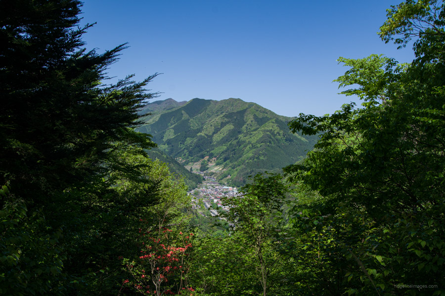
To get to Kosuge-no-Yu 小菅の湯, take a train to Okutama Station 奥多摩駅 and transfer to a bus bound for Kosuge-no-Yu from bus stand no. 2 across the road (60 minutes and 1,030 yen). The first morning weekend bus departs at 7:25 am. Because of the perfect weather and it being the first day of the four-day Golden Week holiday, the bus stop was already crowded with hikers. Thankfully, a good number disembarked at Lake Okutama, and almost everyone else at Tozura, a popular kick-off point for Mt. Kumotori. By the time the bus arrived at Kosuge-no-Yu, I was the last passenger.
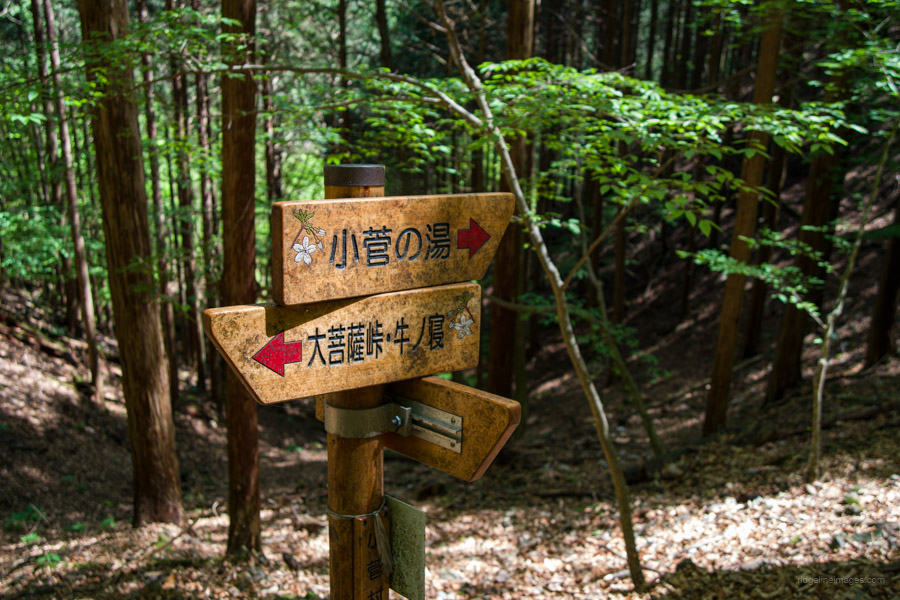
After noting the return bus schedule for the following day, head west and turn left onto a minor road that flanks the Yamasawa River. After a 30-minute walk, you’ll reach a point where the road turns from paved to gravel. Continue upwards through what once were wasabi paddies but have now fallen into disrepair. Keep an eye out for trail run course signs トレイルラン コース – they’ll guide you over the next two days. If you intend to collect water, wait until the upper reaches of the wasabi terraces or around an hour’s walk from the bus stop.
Hiking out of the valley brings you to a trail branch but ignore this and continue straight ahead. The broad-leaved forest gives way to a dense plantation of cedars as you approach the upper ridgeline. At this unmarked junction, turn left. This path traverses around to Ushi-no-ne 牛ノ寝通り and Odawa 大ダワ which is the trail branch for Daibosatsu-toge. In spring, the verdant shinryoku unfolds before you, truly breathtaking from this point forward. Just before reaching Odawa, you’ll see remnants of what appears to be a former teahouse.
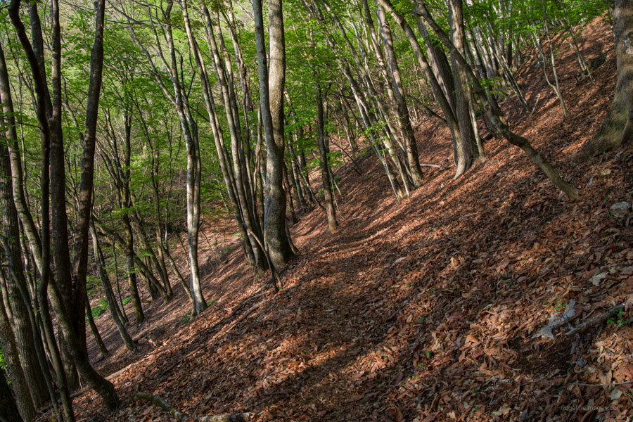
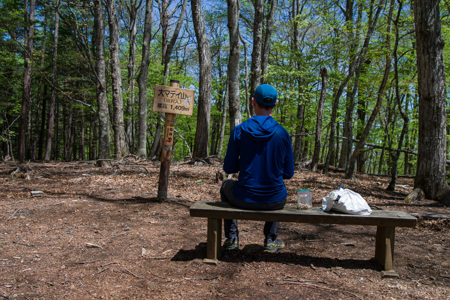
Following the ridgeline, you’ll encounter the first mountain along Ushi-no-ne – Mt. Omatei 大マテイ山 (1,409 m), and marking the highest point of the hike. Unlike other peaks, there’s no sweeping vista from the summit. Instead, a blanket of dense, quiet virgin forest unfolds around you.
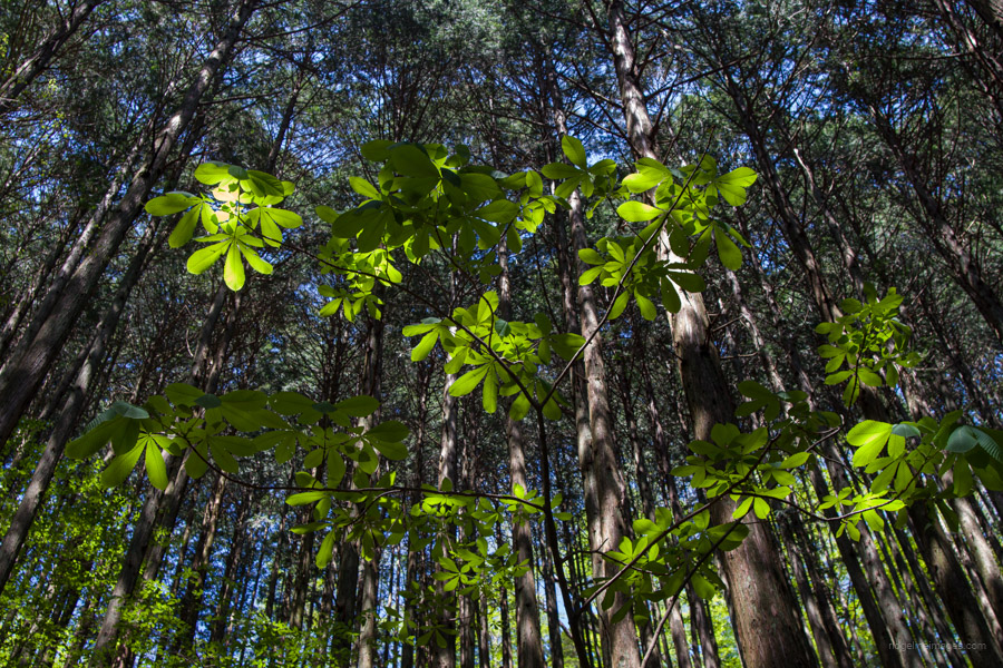
Continuing along Ushi-no-ne, you’ll enter the aptly named Giant Tree Road 巨樹の道. Keep an eye out for towering Japanese beech ブナ, gnarled sawtooth oak クヌギ, and majestic jolcham oak コナラ – some true giants of the forest. Since Ushi-no-ne is a wide, open ridge, the trail can be faint at times. Keep your eye on your GPS device to stay on course, especially since trails in this area frequently intersect. Before descending to Matsuhime Pass 松姫峠 (1.250 m) you’ll find Mt. Tsurune 鶴寝山 (1,368 m) which offers a rare treat: a view of Fujisan through the treeline.
Matsuhime Pass has some restrooms and makes a pleasant spot to have lunch. Legend has it the pass is named after Takeda Shingen’s daughter, who fled via this route. When you’re ready to head off, follow the forestry road towards Mt. Narakura. From time to time, the trail branches off from the forest road, offering a welcome change of scenery.
A curious sight awaits you about 30 minutes into the hike: an abandoned retro-looking truck. This left-hand drive vehicle with a wooden interior is most likely an ex-US military truck that once served the local forestry industry. It seems to have encountered some mechanical trouble and been abandoned here.
The unofficial campsite for the evening is at Mt. Narakura 奈良倉山 (1,349 m). If you are planning on staying there, note that there is no toilet or nearby water source. It is the northernmost mountain among the 12 beautiful views of Mount Fuji nominated by Otsuki City, as such it appears somewhat smaller from this vantage point.
Day 2: A Scenic Descent and Derelict Discoveries (12.2 km)
The previous evening, the air was still, and the temperature remained above 10 degrees Celsius, perfect conditions for camping out. The morning view of Fujisan through the clear-cut was equally grand.
From Mt. Narakura down to Tsuru Pass 鶴峠 (870 m), the trail descends just under 500 metres. Along the way, it intersects with a forestry road frequently, so pay attention to where it cuts back in. Just before reaching Tsuru Pass is Kosuge no Mori 小菅の森. There are toilets here, and the pass can be reached by bus from Uenohara Station.
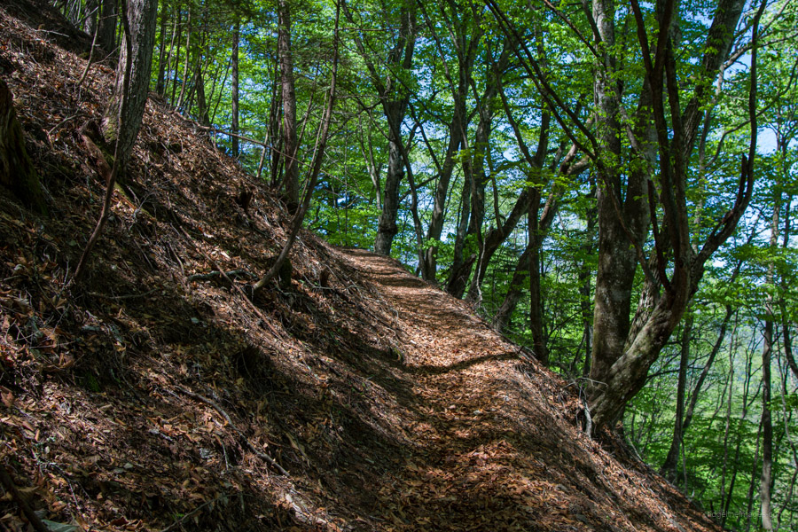
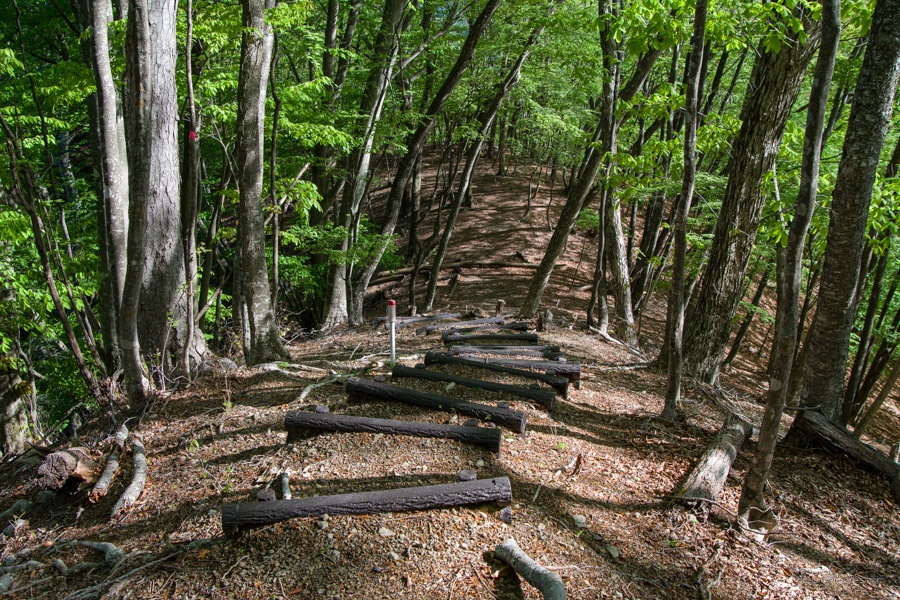
The trail continues on the opposite side of the road. Here, it begins climbing back up 400 metres to the Mt. Muko trail branch. The final kilometre of trail is well maintained, though it includes a traverse with some exposure. At the Mt. Muko trail branch, turn left and begin descending down the steps; heading straight ahead leads to Mt. Mito. The trail here is also home to some wonderful old-growth forest. In parts, the ridge spreads out, so take care not to wander off course. Mt. Muko 向山 (1,078 m) is home to a derelict lookout tower that was once the crowning point of a well-maintained hiking trail.
The trail around the summit is particularly faint and hard to make out. Even with my Garmin GPS, it took some searching to find the correct route. The actual trail seems to track a little to the right as you head down the mountain. At various points thereafter, the trail tended to peter out, and without access to my GPS, it would have been challenging. Also, while I passed half a dozen hikers on the first day, on the second day I didn’t meet a single other person.
When you eventually emerge at the bottom and meet a road, turn left, which swings over a bridge around to the Mt. Mitsugo trailhead. From here, allow a good hour to get back to Kosuge-no-Yu. I was pleased I had made an early start as I could really start to feel the heat on my back climbing up to Mt. Mitsugo 三ッ子山 (850 m). For the return trip, I rode the 10:15 am bus back to Saruhashi Station 猿橋駅 on the Chuo Main Line (52 minutes and 1,190 yen).


Natsukashii
Nice post. I love that area around Daibosatsurei. Have a good summer.
Thanks, Pat,
It’s really lovely, isn’t it! In the autumn, I’m thinking of hiking from Kamihikawa-toge to Kosuge-no-Yu. Apparently, it’s one of the best spots for autumn leaf peeping in the Okutama area.
This sounds like an ideal mash-up of the merry greenwood, Mt Fuji views, and selected haikyo …