.
Kamimagi Shrine 上真木大神社 – Mt. Oiwa 大岩山 – Mt. Hanasaki 花咲山
Distance: 6.7 km
Elevation change: 247 metres
Highest point: 750 metres
Start: Kamimagi bus stop
Finish: Otsuki Station (JR Chuo Main Line)
Difficulty: ▅▅▅▅▅▅▅▅▅▅ ❸
Map: Yama to Kogen Chizu 山と高原地図 [No.29 高尾・陣馬 TAKAO·JINBA]
GPX TrackKML TrackGSI MAPPDF Topo Map
A Cherry Blossom Hike up Oiseyama
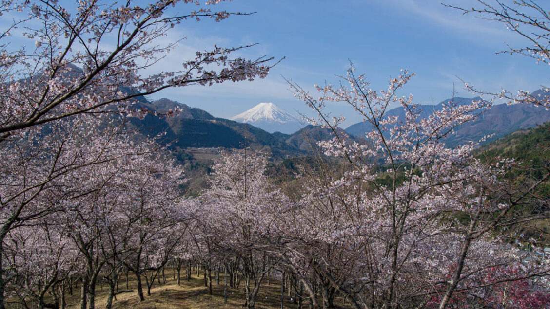
Oiseyama, situated in Magi Village, Yamanashi Prefecture, is renowned for its cherry blossom viewing, boasting around 3,000 cherry blossom trees. It is also known for its breathtaking views of Mt. Fuji. This hike explores Oiseyama and its cherry blossoms, followed by a visit to nearby Mt. Hanasaki before descending to Otsuki Station. For those looking for something longer, the hike can be extended to include Mt. Iwadono.
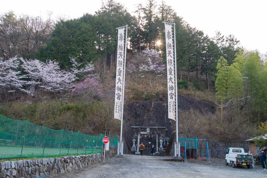
Travelling from Tokyo usually requires transferring at Takao Station to an Otsuki-bound service. At Otsuki Station 大月駅, head over to bus stand 2 and take a bus for Hamaiba-mae ハマイバ前 and get off at the Kamimagi bus stop 上真木 bus stop (16 minutes and 340 yen). To get to Oiseyama turn left at the stone monument a little way back from the Kamimagi bus stop in the direction you came from. After passing through the torii gate climb the steps which takes you past the Kamimagi Shrine 上真木大神社 and the summit which is located behind the main building.
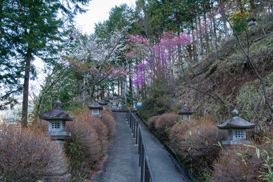
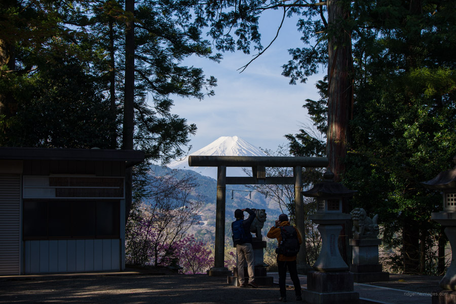
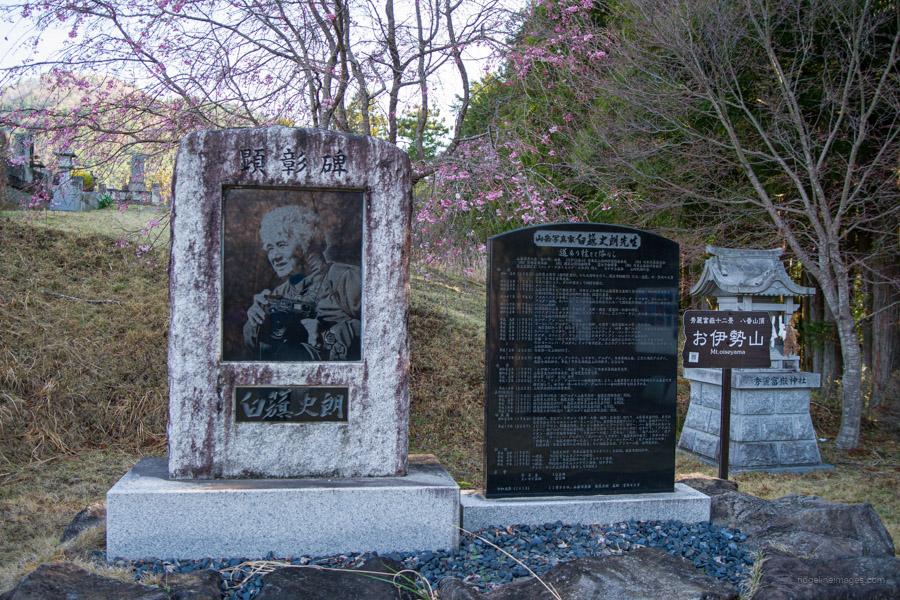
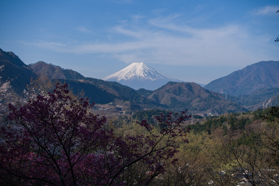
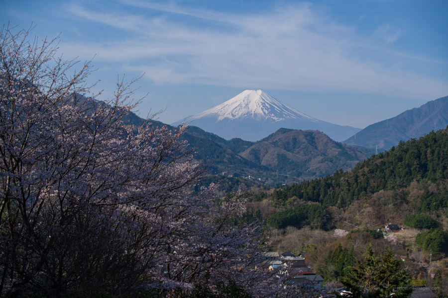
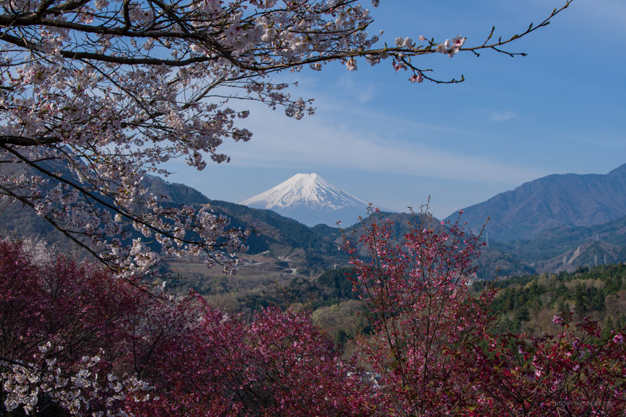
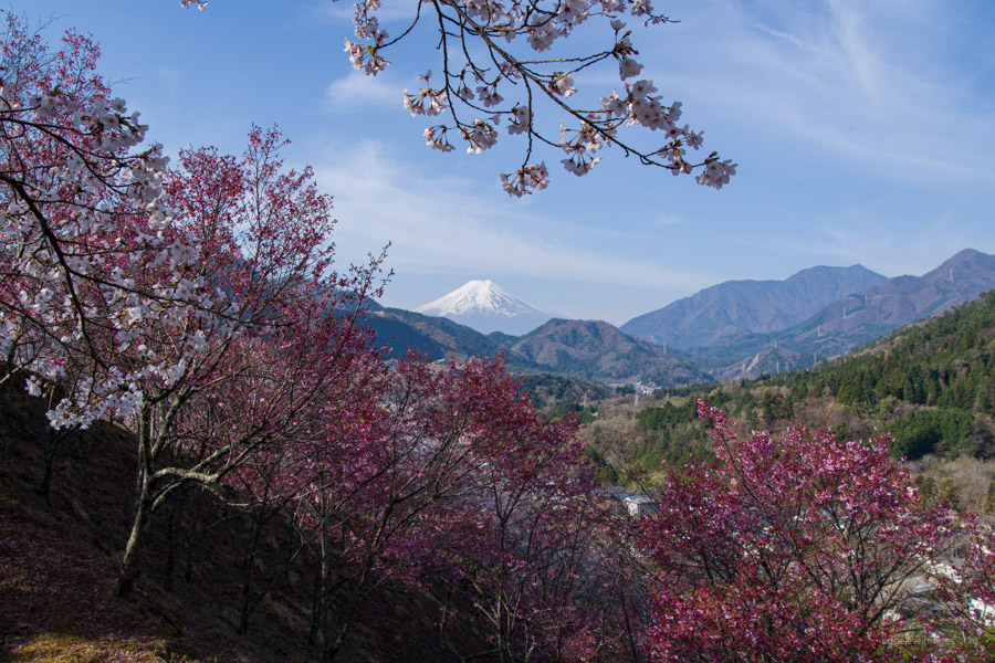
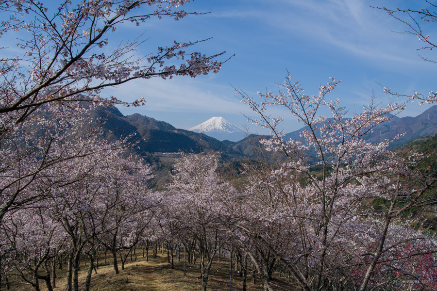
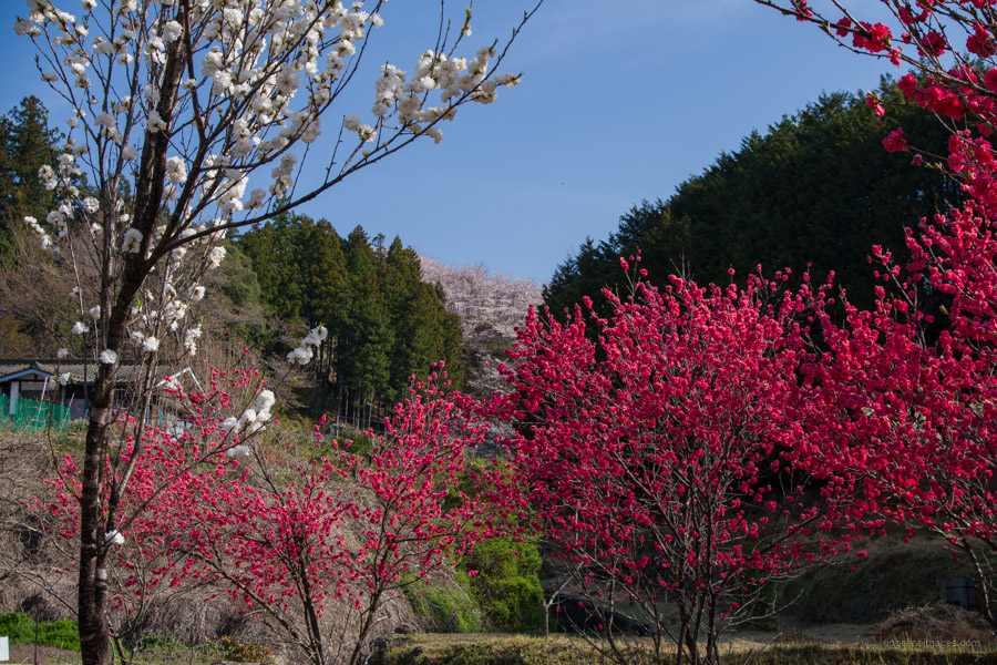
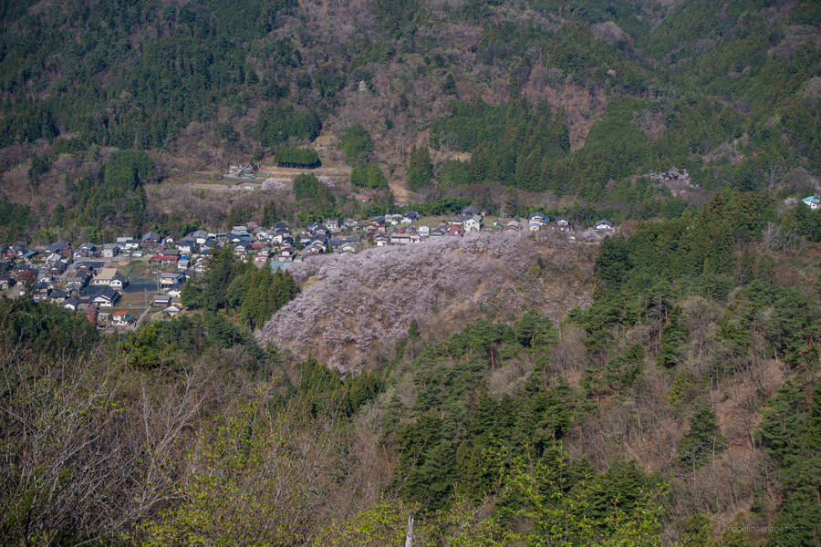
Oiseyama お伊勢山 (550 m), is more than just a mountain as it encompasses a cemetery located within the grounds of the Kamimagi Shrine. During weekends from late March to early April, the mountain’s cherry blossoms are illuminated at night as part of a festival. The summit signpost sits alongside a monument honouring Shiro Shirahata, a local photographer. The view of Mount Fuji framed together with the cherry blossoms is a sight to behold.
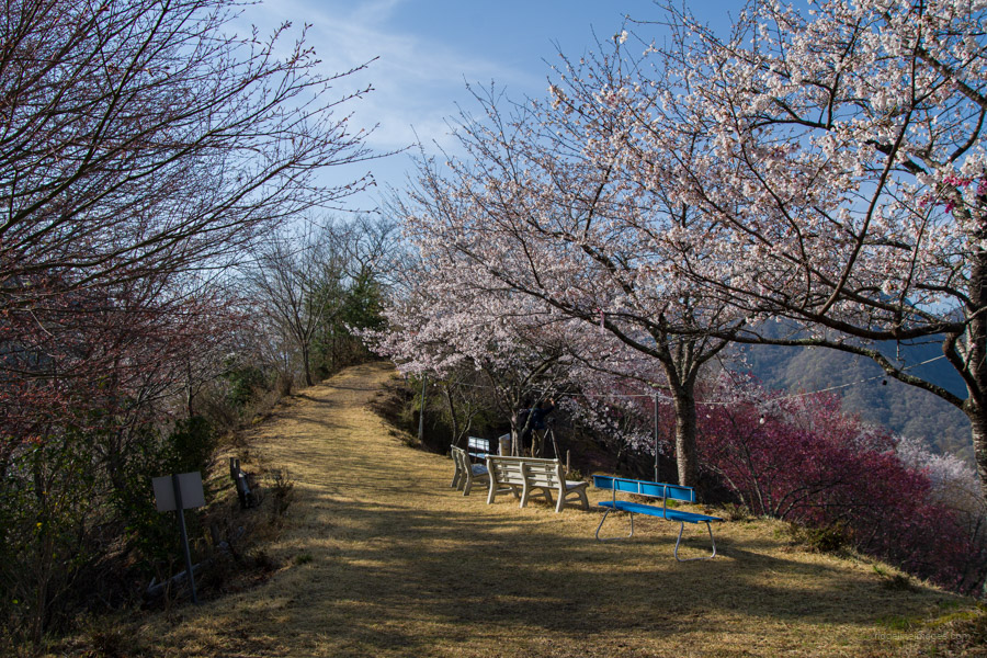
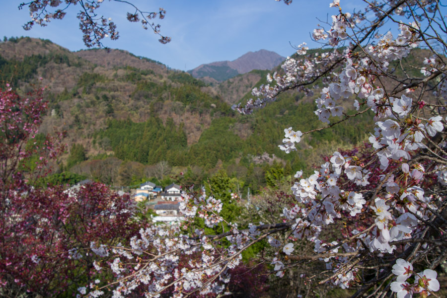
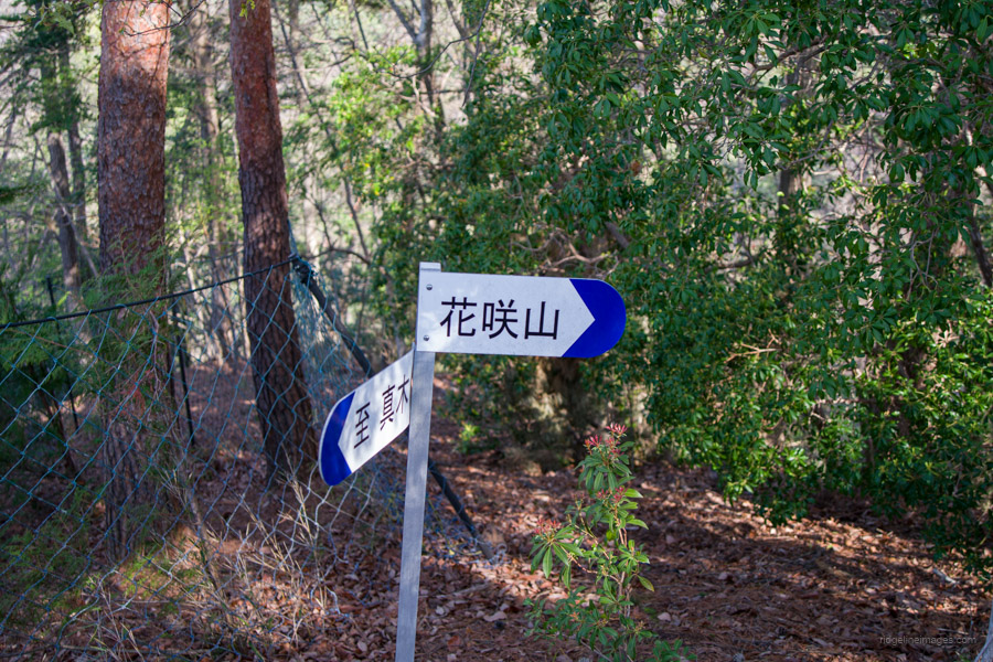
Leaving the ‘summit’ of Oiseyama, return to the main shrine where more cherry blossom trees spread out to the south. This vantage point offers undeniably the most famous view of Oiseyama. The sight of Mount Fuji ringed by the cherry blossoms in full bloom resembles a picture postcard come to life. After soaking up the scenery, it’s time to begin the real hike. Head down the hill lined with cherry trees and look out for a small sign to Mt. Hanasakiyama 花咲山 on your left. Follow the sign, which leads you along a road past an abandoned elementary school, where there is another sign to Mt. Hanasakiyama. The trailhead proper is located next to a private residence. After a short, steep section, the trail crosses a paved road.
The first good lookout spot is Onna Makuiwa 女幕岩, a rocky area with a wide panoramic view of the surrounding area, including Oiseyama. Mountains of interest here include Mt. Mitsutoge, Mt. Takigoyama, and Mt. Gangaharasuri. The bald mountain that stands out, reminiscent of a high alpine pasture, is Shirayanomaru, where I camped out on one occasion. On the opposite side finds the plush Hanasaki Country Club.
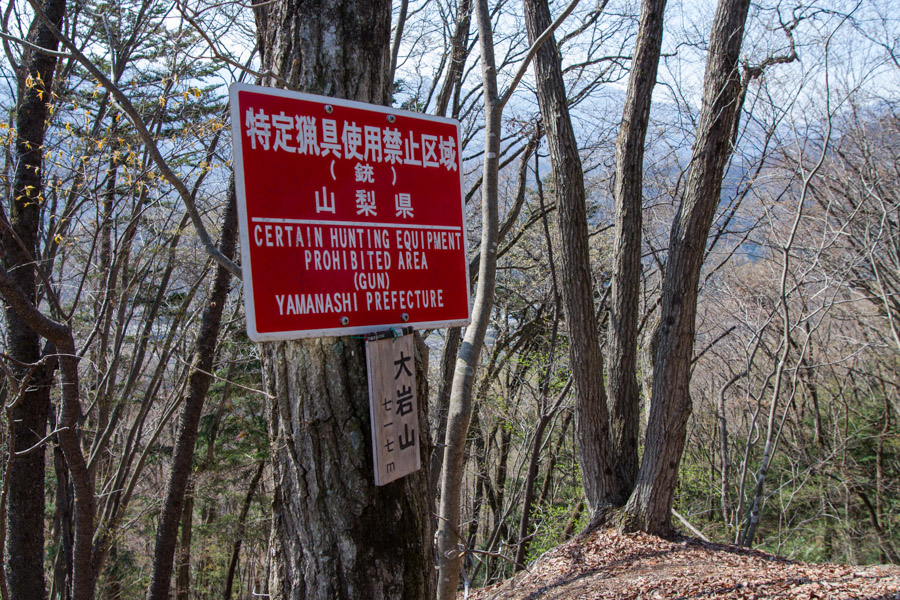
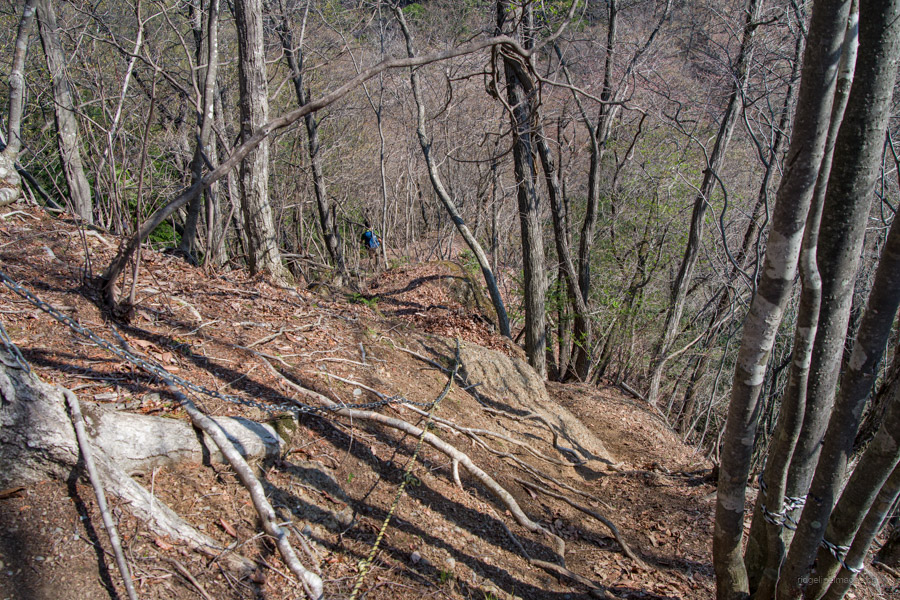
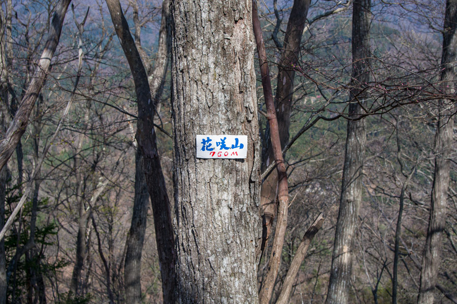
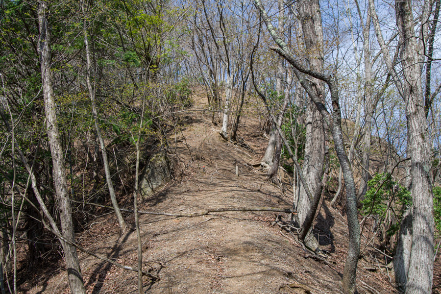
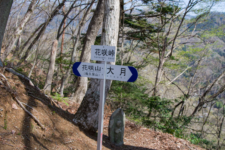
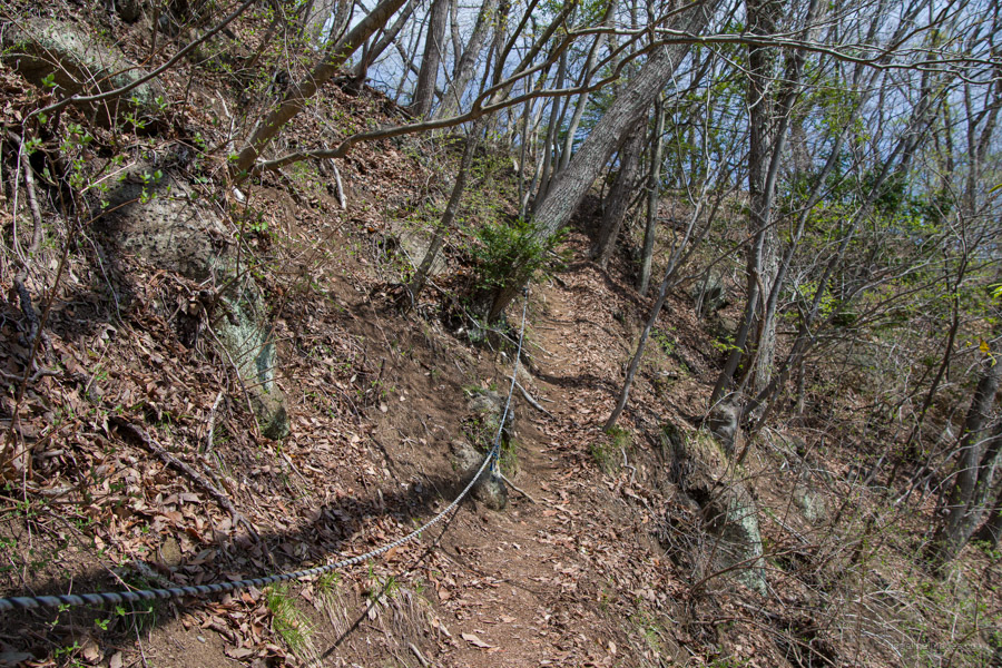
Be aware of a signpost indicating “rough road” 難路 after Mt. Oiwa 大岩山 (717 m). While not technically dangerous, the trail becomes more challenging with frequent ups and downs on loose, dry, sandy ground making it hard to maintain traction. Occasional fixed ropes and chains aid on the steeper sections. After reaching the tree-covered summit of Mt. Hanasakiyama (750 m), the descent towards Otsuki Station begins. Continuing along the ridgeline, next finds Hanasaki-toge 花咲峠.
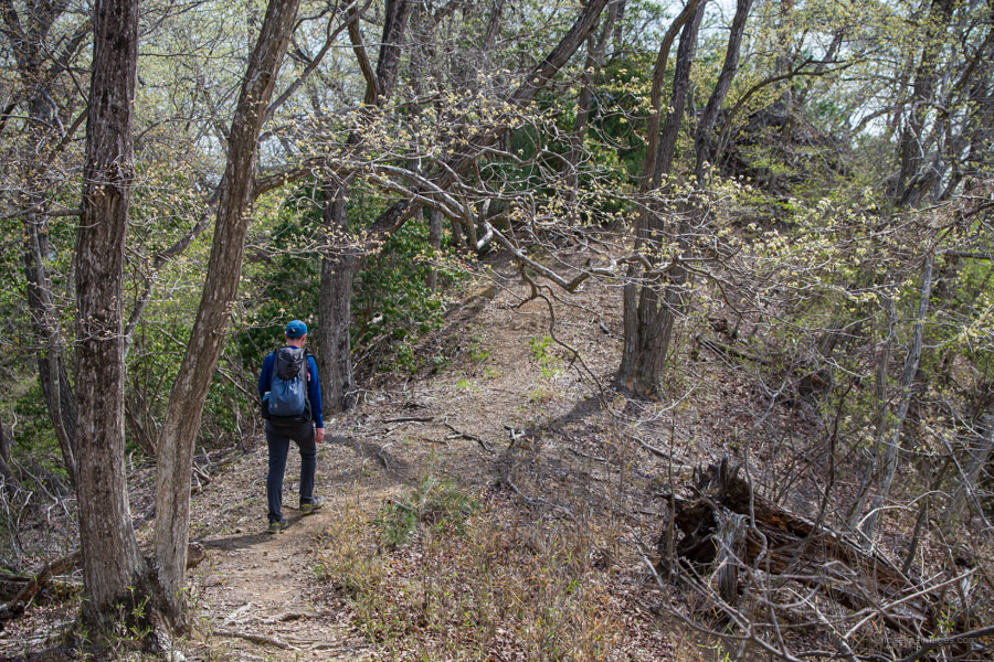
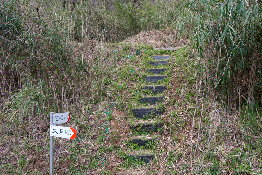
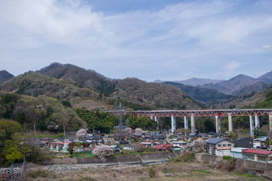
When you turn right for Otsuki Station the first part is quite narrow with care needed. There is a good view across to Mt. Iwadono. The trail eventually pops out at the Mt. Hanasakiyama trailhead. To get back to Otsuki Station take a sharp left and under the Chuo Expressway and over the Katsura River the same way as was done of the Mt. Iwadono loop hike. Finally, cross over the Chuo Line via the pedestrian overpass.


Thanks David!
I did this hike yesterday. Thank you. I want to go again in Spring!
Perhaps you could add to the blog that after Oiseyama お伊勢, you return to the road and walk back the way you came on the bus a little. Look out for a small sign to Mt. Hanasakiyama 花咲山 on your left. Follow the sign which takes you along a road past an abandoned elementary school to the trailhead proper where there is another sign to Mt. Hanasakiyama 花咲山.
Hi Lou,
Thanks for taking the time to comment! I have incorporated your suggestions into the hike report. Yes, it’s definitely worth visiting again in the spring for the cherry blossoms.