.
Asakawa-toge 浅川峠 – Mt. Amefuri 雨降山 – Mt. Nihonsugi 二本杉山
Distance: 15.2 km
Elevation change: 1046 metres
Highest point: 1312 metres
Start: Asakawa Bus Stop
Finish: Arai Bus Stop
Difficulty: ▅▅▅▅▅▅▅▅▅▅ ❸
Map: Yama to Kogen Chizu 山と高原地図 [No.29 高尾・陣馬 TAKAO·JINBA]
GPX TrackKML TrackGSI MAPPDF Topo Map
A Quiet Mountain with an Impressive View
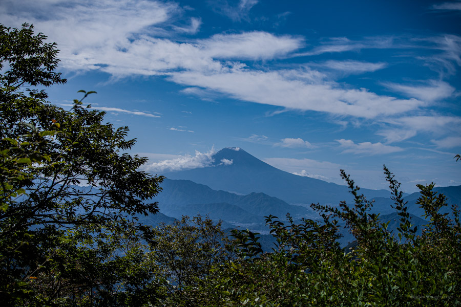
Mount Gongen straddles Otsuki and Uenohara cities in Yamanashi Prefecture. Although less well-known than its neighbours, Momokurasan and Ougiyama, the view of Mt. Fuji from the top is equally splendid and well worth a visit. The only drawback is access, as you need to catch a bus near to the trailhead. Consequently, it draws few visitors, making it a desirable option during long weekends when other, more popular mountains are crowded.
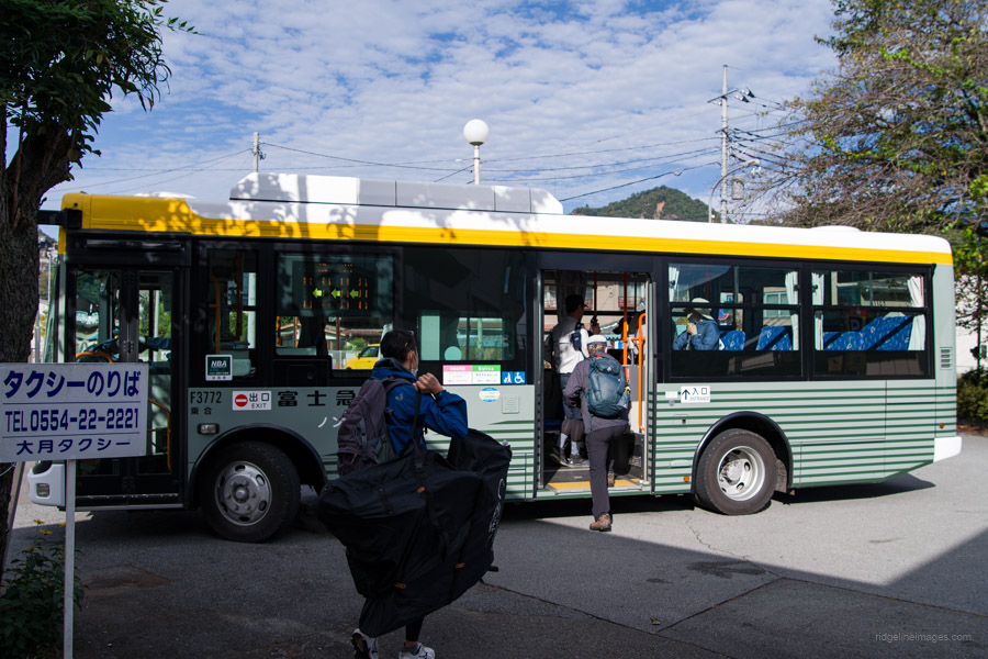
If you are travelling from Tokyo, get off at Saruhashi Station 猿橋駅 on the JR Chuo Main Line. Head out to the north exit, where you can take a bus to Asakawa 浅川 (29 minutes, 680 yen). Please note that on weekends and public holidays, there is only one morning bus departing at 8:23 am. Alternatively, you can catch the same bus from Otsuki Station, where it originates.
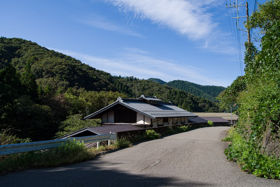
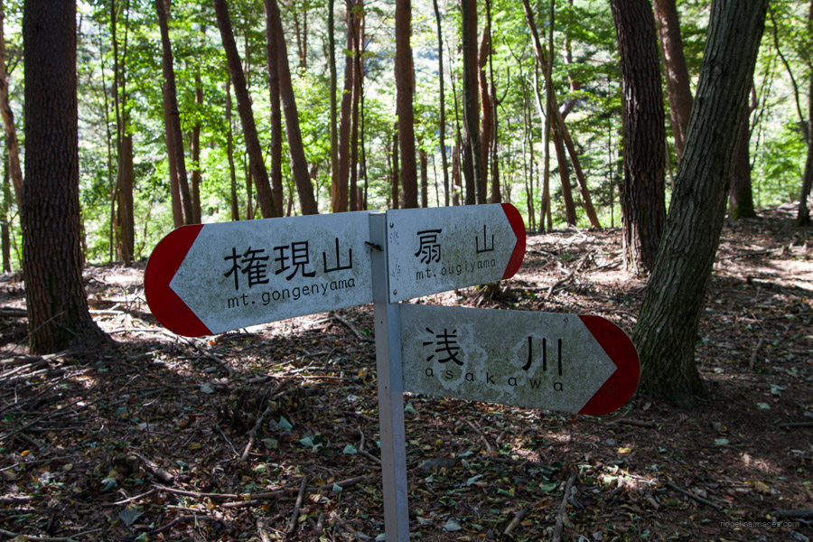
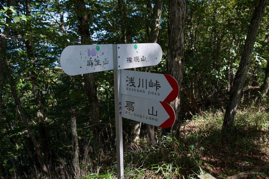
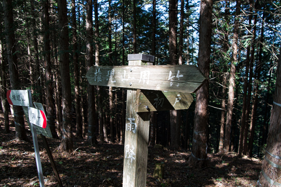
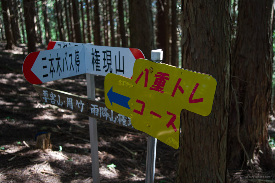
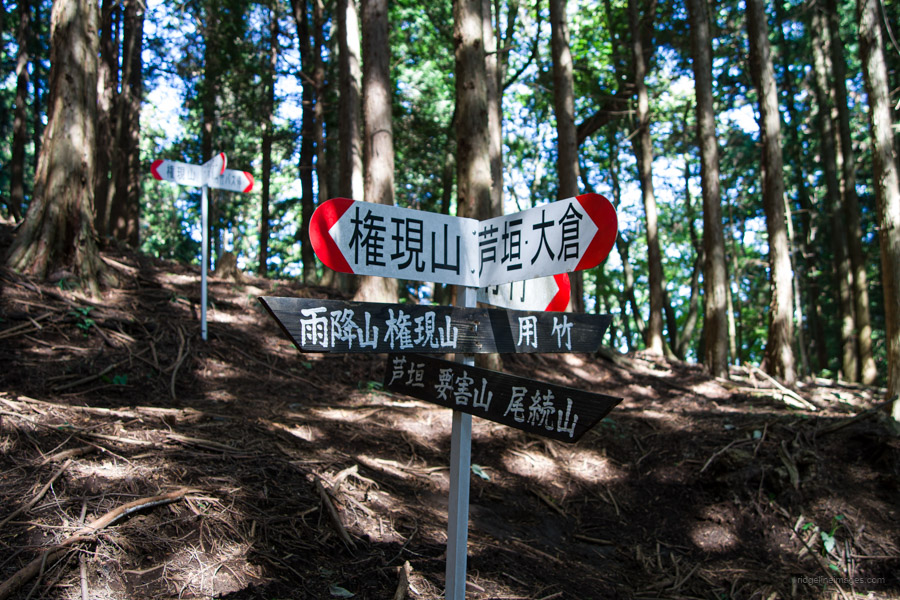
Considering the lovely autumn weather, I had expected a sizable group of hikers waiting for the bus, but I was surprised that there were only six of us by the time we arrived at Asakawa. From the bus stop, look for a signpost that points to Asakawa-toge 浅川峠. Walk along the gravel forest road to the trailhead proper, which takes about 15 minutes. The trail wastes little time gaining elevation, snaking its way up to Asakawa-toge (867 m), a trail junction at the saddle between Mt. Ougiyama and Mt. Gongen, which veers to the left.
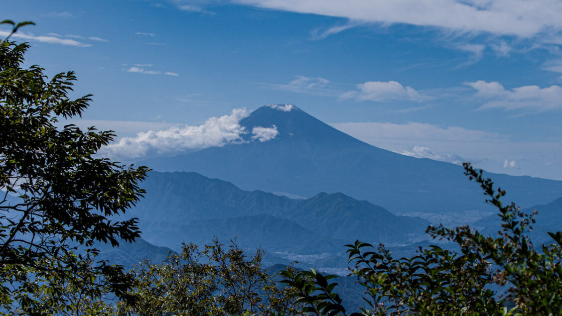
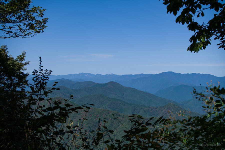
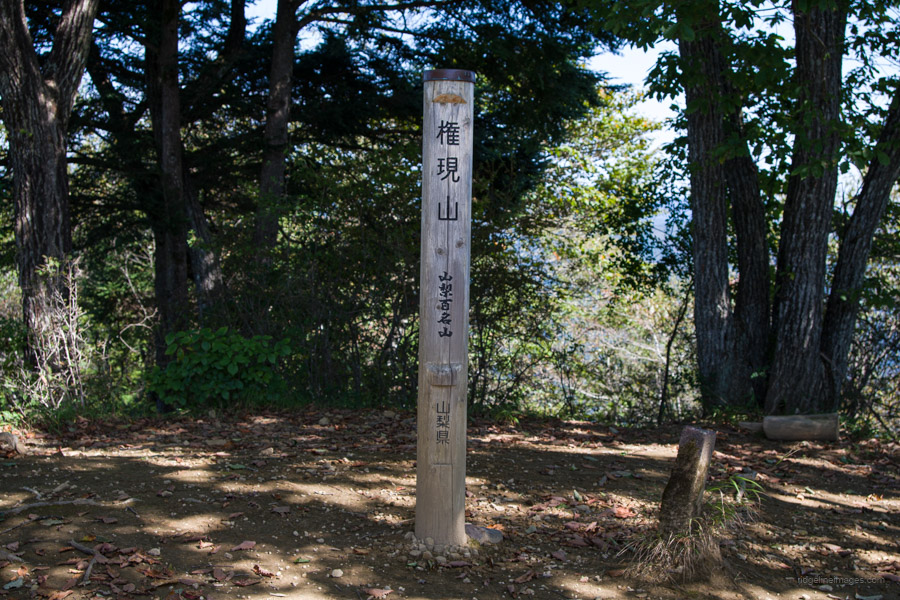
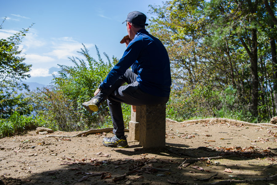
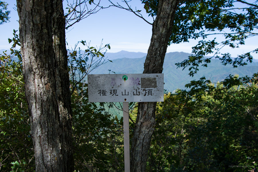
Thanks to accumulated leaf matter, it’s surprisingly easy to lose the trail, especially in open areas. Look out for sporadic pink ribbons to help you stay on course. After a reasonably steep climb, you’ll eventually reach a trail fork for Mt. Gongen 権現山 (1,312 m). If you go left, you will head towards Mt. Aso 麻生山. The path to Mt. Gongen continues to the right. In fine weather, the summit offers a wonderful view of Mt. Fuji, earning its place as one of the 100 Famous Yamanashi Mountains. To the north, you can spot Mt. Odake, easily recognisable thanks to its distinctive silhouette, as well as Mt. Mito, Mt. Kumotori, and even the Skytree in central Tokyo.
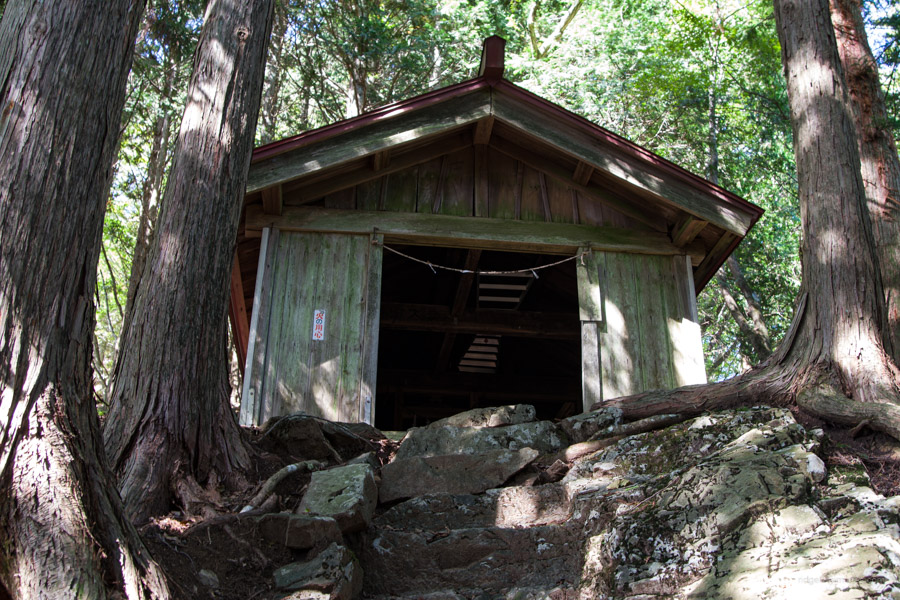
The descent begins on the other side of the summit. The first landmark is the somewhat out-of-place Oserou Shrine 王勢籠神社, fashioned from corrugated iron. After the first steep slope, the mountain path levels into an almost flat gradient, making it easy to walk. The trail is apparently popular among trail runners and mountain bike riders. I encountered one mountain biker, and in the old days, it was frequented by packhorses. Next along the ridgeline is Mt. Amefuri 雨降山 (1,177 m), home to a telecommunications tower and, not surprisingly given the mountain’s name, a rain gauge. Just after this point, I passed only the second hiker going in the opposite direction for the day.
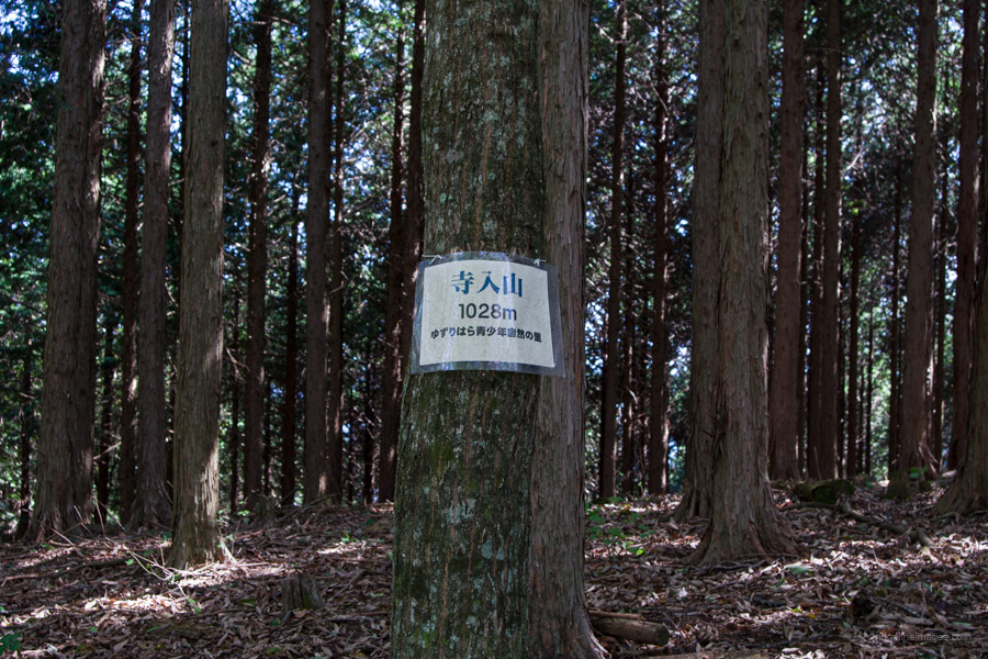
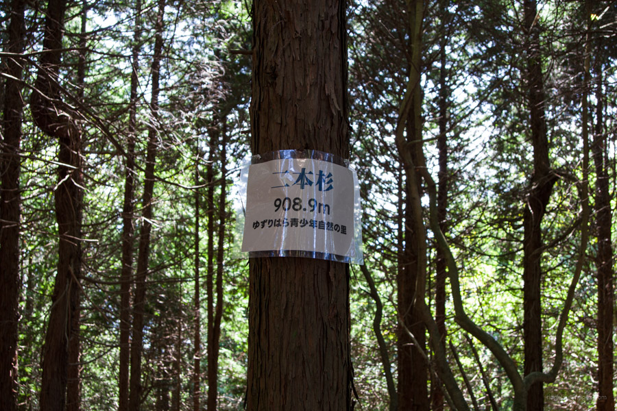
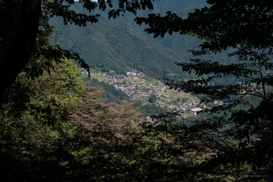
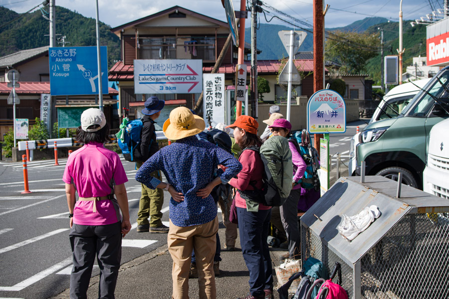
Coniferous and broad-leaved forests continue to alternate as you pass Mt. Teranoiri 寺ノ入山 (1.028 m) and Mt. Nihonsugi 二本杉山 (909 m). As a word of warning, there are countless minor trail branches going in all directions, so take care when descending this route. At a couple of spots, a nice view opens up of the township in the valley below. After reaching the trailhead on the reverse approach, proceed on the paved road that leads to National Route 33. Unfortunately, due to the scarcity of buses travelling along this section of road, you’ll most likely need to walk 3.7 km, or approximately 40 minutes, to the Arai bus stop 新井バス停, which I also used for the Mt. Yogaisan hike. From here, fairly frequent buses head to Uenohara Station 上野原駅 (15 minutes, 300 yen).


Hi David,
懐かしい
Nice place.
Have you ever been by the old Saruohashi? It’s not worth a trip on its own merit, but if your nearby it’s worth looking at the gorge there.
Hey Pat,
This one had been on my bucket list for some time, and I was so pleased to have finally had a chance to climb it. Saruohashi, I can’t say I have, but it looks like a pretty nice wooden bridge. Based on the foliage surrounding it, which I just saw in a photo, I’ll try and stop by this fall after doing the Mt. Iwadono loop. Thanks for the tip 🙂