.
Mt. Takahata 高畑山 – Mt. Kuratake 倉岳山
Distance: 11.4 km
Elevation change: 674 metres
Highest point: 990 metres
Start: Torisawa Station (Chuo Main Line)
Finish: Yanagawa Station (Chuo Main Line)
Difficulty: ▅▅▅▅▅▅▅▅▅▅ ❸
Map: Yama to Kogen Chizu 山と高原地図 [No.29 高尾・陣馬 TAKAO·JINBA]
GPX TrackKML TrackGSI MAPPDF Topo Map
Tranquil Streams and Expansive Views
Mt. Kuratake is the highest peak of the Akiyama mountain range, which runs south of the Katsura River on the border between Otsuki and Uenohara cities. It is also one of the 100 famous mountains of Yamanashi. This hiking route has been documented by several outdoor bloggers and features in Day Walks Near Tokyo by Gary D’A. Walters. Its easy access from Shinjuku (1 hr 15 mins, 1,320 yen) and moderate elevation make it a year-round hiking destination.
A little after departing Takao Station, I was recognised by one of my blog ‘fans’ who was travelling in the same carriage. Andy was nice enough to come over and introduce himself, and we enjoyed having a chat before I got off at Torisawa Station while he prepped himself to climb Mt. Daibosatsu.
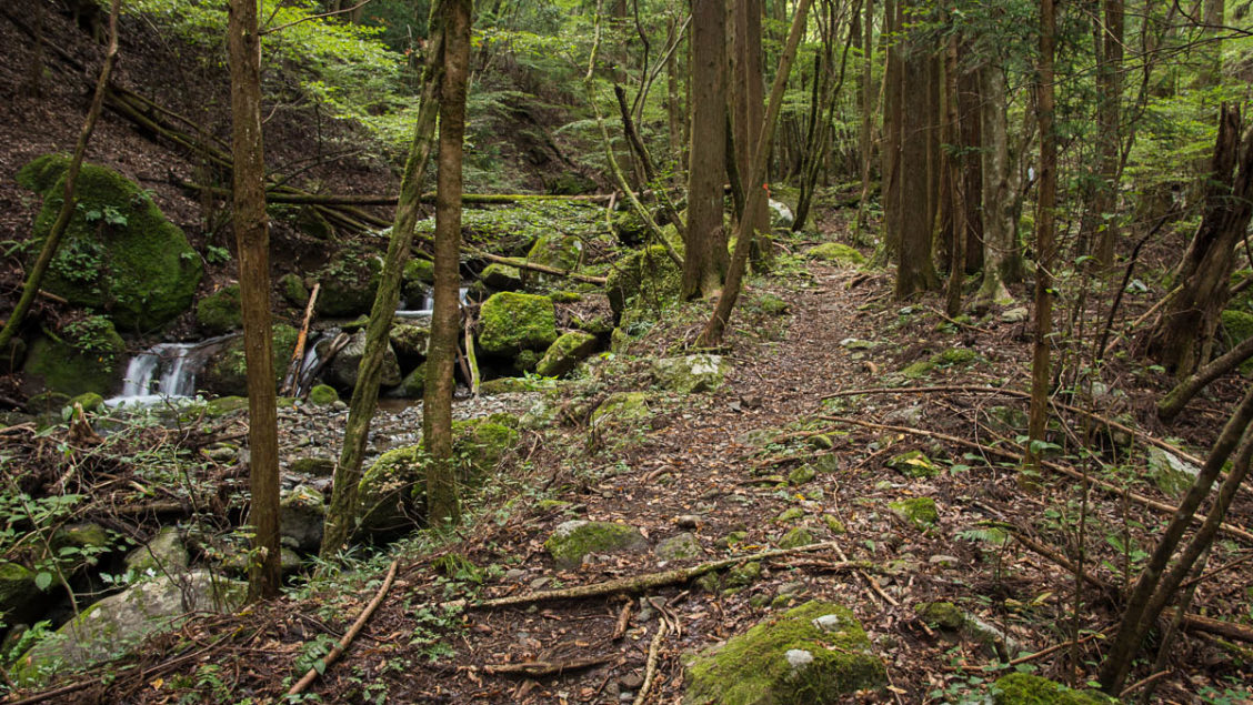
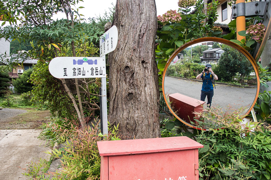
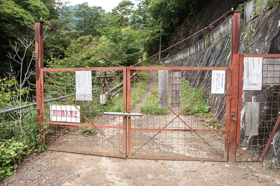
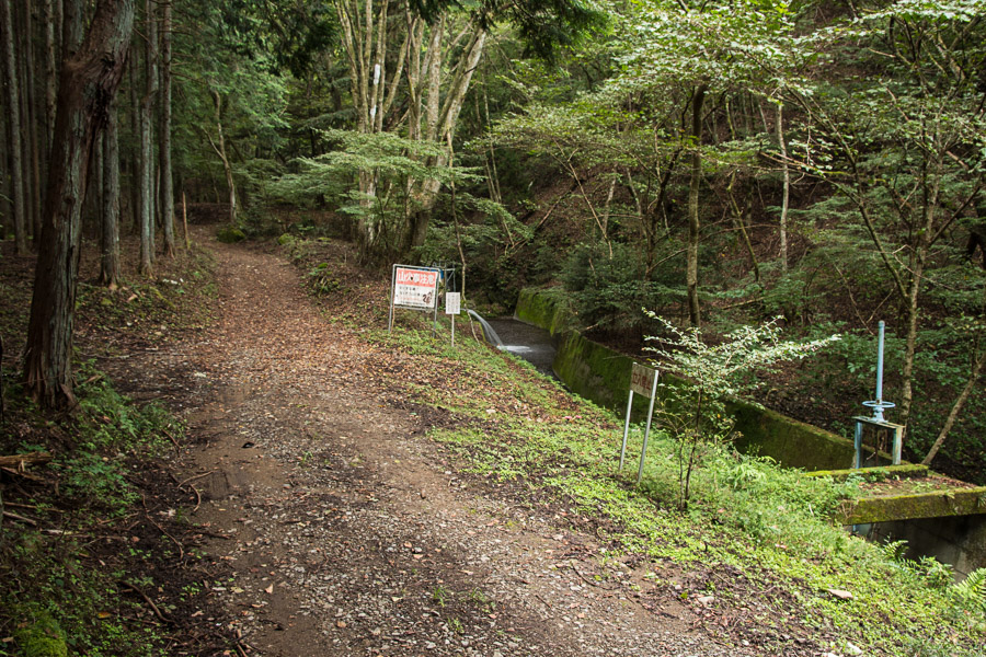
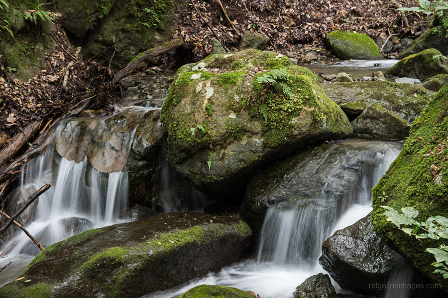
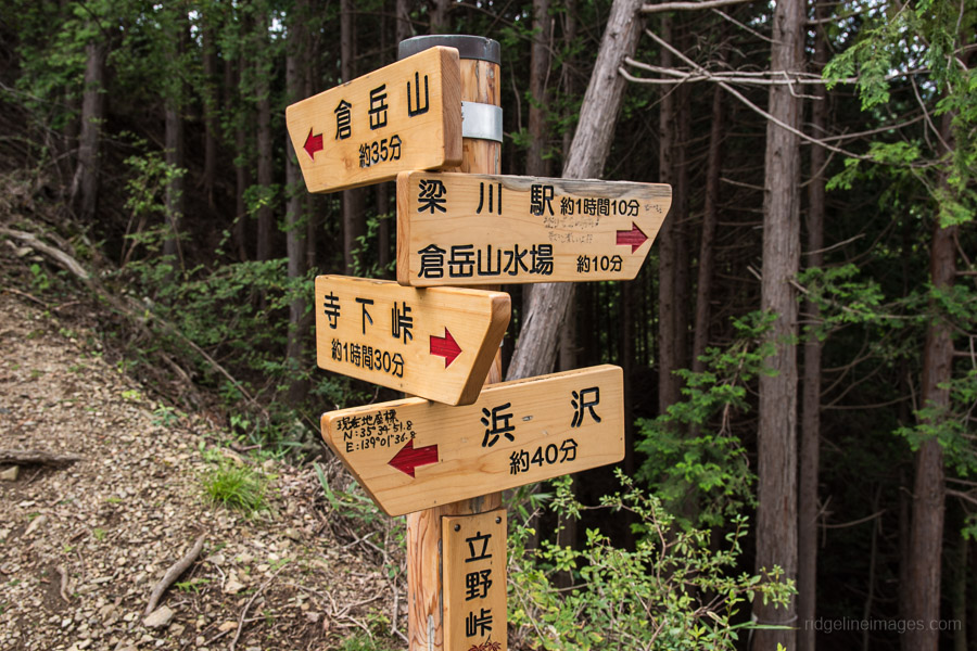
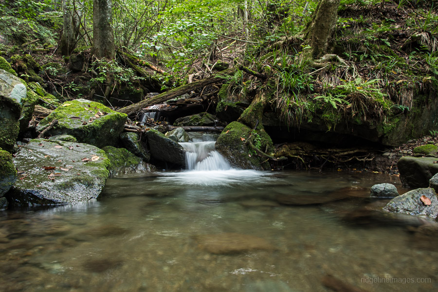
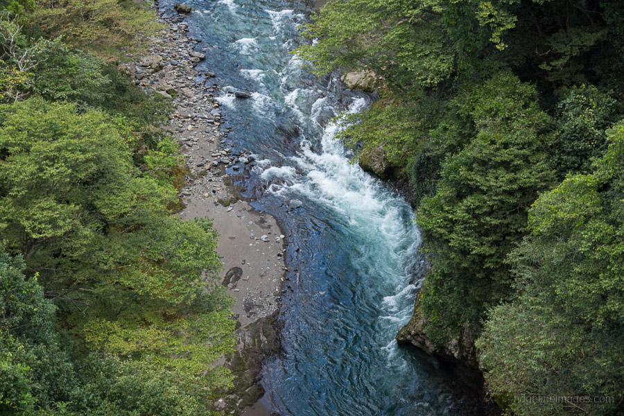
After exiting the Torisawa Station 鳥沢駅 turn right, walk along the highway for around 500 metres and look for a signpost pointing to Mt. Takahata 高畑山 on your right. After dipping under the railway underpass, turn left and follow the road, veering right at the T-intersection, and cross the Katsura River (known as the Sagami River in Kanagawa). Thankfully there are numerous signs signalling the way. After 25 minutes from the station you’ll arrive at a gated road and the Oshino Reservoir, which begins the trail proper. At first, the trail runs parallel to a small stream which you later rock hop across.
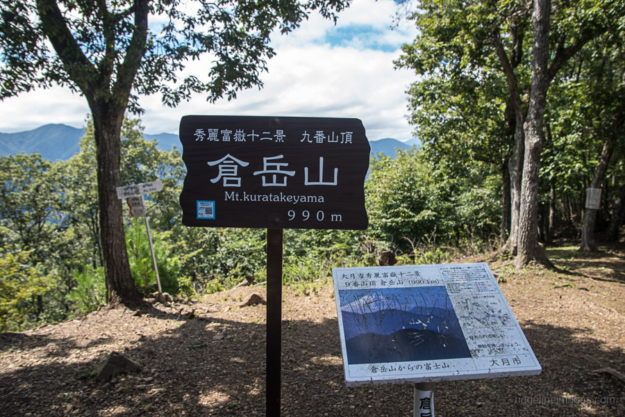
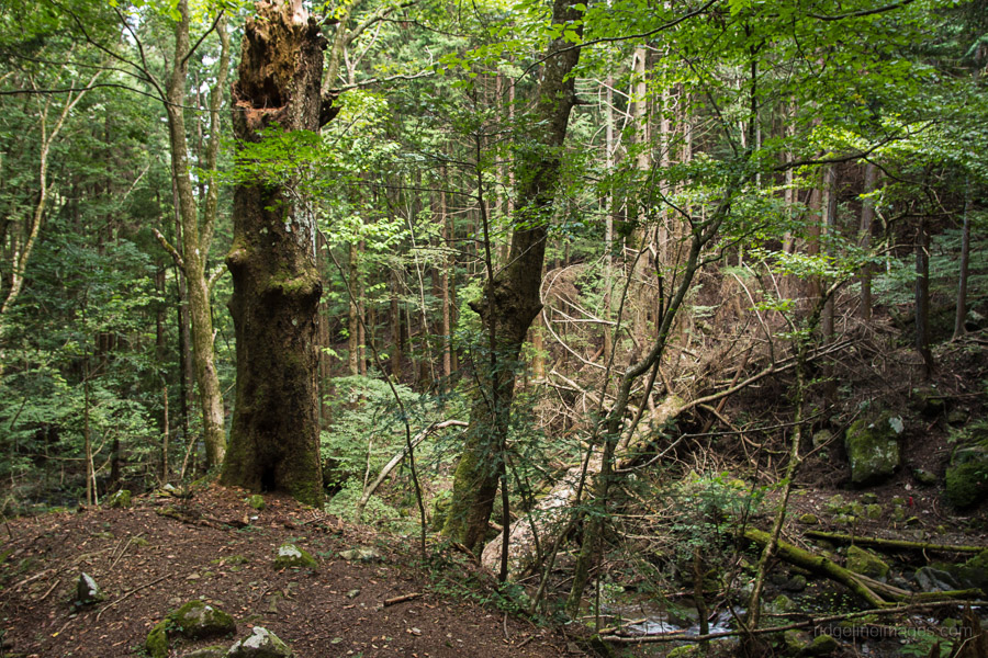
Further along at a major trail branch, there is an option of heading directly to Mt. Kuratake but ignore this and launch into a series of switchbacks up to the main ridgeline. It’s a nice spot to take a breather before the final push to the summit of Mt. Takahata (982 m). At a steady pace it should take around 2 hours to reach this point. In fine weather your efforts are rewarded with fine views of Fuji san though on this hike I met overcast conditions. Next up the trail rises a little, passing Anaji-toge 穴路峠 descending into a saddle before climbing up to Mt. Kuratake 倉岳山 (990 m).
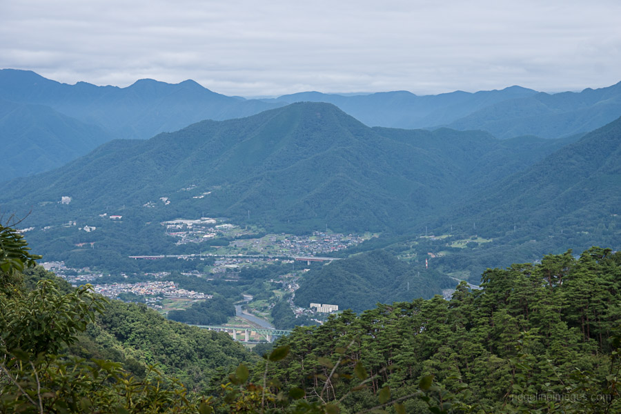
Along with Mt. Fuji, views from the summit include Mt. Ougiyama, Mt. Momokura, Mt. Daibosatsu and the Mt. Tanzawa mountains to the south. After lunch the trail sets off from the south side of the summit. The first part is rather steep and takes around 30 minutes to reach the multi-directional trail branch at Tateno-toge 立野峠. While it’s possible to extend the hike by continuing along the ridge, this time steer left towards Yanagawa Station 梁川駅. Soon you pass a minor watercourse, which appears clean and safe to drink.
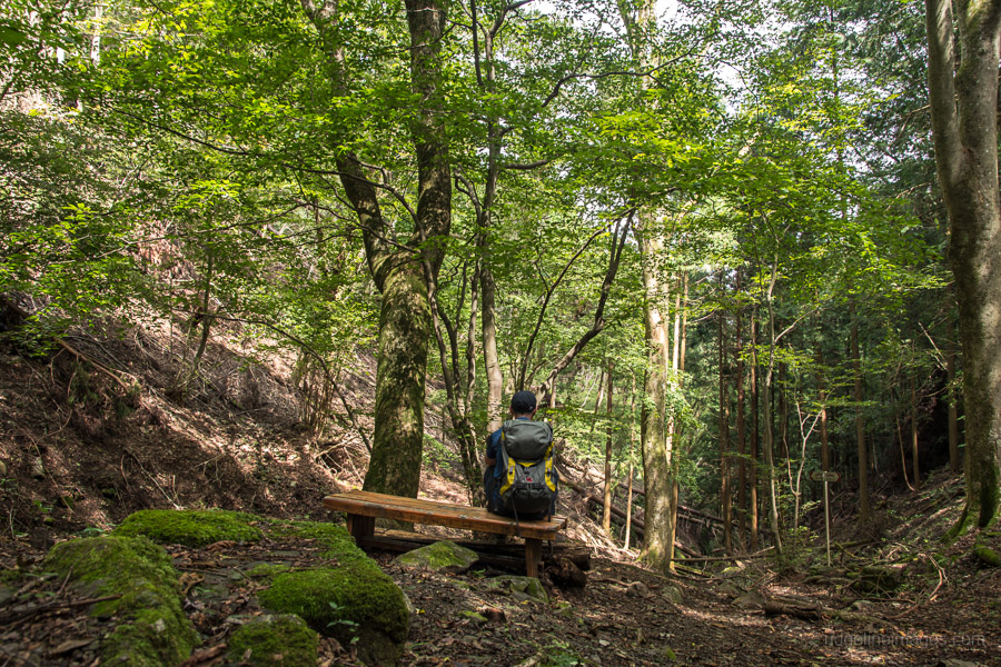
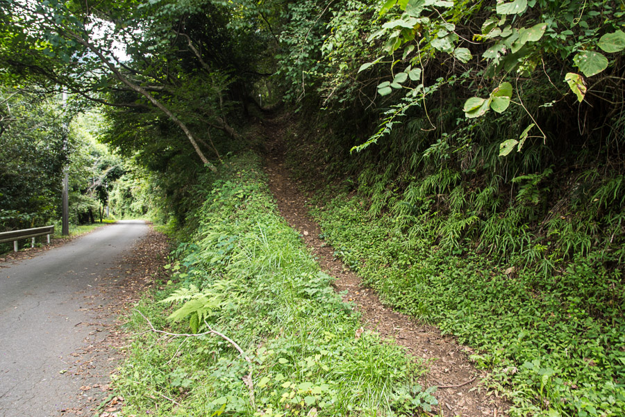
The scenic Tateno River shadows the trail and criss-crosses it several times. Eventually the track pops out at a road which you follow back to the station.


Hi David,
This is Andy (we met on the train, as you mentioned above).
Glad you like this hike. I did it a few years back, and it remains one of my
favourites.
Just got back from Yamanashi. Did the Mt. Iwadono to Chigo Otoshi hike. Access direct from JR Otsuki Station. Short 2.5 hour adventurous hike, some great views inc. Fuji, but some perilous sheer rock drops, and some parts with ropes and chains. Take care if you do it.
https://en.culmina.jp/chubu/yamanashi/iwadonosan
Hey Andy, I enjoyed the Mt. Kuratake hike though there was a bit of a haze that day, so no Fuji san views. Many year’s back I visited Iwadonosan on my way back after climbing Ougiyama and Momokurayama but I’ll have to check out the Chiogo-otoshi cliff hike.
This is a great hike and the woodland and river scenery on the way up is very healing. If you continue along the ridge past Tateno Togei it is interesting and undulating with some views although a lot of tree cover, and even a couple of interesting rocky sections to navigate (although nothing challenging)… and a couple of very steep bits of terrain.
As of early November some of the trail down to Shiotsu station is blocked by trees and rubble but it does not completely block the route or stop the hiker from getting through.
You can also go all the way up to Mt.Takatsuka but it’s not particularly worth it.
These hikes have been an invaluable source of sanctuary during Covid. Before 2020 if I were in nature it would have been more likely attending a rave than hiking, now instead of partying I get up at dawn with a clear head and get my adrenaline fix from grueling winter hiking! I will be sure to tip you a coffee sir.
I have almost worked through all the less severe hikes in and around Tokyo, but this one needs special mention because I encountered a bear, and the bear was not happy! Rather foolishly, and despite having earlier encountered large animal tracks, I deviated from the main path to find a quaint lunch spot by the river. Sure enough a lone adult bear was on the other side of the bank and visibly irritated by my presence. The reduction in hiker numbers this past year is making the wildlife more brave about going near the trails, especially on lesser walked ones such as this one. Respect nature and be cautious out there.
First up thanks for helping support the blog. Regarding the bear glad you got out unscathed. For those who maybe unaware if you see a bear at a distance just leave the area quietly. If you encounter one up close back away slowly – make sure not to turn your back. To avoid encounters in the first instance let bears know your whereabouts by making some noise such as shouting or clapping your hands to alert bears particularly in places with poor visibility and avoid areas where there has been recent bear sightings.
G’day, David. Cheers for this one – did it yesterday. Three years on, and not much has changed from your description. Although, they are doing construction work on the reservoir and the coming and going concrete trucks made for a not-so-picturesque start! I think the way you did it from Torisawa (as opposed from the other direction which other sites often suggest) is perhaps the better way to do it.
The two mountains have spacious areas to plonk down for a feed and they both gave great views across to Mt. Fuji. And: could get 4G at the top(s). Got a bit slippy in places on descents, so the hiking pole came in handy. Not an extreme hike, but one that may test the fitness of those who are not regular hikers a little more. One place I was unsure about was just 50m or so off the top of Mt. Takahata. The trail seemed to branch in two: straight ahead, it headed off a steep incline about 20m down. You could see people had attempted to go down, but it was very soft soil and, well: good luck with that. I went off to the right instead and despite seemingly slightly veering off the GPX track, it soon sorted itself out and I found it was in fact the right route. The trail is well marked elsewhere… it was just this one place there was absolutely nothing when it perhaps could do with something!
No bears, but in the Tateno River valley on the way ‘home’, saw a very busy Japanese badger (anaguma), a small snake, quite a few brilliant blue blue and white flycatchers (oruri – reminded me a little of our superb blue-wrens back in Vic and I got all homesick!), and… what I first thought was a bear down by the river in a steep gully turned out to be a very wary Japanese serow (kamoshika). Big fella, too!
Cheers for the update, Andy. Sounds like you were rewarded with your efforts with some good views. Most hikes I’m lucky if I come across one of those animals you saw and you managed both a kamoshika and an anaguma. Though you’re probably thankful you didn’t end up with the trifecta alongside a bear too!
Haha, I know, right? I tell you… with the 52 year-old eyes and the shadows in the gully, I certainly thought the kamoshika was a bear for a full 10 seconds and started to consider the backwards steps! I had been making a bit of noise, but I guess when you are beside a stream, it’s a little harder for the creatures to hear you coming. That was a blessing yesterday, but may not have been if I had run into one of our furry big friends, eh?