Tag: Yamanashi hikes

Mt. Gongen 権現山

Hiked on Oct 7, 2023 . Asakawa-toge 浅川峠 – Mt. Amefuri 雨降山 – Mt. Nihonsugi 二本杉山   Duration: 5.5 hours   Distance: 15.2 km   Elevation change: 1046 metres   Highest point: 1312 metres   Start: Asakawa Bus Stop...

Southern Alps Traverse 南アルプス縦走

Hiked from July 21 to July 29, 2023 . Hirogawara 広河原 to Akaishi Onsen Shirakabaso 赤石温泉白樺荘   This is a long and demanding multi-day hike suitable for experienced hikers. Do not attempt this hike unless you have experience in route-finding. Carry...

Southern Alps Traverse: Preparation, Food, and Gear

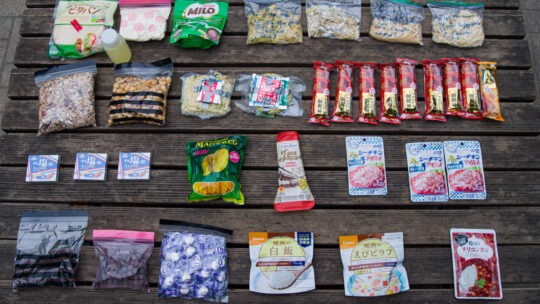
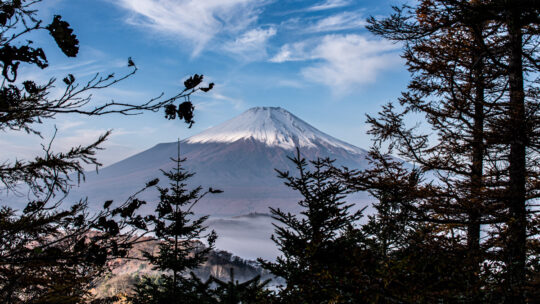
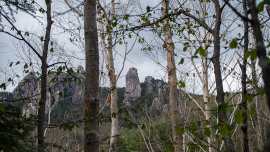
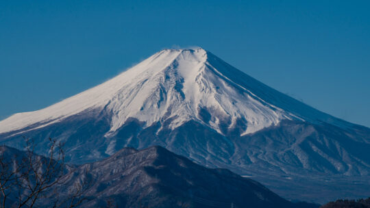
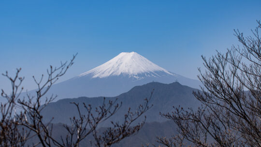
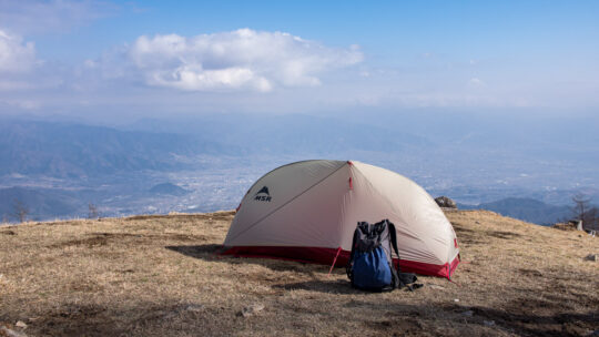
Getting Down to the Nuts and Bolts From July 21st to July 29th, 2023, I completed a full-length traverse of the entire Southern Alps from Hirogawara in Yamanashi Prefecture to Akaishi Onsen Shirakabaso hot spring in Shizuoka Prefecture, a distance...

100 Famous Yamanashi Mountains

Yamanashi’s Most Prominent Peaks One thing Japanese people love to do is rank and categorise things, and mountains are no exception. Ever since the release of Kyuya Fukada’s best seller 100 Famous Japanese Mountains (Nihon Hyaku-meizan) back...

Mt. Ogawayama 小川山

Hiked on May 25, 2023 . Mawarime-daira 廻り目平 – Hacho-daira 八丁平 – Fujimidaira-goya 富士見平小屋   Do not attempt this hike unless you have experience in route-finding, and make sure you carry a topographic map and handheld GPS device.  ...

Mt. Iwadono 岩殿山

Hiked on Feb 26, 2023 . Oni-no-iwaya 鬼の岩屋 – Mt. Iwadono 岩殿山 – Yosuike 用水池 A variation of this hike includes a loop course over the neighbouring mountains of Mt. Tenjin and Mt. Chigootoshi, though it involves several areas with fixed...

Mt. Takatsuka 高柄山

Hiked on Dec 19, 2022 . Senzoku-toge 千足峠 – Shinyanone-toge 新矢野根峠 – Gozenyama 御前山   Duration: 5 hours   Distance: 10.5 km   Elevation change: 493 metres   Highest point: 733 metres   Start: Shiotsu Station (Chuo Main Line)   Finish:...

Mt. Sasagogangaharasuriyama 笹子雁ヶ腹摺山

Hiked on Nov 3, 2022 . Mt. Yonezawa 米沢山 – Mt. Oboyama お坊山 – Ojika-toge 大鹿峠   Do not attempt this hike unless you have experience in route-finding and make sure you carry a topographic map and handheld GPS device.   Duration: 7 hours...

Mt. Kurodake 黒岳

Hiked on May 24, 2022 . Jinzasan 神座山 – Mt.Shakagatake 釈迦ヶ岳 – Shindo Pass 新道峠   Duration: 2 days   Distance: 18.4 km   Elevation change: 1028 metres   Highest point: 1793 metres   Start: Himine jinja mae Bus Stop  ...

Mt. Yogaisan 要害山

Hiked on Apr 19, 2022 . Kaze no Kamisama 風の神様 – Mt. Koyashiro コヤシロ山 – Mt. Minashi 実成山   Duration: 3 hours   Distance: 8.5 km   Elevation change: 402 metres   Highest point: 609 metres   Start: Arai Bus Stop   Finish: Arai Bus Stop  ...

Mt. Ryugadake 竜ヶ岳

Hiked on Mar 29, 2022 . Stone Buddha 石仏 – Hashita-toge 端足峠 – Lake Motosuko 本栖湖   Duration: 5 hours   Distance: 11.1 km   Elevation change: 550 metres   Highest point: 1485 metres   Start: Lake Motosuko Bus Stop (Blue Line)   Finish: Lake...

Tokyo Mountains with Names Overlaid (Updated)

A Panorama of Mountains from Tama Lake in Tokyo. The Tokyo Metropolis sits on the Kanto Plain, the largest lowland area in Japan and home to around a third of the country’s population. To the east, the city is bordered by the Edogawa River and Chiba...

Archives

Subscribe

Get the latest posts straight to your inbox. No spam, ever. Unsubscribe at any time.