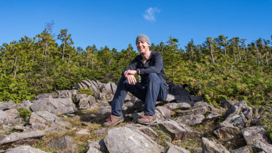
Hiked on Nov 2, 2021 . Naka-no-dake 中ノ岳 – Mt. Ishiwari 石割山 – Mt. Hirao 平尾山 Duration: 2 days Distance: 25 km Elevation change: 1214 metres Highest point: 1681 metres Start: Tsurushi Station (Fujikyuko Line) Finish: Mt. Fuji Yamanakako...
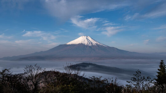
Hiked on Nov 2, 2021 . Naka-no-dake 中ノ岳 – Mt. Ishiwari 石割山 – Mt. Hirao 平尾山 Duration: 2 days Distance: 25 km Elevation change: 1214 metres Highest point: 1681 metres Start: Tsurushi Station (Fujikyuko Line) Finish: Mt. Fuji Yamanakako...
Hiked on May 22, 2021 . Tenguiwa 天狗岩 – Mt. Matateyama 馬立山 – Mt. Gozenyama 御前山 Duration: 5 hours Distance: 9.9 km Elevation change: 550 metres Highest point: 970 metres Start: Kasei Station (Fujikyuko Line) Finish: Saruhashi Station (Chuo...
Hiked on Apr 19, 2021 Feb 16, 2022 . Chinseiga-ike 鎮西ヶ池 – Hinoki-daira 桧平 Duration: 7 hours Distance: 16.4 km Elevation change: 1020 metres Highest point: 1620 metres Start: Sasago Station (Chuo Main Line) Finish: Hatsukari Station...
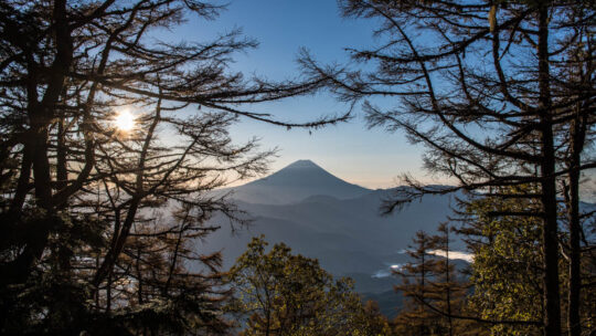
Hiked on Apr 2, 2021 Mar 26, 2022 . Osawa Noto 大沢ノ頭 – Mt. Sashiyama 差山 – Mt. Myoken 妙見山 Duration: 2 days Distance: 15.2 km Elevation change: 1233 metres Highest point: 1713 metres Start: Kubodaira Bus Stop Finish: Tsutsumigawa Onsen...
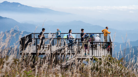
Mountains You Can Climb in a Day from Tokyo Unless otherwise stated, all prices are for one-way travel using local trains and bus services. For residents and tourists alike spending too much time in Tokyo can well make you go bonkers after a while...
Hiked on Mar 23, 2021 . Tenjin-toge 天神峠 – Mt. Mineyama 峯山 – Mt. Musubiyama むすび山 Duration: 4.5 hours Distance: 8.8 km Elevation change: 516 metres Highest point: 976 metres Start: Hatsukari Station (Chuo Main Line) Finish: Otsuki Station...
Hiked on Nov 4, 2020 Aug 15, 2022 . Mt. Tsunotogiyama 角研山 – Honjagamaru 本社ヶ丸 – Mt. Seihachiyama 清八山 Duration: 6.5 hours Distance: 14.4 km Elevation change: 1031 metres Highest point: 1631 metres Start: Sasago Station (Chuo Main Line) ...
Hiked on Oct 24, 2020 . Himuro Shrine 氷室神社 – Hokora Hut ほこら小屋 – Mt. Hadaka 裸山 Duration: 2 days Distance: 16.2 km Elevation change: 1276 metres Highest point: 2052 metres Start: Hirabayashi Bus Stop Finish: Hirabayashi Bus Stop ...
Hiked on Sep 21, 2020 . Mt. Kentoku 乾徳山 – Mt. Kurogane 黒金山 – Nishizawa Gorge 西沢渓谷 The Nishizawa Gorge hiking trail closes during winter (December 1st-April 28th subject to change depending on snowfall) for the latest information please refer to the...
Hiked on Sep 14, 2019 Aug 28, 2021 . Mt. Takahata 高畑山 – Mt. Kuratake 倉岳山 Duration: 5.5 hours Distance: 11.4 km Elevation change: 674 metres Highest point: 990 metres Start: Torisawa Station (Chuo Main Line) Finish: Yanagawa Station...
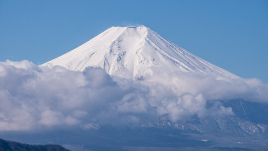
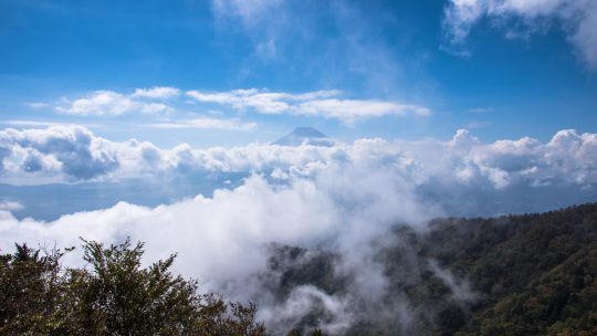
Recollections from my First Hyakumeizan It’s been 19 years since I first climbed Japan’s most iconic peak, so this Mountain Day I thought it fitting to wind back the clock and revisit my first Nihon Hyakumeizan—or 100 Famous Japanese Mountain. . . ...
Hiked on Oct 9, 2018 Feb 4, 2021 . Mt. Kaiun 開運山 – Mt. Tenjo 天上山 Duration: 6.5 hours Distance: 17 km Elevation change: 1171 metres Highest point: 1785 metres Start: Mitsutoge Station (Fujikyuko Line) Finish: Kawaguchiko Station...

Hiked on Jul 20, 2018 Aug 15, 2021 . Mt. Mibudake 三峰岳 – Mt. Ainodake 間ノ岳 – Mt. Notoridake 農鳥岳 Duration: 4 days Distance: 27.5 km Elevation change: 1399 metres Highest point: 3189 metres Start: Norokawa Deai Bus Stop Finish: First...
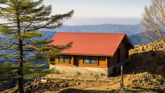
Sleep in these Mountain Huts and Save Some Coin While hiking purists might scoff at the idea of bedding down for the night in a mountain hut either due to cost considerations or the thought of suffering through an ensemble of snorers, huts do have...
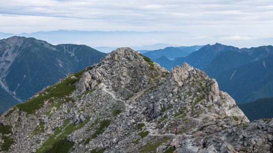
Hiked on Aug 27, 2017 Aug 10, 2022 . Hirogawara 広河原 – Shirane-oike 白根御池 – Kita-dake 北岳 Duration: 3 days Distance: 11.8 km Elevation change: 1673 metres Highest point: 3193 metres Start: Hirogawara Bus Stop Finish: Hirogawara Bus Stop...
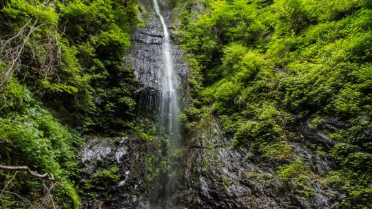
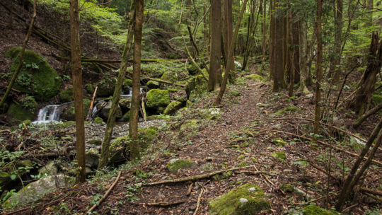
Not the Easiest Access but a Gorgeous Spot Nestled in the back hills of Kosuge Village just inside Yamanashi Prefecture contains a couple of rather beautiful waterfalls. First is the Shiraito Falls (not to be confused with the waterfall of the same...