.
Mt. Kinpu 金峰山 – Mt. Asahi-dake 朝日岳 – Odarumi-toge 大弛峠
Distance: 24.3 km
Elevation change: 1089 metres
Highest point: 2599 metres
Start: Mizugaki-sansou Bus Stop
Finish: Kawahake Bus Stop
Difficulty: ▅▅▅▅▅▅▅▅▅▅ ❹
Map: Yama to Kogen Chizu 山と高原地図 [No.28 金峰山・甲武信 KINPU-SAN·KOBUSHI]
GPX TrackKML TrackGSI MAPPDF Topo Map
Some Hikes Just Don’t Go to Plan
This hike marks the fourth time I’ve made the long bus ride out to the Mizugaki-sansou and second that I’ve had the good fortune of hiking along the striking craggy ridgeline that flanks Mt. Kinpu. I should mention from the outset that this hike was aborted after the first day. The original plan was to be out for an extended five days but I completely underestimated the amount of snow cover. I also neglected to pack my four-point crampons which didn’t help matters. It shows that even after completing over one hundred hikes I still have much to learn. If there is one takeaway from this hike, it’s knowing your limits, when to pull the pin and to never feel ashamed of changing plans on the fly, if it means getting yourself off the mountain in one piece.
Day 1: Last Light After a Snowy Ridgeline (10.3 km)
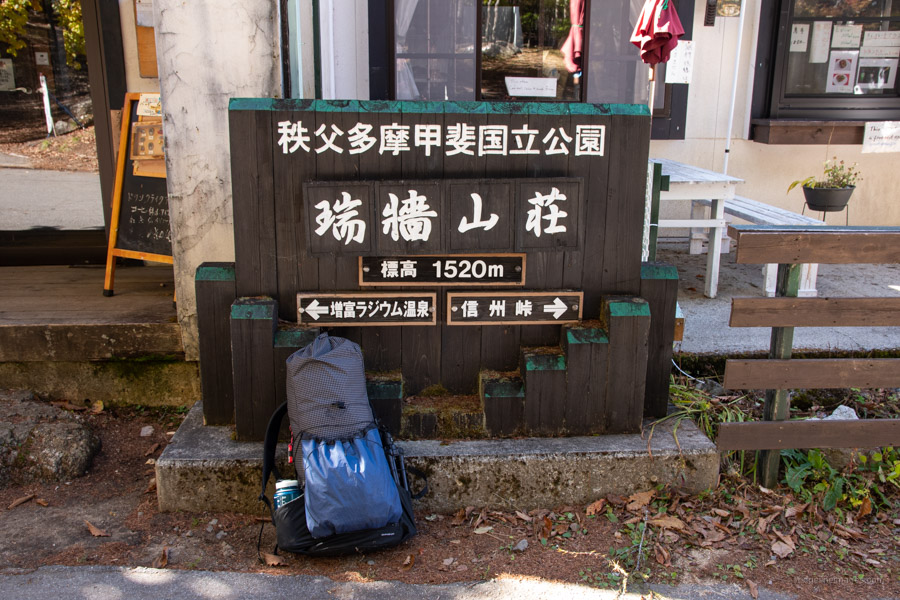
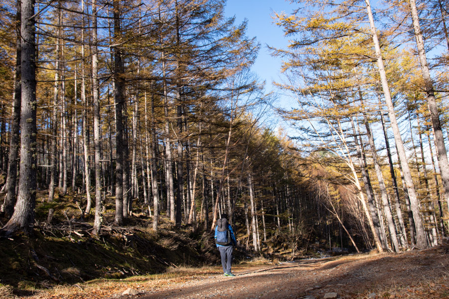
Getting to the Mizugaki-sansou 瑞牆山荘 trailhead entails catching a train to Nirasaki Station 韮崎駅 and picking up one of 5-6 daily buses which make the round trip during the hiking season (1hr 15 mins, 2,060 yen). For 2021 the operation period was from April 1 – November 23. I highly recommend aiming for the first morning bus which departs at 8:50 am especially later in the year when the daylight hours get shorter. Even after catching this said bus and maintaining a good walking cadence, I didn’t arrive at Odarumi Pass 大弛峠 until 16:45. This was partly attributable to the quantity of snow. From Mizugaki-sansou to Odarumi Pass also check out the trail notes from my first sojourn back in 2013.
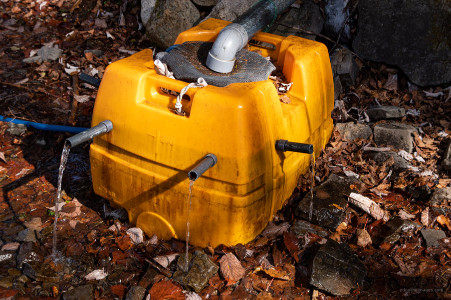
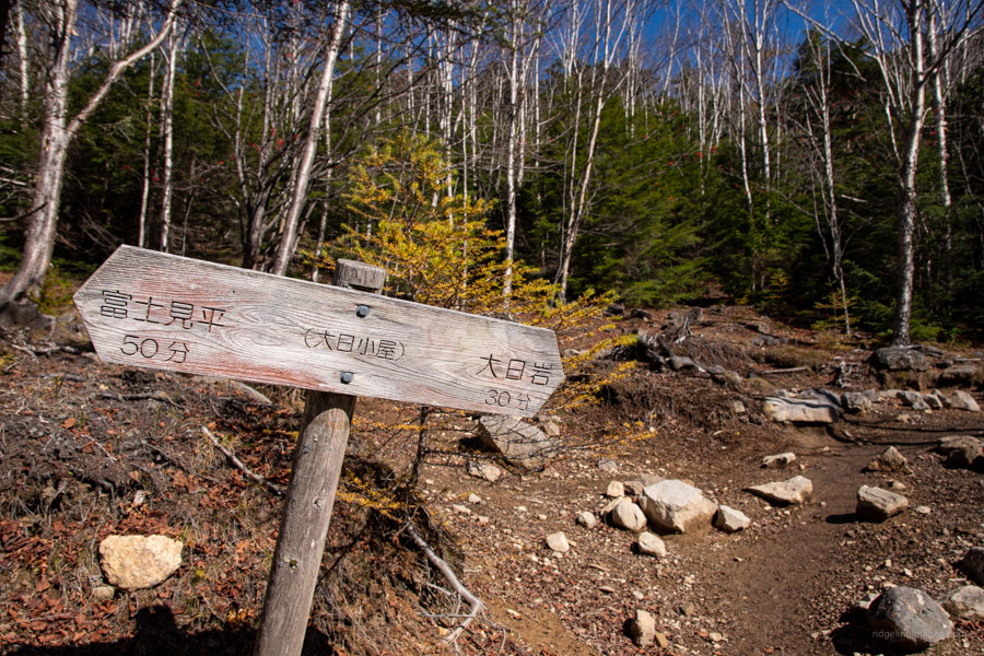
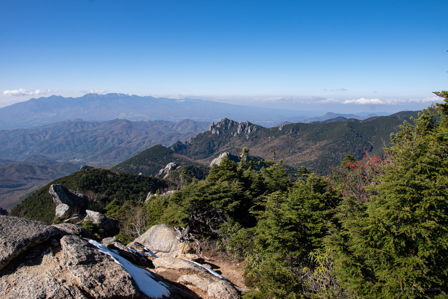
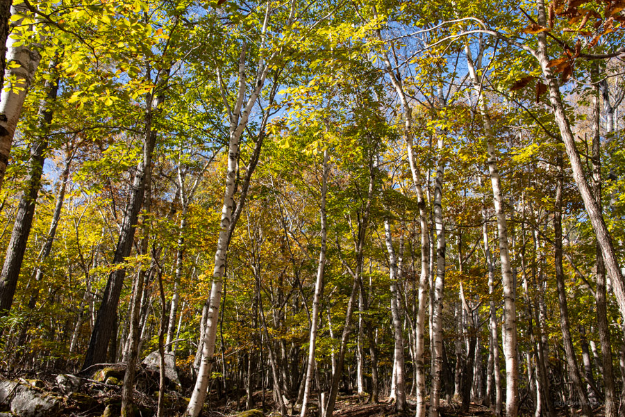
On what was a beautiful autumn weekday morning there was only a handful of us lined up at Nirasaki Station. Perhaps because it was late October or the lingering effects of the Rona but in any case, it’s always nice to ride a mini bus without the burden of nursing one’s backpack on the knees. From Mizugaki-sansou the trail quickly gains elevation, briefly passing an area with a sweeping vista of Mizugaki-yama 瑞牆山. Just before reaching Fujimidaira-goya 富士見平小屋 look out for a short detour to a water hole. Between here and Odarumi Pass the only other spot to collect water is the Dainichi-goya 大日小屋. Note however when I camped there back in the summer of 2016, it was little more than a trickle.
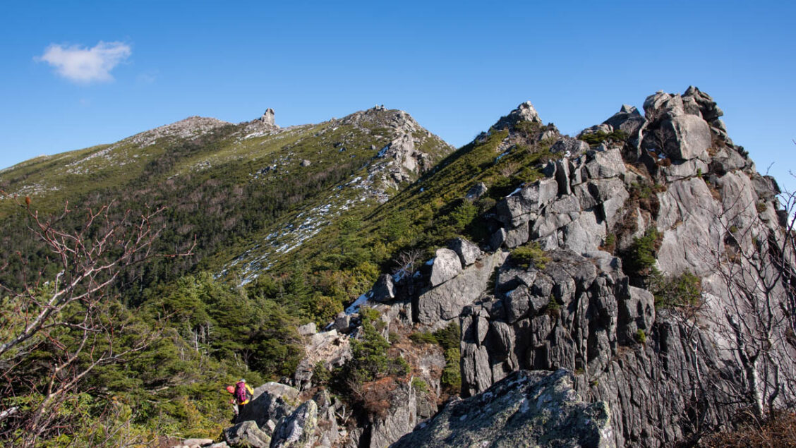
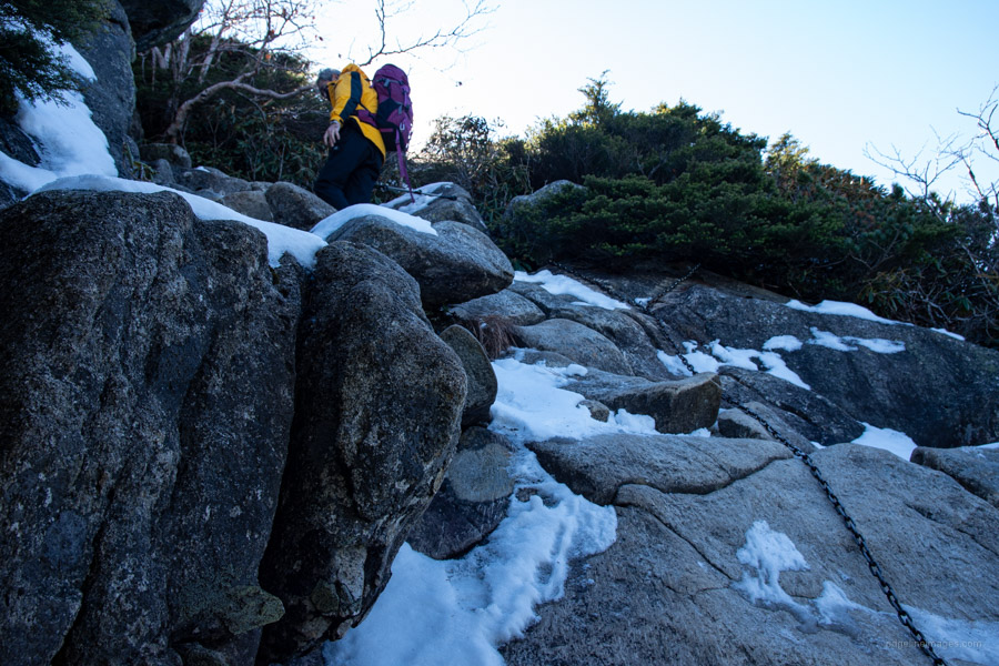
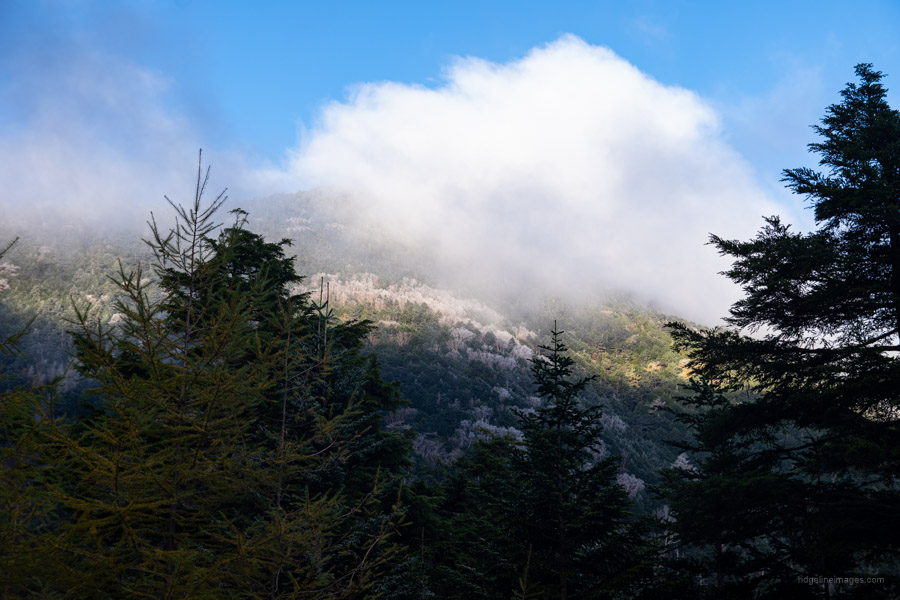
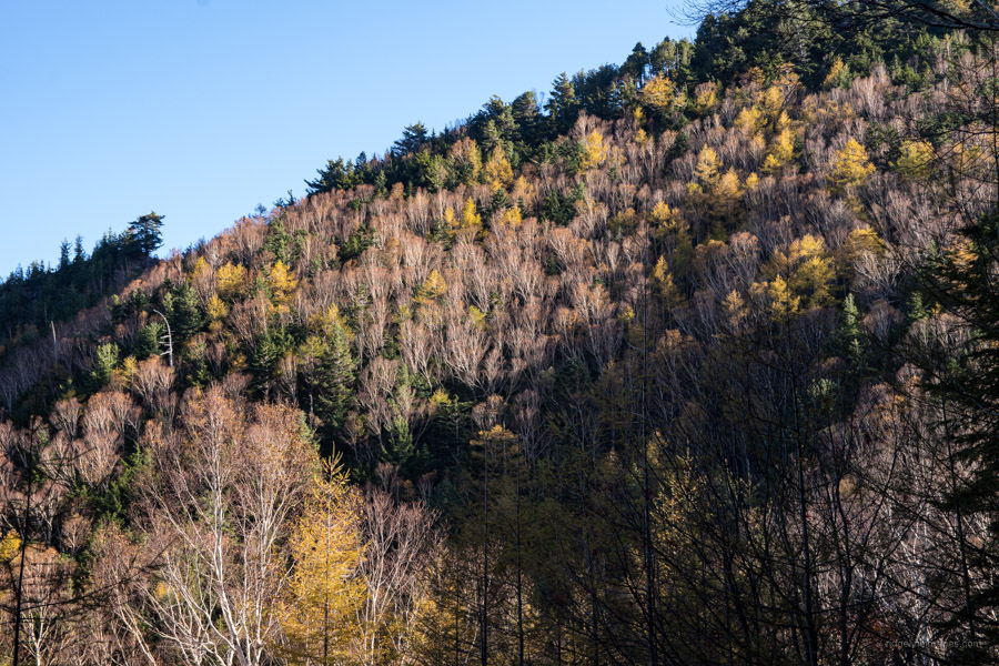
From the Fujimidaira-goya, the trail passes through a dimly lit forest with a mossy floor. Just before reaching the campsite which rests above the ramshackle Dainichi-goya finds the branch off to the Takamiiwa Rock 鷹見岩 (2,092 m) worth paying a visit if you’re making good time. Next up is the Dainichi Boulder 大日岩 similarly worthwhile scaling. By the side of it is a flat area to take lunch. It was also around here that I encountered the first snow. A week earlier a cold front brought a dumping of snow to the Northern Alps followed by a spell of warm weather. Hike reports from Yamareco indicated much of it had melted. Well, it had on the sunbathed summit though the shaded gullies were packed with the white stuff. More telling was where the ice had bonded to bare rock making any semblance of traction near on impossible.
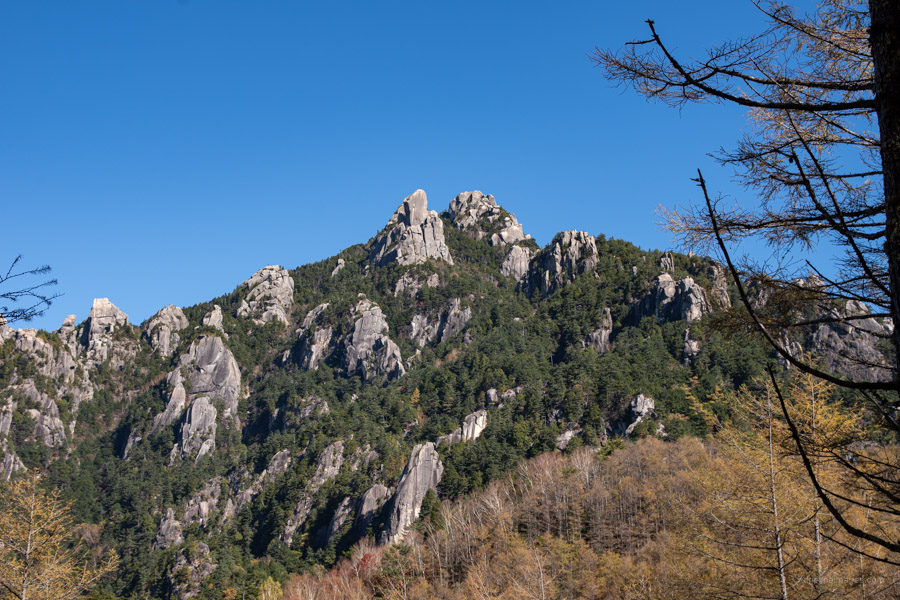
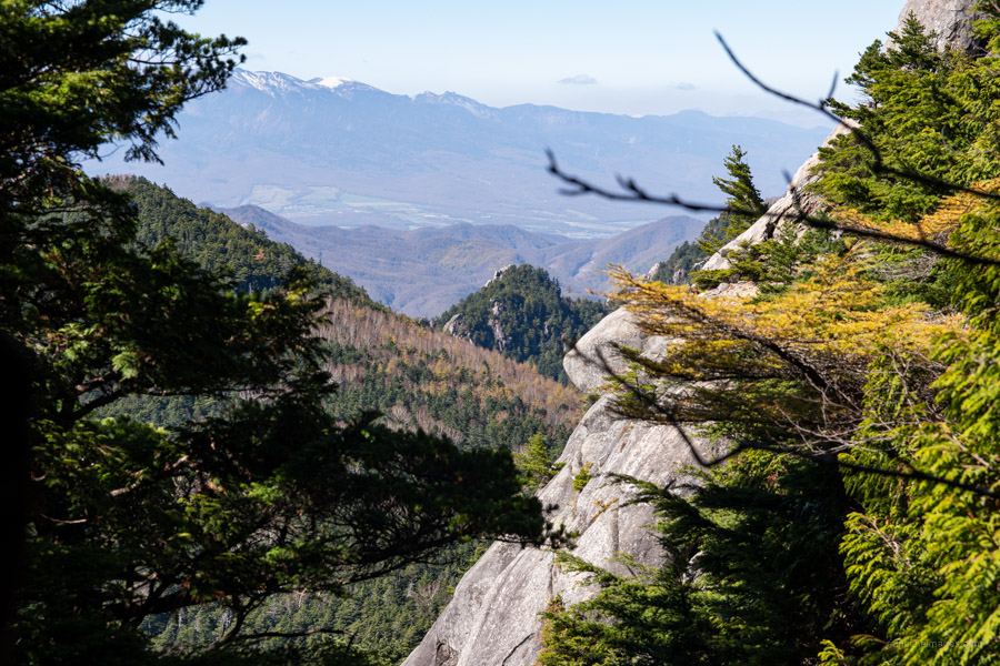
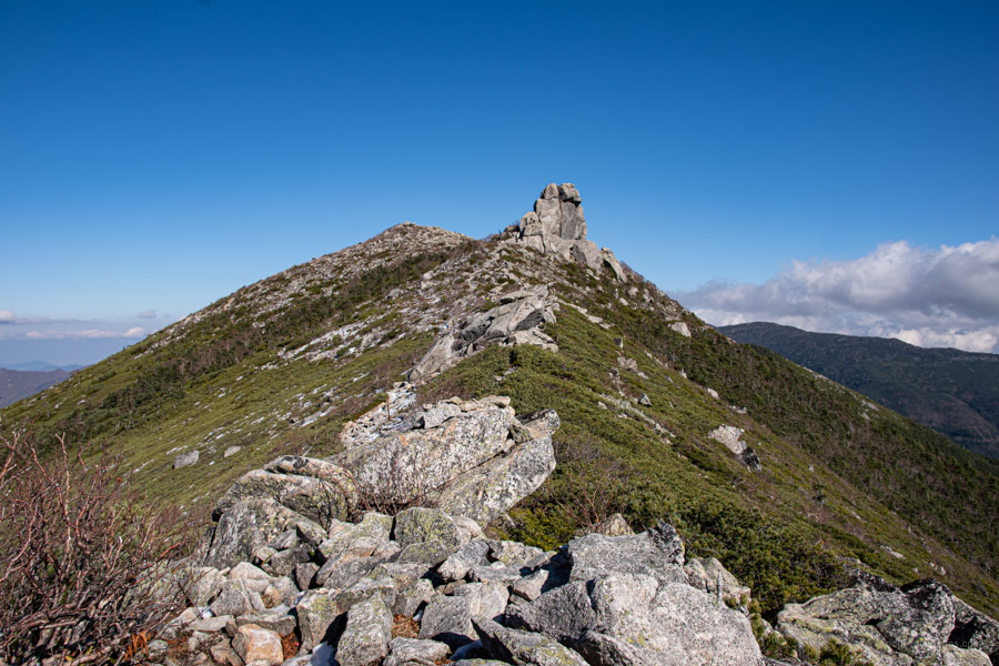
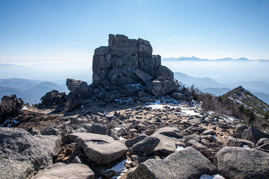
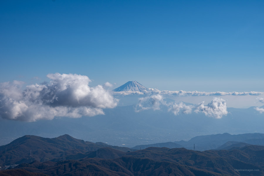
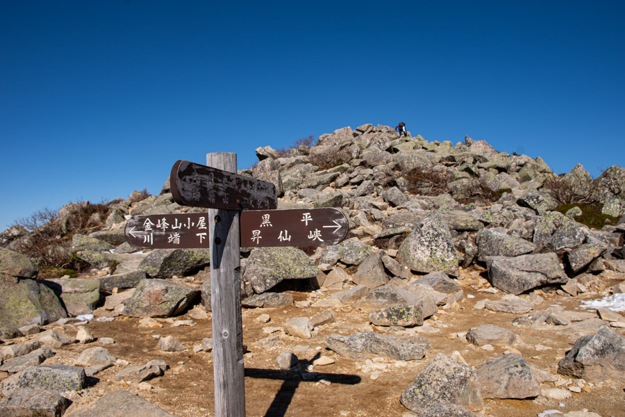
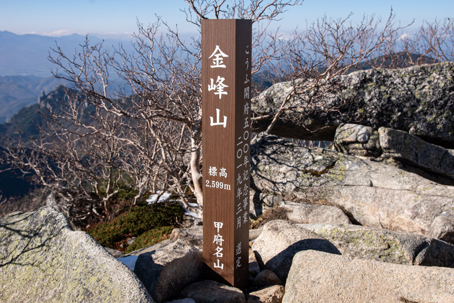
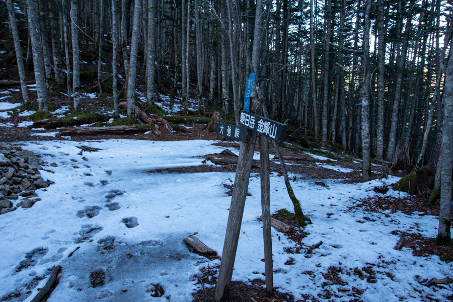
From the bus stop it took 4 hours of steady climbing to reach the Gojoiwa – a 15-metre-high granite obelisk and symbol of Mt. Kinpu 金峰山 (2,599 m). A small torii gate at the foot is linked to the Kanazakura Shrine in Kofu City. There were hardly any hikers milling around and none of whom continued thru to Odarumi Pass which incidentally is Japan’s highest accessible road pass at 2,365 metres. The reason I suspect was that the road to the pass on the Yamanashi side had been cordoned off due to a landslip a few days earlier. From the summit the trail continues north for 30 minutes before veering right through tracks of Abies veitchii (Veitch’s silver-fir) over Mt. Tetsuyama 鉄山 (2,511 m) and Mt. Asahi-dake 朝日岳 (2,579 m).
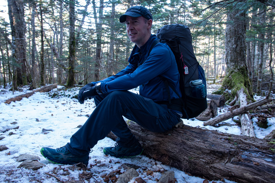
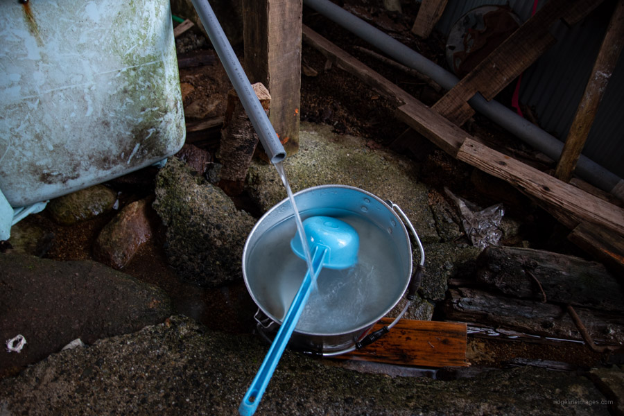
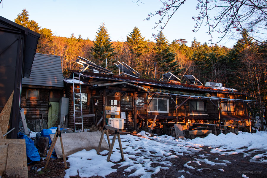
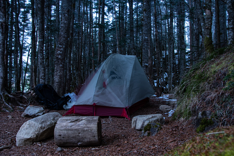
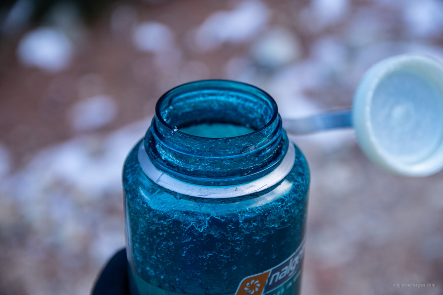
Naively I hoped that was going to be end of the snow, but with the trail to Odarumi Pass mostly shaded meant footslogging in ankle high snow. By the time I arrived at the pass it was approaching dusk. I had envisaged myself scouting for space to pitch my tent, instead the place was completely desolate, no hikers and the hut was also unattended. Thankfully though the water hole in the shed was running. I found a nice spot bereft of snow to setup camp before having an early dinner and retiring to the warm confines of my new Nanga Aurora Light sleeping bag.
Day 2: From Mild Autumn to the Depths of Winter (14 km)
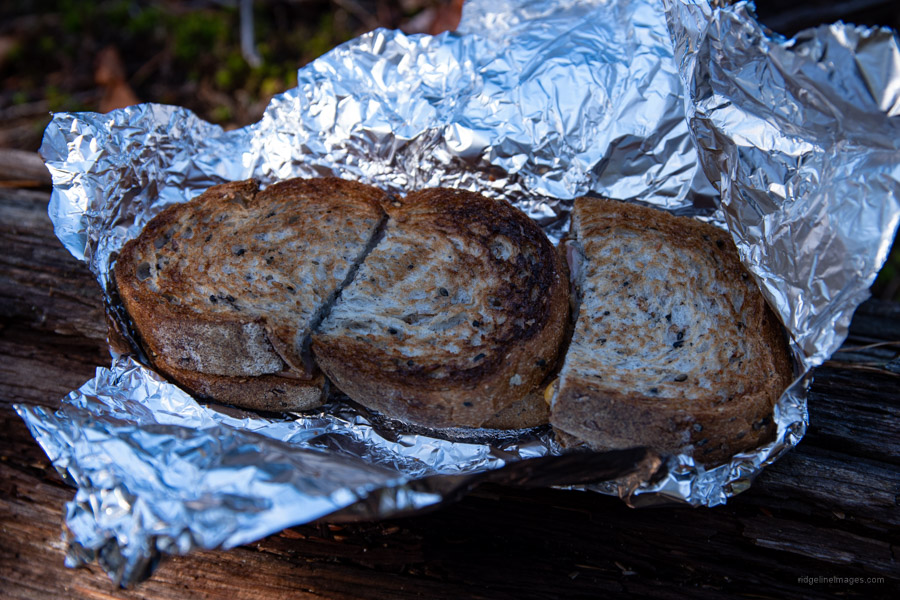
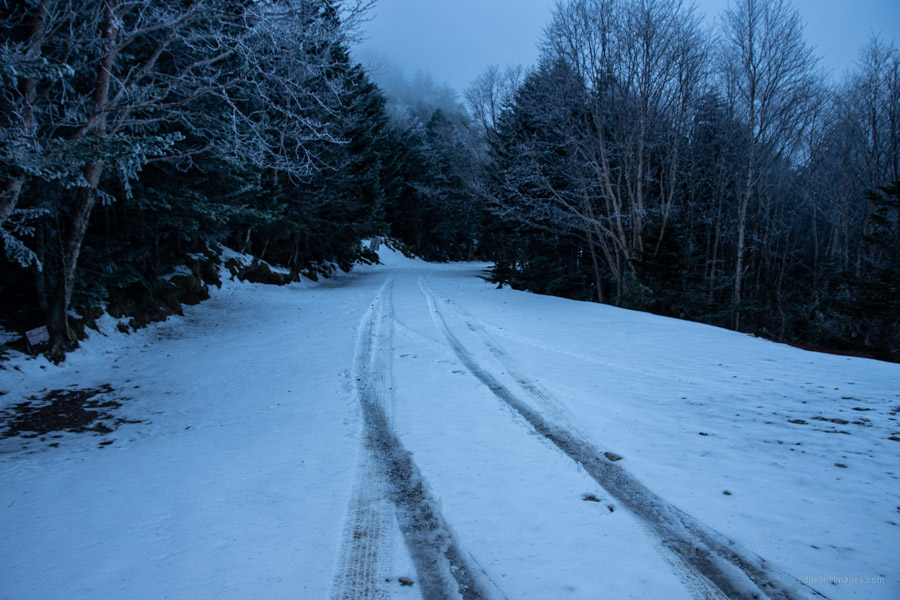
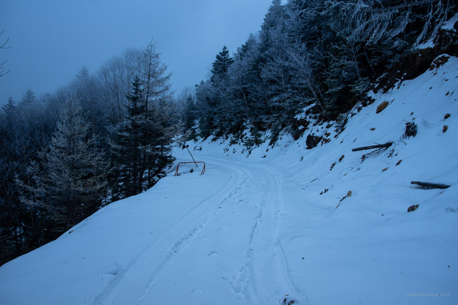
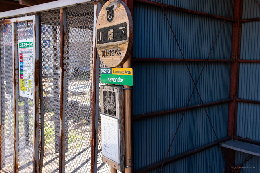
Oh-boy was it one chilly night. I felt warm enough when I fell off to sleep but ended up having to don my Polartec. From the previous days mild autumn weather at the trailhead, I had literally woken to find myself in the depths of winter. My water bottle sitting in the tent vestibule had iced up and there was a snow flurry going on outside. This along with poor visibility made me feel vindicated in my decision to give up on my dream of traversing to Okutama Station. More important now was getting some nourishment by way of muesli and macadamia nuts, breaking camp, and beginning the 14 km (1,000 m) descent along the Kawakami-makioka Rindo forest road 川上村営林道 to the Kawahake Bus Stop.
The trip was rapidly becoming reminiscent of Tokyo Hikeographer’s masterfully written ‘snowpocalypse’. Admittedly the conditions he faced were far severer though similarly quitted at the pass. In TH’s case he fortuitously scored a lift heading downhill on the Yamanashi side. Note transport options on the southern approach of the pass are scant. The closest bus stop is Yakeyama-toge 焼山峠 (weekends and seasonal) but more realistically Shiohira 塩平 a 6-hour road hike away! And even then, there are only 2-3 daily buses to Enzan Station. Thus, I hedged my bets on the making the 10:07 bus from the northern Nagano approach. On weekends and holidays from June to November a bus runs to and from Odarumi Pass from Enzan Station (advanced booking required, 2,000 yen).
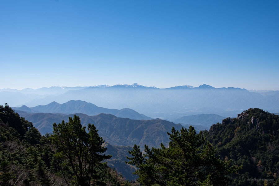
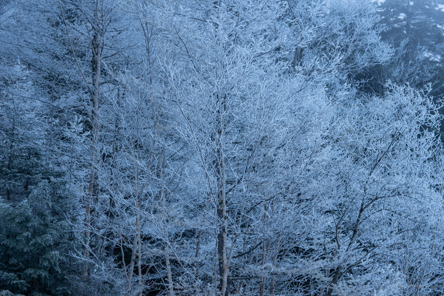
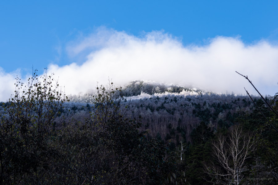
While the sealed road that winds up to the pass from Yamanashi is a well-funded prefectural road the same unfortunately can’t be said for the Nagano approach with a 4WD gravel track funded by the local municipality. At any rate both sides of the pass were under several centimetres of snow. I could see only one other set of footprints, the odds of knocking into another hiker is most unlikely. Gradually my water bottle thawed, and blue skies materialised offering excellent views back towards Asahi-dake. It took almost 90 minutes to drop back below the snowline. The track passes several small river crossings where you can refill your water supplies. Shortly before reaching the turn off to the charming Mawarime Daira Campsite the road becomes paved. From here it’s a further 30-minute walk to the Kawahake Bus Stop 川端下 with 6 daily buses to Shinano-Kawakami Station 信濃川上駅 (35 mins, 580 yen) on the JR Koumi Line.


Nice trip.
The first time I looked at this area was in January or February one year. I planned everything and then happened to come across a blog post by a guy that had just walked the exact route I’d planned–and he almost died! He was really in dire straits because of the snow.
I decided to put off Kinpu until the next summer and went down to Tanzawa instead. 🙂
I wish I could find that post again to share it with you. That guy had a great writing style and it was a great read.
It was tougher than expected but there is always something to learn from the experience. Pat that post you’re talking about is linked on Day 2 ‘snowpocalypse’!
“that post you’re talking about is linked on Day 2 ‘snowpocalypse’!”
Cool. I’m glad you found it. I hadn’t read through your whole post when I wrote. That guy’s post made me laugh–and maybe saved my life. What a saga!
BTW Thanks for the Ko-fi! You’re the first person-and that really means a lot. Your blog has helped me a lot over the past several years.
Yikes. This mountain just seems to have whatever weather it feels like regardless of what’s going on all around it. I would love to have seen everything that I missed on my attempt. Hopefully next time…
Doesn’t it! From hike reports and photos that I read around the time, it appeared there wasn’t much snow but in fact there was quite a bit and much colder than expected. Similarly, I’m planning a revenge hike next year.