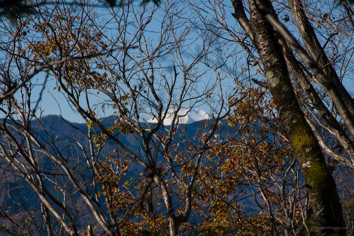
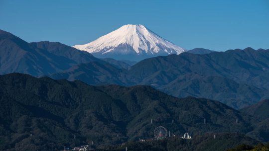
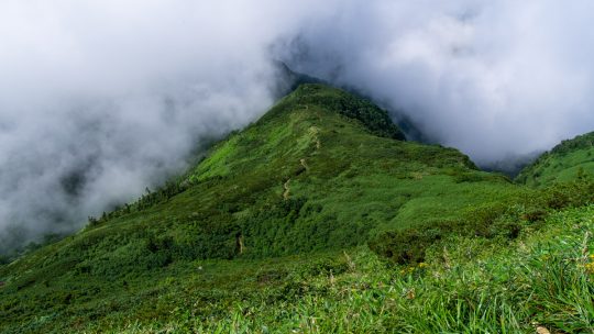
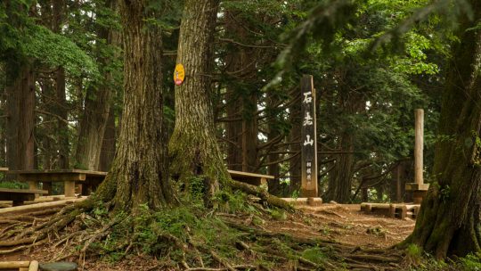
Hiked on Dec 7, 2022 . Mt. Hizure-kongozan 日連金剛山 – Mt. Yasaka 八坂山 – Mt. Takara 宝山 Duration: 3.5 hours Distance: 10.4 km Elevation change: 297 metres Highest point: 460 metres Start: Fujino Station (Chuo Main Line) Finish:...
David grew up in the eastern suburbs of Melbourne, Australia, with hiking and outdoor pursuits being a major part of his life for as long as he can remember. He has been writing, snapping photos, and sharing his adventures on RIDGELINEIMAGES.com since 2013.
At university, David majored in environmental management and holds a Graduate Diploma of Education. He has been living in Japan for over 15 years, first in Fukushima Prefecture and now in the Tokyo Metropolis. With a love of hiking and photography, he felt the best way to combine the two was a blog to provide some inspiration for others to enjoy the myriad of trails and outdoor offerings on Tokyo’s doorstep. You can follow David on Instagram @ridgelineimages.
Hiked on Dec 7, 2022 . Mt. Hizure-kongozan 日連金剛山 – Mt. Yasaka 八坂山 – Mt. Takara 宝山 Duration: 3.5 hours Distance: 10.4 km Elevation change: 297 metres Highest point: 460 metres Start: Fujino Station (Chuo Main Line) Finish:...
10 Mountains In Tokyo Worth Climbing As this blog approaches its 10th anniversary, it’s time to do what any self-respecting Tokyo hiking blogger would; rate from 1 to 10, Tokyo’s best mountains – specifically the list focuses on mountains...
Hiked on Nov 12, 2022 . Mitsumine Shrine 三峯神社 – Mt. Shiraiwayama 白岩山 – Mt. Tenso 天祖山 Do not attempt this hike unless you have experience in route-finding and make sure you carry a topographic map and handheld GPS device. ...
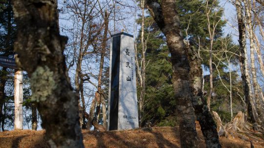
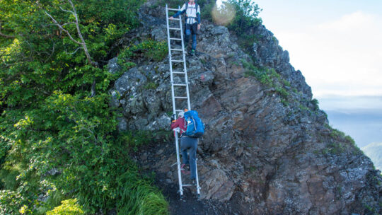
Hiked on Nov 3, 2022 . Mt. Yonezawa 米沢山 – Mt. Oboyama お坊山 – Ojika-toge 大鹿峠 Do not attempt this hike unless you have experience in route-finding and make sure you carry a topographic map and handheld GPS device. Duration: 7 hours...
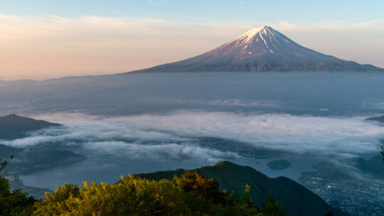
Hiked on Oct 29, 2022 . Mt. Ryugadake 竜ヶ岳 – Hashita-toge – 端足峠 – Mt. Amagadake 雨ヶ岳 Duration: 2 days Distance: 16.5 km Elevation change: 1154 metres Highest point: 1964 metres Start: Lake Motosu Iriguchi...
Hiked on Sep 16, 2022 . Mt. Nishiyamatakatori 西山高取 – Koroyama-santaki 黒山三滝 – Koburi Pass 顔振峠 Duration: 6 hours Distance: 15.7 km Elevation change: 520 metres Highest point: 580 metres Start: Ogose...

Choice Storage Container for your Backpacking Gear Hiking by its very nature almost guarantees that over time you’ll acquire a range of gear that requires a home when not stuffed in a backpack. Easier said than done, until you remember you live in...
Hiked on Aug 22, 2022 . Mt. Shimodaikura 下台倉山 – Ikeno-dake 池ノ岳 – Tamago-ishi 玉子石 Duration: 12 hours Distance: 24.6 km Elevation change: 1326 metres Highest point: 2141 metres Start: Takanosu Kogen...
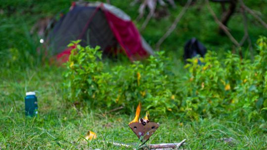
Spending 24 hours in Nature If one overnight summer camp and BBQ isn’t quite enough, you can always head back for more. That was the maxim I clung on to this week as I again sought refuge from the hustle, bustle, and heat of Tokyo. Camping at 1,000...
Hiked on Aug 7, 2022 . Hotaka-jinja 武尊神社 – Kengamine 剣ケ峰山 Duration: 7.5 hours Distance: 13 km Elevation change: 1058 metres Highest point: 2158 metres Start: Urami-no-taki carpark Finish: Urami-no-taki...
Hiked on Jul 25, 2022 . Hibara-toge 日原峠 – Dohyo-dake 土俵岳 – Koyuzuri-toge 小棡峠 Duration: 2 days Distance: 12.3 km Elevation change: 813 metres Highest point: 1098 metres Start: Shin Sannobashi Bridge Bus Stop...
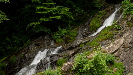
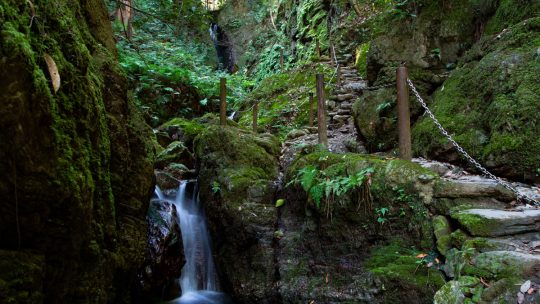
Hinohara Village ‘Takimeguri’ Waterfall Tour Continues This blog post continues my Hinohara Falls Tour Hinohara Takimeguri ひのはら滝めぐり a photographic journey of the 13 main waterfalls in Hinohara Village, Tokyo. Apart from the four...
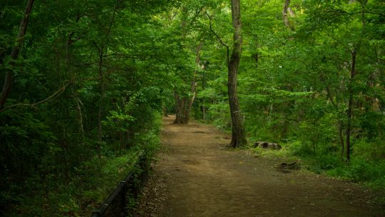
A Nature Fix Without Leaving the City With Tokyo in the grip of the worst June heatwave since 1875 means hiking nearer to the city will have to take a back seat thanks to the searing sun, sky-high temps, and pea-soup humidity. As I write, central...
Hiked on Jun 18, 2022 . Daimyojin Observation Deck 大明神展望台 – Lake Sagami 相模湖 The trail via Kenkyoji Temple has been repaired, and it is now possible to undertake the hike as a loop course, starting and finishing at the Sekrozan Iriguchi bus...
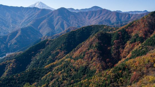
Hiked on May 24, 2022 . Jinzasan 神座山 – Mt.Shakagatake 釈迦ヶ岳 – Shindo Pass 新道峠 Duration: 2 days Distance: 18.4 km Elevation change: 1028 metres Highest point: 1793 metres Start: Himine jinja mae Bus Stop ...
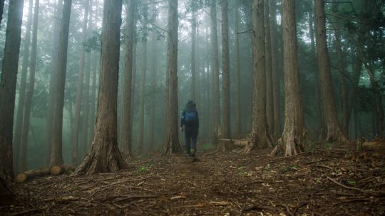
Planning and Managing Risks on the Trail During my formative days hiking in Japan, I must confess I didn’t devote much time to planning my hikes even the overnight ones. My usual approach back then was print out a hike some random person posted on...