.
Mt. Kentoku 乾徳山 – Mt. Kurogane 黒金山 – Nishizawa Gorge 西沢渓谷
Distance: 16.8 km
Elevation change: 1401 metres
Highest point: 2231 metres
Start: Kentokusan Tozanguchi Bus Stop
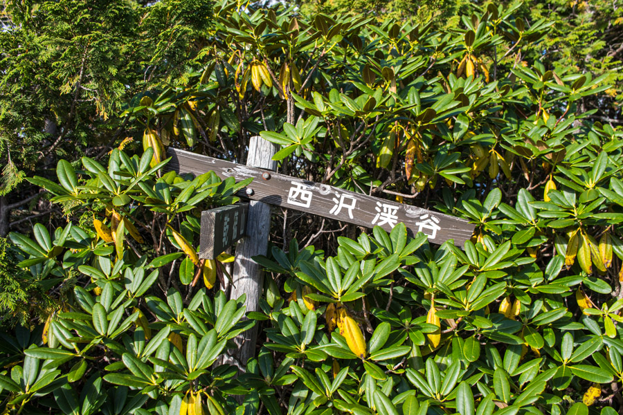
Finish: Nishizawa keikoku iriguchi Bus Stop
Difficulty: ▅▅▅▅▅▅▅▅▅▅ ❺
Map: Yama to Kogen Chizu 山と高原地図 [No.28 金峰山・甲武信 KINPU-SAN·KOBUSHI]
GPX TrackKML TrackGSI MAPPDF Topo Map
Staying the Course: A Time-honoured Hiking Route
If I had to describe Mt. Kurogane using only one word it would be unspoiled. A rare distinction for a mountain in the western part of Tokyo. This is mostly credited to its seclusion. Up until May 2014 it was only accessible by either an out-and-back trail hike, or piston from the from either the Nishizawa Gorge or Mt. Kentoku trailhead both of which took upwards of 8 hours. With the extension of the Kentokusan Forestry Road 乾徳山林道 means it is now possible to reach the summit in about 1 hour and 40 minutes (note the forestry road is closed during the winter). This overnight hike is a mishmash of the former routes setting off from the Mt. Kentoku trailhead and finishing at Nishizawa Gorge.
Day 1: Long Climb to a Remote Okuchichibu Peak (8 km)
Getting to the Kentokusan Tozanguchi Bus Stop (30 mins, 660 yen) entails taking either a Limited Express or local train to Enzan Station 塩山駅 and transferring to a bus bound for the Nishizawa Gorge. Note this timetable is seasonal. From mid-April to the end of September it runs only on weekends and public holidays. Exceptions to this rule include Golden Week, 9 July to 15 August and 1 October to November 20 where it runs daily. If hiking on a weekday out of season you will need to alight two stations further along at Yamanashishi Station 山梨市駅 and take a bus from there. As the first day is quite long, I recommend catching as early bus as possible or shelling out for a taxi (approx. 4,000 yen) if there is two or more of you.
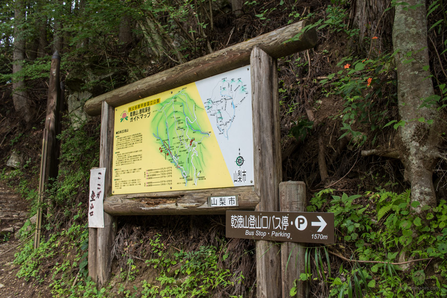
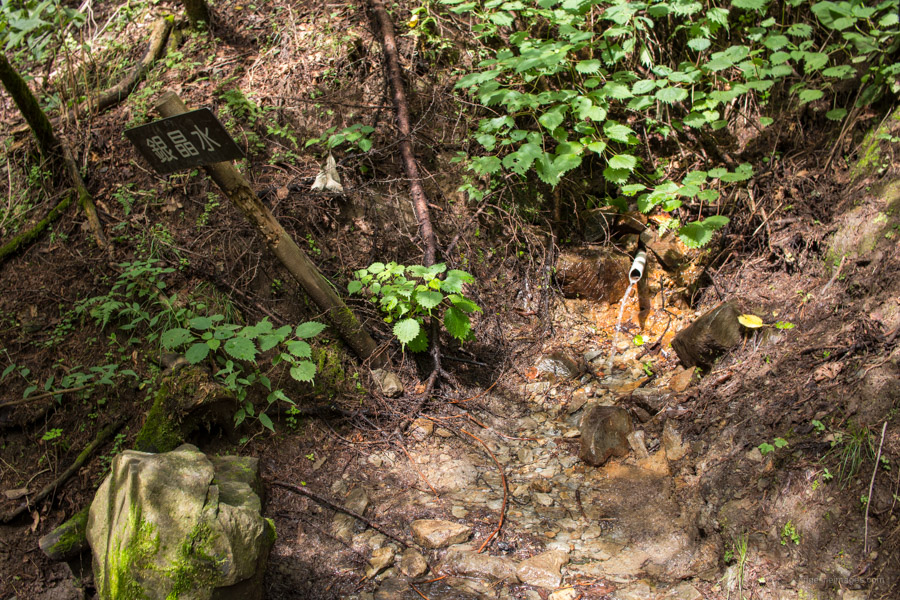
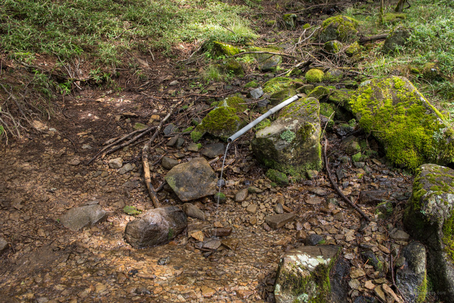
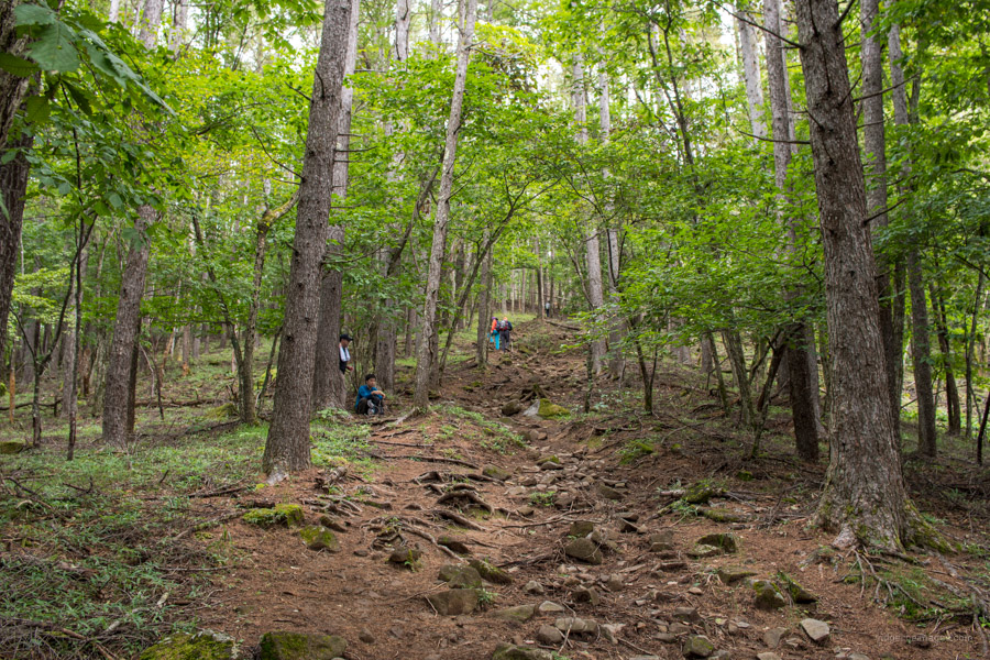
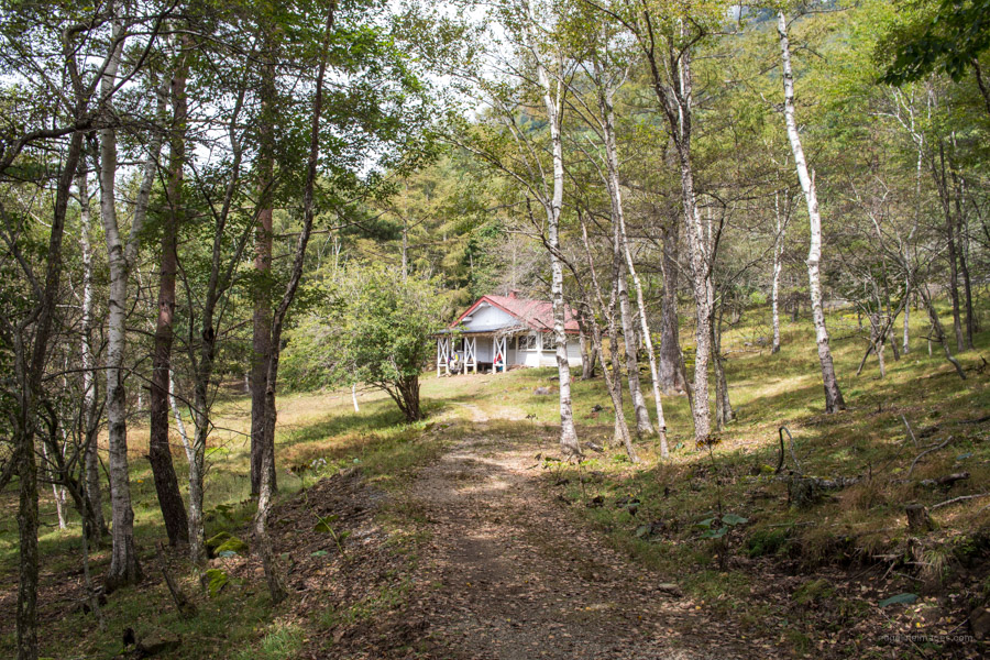
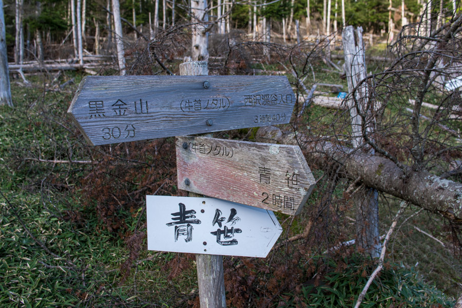
From the bus stop cross the Tokuwa River and start heading up the road. Look for a signboard signalling 1,520 metres to the Kentoku trailhead 乾徳山登山口. After passing the Kentoku Shrine the road rounds a couple of bends before arriving at the trailhead proper. The trail starts off relatively benign as it crosses a forestry road before reaching the first of two water holes 銀晶水. Next up is the curiously named Komadome 駒止 and second water hole a few hundred metres shy of the snowy coloured Kougen Hut 高原ヒュッテ. Fill up to the brim here as it will be your last chance to collect water before finishing at the Nishizawa Gorge. Part of the reason I assigned the hike a five-star difficulty rating is because you need to carry water a good portion of the 1,400 metres in elevation gain on the first day.
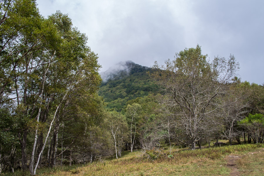
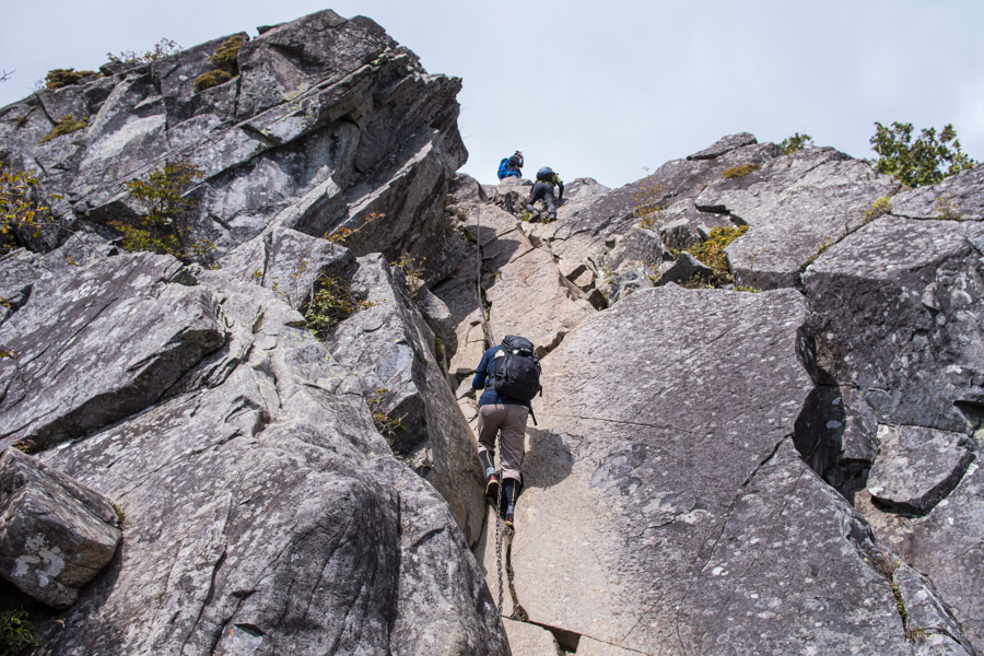
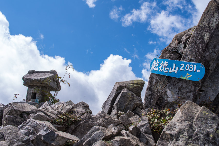
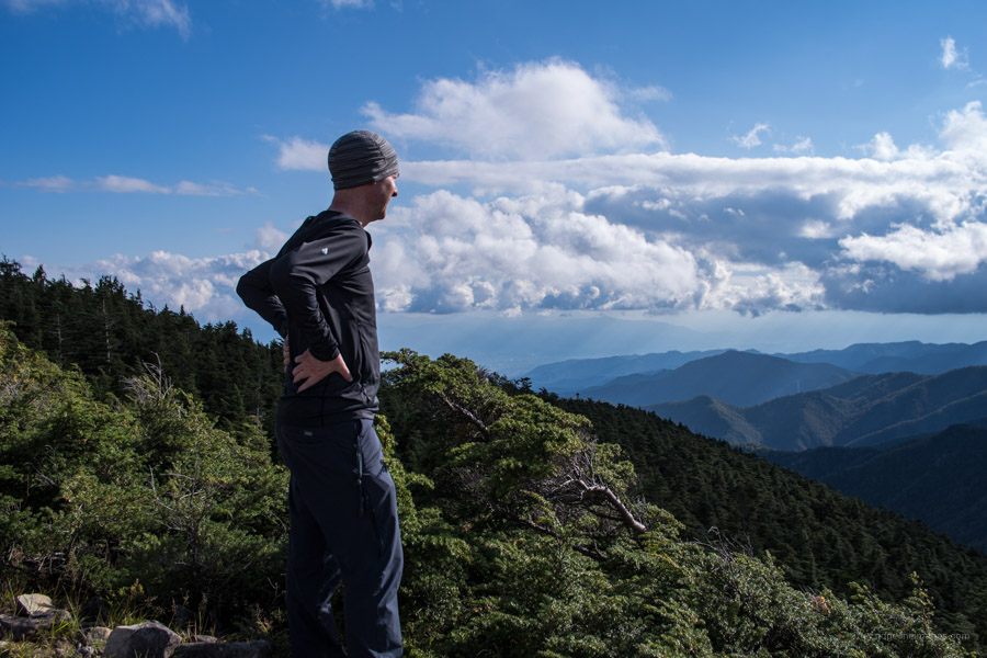
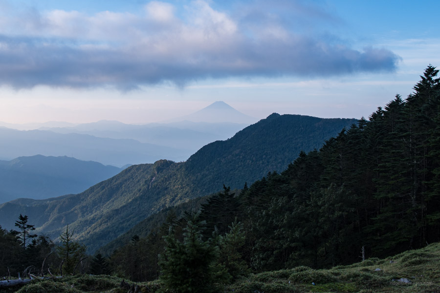
Continue through the Kokushigatake 国師ヶ原 grassland with its plentiful deer and Mt. Kentoku looming in the backdrop. In fine weather enjoy views of Fujisan and the moon too apparently from Tsukimi-iwa 月見岩. Another hour of steady climbing and occasional chain use steers you to the summit of Mt. Kentoku (2,031 m). The peak is rightly bestowed as one of Japan’s 200 Famous Mountains attracting large numbers of weekend warriors on sun-drenched mornings.
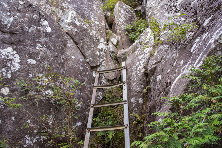
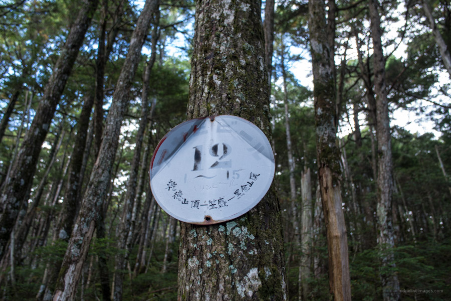
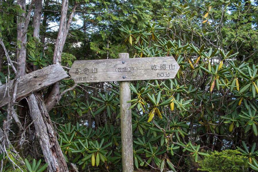
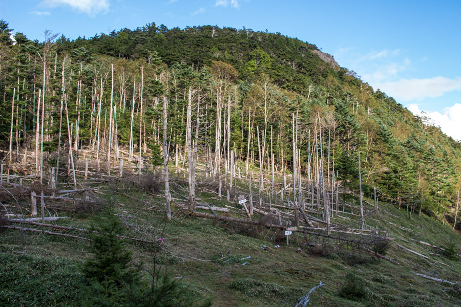
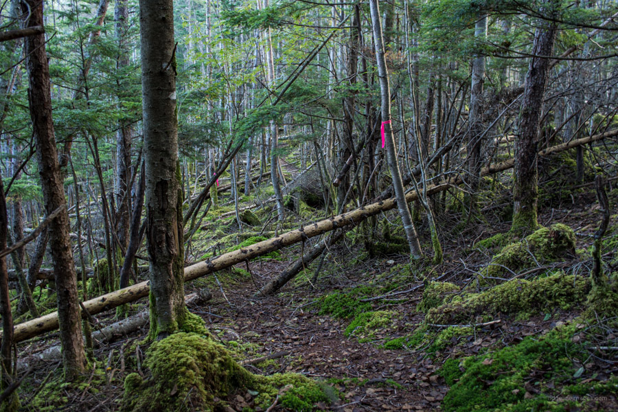
After grabbing some summit pics, head down a small ladder and make your way toward Mizu Notaru 水ノタル, where a lesser-used trail leads back to the Kougen Hut. This is also likely the last place you’ll see anyone until you reach Nishizawa Gorge—or at least it was for me, even on a long weekend. The forest between this junction and Kuroganeyama has largely escaped the ravages of logging, leaving a stretch of pristine, virgin forest. It’s a real treat to hike through this section, especially after battling the crowds on the way up. While the trail can be a little indistinct at times, the hot pink tape does a good job of keeping you on track—though bringing a handheld GPS is a good idea for peace of mind. Also, keep an eye out for the numbered metal plates (1–15) nailed to trees, sponsored by none other than Asahi Beer!
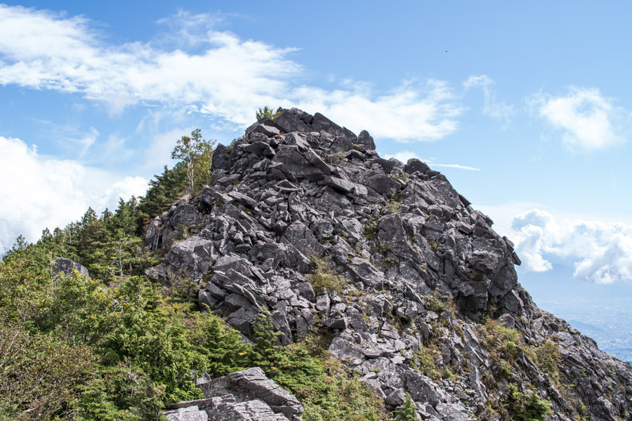
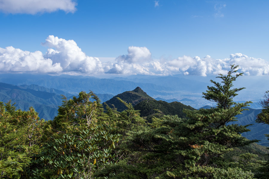
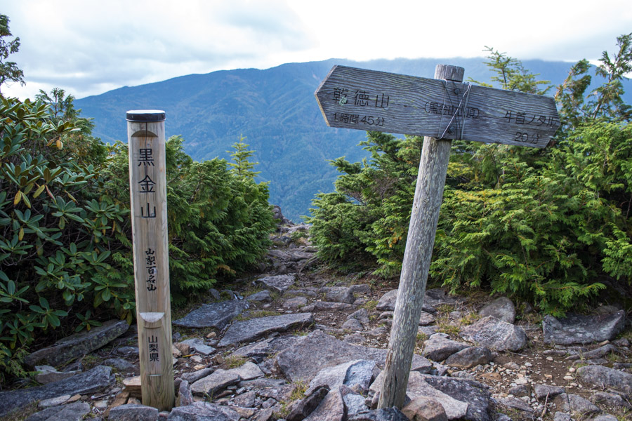
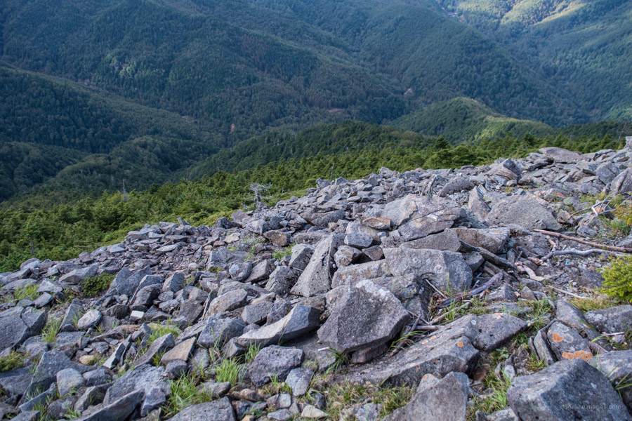
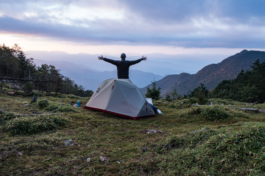
Halfway along finds Kasamoriyama 笠盛山 (2,072 m) and some fine views back towards Mt. Kentoku. From here it takes another hour to the rock-strewn summit of Mt. Kurogane (2,231 m) the highest point of the hike. The summit offers a 180-degree view of the main Okuchichibu ridgeline stretching from Karisaka Toge thru Kokushigatake in the north. The final mission of the day is hiking down to an improvised campsite at Ushikubi notaru 牛首ノタル or the Cow’s Neck. I selected this spot for its commanding views in the direction of Fujisan. The only flat spot I spied was smack bang in the middle of the trail, whilst not ideal ensured I wouldn’t leave any trace.
Day 2: Narrowly Avoiding Misadventure on the Home Stretch (8.8 km)
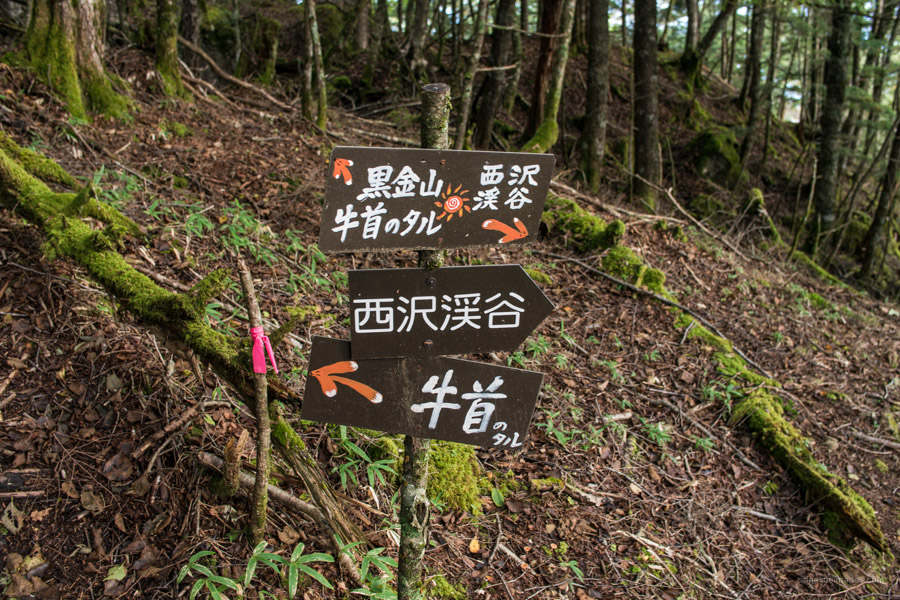
I slept like a log helped by the fact the deer around this neck of the cow woods are more genial than their cousins back at the Kougen Hut. By sunrise, the overnight mist had vanished revealing a nice vista from the tent. From Ushikubi notaru the trail skirts behind 牛首 before rising and falling over a couple minor 2,000-metre plus peaks (no views). In a similar vein to the previous day the trail is adorned with pink tape intermixed with the occasional signpost. After 50 minutes you’ll find a trail branching off on the right but just ignore it and continue heading down.
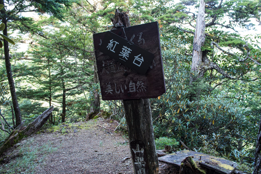
Once you reach the Koyo-dai 紅葉台 the trail steepens as it approaches the far end of the Nishizawa Gorge. Since the lengthening of the Kentokusan Forestry Road it appears the trail maintenance hasn’t been a priority with most of the old steps gone to wrack and ruin. Take it slow and steady using the tree roots if need be to cope with the steeper bits.
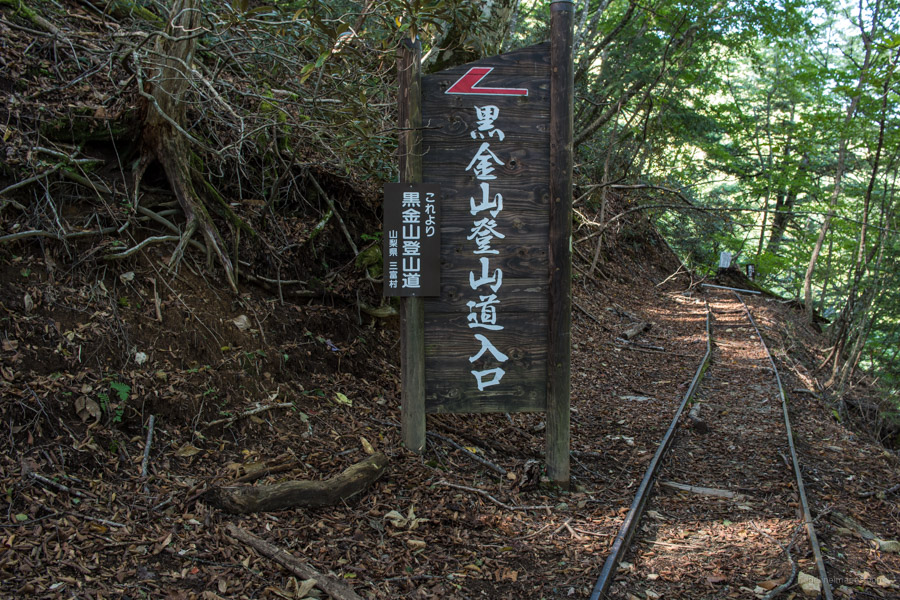
Arriving at the Mt. Kurogane trailhead I gave myself a pat on the back for making it down safely. This might have been a little premature as an ominous 通行止め (tsukodome) trail closure sign awaited me. Before each hike I carefully research each route to avoid this exact predicament. The most recent YamaReco hiking report dated from late August didn’t mention this issue only that access after Mieno Falls on the north side of the ravine was impassable.
At least the trail wasn’t roped off. As you could imagine I wasn’t in the mood for dilly-dallying and hurriedly marched towards the exit. Fortunately, there was only one dodgy section that required using rope some workman had affixed to get past a road collapse. Needless to say, if I were coming from the opposite side, I would have called it quits. The unnecessary stress could have been avoided if one I had delved a little more before undertaking the hike and had a trail closure notice been placed at Ushikubi notaru. If you’re planning to try this hike hold off until Golden Week or instead loop back past the Kentokusan Forestry Road carpark and finish at the Amashina 天科 bus stop.
Under normal circumstances from the Mt. Kurogane trailhead it’s a pleasant 90-minute walk via the Nishizawa Ravine Path 西沢渓谷歩道 to the Nishizawa keikoku iriguchi bus stop for the return trip to Enzan Station (1 hr, 1,050 yen).


Thanks for the report. Just wondering if whole loop of Nishizawa trail is closed or just the return part that follows abandoned log railroad ?
It’s basically the whole loop Naresh. On the ravine side the furthest you can go is the Mienotaki 三重の滝 and on the railroad side it’s completely closed off.
Hi! Thanks for all your explanations!
I want to do this trail (Kentoku-Kurogane-Nishizawa) this weekend, camping one night. Do you know if the trail is open or if is there any trouble or section close? I tried to look at the Yamanashi webpage but I could not find any info…
Hi Javier, sorry somehow I missed your comment. For others intending to follow this route the trail is passable (at least until late Nov) so you shouldn’t expect any trouble.
Thank you! I was just looking for this information and I am happy to find it here. 🙂
I’m pleased to hear that 😊
David,
Great information, thank you. I’m hoping to do this the first weekend of August… I’d like to park near the Kentoku trailhead, and then take a bus (or taxi) from Nishizawa back towards the Kentoku trailhead. However, it looks like the Nishizawa Keikoku Iriguchi bus stop is permanently closed. Do you know if there are other buses that I could take back to my car?
Thanks in advance!
Hi Chris, as far as I can tell, the Nishizawa Keikoku Iriguchi bus stop is indeed open. From mid-July to mid-August, buses from there to both Enzan Station and Yamanashishi Station run on weekdays and weekends. Both routes pass via the Kentoku trailhead, so you should have no trouble getting back to your car after the hike.
If you’re doing it as a day trip, just note the last bus to Yamanashishi Station is at 4:25 pm, and the last to Enzan Station is at 3:40 pm. Hope that helps–enjoy the hike!
Great information, thank you!
Hey David,
Few follow up questions:
How long do you think it takes to go from Kentoku trailhead to the Ushikubi notaru camp spot? I’m planning to do this with some friends on 8/2-8/3. Coming from a few hours away in a car, and wondering what’s a good time to start the hike.
Also, do you thinking 5 tents would fit at the Ushikubi camp spot?
Thanks again!
Hey Chris,
Just checked my photos from that hike, and it took around 6 hours from the Kentoku trailhead to Ushikubi, moving at a steady pace with minimal breaks. As I mentioned in the trail report, you’ll need to carry all your water for camp and cooking up a good part of 1,400 metres of elevation gain on Day 1, since there’s no reliable water source after the Kougen Hut. Personally, I’d rate this as one of the toughest hikes in the Kanto region, mainly because of the water haul and steep ascent.
Also, Ushikubi isn’t an official campsite, so flat ground is pretty limited. Fitting five tents would be a stretch, maybe doable with compact solo tents and some creativity, but it wouldn’t be ideal.
If you’re driving in from a few hours away, I’d aim to be on the trail no later than 9 am to give yourselves enough margin.