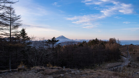
Hiked on Oct 31, 2020 Nov 10, 2021 . Gan-toge 雁峠 – Kasatori-goya 笠取小屋 – Tama River Headwaters 多摩川源流 Duration: 2 days Distance: 20 km Elevation change: 893 metres Highest point: 1953 metres ...
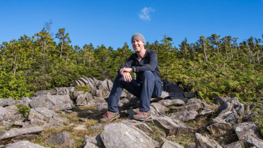
David grew up in the eastern suburbs of Melbourne, Australia, with hiking and outdoor pursuits being a major part of his life for as long as he can remember. He has been writing, snapping photos, and sharing his adventures on RIDGELINEIMAGES.com since 2013.
At university, David majored in environmental management and holds a Graduate Diploma of Education. He has been living in Japan for over 15 years, first in Fukushima Prefecture and now in the Tokyo Metropolis. With a love of hiking and photography, he felt the best way to combine the two was a blog to provide some inspiration for others to enjoy the myriad of trails and outdoor offerings on Tokyo’s doorstep. You can follow David on Instagram @ridgelineimages.
Hiked on Oct 31, 2020 Nov 10, 2021 . Gan-toge 雁峠 – Kasatori-goya 笠取小屋 – Tama River Headwaters 多摩川源流 Duration: 2 days Distance: 20 km Elevation change: 893 metres Highest point: 1953 metres ...
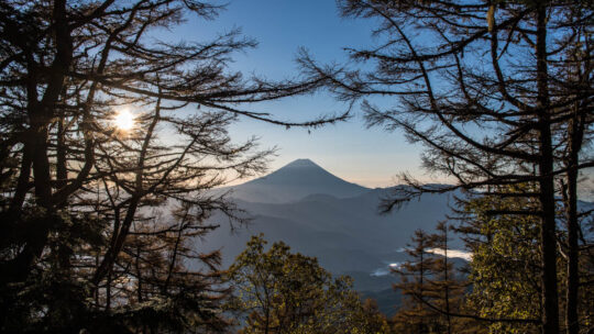
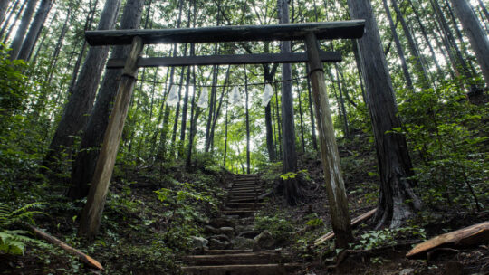
Hiked on Oct 24, 2020 . Himuro Shrine 氷室神社 – Hokora Hut ほこら小屋 – Mt. Hadaka 裸山 Duration: 2 days Distance: 16.2 km Elevation change: 1276 metres Highest point: 2052 metres Start: Hirabayashi Bus Stop...
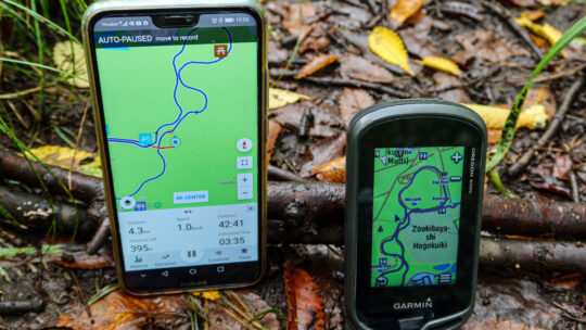
Viewing Interactive GPS Maps Then & Now Not long after starting this blog I began using the pro version of WP Google Maps, a WordPress plugin to plot ‘polylines’ to display my hiking routes on Google Maps. As I commented at the time not having...
Hiked on Sep 30, 2020 . Wada Hut 和田小屋 – Kaguragamine 神楽ヶ峰 Duration: 8 hours Distance: 13.9 km Elevation change: 925 metres Highest point: 2145 metres Start: Carpark below Wada Hut Finish: Carpark below...
Hiked on Sep 21, 2020 . Mt. Kentoku 乾徳山 – Mt. Kurogane 黒金山 – Nishizawa Gorge 西沢渓谷 The Nishizawa Gorge hiking trail closes during winter (December 1st-April 28th subject to change depending on snowfall) for the latest information please...
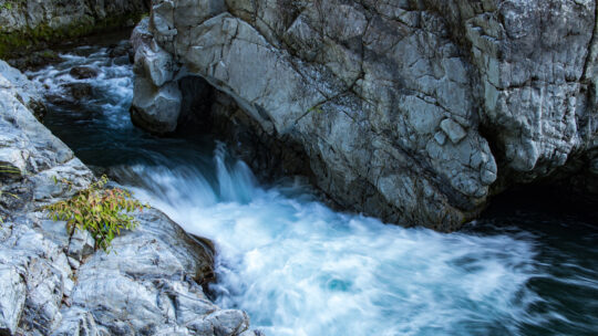
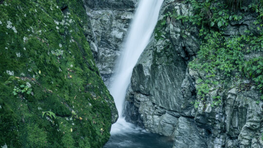
Hinohara Village ‘Takimeguri’ Waterfall Tour This blog post continues my Hinohara Falls Tour Hinohara Takimeguri ひのはら滝めぐり a photographic journey of the 13 main waterfalls in Hinohara Village, Tokyo. Apart from the two waterfalls...
Hiked on Aug 19, 2020 . Komanogoya 駒ノ小屋 – Chumon-dake 中門岳 Duration: 8 hours Distance: 17.6 km Elevation change: 1233 metres Highest point: 2133 metres Start: Mitori Auto Campground Finish: Mitori Auto...
Solo Summer Hike and Camp in Okutama Arriving mid-morning at Okutama Station during the Obon holidays was, as expected, bustling with activity. Perhaps a little surprising given COVID-19. I made a beeline for one of the two diminutive buses headed...
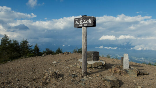
Hiked on Aug 1, 2020 . Nyukasa Marsh 入笠湿原 – Mt. Nyukasa 入笠山 Duration: 2 days Distance: 23.3 km Elevation change: 1095 metres Highest point: 1955 metres Start: Aoyagi Station (Chuo Main Line) Finish:...
Hiked on Jul 17, 2020 . Suwa Shrine 諏訪神社 – Mt. Ogamiyama 越上山 – Yugate ユガテ Duration: 4.5 hours Distance: 11.9 km Elevation change: 396 metres Highest point: 566 metres Start: Agano Station (Seibu...
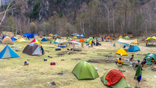
Tracking Down Campgrounds Like Pro There is no shortage of camping locations in Japan in fact there are over 3,000 campgrounds according to this Japan National Tourism Organization (JNTO) travel guide. They can be found in just about every nook and...
Rainy Season Delights at a Suburban Tokyo Park A mere 25 km (16 mi.) from Shinjuku Station finds one of Tokyo’s most underrated parks that being Hachikokuyama Park 八国山緑地. Together with Kitayama Park abutting to the south it is one of four discrete...
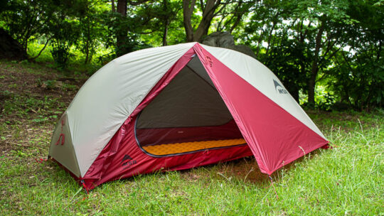
Lightweight, Double-wall Backcountry Workhorse Choosing a lightweight solo backpacking tent is no easy undertaking especially with an ever-expanding range of brands and designs to choose from. However, after much deliberation I settled on an MSR...
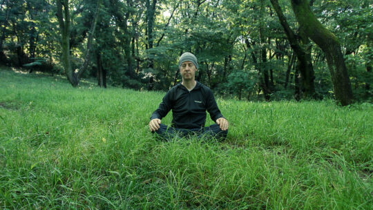
Reduce Stress by Spending Time in Nature Focused or mindful breathing meditation is something I have been practising on and off for a long time now. I first came across the method in the mid-90s after reading a local newspaper article titled...
Hiked on Jun 16, 2020 . Saitama Prefectural Nature Park – Noyamakita-Rokudoyama Park Duration: 4 hours Distance: 12.9 km Elevation change: 60 metres Highest point: 172 metres Start: Seibu-Kyujo-mae Station ...

A Simplified Backpacking Cook Kit One of my resolutions this year was to lighten my base weight. It’s easier said than done. First up I tackled my first aid kit, followed by some upgrades to my sleep system and shelter with a Nemo insulated...