.
Nyukasa Marsh 入笠湿原 – Mt. Nyukasa 入笠山
Distance: 23.3 km
Elevation change: 1095 metres
Highest point: 1955 metres
Start: Aoyagi Station (Chuo Main Line)
Finish: Fujimi Station (Chuo Main Line)
Difficulty: ▅▅▅▅▅▅▅▅▅▅ ❸
Map: Yama to Kogen Chizu 山と高原地図 [No.44 北岳・甲斐駒 KITA-DAKE·KAIKOMA]
GPX TrackKML TrackGSI MAPPDF Topo Map
Best-in-class Hiking for Families, Beginners, and Adventure Seekers
Mt. Nyukasa lies at the north end of the Southern Alps in Nagano Prefecture though technically falls outside the Minami Alps National Park. Normally climbed as a leisurely day hike but can also be tackled as an overnighter with two campgrounds below the summit. The mountain is famed for its flowers which bloom from spring thru autumn in the Nyukasa Marsh and Wild Lily of the Valley (Suzuran). In the winter, the mountain slopes become the ‘Fujipara’ ski resort.
Day 1: Skip the Gondola and ‘Hike Like a Boss’ (11 km)
If you’re doing this as a day hike get off at Fujimi Station 富士見駅 and take the free Fujimi Panorama Shuttle Bus 富士見パノラマリゾート outside the exit which drops you at the lower gondola station. Departs daily from 10:00 with the last return bus leaving the lower gondola station at 15:00. For those coming by car there is a large carpark at the Sawairi trailhead 沢入登山口 for an out-and-back piston climb. If you’re after a little adventure I recommend hiking this mountain ‘like a boss’ directly from the Chuo Main Line. For starters you’ll meet next to no one as extremely few hikers start out from Aoyagi or Suzurannosato stations, you get to partake in lovely lowland forest as well as bask in the glory of having climbed near on 1,100 metres in vertical elevation.
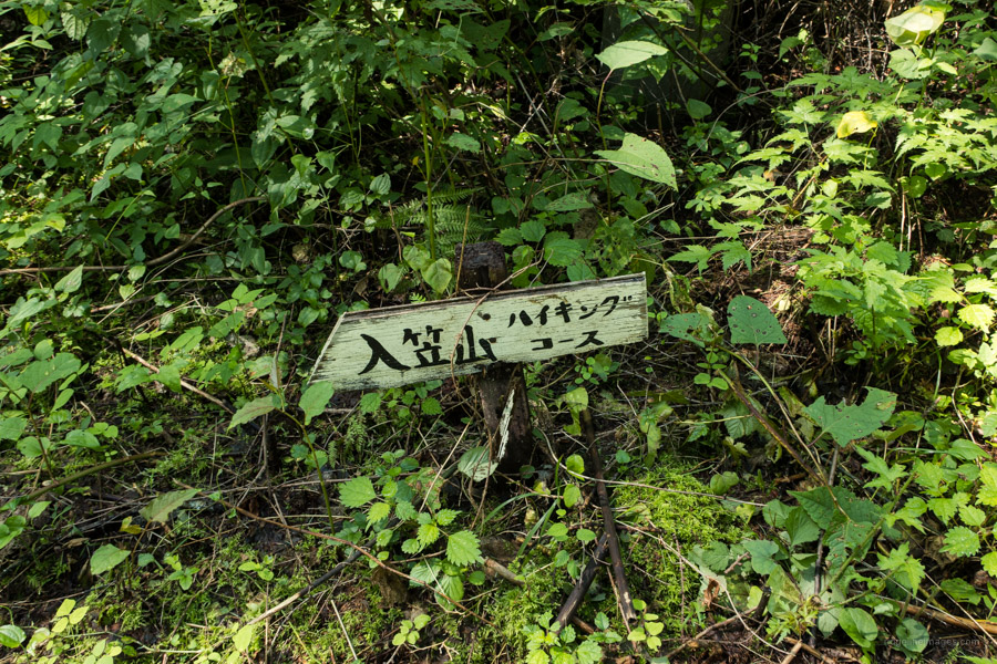
To avoid the heat and ‘3Cs’ I took a 05:30 local train from Kokubunji Station, transferred once at Takao and arrived at Aoyagi Station 青柳駅 approximately 3 hours later (2,490 yen). The train was thankfully sparsely patronised. After exiting the station head across the Miyagawa River turn right past the liquor store and an old wooden building which looks straight out of the Taisho period. Cross the main highway and start snaking your way up the back streets. After 15 mins you should come across a faded sign 入笠山登山口コース motioning you up a 4WD track. The trail isn’t very well signposted so carry a handheld or smartphone enabled GPS.
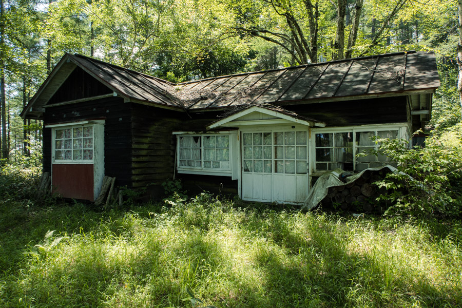
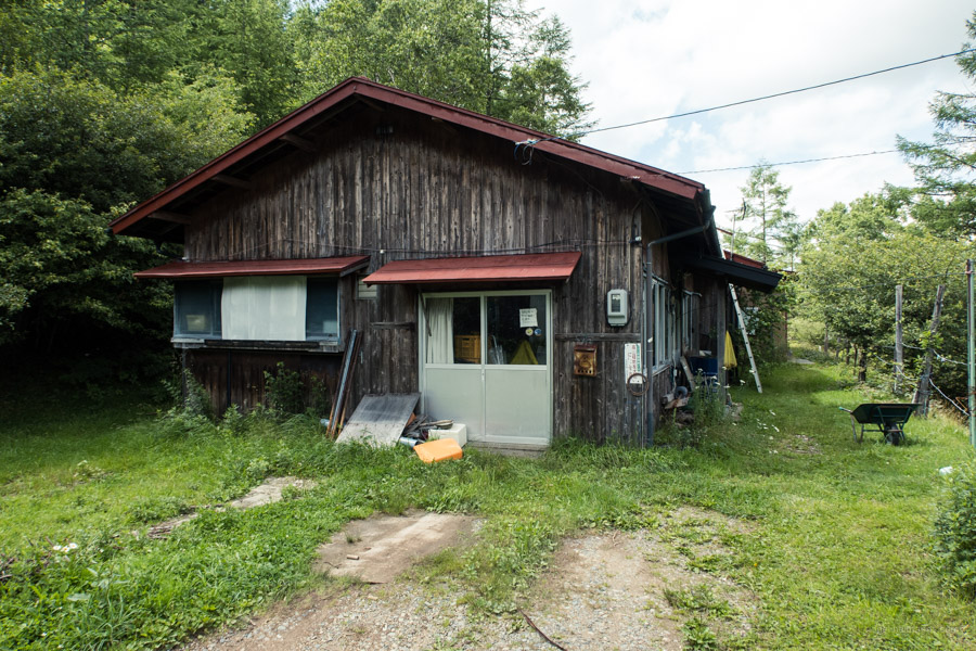
Another 15-minutes of walking brings you to the trailhead proper. To say the start of the trail is overgrown would be a vast understatement. For the first 100 metres or so prepare to battle through a green wall of foliage. Mercifully, it soon peters out and becomes much easier to follow. At regular intervals, the trail crosses a vehicular road that winds its way up the mountainside. After another hour of walking you’ll arrive at a derelict mountain hut. A seemingly idyllic spot but evidently too far from the main tourist haunt to survive. Sit on the inviting log outside the cabin for an opportune rest stop.
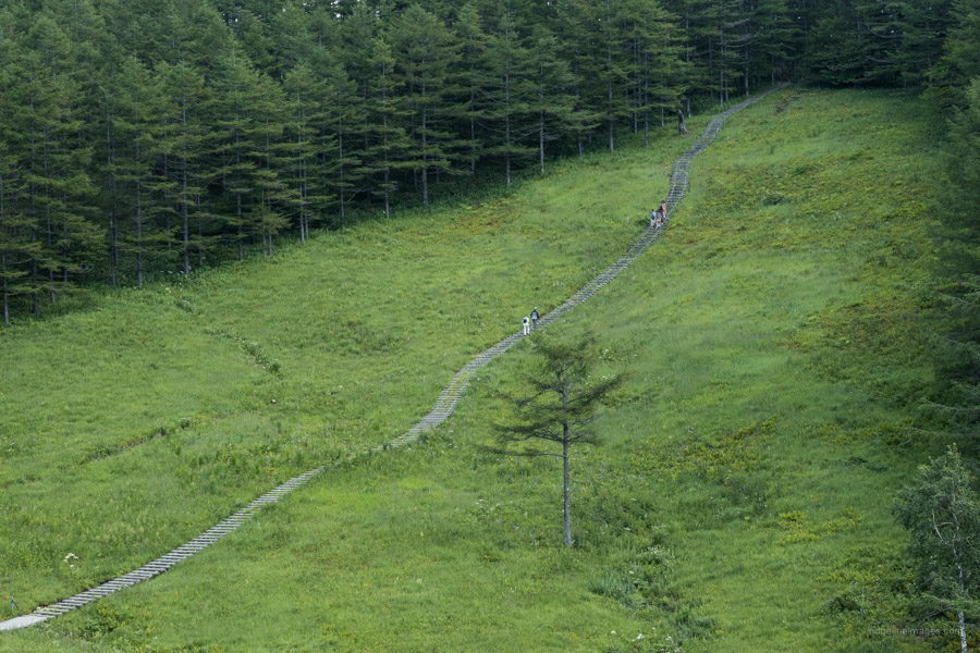
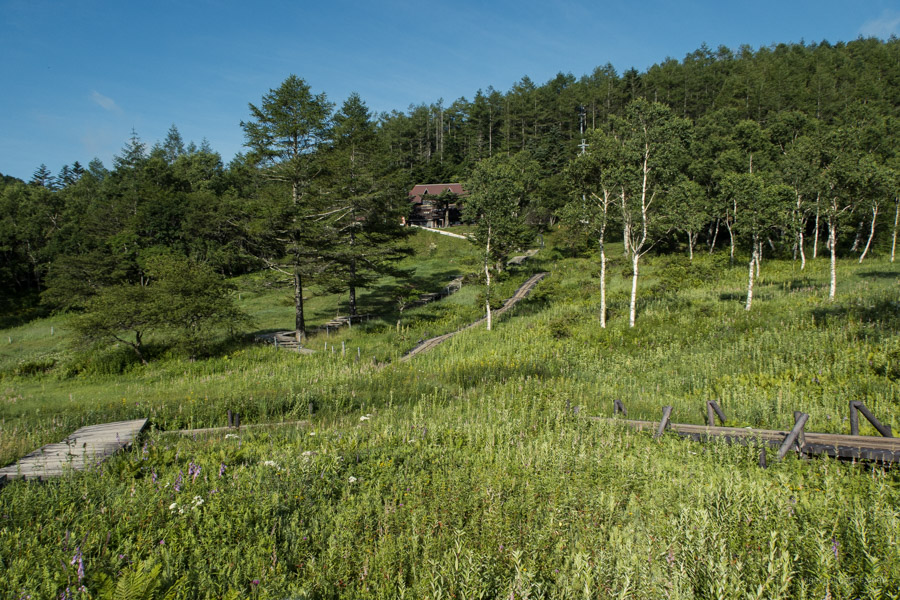
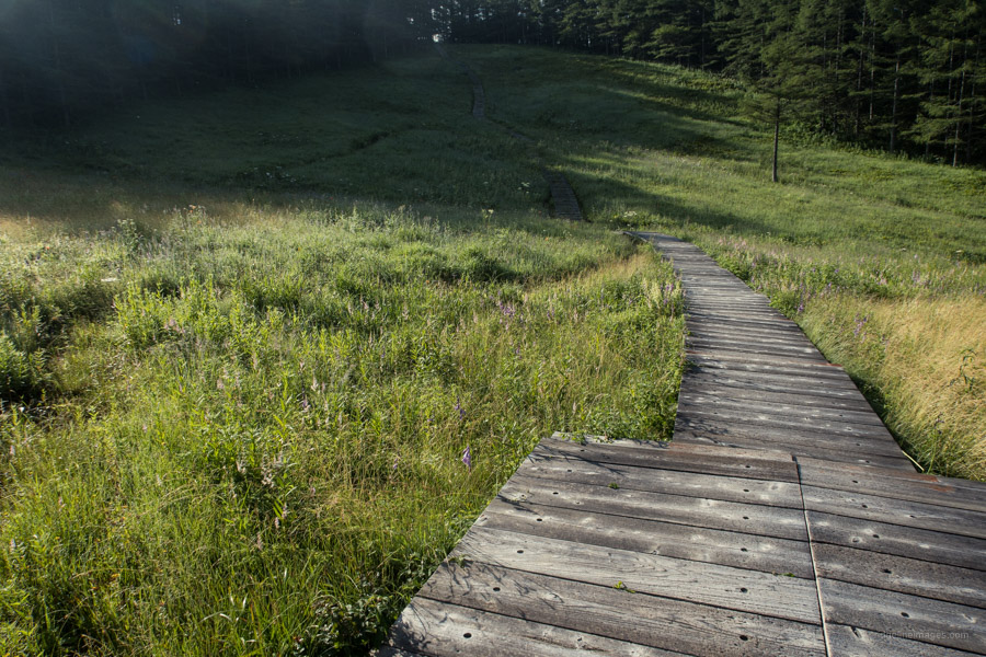
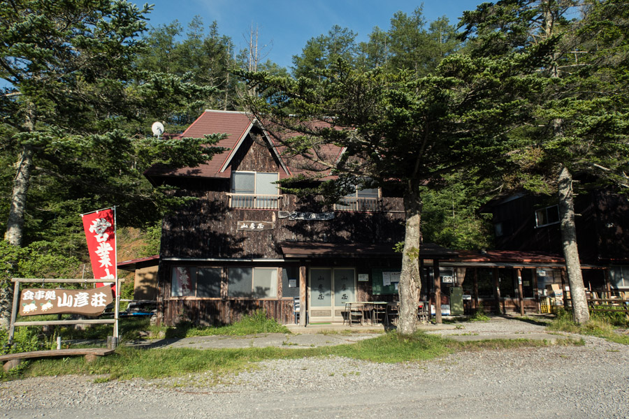
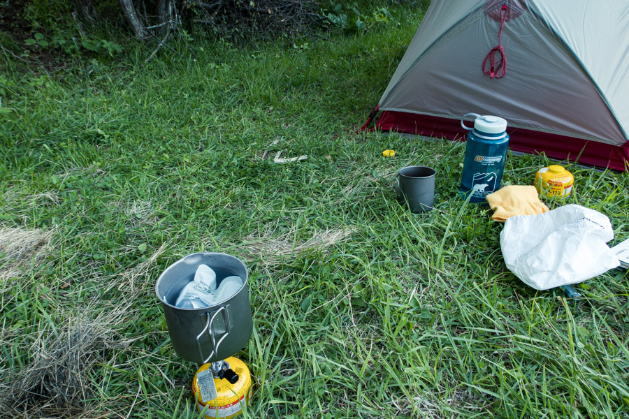
When you’re ready to head off stick to the vehicular road as you steadily make headway towards the Nyukasa Marsh 入笠湿原. Along the way you’ll pass several mountain huts most of which were closed on this particular weekend. Only the Yamabiko and Manaslu lodges at the trailhead were open. Feeling pooped out from summer heat I headed directly to the Nyukasa House 入笠JAハウス campground a 25-minute walk away.
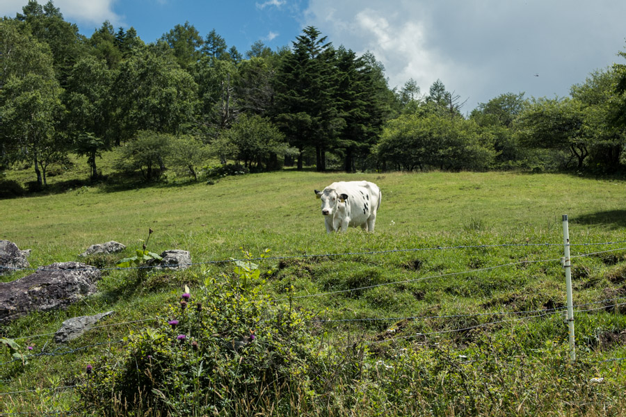
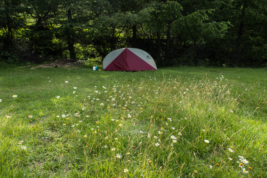
Upon arrival the owner asked if I had made a reservation to which I replied I hadn’t. At first, he grumbled “no reservation no stay” after some gentle persuasion he relented and pointed to a clearing away from the main shaded campground (1,500 yen). Rather fortuitous as a large group set up base camp and weren’t shy in making their presence known. A timely reminder to ring ahead during this time of COVID-19. If you’re planning to camp on a weekend, you’d probably fair better staying at the small campground behind Restaurant Koyoken 紅葉軒 (2,000 yen) adjacent to the Mt. Nyukasa trailhead. As cattle graze in the area it’s recommended to either boil or treat the water at the campground.
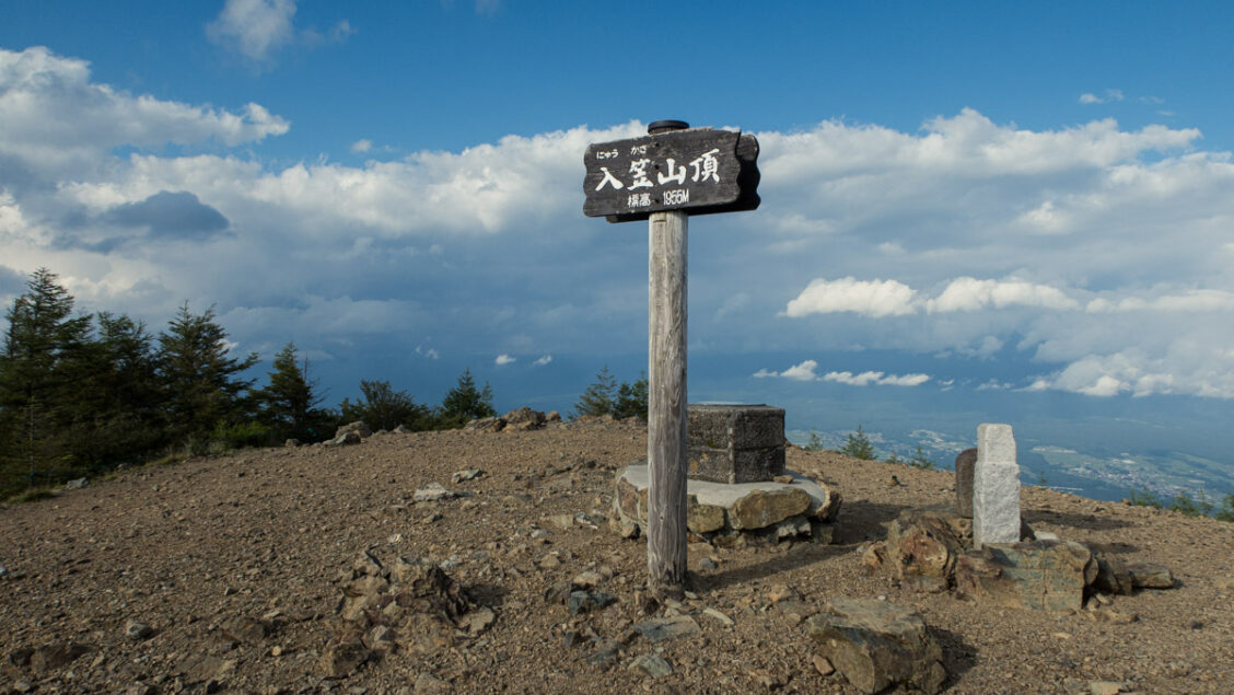
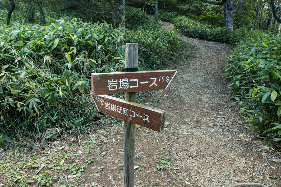
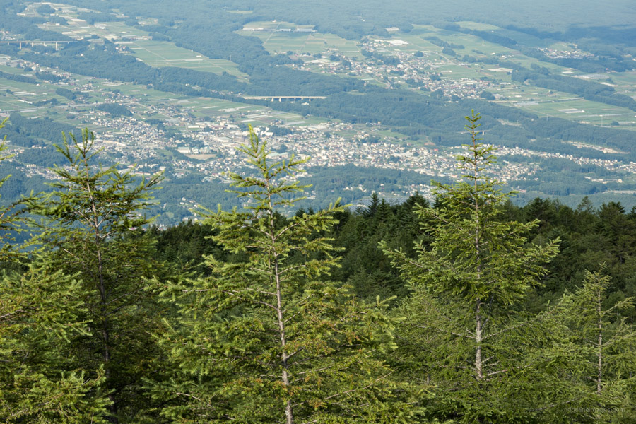
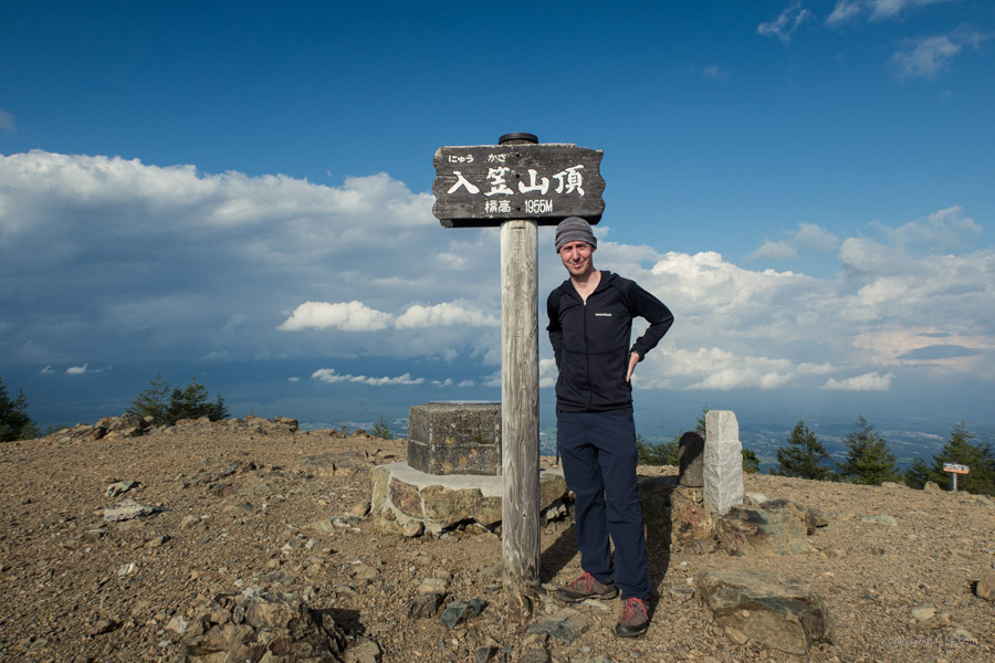
In the late afternoon I returned to the Mt. Nyukasa trailhead for the short 30-minute climb to the summit (1,955 m). Halfway up you can choose from two paths which lead to the top. Fine weather provides a commanding 360-degree panorama spanning the Southern, Central and Northern Alps taking in 22 of Kyuya Fukada’s auspicious Nihon Hyaku-meizan.
Day 2: Meadows, Mountain Ridges, and Idyllic Grazing Scenery (12.3 km)
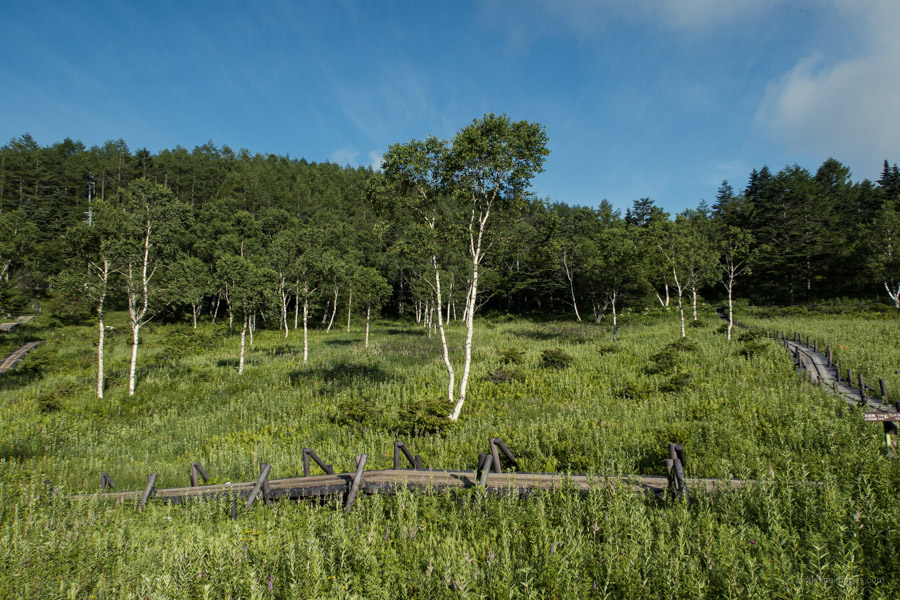
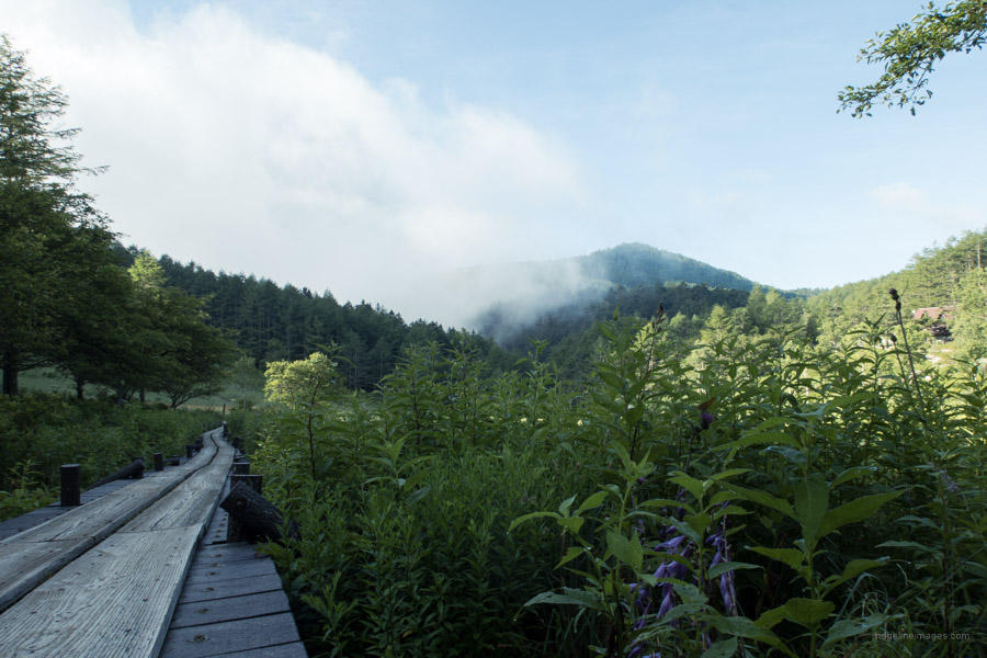
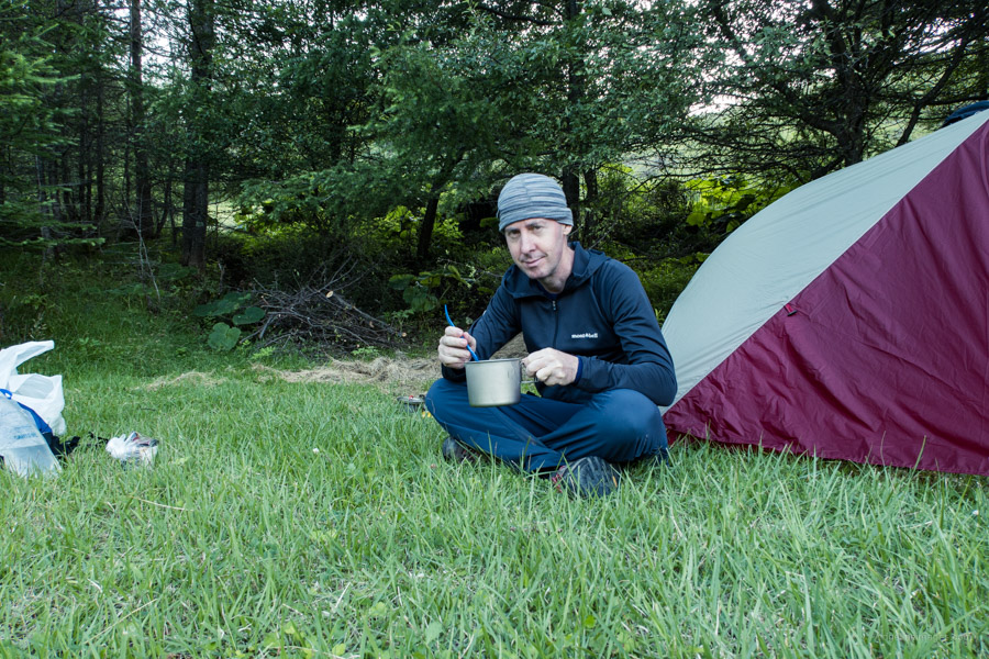
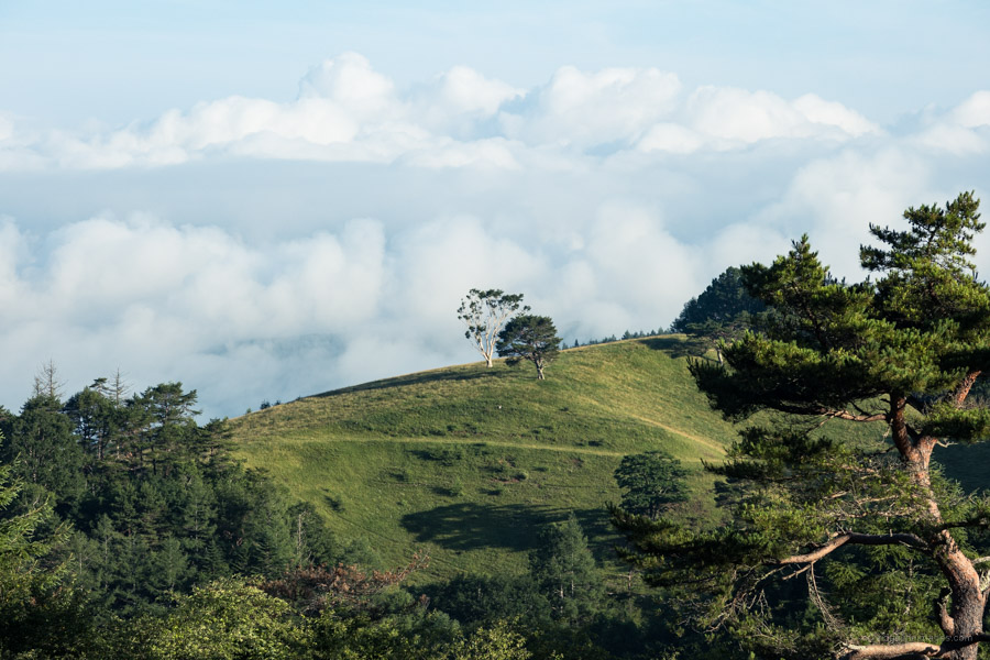
I woke up early, broke camp, and did a quick meishi exchange with the owner, to my surprise he even asked me to return in the autumn! First mission was dropping by the Nyukasa Marsh and wandering around the elevated board walks. Rather than repeating the route from the previous day I decided instead to shoot for Fujimi Station. The hiking trail down to the Sawairi trailhead which begins at the marsh is quite nice with the serenity only punctuated by the steady stream of day trippers heading up.
When you reach the carpark turn left and begin approximately 8 km of roadside walking to Fujimi Station. There wasn’t too much traffic and it’s well shaded. After the final long hairpin turn, veer left just above the Takechi River. When you reach Fujimi Park head right and make your way over to the station. This last part is somewhat convoluted so best navigated using your smartphone or handheld GPS.


Thank you David. A lovely part of the world that I am missing, with my August/September Southern alps hike plans torpedoed by the international travel restrictions.
I have a question: in that area in the lower slopes to the west of national road 20, probably between the line of Nyukasa and Kaikoma, I recall a lovely temple that was plastered in the vertical wall of a small ravine that headed away from a smaller road that paralleled #20. I was there in the mid-90s when I was Japan posted and would love to find it again. Does this description register with you?
Sadly, even the best laid plans sometimes go awry. Hopefully, next year Stewart you’ll be able to realise Southern Alps adventure. I found a minor road which runs parallel to the National HWY 20 however the temples located near it don’t resemble your description. I did find the mighty nice Sekison Shrine which almost fits the bill.
Great to see a write-up and photos of Nyukasa-yama in summer – in winter, we used to go there to introduce beginners to the delights of ski-touring – as a one-day excusrion from Tokyo, using the ski-lifts of the nearby ski resort. The tour is mostly undemanding – indeed, too flat – but the highlights include the view of Yatsugatake, the steep drop-off from the summit, and the fast ski down the pistes of what used to be the Fujimi ski ground. Something for everybody ….
Quite enjoyed this hike and the nice thing is you can make it as challenging or easy-going as you like. By taking the gondola the elevation change is only 150 metres which makes it suitable for families with younger children or for taking a winter peep of Yatsugatake and many other Hyaku-meizan.