Choose Your Next Hike with Confidence With so many hiking trails around Tokyo to choose from it can be tough to know where to begin especially if you’re a novice hiker or new to the prefecture. Over the years probably the single most sought out...
Choose Your Next Hike with Confidence With so many hiking trails around Tokyo to choose from it can be tough to know where to begin especially if you’re a novice hiker or new to the prefecture. Over the years probably the single most sought out...
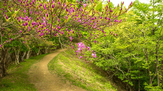
Hiked on Apr 28, 2019 May 5, 2022 . Mt. Jinba 陣馬山 – Maruyama 丸山 – Mt. Mito 三頭山 Duration: 2 days Distance: 28.5 km Elevation change: 1166 metres Highest point: 1531 metres Start: Wada bus stop Finish: Tomin no mori bus stop ...
Hiked on Apr 13, 2019 . Unazawa Otaki Falls 海沢大滝 – Onara Pass 大楢峠 Duration: 5 hours Distance: 14.8 km Elevation change: 340 metres Highest point: 680 metres Start: Shiromaru Station (Ome Line) Finish: Kori Station (Ome Line) ...
Another Piece of the Puzzle Let’s rewind to the early 1960s in Tokyo. The city was in the midst of massive transition both socially and economically, a stark contrast to just 20 years before. If you were a Japanese housewife, you pined for the ‘3Cs’...
Some Great Places to Explore Around Tokyo There’s lots to love about Tokyo including its vibrant culture, nightlife and atmospheric alleyways full of nook and cranny style eating establishments. However, you need the occasional getaway whether...
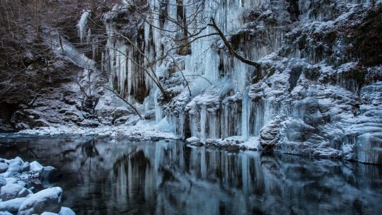
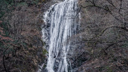
Chichibu’s Natural Ice Sculpture If you’re looking for a day adventure to get your nature fix during the winter months the Misotsuchi no Tsurara 三十槌の氷柱 (Icicles of Misotsuchi) could be just the ticket. Located in a remote pocket in Chichibu, Saitama...
Hiked on Dec 1, 2018 Jan 3, 2022 . Mt. Aso 麻生山 – Mt. Hinodeyama 日の出山 – Tsurutsuru onsen つるつる温泉 Duration: 3.5 hours Distance: 8 km Elevation change: 597 metres Highest point: 902 metres Start: Shiraiwataki bus stop Finish: Tsurutsuru...
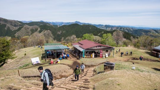
Hiked on Oct 21, 2018 Apr 19, 2022 . Mt. Takao 高尾山 – Mt. Shiroyama 城山 – Mt. Kagenobu 景信山 Duration: 6 hours Distance: 17.2 km Elevation change: 665 metres Highest point: 857 metres Start: Takaosanguchi Station (Keio Takao line) Finish:...
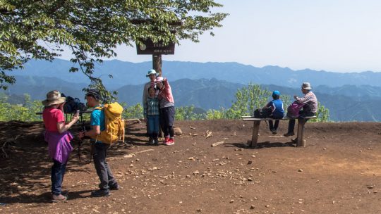
Where to Hike as a Family in the Greater Tokyo Area Hiking with children is a great way to get them connected to the outdoors and enjoy nature but knowing exactly where to go can be a challenge. Thankfully the Greater Tokyo Area has plenty of...
Hiked on Jun 6, 2018 . Irikawa Gorge 入川渓谷 – Arakawa River Starting Point 荒川起点石標 Duration: 4 hours Distance: 12.3 km Elevation change: 290 metres Highest point: 920 metres Start: Kawamata bus stop Finish: Kawamata bus stop Difficulty:...
Hiked on May 5, 2017 Nov 13, 2022 . Mt. Bonomine 棒ノ峰山 – Mt. Sobatsubu 蕎麦粒山 – Mt. Tenmoku 天目山 Duration: 2 days Distance: 19.8 km Elevation change: 1171 metres Highest point: 1576 metres Start: Seitobashi bus stop Finish: Higashi...
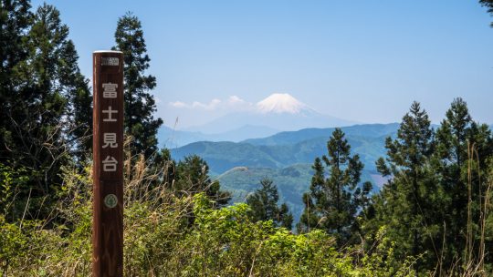
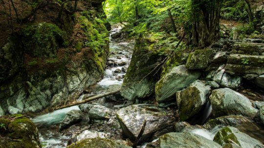
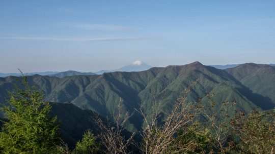
Hiked on Apr 28, 2018 . Tenguno Falls 天狗の滝 – Tsuzuraiwa Rock つづら岩 – Fujimidai 富士見台 Duration: 5 hours Distance: 8 km Elevation change: 764 metres Highest point: 1054 metres Start: Senzoku bus stop Finish: Odake Shonudo Iriguchi bus stop ...
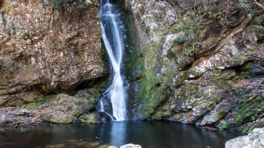
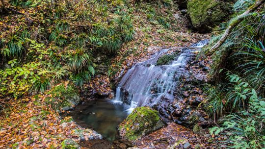
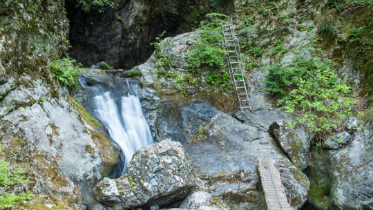
The Tranquil Tenguno Falls Hinohara Village in the backblocks of Tokyo has nature in abundance and is home to several stunning waterfalls including the Odake and Hossawa Falls. Located a stone’s throw away from the latter is the no less imposing...
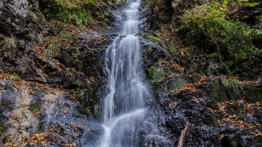
The Perfect Place to Relax and Get Back to Nature Hinohara Village in western Tokyo is home to several scenic spots including the Hossawa and Odake waterfalls, Hinohara Tokyo Citizens’ Forest and Mount Mito to name a few. Adding to this list is the...
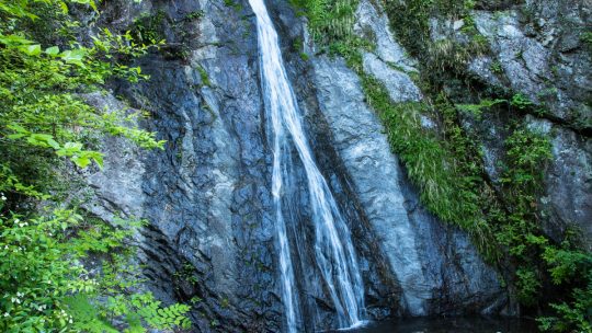
Tracking Down Saitama’s Tallest Waterfall Saitama Prefecture like neighbouring Tokyo has only one waterfall chosen as one of the 100 Japanese waterfalls of Japan way back in 1990. Whilst it’s not the easiest location to reach by public transport...
Exploring the Backwoods of Okutama One of the places I love frequenting in Okutama, Tokyo is the rather obscure Kurasawa Valley a lazy 20-minute bus ride from Okutama Station. Flanked on either side by precipitous cliff faces it was once home to the...