.
Mt. Bonomine 棒ノ峰山 – Mt. Sobatsubu 蕎麦粒山 – Mt. Tenmoku 天目山
Distance: 19.8 km
Elevation change: 1171 metres
Highest point: 1576 metres
Start: Seitobashi bus stop
Finish: Higashi Nippara bus stop
Difficulty: ▅▅▅▅▅▅▅▅▅▅ ❹
Map: Yama to Kogen Chizu 山と高原地図 [No.24 奥多摩 OKUTAMA]
GPX TrackKML TrackGSI MAPPDF Topo Map
Some of the Finest Mountain Hiking in Tokyo
This lesser hiked trail follows the Nagasawa Hairyo 長沢背稜 which forms part of the boundary between Tokyo and Saitama Prefecture. South of the range falls into Okutama while north of the divide is part of the Chichibu Mountains. Aside from the hugely popular, Mt. Bonomine, the hike largely steers a course away from the crowds, with rugged trails, superb scenery and includes some of the most beautiful forests near Tokyo. Highlights include camping by the charming Ippaimizu Refuge Hut and making an early morning scramble to the summit of Mt. Tenmoku.
Day 1: Finding Solitude Amongst the Forests (12.9 km)
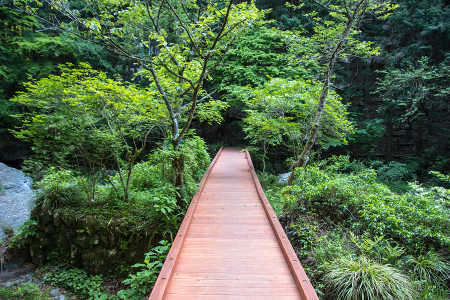
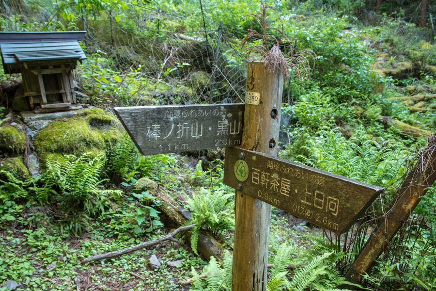
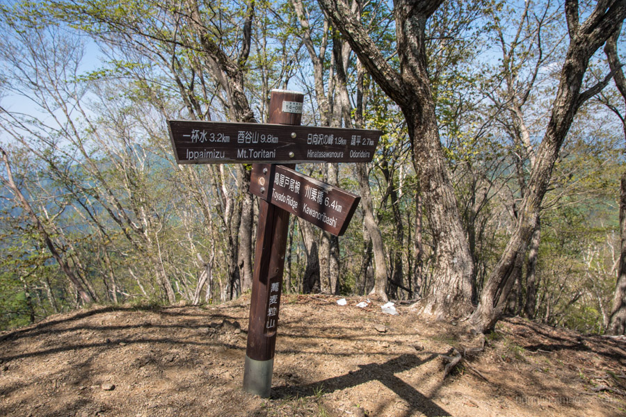
Getting to the trailhead is the same as for the Mt. Kuroyama hike by taking a Chuo Line train bound for Okutama from either Shinjuku, Tachikawa or Ome stations and getting off at Kawai Station 川井駅. On weekends you should only need to wait a couple of minutes for the 07:29 bus to Seitobashi 清東橋 (16 mins, 260 yen) which departs a short walk from the station. If you happen to miss the bus, you’ll have an additional 4.7 km of roadside walking ahead of you. From the bus stop continue along the road for 10 minutes and look for a sign pointing to Mt. Bonomine 棒ノ峰山 (976 m). After crossing the footbridge, the trail follows the river and passes some wasabi fields. Note this will be your last chance to top up water supplies until you reach the campsite.
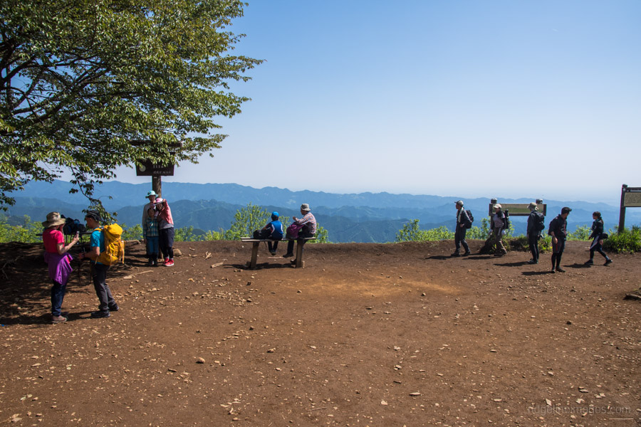
The trail is in good shape and should only take around 90 minutes to reach the summit. As a popular mountain expect to find Mt. Bonomine well patronised especially on weekends. After taking a short breather the real hiking begins with the objective of reaching Hinatazawanomine 日向沢ノ峰 (1,356 m) some 6 km away by lunchtime. This trail sees considerably less foot traffic and apart from the odd trail runner it was very peaceful. After 20 minutes you’ll pass Mt. Makinooyama 槙ノ尾山 (945 m) which I visited previously via the tough going Sengaku Ridge. The next mountain is Nagaomaruyama 長尾丸山 which can be side-stepped by skirting around the left shoulder.
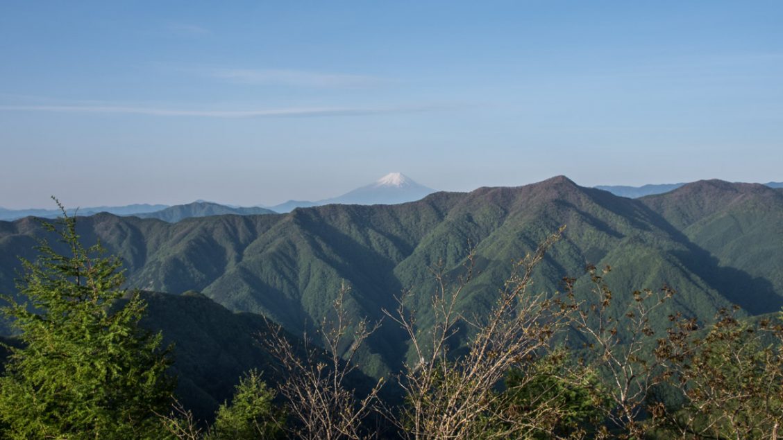
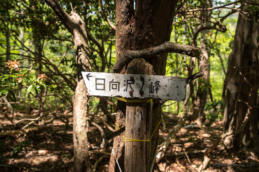
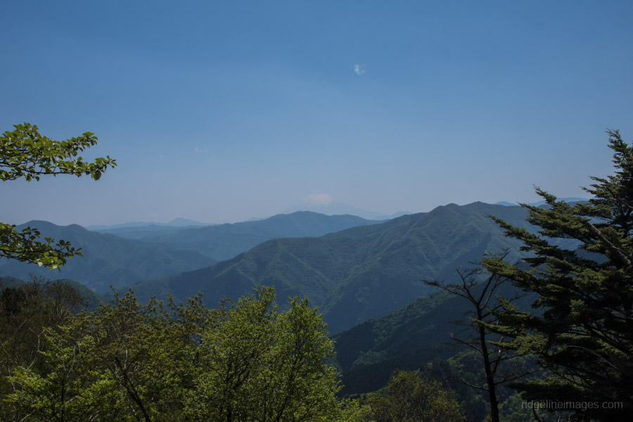
After a couple of hours of hiking you’ll pass under a transmission tower which marks the start of a longish and at times steep climb up to Hinatazawanomine. In stark contrast to Mt. Bonoreyama there were only a handful of folk milling about on what was delightful sun-bathed plateau. A short detour up to highest point takes in a wonderful view towards Fuji san.
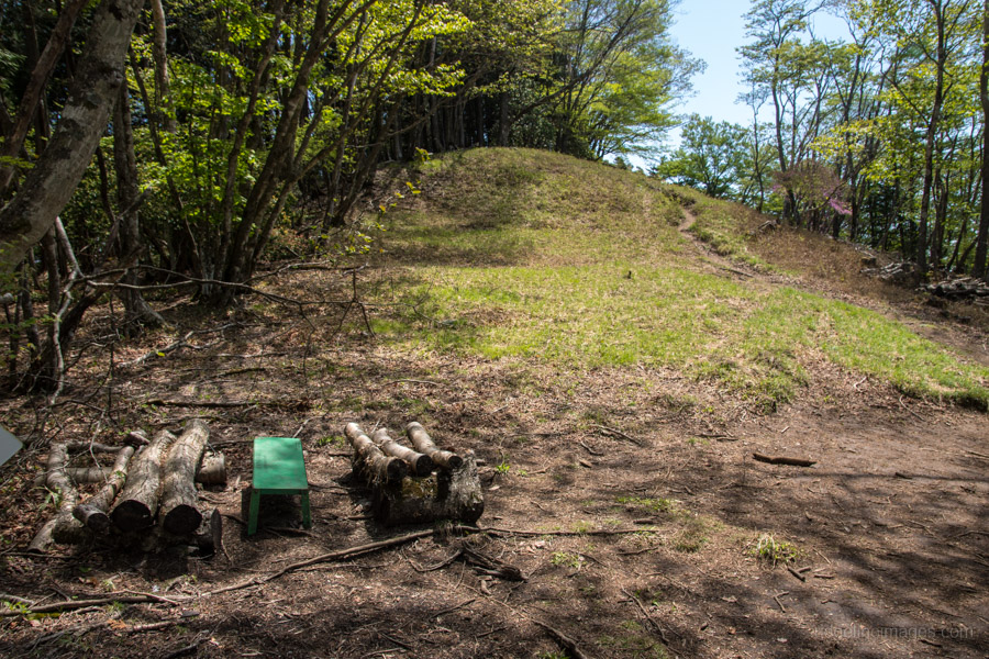
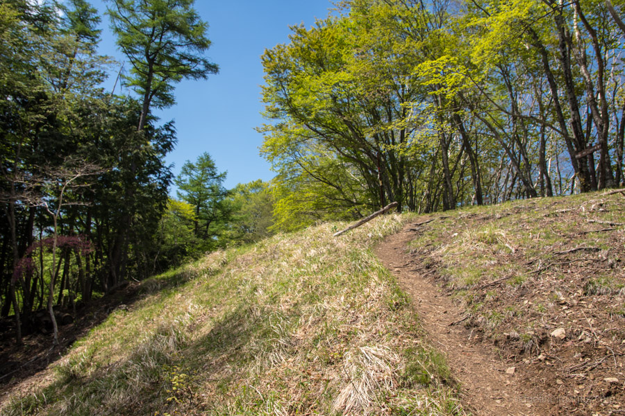
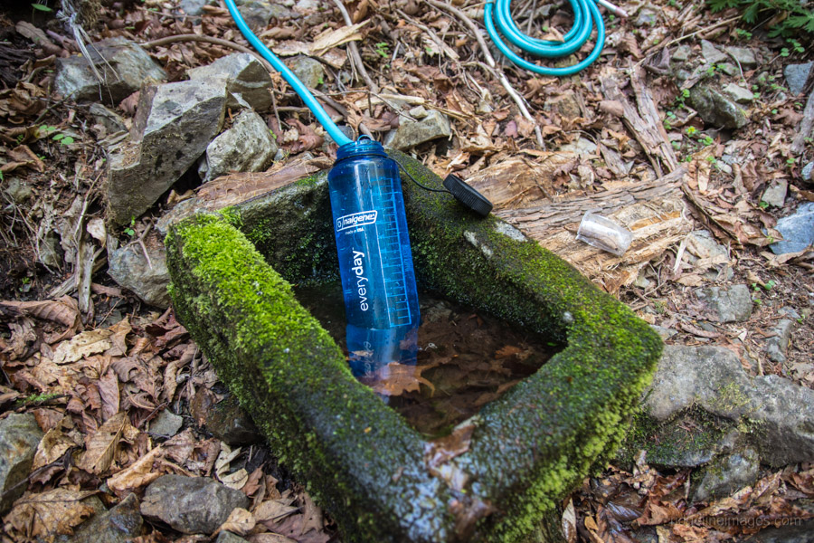
The first hour after lunch continues along a firebreak with Mt. Sobatsubu 蕎麦粒山 (1,472 m) marking the highest point of the day. The final section levels out and passes a small waterhole just before you reach the Ippaimizu Refuge Hut 一杯水避難小屋. While there was sufficient of water on this occasion it’s sometimes reduced to a trickle and also freezes in the winter. If the waterhole isn’t running check that the hosepipe is properly fixed at the spring. The refuge hut while quaint is starting to show its age though is clean and well-kept with space for around 15 at a pinch. Alternatively, there is space to set up your tent on a flat area beside the hut.
Day 2: A Quick Scramble Before Brekky (6.9 km)
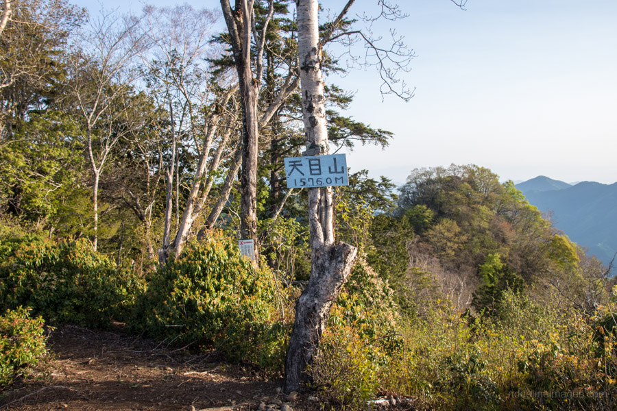
If the weather cooperates its worth making a pre-brekky dash up Mt. Tenmoku 天目山 (1,576 m) for a stunning vantage point. For a round trip to the summit allow an hour. After the previous days 1,100 metres elevation gain the hike along the Yokosuzu Ridge ヨコスズ尾根 down to the Higashi Nippara bus stop is considerably kinder on the legs. The track starts off gently losing only a little elevation. After around 30 minutes there is a bit of trail around 400 metres which is narrow and at times quite exposed. Pay attention to your footwork and take it slowly. Once you reach the sugi plantations you’re on the home stretch. For the Higashi Nippara bus stop take the trail on the left which criss-crosses its way down to the road. All told from the refuge hut to the bus stop for the return trip to Okutama Station (30 mins, 460 yen) should take a little under 2 hours at a steady pace.


Hi there, I really enjoy your tips, thanks so much for sharing and making hiking in Japan (off touristy sites) so easy!!!
What do you think, can a woman walking alone (no tent) do this trip? I feel more than safe in Japan but I don‘t want to jinx it…
Looking forward to your reply,
M
Hey Mimi. Thanks a lot for the words of support. Although I have described this hike as a two-day hike, it’s possible to do it in one day, but to do this you need to be fairly fit and get a very early start. However you’d probably miss the chance to climb Mt. Tenmoku. If you’re not going to carry a tent you will have to spend a night at the Ippaimizu Refuge Hut which can accommodate 15 people. When I camped there during this most recent Golden Week there were two guys staying in the hut. It’s always better to hike with a friend but if you want to hike alone I recommend carrying a map and compass (and know how to use it) as well as a handheld GPS or Smartphone with a downloaded map. Importantly give a copy of your hiking itinerary to a co-worker or trusted friend.
Thank you very much for the website and great trail descriptions. I hiked this over the weekend (Mar-20) and had it lived up to expectations. I was late getting there so only began the hike around 10am after catching the 9:35 bus from Kawai station. It was a strenuous hike for the rest of day 1, eating lunch on the fly to power to the Refuge Hut by sundown. The hike down the ridgeline to Nippara on Day 2 was fine, save for some sketchy trails through the plantation. Note that hurricane damage has taken out a chunk of the road from Nippara to Okutama Station so the bus no longer runs. If you hike this route it’s a 2 hour walk back to Okutama Station including through a 1km empty tunnel and over some temporary scaffolding where they are slowly repairing the road. Overall 5/5 hike.
Glad you enjoyed the hike. That first day is pretty tough going isn’t it, probably the best part for me was hiking along the ridge in the afternoon. Hope you also had a chance to climb up Mt. Tenmoku. Thanks for the information about the bus. I read earlier in the year that the road was going to be repaired with the bus back up and running by April but looks like it will be out of action for the foreseeable future.
As of June 2020 the bus is running again- Shiggy
Good to know thanks for sharing.