.
Tenguno Falls 天狗の滝 – Tsuzuraiwa Rock つづら岩 – Fujimidai 富士見台
Distance: 8 km
Elevation change: 764 metres
Highest point: 1054 metres
Start: Senzoku bus stop
Finish: Odake Shonudo Iriguchi bus stop
Difficulty: ▅▅▅▅▅▅▅▅▅▅ ❷
Map: Yama to Kogen Chizu 山と高原地図 [No.25 奥多摩 OKUTAMA]
GPX TrackKML TrackGSI MAPPDF Topo Map
Hike Amidst Tokyo’s Hidden Forests
If you’re looking to dip a toe into the local hiking scene heading out to Hinohara Village is an excellent choice. Its proximity to downtown Tokyo coupled with natural beauty means there is plenty to hold your interest. This hike is a good case in point. To access the trailhead take a train to Musashi-Itsukaichi Station, board a bus bound for Fujikura 藤倉 and get off at the Senzoku 千足 bus stop (26 mins, 470 yen). Alternatively alight at the Hossawa no Taki Iriguchi bus stop a couple of stops before and drop by Tokyo’s famed Hossawa Falls.
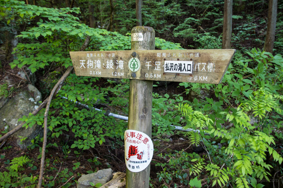
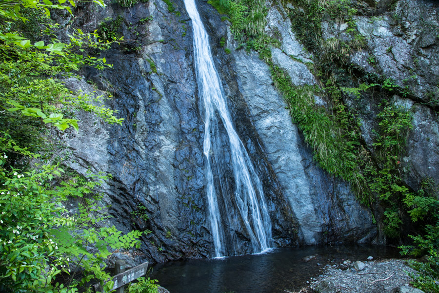
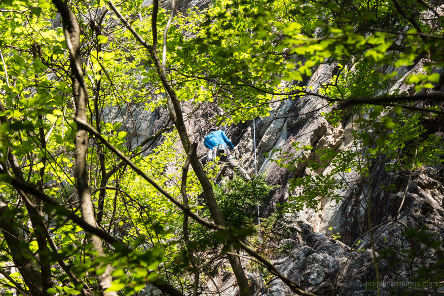
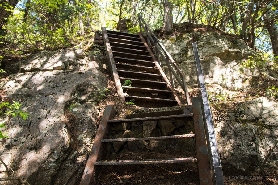
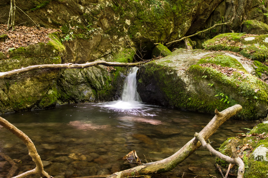
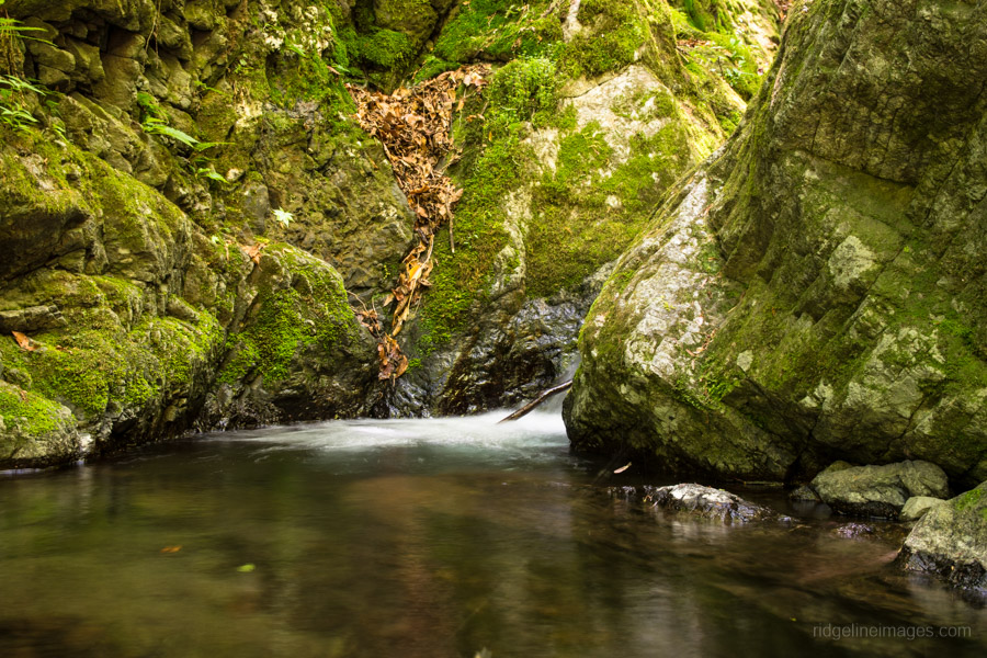
The morning’s first mission is visiting the Tenguno Falls 天狗の滝 and its smaller sibling the Kotengunotaki 小天狗の滝 which is about a 30-minute walk from the bus stop. The first 15 minutes follows a paved road before entering the trail proper. Both waterfalls are quite beautiful and worth taking a moment to enjoy. The final waterfall in the series is the Aya Falls 綾滝 a further 20 minutes along the trail. Take a break at this last waterfall as there is a fairly long, steep and sustained climb up to the Mazukari Ridge 馬頭刈尾根. Just above the ridge soars the Tsuzuraiwa Rock つづら岩 a popular rock climbing spot.
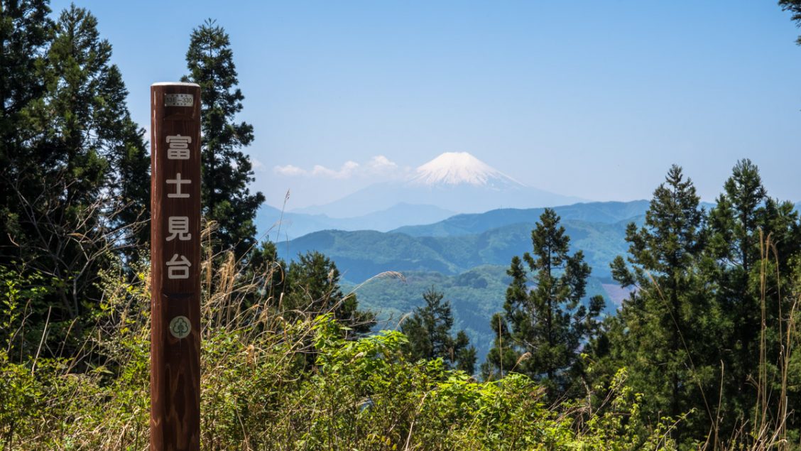
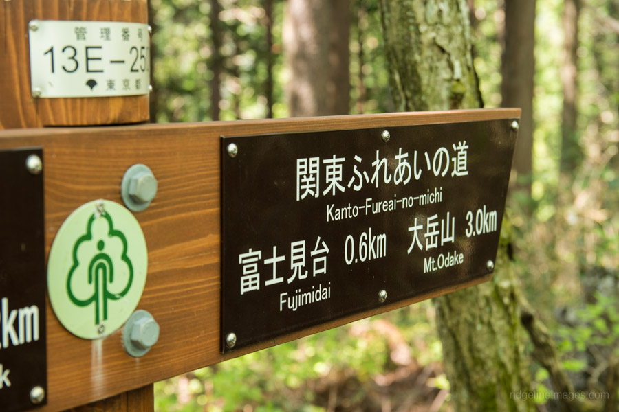
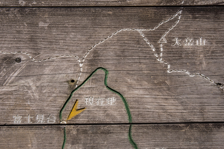
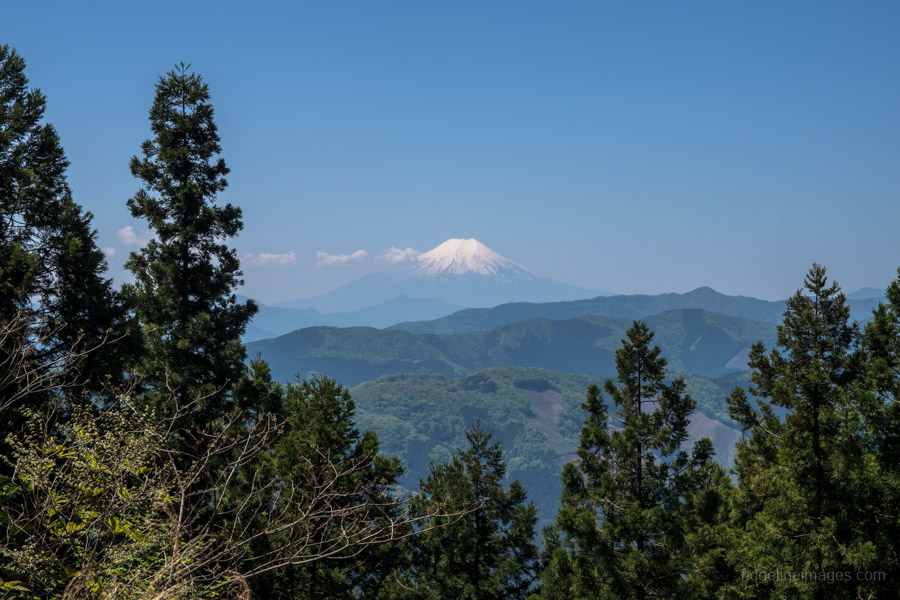
Turn left at the junction and follow the signs to Fujimidai 富士見台 an open clearing with a small shelter and terrific views. From the bus stop up to the Fujimidai plateau gains some 750 metres in elevation. When you’re ready to head off, veer down to the right and look out for the Odake Falls turn off 大滝分岐 which is a little after a small rest area with some benches. Time permitting it’s possible to make a detour to Mt Odake though allow a good hour for the return trip.
The trail down to the falls shadows the Odake River a gorgeous trail at any time but especially so in the autumn. When you reach the Odake Falls continue along the trail for a short distance until it meets a paved road. This road passes the Odake Limestone Caves and Odake Campground before arriving at Kamiyozawa and the Odake Shonudo Iriguchi bus stop 大岳鍾乳洞入口 for the return trip to Musashi-Itsukaichi Station (35 mins, 480 yen).


DId this during Golden Week. I left so early to beat the crowds that I would have finished at 11:00 if I went down to the limestone caves and ended there. I decided to go from Fujimidai on to Otake, Okunoin, Mitake and, finally, Otsukayama. Otsukayama was the real goal because it is the only peak there I hadn’t hit. Mitake was insanely crowded. I expected that. I think hiking there in Golden Week must be like bar-hopping on New Year’s Eve.
For the Odake Limestone Caves, I decided to take a bicycle/hiking trip out that way the next week. I biked to the trailheads for the Nanayo Falls, Otaki, the Odake Limestone Caves and somewhere else I can’t recall right now. I didn’t go into the caves because I was afraid I’d be too cold after working up such a sweat on the bike.
It’s been fun to bike to different trailheads than I’ve been to by train or bus. It gives a different perspective on the usual places.
David, on an un-related point, do you have any advice on tenting? Specifically I am wondering if I need to hang foodstuffs to keep them out of the reach of bears.
Thanks again for this site!
Great to hear you enjoyed the hike and you did well to avoid the conga line that unfurls itself around Mt. Mitake each Golden Week. In the Kanto Region it’s very unlikely you will encounter bears at close range so no need to hang your foodstuffs.
So, I think perhaps our intrepid writer is a bit of a masochist :p I am in moderately good shape by athletic standards, but I managed to complete this whole route in about 3.5 hours.
I followed this route as written, though, and once I made my way up the very steep, pretty demanding ascent to the namesake 岩,I was soon after greeted by 4 Japanese professorly types in their late 40s, coming from the other direction. The lead said “珍しい、そこの方向から来るなんて”, and come to think of it, I was the only one of like 10 people I met ascending that tough bit rather than descending, hahaha. Which is to say, you could follow this route in reverse and have an easier time of it, but I do think doing the tough bit as an ascent rather than a descent will spare the joints. The unfortunate trade-off is that you might find your legs quivering (if you’re not a seasoned hiker) on the latter portion, which is definitely the most beautiful portion, apart from the smaller waterfalls. Aya waterfall is beautiful and large, but you can’t dip your head under it like you can with the Tengu waterfalls. So, there are pros and cons from either direction.
I just completed this one and am now waiting for the next bus for a little over an hour.
Foolishly I didn’t expect snow (in my mind I was safe since it didn’t really fall in the city, but got hit with reality) so I didn’t bring poles, which would have helped a lot on the way down to prove a little the knee-deep snow.
Still had a blast though, it’s the serving time in my life that I get to be close to so much snow, so I was just in awe of the view.
Thanks for all these reviews / guides, they have helped me a lot over the past year or so 😁
Nice one Lou, glad to hear you enjoyed the hike and all the snow too by the sounds of it! It’s sometimes a bit hard to predict the expected conditions and have been caught out myself more than a few times over the years. Carrying a pair of lightweight crampons or microspikes is a good idea during the winter also.
Ah yeah, I did carry crampons, though I was not sure if they helped in snow and only put them on after sliding a few times on my ass 😬. After that it was definitely easier to walk 😂
Don’t feel bad. I went to Niigata a few weeks ago and was confronted with waist-deep snow. I rented snowshoes for my next hike.
Ohhh, never even thought about special shoes for snow O.o.
Learn something new every day! Thanks!
I learned a little bit in the last month….. Like you, I always carry crampons and they’re usually enough around here.
After my debacle in Niigata, I watched a lot of youtube videos about hiking and climbing in deeper snow.
There are snowshoes (スノーシュー)and there are things called wakan ワカン。 Those are not as big as what you would think of as snowshoes. They are an aluminum frame that surrounds your boot. They have spikes underneath. Traditional snowhoes are more for deep snow and flatter places. Wakan are more suited to ridges and places with a lot of roots.
I went for a hike at Lake Okutama yesterday and I was really surprised on the bus from Okutama Station to see several people sporting snowshoes and or wakan attached to their packs. (I didn’t even need to break out my crampons because I wasn’t going high.)
ps I am the same as you. This blog of David’s has been a huge help to me over the years!