.
Unazawa Otaki Falls 海沢大滝 – Onara Pass 大楢峠
Distance: 14.8 km
Elevation change: 340 metres
Highest point: 680 metres
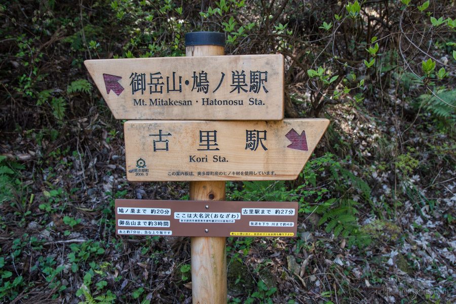
Start: Shiromaru Station (Ome Line)
Finish: Kori Station (Ome Line)
Difficulty: ▅▅▅▅▅▅▅▅▅▅ ❷
Map: Yama to Kogen Chizu 山と高原地図 [No.25 奥多摩 OKUTAMA]
GPX TrackKML TrackGSI MAPPDF Topo Map
An Early Spring Hike
This hike pays a second visit the picturesque Unazawa Valley in Okutama. A few years back I made it as far as the Mitsugama Falls before succumbing to a migraine which put a stop to seeing the other two falls which make up the Unazawa-no-santaki or Unazawa three waterfalls. It’s recommended to go in fine weather as the path near the Otaki waterfall requires crossing some rocks which are most likely slippery in the wet.
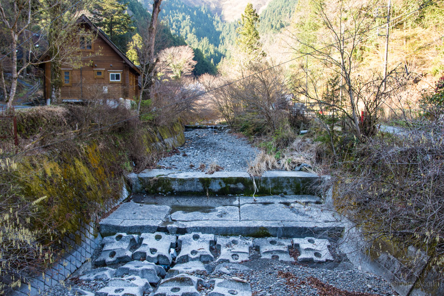
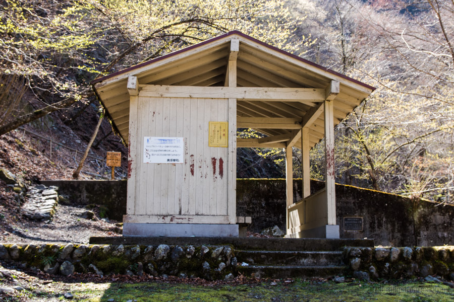
The hike starts out from Shiromaru Station 白丸駅 one stop before Okutama on the JR Chuo Line. After exiting the station go down the stairs, cross the Kazumakyo Bridge and follow the trail which snugs the banks of the Tama River. After 15 minutes the path reverts to bitumen where there are some restrooms below the nearby power plant. Head up to the road where you will pass some fish ponds on your left and look for a sign pointing to the America Camp Village. The distance from here to the rest area at Unazawa enchi 海沢園地 is around 3.5 km.
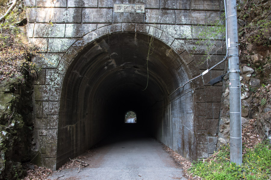
Along the way you need to pass through the Unazawa Tunnel 海沢トンネル a supposedly haunted spot. The tunnel is 70 metres in length, built in the early 1960s and has a creepy ass atmosphere. A little further along I came across a kamoshika or Japanese serow in a clearing just off the road which took me by surprise. The trailhead makes an ideal rest stop a little up from the Tenguiwa Falls. To properly explore falls and return the Unazawa enchi rest area allow a good hour.
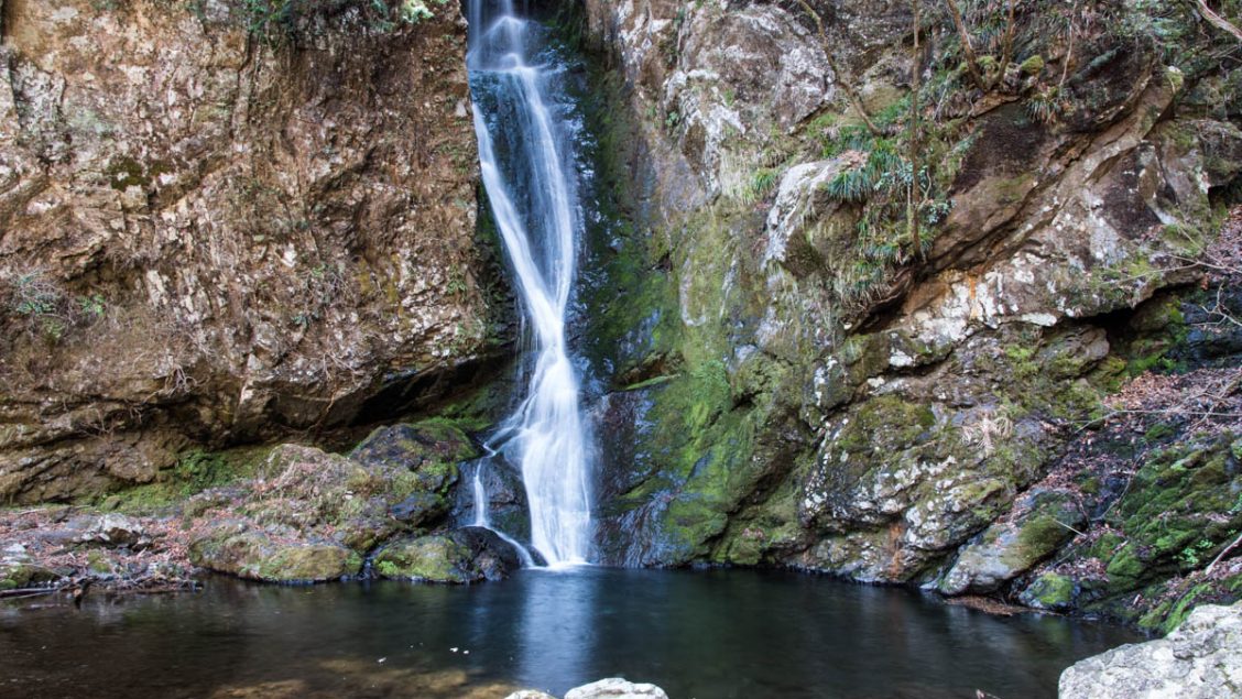
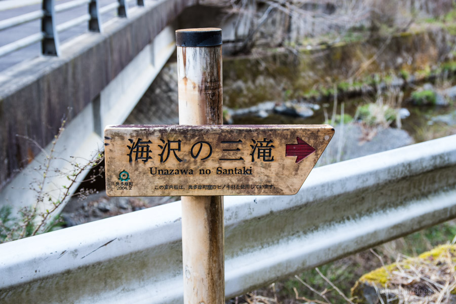
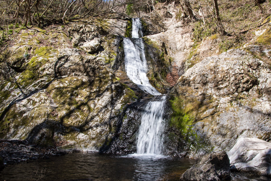
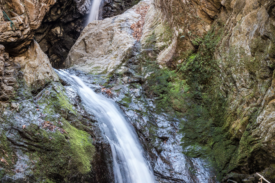
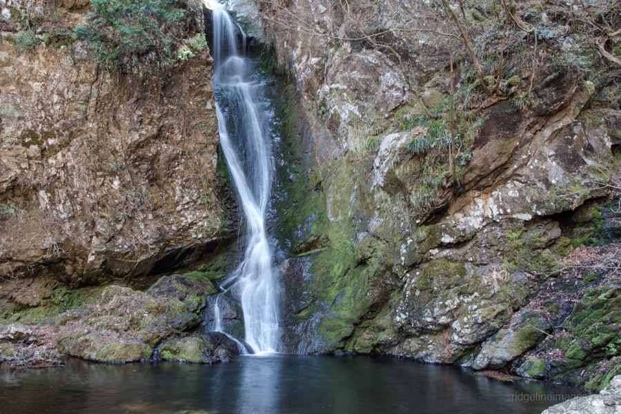
A 5-minute walk from the carpark finds the three-tiered Mitsugama Falls 三つ釜の滝 (12-metres) which I photographed on the previous outing. These falls are arguably the finest of the trio formed like a natural water slide. Ascending a steep flight of stairs finds the twisted and dimly lit two-tiered Nejire Falls ネジレの滝 (10-metres). To reach Otaki Falls 大滝 (23-metres) follow the trail which cuts around up stream and down some earthen steps. Interestingly one sign indicates a fourth waterfall 海沢四滝 namely the Fudo Waterfall 不動滝 located just above the Otaki Falls however there didn’t appear any obvious access.
After getting your fill of waterfalls return to the rest area and continue along the road to the Onara Pass 大楢峠. The trail to Hatonosu and Kori Stations passes the Kaizawa Buttress a popular rock-climbing spot before hitting a paved road. At the second picnic shelter turn right and follow the signs back to Kori Station 古里駅.


Hi, David. Just completed this one by going through the haunted tunnel, going to the three waterfalls (I liked the last, larger one the most) and climbing Shiroyama (城山) by mistake. Quite a steep and rough summit at 759.8 mts. Have no clue how you made it to Kori, couldn’t find a marker anywhere.
Beautiful place in any case. Didn’t find the Serow.
One question, do you think it is ok to drink Tamagawa water, especially up in the mountain?
Buying you two Ko-Fi now.
Hey Francisco, glad you enjoyed the hike. Those waterfalls are quite lovely especially in the autumn and nice that you made it to the Otaki. I count myself lucky to have seen a serow that day as they are fairly timid. Regarding the trail to Kori typhoon Hagibis rendered it impassible according to the latest Yama to Kogen map. Personally, I wouldn’t collect and drink the water directly from the Tama River at least not without filtering or boiling it first. In the higher tributaries which feed into it, it could be OK but as a general rule for Tokyo based day hikes, I recommend bringing sufficient supplies and only collecting from water sources marked on the Yama to Kogen maps. As always thanks for supporting my blog!
Did this hike today, as always thanks for the directions. Due to my own lack of research, I wasn’t aware, but the Onara pass is still closed. Furthermore, only the first two waterfalls can be reached; the third fall and also the mountain beyond is unreachable at this point. Beautiful waterfalls though!
As usual with your tips, I was virtually alone, and could enjoy nature easily. I saw three new birds, but what made it extra special was spotting a Japanese Serow! I could capture close-up pictures, so I’m happy. Thanks!
Glad you still enjoyed it, and nice work spotting the serow – that’s a great sighting! Thanks also for the update about Onara Pass and the waterfalls; that’s really useful to know.