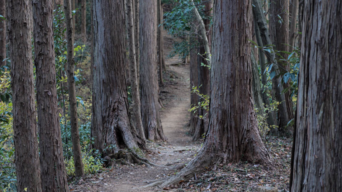
Hiked on Dec 29, 2020 . Enoki-toge 榎峠 – Nago-toge 名郷峠 – Mt. Sanbosan 三方山 Duration: 4 hours Distance: 10.9 km Elevation change: 244 metres Highest point: 494 metres Start: Ikusabata Station (Ome Line) Finish: Ome Station (Ome Line) ...
Hiked on Dec 29, 2020 . Enoki-toge 榎峠 – Nago-toge 名郷峠 – Mt. Sanbosan 三方山 Duration: 4 hours Distance: 10.9 km Elevation change: 244 metres Highest point: 494 metres Start: Ikusabata Station (Ome Line) Finish: Ome Station (Ome Line) ...
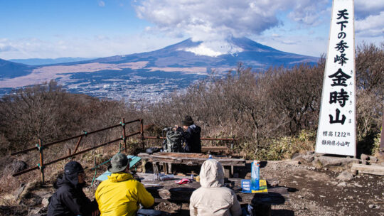
Hiked on Dec 16, 2020 . Kintoki-jinja Shrine 金時神社 – Mt. Nagao 長尾山 – Otome-toge 乙女峠 Duration: 3.5 hours Distance: 6.3 km Elevation change: 517 metres Highest point: 1212 metres Start: Kintoki Jinja Iriguchi Bus Stop Finish: Kintoki Jinja...
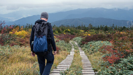
Hiked on Nov 28, 2020 . Umenokidaira 梅ノ木平 – Odarumi Pass 大垂水峠 – Mt. Takao 高尾山 Duration: 6 hours Distance: 17.7 km Elevation change: 480 metres Highest point: 670 metres Start: Takaosanguchi Station (Keio Takao Line) Finish: Takaosanguchi...
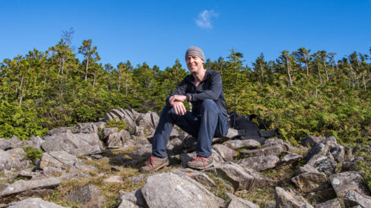
Perennial Favourite Among Lightweight Backpackers KS ultralight gear is one of a growing number of cottage companies serving the needs of ultralight backpackers both here in Japan and around the world. It’s run by French expat Laurent Barikosky who...
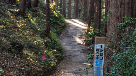
Hiked on Nov 17, 2020 . Kitamuki-Jizo 北向地蔵 – Mt. Monomi 物見山 – Mt. Takazasu 高指山 Duration: 3.5 hours Distance: 9.2 km Elevation change: 270 metres Highest point: 380 metres Start: Musashi-Yokote Station (Seibu Ikebukuro Line) Finish: Koma...
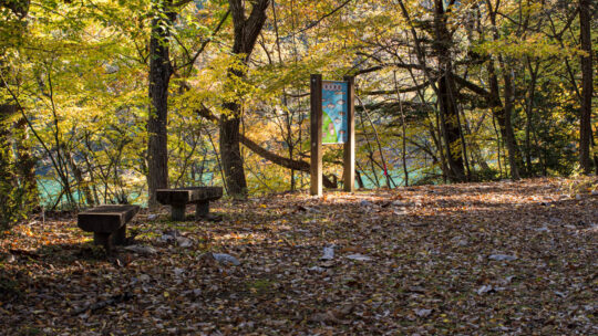
Guns, Momiji, and Waterfalls If you’re in search of abundant nature Hinohara Village on the outskirts of Tokyo is a good place to start. Each year I make more than a few trips to the metropolis’s only village to escape the city and enjoy fresh air...
Hiked on Nov 11, 2020 Jan 28, 2026 . Ogouchi Dam 小河内ダム – Yama-no-furusatomura 山のふるさと村 The first part of the route from Lake Okutama Bus Stop towards the Yama-no-furusato-mura is currently undergoing repairs and is not expected to reopen until...
Hiked on Nov 4, 2020 Aug 15, 2022 . Mt. Tsunotogiyama 角研山 – Honjagamaru 本社ヶ丸 – Mt. Seihachiyama 清八山 Duration: 6.5 hours Distance: 14.4 km Elevation change: 1031 metres Highest point: 1631 metres Start: Sasago Station (Chuo Main Line) ...
Hiked on Oct 31, 2020 Nov 10, 2021 . Gan-toge 雁峠 – Kasatori-goya 笠取小屋 – Tama River Headwaters 多摩川源流 Duration: 2 days Distance: 20 km Elevation change: 893 metres Highest point: 1953 metres Start: Shinchidaira Bus Stop Finish:...
Hiked on Oct 24, 2020 . Himuro Shrine 氷室神社 – Hokora Hut ほこら小屋 – Mt. Hadaka 裸山 Duration: 2 days Distance: 16.2 km Elevation change: 1276 metres Highest point: 2052 metres Start: Hirabayashi Bus Stop Finish: Hirabayashi Bus Stop ...
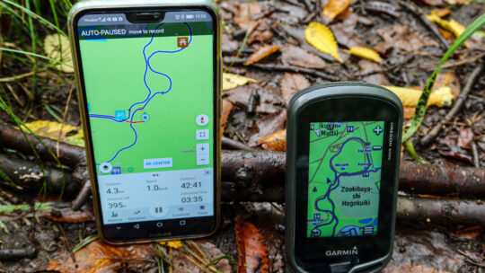
Viewing Interactive GPS Maps Then & Now Not long after starting this blog I began using the pro version of WP Google Maps, a WordPress plugin to plot ‘polylines’ to display my hiking routes on Google Maps. As I commented at the time not having a map...
Hiked on Sep 30, 2020 . Wada Hut 和田小屋 – Kaguragamine 神楽ヶ峰 Duration: 8 hours Distance: 13.9 km Elevation change: 925 metres Highest point: 2145 metres Start: Carpark below Wada Hut Finish: Carpark below Wada Hut Difficulty: ▅▅▅▅▅▅▅▅▅▅...
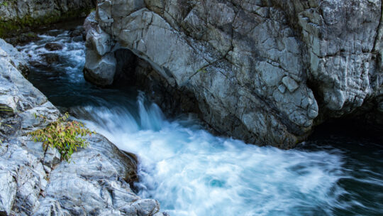
Hiked on Sep 21, 2020 . Mt. Kentoku 乾徳山 – Mt. Kurogane 黒金山 – Nishizawa Gorge 西沢渓谷 The Nishizawa Gorge hiking trail closes during winter (December 1st-April 28th subject to change depending on snowfall) for the latest information please refer to the...
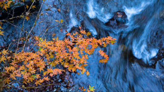
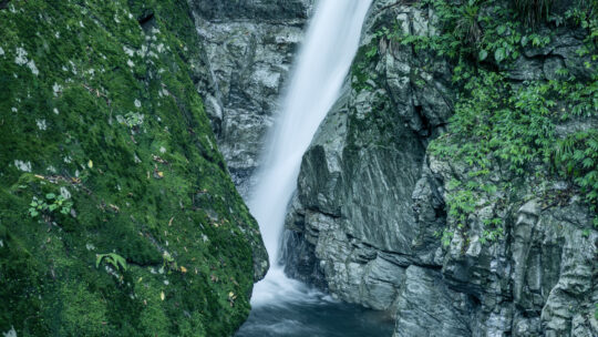
Hinohara Village ‘Takimeguri’ Waterfall Tour This blog post continues my Hinohara Falls Tour Hinohara Takimeguri ひのはら滝めぐり a photographic journey of the 13 main waterfalls in Hinohara Village, Tokyo. Apart from the two waterfalls introduced below I...
Hiked on Aug 19, 2020 . Komanogoya 駒ノ小屋 – Chumon-dake 中門岳 Duration: 8 hours Distance: 17.6 km Elevation change: 1233 metres Highest point: 2133 metres Start: Mitori Auto Campground Finish: Mitori Auto Campground Difficulty: ...
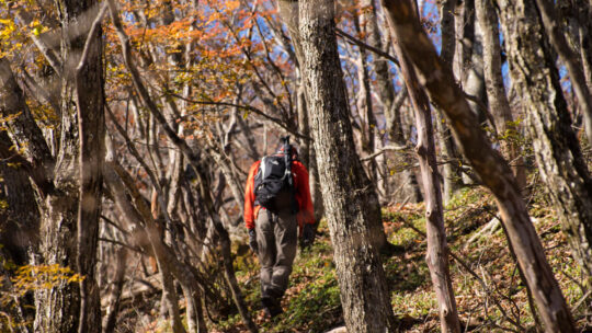
Solo Summer Hike and Camp in Okutama Arriving mid-morning at Okutama Station during the Obon holidays was, as expected, bustling with activity. Perhaps a little surprising given COVID-19. I made a beeline for one of the two diminutive buses headed...