.
Kitamuki-Jizo 北向地蔵 – Mt. Monomi 物見山 – Mt. Takazasu 高指山
Distance: 9.2 km
Elevation change: 270 metres
Highest point: 380 metres
Start: Musashi-Yokote Station (Seibu Ikebukuro Line)
Finish: Koma Station Station (Seibu Ikebukuro Line)
Difficulty: ▅▅▅▅▅▅▅▅▅▅ ❷
Map: Yama to Kogen Chizu 山と高原地図 [No.23 奥武蔵・秩父 OKUMUSASHI·CHICHIBU]
GPX TrackKML TrackGSI MAPPDF Topo Map
A Mountain that Everyone can Enjoy!
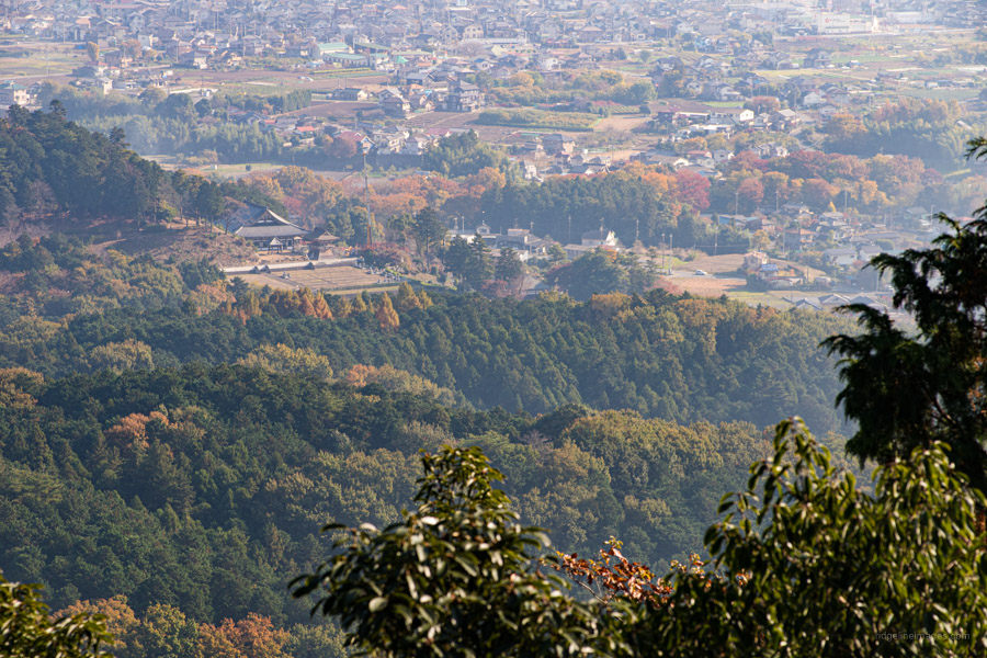
Hiwadasan looms over Kinchakuda a.k.a. Spider Lily Park and is one of Saitama Prefectures most popular mountains suitable for all levels of hikers. It’s convenient access from downtown Tokyo, low elevation combined with natural surroundings make it a favourite year-round retreat. Hidaka City where Mt. Hiwada is located is notable for its early Korean heritage adding some historical interest to the hike.
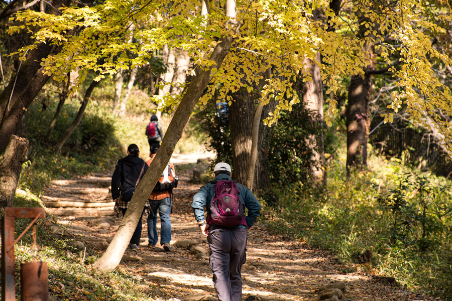
For those without much time or with little ones in tow, the standard hiking course starting and finishing at the trailhead carpark is the way to go. In this case the hike can be completed in around a couple of hours. The unmanned carpark costs 300-yen so bring some small change. This hike follows a longer circuit though is also relatively family friendly and intended as a half day outing. You can commence from either station though I set out in a clockwise direction. Seibu Railway has a good map of this hiking route in Japanese.
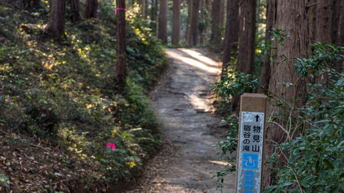
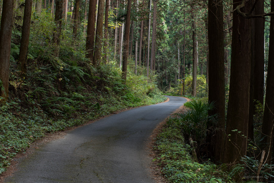
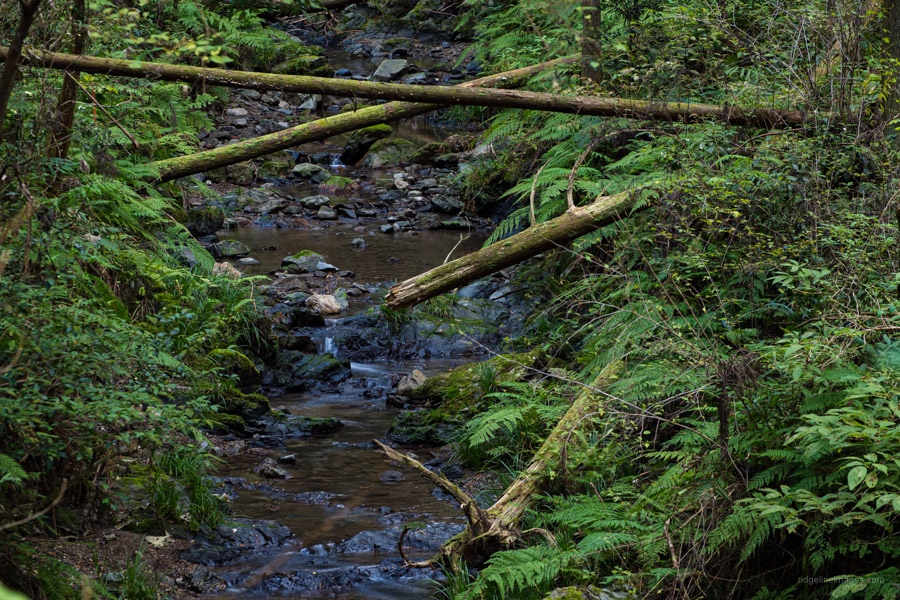
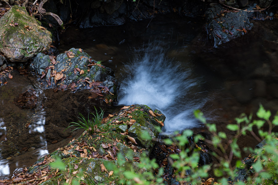
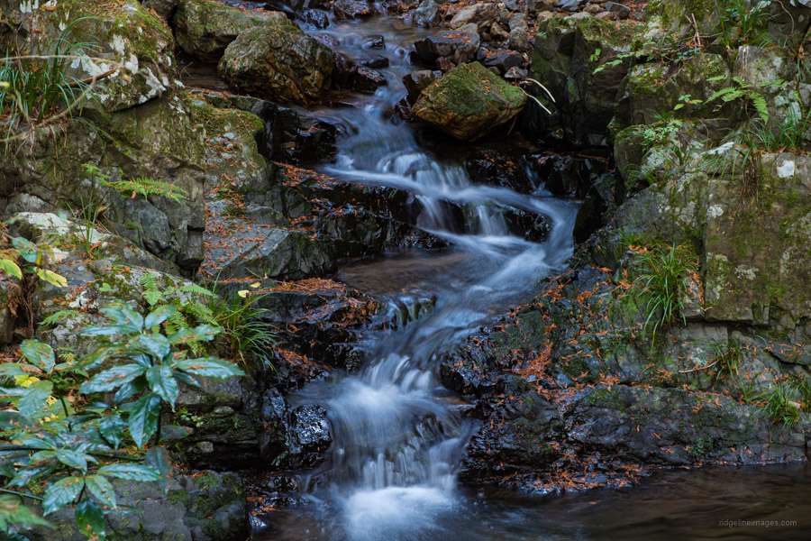
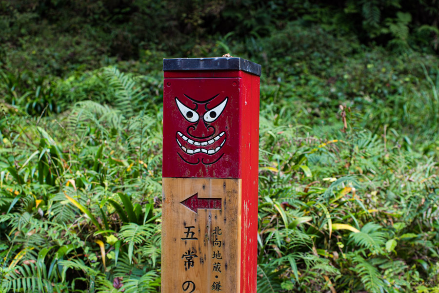
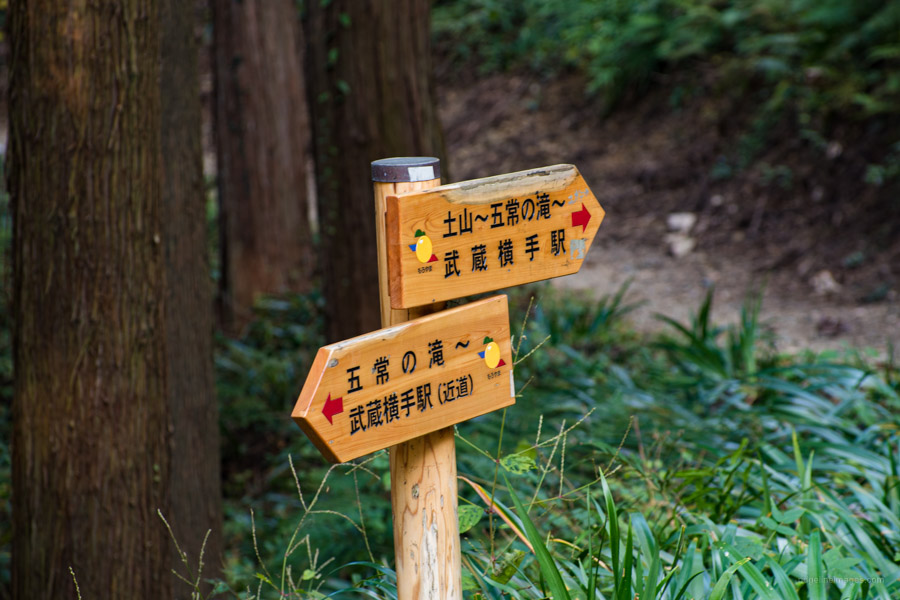
From Musashi-Yokote Station a short 10-minute ride from Hanno Station cross the National Route 299 and begin heading up a gentle paved forest road. As far as roadside walking goes this one is rather scenic. It tails a tranquil stream, bordered on either side by mature Japanese cedar trees. I hiked in the early morning and didn’t see any cars or people until I reached Kitamuki-Jizo. After 30 minutes of walking, you’ll reach a trail sign sporting a devil insignia just before the Gojo Falls 五常の滝. The privately owned falls are 12-metres-high and costs 200-yen to enter, see the Gojo Falls homepage for opening hours.
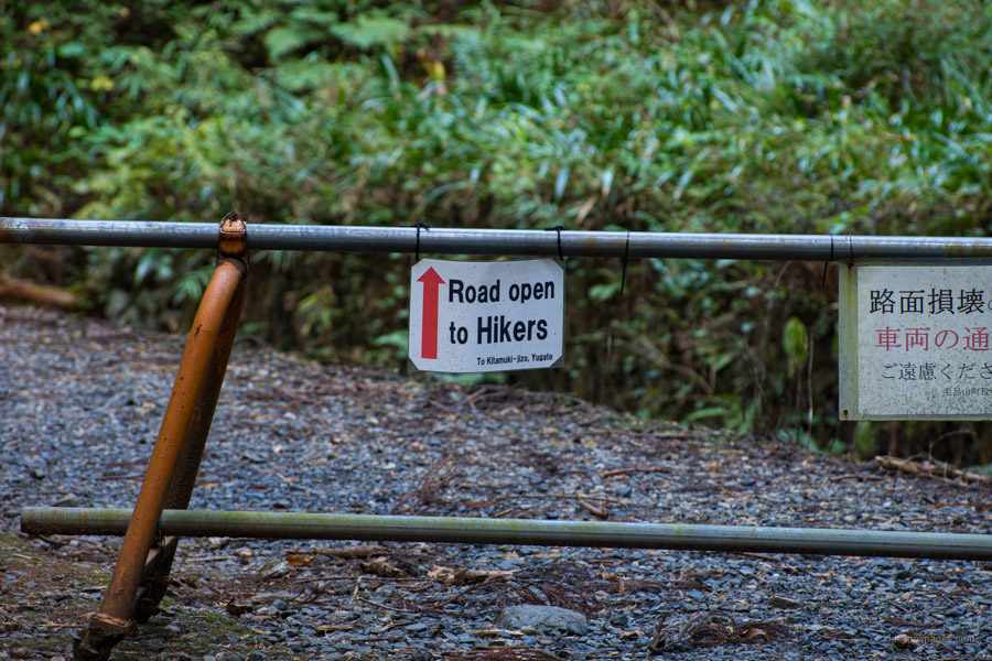
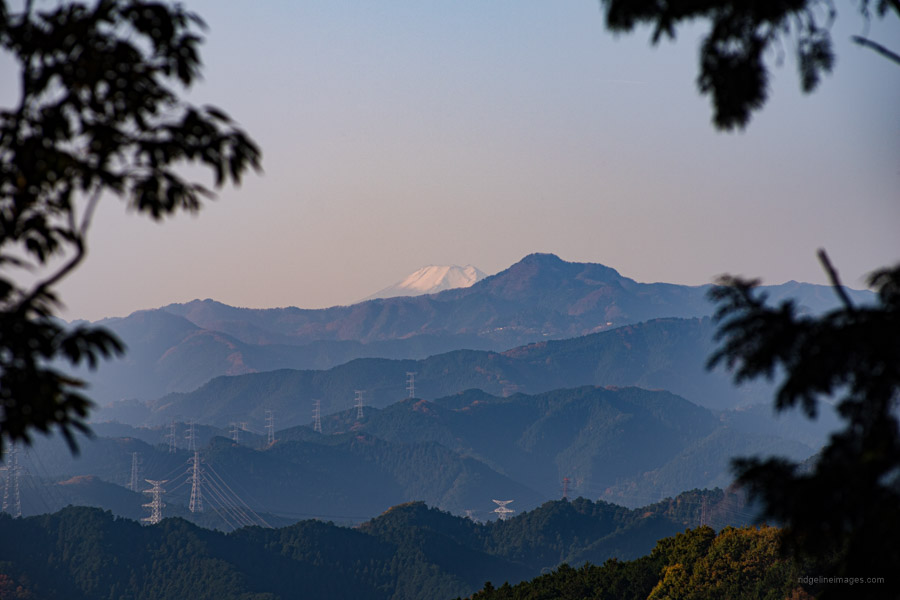
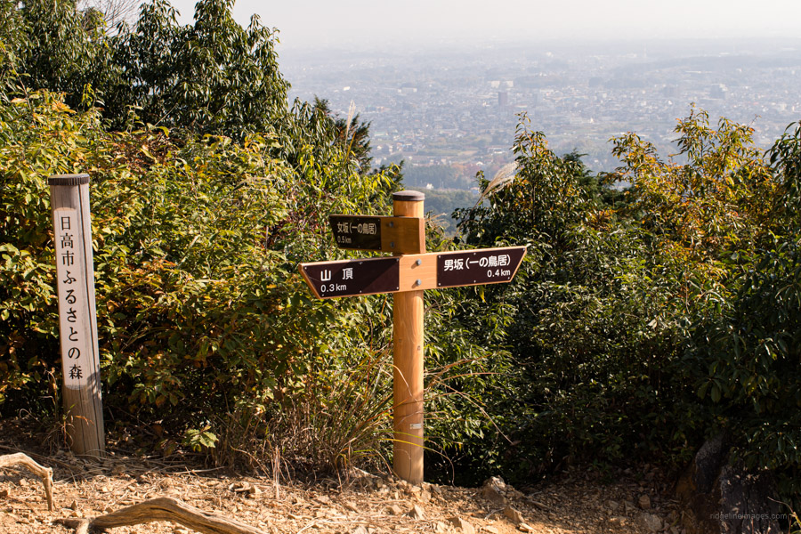
Just north of here a gravel road forks off to the left with ‘road open to hikers’ written in English. Speaking of signs, the course overall has limited signage most of which is in Japanese and with unmarked trails veering off every which way I recommend carrying a GPS device. Next slink under a roped off road closed to cars before arriving at Kitamuki-Jizo 北向地蔵 (380 m). If the weather is crisp and clear climb up towards Mt. Atago 愛宕山 on your left for a fleeting view of Fujisan.
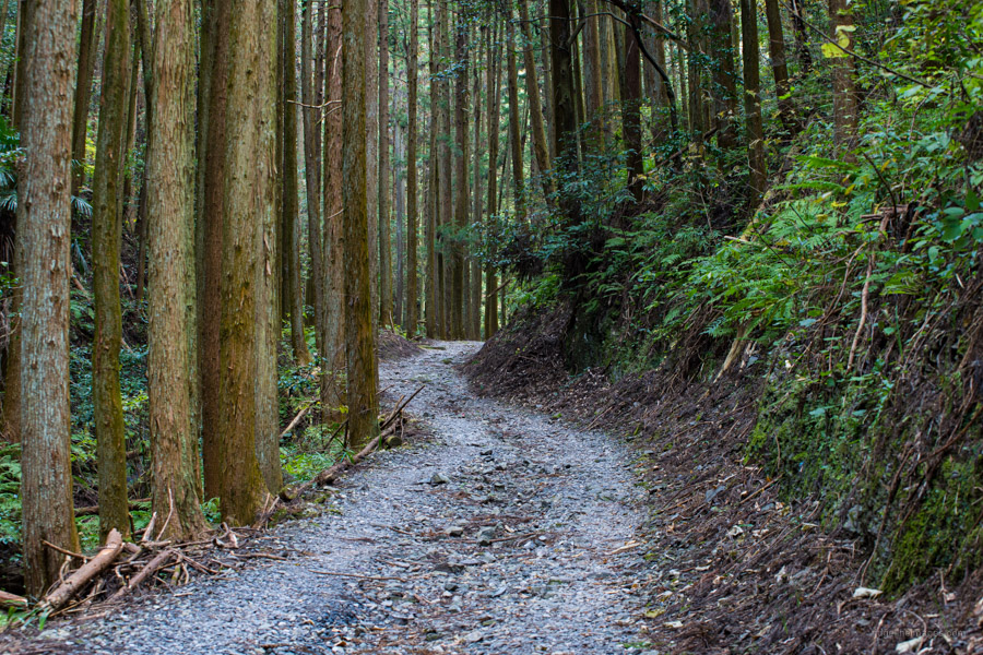
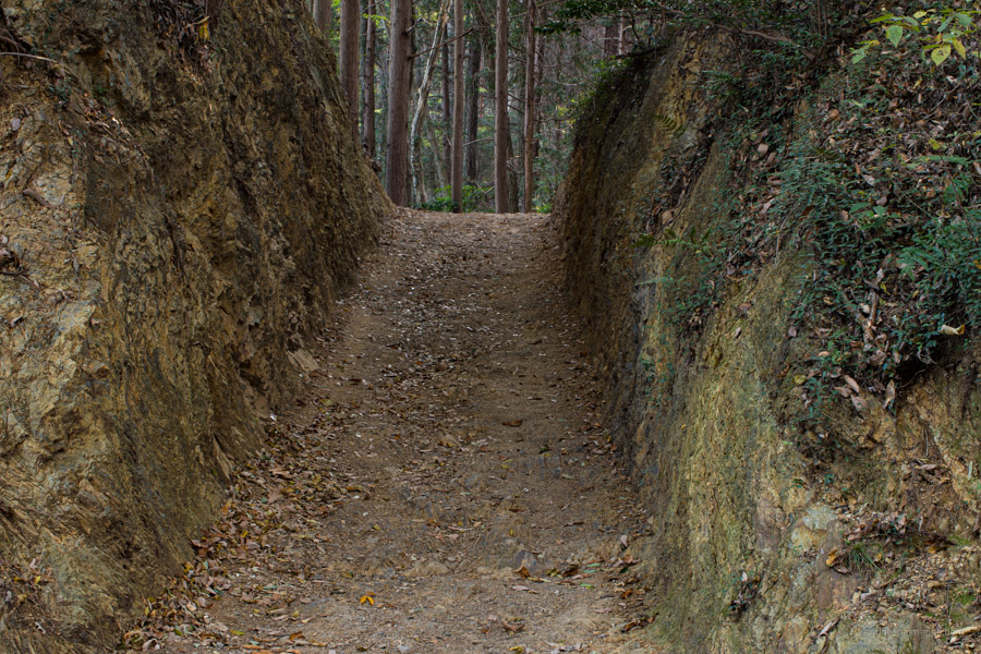
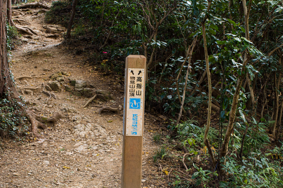
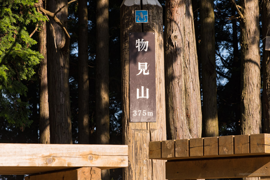
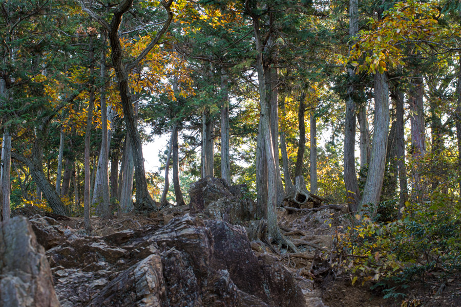
From here proceed to the right shadowing the road below. The next section of trail is flat flanked by sugi and hinoki. Follow the signposts towards Mt. Monomi 物見山 (375 m) the open summit has some rough-hewn benches to take a break. Heading down from the summit finds some restrooms and a vending machine. The official summit of Mt. Takazasu 高指山 (330 m) is the gated off broadcast tower so continue down the mountain trail on the right. A word of warning the clay loam path here will be slippery as a butcher’s apron in the wet so I’d advise against hiking during the rainy season.
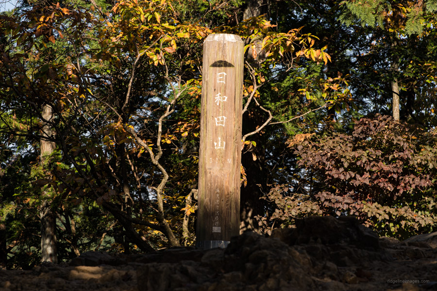
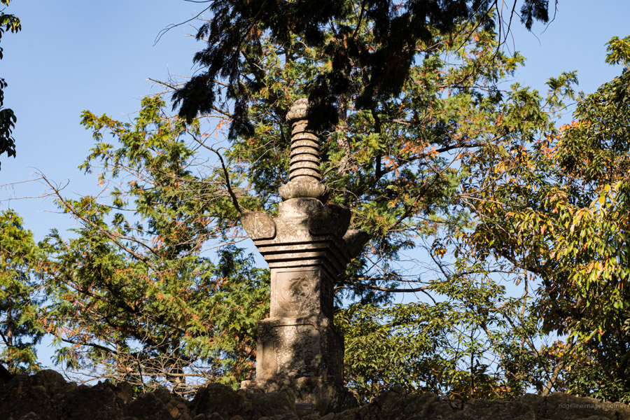
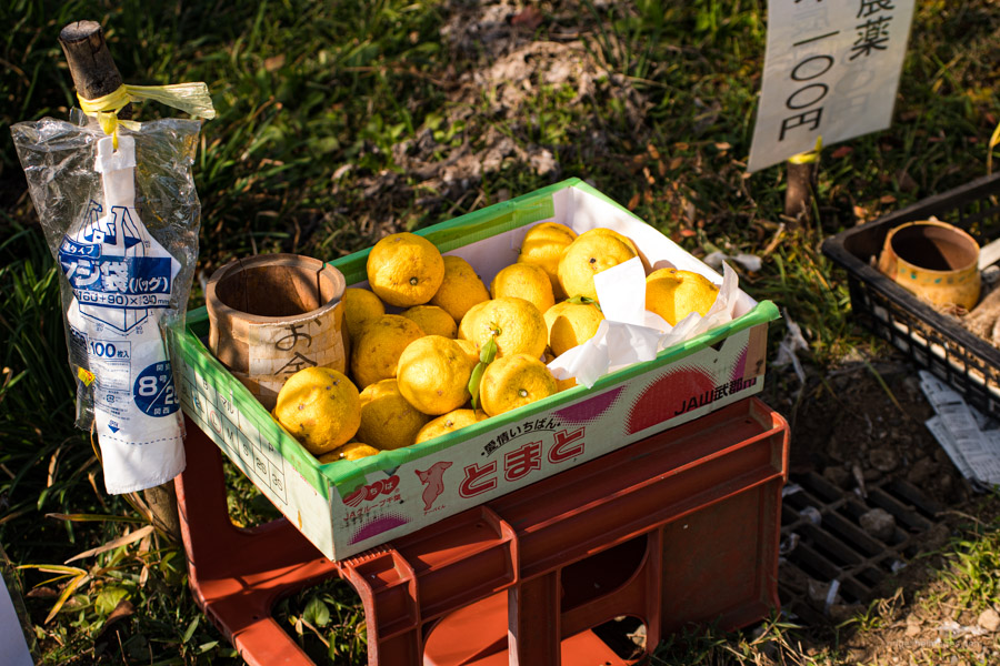
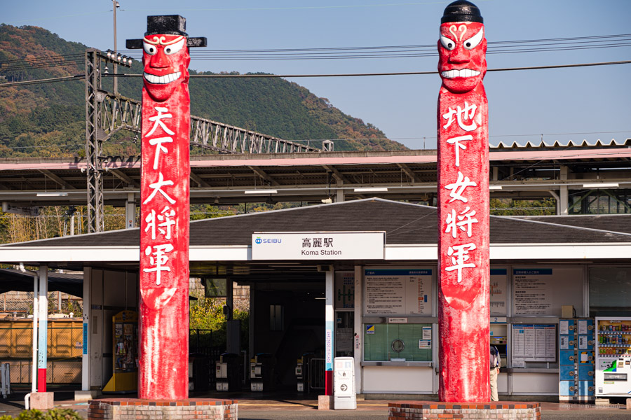
The summit of Mt. Hiwadasan 日和田山 (305 m) is hemmed in by trees though offers a panorama of Hidaka City on one side. It is also home to a hefty stone monument. The views open up before the final descent to the rest area and carpark. Just below the Kotahira Shrine pick from either the onna-zaka (female) or otoko-zaka (male) path. The latter was steeper and gravellier than I expected, and no doubt causes bottlenecks on busy weekends. From the trailhead it’s a 15-minute walk back to Koma Station famed for its two red Korean jangseung totem-poles that stand guard at the front. Finally, if you’re feeling peckish afterwards drop by Alishan Organic Center a local favourite that serves a mean veggie burger and pizza.


After leaving the cafe and crossing the bridge over the river, take your first left turn up a little path (it’s signposted to Koma Station). Follow it up and round to a small T-junction (1 minute). Turn left. You’ll now walk through several houses selling fresh vegetables from their gardens. After 1 minute, at the end of the lane, turn left onto a larger road. 10 metres up the road, there’s a small shop selling delicious tofu. Continue up the road and over the crossroads (with a convenience store on your left), and up over the train tracks. Immediately after, there’s a little lane that takes you to Koma Station.
The GPX route I was following was pretty much as you describe but as some construction work was going on around the bridge, I ended up missing the first left after Alishan. I did however pass that tofu shop. When I first came to Japan, I lived for a year in the inaka and definitely one of the best bits was ready access to farm fresh fruit and veggies which is much harder to come by in Tokyo.