Hiked on Dec 17, 2024 . Misaka-toge 御坂峠 – Kurodake Tenbodai 黒岳展望台 – FUJIYAMA ツインテラス Duration: 6 hours Distance: 12 km Elevation change: 783 metres Highest point: 1793 metres Start: Mitsutoge Iriguchi Bus Stop Finish: Kawaguchiko Natural...
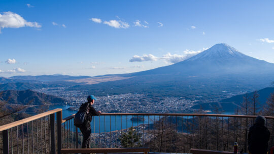
Hiked on Dec 17, 2024 . Misaka-toge 御坂峠 – Kurodake Tenbodai 黒岳展望台 – FUJIYAMA ツインテラス Duration: 6 hours Distance: 12 km Elevation change: 783 metres Highest point: 1793 metres Start: Mitsutoge Iriguchi Bus Stop Finish: Kawaguchiko Natural...

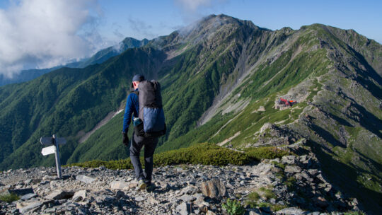
July 21st to July 27th, 2024 . Murodo 室堂 to Shin-Hotaka Ropeway 新穂高ロープウェイ This is a long and demanding multi-day hike suitable for experienced hikers. Do not attempt this hike unless you have experience in route-finding. Carry the relevant...
Hiked on Aug 29, 2023 . Reclining Buddha statue 寝釈迦像 – Sai-no-kawara 賽の河原 – Mt. Komaruyama 小丸山 Duration: 2 days Distance: 26.4 km Elevation change: 1408 metres Highest point: 1878 metres Start: Sori Station (Watarase Keikoku Line) ...
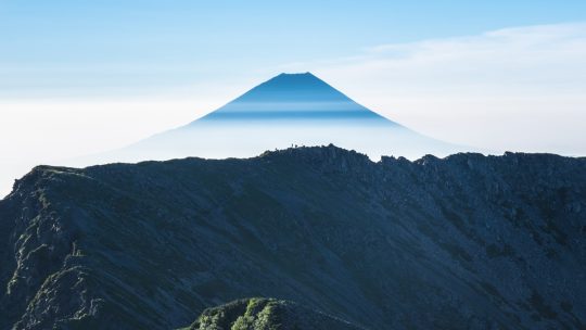
Hiked from July 21 to July 29, 2023 . Hirogawara 広河原 to Akaishi Onsen Shirakabaso 赤石温泉白樺荘 This is a long and demanding multi-day hike suitable for experienced hikers. Do not attempt this hike unless you have experience in route-finding. Carry the...
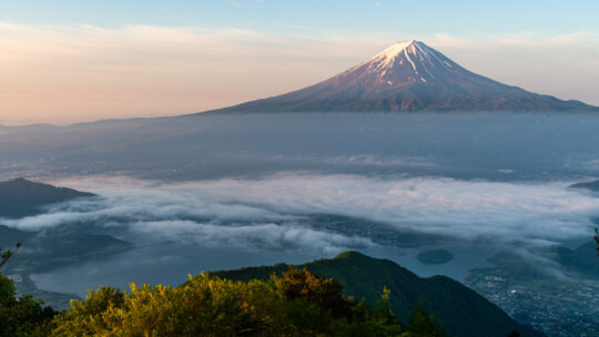
Hiked on May 24, 2022 . Jinzasan 神座山 – Mt.Shakagatake 釈迦ヶ岳 – Shindo Pass 新道峠 Duration: 2 days Distance: 18.4 km Elevation change: 1028 metres Highest point: 1793 metres Start: Himine jinja mae Bus Stop Finish: Kawaguchiko Natural Living...
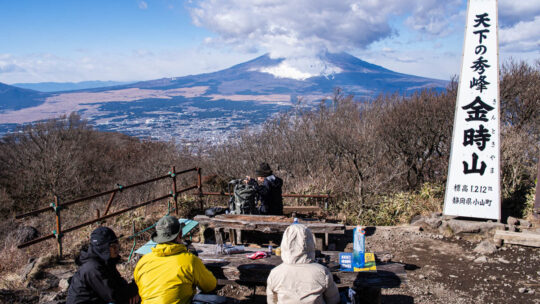
Hiked on Dec 16, 2020 . Kintoki-jinja Shrine 金時神社 – Mt. Nagao 長尾山 – Otome-toge 乙女峠 Duration: 3.5 hours Distance: 6.3 km Elevation change: 517 metres Highest point: 1212 metres Start: Kintoki Jinja Iriguchi Bus Stop Finish: Kintoki Jinja...
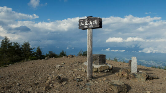
Hiked on Aug 1, 2020 . Nyukasa Marsh 入笠湿原 – Mt. Nyukasa 入笠山 Duration: 2 days Distance: 23.3 km Elevation change: 1095 metres Highest point: 1955 metres Start: Aoyagi Station (Chuo Main Line) Finish: Fujimi Station (Chuo Main Line) ...
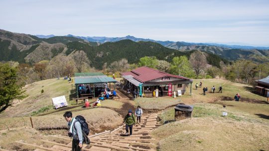
Hiked on Apr 28, 2019 May 5, 2022 . Mt. Jinba 陣馬山 – Maruyama 丸山 – Mt. Mito 三頭山 Duration: 2 days Distance: 28.5 km Elevation change: 1166 metres Highest point: 1531 metres Start: Wada bus stop Finish: Tomin no mori bus stop ...
Japan’s Most Prominent Peaks For better or worse, Kyuya Fukada’s 1964 best seller “100 Famous Japanese Mountains” (日本百名山 Nihon Hyaku-meizan) has had a profound influence on modern alpinism in Japan. It has led to a decades long hiking boom...
Hiked on Aug 4, 2018 . Mt. Yamizo 八溝山 – Nichirin Temple 日輪寺 Duration: 4 hours Distance: 9.8 km Elevation change: 667 metres Highest point: 1022 metres Start: Jakechi bus stop Finish: Jakechi bus stop Difficulty: ▅▅▅▅▅▅▅▅▅▅ ❶ Map:...
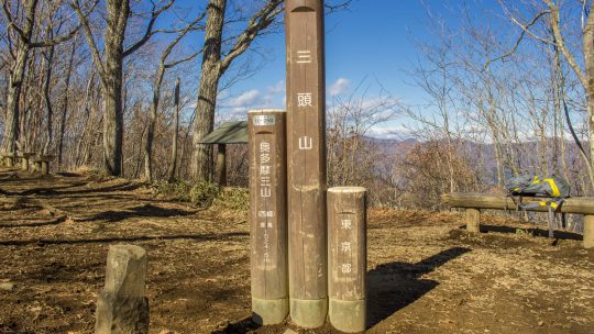
Hiked on Dec 12, 2013 May 5, 2024 . Mt. Iyo イヨ山 – Mt. Nukazasu ヌカザス山 – Mt. Mito 三頭山 The floating bridge near the Ogouchi Jinja Bus Stop is temporarily closed due to the declining water level of Lake Okutama. For the latest information about the...