.
Mt. Senmai-dake 千枚岳 – Mt. Warusawa 悪沢岳 – Mt. Eboshi 烏帽子岳
Distance: 29.1 km
Elevation change: 2021 metres
Highest point: 3141 metres
Start: Sawarajima Lodge
Finish: Torikura Bus Stop
Difficulty: ▅▅▅▅▅▅▅▅▅▅ ❺
Map: Yama to Kogen Chizu 山と高原地図 [No.45 塩見・赤石・聖岳 SHIOMI·AKAISHI·HIJIRI-DAKE]
GPX TrackKML TrackGSI MAPPDF Topo Map
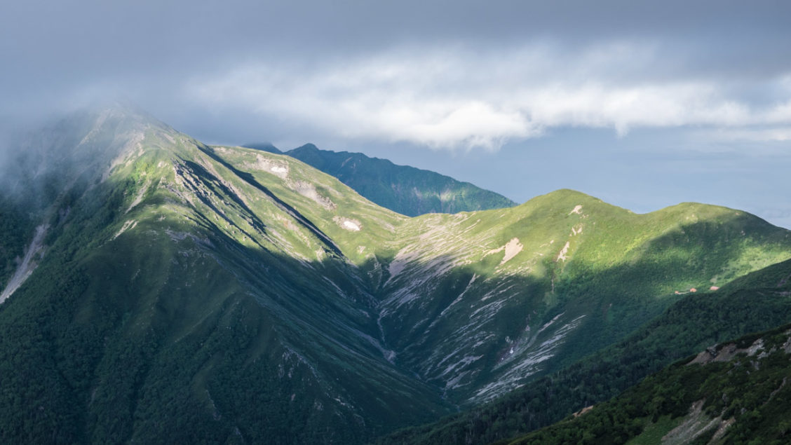
Exploring the Southern Minami Alps
If you want to enjoy some of the most pristine and rugged nature Japan has to offer than the south end of the Minami Alps is an excellent choice. The area is home to five of the ten hyakumeizan in the Minami Alps and sees a relatively small portion of the 65,000 travellers that visit the National Park each year. This hike was completed over five days but could be shortened by catching the afternoon bus to Ina-Oshima Station on the fourth day. Another option is turning it into six days with an optional side trip to Mt. Shiomi. For other great hikes in the area be sure to check out the Hiking and Trekking: The Japan Alps and Mount Fuji guidebook.
Day 1: Getting to the Sawarajima Lodge
Given the remoteness of the south end of the Minami Alps means only the most dedicated hikers make the long trip to Sawarajima a jumping-off point for the region’s many hikes. From west Tokyo it took the better part of 9 hours to reach Sawarajima costing around 13,000-yen. The price breakdown was as follows. Local trains plus Shinkansen to JR Shizuoka Station (7,000-yen). A long bus ride from Shizuoka to the Hatanagi Dai-ichi Dam (3 hrs, 3,100 yen) get off at the Rinji chushajo bus stop. Finally, transferring to a shuttle bus for the final leg to Sawarajima (1 hr, 3,000-yen). Note the bus to the Hatanagi Dai-ichi Dam needs to be booked online at least one day in advance. There are 3-5 daily shuttle buses to the Sawarajima Lodge 椹島ロッジ with tickets (vouchers) purchased prior to boarding.
If you plan on riding the shuttle bus on the return leg you will need to stay at one of the Tokushu Tokai Paper Co., Ltd huts with the 3,000-yen voucher going towards the cost. Even though I was ‘thru-hiking’ with no need for a return shuttle bus the staff at the Sawarajima Lodge were insistent I stay at one of huts along the route to the point of offering to contact one of the huts on my behalf. In reality none of the huts will force you to stay nor ask for proof that you have already done so. One last point is, at the Rinji chushajo and at every hut or campsite you stay you’ll be asked to fill in a hiking plan (tozantodoke) where you register your name, dates and emergency contact.
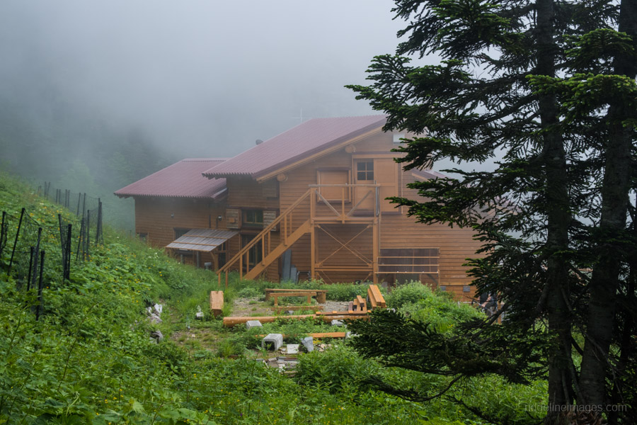
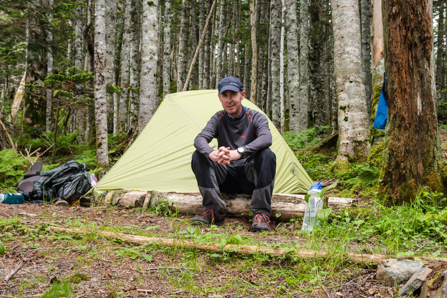
After arriving at the Rinji chushajo there was a 90 minutes wait for the next shuttle bus. Not surprisingly when it did eventually leave the bus was packed to the rafters and travelling along a pothole-strewn road wasn’t much fun. Thankfully the campsite at Sawarajima (1,000 yen) had a communal bathhouse (sento) a godsend after a long trip.
Day 2: Ascending 1,620 metres to the Tree Line (9.4 km)
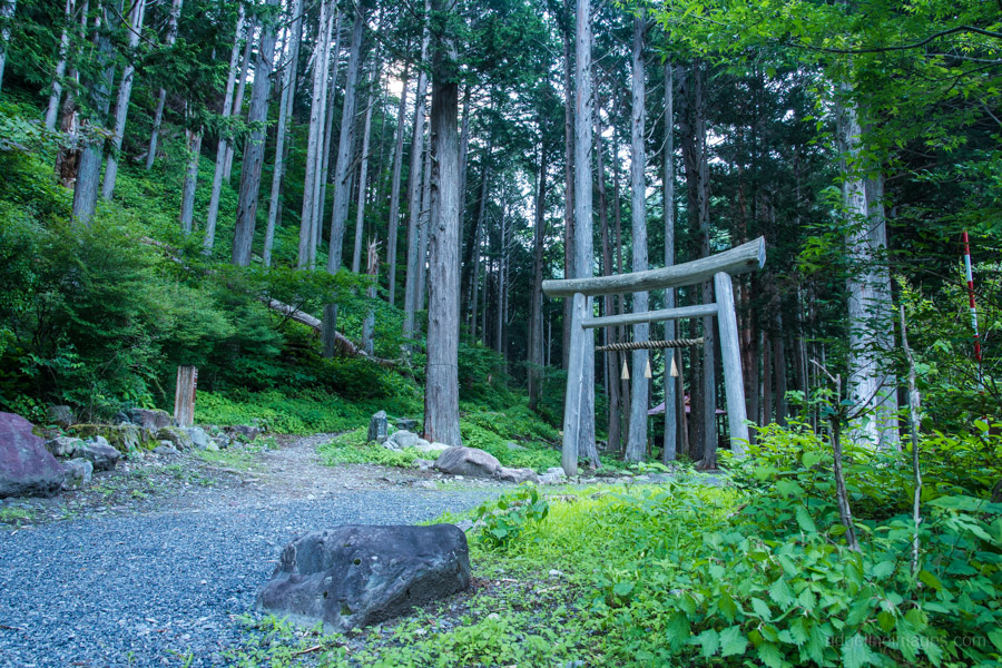
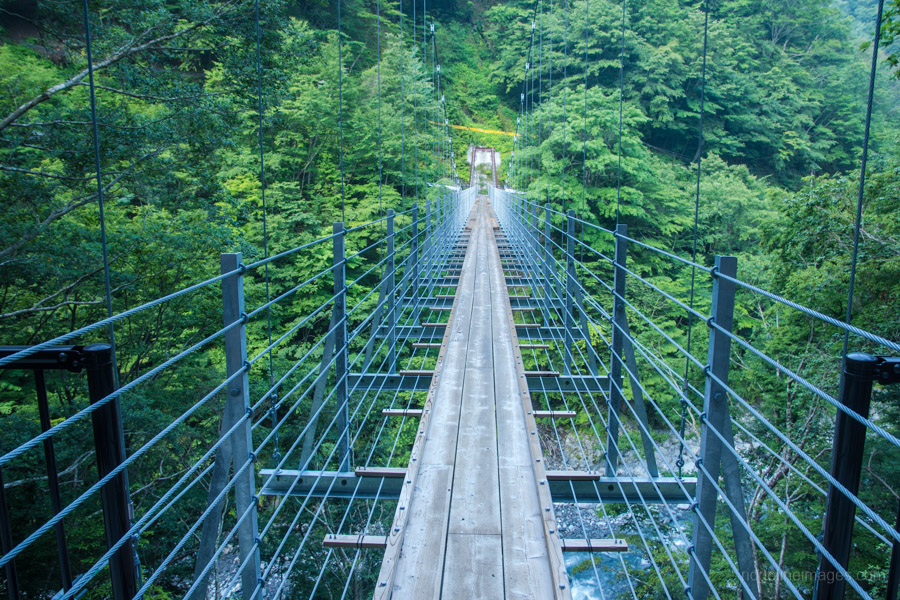
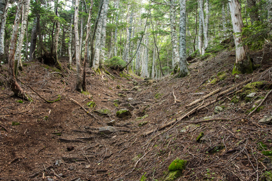
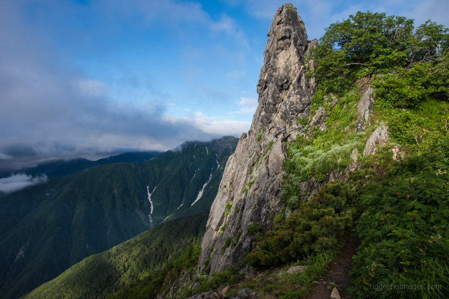
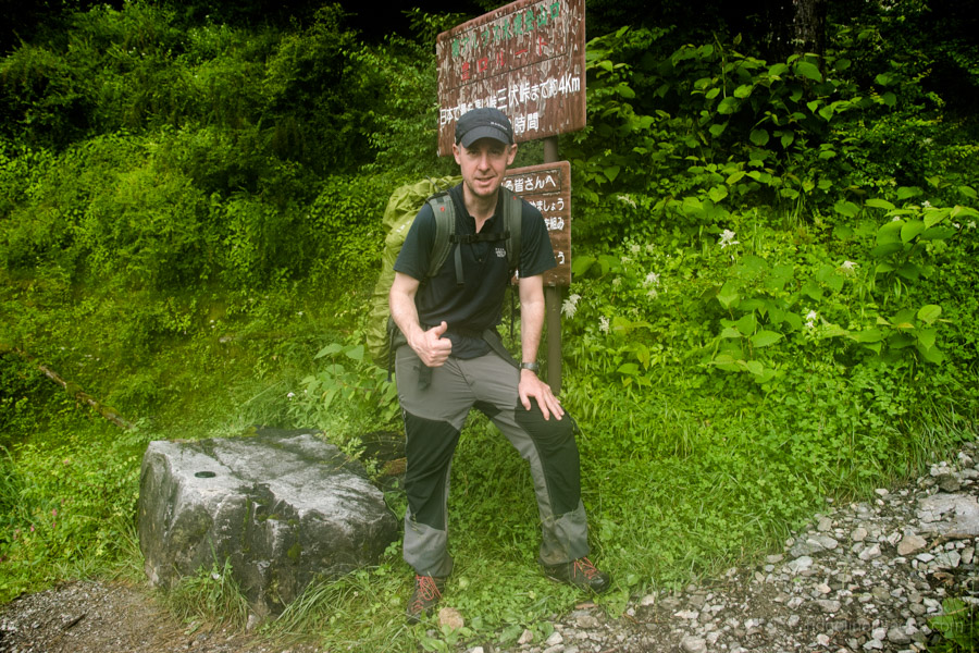
As most hikers were corralled into the mountain lodges there was only a handful of us pitched on the grassy campsite. With a day of fine weather ahead I was packed up and on the trail by 5:30 am. The hike starts besides the shrine where you zigzag up to the road. Turn right, continue over a green bridge for 200 metres where you’ll find a newly constructed suspension bridge and a signpost pointing towards Senmai-dake 千枚岳. The first landmark to look out for are two transmission towers a good spot a take a quick breather. A little further along the trail dips into a rocky section, the top of which provides the first glimpse of Mt. Warusawa. Around 90 minutes after leaving the campsite you’ll pop out on the road again near a metal staircase.
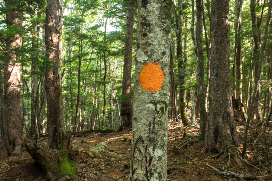
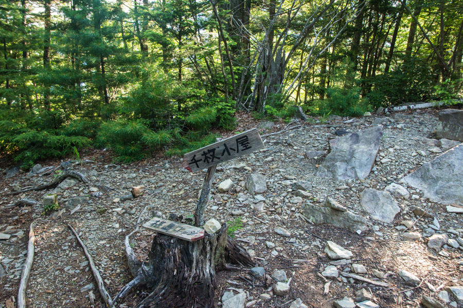
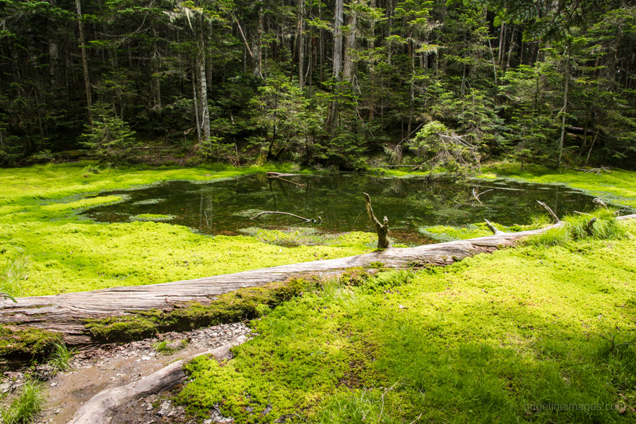
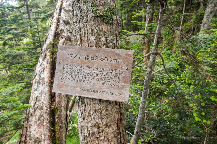
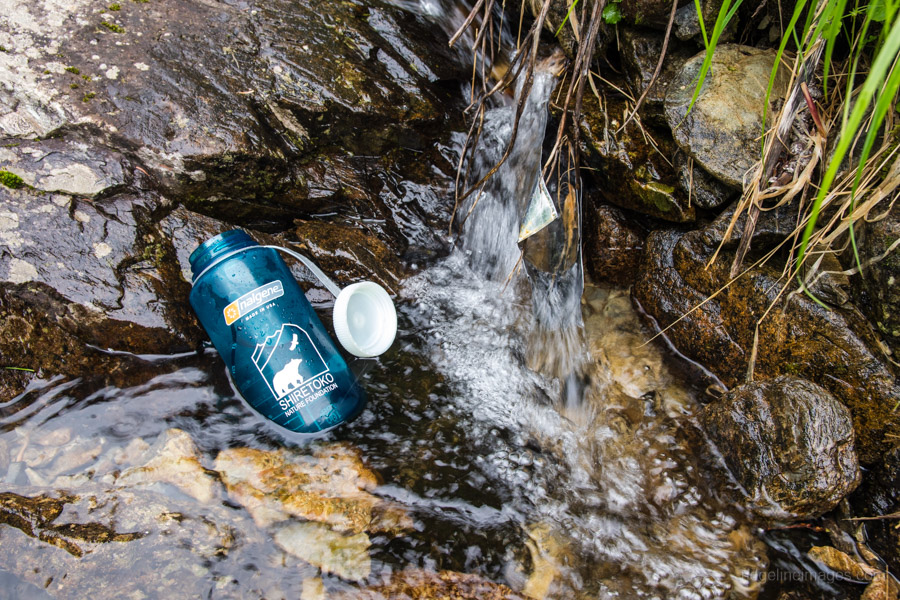
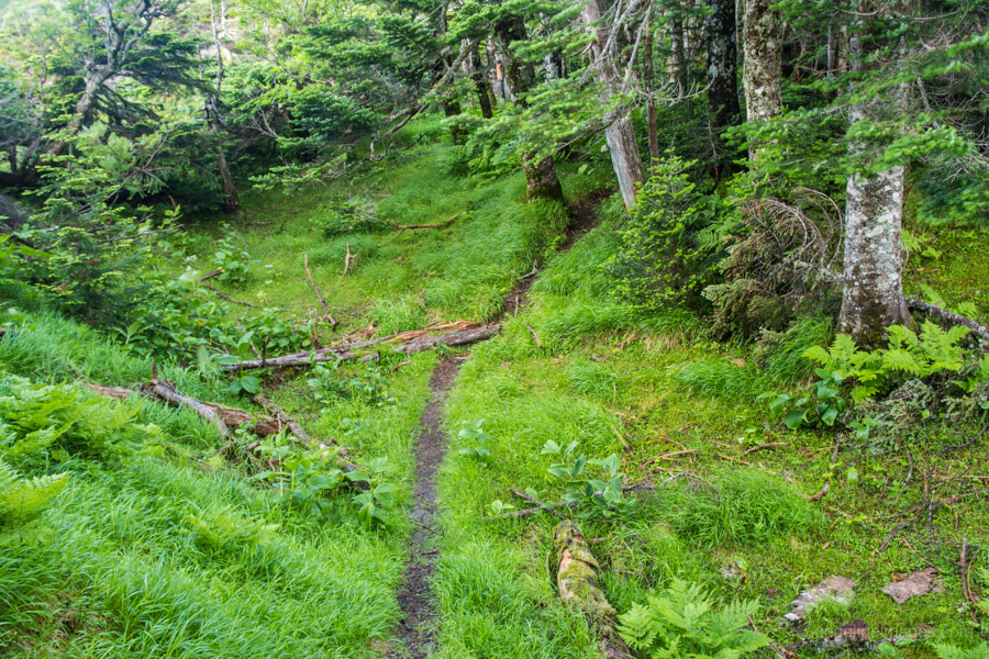
From here the ridge is divided into seven stages up to the Senmai goya 千枚小屋. The trail easy to follow with splashes of orange on rocks and trees. Shortly before arriving at the Shimizu daira 清水平 water hole the trail once again passes over the gravel road used by the hut staff. This water hole marks the approximate half way point. A little perplexing are signs indicating the hiking times with some tallying a total duration of 5 hours and others 6 hours. The elevations are similarly imprecise so better to rely on your map and GPS. Just before reaching the hut there is a short detour to the Komadori-ike 駒鳥池 a moss encircled pond. The Senmai goya has a water hole, along with a sheltered campsite (700 yen).
Day 3: A Rapid Deterioration in Weather (7.2 km)
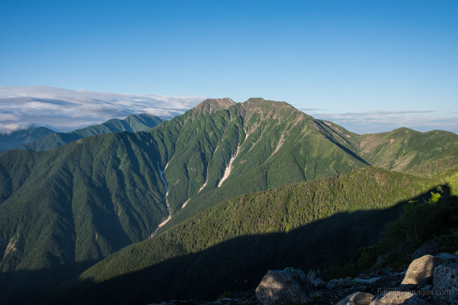
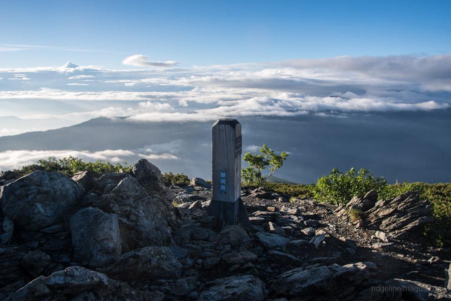
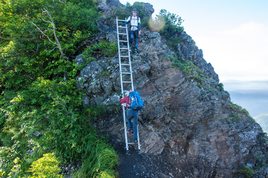
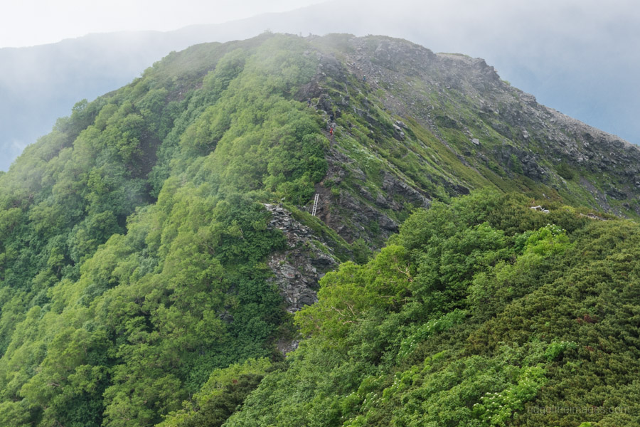
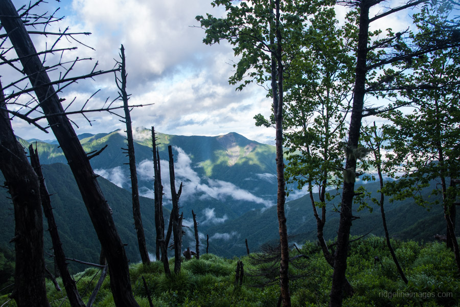
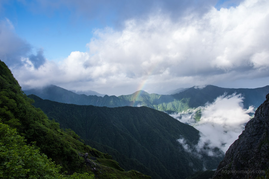
Being the longest day of the hike it’s best to hit the trail as early as possible. The first views of the morning from the short climb up to Senmai-dake 千枚岳 (2,880 m) were stunning and as it turned out short lived. By the time I reached Mt. Maruyama 丸山 (3,032 m) the weather had deteriorated markedly. Take care traversing between these two peaks as there is some exposure and also a fixed ladder to clamber down as you pass through a col.
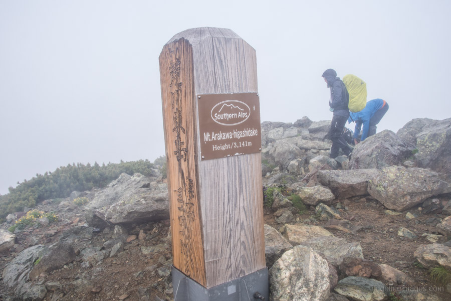
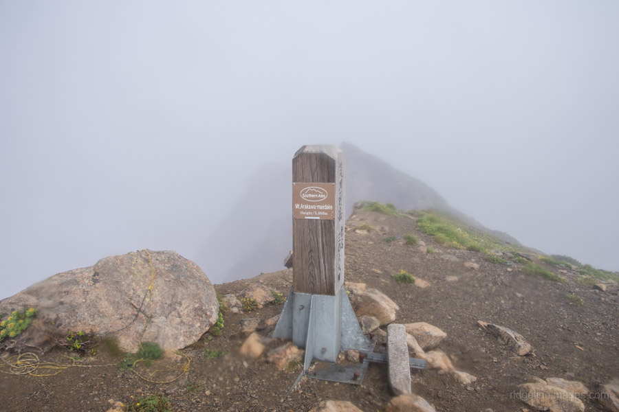
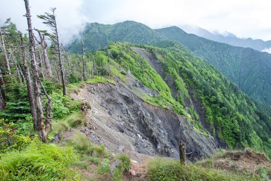
At Mt. Maruyama the wet weather gear came out and seldom left my person and pack for the next two days. The highlight of the hike was supposed to be the splendid 360-degree views from Mt. Warusawa 悪沢岳 aka Mt. Arakawa-Higashidake (3,141 m) however the pea soup fog and blustery weather ensured a swift retreat from the unprotected ridgeline. From Mt. Warusawa the trail drops into another col before rising slightly before the Arakawa-Nakadake hinangoya which was undergoing repairs. A little further along finds a key trail branch so turn right towards Mt. Arakawa-Nakadake 荒川中岳 (3,083 m).
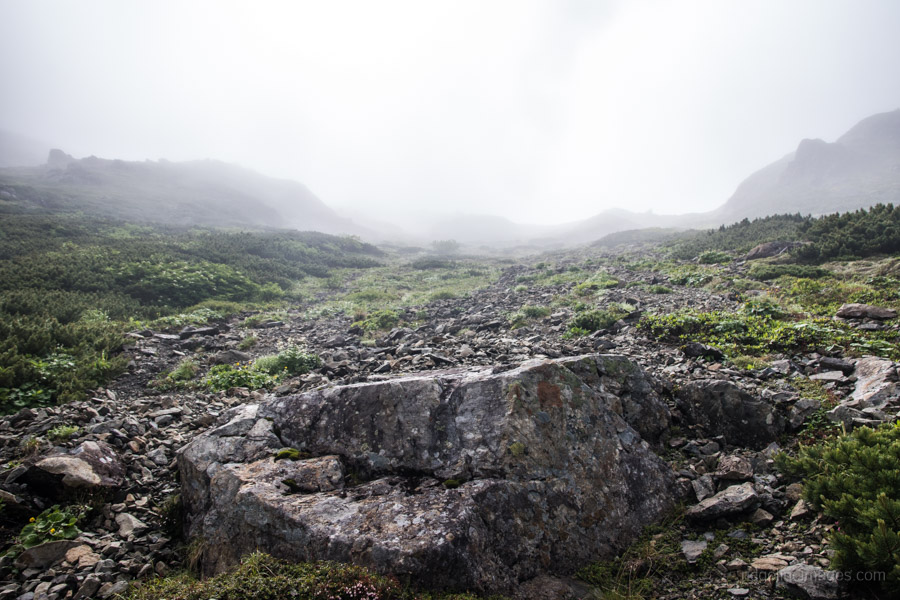
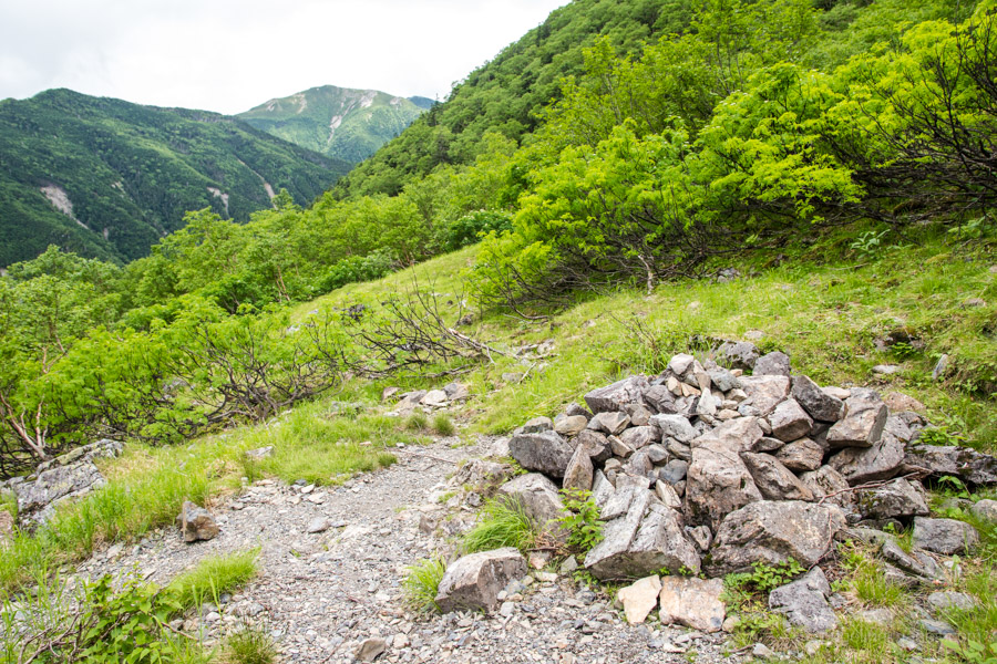
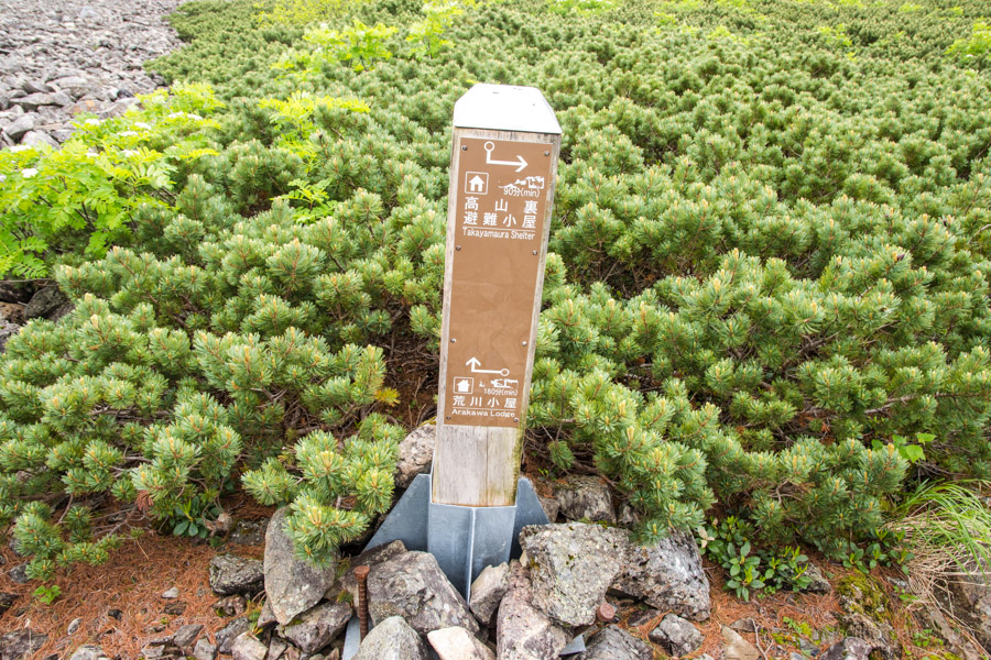
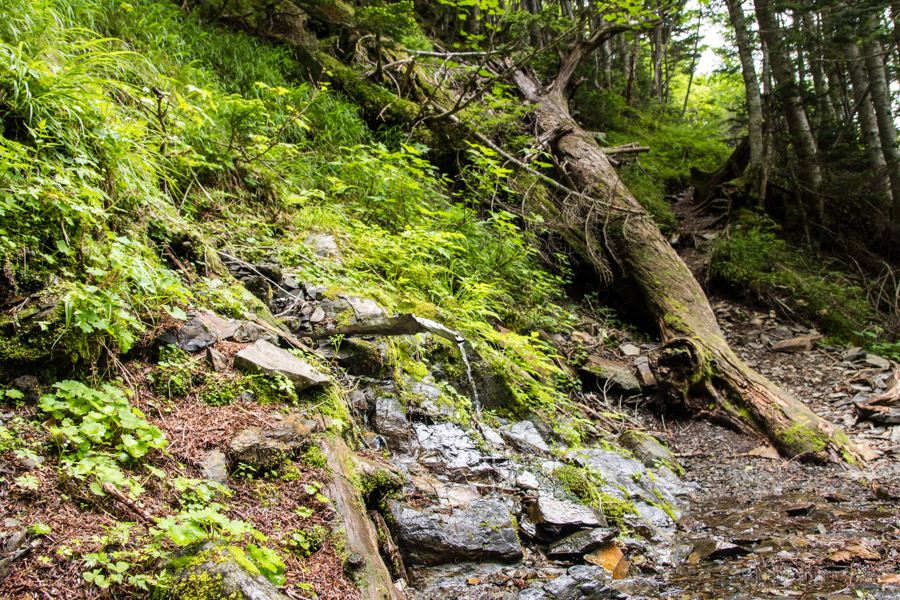
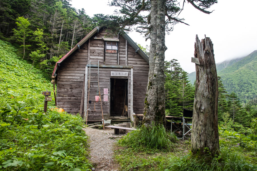
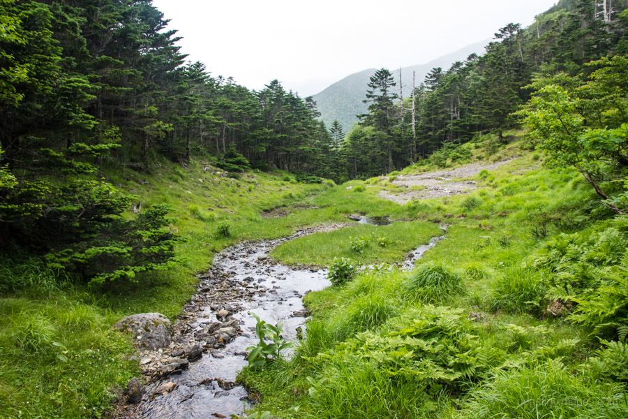
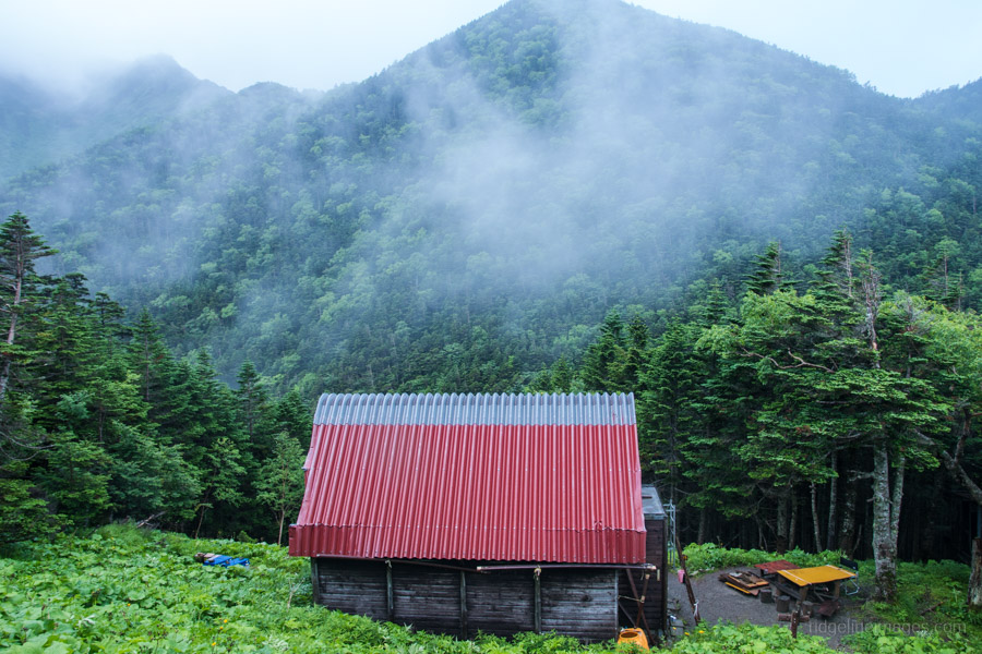
The section between Mt. Arakawa-Nakadake and the bottom of the 600-metre boulder field is shown as a dotted line on the Yama-to-Kogen map. One reason for this perhaps is a short section of crumbling knife ridge that requires attentiveness. Once passed it’s a restful descent to the tree line and a rock cairn at Kohiroba 小広場. Before reaching the rustic Takayamaura Hut 高山裏避難小屋 campsite (600 yen) there is a short chain to lower yourself down and a water hole. The actual water hole at the hut is at the bottom of a gully (a 20-minute round trip).
Day 4: Finding Refuge at the Sanpuku-toge Hut (8.8 km)
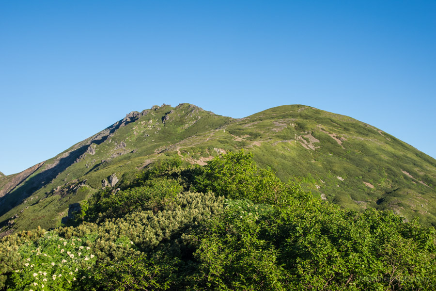
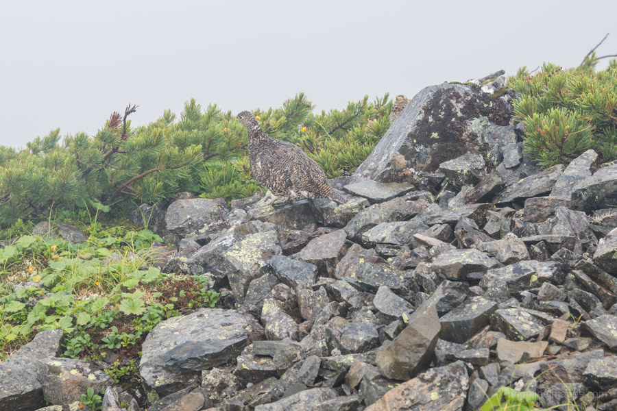
By sunrise the rain had subsided though like the previous day it began raining shortly after breaking camp. The trail starts out on the upper side of the hut passing through white pine and fir forest. During the first hour to Mt. Itayadake 板屋岳 (2,645 m) the trail sits just below and occasionally on an eroded knife ridge so be vigilant. From here on the trail became a bit of slog dealing with the vagaries of weather, lack of views and desperate need to find shelter. In fine weather Mt. Kogochi-dake 小河内岳 (2,802 m) and Mt. Eboshi-dake 烏帽子岳 (2,726 m) would surely afford excellent vistas but apart seeing a family of Raicho (Japanese Rock Ptarmigan) and the foggy outline of the Kogochi-dake hinangoya there were few points of interest.
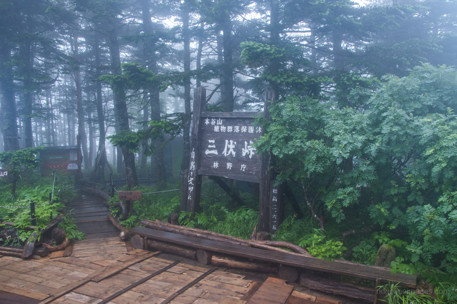
It was a welcome sight arriving at the Sanpuku-toge Hut 三伏峠小屋 a little before midday. Due to the approaching typhoon I decided stay lodging only (sudomari) 5,500-yen rather than battle it out in the uninviting campsite. The advantage of this was availing myself of the drying room (kansoshitsu) though my waterlogged shoes would need days to dry out. The water hole at the hut is a 25-minute round trip.
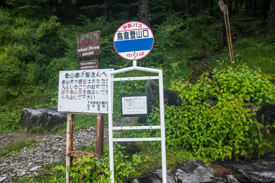
Day 5: Makeshift Bridges a Plenty (3.7 km)
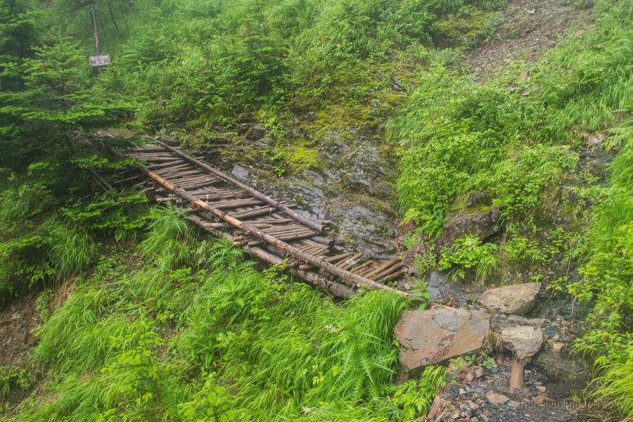
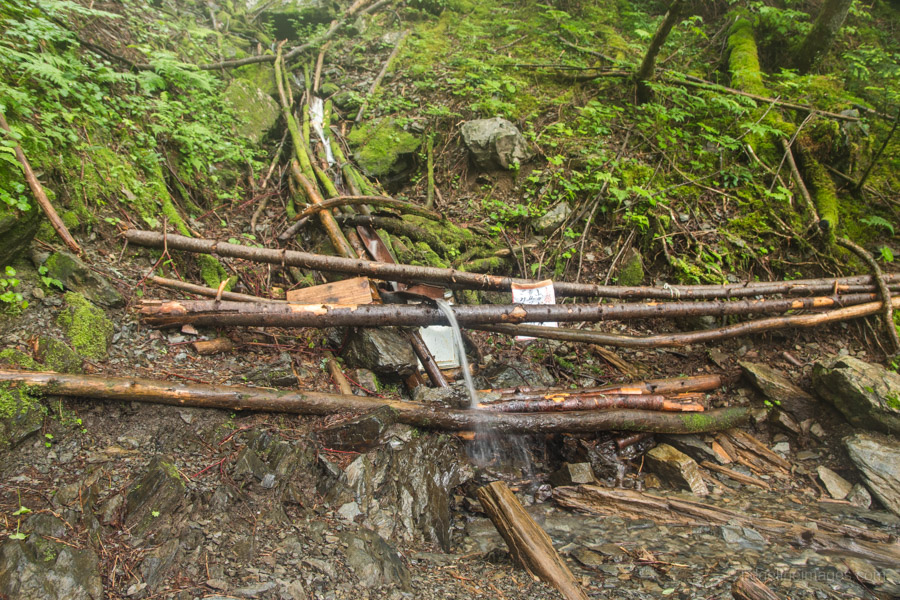
One good point of the unending rain was it drowned out the snorers and I managed a half decent sleep. It even made the sound of 30-odd senior hikers from Okayama hell-bent on getting an early start bearable. From the Sanpuku-toge Hut it takes 2.5 hours and a drop of 790 metres to the reach the Torikura trailhead 鳥倉登山口. Give yourself more time in the wet as there are numerous rough-hewn bridges tilted at awkward angles to deal with. The two incoming buses from Ina-Oshima Station 伊那大島駅 had only 3 hikers – testament to the abysmal weather and only me for the return trip (1 hr 45 mins, 1,660-yen plus a 830-yen backpack surcharge!).


Hi. I’m looking to do a Warusawa/Akaishi loop out of Sawarajima in two weeks (weekend of September 14), with two nights in huts and three days of hiking. Do you know if the buses/shuttles will still be operating in and out of Sawarajima?
From 9/1-11/4 there are three daily buses from the Rinji chushajo to the Sawarajima Lodge departing at 07:30/11:30/15:00. Though you will need to make your own way to the car park as the Shizuoka to Hatanagi Dai-ichi Dam bus finished on August 25th. Hope that helps.
Hi David,
Regarding last comment, does that mean last car park is at Hatanagi Dai-Chi dam ? I was naively hoping to get all the way to sawarajima with my rental.
Cheers,
Adrien that is correct, the road from the dam to Sawarajima is privately owned so your options are either forking out for the shuttle bus or walking 4-5 hours north along the gravel road.