.
Dainichi-goya 大日小屋 – Takamiiwa Rock 鷹見岩
Distance: 7.3 km
Elevation change: 572 metres
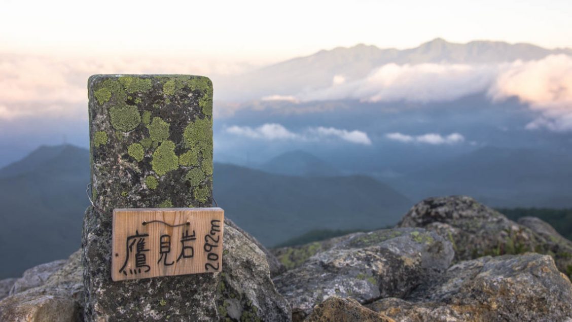
Highest point: 2092 metres
Start: Mizugaki-sansou
Finish: Mizugaki-sansou
Difficulty: ▅▅▅▅▅▅▅▅▅▅ ❷
Map: Yama to Kogen Chizu 山と高原地図 [No.28 金峰山・甲武信 KINPU-SAN·KOBUSHI]
GPX TrackKML TrackGSI MAPPDF Topo Map
One of the Finest Views in the Chichibu Tama Kai NP
The main driver behind this hike was less about putting in a lot of kilometres but to retreat to familiar territory and explore a remote and little known rock outcrop.
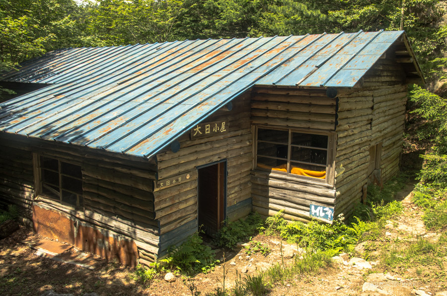
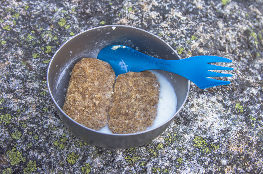
This hike once again starts out from the Mizugaki-sansou, a main jumping off point for climbing Mt. Kinpu 金峰山 and Mt. Mizugaki 瑞牆山. While the trail starts out at 1,520 metres the summer heat and humidity even at this elevation means quickly working up a sweat. From the bus stop it takes around 50 minutes to reach the Fujimidaira-goya 富士見平小屋. I was a little surprised to find the hut closed especially as this is traditionally one of the busiest times of year. After eating lunch amongst the pleasant surrounds it was time head up to the Dainichi-goya campsite 大日小屋 my intended haunt for the night.
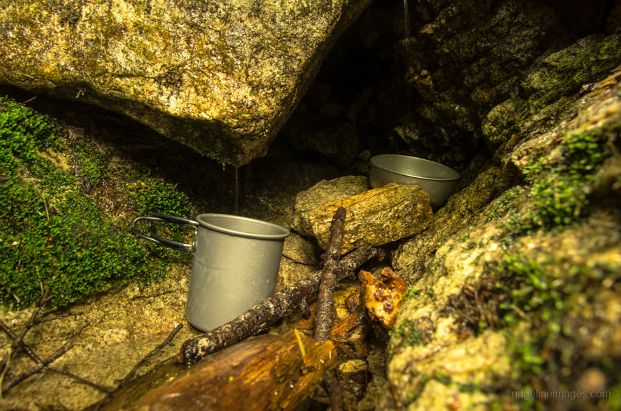
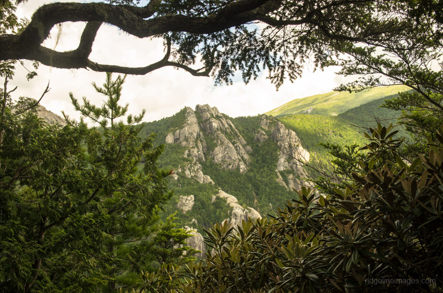
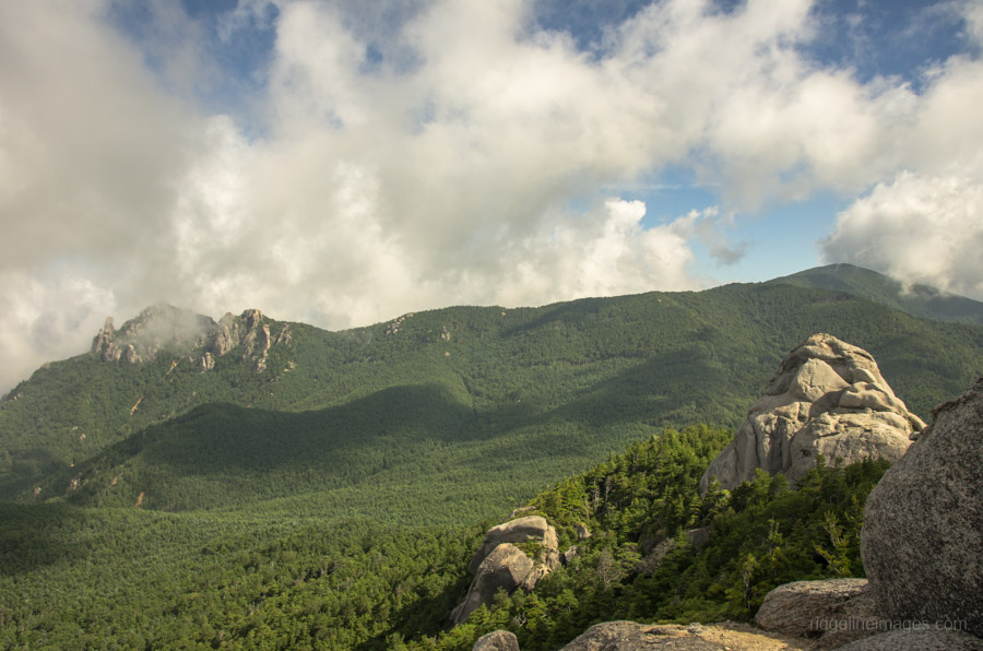
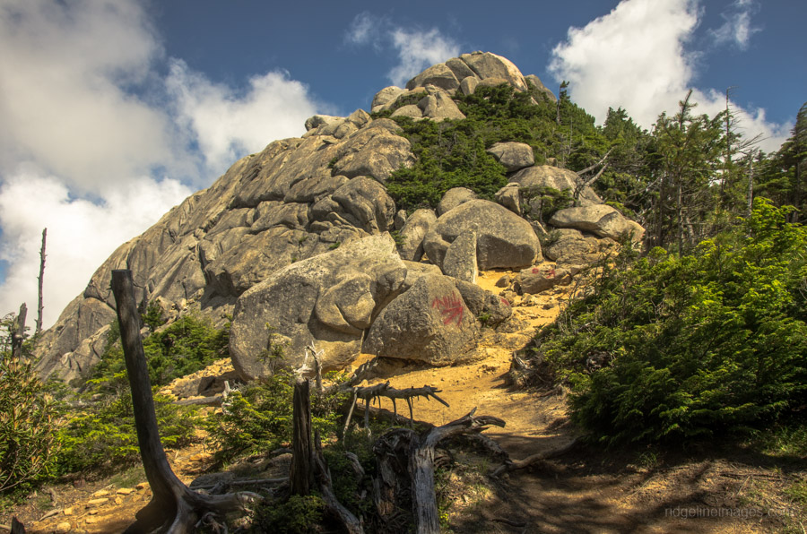
Passing the site on previous occasions gave the inkling of a nice enough spot to pitch a tent. Sadly, the hut itself which is on the downward side of the trail is in a palpable state of neglect and you would only ever consider resting up for the night in an emergency. Thankfully I was the only one camping, as there is also distinct lack of level sites to choose from. The other hindrance you’ll be up against is collecting sufficient water. While there is a waterhole marked on the map it took time and a resolute doggedness to fill up my water bottles each time. Having said that the water I did manage to collect was incredibly clean due to percolating though an underground spring. The campsite sits near two prominent landmarks namely; the Takamiiwa Rock 鷹見岩 2,092 m and the cone shaped Mt. Imoriyama 飯森山 2,116 m. Some adventurous soles have managed to bag the latter mountain, though without a discernible trail to follow it would be a risky undertaking. In contrast, a dotted line delineates a mountain path up to Takamiiwa Rock on the Yama-to-Kogen map.
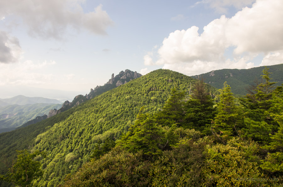
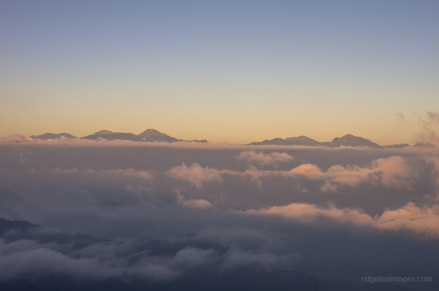
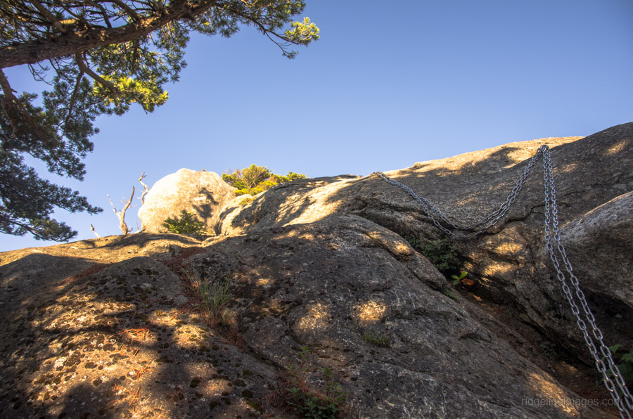
I made the round trip up there twice and although it doesn’t see much foot traffic is remains unobstructed and clearly tapped out. On the first afternoon the view was a tad hazy however the two nearby hyaku-meizan were conspicuous as ever. It was the following early morning that the Takamiiwa Rock came into its own, with a line of sight across to the Minami Alps, Mount Fuji and the Yatsugatake mountains. In fact, I would argue the panorama from this vantage point is as good as any I’ve come across in the Chichibu Tama Kai NP. Given its remoteness also means a high probability of enjoying it in solitude. After returning to camp on the second day I also made a short climb up to the Dainichi Boulder 大日岩 which is always a lot of fun climbing up its exposed verges and snaking under the large cavernous boulder.