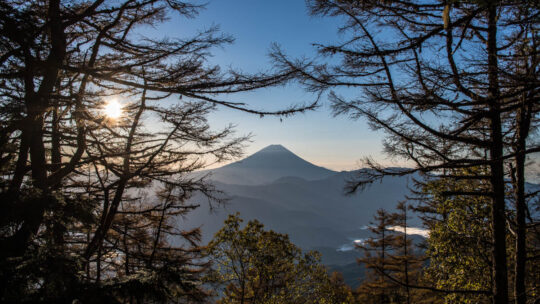
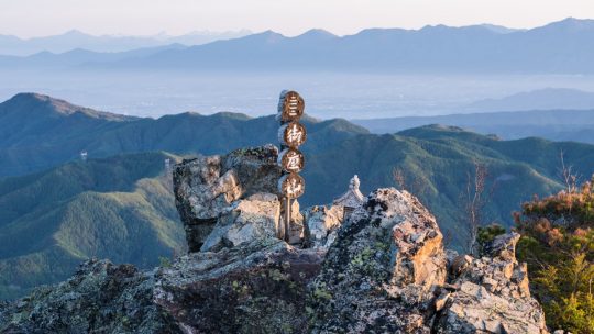
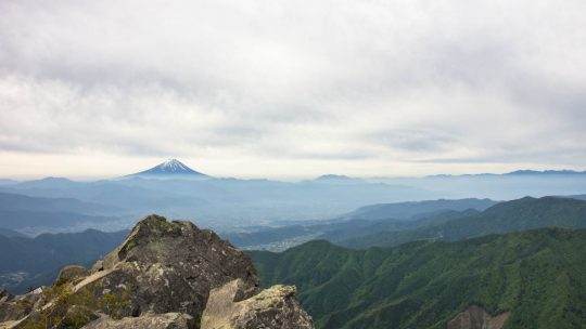
Hiked on Dec 2, 2023 . Umanose Miharashidai 馬ノ背見晴台 – Mt. Echizen 越前岳 – Mt. Kuro-dake 黒岳 Duration: 5 hours Distance: 9.8 km Elevation change: 624 metres Highest point: 1504 metres Start: Jurigi Bus Stop Finish: Ashitaka Tozan-guchi Bus...
Hiked on Dec 2, 2023 . Umanose Miharashidai 馬ノ背見晴台 – Mt. Echizen 越前岳 – Mt. Kuro-dake 黒岳 Duration: 5 hours Distance: 9.8 km Elevation change: 624 metres Highest point: 1504 metres Start: Jurigi Bus Stop Finish: Ashitaka Tozan-guchi Bus...
Hiked on Oct 29, 2022 . Mt. Ryugadake 竜ヶ岳 – Hashita-toge – 端足峠 – Mt. Amagadake 雨ヶ岳 Duration: 2 days Distance: 16.5 km Elevation change: 1154 metres Highest point: 1964 metres Start: Lake Motosu Iriguchi Bus Stop Finish: Asagiri Green...
Hiked on Nov 2, 2021 . Naka-no-dake 中ノ岳 – Mt. Ishiwari 石割山 – Mt. Hirao 平尾山 Duration: 2 days Distance: 25 km Elevation change: 1214 metres Highest point: 1681 metres Start: Tsurushi Station (Fujikyuko Line) Finish: Mt. Fuji Yamanakako...
Hiked on Oct 2, 2021 Nov 15, 2022 . Higashisenba 東仙波 – Mt. Karamatsuo 唐松尾山 – Mt. Kasatori 笠取山 Do not attempt this hike unless you have experience in route-finding and make sure you carry a topographic map and handheld GPS device. Duration: 3...
Hiked on Oct 24, 2020 . Himuro Shrine 氷室神社 – Hokora Hut ほこら小屋 – Mt. Hadaka 裸山 Duration: 2 days Distance: 16.2 km Elevation change: 1276 metres Highest point: 2052 metres Start: Hirabayashi Bus Stop Finish: Hirabayashi Bus Stop ...
Hiked on Sep 21, 2020 . Mt. Kentoku 乾徳山 – Mt. Kurogane 黒金山 – Nishizawa Gorge 西沢渓谷 The Nishizawa Gorge hiking trail closes during winter (December 1st-April 28th subject to change depending on snowfall) for the latest information please refer to the...
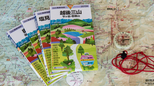
The Low-Down on Japanese Hiking Maps The map images and contents of this article have been obtained with the permission of the publisher (株式会社昭文社 Shobunsha Publications, Inc.). Writing about topographic maps i.e. a map which uses elevation contours...
Hiked on Sep 27, 2019 Aug 15, 2021 . Futarayama Shrine 二荒山神社 – Mt. Nyoho 女峰山 – Kirifuri-kougen 霧降高原 Duration: 2 days Distance: 15.9 km Elevation change: 1853 metres Highest point: 2483 metres Start: Taiyuin Futarasan jinja mae bus stop...
Hiked on May 29, 2019 . Mt. Ogura 御座山 – Zeneimine 前衛峰 – Miharashidai 見晴台 Duration: 2 days Distance: 11 km Elevation change: 972 metres Highest point: 2112 metres Start: Kuryu bus stop Finish: Shiraiwa bus stop Difficulty: ▅▅▅▅▅▅▅▅▅▅...
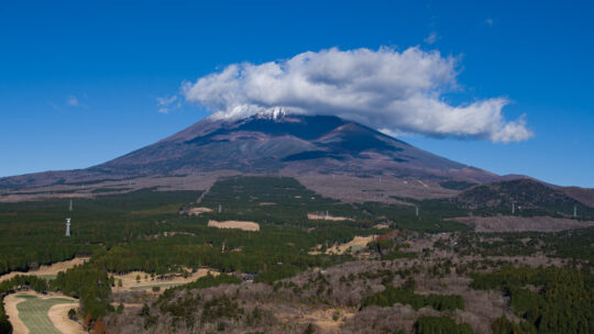
Japan’s Most Prominent Peaks For better or worse, Kyuya Fukada’s 1964 best seller “100 Famous Japanese Mountains” (日本百名山 Nihon Hyaku-meizan) has had a profound influence on modern alpinism in Japan. It has led to a decades long hiking boom...
Hiked on Oct 9, 2018 Feb 4, 2021 . Mt. Kaiun 開運山 – Mt. Tenjo 天上山 Duration: 6.5 hours Distance: 17 km Elevation change: 1171 metres Highest point: 1785 metres Start: Mitsutoge Station (Fujikyuko Line) Finish: Kawaguchiko Station...
Hiked on Jul 6, 2016 Aug 24, 2023 . Honzawa Onsen 本澤温泉 – Mt. Tengu 天狗岳 – Shibunoyu 渋の湯 Duration: 3 days Distance: 15.8 km Elevation change: 1140 metres Highest point: 2640 metres Start: Midori-no-ike Bus Stop Finish: Shibunoyu Bus...
Hiked on May 21, 2015 Aug 24, 2023 . Kougen Hut 高原ヒュッテ – Mt. Kentoku 乾徳山 – Mt. Douman 道満山 Duration: 2 days Distance: 11.1 km Elevation change: 1186 metres Highest point: 2013 metres Start: Kentokusan Tozanguchi Bus Stop Finish:...
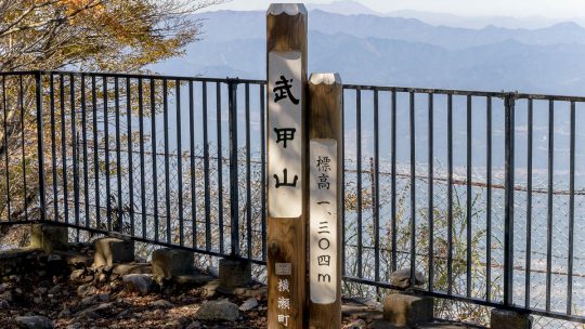
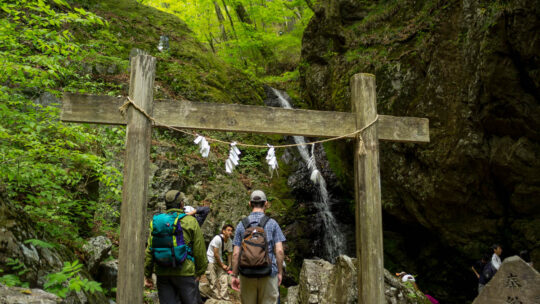
Hiked on Oct 25, 2014 Aug 24, 2023 . Fudou Falls 不動滝 – Mt. Buko 武甲山 Duration: 6 hours Distance: 15.6 km Elevation change: 1054 metres Highest point: 1304 metres Start: Yokoze Station (Seibu Chichibu Line) Finish: Urayamaguchi Station...
Hiked on May 4, 2013 Aug 23, 2023 . Mt. Odake 大岳山 – Nokogiriyama 鋸山 Duration: 5.5 hours Distance: 14.5 km Elevation change: 916 metres Highest point: 1266 metres Start: Mitake Cable lower station (Takimoto) Finish: Okutama Station...