.
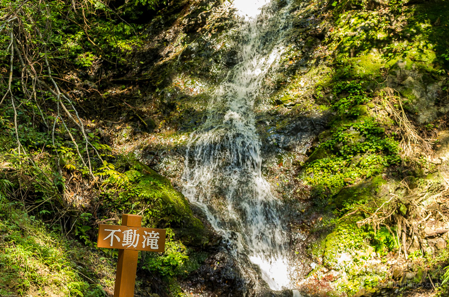
Fudou Falls 不動滝 – Mt. Buko 武甲山
Distance: 15.6 km
Elevation change: 1054 metres
Highest point: 1304 metres
Start: Yokoze Station (Seibu Chichibu Line)
Finish: Urayamaguchi Station (Chichibu Main Line)
Difficulty: ▅▅▅▅▅▅▅▅▅▅ ❸
Map: Yama to Kogen Chizu 山と高原地図 [No.23 奥武蔵・秩父 OKUMUSASHI·CHICHIBU]
GPX TrackKML TrackGSI MAPPDF Topo Map
Mt. Buko’s Scarred Facade Unmasks an Impressive Backdrop
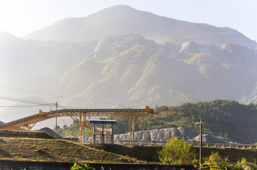
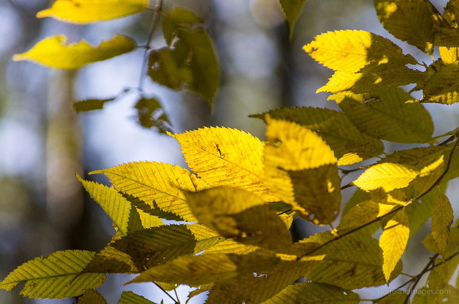
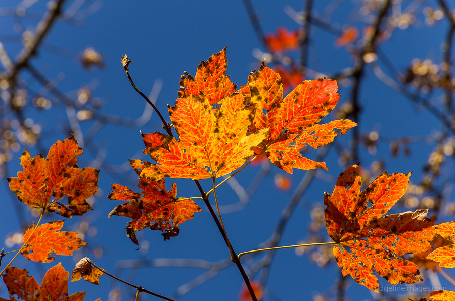
My first glimpse of Mount Buko’s chiselled veneer was on the way to Mount Kumotori last year, and if it hadn’t been pointed out, I would have quickly dismissed the mountain as nothing more than a gargantuan quarry. Over the past 74 years an impressive quantity of limestone around 400 million metric tonnes, by some estimates, have been extracted. This is only half the story of Mt. Buko, as while the northern face exerts a brutal facade, the opposing side is from another world with lush forests, waterfalls, and clear spring waters.
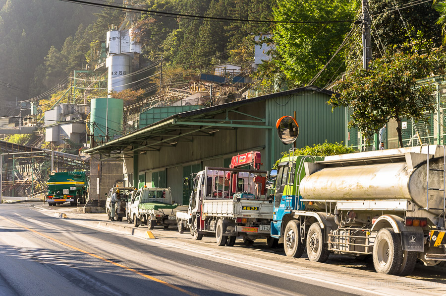
The hike starts from Yokoze Station 横瀬駅 on the Seibu Chichibu Line, about 75 minutes from Ikebukuro by Limited Express train. The downside of climbing this mountain is walking along a heavy vehicle access road for around 90 minutes, as unfortunately there isn’t a bus service to the trailhead. Here you will live a fairly precarious existence with 30-tonne dump trucks speeding by every few minutes. Not surprisingly, most hikers avoid this section like the plague with local taxi companies collecting a nice windfall ferrying hikers to the trailhead.
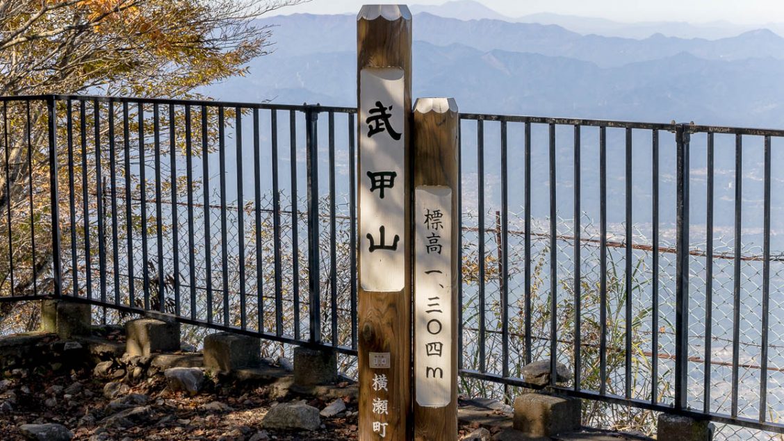
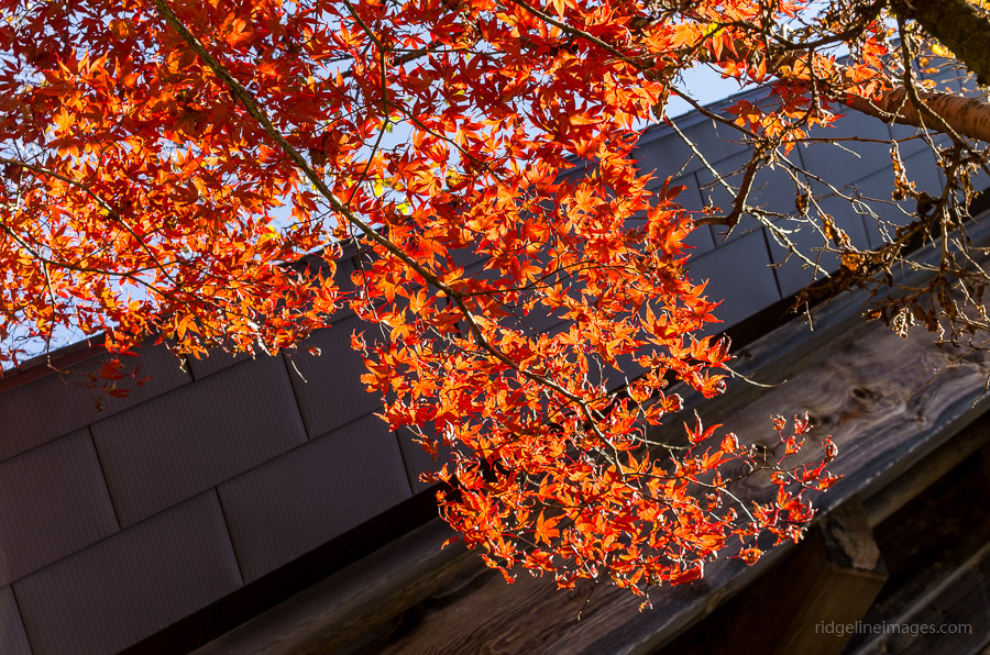
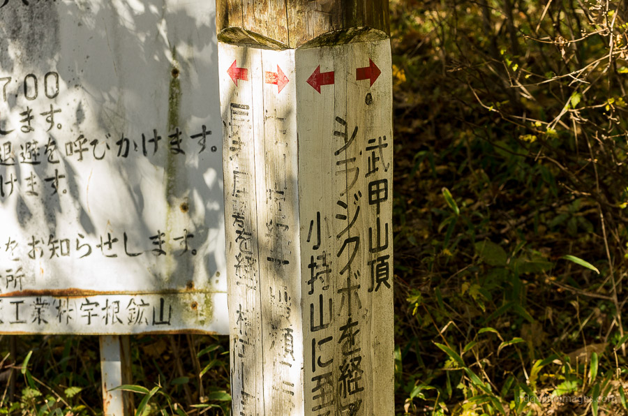
The fine autumn weather coupled with Mt. Buko’s 200 famous Japanese mountain status meant there was no shortage of hikers heading up. After passing by the torii gate, the trail follows a vehicular access road before veering right and gradually steepening towards the Fudou Falls. A little further along, look out for the grand cedar tree standing gracefully near the trail. Just below the summit of Mt. Buko 武甲山 (1,304 metres), there is a nice grassy open area to take lunch below the Mitake Shrine with restroom facilities. The actual summit is on the other side of the shrine, and while fenced along the northern edge, there is a wonderful bird’s-eye view over Chichibu City and the ghastly limestone quarry beneath.
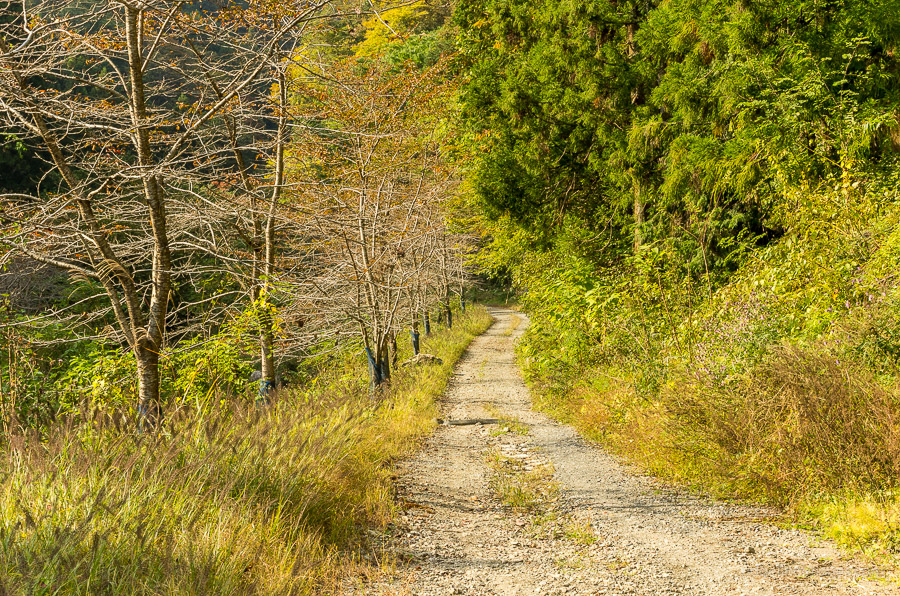
While most hikers head back the same way or loop around the neighbouring peaks of Komochiyama 小持山 and Omochiyama 大持山 this hike continues over to Urayamaguchi Station 浦山口駅 on the Chichibu Mainline. Note, however, that the trail tends to be quite steep and rocky and includes a long section of tightly laced switchbacks down to the Hashidate River. The first downhill leg off the peak includes a short detour to a watering hole. The river is traversed with the help of a rough-hewn bridge, and the final stretch back to the station follows a rather quaint, unsealed road. Just before the station, there is a faucet dispensing spring water on the roadside. Highly praised for its taste and health benefits, it makes a nice place to rehydrate before heading back.


I hiked Mt Buko yesterday. Loved it despite the no-views up top (very cloudy about 2/3 the way up). But the clouds were just below the summit so at least we had some sun up there. I did the Buko-Komochi-Omochi and back to the parking lot loop since I drove. The parking lot was full but there’s plenty of parking just outside on the road. Great steep trail up to Buko. There were other hikers going up and down on Sunday so this is a pretty well-traveled trail. From Buko to Komochi I was surprised at the gradient both down and up. Omochi was pretty easy but oh my, the downhill trail back to the last way point (妻坂峠) was wayyyy steep. My legs are still sore today from that steep downhill.
Quite a nice hiking trail that I’d do again. Thanks for your write-up that helped me decide this was a mountain I wanted to hike!
Hi Tim,
Thanks for the comment and glad you enjoyed the hike. A wise decision driving to the trail head. The loop hike sounds like it was a good workout though.
Recommend this hike: Ashigakubo Station loop hike to Mt Shiro to Mt Maru to Ono pass.
4 hrs. Best done clockwise. Highlights: Mt Maru 3 storey observatorywith 4 dedicated telescopes and some benches. 270 degree view of Chichibu Sanchi, Yatsugatake and Fuji on good days. From a spot near the summit of Maru, see paragliders take off on weekends. Ashigakubo Station service area seasonal fruit & veg shop, bakery, canteen style eatery (ramen, curry etc).
https://thetokyofiles.com/2012/05/30/tokyo-hiking-murayama-mountain-ashigakubo-station/
Thanks for the great writeup. I just got finished backpacking this and it made for a wonderful experience as only my second time solo camping. One note: The toilet up top is currently closed due to a lack of water but will apparently be up and running from May 1 (Yamap clued me in beforehand so I wasn’t caught unaware, thankfully).
Thanks for the info Ian. Glad to hear it and hope you scored a top view from the summit.
Thanks for this recommendation and the explanation about the taxi service, David. Took one to go there and walked back once down from the mountain. Good hike indeed, the view of Asamayama covered in snow was superb. Sending you a patron.
Cheers
A sensible move taking a taxi to the trailhead and somehow wish I done the same. Like yourself Francisco I really enjoyed Bukosan and I take it you hiked after the most recent snow fall so the views must have been spectacular. I very much appreciate your support on Patreon!