
.
Futarayama Shrine 二荒山神社 – Mt. Nyoho 女峰山 – Kirifuri-kougen 霧降高原
Distance: 15.9 km
Elevation change: 1853 metres
Highest point: 2483 metres
Start: Taiyuin Futarasan jinja mae bus stop
Finish: Kirifuri kougen bus stop
Difficulty: ▅▅▅▅▅▅▅▅▅▅ ❺
Map: Yama to Kogen Chizu 山と高原地図 [No.13 日光 NIKKO]
GPX TrackKML TrackGSI MAPPDF Topo Map
Where the Lesser is Greater
While only a metre in height separates the sacred peaks of Mt. Nantai and Mt. Nyoho they have a vastly different feel. For starters Mt. Nantai is a Hyaku-meizan or 100 famous mountain, whereas Mt. Nyoho is relegated to the 200 mountain list. Many seem to think this was an oversight by Kyuya Fukada and I tend to agree. This factor alone means Mt. Nyoho’s sees far fewer visitors in turn offering a more wilderness experience. A longish day hike is possible starting and finishing at Kirifuri-kogen however a better approach is to ascend gradually from the Futarasan Shrine and overnight at the timeworn refuge hut which lies below the summit.
Day 1: A Gradual Climb Through Primeval Forest (8.7 km)
Getting to Nikko from where I live in west Tokyo can be quite a mission. In the past I have taken an express train from Asakusa using the Nikko all area pass (4,520 yen) available from the TOBU Tourist Information Center. A drawback of this is the center doesn’t open until 7:20 am and you also have to pick your return train. This time I opted for local trains transferring at Shin Koshigaya, arriving at Tobu Nikko Station around 8:15 am and bolting for the first “The World Heritage Sightseeing Bus” bound for the Futarasan Shrine (15 mins, 320 yen). All told it took less than 3 hours and meant I could hit the trail before 9:00 am.
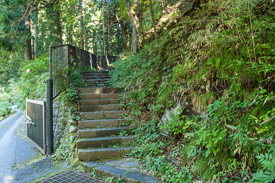
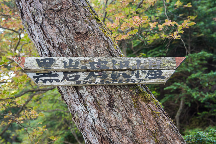
Given that the elevation gain from the shrine to the emergency hut is over 1,600 metres making an early start is well recommended. From the shrine mosey along the wide boulevard turning left at the first corner, pass by the giant torii gate and head up and along the path which follows a red boundary fence. You should soon see a signpost pointing to Mt. Nyoho 女峰山 and some stone steps on your right. The trail proper begins behind “Gyojado, Hall of the Ascetic” a small shrine at the far end of the stone path.
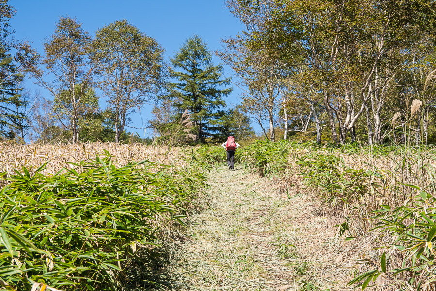
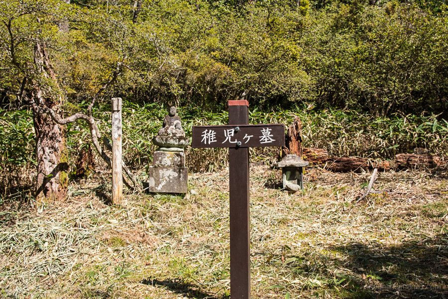
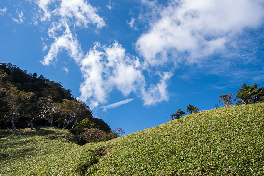
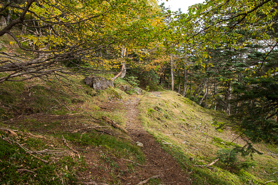
Unlike Nantai san which is basically a slog from the outset, this hike starts off gentle, building in steepness along the way. After 30 minutes walking through plantation pines the trail momentarily follows a forestry road. From here the trail heads north west, surrounded on both sides with Kuma-zasa (Sasa veitchii) bamboo grass. Not long after the trail splits the right fork is more popular though they later meet up at Chigogahaka 稚児ヶ墓 alongside a stone carved Buddha. In fine weather there are intermittent views of Mt. Nantai and back through the Nikko township.
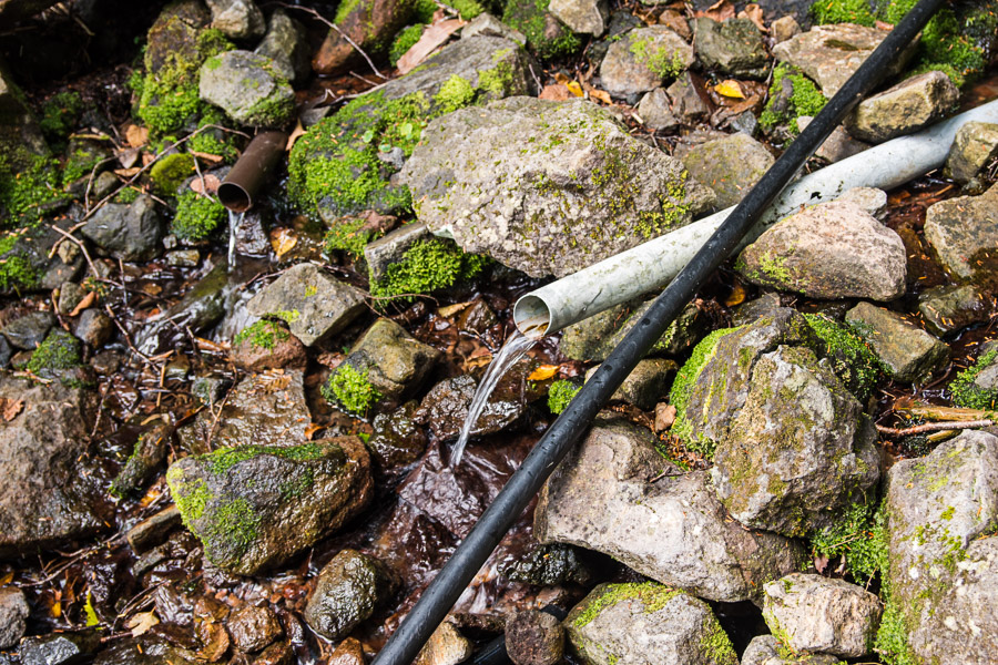
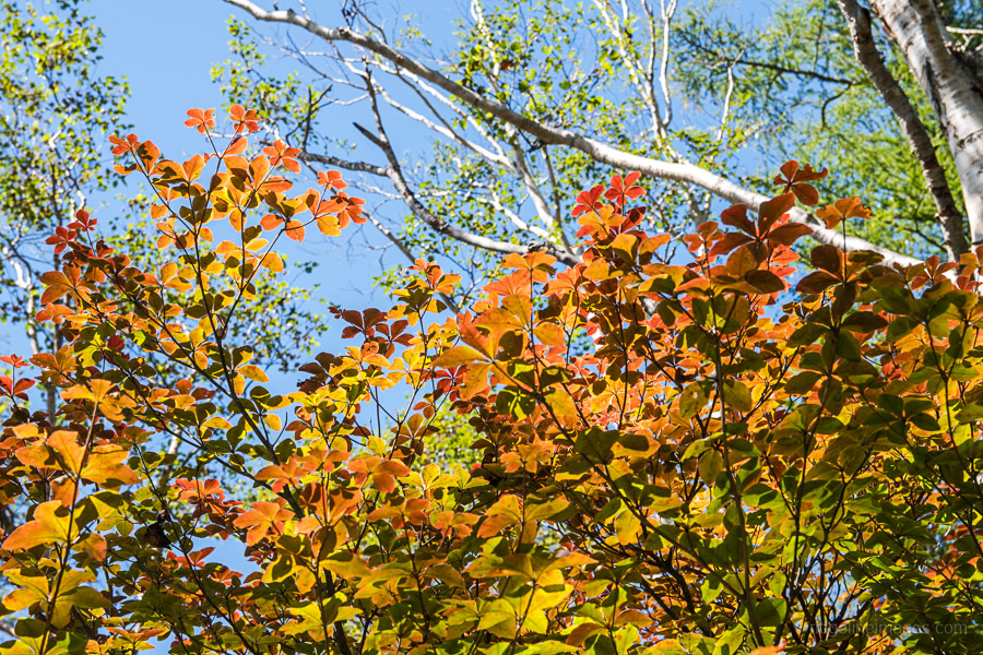
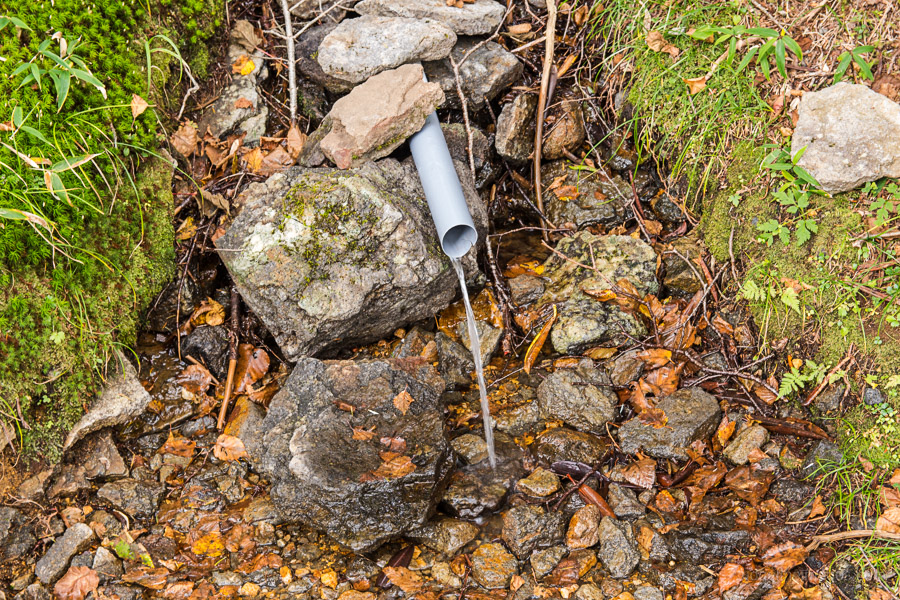
The next landmark to be on the watch for is a waterhole 15 metres down a rabbit trail on your right. With some perseverance, I managed to collect about 1 litre worth from the slow-moving creek. At around 1,500 metres elevation the changing leaves become apparent in the early autumn. Plodding along further finds Happu 八風 just below a rocky outcrop which makes a good lunch spot.
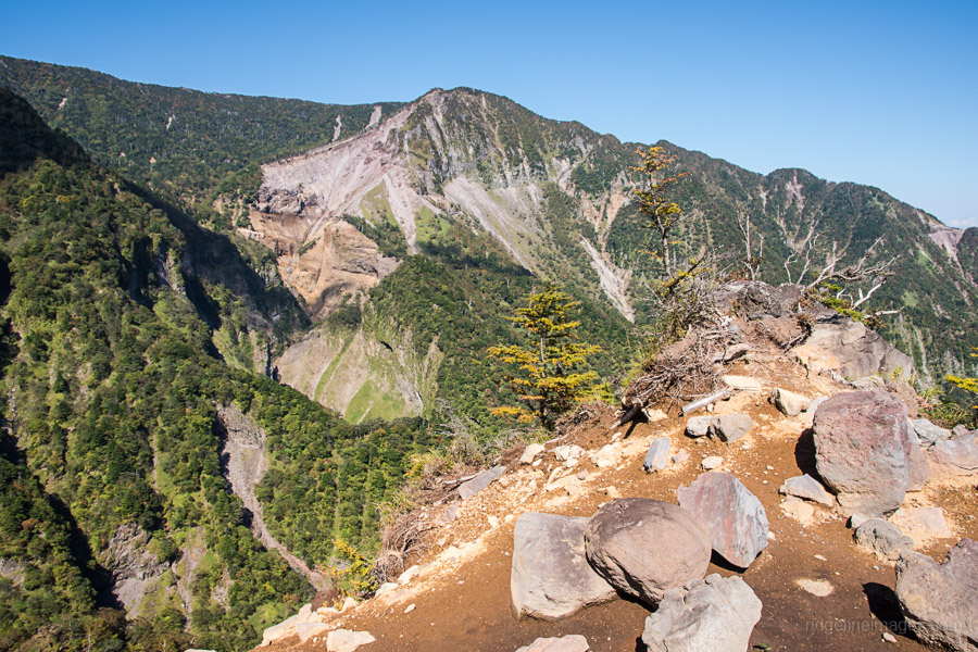
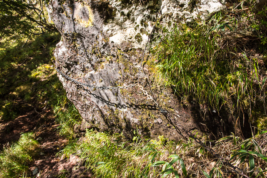
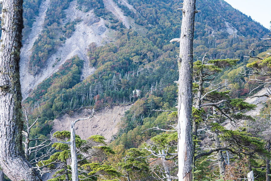
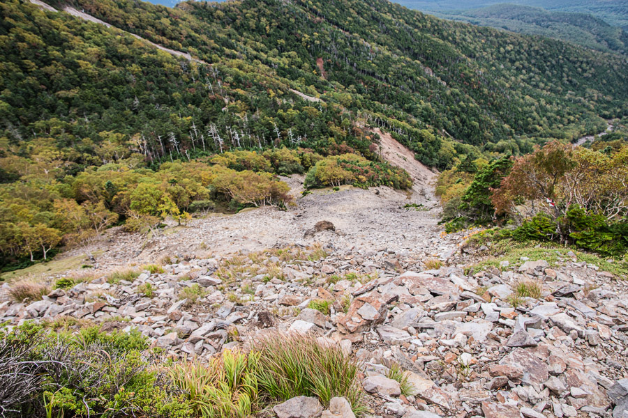
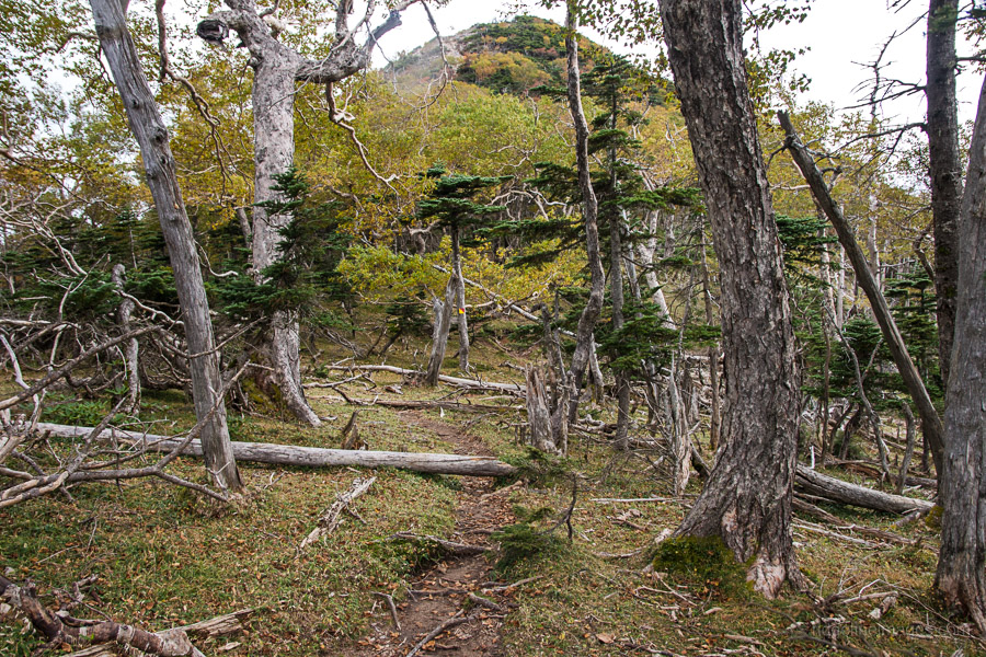
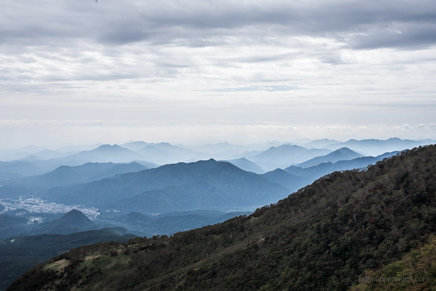
Following this finds a rocky stretch up to Youhai ishi 遥拝石 and a striking view of the ridgeline covered on day 2 together with a rather high waterfall in the distance. From here on the trail noticeably steepens as is passes through magnificent old growth forest. At one point there is slightly exposed area but easily crossed using an anchored chain. When the trail becomes indistinct look for one of the plentiful red and white metals plates to help guide you.
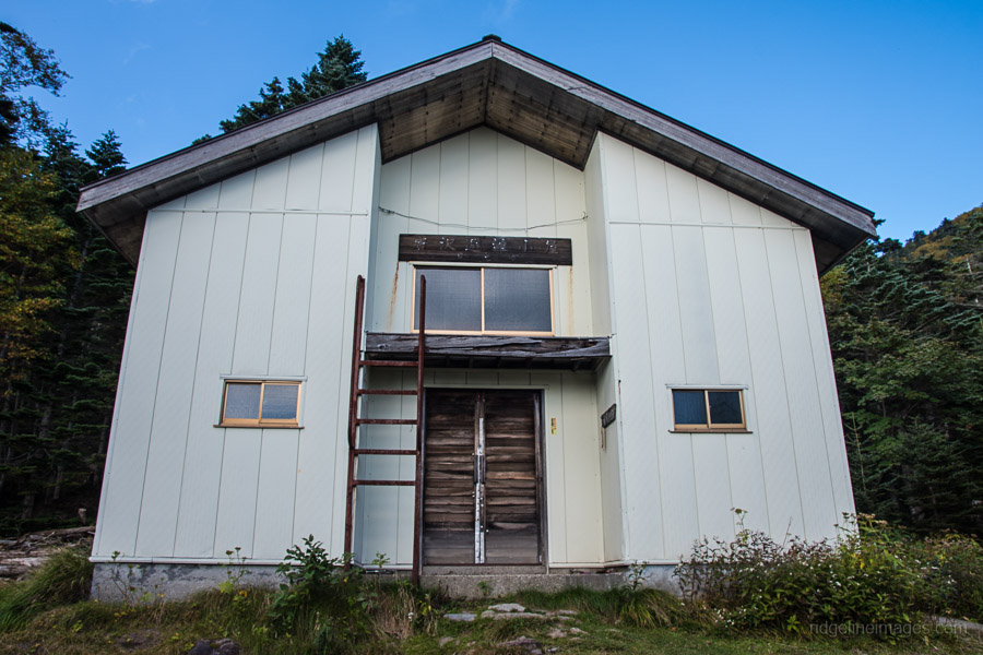
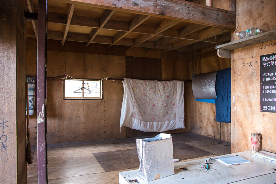
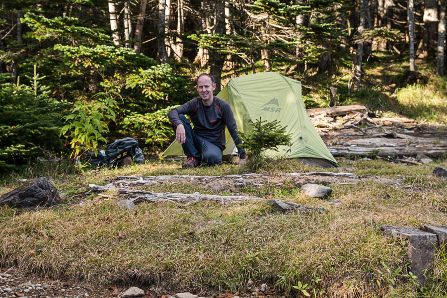
Once you’re around the backside of the mountain you should be able to glimpse the white Karasawa Hinangoya 唐沢避難小屋. Just before reaching the refuge hut you need to cross a rock-strewn gully. If you prefer to camp, there are a few level spots near the hut. The inside of the hut is rustic, has no toilet and the waterhole is a good 30-minute return trip down a steep gully not 16 minutes as indicated by a scrawl on the exterior wall.
Day 2: Fantastic Views Along the Ichirigasone Ridge (7.2 km)
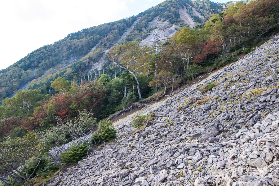
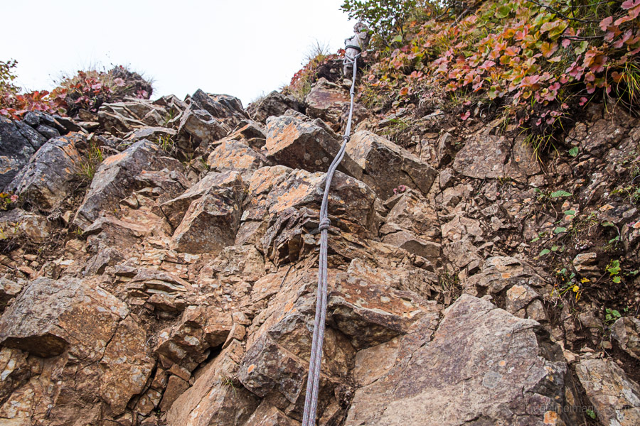
Breaking camp around 6:00 am there were a few drops of rain but thankfully didn’t amount to anything. The trail starts in the forest but soon hits a steep scree slope. Follow the yellow painted rocks for a safe ascent. Just below the summit there is a plaque commemorating a Meiji University student who was injured in or around the scree slope and brought back to the hut where he unfortunately succumbed to his injures.
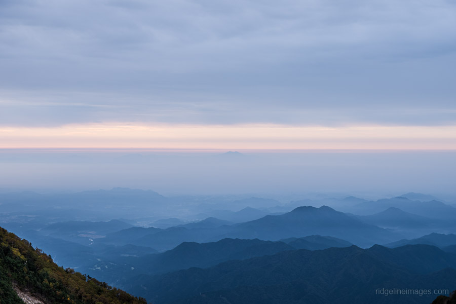
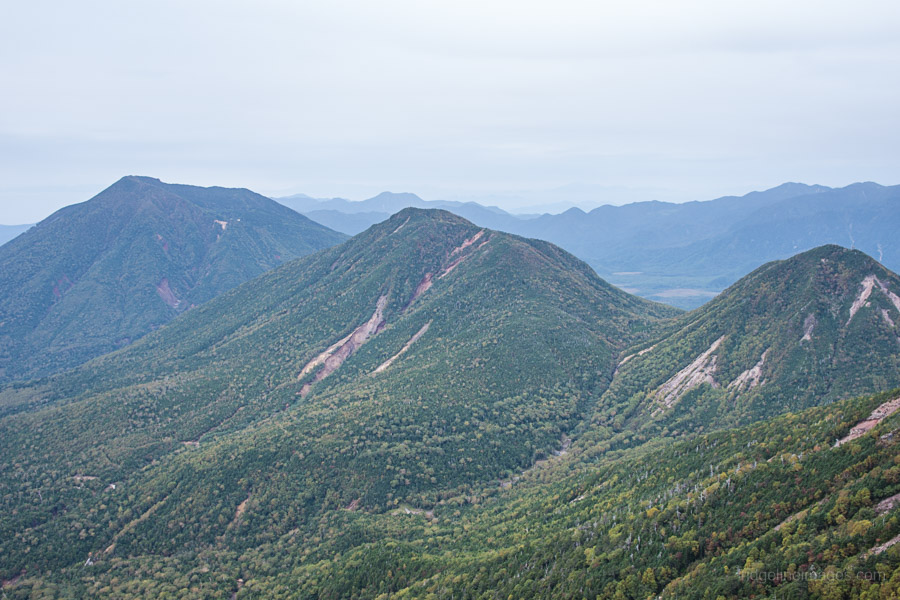
The summit of Mt. Nyoho 女峰山 (2,483 m) affords commanding 360-degree views including Mt. Nantai, Mt. Oku-Shirane and even the twin peaks of Mt. Tsukuba some 80 km away. It’s always lovely to have an unencumbered view from a summit especially early in the morning. When you’re ready to head off proceed along the Ichirigasone Ridge 一里ヶ曽根 which starts flat but soon reveals a precipitous rock ledge thankfully with a rope to help with the descent. There are more steep points to pass before reaching a waterhole a short distance from the trail.
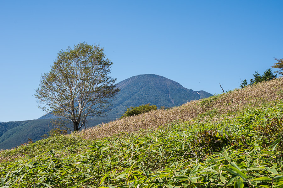
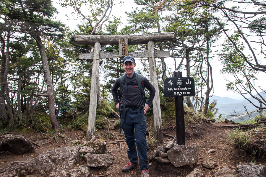
The trail meanders up and down finally reaching Mt. Akanagisan 赤薙山 (2,010 m) around 2.5 hours hike from the summit. As the return hike from the Kirifuri-kogen 霧降高原 to Mt. Nyoho is 10 hours map time this is about as far as many hikers manage. Looking straight ahead you should be able to see the Kuriyama Dam 栗山ダム resting above some agricultural land. Next up along the ridgeline finds Komaruyama 小丸山 with a sojourn possible to its loftier sibling.
The trail finally tapers off as it arrives at Kirifuri-kogen a one-time ski resort now famous for flower viewing in spring, summer and early autumn. The last stretch down to the Kirifuri-kogen rest house makes use of a comically long 1,445-step stairway called Tenku Kairo (corridor in the sky). Here you can pick up one of 11 daily buses back to Nikko Station (30 mins, 720 yen).


Many thanks for summoning Mt Nyoho into the limelight – surely she is, aesthetically, every bit a match for Nantai. In fact, the names Nantai and Nyoho suggested that people have always seen them as a natural pair. I guess Fukada chose Nantai as the Meizan because of the very well authenticated first ascent by Monk Shōdō in 782 – which adds a “historical” dimension that Nyoho lacks ….
By all accounts Shodo Shonin was quite the explorer along with establishing the Futarasan Shrine and Rinnoji Temple. The first part of the trail from the Futarasan Shrine up to the Gyojado follows the stone-paved Takino-o Path trodden by Monk Shodo past those enormous age-old cedar trees.
Thanks for the write up of an interesting looking hike. You find some great routes!
I have to confess, I had never heard of this one before, despite having climbed Nantai. I guess I must be guilty Hyakumeizan-fixation too!
Based on the conditions you saw, how late in the year do you think it is practical to follow this route?
Thanks for your comment and question. If you’re chasing fall foliage the best time to climb is mid to late October. From early November onwards it’s likely to be quite cold (depending on the conditions you may need 4 point crampons or microspikes) and probably the latest I’d climb without proper winter clothing would be early December. To give some context Mt. Nantai’s official climbing season is from May 5th to October 25th.
Thanks very much for the advice.
With the recent terrible weather it might be one for next year then.
Awesome route but beware of leeches! Hiking in the rainy season the first 3/4 ofthe trail on day 1 was teeming with them. The top section and day 2 was thankfully leech free.
The emergency hut is quite rundown. There’s some good secluded grassy areas for camping if you follow the small trail that passes off the right side/behind the hut (when facing the main entrance).
Day 2 was quite crowded! After seeing a total of 2 hikers on day 1 (and only 1 spending the night) we summited alone on day 2 decently early (left camp at 0730). Within 10 min of summiting there were 10+ hikers, many on day hikes. The route down I lost count.
Lastly if you’re driving you can park at tobu-nikko station for 500 a day. Catch the 2B bus to the trailhead. On return you can catch the bus at the bottom of the stairs to the station, but there are only a few trips per day.
Hi David,
Can this be done in a day?
There and back from Kirifuri-kogen is doable. As for the route described, for very fit and very fast hikers it may be possible but I wouldn’t recommend it.
Hi David. I am a seasoned hiker whose twenty-plus years of experience in Japan have included difficult and demanding trails. I have been invited to a two-day hike on Mt. Nyoho. Please let me know whether, in your opinion, the section near the summit and the section near the Karasawa refuge hut (where we will be staying overnight) are dangerous.
Yaron, from what I can recall there weren’t any sections I’d consider dangerous. If you’re following this route, the toughest part is probably the considerable elevation gain up to the refuge hut. Overall it’s a really nice mountain and, in my opinion, the better hike of the two other nearby Hyakumeizan.
Thank you very much for getting back to me so quickly. Your clear reply is very helpful and reassuring.